Topics > Northumberland > Civil Parishes in Northumberland > Hartburn Civil Parish > Hartburn Parish, 1855
Hartburn Parish, 1855
Extract from: History, Topography, and Directory of Northumberland...Whellan, William, & Co, 1855.
HARTBURN PARISH
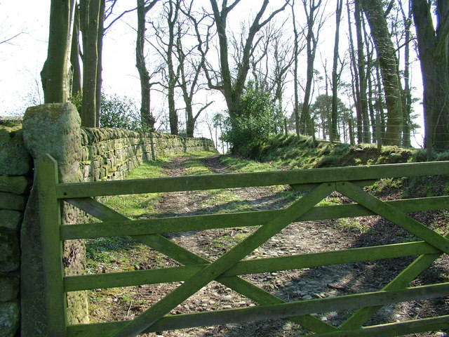
HARTBURN, a parish partly in the west division of Morpeth Ward, and partly in the east division of Tindale Ward, is a very large district com- prising twenty-four townships, whose united area is 25,778 acres, and has for its boundaries the parishes of Bolam, Kirkwhelpington, Meldon, Mitford, Nether Witton, and Rothbury. Population in 1801, 1,340; in 1811, 1,430; in 1821, 1,474; in 1831, 1,440; in 1841, 1,322; and in 1851, 1,506 souls. The greater portion of this extensive district is fertile, luxuriant, and picturesque, abounding with excellent limestone, while the townships of Harwood and Green Leighton consist principally of bleak moor lands. Coal and lead are. found in this parish. [High Angerton, Low Angerton, Cambo, Corridge, Deanham, Fairnley, Green Leighton, Hartburn, Hartburn Grange, Hartington, Hartington Hall, Harwood, Highlaws, Longwhitton, North Middleton, South Middleton, Rothley, East Shafto, West Shafto, East Thornton, West Thornton, Todridge, Wallington, Whitridge]
ANGERTON (High) is a township and hamlet, the property of J. H. H. Atkinson, Esq. The area of the township is 1,232 acres, and the rateable value £1,342. The number of its inhabitants in 1801, was 111; in 1811, 89; in 1821, 87; in 1831, 64; in 1841, 75; and in 1851, 125 souls. Here is a good colliery. The HAMLET of High Angerton is about seven miles west of Morpeth. ANGERTON HALL; the residence of J.H.H. Atkinson, Esq., is a handsome edifice in the Elizabethan style, erected from designs by Mr. Dobson of Newcastle. and is situated on a gentle eminence a little north of the river Wansbeck.
|
Atkinson J H. H. Esq. Angerton Hall Dickinson James, brick and tile maker Gibson Thomas, vict. and joiner, Bee Hive Hall Alexander, gardener Rogerson William, blacksmith |
Farmers Anderson Richard and George, Broom House Bewick Robert, Glebe Farm Crawford Ralph, Marlish Ramsey Matthew, Angerton Moor |
ANGERTON (Low) is a township and hamlet, the property of J. H. H. Atkinson, Esq. The township contains 1,040 acres, and the rateable value is £1,021. The number of inhabitants in 1801, was 88; in 1811, 112; in 1821, 75; in 1831, 55; in 1841, 64; and in 1851, 52 souls. The HAMLET of Low Angerton is seven and a half miles West by south of Morpeth.
DIRECTORY. Richard Brewis, farmer, Low Angerton; William Brewis, farmer, Old Mill; Mr. Thomas Hall, Angerton House: Matthew F. Lamb, Steads Farm; and William Lumsdon, East Farm.
CAMBO is a township and village in this parish, but locally situated in the north-eastern division of Tindale Ward. The township contains an area of 630 acres, and its rateable value is £J83. Population in 1801, 87; in 1811, 111; in 1821, 101 ; in 1831, 108; in 1841, 99; and in 1851, 106 souls. Sir W. C. Trevelyan, Esq., is lord of the manor and sole proprietor. THE VILLAGE of Cambo occupies a pleasant situation about eleven and a quarter miles west by north of Morpeth, and from its name many suppose it to have been originally a camp or fort. Here is a Chapel of Ease, dedicated to the Holy Trinity. It is a handsome stone structure in the Gothic st.de, erected by subscription in 1841, at a cost of £1,250 3s 4d. The site of the chapel is on a beautiful elevation called the Foot Hill. just to the north-east side of Cambo. and overlooking the country as far as Simonside on the north, the German Ocean on the east, and a great extent into the county of Durham on the south. Till the beginning of the seventeenth century divine service was constantly performed in an ancient chapel in the same field as the new edifice The living, a perpetual curacy valued at about £70 per annum, is in the gift of the vicar of Hartburn, and incumbency of the Rev. John Wilkinson, BA. There is a good school here, which was rebuilt, in 1831, by Sir W. C. Trevelyan, Bart., who guarantees a certain fixed salary to the teacher. There is a library containing about 1,400 volumes attached to the school.
POST OFFICE, CAMBO - John Brown, postmaster. Letters arrive here, from Newcastle, at 1-30 p.m., and are dispatched at 5-30 p.m.
|
Arthur, Mrs. Tryphena Aynsley Mark, steward CAMBO SCHOOL, John Brown and Alice Arkle, teachers Coulson Abigail & Elizabeth, dressmakers Dagg Matthew, builder Gibson John, saddler Gow Thomas, land agent Handyside John, tailor and shopkeeper |
Hepple George and Joseph, joiners Howison James, surgeon Lambert Matthew, joiner Sadler Henry, blacksmith Snowden Ralph, shoemaker Wilkinson Rev. John, B.A. Farmers Hepple Robert Rutherford Robert |
CORRIDGE, a township in the above parish, is situated about nine miles west by south of Morpeth. It contains 329 acres, the property of John ·Robson, Esq., and E. Kielder, Esq., and its rateable value is .£400. The population in 1801, was 23, in 1811, 31; in 1821, 27; in 1831, 23; in 1841, 21; and in 1851, 25 souls. This township contains one farm, which is occupied by Mr. John Wardle, farmer.
DEANHAM is a township and hamlet in this parish, and north-easten1 division of Tindale Ward, the property of Lord Decies, who is also lord of the manor. The area of the township is 740 acres, and the number of its inhabitants in 1801, was 36; in 1811, 68; in 1821, 53; in 1831, 46; in 1841, 43; and in 1851, 30 souls. Its rateable value is £811. THE HAMLET of Deanham is situated ten and a half miles west by south of Morpeth.
DIRECTORY. James Cuthbert, joiner; and the farmers are Forster Charlton, New Deanham; John and William Fenwick; and William Gallon and Sons.
FAIRNLEY is another township in the north-eastern division of Tindale Ward, belonging to Hartburn parish. It is situated about six miles E. S. E. of Elsdon, and the same distance north-west of Hartburn. The rateable value is £145 4s. 0d., and it comprises 203 acres, the property of Sir W. Trevelyan, who also possesses the manorial rights. Its population in 180l, was 15 ; in 1811, 8; in 182l, 16; in 1831, 15; in 1841, 12; and in 1851, 20 souls. Thomas Hall and Sons, farmers, are the principal residents.
GREEN LEIGHTON is also a township in this parish arid north-eastern division of Tindale Ward. It comprises 1,572 acres, and it contained in 1801, 39; in 1811, 41; in 1821, 37; in 1831, 20; in 1841, 13; and in 1851, 25 inhabitants. The principal proprietor is Sir W. C. Trevelyan who is also lord of the manor; and the rateable value is £546. The principal inhabitants are John Thompson, lime burner; and Robert Thornton, farmer.
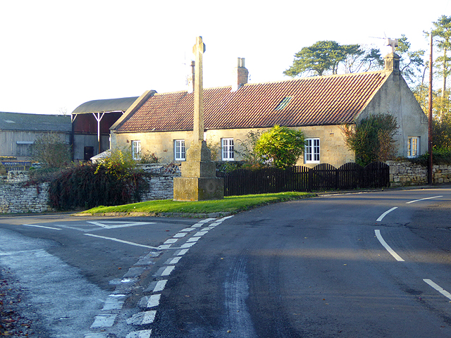
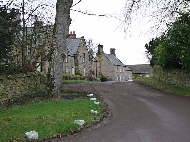
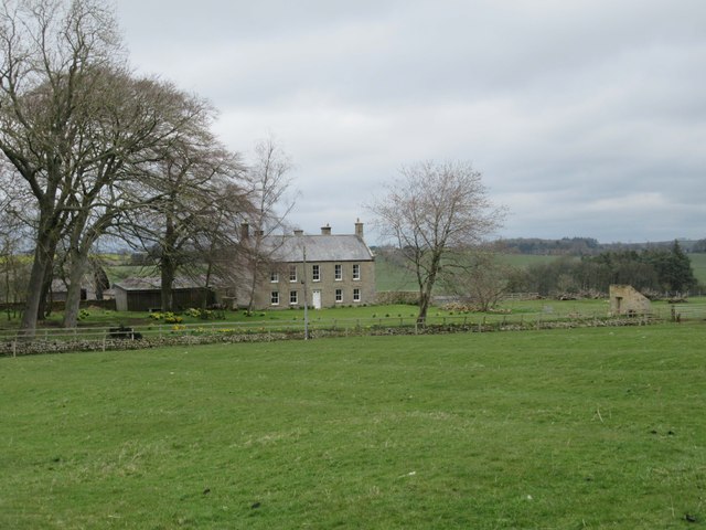
HARTBURN, a township and small village in the parish of the same name, }.s the property of Greenwich Hospital. The township contains 86 acres, and its rateable value is £104. The number of inhabitants in 1801, was 25; in 1811, 16; in 1B21, 23; in 1831, 17; in 1841, 30; and in 1851, 40 souls. THE VILLAGE of Hartburn is situated seven and a half miles west by north of Morpeth, on the west side of the beautiful glen and rivulet from which it derives its name. This burn, which is here crossed by a good stone bridge, rises at Otter-caps, eight miles W.N.W. of Hartburn, and falls into the Wans-beck, about one mile and a half E.S.E. of this village. THE PARISH CHURCH is an ancient structure, consisting of a large square tower, and a chancel, nave, and aisles. Its register commences in the year 1678. The living is a vicarage with the curacy of Nether Witton attached, in the archdeaconry of Lindisfarne and deanery of Morpeth, valued in the Liber Regis, at £20 0s. l0d.; gross income £520. Patron, the Bishop of Durham; incumbent, the Rev. Richard Croft, M.A. There is a school here, the master of which receives the interest of £90 for teaching four poor-children. Of the above £86 Mr. John Arthur bequeathed £50 in 1802, and the remaining £36 were left by Mr. John Green, in 1824.
DIRECTORY. Rev. Richard Croft, M.A., vicar; Henry Barrister, school master; and Robert Sisterson, road surveyor, Rothley Saw Mills.
HARTBURN GRANGE, a township in the above parish, is situated about two miles west of Hartburn. It contains 1,157 acres, the property of Greenwich Hospital, and the rateable value is £664 16s. Its population in 1801, was 54; in 1811, 68; in 1821, 68; in 1831, 66; in 1841,60; and in 1851, 59 souls. This township comprises three farms; and the farmers are Joseph Patterson, Greenside; Samuel Brewis, and Hannah Brewis, Hartburn Moor.
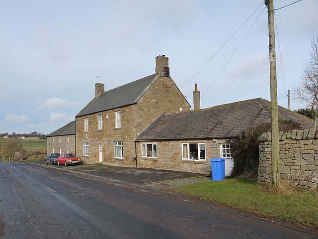
HARTINGTON is a township and hamlet in Hartburn parish, but locally situated in the north-east division of Tindale Ward. It contains 1,935 acres, and its rateable value is £714. The number of its inhabitants in 1801, was 57; in 1811, 54: in 1821, 55; in 1831, 66; in 1841, 72; and in 1851, 68 souls. Principal landowner, Sir W. C. Trevelyan, Bart. There is a tile works carried on in this township. THE HAMLET of Hartington is situated about seven miles E.S.E. of Elsdon.
DIRECTORY. Robert Oliver, blacksmith; and the farmers are Robert Dunn, Thomas Murray, and Francis and William Potts.
HARTINGTON HALL, an adjacent township to the above, is included in the same parish, and same division of Tindale ,Ward. It comprises 1,005 acres, the property of Sir W. C. Trevelyan, Bart., and its rateable value is £567. The number of its inhabitants in 1801, was 36 ; in 1811, 37; in 1821, 45; in 1831, 44; in 1841, 36; and in 1851, 51 souls. Robert Forster, Hartington Hall, is the principal resident.
HARWOOD, a township in the north eastern division of Tindale Ward, and parish of Hartburn, contains 3,795 acres, the property of Sir W. C. Trevelyan, Bart., and consists principally of uncultivated moorland. The number of its inhabitants in 1801, was 34; in 1811, 36 ; in 1821, 39; in 1831, 47; in 1841, 42; and in 1851, 48 souls. The rateable value is £605. The remain& pf a Roman camp are still visible in this township, near the residence of Mr. John Thornton. The principal residents are John Aynsley; and John Thornton, Harwood.
HIGHLAWS township is situated eight and a half miles west by south of Morpeth, and contains 295 acres, the property of John Robson, Esq. Its population in 1801, was 16; in 1811, 26; in 1821, 27; in 1831, 18; in 1841,16; and in 1851, 7 souls. The rateable value is £243. This township consists of one farm, which is occupied by Mr. Edward Lamb, farmer.
LONGWHITTON is a township and village, the property of Sir Waiter Trevelyan, Bart. The township contains 2,247 acres, and its rateable value is £1,422. The population in 1801, was 124; in 1811, 143; in 1821, 149; in 1831, 143 ; in 1811, 135; and in 1851, 149 souls. There is a colliery in this township worked by Messrs. Blackett and Davison. In the Hartburn Dean, in this township, three medicinal springs issue from a high ridge of whinstone rock, and are said to be of much utility in cases of scurvy, agues, and diseases of the eye. THE VILLAGE of Longwhitton is situated ten miles W.N.W. or Morpeth; and at its eastern end is LONGWHITTON HALL, the seat of Edward Spencer Trevelyan, Esq.
|
Blackett John, tailor & draper, shopkeeper, and colliery owner Greason William, joiner and cartwright Richardson William, blacksmith Trevelyan Edward Spencer .Esq., The Hall |
Farmers Bell Thomas Bewick George, South Whitton Dixon George, Dean Liddell Joseph, Whitton Stone Patterson John, Hill End |
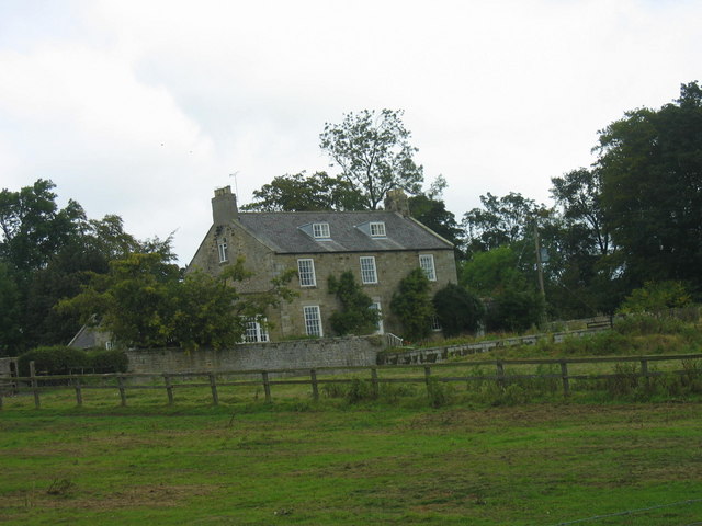
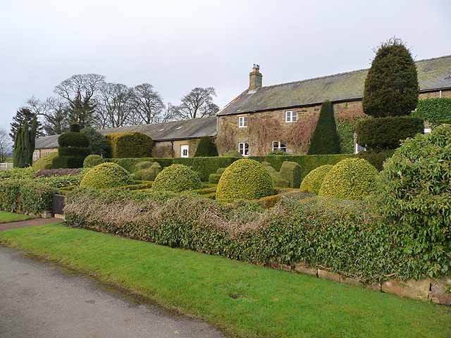
MIDDLETON (NORTH) is a township and village containing, with Todrige township, an area of 1,128 acres. It is the property of Robert Coull, Esq., and Miss Bell, and its rateable value is £1,413 10s. The number of its inhabitants in 1801, was 88; in 1811, 63; in 1821, 75; in 1831, 108; in 1841, 92; and in 1851, 104 souls. THE VILLAGE of North Middleton is nine miles west of Morpeth, and possesses a small Chapel, belonging to the United Secession Church of Scotland, erected, in 1815, on a site given by William Coull, Esq. Rev. James Robertson is the present minister. NORTH MIDDLETON HALL, the seat of Robert Coull, Esq., is delightfully situated on the north side of the Wansbeck.
|
Coull Robert, Esq. The Hall Davidson William, farmer and miller Dixon Thomas, vict. Three Horse Shoes Hall Robert, land steward |
Lamb James, shopkeeper Robertson Rev. James (Presbyterian) Robertson Andrew farmer |
CARRIER. John Turner, to Morpeth on Wednesdays, and Newcastle on Saturdays.
MIDDLETON (SOUTH) is a township on the south side of the river Wansbeck, eighteen miles north-west by west of Newcastle. It contains 609 acres, the property of J. H. H. Atkinson, Esq., and its rateable value is £490. The population id 1801, was 17; in 1811, 27; in 1821, 31; in 1831, 33; in 1841, 19, and in 1851, 23 souls.
DIRECTORY. Lancelot Robson, farmer, East Farm; and William Robson, farmer, West Farm.
ROTHLEY, a township and village in Hartburn parish contains 2,720 acres, and its rateable value is £1,148. Its population in 1801, was 160; in 1811, 144; in 1821, 150; in 1831, 138; in 1841, 143; and in 1851, 141 souls. The sole landowner is Sir Waiter Trevelyan, Bart., lord of the manor. THE VILLAGE of Rothley is situated ten miles west by north of Morpeth. A little to the north of the village, on the summit of a lofty crag, is situated Rothley Castle, an ornamental building, erected by Sir W. C. Blackett. It stands in a spacious park; and. when viewed from a distance, has every appearance of an old baronial mansion. During the border ''raids,'' Rothley served as a depot for the reception of cattle.
|
Brody Matthew, tailor Lambton Margaret, shopkeeper Lambton Mary, shopkeeper Thornton James, shoemaker |
Farmers Hindmarsh Thomas Lamb Joseph, and miller, Rothley Mill Mather John, Rothley Shields Thornton Richard, Duncan Ridge |
SHAFTOE (EAST) is a township in this parish, but locally situated in the north-eastern division of Tindale Ward, seventeen miles north-west from Newcastle. It contains 602 acres, the property of Lord Decies, who is also lord of the manor. The number of its inhabitants in 1801, was 36 ; in 1811, 28; in 1821, 35; in 1831, 41; in 1841. 38; and in 1851, 30 souls. Shaftoe was in ancient times the property of a family which assumed the local name. Behind the Old HALL is a lofty and fertile eminence called Shaftoe Crag; and near to this is a large natural cave, capable of seating forty persons.
DIRECTORY. The farmers are Samuel Brewis, John Gledston, and James and Thomas Lumsdon.
SHAFTOE (WEST) is an adjacent township to the above, and is also the property of the same proprietor. It contains 489 acres, and its population in 1801, was 40; in 1811, 40; in 1821, 54; in 1831, 68; in 1841, 31; and in 1851, 36 souls. This township was formerly the property of the Aynsley family.
DIRECTORY. John Lumsdon, farmer, West Shaftoe; and Joseph Vardy, surgeon, Shaftoe Moor.
THORNTON (EAST) is a township situated six miles west by north of Morpeth. Its area is 1,026 acres, and its rateable value £699. The number of its inhabitants in 1801, was 58; in 1811, 40; in 1821, 61 ; in 1831, 59; in1841, 51; and in 1851, 76 souls. This township includes the village of Meldon-Park-Corner, and is the property of John Cookson Esq., of Meldon Hall.
|
Hindmarsh James, tailor, draper, and shopkeeper Lawton Ann, shopkeeper Mitchell George, vict. Fox and Hounds Rear William, blacksmith |
Farmers Howey William, Needless Hall Swan William, Needless Hall Moor |
THORNTON WEST is a township and hamlet containing 1,047 acres, the property of Messrs. Trevelyan and Witham, and its rateable value is £983. The number of inhabitants in 1801, was 21; in 1811, 36; in 1821, 43; in 1831, 53; in 1841, 58; and in 1851, 75 souls. THE HAMLET of West Thornton is situated on an eminence, which is supposed to have been the site of a Roman castellum, seven miles west by north of Morpeth. It is said that in 1717, there were vestiges of a considerable town here, intersected by a military road; but they have all disappeared.
DIRECTORY. Messrs. John and Frederick Swan, farmers and graziers, Thornton House.
TODRIDGE township is situated three miles W.S.W. of Hartburn. Its area is returned with that of North Middleton, and the rateable value is £65. Its population in 1801, was 4; in 1811, 10; in 1821, 8; in 1831, 4; in 1841, 6; in 1851, 5 souls. Sole. proprietor, Robert Coull, Esq-; and Thomas Shanks, farmer, is the principal ,resident.
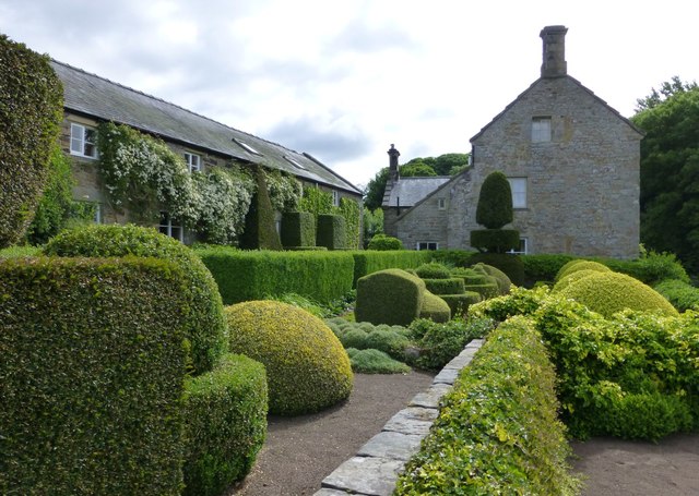
WALLINGTON is a township and hamlet, in the north-eastern division of Tindale Ward and parish of Hartburn. It comprises 1,781 acres, and contained ln 1801, 161; in 1811, 192; in 1821, 205; in 1831, 193; in 1841, 167; and in 1851, 204 inhabitants. The rateable value is £1,069. The manor of Wallington was held under the Bolbeck barony, from 1326 to 1365, by John. Grey, better known by the name of John de Wallington, upon whose death the estates and honours of the family devolved upon his daughter, at whose demise Wallington became the property of Sir John Fenwick, of Fenwick Tower, who had married her youngest daughter, and co-heiress. It remained in the Fenwick family for many ages, but was purchased, about the beginning of the 18th century, by Sir William Blackett, Bart., upon whose death the whole of his large possessions became the property of Elizabeth Ord, his natural daughter, upon her marriage with Walter Calverley, his nephew, who, in conformity with his uncle's will, assumed the name and arms of Blackett. He represented Newcastle in parliament for the space of forty years; and in 1734 erected the edifice on the south side of St. Nicholas's Church in that town, for the reception of the library, which had been bequeathed to the inhabitants of Newcastle by Dr. Tomlinson. He was remarkable for his many acts of benevolence; and Blackett's Hospital in Newcastle, will long cause his name to be remembered. He died without issue in 1777, when Wallington estate was inherited by his sister Julia, who married Sir George Trevelyan, Bart., of Nettlecomb, near Taunton, Somersetshire, and after her death it became the property of Sir John Trevelyan, Bart., who died in 1828, and was succeeded by his son, Sir John Trevelyan, Bart. It is now the property of Sir Waiter Calverley Trevelyan, Bart. THE HAMLET of Wallington is situated eleven and a quarter miles west of Morpeth. WALLTNGTON HALL, the seat and property of the lord of the manor, is an elegant and extensive stone structure, occupying a beautiful situation on a gentle eminence, sur- rounded by thick groves of luxuriant forest trees. The Wansbeck runs eastwards through the lawn, and is crossed by a fine stone bridge, with three arches and open battlements. The gardens are tastefully laid out, and every surrounding object is so happily arranged as to form a scene beautifully romantic.
|
Anderson Robert, tailor, Close Houses Arkle James, tea dealer, Scotch Gap Codling Henry, joiner, Dove Cot Hedley Anthony, gardener, Wallington Portico Simpson Mr. George, Newbiggan Trevelyan Sir Waiter Calverley, Bart. Wallington Hall Young Matthew, boot & shoemaker, Close Houses |
Farmers Aynsley William, Newhouses Brown Thomas, Elfhills Davison Joseph, Newbiggan Richardson George, Brown House Snowball John and James, Price Hall Wanlace George |
WHTRIDGE township is situated three miles north-west of Hartburn, and is the property of Sir Waiter Trevelyan, Bart. The rateable value is £96, and its population in 1801, was 10; in 1811, 10; in 1821, 10; in 1831, 11; in 1841, 9; and in 1851, 7 souls. The principal resident is Robert Snowden, farmer.