Topics > Historical Periods > Middle Ages (1154 to 1485 AD) > Standing Cross
Standing Cross
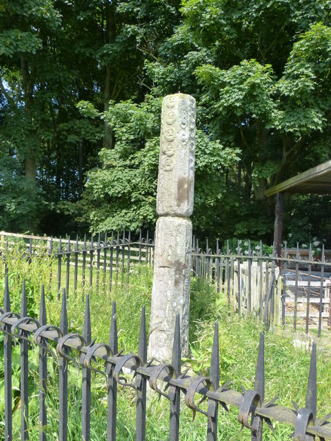
Standing crosses are free-standing structures, mostly erected during the Medieval period. They have a diverse range of designs, ranging from simple monoliths and common stepped crosses to elaborate spire-shaped monuments and vaulted preaching crosses. They served various religious and secular purposes; some served as boundary markers, battle commemorations, sanctuary symbols, and focal points for market transactions, public announcements, and penance. It is estimated that there were around 12,000 standing crosses in England - fewer than 2,000 remain today, as many were destroyed during the Reformation, and lost over time. Standing crossed are important for understanding Medieval customs and settlement patterns.
Standing cross is a broad term, which includes, but is not limited to:
- Village cross
- Market cross
- High cross
- Wayside cross
- Boundary cross (or stone)
- Plague stones (often socket stones)
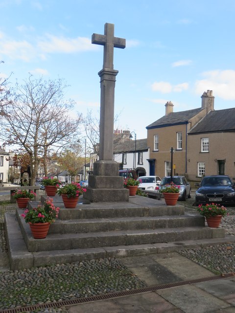
- Commemorative cross
Below are some examples of Standing Crosses in the North East and Cumbria.
Co-Curate Page
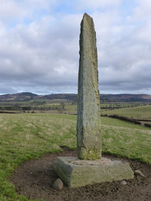
The Hurl Stone
- Overview Map Tthe Hurl Stone is a Medieval standing cross located near Newtown and Lilburn Tower in Northumberland. The stone is a Scheduled Monument.

Co-Curate Page
Medieval Wayside Cross, Bowes
- Overview Map Street View The substantial remains of a Medieval wayside cross are located in the front garden of Cross House, on the north side of The Street in Bowes. …
Co-Curate Page
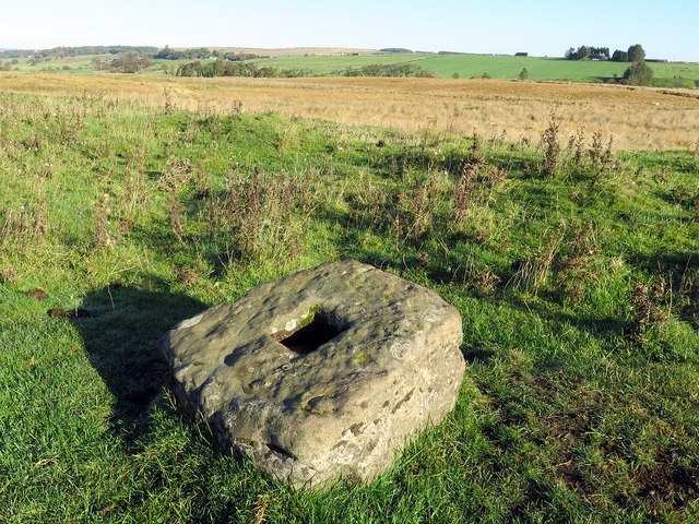
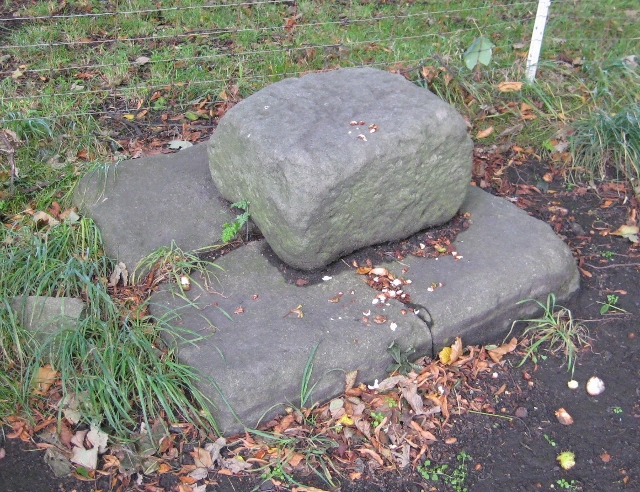
Medieval wayside cross, Brownrigg
- Overview Map The socket stone of a Medieval wayside cross is located 200m north-west of Brownrigg (in Rochester with Byreness Civil Parish), by the route of Dere Street (Roman Road). …
Co-Curate Page
Crosshill Stone, Grains o'th' Beck
- Overview Map Street View Crosshill Stone, is an old wayside cross by the B6276 road, at Grains o'th' Beck, is a Medieval cross base with a (probably) later slab. It …

Co-Curate Page
Outer Golden Pot
- Overview Map The Outer Golden Pot is the socket stone of a medieval wayside cross, situated in an elevated position on the western edge of Dere Street, the Roman road between …

Co-Curate Page
Medieval Cross, south of Walwick Grange
- Overview Map Street View The substantive remains of a Medieval wayside cross are located on Homer's Lane, a minor road which runs along the west banks of the River North …
Co-Curate Page
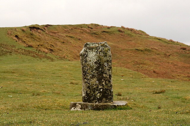
Percy's Cross (between Powburn & Wooperton)
- Overview Map This is a 15th century wayside cross, located close to the A697 road between Powburn and Wooperton in Northumberland. The cross commemorates Sir Ralph Percy who was killed near …

Co-Curate Page
Middle Golden Pot
- Overview Map The Middle Golden Pot is the socket stone of a medieval wayside cross, situated in an elevated position on the western edge of Dere Street, the Roman road …
Co-Curate Page
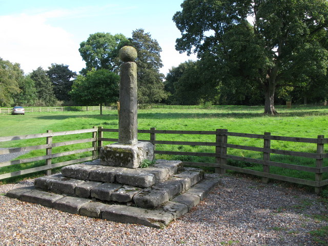
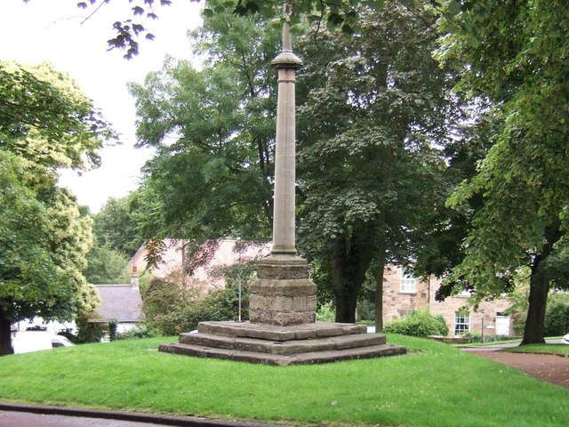
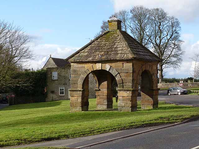
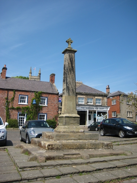
Village Cross
- Overview Map Street View The village Cross in Bywell dates from the 13th century. Having being damaged the structure was altered in the 18th century when a stone ball was …
Co-Curate Page
Village Cross, Greystoke
- Overview Map Street View The red sandstone village cross stands on an octagonal plinth on a green in Greystoke. It was probably built in the 17th century (first mentioned in …
Co-Curate Page
Village Cross, Esh
- Overview Map Street View Esh Cross is located in its original position on a raised area at the southern end of the village green in Esh. It is an important …
Co-Curate Page
Village Cross, Cleatlam
- Overview Map Street View The base stones of a village cross, thought to be of medieval origin, are located on the Village Green at Cleatlam.[1] The stone base is Grade …
Co-Curate Page
Village Cross
- Overview Map Street View The village cross in Ryton is situated in a prominent position on the village green. Standing on the site of an earlier cross, it dates from …
Co-Curate Page
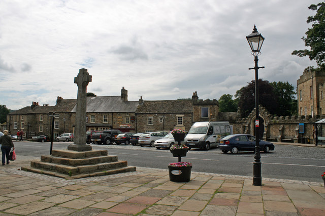
Legs Cross
- Overview Map Street View Near Bolam, County Durham. "The base and fragment of a cross shaft dating from the 9th century. A rough cut rectangular sandstone base, badly worn, but …
Co-Curate Page
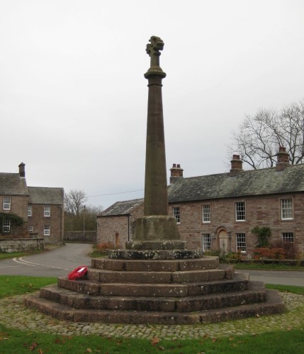
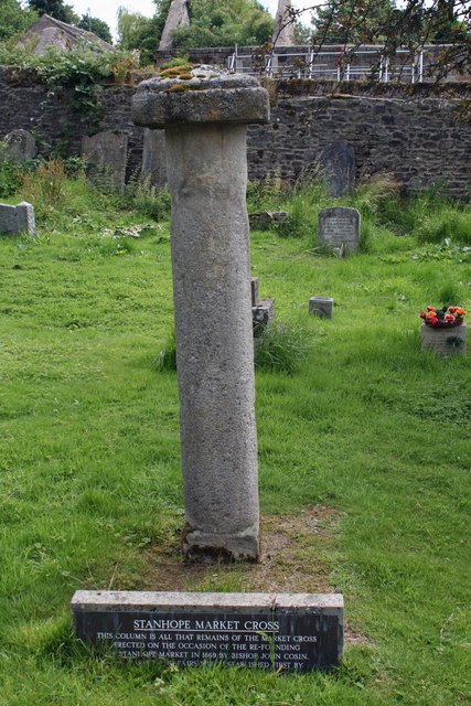
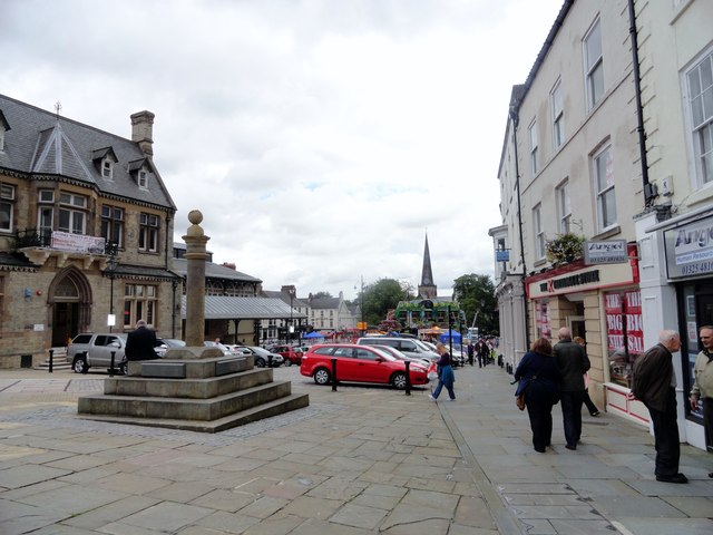
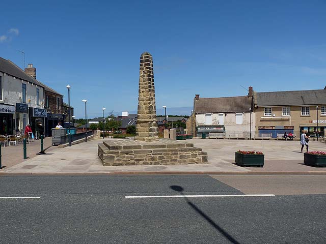
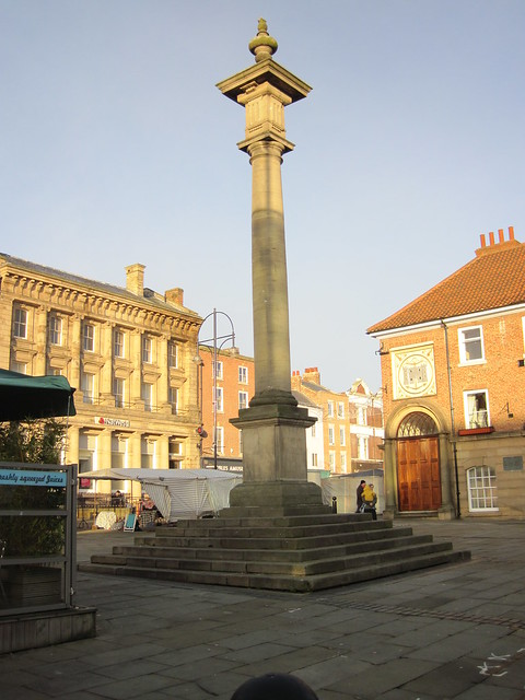
Old Market Cross
- Overview Map The remains of the original Stanhope market cross of 1669 are located in the churchyard of St Thomas' Church. It was moved there after the 'new' market cross …
Co-Curate Page
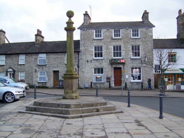
Market Cross, Milnthorpe
- Overview Map Street View The Market Cross in Milnthorpe dates from the 18th century, with the cross repaired or replaced in the early 19th century. In 1845 the cross was …
Co-Curate Page
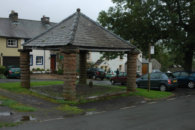
Market Cross
- Overview Map Street View The Market Cross (aka "Butter Cross") is located on the western side of the village green in Stamfordham. It is a small square, single-storey building, with …
Co-Curate Page
Market Cross
- Overview Map Street View The Market Cross is located in the Market Place in Alston. It was first erected in 1764. The Market Cross was rebuilt in 1883, but taken …
Co-Curate Page
Market Cross, Dalton-in-Furness
- Overview Map Street View The Market Cross stands in the Market Place in the heart of Dalton-in-Furness. It was built, along with a crescent shaped stone bench in 1869-1870. It …
Co-Curate Page
Horsemarket, Darlington
- Overview Map Street View Horsemarket (Horse Market on some maps) is a street in the centre of Darlington, running west from Feethams (street) to West Row. The Old Town Hall …
Co-Curate Page
Market Cross, Hesket Newmarket
- Overview Map Street View The Market Cross is located on the village green at Hesket Newmarket. It is an early 19th century rebuild of an earlier market cross, built after …
Co-Curate Page
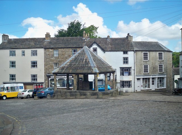
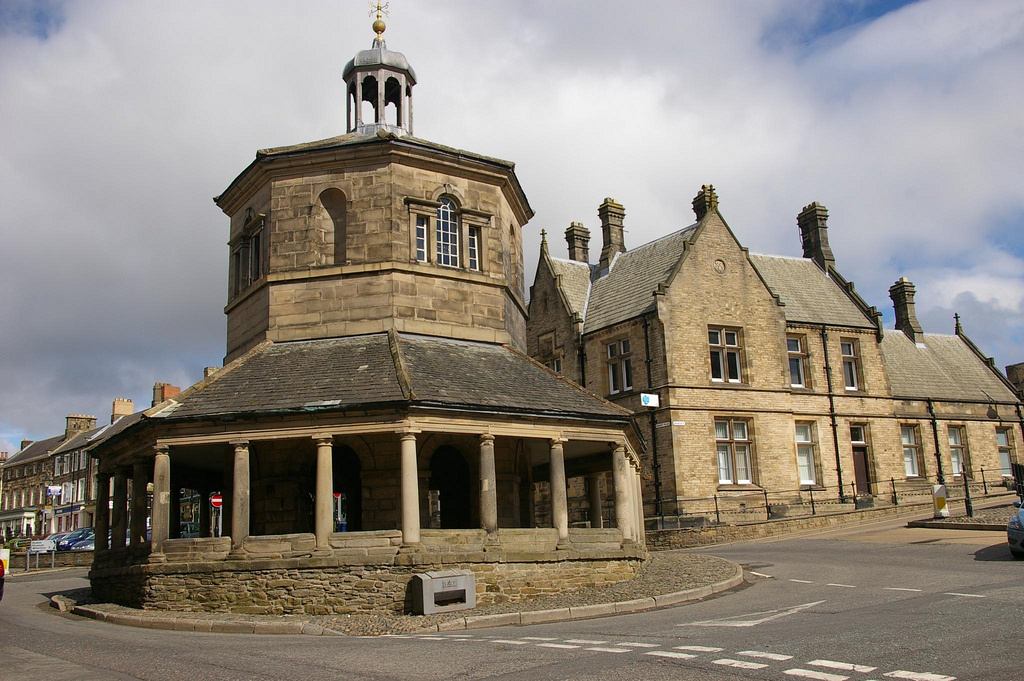
Market Cross
- Overview Street View The Market Cross or Butter Market at Barnard Castle was built in 1747 at the expense of Thomas Breaks. During its history the octagonal building has served …
Co-Curate Page
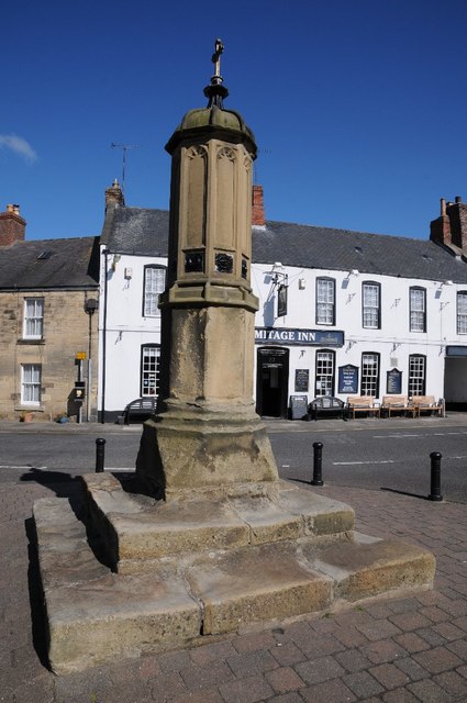
Market Cross, Warkworth
- Overview Map Street View The Market Cross in Warkworth is located on Castle Street, at the junction with Dial Place. It's stepped base probably survives from 1706. The upper part of …
Co-Curate Page
Old Market Cross, Kirkby Lonsdale
- Overview Map Street View The medieval market cross is located on the cobbled square of the Swinemarket in Kirkby Lonsdale. The cross originally stood at junction of Main Street, Market …
Co-Curate Page
Market Cross
- Overview Map Street View The Market Cross stands in the Market Place in Belford, opposite the Blue Bell Hotel. The cross dates from the 18th or early 19th century, and it's …
Co-Curate Page
Market Cross
- Overview Map Street View The market cross in Middleton-in-Teesdale is thought to date from the early 18th century. It is located on a green by the Market Place, at the …
Co-Curate Page
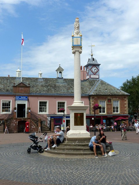
Market Cross, Darlington
- Overview Map Street View The Market Cross in Darlington is located by the junction of Horsemarket and West Row / Blackwellgate. The current cross dates from 1727, commissioned by Dame …
Co-Curate Page
Market Cross
- Overview Map Street View The Market Cross, thought to be from the 18th century, is located in the Market Place in Bedlington. The cross is Grade II listed.
Co-Curate Page
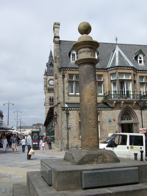
Market Cross
- Overview Map Street View The Market Cross in Carlisle was built in 1682 on the site of a previous medieval cross. It is inscribed "JOSEPH REED MAYOR 1682" and features …
Co-Curate Page
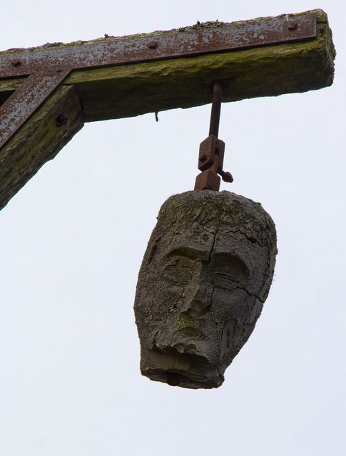
Winter's Gibbet and Steng Cross
- Overview Map Street View Winter's Gibbet is a 19th century replica of the gallows from which William Winter was hung for the murder of Margaret Crozier in 1791. It is …
Co-Curate Page
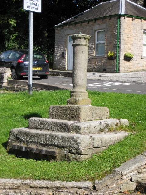
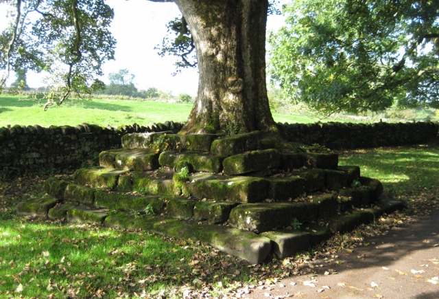
Roadside Preaching Cross, Great Ormside
- Overview Map Street View There is a square late medieval cross-base with 5 steps at Great Ormside. The cross was destroyed during the Commonwealth and, shortly afterwards, a sycamore sapling …
Co-Curate Page
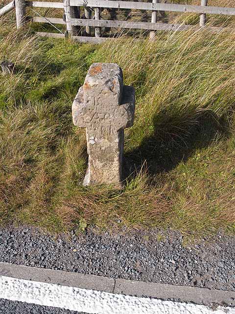
Killhope Cross, near Nenthead
- Overview Map Street View Killhope Cross is a small roadside cross, thought to be of medieval origins, located by the A689 on the county border between Cumbria and County Durham, …
Co-Curate Page
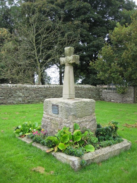
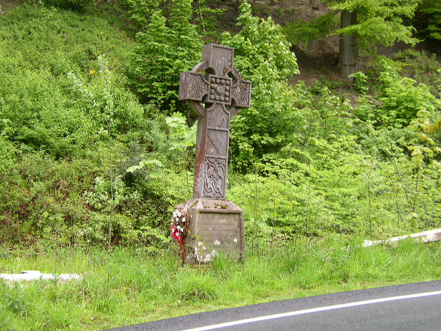
Derwentwater Memorial Cross
- Overview Map Street View This carved memorial cross is located on the roadside on the A686 between Langley Castle and Haydon Bridge. The Celtic-style wheel cross was erected by Cadwallader …

Co-Curate Page
The Hurl Stone
- Overview Map Tthe Hurl Stone is a Medieval standing cross located near Newtown and Lilburn Tower in Northumberland. The stone is a Scheduled Monument.
Co-Curate Page
Medieval Wayside Cross, Bowes
- Overview Map Street View The substantial remains of a Medieval wayside cross are located in the front garden of Cross House, on the north side of The Street in Bowes. …
Co-Curate Page
Medieval wayside cross, Brownrigg
- Overview Map The socket stone of a Medieval wayside cross is located 200m north-west of Brownrigg (in Rochester with Byreness Civil Parish), by the route of Dere Street (Roman Road). …
Co-Curate Page
Crosshill Stone, Grains o'th' Beck
- Overview Map Street View Crosshill Stone, is an old wayside cross by the B6276 road, at Grains o'th' Beck, is a Medieval cross base with a (probably) later slab. It …
Co-Curate Page
Outer Golden Pot
- Overview Map The Outer Golden Pot is the socket stone of a medieval wayside cross, situated in an elevated position on the western edge of Dere Street, the Roman road between …
Co-Curate Page
Medieval Cross, south of Walwick Grange
- Overview Map Street View The substantive remains of a Medieval wayside cross are located on Homer's Lane, a minor road which runs along the west banks of the River North …
Co-Curate Page
Percy's Cross (between Powburn & Wooperton)
- Overview Map This is a 15th century wayside cross, located close to the A697 road between Powburn and Wooperton in Northumberland. The cross commemorates Sir Ralph Percy who was killed near …
Co-Curate Page
Middle Golden Pot
- Overview Map The Middle Golden Pot is the socket stone of a medieval wayside cross, situated in an elevated position on the western edge of Dere Street, the Roman road …
Co-Curate Page
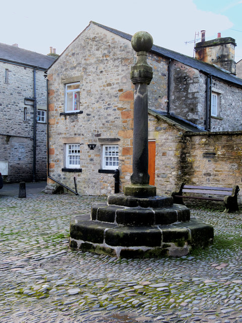
Village Cross
- Overview Map Street View The village Cross in Bywell dates from the 13th century. Having being damaged the structure was altered in the 18th century when a stone ball was …
Co-Curate Page
Village Cross, Greystoke
- Overview Map Street View The red sandstone village cross stands on an octagonal plinth on a green in Greystoke. It was probably built in the 17th century (first mentioned in …
Co-Curate Page
Village Cross, Esh
- Overview Map Street View Esh Cross is located in its original position on a raised area at the southern end of the village green in Esh. It is an important …
Co-Curate Page
Village Cross, Cleatlam
- Overview Map Street View The base stones of a village cross, thought to be of medieval origin, are located on the Village Green at Cleatlam.[1] The stone base is Grade …
Co-Curate Page
Village Cross
- Overview Map Street View The village cross in Ryton is situated in a prominent position on the village green. Standing on the site of an earlier cross, it dates from …
Co-Curate Page
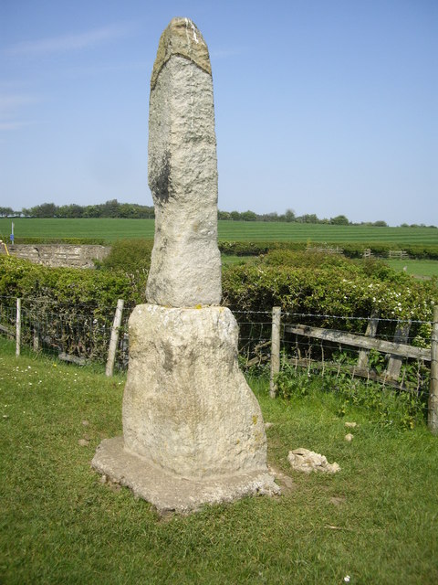
Legs Cross
- Overview Map Street View Near Bolam, County Durham. "The base and fragment of a cross shaft dating from the 9th century. A rough cut rectangular sandstone base, badly worn, but …
Co-Curate Page
Old Market Cross
- Overview Map The remains of the original Stanhope market cross of 1669 are located in the churchyard of St Thomas' Church. It was moved there after the 'new' market cross …
Co-Curate Page
Market Cross, Milnthorpe
- Overview Map Street View The Market Cross in Milnthorpe dates from the 18th century, with the cross repaired or replaced in the early 19th century. In 1845 the cross was …
Co-Curate Page
Market Cross
- Overview Map Street View The Market Cross (aka "Butter Cross") is located on the western side of the village green in Stamfordham. It is a small square, single-storey building, with …
Co-Curate Page
Market Cross
- Overview Map Street View The Market Cross is located in the Market Place in Alston. It was first erected in 1764. The Market Cross was rebuilt in 1883, but taken …
Co-Curate Page
Market Cross, Dalton-in-Furness
- Overview Map Street View The Market Cross stands in the Market Place in the heart of Dalton-in-Furness. It was built, along with a crescent shaped stone bench in 1869-1870. It …
Co-Curate Page
Horsemarket, Darlington
- Overview Map Street View Horsemarket (Horse Market on some maps) is a street in the centre of Darlington, running west from Feethams (street) to West Row. The Old Town Hall …
Co-Curate Page
Market Cross, Hesket Newmarket
- Overview Map Street View The Market Cross is located on the village green at Hesket Newmarket. It is an early 19th century rebuild of an earlier market cross, built after …
Co-Curate Page
Market Cross
- Overview Street View The Market Cross or Butter Market at Barnard Castle was built in 1747 at the expense of Thomas Breaks. During its history the octagonal building has served …
Co-Curate Page
Market Cross, Warkworth
- Overview Map Street View The Market Cross in Warkworth is located on Castle Street, at the junction with Dial Place. It's stepped base probably survives from 1706. The upper part of …
Co-Curate Page
Old Market Cross, Kirkby Lonsdale
- Overview Map Street View The medieval market cross is located on the cobbled square of the Swinemarket in Kirkby Lonsdale. The cross originally stood at junction of Main Street, Market …
Co-Curate Page
Market Cross
- Overview Map Street View The Market Cross stands in the Market Place in Belford, opposite the Blue Bell Hotel. The cross dates from the 18th or early 19th century, and it's …
Co-Curate Page
Market Cross
- Overview Map Street View The market cross in Middleton-in-Teesdale is thought to date from the early 18th century. It is located on a green by the Market Place, at the …
Co-Curate Page
Market Cross, Darlington
- Overview Map Street View The Market Cross in Darlington is located by the junction of Horsemarket and West Row / Blackwellgate. The current cross dates from 1727, commissioned by Dame …
Co-Curate Page
Market Cross
- Overview Map Street View The Market Cross, thought to be from the 18th century, is located in the Market Place in Bedlington. The cross is Grade II listed.
Co-Curate Page
Market Cross
- Overview Map Street View The Market Cross in Carlisle was built in 1682 on the site of a previous medieval cross. It is inscribed "JOSEPH REED MAYOR 1682" and features …
Co-Curate Page
Winter's Gibbet and Steng Cross
- Overview Map Street View Winter's Gibbet is a 19th century replica of the gallows from which William Winter was hung for the murder of Margaret Crozier in 1791. It is …
Co-Curate Page
Roadside Preaching Cross, Great Ormside
- Overview Map Street View There is a square late medieval cross-base with 5 steps at Great Ormside. The cross was destroyed during the Commonwealth and, shortly afterwards, a sycamore sapling …
Co-Curate Page
Killhope Cross, near Nenthead
- Overview Map Street View Killhope Cross is a small roadside cross, thought to be of medieval origins, located by the A689 on the county border between Cumbria and County Durham, …


