Topics > Tyne and Wear > Newcastle upon Tyne > Scotswood > Scotswood Road
Scotswood Road
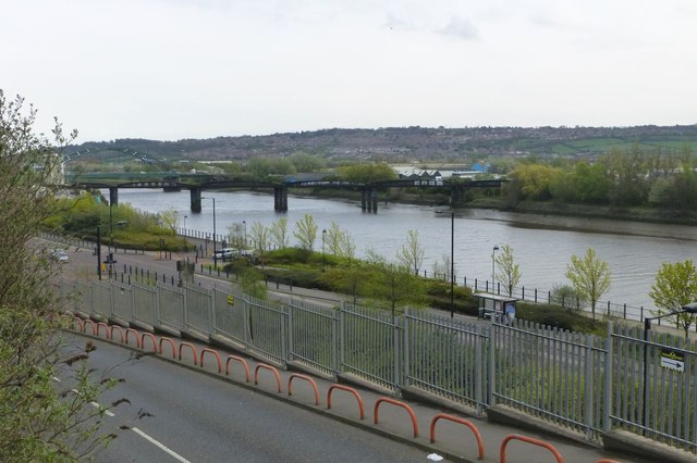
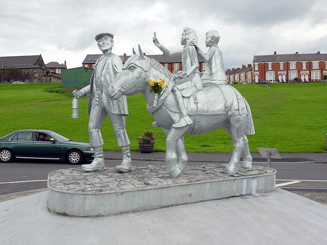
Scotswood Road is a main route along the north side of the River Tyne from Newcastle to the West End. The road, once dominated by the factories of Vickers Armstrong, is featured in the iconic song "Blaydon Races". The road begins in Newcastle city centre near the Centre for Life. It runs west, close to the riverside, through Cuddas Park, Elswick, Benwell / Benwell Grange and on to Scotswood as the A695 until the Scotswood Bridge. After the bridge, Scotswood Road itself continues beyond Scotswood as the A6085 to Bells Close and goes on to join Tyne View in Lemington.
from Newcastle libraries (flickr)
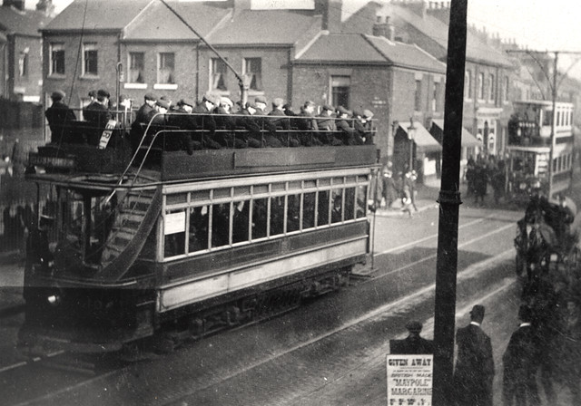
049111:Tram Scotswood Road/Park Road Elswick Unknown 1910
Pinned by Simon Cotterill
from Newcastle libraries (flickr)
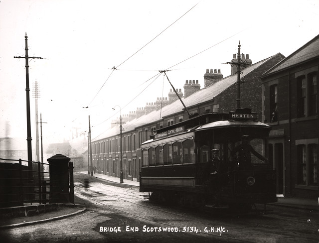
022980:Scotswood Road, Newcastle Upon Tyne c.1907
Pinned by Simon Cotterill
from Newcastle libraries (flickr)
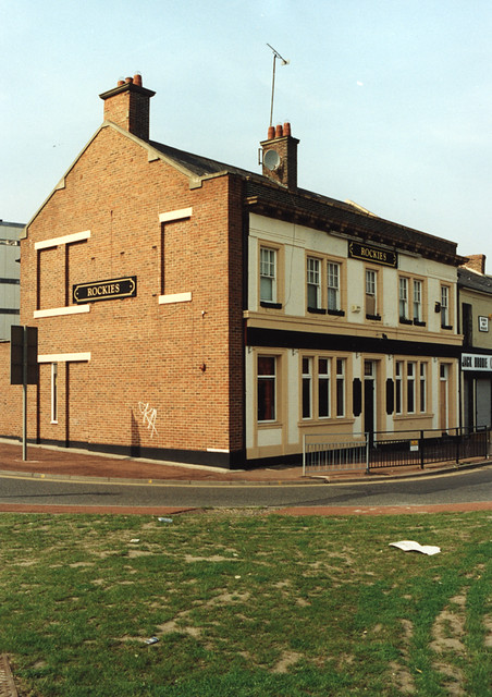
061529:Rockies Scotswood Road Maybury Malcolm 1995
Pinned by Simon Cotterill
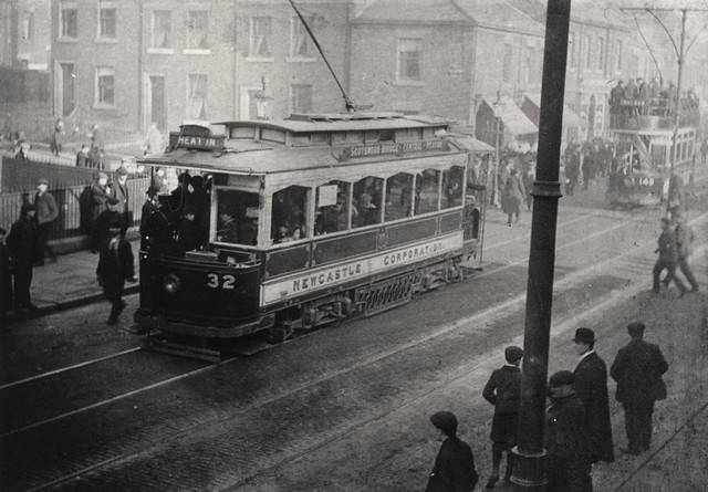
from Newcastle libraries (flickr)
049112:Tram Scotswood Road/Park Road Elswick Unknown 1910
Pinned by Simon Cotterill
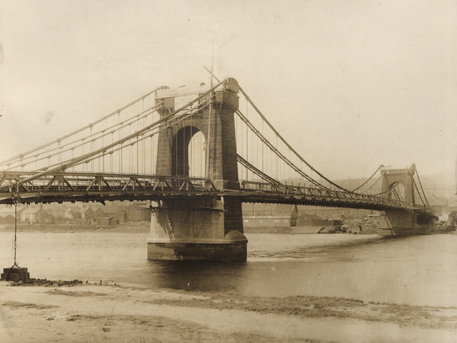
from Newcastle libraries (flickr)
003377:Scotswood Bridge Newcastle upon Tyne Unknown 1931
Pinned by Simon Cotterill
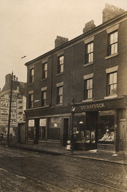
from Newcastle libraries (flickr)
050137:Scotswood Road Fenham/Benwell unknown around 1904
Pinned by Simon Cotterill
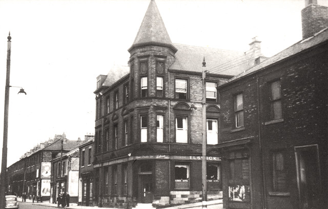
from Newcastle libraries (flickr)
714532:Elswick Hotel Scotswood Road. Unknown. 1960
Pinned by Simon Cotterill
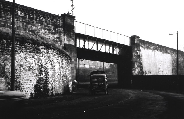
from Newcastle libraries (flickr)
051932:Paradise Bridge Scotswood Road Unknown 1957/8
Pinned by Simon Cotterill
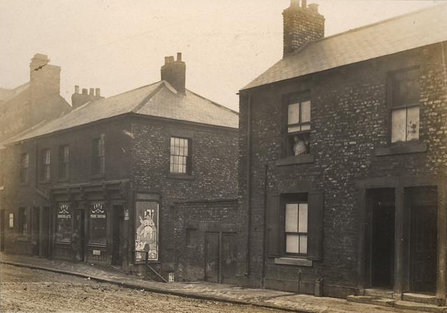
from Newcastle libraries (flickr)
050135:Scotswood Road Fenham/Benwell unknown 1904
Pinned by Simon Cotterill
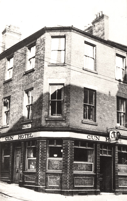
from Newcastle libraries (flickr)
714531:Gun Hotel Scotswood Road. Unknown. 1965
Pinned by Simon Cotterill
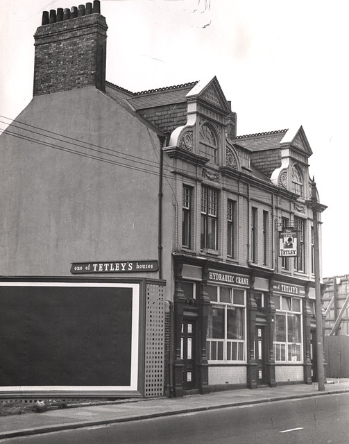
from Newcastle libraries (flickr)
020003:Hydraulic Crane pub, Scotswood Road, 1969
Pinned by Simon Cotterill
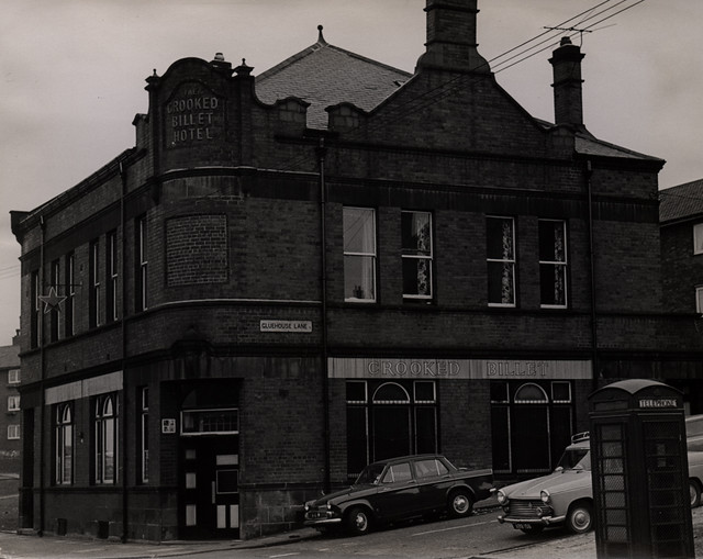
from Newcastle libraries (flickr)
017058:The Crooked Billet Hotel, Scotswood Road, 1969
Pinned by Simon Cotterill
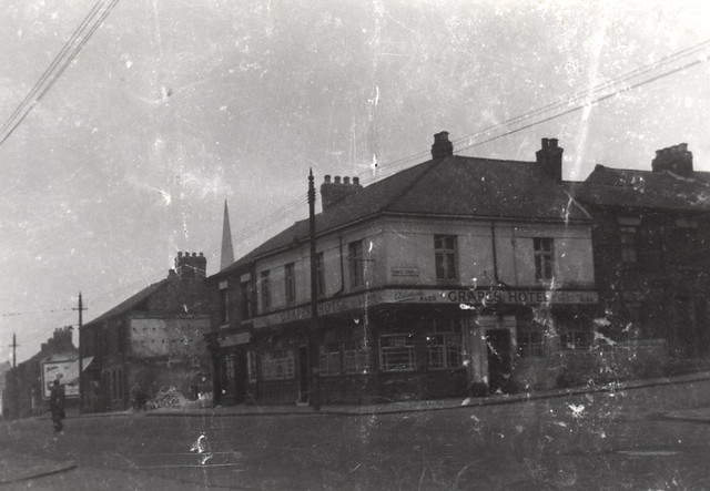
from Newcastle libraries (flickr)
038711:Grapes Hotel Scotswood Road Unknown c. 1961
Pinned by Simon Cotterill
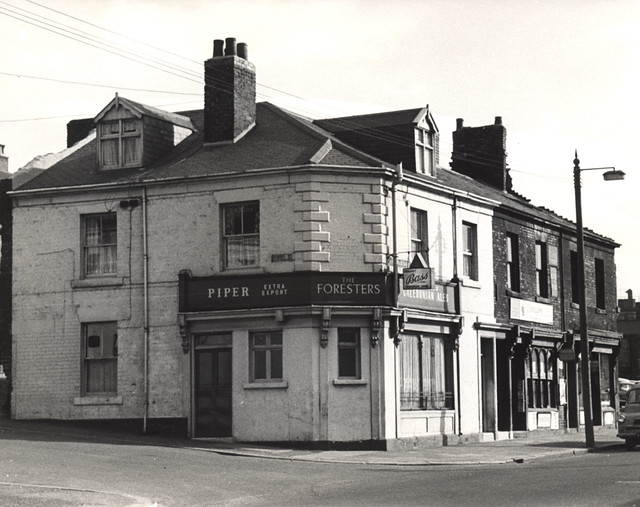
from Newcastle libraries (flickr)
015243:The Foresters Scotswood Road 1966
Pinned by Simon Cotterill
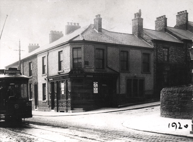
from Newcastle libraries (flickr)
015592:The Dene Hotel Scotswood RoadNewcastle upon Tyne 1920
Pinned by Simon Cotterill
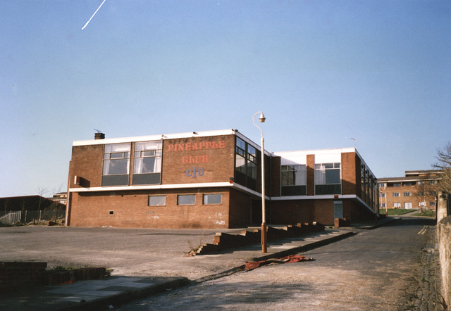
from Newcastle libraries (flickr)
069303:Pineapple Club, Scotswood Road, Newcastle upon Tyne
Pinned by Simon Cotterill
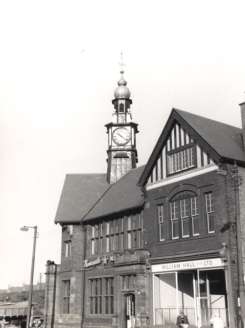
from Newcastle libraries (flickr)
058165:Ord Arms Scotswood Road Unknown c. 1960
Pinned by Simon Cotterill
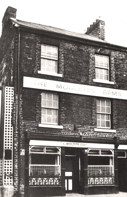
from Newcastle libraries (flickr)
714921:The Moulders Arms Scotswood Road Unknown 1965
Pinned by Simon Cotterill
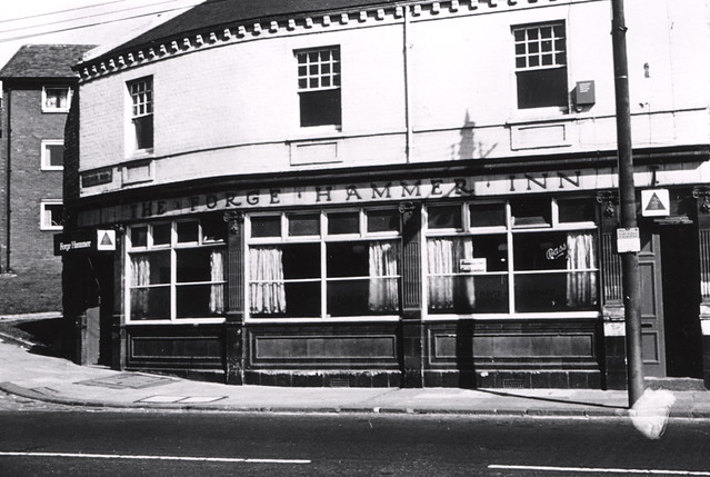
from Newcastle libraries (flickr)
030428:The Forge Hammer Inn, Scotswood Road, 1960
Pinned by Simon Cotterill
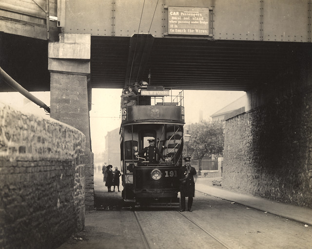
from Newcastle libraries (flickr)
050191:Tram Scotswood Road Newcastle upon Tyne Unknown c.1900
Pinned by Simon Cotterill
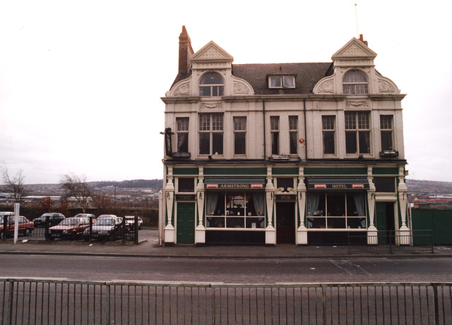
from Newcastle libraries (flickr)
061917:Armstrong Hotel Scotswood Road Maybury Malcolm 1995
Pinned by Simon Cotterill
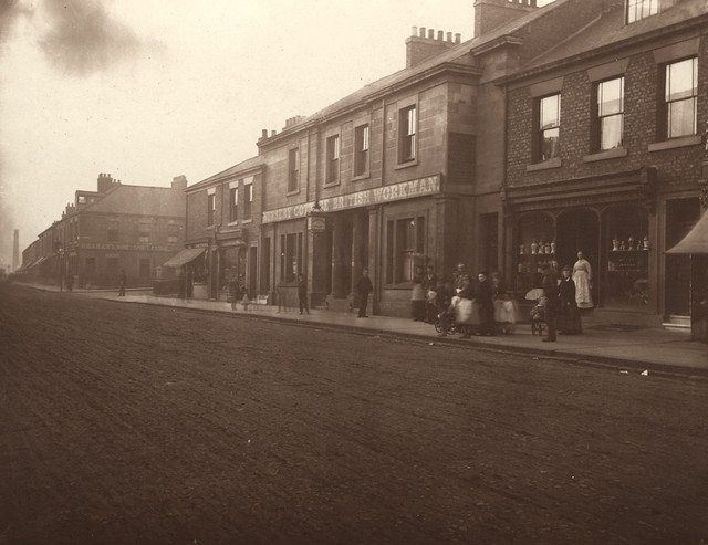
from Newcastle libraries (flickr)
003643:Nursery Cottage British Workman Scotswood Road Holmes John H. about 1876
Pinned by Simon Cotterill
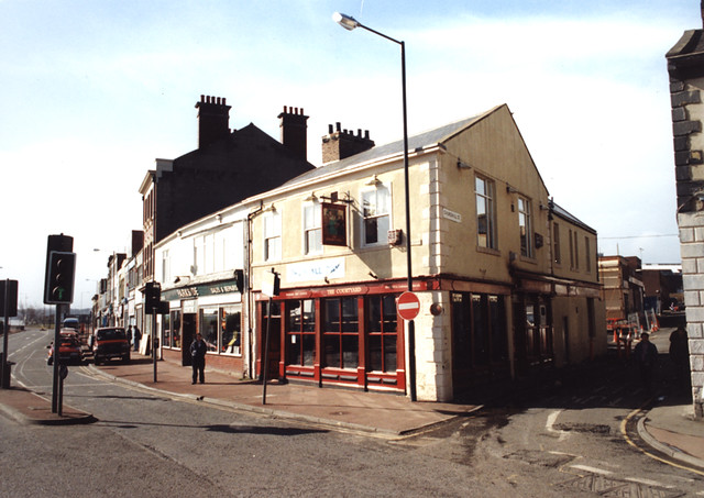
from Newcastle libraries (flickr)
061857:The Courtyard, Scotswood Road/Churchill Street, Maybury Malcolm 1995
Pinned by Simon Cotterill
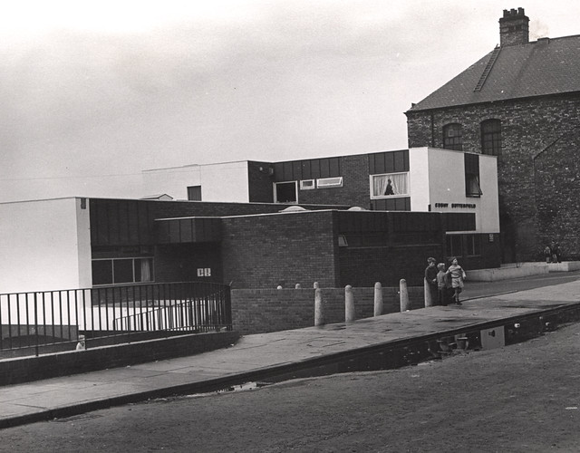
from Newcastle libraries (flickr)
020028:Cushy Butterfield, Scotswood Road, 1969
Pinned by Simon Cotterill
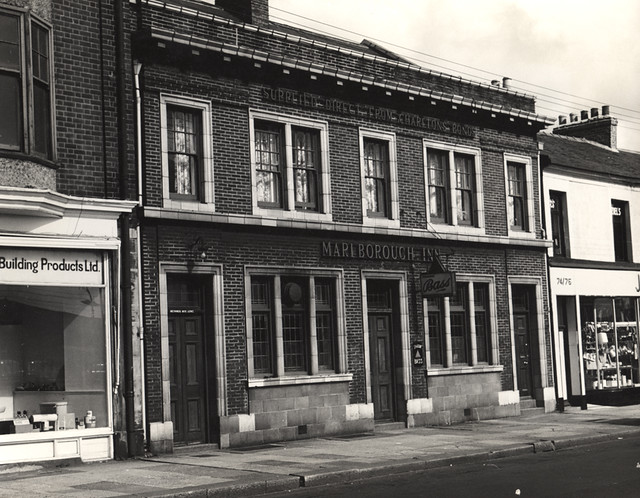
from Newcastle libraries (flickr)
015328:Marlborough Inn Scotswood Road 1966
Pinned by Simon Cotterill
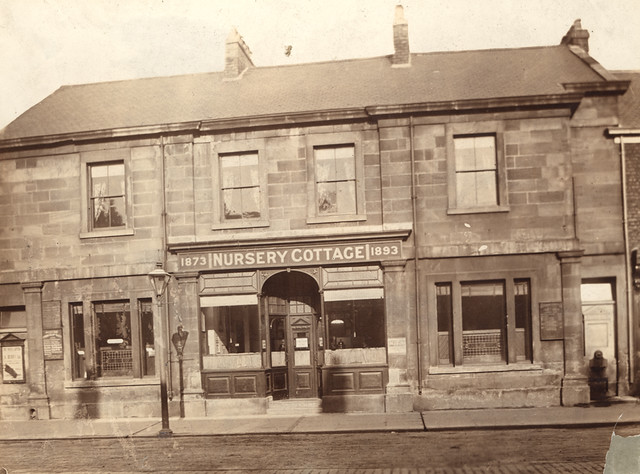
from Newcastle libraries (flickr)
003644:Nursery Cottage Scotswood Road Unknown c.1895
Pinned by Simon Cotterill
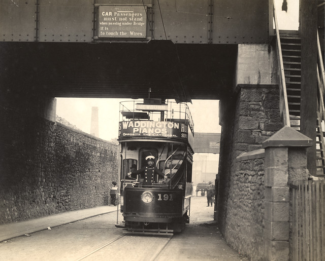
from Newcastle libraries (flickr)
050201:Tram Scotswood Road Newcastle upon Tyne Unknown c.1900
Pinned by Simon Cotterill
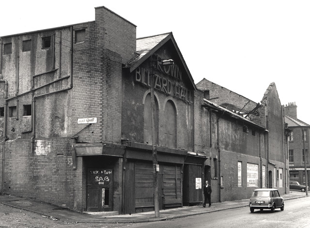
from Newcastle libraries (flickr)
051696:Crown cinema Scotswood Road Newcastle upon Tyne City Engineers 1971
Pinned by Simon Cotterill
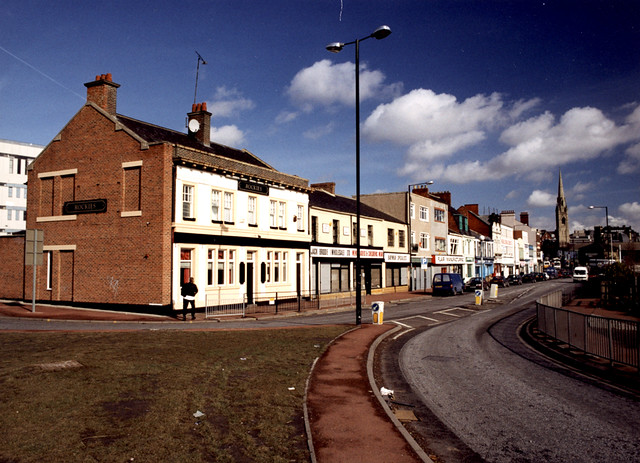
from Newcastle libraries (flickr)
061839:Scotswood Road Newcastle upon Tyne; Malcolm Maybury; 1995
Pinned by Simon Cotterill
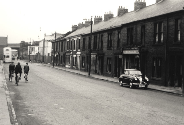
from Newcastle libraries (flickr)
055484: Scotswood Road, Newcastle upon Tyne, 1960s
Pinned by Simon Cotterill
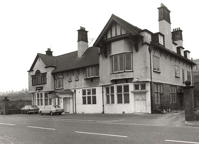
from Newcastle libraries (flickr)
030382:Delaval Arms, Scotswood Road, Newcastle upon Tyne, 1966
Pinned by Simon Cotterill
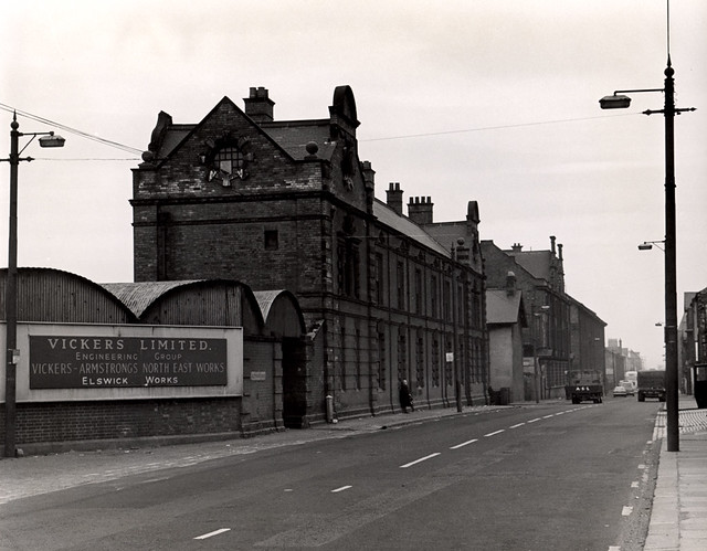
from Newcastle libraries (flickr)
017066:Main Entrance Vickers Ltd Elswick Works Elswick Unknown 1969
Pinned by Simon Cotterill
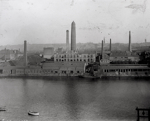
Co-Curate Page
Elswick
- Overview History Map Elswick is an area in the West End of Newcastle, bordering the River Tyne. Elswick was originally a separate small rural town in Northumberland but became part …
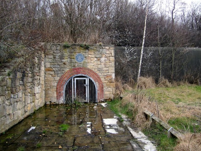
Co-Curate Page
Benwell
- Overview History Map Street View Benwell is a suburb in the West End of Newcastle. It was a separate village surrounded by fields and only became part of Newcastle in …
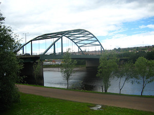
Co-Curate Page
Scotswood Bridge
- Overview History Map Street View 16th April 1831; opening of the Scotswood Bridge (Chain Bridge) crossing the tyne between Newcastle and Blaydon 20th March 1967; opening of the current Scotswood Bridge. Scotswood Bridge is one of the main …
Co-Curate Page
Cruddas Park
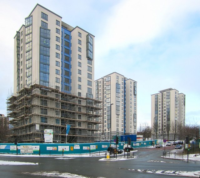
- Overview Map Street View Cruddas Park is a residential area in the West End of Newcastle, usually considered part of Elswick / Low Elswick. It was named after George Cruddas, …

from Geograph (geograph)
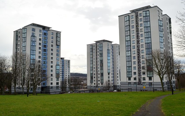
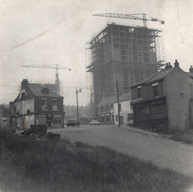
The refurbishment of the Cruddas Park tower blocks, Scotswood Road
Pinned by Simon Cotterill
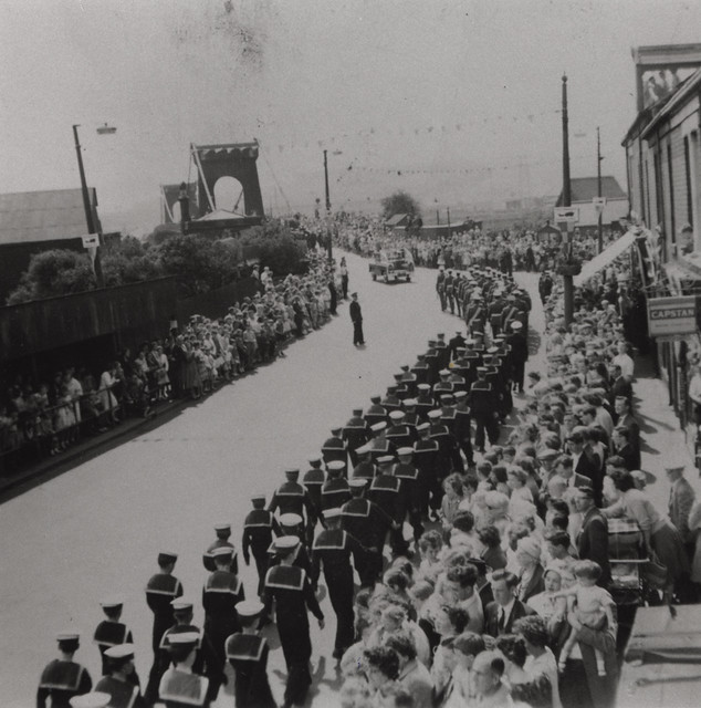
from Newcastle libraries (flickr)
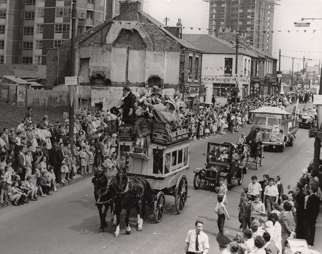
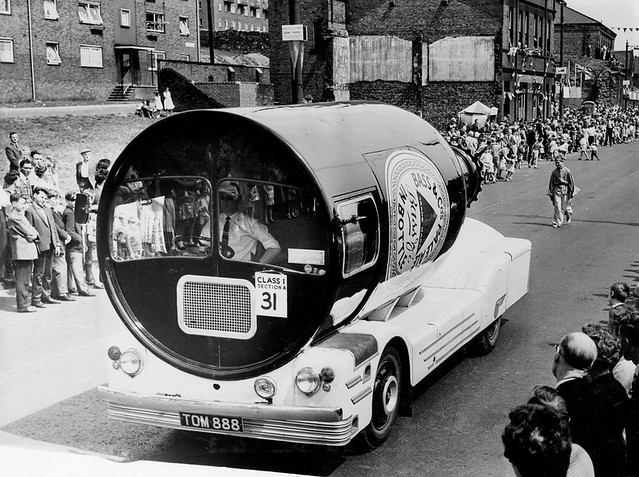
069206: Blaydon Races Centenary Procession, Scotswood, 1962
Pinned by Simon Cotterill
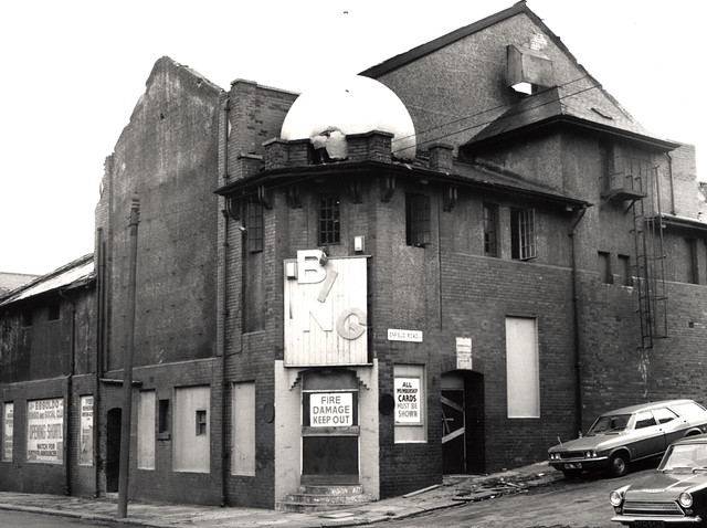
from Newcastle libraries (flickr)
051694:Crown Theatre Scotswood Rd Newcastle upon Tyne City Engineers 1971
Pinned by Simon Cotterill
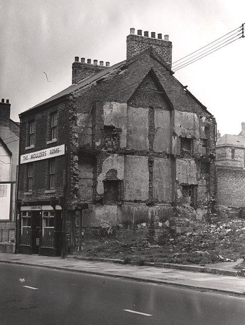
from Newcastle libraries (flickr)
020007:The Moulders Arms, Scotswood Road, 1969
Pinned by Simon Cotterill
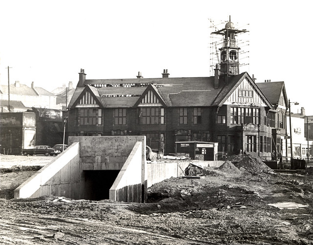
from Newcastle libraries (flickr)
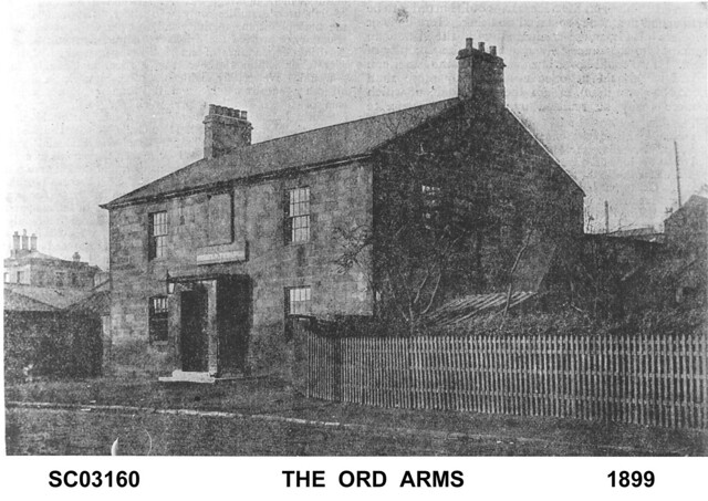
014823:Ord Arms, Scotswood Road, Newcastle upon Tyne, 1965/66
Pinned by Simon Cotterill
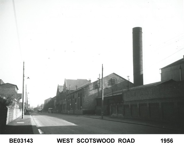
from Flickr (flickr)
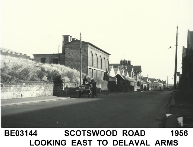
Scotswood Road looking east with Vickers Armstrong Works on the right and the gable end of a Vickers electricity sub-station showing on the left. This is Delaval.
Pinned by Simon Cotterill
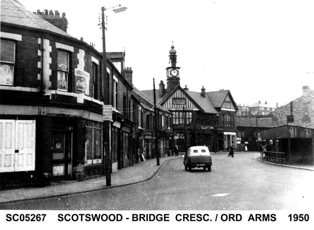
from Flickr (flickr)
Bridge Crescent, Scotswood Road with the Ord Arms pub in thebackground.
Pinned by Simon Cotterill
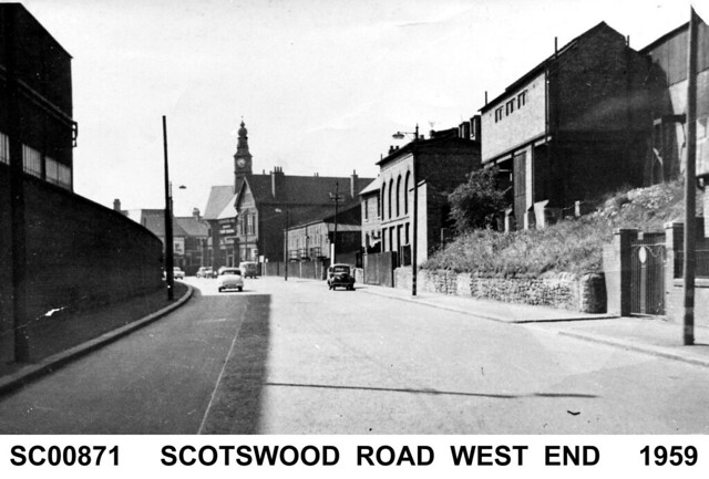
from Flickr (flickr)
Scotswood Road looking west with Vickers Works on the left, a Vickers electricity sub-station on the right and the Ord Arms in the middle distance.
Pinned by Simon Cotterill
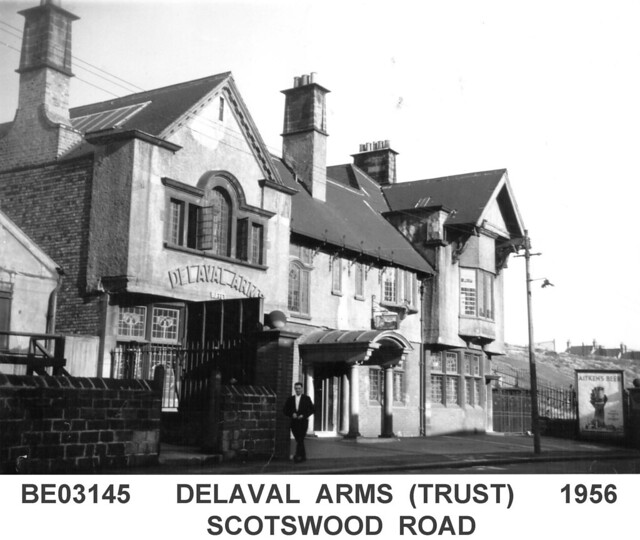
from Flickr (flickr)
The Delaval Arms nicknamed the "Trust" as it had a six day licence, excluding Sundays.
Pinned by Simon Cotterill
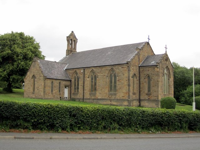
Co-Curate Page
Holy Saviour Church, Sugley
- Overview Map Street View Holy Saviour Church in Lemington was built in 1837 as Sugley Parish Church, and is located by Sugley Dene. The church was designed by Benjamin Green. …
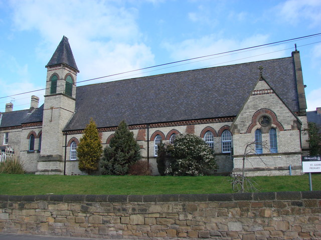
Co-Curate Page
Church of St George, Bells Close
- Overview Map Street View St George's RC Church is located by Scotswood Road in Bell's Close, between Scotswood and Lemingon. The church was built 1868-1869, designed by A.M. Dunn, and funded …


from Newcastle libraries (flickr)
049111:Tram Scotswood Road/Park Road Elswick Unknown 1910
Pinned by Simon Cotterill

from Newcastle libraries (flickr)
022980:Scotswood Road, Newcastle Upon Tyne c.1907
Pinned by Simon Cotterill

from Newcastle libraries (flickr)
061529:Rockies Scotswood Road Maybury Malcolm 1995
Pinned by Simon Cotterill

from Newcastle libraries (flickr)
049112:Tram Scotswood Road/Park Road Elswick Unknown 1910
Pinned by Simon Cotterill

from Newcastle libraries (flickr)
003377:Scotswood Bridge Newcastle upon Tyne Unknown 1931
Pinned by Simon Cotterill

from Newcastle libraries (flickr)
050137:Scotswood Road Fenham/Benwell unknown around 1904
Pinned by Simon Cotterill

from Newcastle libraries (flickr)
714532:Elswick Hotel Scotswood Road. Unknown. 1960
Pinned by Simon Cotterill

from Newcastle libraries (flickr)
051932:Paradise Bridge Scotswood Road Unknown 1957/8
Pinned by Simon Cotterill

from Newcastle libraries (flickr)
050135:Scotswood Road Fenham/Benwell unknown 1904
Pinned by Simon Cotterill

from Newcastle libraries (flickr)
714531:Gun Hotel Scotswood Road. Unknown. 1965
Pinned by Simon Cotterill

from Newcastle libraries (flickr)
020003:Hydraulic Crane pub, Scotswood Road, 1969
Pinned by Simon Cotterill

from Newcastle libraries (flickr)
017058:The Crooked Billet Hotel, Scotswood Road, 1969
Pinned by Simon Cotterill

from Newcastle libraries (flickr)
038711:Grapes Hotel Scotswood Road Unknown c. 1961
Pinned by Simon Cotterill

from Newcastle libraries (flickr)
015243:The Foresters Scotswood Road 1966
Pinned by Simon Cotterill

from Newcastle libraries (flickr)
015592:The Dene Hotel Scotswood RoadNewcastle upon Tyne 1920
Pinned by Simon Cotterill

from Newcastle libraries (flickr)
069303:Pineapple Club, Scotswood Road, Newcastle upon Tyne
Pinned by Simon Cotterill

from Newcastle libraries (flickr)
058165:Ord Arms Scotswood Road Unknown c. 1960
Pinned by Simon Cotterill

from Newcastle libraries (flickr)
714921:The Moulders Arms Scotswood Road Unknown 1965
Pinned by Simon Cotterill

from Newcastle libraries (flickr)
030428:The Forge Hammer Inn, Scotswood Road, 1960
Pinned by Simon Cotterill

from Newcastle libraries (flickr)
050191:Tram Scotswood Road Newcastle upon Tyne Unknown c.1900
Pinned by Simon Cotterill

from Newcastle libraries (flickr)
061917:Armstrong Hotel Scotswood Road Maybury Malcolm 1995
Pinned by Simon Cotterill

from Newcastle libraries (flickr)
003643:Nursery Cottage British Workman Scotswood Road Holmes John H. about 1876
Pinned by Simon Cotterill

from Newcastle libraries (flickr)
061857:The Courtyard, Scotswood Road/Churchill Street, Maybury Malcolm 1995
Pinned by Simon Cotterill

from Newcastle libraries (flickr)
020028:Cushy Butterfield, Scotswood Road, 1969
Pinned by Simon Cotterill

from Newcastle libraries (flickr)
015328:Marlborough Inn Scotswood Road 1966
Pinned by Simon Cotterill

from Newcastle libraries (flickr)
003644:Nursery Cottage Scotswood Road Unknown c.1895
Pinned by Simon Cotterill

from Newcastle libraries (flickr)
050201:Tram Scotswood Road Newcastle upon Tyne Unknown c.1900
Pinned by Simon Cotterill

from Newcastle libraries (flickr)
051696:Crown cinema Scotswood Road Newcastle upon Tyne City Engineers 1971
Pinned by Simon Cotterill

from Newcastle libraries (flickr)
061839:Scotswood Road Newcastle upon Tyne; Malcolm Maybury; 1995
Pinned by Simon Cotterill

from Newcastle libraries (flickr)
055484: Scotswood Road, Newcastle upon Tyne, 1960s
Pinned by Simon Cotterill

from Newcastle libraries (flickr)
030382:Delaval Arms, Scotswood Road, Newcastle upon Tyne, 1966
Pinned by Simon Cotterill

from Newcastle libraries (flickr)
017066:Main Entrance Vickers Ltd Elswick Works Elswick Unknown 1969
Pinned by Simon Cotterill

Co-Curate Page
Elswick
- Overview History Map Elswick is an area in the West End of Newcastle, bordering the River Tyne. Elswick was originally a separate small rural town in Northumberland but became part …

Co-Curate Page
Benwell
- Overview History Map Street View Benwell is a suburb in the West End of Newcastle. It was a separate village surrounded by fields and only became part of Newcastle in …

Co-Curate Page
Scotswood Bridge
- Overview History Map Street View 16th April 1831; opening of the Scotswood Bridge (Chain Bridge) crossing the tyne between Newcastle and Blaydon 20th March 1967; opening of the current Scotswood Bridge. Scotswood Bridge is one of the main …

Co-Curate Page
Cruddas Park
- Overview Map Street View Cruddas Park is a residential area in the West End of Newcastle, usually considered part of Elswick / Low Elswick. It was named after George Cruddas, …

from Geograph (geograph)
The refurbishment of the Cruddas Park tower blocks, Scotswood Road
Pinned by Simon Cotterill

from Newcastle libraries (flickr)
069206: Blaydon Races Centenary Procession, Scotswood, 1962
Pinned by Simon Cotterill

from Newcastle libraries (flickr)
051694:Crown Theatre Scotswood Rd Newcastle upon Tyne City Engineers 1971
Pinned by Simon Cotterill

from Newcastle libraries (flickr)
020007:The Moulders Arms, Scotswood Road, 1969
Pinned by Simon Cotterill

from Newcastle libraries (flickr)
014823:Ord Arms, Scotswood Road, Newcastle upon Tyne, 1965/66
Pinned by Simon Cotterill

from Flickr (flickr)
Scotswood Road looking east with Vickers Armstrong Works on the right and the gable end of a Vickers electricity sub-station showing on the left. This is Delaval.
Pinned by Simon Cotterill

from Flickr (flickr)
Bridge Crescent, Scotswood Road with the Ord Arms pub in thebackground.
Pinned by Simon Cotterill

from Flickr (flickr)
Scotswood Road looking west with Vickers Works on the left, a Vickers electricity sub-station on the right and the Ord Arms in the middle distance.
Pinned by Simon Cotterill

from Flickr (flickr)
The Delaval Arms nicknamed the "Trust" as it had a six day licence, excluding Sundays.
Pinned by Simon Cotterill

Co-Curate Page
Holy Saviour Church, Sugley
- Overview Map Street View Holy Saviour Church in Lemington was built in 1837 as Sugley Parish Church, and is located by Sugley Dene. The church was designed by Benjamin Green. …


