Topics > Tyne and Wear > Newcastle upon Tyne > Benwell
Benwell
Benwell village was recorded in A.D. 1050 known as Bynnewalle which roughly translates as "behind the wall" or "by the wall". Referring to its position relative to Hadrian's Wall (next to which was the Roman fort of Condercum, hence the nearby Condercum Road). At this time it was part of the Barony of Bolbec.
By the 13th century the medieval manor of Benwell had been subdivided, originally into two, but then one of the halves was further subdivided. So, although people usually refer to the three sections of Benwell Manor as ‘thirds’, this gives a misleading impression, because one of the ‘thirds’ was larger and wealthier than the other two. This third belonged to the Scot family, who were wealthy merchants from Newcastle and by 1296 they were the principal taxpayers in Benwell. The Scot family later went on to create a deer park in 1367, which later became Scotswood.
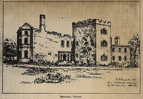
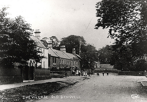
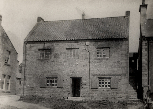
In the 16th century Benwell village was arranged in two rows of houses on either side of a wide street or green. A plain oblong tower, three storeys high with battlements around the roof was also recorded as being built.
In 1540, the crown (Henry VIII), took possession of Benwell Tower from Tynemouth Priory when it dissolved the monasteries.
Early in the 17th century, Benwell was split into smaller estates which were bought by the Shafto and Riddell families who were merchant families interested in exploiting the coal reserves on the banks of the Tyne.
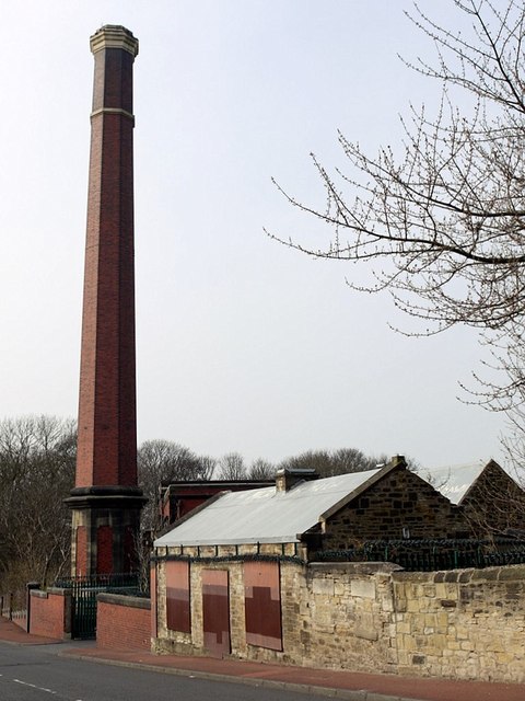
Benwell Colliery was opened in 1766 and operated until 1938.
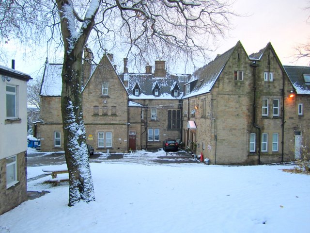
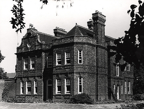
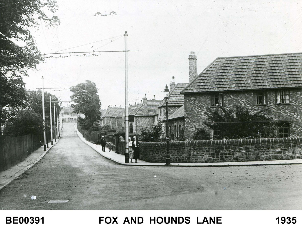
The original layout of Benwell exists in the form of Benwell Village, Benwell Lane, Ferguson's Lane and Fox and Hounds Lane however no buildings still exist other than from the early 19th century. The tower from the 16th century was rebuilt in the 18th century and then all traces were removed when the present hall, Benwell Towers was built in a Tudor style by John Dobson in 1831. Benwell Towers featured in the BBC television show Byker Grove.

from North East Museums (youtube)
West End Stories: The Roman God of Benwell - Antenociticus
Pinned by Simon Cotterill
from http://newcastlephotos.blogsp…
Old Benwell
- Photos of derelict buildings from the 1980s
Added by
Simon Cotterill


from Newcastle University (youtube)
North Benwell Youth Project, Newcastle
Pinned by Simon Cotterill
from Newcastle libraries (flickr)
022342:Benwell Grange Benwell Lane Benwell Unknown 1973
Pinned by Simon Cotterill
from Newcastle libraries (flickr)
015424a:Benwell Tower Benwell Lane Benwell Knowles W.H.
Pinned by Simon Cotterill
from Newcastle libraries (flickr)
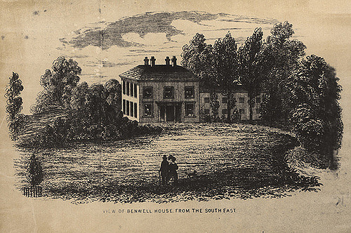
015425:Benwell House Benwell, Lane Benwell 1830
Pinned by Simon Cotterill
from Newcastle libraries (flickr)
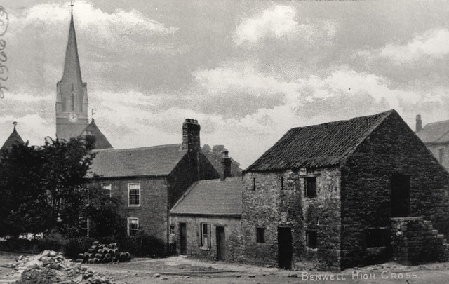
050001:Benwell High Cross Benwell Unknown 1906
Pinned by Simon Cotterill
from Newcastle libraries (flickr)
048188:Benwell Library Atkinson Road Benwell Unknown 1986
Pinned by Simon Cotterill
from Newcastle libraries (flickr)
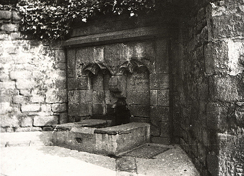
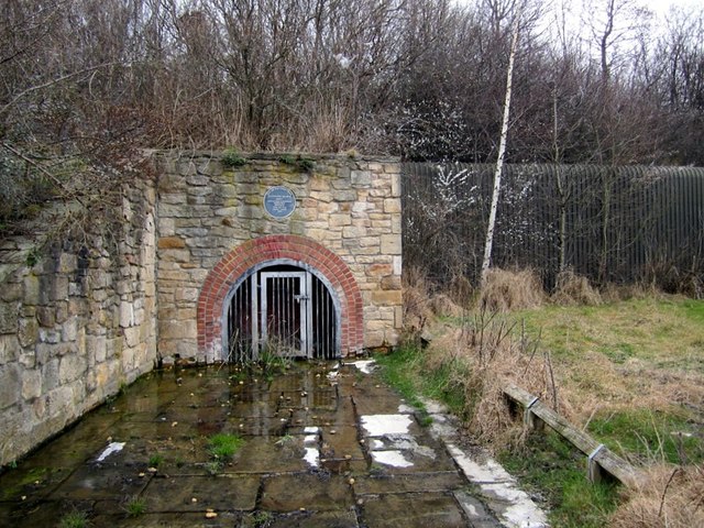
008674:The Well Benwell Lane Benwell Unknown c.1925
Pinned by Simon Cotterill
from Newcastle libraries (flickr)
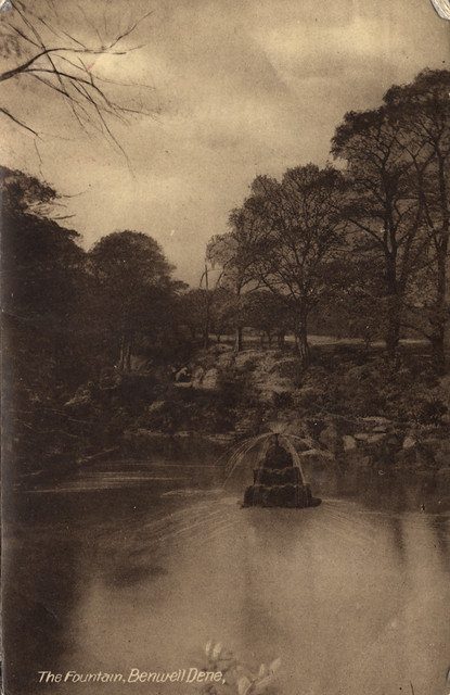
068040:Benwell Dene Hodgkin Park Benwell Newcastle upon Tyne Unknown 1902
Pinned by Simon Cotterill
from Newcastle libraries (flickr)
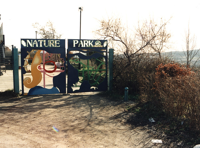
064144:Benwell Nature Park Benwell Newcastle upon Tyne Maybury Malcolm 1997
Pinned by Simon Cotterill

from Newcastle libraries (flickr)
064152:St. James Church Atkinson Road/Benwell Lane Benwell Maybury Malcolm 1997
Pinned by Simon Cotterill
from Newcastle libraries (flickr)
052054:South Benwell Primary School South Benwell Unknown 1988
Pinned by Simon Cotterill
from Newcastle libraries (flickr)
049184:Benwell Library? Atkinson Road Benwell Unknown c.1950
Pinned by Simon Cotterill

from Newcastle libraries (flickr)
008905:Benwell (High Cross) Cottages Benwell Unknown 1894
Pinned by Simon Cotterill
from Newcastle libraries (flickr)
051952:The Fairholme Club Benwell Unknown 1929
Pinned by Simon Cotterill
from Newcastle libraries (flickr)
049308:Benwell Presbyterian Church Armstrong Road Newcastle upon Tyne Unknown 1982
Pinned by Simon Cotterill
from Newcastle libraries (flickr)
034800:East Cottages Benwell Dept of Environmental Health 1937
Pinned by Simon Cotterill
from Newcastle libraries (flickr)
051878:Cannon Street Benwell Unknown 1957/8
Pinned by Simon Cotterill
from Newcastle libraries (flickr)
049825:Royal Victoria School for the Blind Benwell Unknown c.1930
Pinned by Simon Cotterill
from Newcastle libraries (flickr)
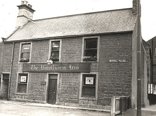
008676:Hawthorn Inn Benwell Unknown c. 1925
Pinned by Simon Cotterill
from Newcastle libraries (flickr)
068338:Atkinson Road Infants School Atkinson Road Benwell Unknown 1953
Pinned by Simon Cotterill
from Newcastle libraries (flickr)
064154:Adelaide Centre Adelaide Terrace Benwell Maybury Malcolm 1997
Pinned by Simon Cotterill
from Newcastle libraries (flickr)
051266:Hodgkin Park Benwell Newcastle upon Tyne Unknown 1957-8
Pinned by Simon Cotterill
from Newcastle libraries (flickr)
049836:Royal Victoria School for the Blind Benwell Unknown c.1905
Pinned by Simon Cotterill
from Newcastle libraries (flickr)
051240:Hodgkin Park Benwell Newcastle upon Tyne Northern Gossip 1899
Pinned by Simon Cotterill
Co-Curate Page
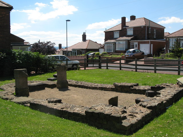
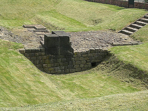
Benwell Temple of Antenociticus
- Overview About Antenociticus Map Street View "The fort at Benwell, which was occupied throughout most of the Roman period by the cavalry regiment ala I Asturum, is no longer visible. …
Co-Curate Page
Benwell Vallum Crossing / Condercum
- Overview About Condercum Map Street View "Nothing is now visible of the fort at Benwell (Condercum) in Newcastle, which was occupied throughout most of the Roman period by the Asturian …
from Newcastle libraries (flickr)
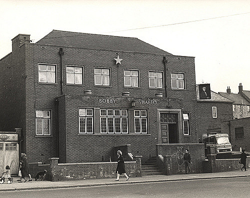
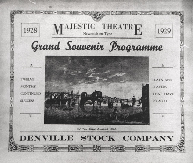
060693:Majestic Theatre Condercum Road Benwell Unknown 1929
Pinned by Simon Cotterill
from https://stjameschurchnewcastl…
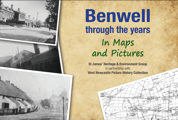
Benwell through the years - in Maps and Pictures
- A 32 page document about the history of Benwell by St James’ Heritage & Environment Group in partnership with West Newcastle Picture History Collection.
Added by
Simon Cotterill


from http://www.chroniclelive.co.u…
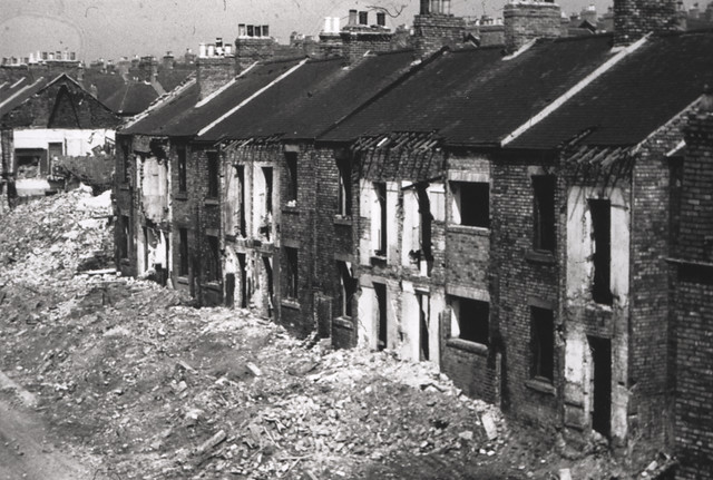
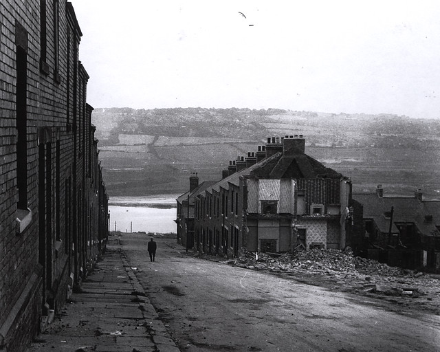
24 unseen images of Newcastle West End under demolition in the early 1970s
- Chronicle live 16 MAY 2016. Article by David Morton. Rare photographs show Newcastle West End changing as the bulldozers moved into Benwell in the early 1970s...
Added by
Pat Thomson


from https://stjameschurchnewcastl…
The Boy and The Hall
- Illustrated book (PdF) by Ron Henzell. "The Boy and the Hall is a story of the links between the past and the present through the autobiography of one individual." Relates …
Added by
Simon Cotterill
from Newcastle libraries (flickr)
057853:Adelaide Terrace Benwell Unknown c.1905
Pinned by Simon Cotterill
from Newcastle libraries (flickr)
033746:Adelaide Terrace Benwell Unknown c.1935
Pinned by Simon Cotterill

from Newcastle libraries (flickr)
Plan of Benwell Tower Estate near Newcastle upon Tyne
Pinned by Simon Cotterill
from Newcastle libraries (flickr)
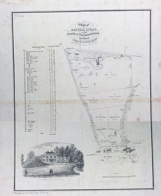
Plan of Benwell estate in the county of Northumberland
Pinned by Simon Cotterill
from Newcastle libraries (flickr)
025861:Church House Grainger Park Road Benwell City Engineers 1976
Pinned by Simon Cotterill
from Newcastle libraries (flickr)
043095:Whitehouse Road Benwell City Engineers 1967
Pinned by Simon Cotterill
from Newcastle libraries (flickr)
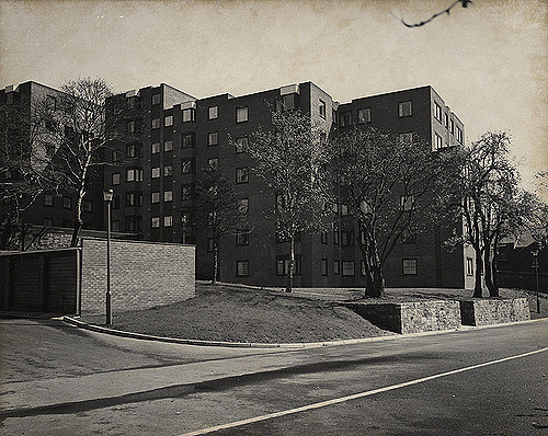
053272:Dolphin Court Flats Benwell Unknown c.1975
Pinned by Simon Cotterill

from Newcastle libraries (flickr)
003355:Roman Mask Newcastle-Upon-Tyne 1906
Pinned by Simon Cotterill

from Newcastle libraries (flickr)
015167:The Venerable Bede Benwell Grove Benwell 1965
Pinned by Simon Cotterill
from Newcastle libraries (flickr)
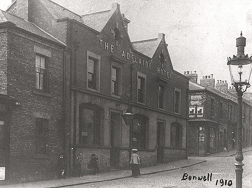
030397:The Adelaide Hotel Elm Street Benwell 1910
Pinned by Simon Cotterill
from Newcastle libraries (flickr)
067815:Violet Street Benwell Whillis 1967/8
Pinned by Simon Cotterill
from Newcastle libraries (flickr)
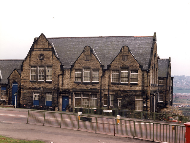
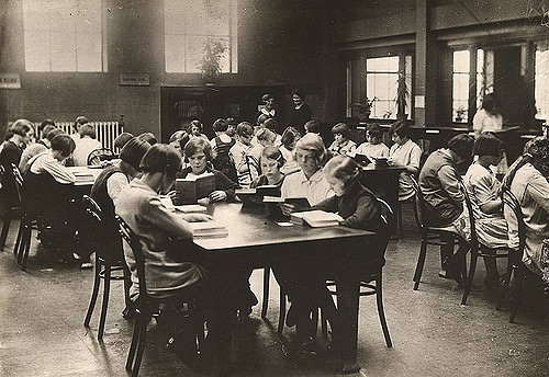
008789:Benwell Village School Benwell Unknown c.1905
Pinned by Simon Cotterill

Co-Curate Page
Wall Mile 6
- <Mile 5 | Mile 6 | Mile 7> Hadrian's Wall - Wall Mile 6 Hadrian's Wall stretches from the east to west coast of England and was an important frontier …

from North East Museums (youtube)
West End Stories: The Roman God of Benwell - Antenociticus
Pinned by Simon Cotterill
from http://newcastlephotos.blogsp…
Old Benwell
- Photos of derelict buildings from the 1980s
Added by
Simon Cotterill
from Newcastle University (youtube)
North Benwell Youth Project, Newcastle
Pinned by Simon Cotterill
from Newcastle libraries (flickr)
022342:Benwell Grange Benwell Lane Benwell Unknown 1973
Pinned by Simon Cotterill
from Newcastle libraries (flickr)
015424a:Benwell Tower Benwell Lane Benwell Knowles W.H.
Pinned by Simon Cotterill
from Newcastle libraries (flickr)
015425:Benwell House Benwell, Lane Benwell 1830
Pinned by Simon Cotterill
from Newcastle libraries (flickr)
050001:Benwell High Cross Benwell Unknown 1906
Pinned by Simon Cotterill
from Newcastle libraries (flickr)
048188:Benwell Library Atkinson Road Benwell Unknown 1986
Pinned by Simon Cotterill
from Newcastle libraries (flickr)
008674:The Well Benwell Lane Benwell Unknown c.1925
Pinned by Simon Cotterill
from Newcastle libraries (flickr)
068040:Benwell Dene Hodgkin Park Benwell Newcastle upon Tyne Unknown 1902
Pinned by Simon Cotterill
from Newcastle libraries (flickr)
064144:Benwell Nature Park Benwell Newcastle upon Tyne Maybury Malcolm 1997
Pinned by Simon Cotterill
from Newcastle libraries (flickr)
064152:St. James Church Atkinson Road/Benwell Lane Benwell Maybury Malcolm 1997
Pinned by Simon Cotterill
from Newcastle libraries (flickr)
052054:South Benwell Primary School South Benwell Unknown 1988
Pinned by Simon Cotterill
from Newcastle libraries (flickr)
049184:Benwell Library? Atkinson Road Benwell Unknown c.1950
Pinned by Simon Cotterill
from Newcastle libraries (flickr)
008905:Benwell (High Cross) Cottages Benwell Unknown 1894
Pinned by Simon Cotterill
from Newcastle libraries (flickr)
051952:The Fairholme Club Benwell Unknown 1929
Pinned by Simon Cotterill
from Newcastle libraries (flickr)
049308:Benwell Presbyterian Church Armstrong Road Newcastle upon Tyne Unknown 1982
Pinned by Simon Cotterill
from Newcastle libraries (flickr)
034800:East Cottages Benwell Dept of Environmental Health 1937
Pinned by Simon Cotterill
from Newcastle libraries (flickr)
051878:Cannon Street Benwell Unknown 1957/8
Pinned by Simon Cotterill
from Newcastle libraries (flickr)
049825:Royal Victoria School for the Blind Benwell Unknown c.1930
Pinned by Simon Cotterill
from Newcastle libraries (flickr)
008676:Hawthorn Inn Benwell Unknown c. 1925
Pinned by Simon Cotterill
from Newcastle libraries (flickr)
068338:Atkinson Road Infants School Atkinson Road Benwell Unknown 1953
Pinned by Simon Cotterill
from Newcastle libraries (flickr)
064154:Adelaide Centre Adelaide Terrace Benwell Maybury Malcolm 1997
Pinned by Simon Cotterill
from Newcastle libraries (flickr)
051266:Hodgkin Park Benwell Newcastle upon Tyne Unknown 1957-8
Pinned by Simon Cotterill
from Newcastle libraries (flickr)
049836:Royal Victoria School for the Blind Benwell Unknown c.1905
Pinned by Simon Cotterill
from Newcastle libraries (flickr)
051240:Hodgkin Park Benwell Newcastle upon Tyne Northern Gossip 1899
Pinned by Simon Cotterill
Co-Curate Page
Benwell Temple of Antenociticus
- Overview About Antenociticus Map Street View "The fort at Benwell, which was occupied throughout most of the Roman period by the cavalry regiment ala I Asturum, is no longer visible. …
Co-Curate Page
Benwell Vallum Crossing / Condercum
- Overview About Condercum Map Street View "Nothing is now visible of the fort at Benwell (Condercum) in Newcastle, which was occupied throughout most of the Roman period by the Asturian …
from Newcastle libraries (flickr)
060693:Majestic Theatre Condercum Road Benwell Unknown 1929
Pinned by Simon Cotterill
from https://stjameschurchnewcastl…
Benwell through the years - in Maps and Pictures
- A 32 page document about the history of Benwell by St James’ Heritage & Environment Group in partnership with West Newcastle Picture History Collection.
Added by
Simon Cotterill
from http://www.chroniclelive.co.u…
24 unseen images of Newcastle West End under demolition in the early 1970s
- Chronicle live 16 MAY 2016. Article by David Morton. Rare photographs show Newcastle West End changing as the bulldozers moved into Benwell in the early 1970s...
Added by
Pat Thomson
from https://stjameschurchnewcastl…
The Boy and The Hall
- Illustrated book (PdF) by Ron Henzell. "The Boy and the Hall is a story of the links between the past and the present through the autobiography of one individual." Relates …
Added by
Simon Cotterill
from Newcastle libraries (flickr)
057853:Adelaide Terrace Benwell Unknown c.1905
Pinned by Simon Cotterill
from Newcastle libraries (flickr)
033746:Adelaide Terrace Benwell Unknown c.1935
Pinned by Simon Cotterill
from Newcastle libraries (flickr)
Plan of Benwell Tower Estate near Newcastle upon Tyne
Pinned by Simon Cotterill
from Newcastle libraries (flickr)
Plan of Benwell estate in the county of Northumberland
Pinned by Simon Cotterill
from Newcastle libraries (flickr)
025861:Church House Grainger Park Road Benwell City Engineers 1976
Pinned by Simon Cotterill
from Newcastle libraries (flickr)
043095:Whitehouse Road Benwell City Engineers 1967
Pinned by Simon Cotterill
from Newcastle libraries (flickr)
053272:Dolphin Court Flats Benwell Unknown c.1975
Pinned by Simon Cotterill
from Newcastle libraries (flickr)
003355:Roman Mask Newcastle-Upon-Tyne 1906
Pinned by Simon Cotterill
from Newcastle libraries (flickr)
015167:The Venerable Bede Benwell Grove Benwell 1965
Pinned by Simon Cotterill
from Newcastle libraries (flickr)
030397:The Adelaide Hotel Elm Street Benwell 1910
Pinned by Simon Cotterill
from Newcastle libraries (flickr)
067815:Violet Street Benwell Whillis 1967/8
Pinned by Simon Cotterill
from Newcastle libraries (flickr)
008789:Benwell Village School Benwell Unknown c.1905
Pinned by Simon Cotterill
Co-Curate Page
Wall Mile 6
- <Mile 5 | Mile 6 | Mile 7> Hadrian's Wall - Wall Mile 6 Hadrian's Wall stretches from the east to west coast of England and was an important frontier …

Tyne and Wear

Newcastle upon Tyne
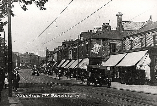
Adelaide Terrace, Benwell

Armstrong Road, Benwell / Scotswood
Atkinson Road, Benwell

Benwell at War
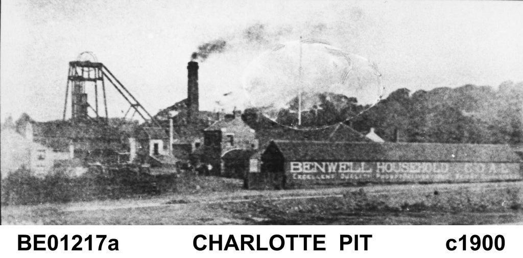
Benwell Colliery (1766 - 1938)
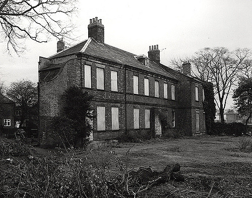
Benwell Hall

Benwell Lane

Benwell, Historical Account, 1848

Benwell, Historical Account, 1890

Buddle Road, Benwell - Elswick
Condercum Road, Benwell
Ferguson's Lane, Benwell
Hodgkin Park, Benwell
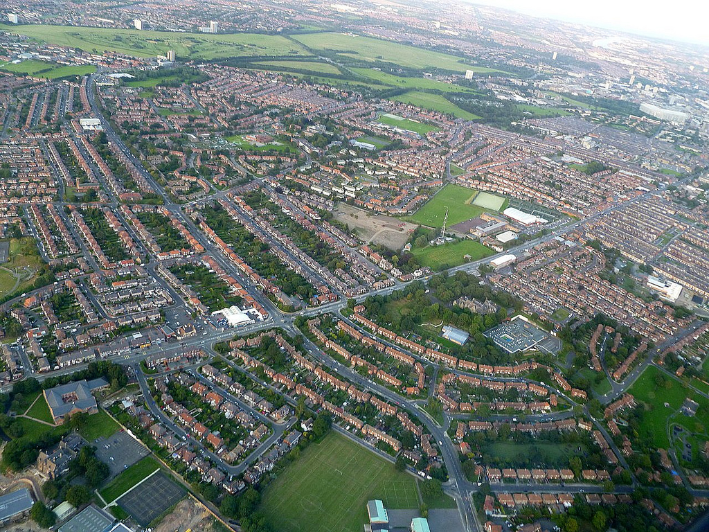
Map and Aerial View of Benwell
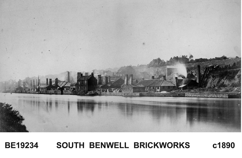
South Benwell Fire Brick Works
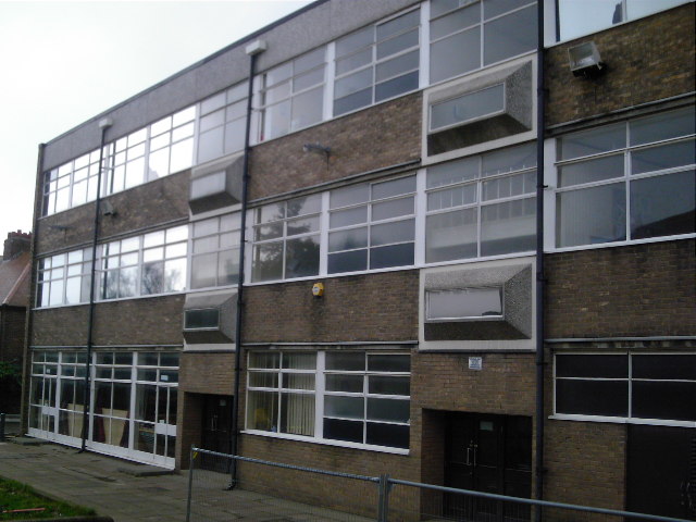
South Benwell School (1893 - 1980)
St Cuthbert's High School, Newcastle

West Road, Benwell