Topics > Heritage Sites > Scheduled Monument > Scheduled Monuments in Gateshead
Scheduled Monuments in Gateshead
This page includes Scheduled Monuments in Gateshead.
Scheduled Monuments are sites of national significance which have been given the top-level of legal protection under the Ancient Monuments and Archaeological Areas Act 1979. They range from archaeological sites (prehistoric, Roman, Medieval etc) to ruins or surviving structures (including some 19th/20th century industrial and military sites).
Co-Curate Page
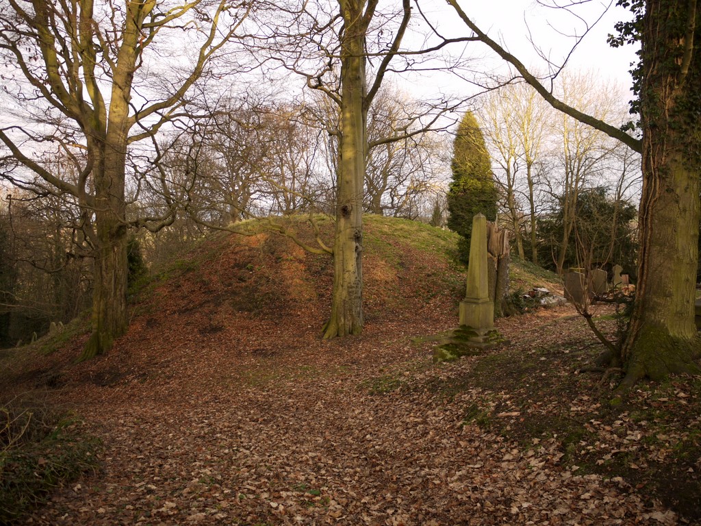
Motte Castle, Ryton
- Map showing the Scheduled Monument area of the Motte Castle, north of Holycross Church, Ryton In the the churchyard, to the north of Holycross Church in Ryton, are the remains …

Co-Curate Page
Wardley Medieval Moated Site
- Scheduled Monument areas - based on Historic England data (Open Government Licence). There are earthwork remains at Wardley, Gateshead, of a medieval moated site and associated ridge and furrow cultivation. …
Co-Curate Page
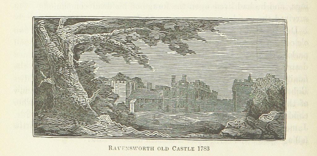
Ravensworth quadrangular castle
- Scheduled Monument area - based on Historic England data (Open Government Licence). Scheduled Monument (#1016975): Ravensworth quadrangular castle Click the headings below to expand (selected extracts from the Historic England …
Co-Curate Page
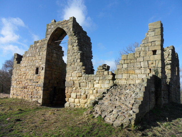
Old Hollinside
- Overview Map A 13th Century fortified manor house. Old Hollinside is a substantial ruin on the edge of the River Derwent valley, located just over a mile south-west of Whickham. …
Co-Curate Page
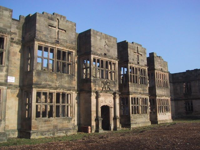
Gibside Hall
- Overview Map Street View The substantive remains of Gibside Hall are an important example of a country house and its’s developments from the 17th century to the 19th century. The …
Co-Curate Page
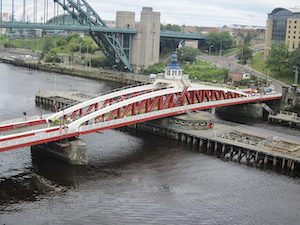
Newcastle Swing Bridge
- Overview Further Information Map Street View The Swing Bridge over the River Tyne was first used for road traffic on 15th June 1876 and opened for river traffic on 17th …
Co-Curate Page
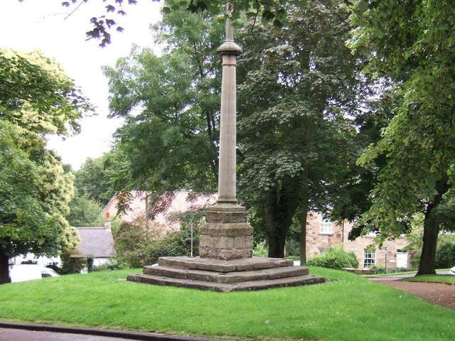
Village Cross
- Overview Map Street View The village cross in Ryton is situated in a prominent position on the village green. Standing on the site of an earlier cross, it dates from …
Co-Curate Page
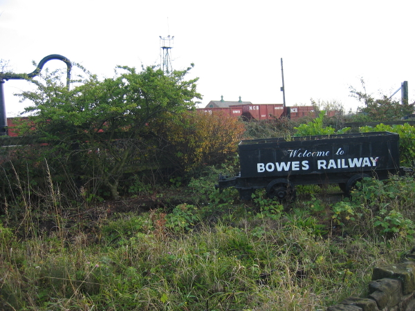
Bowes Railway
- Overview About Bowes Railway Map Street View Map showing the Scheduled Monument area, Bowes Railway visitor cente, Blackhams Hill Station, and site of Kibblesworth Colliery to the south-west. Bowes Railway …
Co-Curate Page
Ditched enclosure S of North View, Coalburns
- Map showing North View Farm, with the Scheduled Monument area to the south. North View Farm is located on Bradley Fell Road, about 1½ miles SSW of Greenside and ¾mile …
Co-Curate Page
Washingwells Roman fort, Whickham
- Scheduled Monument area - based on Historic England data (Open Government Licence). The site of Washingwells Roman fort is located to the east of Whickham, near Watergate Forest Park. The …
Co-Curate Page
Coal working and waggon way at Dunston Hill
- Scheduled Monument area - based on Historic England data (Open Government Licence). On the north side of Dunston Hill are the remains of coal workings and an early waggon way, …
Co-Curate Page
Ravensworth Coalmill
- Scheduled Monument areas - based on Historic England data (Open Government Licence). Coalmills were water-powered pumping systems, developed in the 17th and early 18th centuries, to drain mine workings. They …
Co-Curate Page
Enclosure near Damhead Wood, Whickham
- Scheduled Monument area - based on Historic England data (Open Government Licence). The remains of a rectilinear, double-ditched, enclosure are situated near Damhead Wood, to the east of the River …
Co-Curate Page
Winlaton Mill ironworks (1691 - 1863)
- Scheduled Monument area - based on Historic England data (Open Government Licence). Scheduled Monument (#1017224): Winlaton Mill ironworks, south east of Winlaton Mill village Click the headings below to expand …
Co-Curate Page
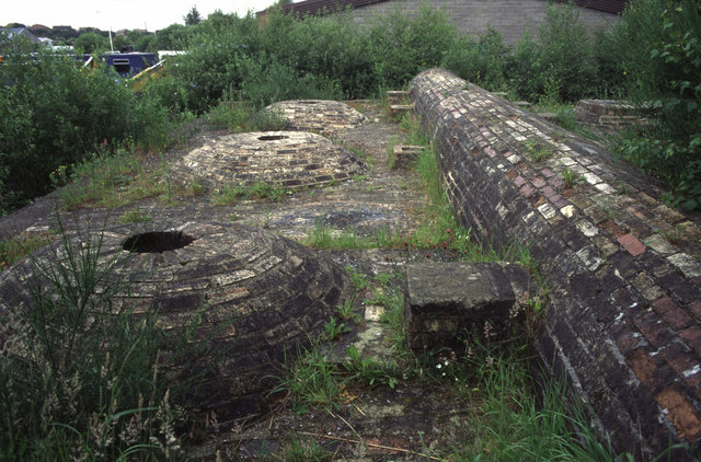
Whinfield coking ovens (1861 - 1958)
- Scheduled Monument areas - based on Historic England data (Open Government Licence). The site of Whinfield coking ovens is located on the east side of what is now Whinfield Industrial …

Co-Curate Page
Motte Castle, Ryton
- Map showing the Scheduled Monument area of the Motte Castle, north of Holycross Church, Ryton In the the churchyard, to the north of Holycross Church in Ryton, are the remains …
Co-Curate Page
Wardley Medieval Moated Site
- Scheduled Monument areas - based on Historic England data (Open Government Licence). There are earthwork remains at Wardley, Gateshead, of a medieval moated site and associated ridge and furrow cultivation. …
Co-Curate Page
Ravensworth quadrangular castle
- Scheduled Monument area - based on Historic England data (Open Government Licence). Scheduled Monument (#1016975): Ravensworth quadrangular castle Click the headings below to expand (selected extracts from the Historic England …
Co-Curate Page
Old Hollinside
- Overview Map A 13th Century fortified manor house. Old Hollinside is a substantial ruin on the edge of the River Derwent valley, located just over a mile south-west of Whickham. …
Co-Curate Page
Gibside Hall
- Overview Map Street View The substantive remains of Gibside Hall are an important example of a country house and its’s developments from the 17th century to the 19th century. The …
Co-Curate Page
Newcastle Swing Bridge
- Overview Further Information Map Street View The Swing Bridge over the River Tyne was first used for road traffic on 15th June 1876 and opened for river traffic on 17th …
Co-Curate Page
Village Cross
- Overview Map Street View The village cross in Ryton is situated in a prominent position on the village green. Standing on the site of an earlier cross, it dates from …
Co-Curate Page
Bowes Railway
- Overview About Bowes Railway Map Street View Map showing the Scheduled Monument area, Bowes Railway visitor cente, Blackhams Hill Station, and site of Kibblesworth Colliery to the south-west. Bowes Railway …
Co-Curate Page
Ditched enclosure S of North View, Coalburns
- Map showing North View Farm, with the Scheduled Monument area to the south. North View Farm is located on Bradley Fell Road, about 1½ miles SSW of Greenside and ¾mile …
Co-Curate Page
Washingwells Roman fort, Whickham
- Scheduled Monument area - based on Historic England data (Open Government Licence). The site of Washingwells Roman fort is located to the east of Whickham, near Watergate Forest Park. The …
Co-Curate Page
Coal working and waggon way at Dunston Hill
- Scheduled Monument area - based on Historic England data (Open Government Licence). On the north side of Dunston Hill are the remains of coal workings and an early waggon way, …
Co-Curate Page
Ravensworth Coalmill
- Scheduled Monument areas - based on Historic England data (Open Government Licence). Coalmills were water-powered pumping systems, developed in the 17th and early 18th centuries, to drain mine workings. They …
Co-Curate Page
Enclosure near Damhead Wood, Whickham
- Scheduled Monument area - based on Historic England data (Open Government Licence). The remains of a rectilinear, double-ditched, enclosure are situated near Damhead Wood, to the east of the River …
Co-Curate Page
Winlaton Mill ironworks (1691 - 1863)
- Scheduled Monument area - based on Historic England data (Open Government Licence). Scheduled Monument (#1017224): Winlaton Mill ironworks, south east of Winlaton Mill village Click the headings below to expand …


