Topics > Northumberland > Civil Parishes in Northumberland > Belsay Civil Parish > Historic Buildings and Monuments in Belsay Civil Parish
Historic Buildings and Monuments in Belsay Civil Parish
Listed buildings and scheduled monuments in Belsay Civil Parish, Northumberland, from the National Heritage List for England[1]. Use the Search (below) if looking for a specific building / monument.
| Structure | List No. | Grade | Built~ | Notes |
|---|---|---|---|---|
| Belsay Hall Grounds | 1001042 | I | C18th | Listed Park and Garden |
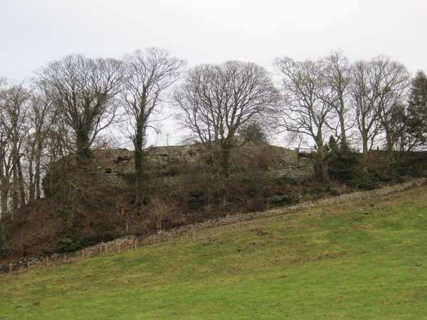
| Defended settlement on Slate Hill, 300m north west of Bolam Lake | 1011834 | n/a | Iron Age | Scheduled Monument |
| Medieval wayside cross, 190m east of Belsay Tower | 1015518 | n/a | Medieval | Scheduled Monument |
| Belsay tower house and attached unfortified wing, deserted medieval village, possible moated site, promontory fort and watch post | 1015517 | n/a | C15th | Scheduled Monument |
| Standing stone and adjacent round cairn, 760m north east of East Shaftoe Hall | 1015530 | n/a | Bronze Age | Scheduled Monument. The Poind & His Man |
| Standing stone on Bygate Hill, 660m north west of Bygate Farm | 1015843 | n/a | Bronze Age | Scheduled Monument |
| Round cairn 680m north east of Bygate Farm | 1015845 | n/a | Bronze Age | Scheduled Monument |
| Middle Newham deserted village | 1006421 | n/a | Medieval | Scheduled Monument |
| Bowl barrow, 200m ENE of Shortflatt | 1011833 | n/a | Bronze Age | Scheduled Monument |
| Defended settlement, 200m south west of Bolam Hall | 1011836 | n/a | Iron Age | Scheduled Monument |
| Round cairn, 400m SSW of Bolam church | 1011837 | n/a | Bronze Age | Scheduled Monument |
| Huckhoe palisaded enclosure, defended settlement and Romano-British settlement, 550m north east of Bolam West Houses | 1011838 | n/a | C6th BC | Scheduled Monument |
| No. 1, Harnham | 1154084 | II | 1757 | Harnham |
| Nos. 3 and 4, Harnham | 1154102 | II | C18th | Harnham |
| Anderson, Colley and 2 Other Headstones Approx 2-10 Yards South of Church of St Andrew | 1153916 | II | C18th | Bolam |
| Armorial Beast Approx 10 Yds East of Shortflatt Tower | 1370657 | II | Medieval | Sandstone carving |
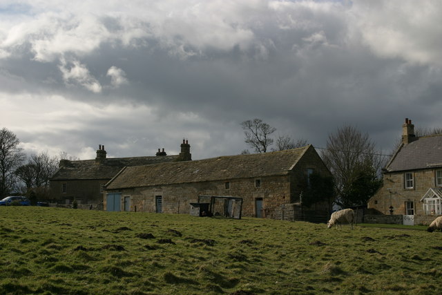
| Bantam Folly, Approx 200 Yards West of Belsay Castle | 1152975 | II | c.1757 | Belsay |
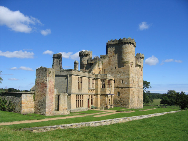
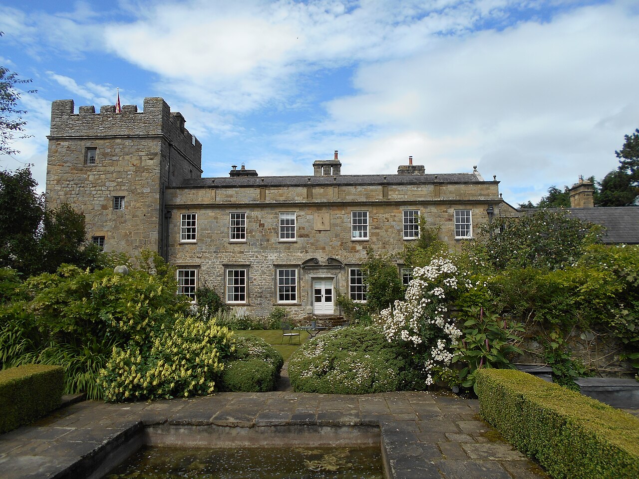
| Belsay Castle | 1042837 | I | 1370 | Belsay. With house added 1614. |
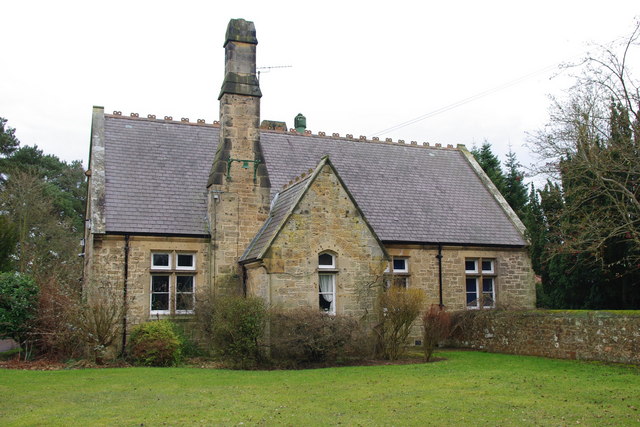
| Belsay County First School | 1153721 | II | 1870 | Belsay |
| Belsay Dene House | 1042810 | II | C18th | Belsay |
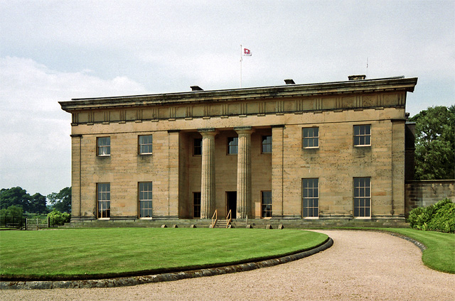
| Belsay Hall | 1304489 | I | 1817 | Belsay |
| Belsay Village Cross Approx 250 Yds East of Belsay Castle | 1042841 | II | Medieval | Belsay |
| Blackheddon Farmhouse | 1370688 | II | 1613 | Black Heddon |
| Blackheddon Hall | 1042813 | II | 1824 | Black Heddon |
| Boat House 450 Yards North-East of Belsay Hall | 1042846 | II | 1820s | Belsay |
| Bolam Hall East Wing, and Bolam Hall West Wing | 1370689 | II | 1810 | Bolam |
| Boundary Stones in Laker Plantation Approx 44o Yards North of Belsay Dene House | 1042811 | II | 1788 | |
| Bowman and Morgan Headstones Approx 20 Yds South of Church of St Andrew | 1153905 | II | 1712 | |
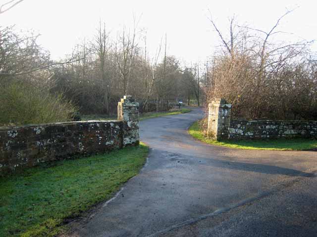
| Bridge and Gateway Approx 750 Yards West of Belsay Castle | 1042840 | II | C18th | Belsay |
| Bridge Approx 350 Yards North of Belsay Castle | 1370666 | II | C18th | Belsay |
| Bridge Approx 440 Yards East of Shortflatt Tower | 1042823 | II | C18th | |
| Bridge Approx 440 Yds North-East of Belsay Castle | 1304526 | II | C18th | Belsay |
| Bridge Approx 600 Yards West-North-West of Belsay Castle | 1152985 | II | C19th | Belsay |
| Byre and Barn to East of No 2 | 1042820 | II | C18th | Harnham |
| Byres and Granary to East of Harnham Hall | 1370655 | II | C18th | Harnham |
| Byres and Shelter Sheds Approx 10 Yards North of Bantam Folly, Belsay Castle | 1042839 | II | C18th | |
| Byres and Shelter Sheds Approx 30 Yards South-East of Blackheddon Farmhouse | 1042812 | II | 1856 | Black Heddon |
| Cascade at East End of Belsay Lake, Approx 270 Yards South of Belsay Hall | 1042845 | II | C19th | Belsay |
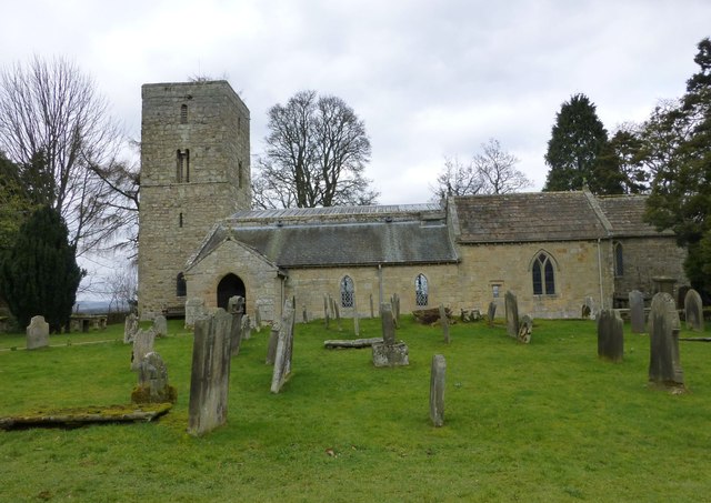
| Church of St Andrew | 1304102 | I | Saxon | Bolam. Norman interior. |
| Cook, Hepple, Steel, Renwick and Crow Headstones Approx 2-8 Yards South of Church of St Andrew | 1042817 | II | C18th | Bolam |
| Courtyard Wall East and North of Belsay Castle | 1370664 | II | C18th | Belsay |
| Dovecote and Outbuilding Approx 30 Yards North of Bolam Hall | 1153843 | II | C18th | Bolam |
| East Lodge to Belsay Hall | 1042848 | II | C19th | Belsay |
| Farmbuildings Approx 20 Yards South-West of Woodhouse | 1304154 | II | c1830s | |
| Farmbuildings to North of Belsay Dene House | 1370687 | II | C18th | |
| Field Hall Lodge | 1153674 | II | 1817 | |
| Folly Farmhouse and Attached Barn | 1153969 | II | C18th | |
| Garden Cottage and Stables to North West of Shortflatt Tower | 1154161 | II | C19th | |
| Garden Gates Approx 30 Yards East of Shortflatt Tower | 1303944 | II | C20th | |
| Garden Wall Attached to West Side of Shortflatt Tower | 1042822 | II | C19th | |
| Garden Walls and Dovecote to South of Nos 3 and 4 | 1370656 | II | Uncertain | Harnham. |
| Gate Piers and Walls Approx 300 Yards South-East of Bolam Hall | 1042814 | II | C19th | Bolam |
| Gateway and Churchyard Wall to South of Church of St Andrew | 1042816 | II | C18th | Bolam |
| Gateways, Wall and Railings Approx 40 Yds West of Belsay County First School | 1042849 | II | c.1830 | Belsay |
| Harnham Hall | 1042818 | II* | C16th | Harnham. House with tower |
| Kennels Approx 40 Yds North of Belsay Castle | 1042838 | II | C19th | Belsay |
| Milepost Approx 440 Yds East of Edgehouse | 1042834 | II | c.1830 | |
| Milepost at Junction with B6309 | 1042833 | II | c.1830 | A696 |
| Mounting Block Approx 20 Yards South of Church of St Andrew | 1153897 | II | C18th | Bolam |
| North Lodge | 1153623 | II | C19th | A696 |
| Number 2 and Attached Shed | 1042819 | II | C18th | Harnham |
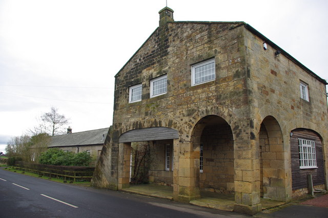
| Pant Approx 40 Yards South of the Arcade | 1042809 | II | C19th | Belsay |
| Pigsty, Forge and Garden Wall Approx 10 Yards North of Belsay Hall Stables | 1370667 | II | C19th | Belsay |
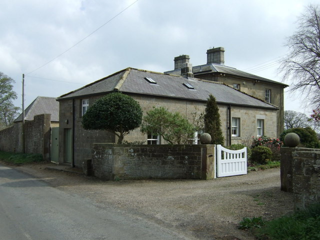
| Redhouse Farm Buildings | 1042836 | II | C19th | |
| Redhouse Farmhouse | 1370663 | II | C19th | |
| Remains of Cross Approx 15 Yards South of Church of St Andrew | 1042815 | II | Medieval | Bolam |
| Restaurant to Rear of the Highlander Public House | 1042835 | II | C19th | A696, near Belsay |
| Robson Headstone Approx 15 Yards South of Church of St Andrew | 1370691 | II | 1741 | Bolam |
| Sandyford Cottages Farm Buildings and Garden Walls | 1154129 | II | C19th | Harnham |
| Shelter Sheds Tack Room and Stables Approx 40 Yards North of West Bitchfield | 1154264 | II | C19th | West Bitchfield |
| Shortflatt Tower | 1042821 | I | 1257 | near Bolam |
| Snowball Headstone Approx 10 Yards South of Church of St Andrew | 1304063 | II | 1799 | Bolam |
| Stable Block Approx 20 Yards South of Woodhouse | 1042847 | II | 1836 | |
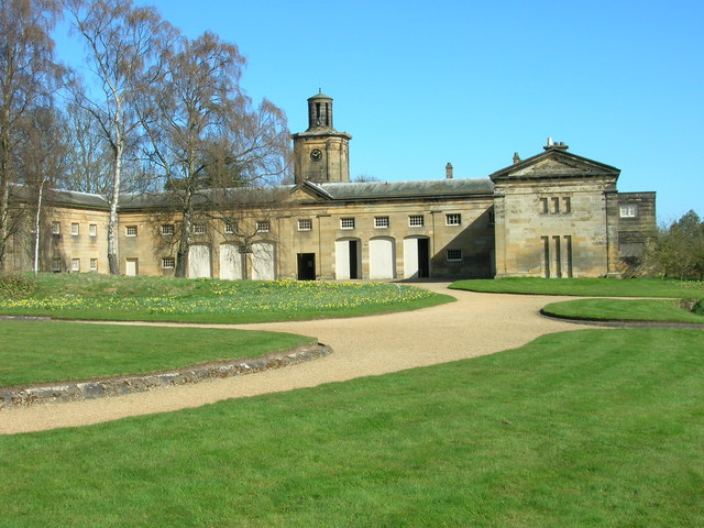
| Stable Block Approx 30 Yards North-East of Belsay Hall | 1153036 | II* | c.1817 | Belsay |
| Stable, Barn and Gingang Approx 20 Yds North of West Bitchfield | 1042825 | II | C19th | West Bitchfield |
| Stables Approx 30 Yds North-West of Belsay Castle | 1370665 | II | C18th | Belsay |
| Steps and Terrace Wall Approx 5 Yards South of Belsay Hall | 1042843 | II | c.1817 | Belsay |
| Sundial Approx 20 Yards West of Shortflatt Tower | 1303928 | II | C18th | |
| Terrace Wall Approx 30 Yards South of Belsay Hall | 1042844 | II | c.1817 | Belsay |
| The Arcade, 1 | 1153733 | II | 1830's | Belsay |
| The Arcade, 2-4 | 1370668 | II | 1830's | Belsay |
| The Arcade, 5-13 | 1370686 | II | 1830s | Belsay |
| The Highlander Public House | 1370662 | II | C19th | A696, near Belsay |
| The Old School House | 1042826 | II | 1829? | Belsay |
| The Old Vicarage | 1370692 | II | C18th | Bolam |
| Tomb of Katherine Babington, Wall and Statues Approx 20 Yds West of Harnham Hall | 1304022 | II | 1670 | Harnham |
| Wall and Gatepiers and Gate Approximately 350 Yards South West of Bolam Hall | 1370690 | II | C19th | Bolam |
| Walled Garden and Garden Cottages North of Belsay Hall | 1042842 | II | C19th | Belsay |
| Walled Garden Attached to South of West Bitchfield | 1042824 | II | C17th | West Bitchfield |
| Walls Around Winter Garden Approx 150 Yds West of Belsay Hall | 1153649 | II | C19th | Belsay |
| West Bitchfield Tower | 1303894 | I | C14th | West Bitchfield |
| Woodhouse | 1153693 | II | 1836 | Belsay |
| Belsay Conservation Area | - | n/a | - | Conservation Area |
Primary source: the National Heritage List for England - NHLE is the register of nationally protected historic buildings and sites in England, including listed buildings, scheduled monuments, protected wrecks, registered parks and gardens, and battlefields. The list is maintained by Historic England. Check NHLE for updates and new entries. Secondary sources: British Listed Buildings and Keys to the Past.
Co-Curate Page
Belsay Hall
- Overview About Belsay Hall Map Street View Pillar Hall Belsay Hall is a country house at Belsay, which was built from 1810-1817. The Greek Doric style building was by and …
Co-Curate Page
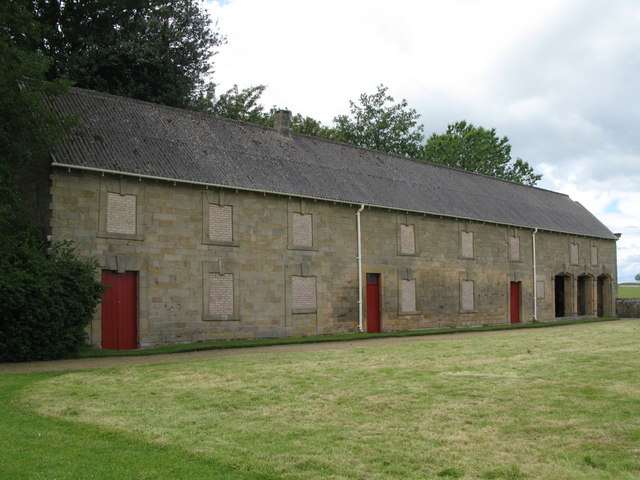
Old Stable Block near Belsay Castle
- The former stables and carriage house located by Belsay Castle were built in the early 18th Century. They are a Grade II listed building. A new stable block was built …
Co-Curate Page
Belsay Castle
- Overview About Belsay Castle Map Street View Belsay Castle is a tower house built in c.1370, with an attached house added in 1614 (possibly around earlier core), by Thomas and Dorothy …
Co-Curate Page
Stable Block, Belsay Hall
- Overview Map Street View This elegant stable block with an open courtyard was built at the same time as Belsay Hall, c.1817. It was for and by Sir Charles Monck, …
Co-Curate Page
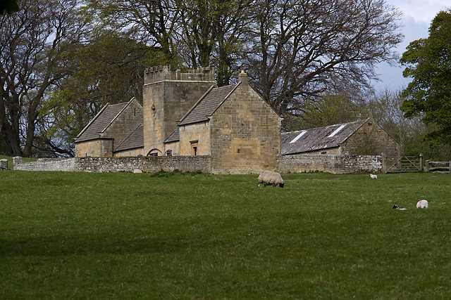
Church of St Andrew, Bolam
- Overview Map The Church of St Andrew at Bolam, Northumberland, dates back to Saxon times. The tower is of the late Saxon period, whilst the interior is largely Norman with …
Co-Curate Page
Shortflatt Tower
- Overview Map Shortflatt Tower is a historic house and defensive tower in the civil parish of Belsay, and located close to Bolam, Northumberland. Originally built in 1257, permission to crenellate …
Co-Curate Page
West Bitchfield
- Overview About West Btichfield Tower Map Bitchfield Tower or West Bitchfield Tower is a 15th-century medieval pele tower near Belsay, Northumberland, England. It is Grade I listed on the …
Co-Curate Page
Belsay School
- Overview Map Street View Belsay School was previously known as Belsay Primary School, Belsay First School, and before that: Belsay County First School. The school building was constructed in 1870, …
Co-Curate Page
Blackheddon Hall
- Former manor house in Black Heddon, Northumberland. Built in 1824, this is a Grade II Listed Building.
Co-Curate Page
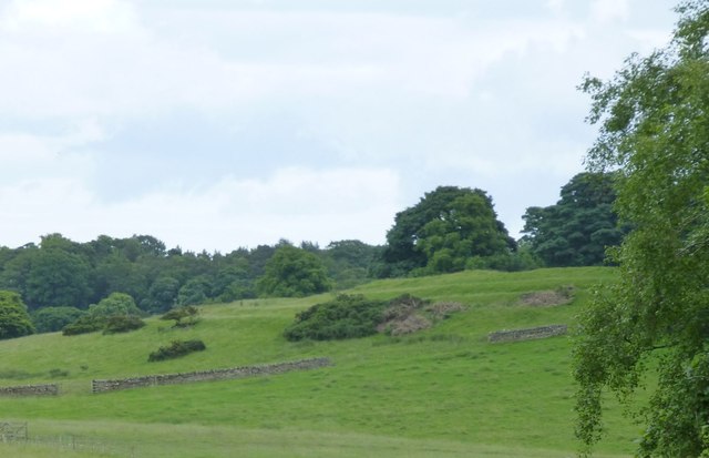
Slate Hill Settlement Earthworks, Bolam
- Overview Map Remains of a defended Iron Age settlement around the top of Slate Hill, just north of Bolam Lake in Northumberland. The ruins are a Sheduled Monument.
Co-Curate Page
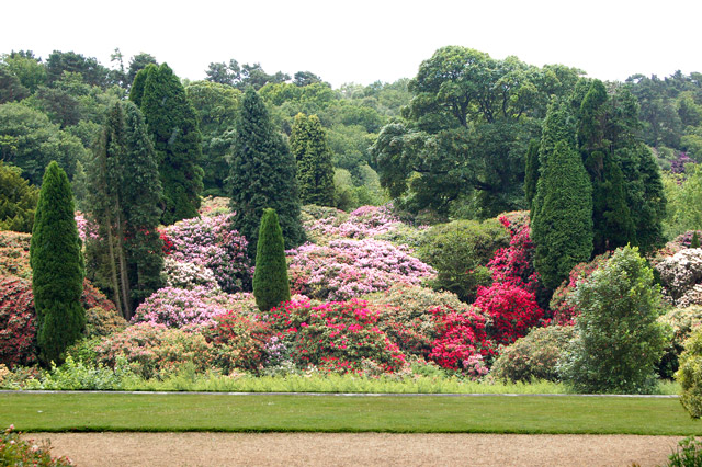
Belsay Hall Grounds
- The grounds and parkland around Belsay Hall were laid out from 1806-1867 by Sir Charles Monck, incorporating features from an earlier landscape park developed during the 18th Century by the …
Co-Curate Page
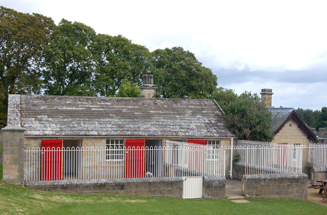
Bantam Folly, Belsay
- Bantam Folly, near Belsay Castle, are farm buildings, built in c.1757 for Sir William Middleton. The buildings were designed to provide a landscape feature; until the mid-20th Century, the folly …
Co-Curate Page
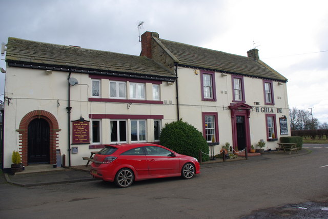
The Highlander, near Belsay
- Overview Map Street View The Highlander is a public house and restaurant, located on the A696 road, about 2 miles south-east of Belsay and 2 miles north-west of Ponteland. It …
Co-Curate Page
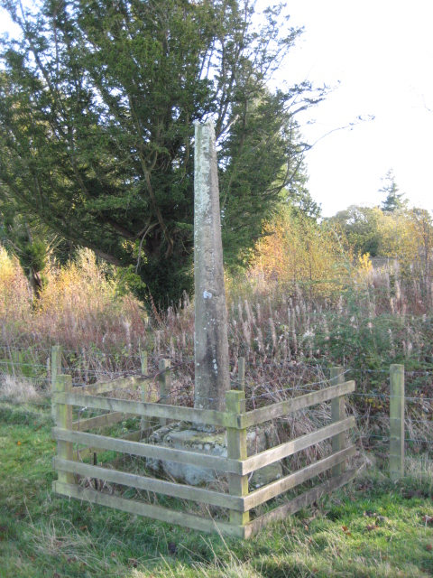
Old Village Cross, Belsay
- Formerly the village cross of Old Belsay Village, which was moved into the grounds of Belsay Castle by Sir Charles Monck in the 1830's. The cross is a Scheduled Monument …
Co-Curate Page
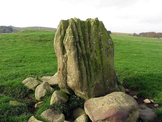
The Poind & His Man
- "The monument includes a standing stone and an adjacent round cairn of Late Neolithic/Early Bronze Age date situated in a prominent position on the top of a small knoll.....The cairn …
Co-Curate Page
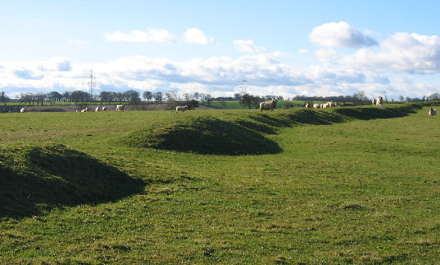
Middle Newham deserted medieval village
- Scheduled Monument areas - based on Historic England data (Open Government Licence). Middle Newham was a much larger village during Medieval times. There are earthwork remains of at least eight …

Co-Curate Page
Belsay Hall
- Overview About Belsay Hall Map Street View Pillar Hall Belsay Hall is a country house at Belsay, which was built from 1810-1817. The Greek Doric style building was by and …
Co-Curate Page
Old Stable Block near Belsay Castle
- The former stables and carriage house located by Belsay Castle were built in the early 18th Century. They are a Grade II listed building. A new stable block was built …
Co-Curate Page
Belsay Castle
- Overview About Belsay Castle Map Street View Belsay Castle is a tower house built in c.1370, with an attached house added in 1614 (possibly around earlier core), by Thomas and Dorothy …
Co-Curate Page
Stable Block, Belsay Hall
- Overview Map Street View This elegant stable block with an open courtyard was built at the same time as Belsay Hall, c.1817. It was for and by Sir Charles Monck, …
Co-Curate Page
Church of St Andrew, Bolam
- Overview Map The Church of St Andrew at Bolam, Northumberland, dates back to Saxon times. The tower is of the late Saxon period, whilst the interior is largely Norman with …
Co-Curate Page
Shortflatt Tower
- Overview Map Shortflatt Tower is a historic house and defensive tower in the civil parish of Belsay, and located close to Bolam, Northumberland. Originally built in 1257, permission to crenellate …
Co-Curate Page
West Bitchfield
- Overview About West Btichfield Tower Map Bitchfield Tower or West Bitchfield Tower is a 15th-century medieval pele tower near Belsay, Northumberland, England. It is Grade I listed on the …
Co-Curate Page
Belsay School
- Overview Map Street View Belsay School was previously known as Belsay Primary School, Belsay First School, and before that: Belsay County First School. The school building was constructed in 1870, …
Co-Curate Page
Blackheddon Hall
- Former manor house in Black Heddon, Northumberland. Built in 1824, this is a Grade II Listed Building.
Co-Curate Page
Slate Hill Settlement Earthworks, Bolam
- Overview Map Remains of a defended Iron Age settlement around the top of Slate Hill, just north of Bolam Lake in Northumberland. The ruins are a Sheduled Monument.
Co-Curate Page
Belsay Hall Grounds
- The grounds and parkland around Belsay Hall were laid out from 1806-1867 by Sir Charles Monck, incorporating features from an earlier landscape park developed during the 18th Century by the …
Co-Curate Page
Bantam Folly, Belsay
- Bantam Folly, near Belsay Castle, are farm buildings, built in c.1757 for Sir William Middleton. The buildings were designed to provide a landscape feature; until the mid-20th Century, the folly …
Co-Curate Page
The Highlander, near Belsay
- Overview Map Street View The Highlander is a public house and restaurant, located on the A696 road, about 2 miles south-east of Belsay and 2 miles north-west of Ponteland. It …
Co-Curate Page
Old Village Cross, Belsay
- Formerly the village cross of Old Belsay Village, which was moved into the grounds of Belsay Castle by Sir Charles Monck in the 1830's. The cross is a Scheduled Monument …
Co-Curate Page
The Poind & His Man
- "The monument includes a standing stone and an adjacent round cairn of Late Neolithic/Early Bronze Age date situated in a prominent position on the top of a small knoll.....The cairn …


