Topics > County Durham > Civil Parishes in County Durham > Stanhope Civil Parish > Historic Buildings and Monuments in Stanhope Civil Parish
Historic Buildings and Monuments in Stanhope Civil Parish
Listed buildings and scheduled monuments in Stanhope Civil Parish, County Durham, from the National Heritage List for England[1]. Use the Search (below) if looking for a specific building / monument.
| Structure | List No. | Grade | Built~ | Notes |
|---|---|---|---|---|
| 5 Boundary Stones on Border with Cumbria | 1322754 | II | 1880 | Alston Moor |
| 7/8 Stone Houses | 1231097 | II* | 1533 | Stanhope, Former Rectory |
| Aller's Bridge over Killhope Burn | 1233602 | II | C18th | |
| Amrita Cottage | 1232348 | II | ||
| Arch of Former Lintzgarth Smelt Mill Flue | 1277257 | II | ||
| Barn and Byre North of Old Park Farmhouse | 1230050 | II | ||
| Barn and Stable Range to East of Park House Farmhouse | 1230492 | II | ||
| Barn Range South of Ludwell Farmhouse | 1277426 | II | ||
| Barn to East of Peakfield Farmhouse | 1277252 | II | ||
| Barn to North of Low Allers | 1233680 | II | ||
| Bishop Butler's House | 1278074 | II | ||
| Blackcleugh Farmhouse and Outbuilding | 1232343 | II | ||
| Blaeberry Cleugh Lead Mine Bouse Team | 1232306 | II | ||
| Blaeberry Cleugh Lead Mine Buddle, on West Bank of Blaeberry Cleugh | 1232477 | II | ||
| Blaeberry Cleugh Lead Mine Knocking Wall and Bingstead on West Bank of Blaeberry Burn | 1232461 | II | ||
| Bollihope House Farmhouse and Barn Adjoining | 1231172 | II | ||
| Bonnymoor and Harthopeburn Cottage | 1232082 | II | ||
| Bridge End | 1229602 | II | C16th | Cowshill. Farmhouse, incorporates bastle. |
| Bridge over River Wear | 1277160 | II | C18th | West Blackdene |
| Bridge over Rookhope Burn | 1231376 | II | C19th | Eastgate |
| Broadwood Farmhouse | 1229993 | II | ||
| Burtree Ford House and Barn Adjoining | 1231311 | II | ||
| Butts House | 1231313 | II | ||
| Candle House at Newhouse | 1233515 | II | ||
| Cart Shed North of Willow Green Farmhouse | 1229604 | II | ||
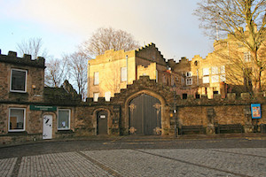
| Castle Wall Including Market Lodge, Gateway and Bus Shelter | 1232029 | II | ||
| Church of St John the Baptist | 1232171 | II | 1752 | St John's Chapel. On site of medieval church. |
| Church of St John the Evangelist | 1232216 | II | 1822 | Rookhope. Rebuilt 1905 |
| Church of St Michael and All Angels | 1231459 | II | ||
| Church of St Thomas | 1231701 | II* | C12th | Stanhope |
| Churchyard Wall with Gates, Piers and War Memorial | 1231956 | II | ||
| Churchyard Walls and Hearse House to North of Church of St Thomas | 1231166 | II | C19th | Stanhope |
| Co-Operative Stores | 1231492 | II | ||
| Coach House North of the Rectory | 1231589 | II | ||
| Coronation Bridge over River Wear | 1230037 | II | ||
| County Library Branch | 1231493 | II | ||
| Cow Shed, Stable and Hay Loft to South of Dry Gill West Farmhouse | 1230039 | II | ||
| Cowshill War Memorial | 1436799 | II | ||
| Cragside Cottage | 1278161 | II | ||
| Currah Tomb About 4 Metres South of Church of St John | 1232081 | II | ||
| Dene View | 1231319 | II | ||
| Dovecote North West of Frosterley House | 1278149 | II | ||
| Dry Gill West Farmhouse | 1230342 | II | ||
| Dwarf Walls in Front of Eastgate Mill | 1278146 | II | ||
| Earle and Collingwoods Tombs About 3 Metres South of Church of St Thomas | 1231872 | II | ||
| East and West Houses, Longhorn Ends | 1278256 | II | ||
| Eastern Lime Kiln on North Bank of Bollihope Burn | 1231170 | II | ||
| Eastgate Mill | 1231373 | II | ||
| Eastgate War Memorial | 1434063 | II | ||
| Emerson Tomb About 15 Metres East of Church of St John, Near South Wall of Churchyard | 1232199 | II | ||
| Emmerson Cottage, The Cottages and Muschamp House | 1231307 | II | ||
| Farmbuildings to South East of Low Allers Cottage | 1233700 | II | ||
| Farmhouse on North Bank of Stotfield Burn, with Attached Outbuilding | 1277204 | II | ||
| Fell View Cottage | 1277059 | II | ||
| Field Barn About 100 Metres South of Newhouse | 1232093 | II | ||
| Field Barn and Wall at Junction of Heights Quarry Road | 1278822 | II | ||
| Footbridge over Railway Line | 1231181 | II | ||
| Former Farmhouse to West of Snowhope Close Farmhouse | 1232083 | II | ||
| Former House and Byre, with Loose Boxes, South of Ludwell Farmhouse Barn | 1231826 | II | ||
| Former Inn | 1232214 | II | ||
| Former Lock Up West of Former Police House | 1230036 | II | ||
| Former Rectory, Now Parish Hall, Flats and Private House | 1278083 | II | ||
| Frosterley Bridge over River Wear | 1278085 | II | ||
| Frosterley House | 1231416 | II | ||
| Frosterley House Cottage and Arch Adjoining | 1231382 | II | ||
| Garage North of the Rookhope Inn | 1231178 | II | ||
| Garden Wall and Dog Shelter North of Frosterley House | 1231431 | II | ||
| Gate Piers and Walls South of Peakfield Farmhouse | 1277254 | II | ||
| Gate Piers to North East of Church of St Michael and All Angels | 1231470 | II | ||
| Greenhead Farmhouse and Outbuilding Attached | 1230040 | II* | C17th | Green Head |
| Greenlaws (Former Primitive Methodist Chapel) | 1278815 | II | 1858 | Lanehead |
| Greenlaws East Level Portal Arch at Middle Level Mine | 1278086 | II | ||
| Greenlaws West Level Portal Arch at Middle Level Mine | 1231675 | II | ||
| Grove Rake Mine Lodging Shop | 1232075 | II | ||
| Guidepost at Junction of A689 and Causeway Road | 1231699 | II | ||
| Hackword Tomb About 2 Metres East of East End of Church of St John | 1277259 | II | ||
| Haswick's Bridge over River Wear | 1232310 | II | ||
| Heather Lea | 1231316 | II | ||
| Heathery Cleugh Bridge, over Heathery Cleugh | 1278265 | II | ||
| High Bishopley Farmhouse and Barn Adjoining | 1278248 | II | ||
| High Crooked Well | 1231741 | II | ||
| High Greenwell Farmhouse and Barn Attached | 1232213 | II | ||
| High House Chapel and Former Minister's House | 1230009 | II | ||
| High Smailsburn Farmhouse | 1232079 | II | ||
| Hog Hill Tunnel North Entrance | 1230546 | II | ||
| Hog Hill Tunnel South Entrance | 1278789 | II | ||
| Hole Dam Farmhouse | 1230045 | II | ||
| Holroyd | 1278148 | II | ||
| Hope Level Entrance Arch in Stanhope Dene | 1230517 | II | ||
| Horsley Hall | 1229603 | II | ||
| House East of the Cottage | 1231379 | II | ||
| House Occupied by Mrs Burgess and Garden Wall Adjoining | 1231314 | II | ||
| Iley Tomb Circa 28 Metres South of Church of St Thomas | 1277434 | II | ||
| Inscription Stone Set in Garden South of Rancho Del Rio | 1229607 | II | ||
| Island House | 1231317 | II | ||
| Ivy Cottage and Barn Adjoining | 1231806 | II | ||
| Killhopeburn Shielding | 1230206 | II | ||
| Lime Kiln | 1229978 | II | c.1800 | Frosterley |
| Lime Kiln North East of Broadwood Kiln House | 1276478 | II | ||
| Lime Kiln West of Fine Burn Quarry | 1278191 | II | ||
| Limekiln About 100 Metres West of Allercleugh Plantation, South East of Middle Whitestones Farm | 1232355 | II | ||
| Limekiln Circa 300 Metres South of Burnhope Reservoir | 1278198 | II | ||
| Limekiln East of Clarty Lane | 1278782 | II | ||
| Limekiln North East of Bollihope Shield Farm | 1231177 | II | ||
| Limekiln North East of High Greenfield Farmhouse | 1278556 | II | ||
| Limekiln North of High Greenfield | 1230067 | II | ||
| Lintzgarth Bridge over Rookhope Burn | 1277207 | II | ||
| Low Aller's Cottage | 1233589 | II | ||
| Low Allers | 1276529 | II | ||
| Low Bishopley Farmhouse and Barn Adjoining | 1278846 | II* | C17th | |
| Low Hawkwell Head | 1278628 | II | ||
| Ludwell Farmhouse | 1231700 | II | ||
| Marker Stone on Bridge over Bollihope Burn | 1231171 | II | ||
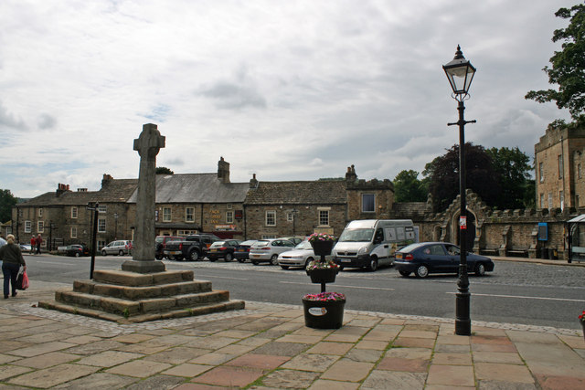
| Market Cross | 1231714 | II | 1871 | Stanhope |
| Mellbutts Bank | 1231719 | II | ||
| Memorial Fountain at Junction with Road to Ford | 1277124 | II | ||
| Memorial to John Wesley | 1229605 | II | C18th | Ireshopeburn |
| Methodist Chapel | 1278797 | II | ||
| Middle Level Lead Mine North Bouse Teams | 1231634 | II | ||
| Middle Level Lead Mine Timber Store | 1231495 | II | ||
| Middle Level Lead Mine Water Race and Steps and Retaining Wall at Dressing Floor | 1231496 | II | ||
| Middle Level Mine Shop | 1278087 | II | ||
| Milepost About 100 Metres East of Killhope Head Bridge | 1230019 | II | ||
| Milepost About 120 Metres East of Park House Farmhouse | 1230048 | II | ||
| Milepost About 15 Metres East of Junction to Road to Bondisle Way | 1231609 | II | ||
| Milepost About 200 Metres West of Park Level Mine | 1230020 | II | ||
| Milne Farmhouse and Barn, with Wall and Implement Shed Attached | 1231169 | II | ||
| New Close Farmhouse with Stable, Byre and Lofts | 1232289 | II | ||
| New Park and Cottage Adjoining | 1230046 | II | ||
| Newhouse, and Walls Attached | 1232062 | II* | C17th | |
| North Lodge and Wall to Stanhope Castle (Castle Lodge) | 1231528 | II | ||
| Number 1 and Houses Adjoining in Butts Head, the Butts | 1232019 | II | ||
| Numbers 1 - 4 Consecutive and Stables Attached | 1278197 | II | ||
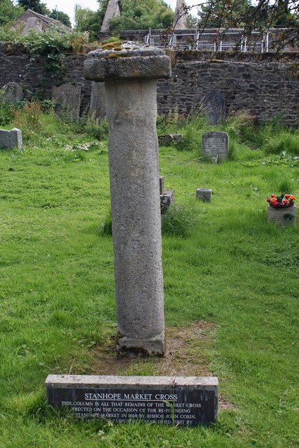
| Old Market Cross in Churchyard About 3 Metres North of Gate | 1277435 | II | 1669 | Stanhope |
| Old Park Farmhouse, with Cottage and Byre Attached | 1230494 | II | ||
| Outbuilding East of High Bishopley Farmhouse | 1231168 | II | ||
| Outbuilding North of Whitestones Cottage | 1232291 | II | ||
| Outbuilding South of Stanhope Hall Mill | 1232085 | II | ||
| Outbuilding to North West of Former Inn | 1232215 | II | ||
| Outbuilding to South of Park House Farmhouse | 1278786 | II | ||
| Outbuilding to South of Swinhopeburn Farmhouse | 1232288 | II | ||
| Outbuildings and Wall North East of Frosterley House | 1278133 | II | ||
| Outbuildings North of Frosterley House | 1231380 | II | ||
| Outbuildings to North of Phoenix Inn | 1231491 | II | ||
| Outbuilidng South of Eastgate Mill | 1231375 | II | ||
| Parish Hall of Church of St Michael | 1231490 | II | ||
| Park Level Entrance Arch | 1278746 | II | ||
| Park Level Mine Bouse Teams | 1278747 | II | ||
| Park Level Mine Jigger House and Crushing Mill Water Wheel | 1278814 | II* | 1870 | |
| Park Level Mine Masterman Washer's Hut | 1230024 | II | ||
| Park Level Mine Shop | 1278769 | II | ||
| Park Shops | 1278632 | II | ||
| Peakfield Farmhouse and House Adjoining to Right | 1232073 | II | ||
| Peart Tomb About 4 Metres South of Church of St John | 1232180 | II | ||
| Peathill Brow | 1232308 | II | ||
| Phoenix Inn | 1278082 | II | ||
| Pine Cottage (Former Police House, North of Heatheryclough) | 1278643 | II | ||
| Pound at West End of Village | 1232345 | II | ||
| Premises Formerly Occupied by J and G Archibald Limited | 1232050 | II | ||
| Premises Occupied by Wh Busby and Market Cottage | 1231715 | II | ||
| Railway Marker About 600 Metres South of Weatherhill Engine | 1278577 | II | ||
| Railway Marker About 660 Metres South of Weatherhill Engine | 1278794 | II | ||
| Rancho Del Rio | 1229606 | II | ||
| Reading Room and Cottage Adjoining to Right | 1232064 | II | ||
| Retaining Wall South of Stone House | 1230072 | II | ||
| Rookhope War Memorial | 1439719 | II | ||
| Row of Houses at Wolfcleugh, About 200 Metres South of Rookhope Burn | 1277255 | II | ||
| Scarsike Head Guide Post on North Side of Road Junction One Metre West of Wall | 1232200 | II | ||
| Shield Ash Farmhouse | 1278790 | II | ||
| Snape Gate Farmhouse (West) and Outbuildings Attached | 1232067 | II | ||
| Somerville Tomb About 5 Metres South of Chancel of Church of St John | 1232189 | II | ||
| Spring Spout and Trough North of High Bishopley Farmhouse | 1278249 | II | ||
| Stanhope Bridge over River Wear | 1277203 | II* | C15th | Stanhope. Widened in 1792 |
| Stanhope Castle | 1231718 | II* | 1798 | Stanhope |
| Stanhope Hall | 1277202 | II* | C16th | Stanhope |
| Stanhope Hall Mill | 1277261 | II | ||
| Stockton and Darlington Railway marker about 400 metres south of Weatherhill Engine | 1278791 | II | ||
| Stockton and Darlington Railway Marker About 530 Metres South of Weatherhill Engine | 1278792 | II | ||
| Sundorne and Milburn, Adjoining to Right | 1232066 | II | ||
| Swinhopeburn Court House | 1277158 | II | ||
| Swinhopehead House | 1232339 | II | ||
| The 'Golden Lion' | 1277260 | II | ||
| The Cottage | 1231377 | II | ||
| The Cottage | 1231378 | II | ||
| The Cottage and Adjoining Farm Buildings | 1232217 | II | ||
| The Cross Keys Public House | 1231320 | II | C18th | Eastgate. 2 houses, later converted to inn |
| The Curatage and House Adjoining on West | 1278084 | II | ||
| The Frosterley Inn | 1231455 | II | ||
| The Pack Horse Inn | 1277436 | II | ||
| The Rectory | 1231564 | II | ||
| The Rookhope Inn | 1278192 | II | ||
| Trustees Savings Bank | 1231509 | II | ||
| Unthank Hall | 1230062 | II* | C16th | Stanhope |
| Unthank Mill, Houses and Cow House Attached | 1230065 | II | ||
| Wall of Former Rectory Garden and Retaining Wall to Stanhope Caravan Site | 1278196 | II | ||
| Wall of Former Rectory Garden, Now Stanhope Caravan Site | 1231186 | II | ||
| Wall on North East Side of Castle Garden, and Gazebo Attached | 1278798 | II | ||
| Walls and Gate Piers in Front of Frosterley House | 1231381 | II | ||
| Walton Tomb About 10 Metres South of Church of St Thomas on East Side of Path | 1231710 | II | ||
| War Memorial | 1277222 | II | 1922 | St John's Chapel |
| Warden Hill Farmhouse East Part | 1230422 | II | ||
| Wearhead Methodist Chapel | 1230042 | II | 1826 | Wearhead |
| Weavers Workshop at Junction of A689 and Causeway Road | 1231820 | II | ||
| Well Head to West of Frosterley House | 1278150 | II | ||
| Western Limekiln on North Bank of Bollihope Burn | 1278250 | II | ||
| Westernhope Burn East Farmhouse | 1232301 | II | ||
| Westernhope New Mine Washing Floor on East Bank of Ash Burn | 1232489 | II | ||
| Westernhope Old (Lead) Mine Dressing Floor on South Bank of West Grain | 1232444 | II | ||
| Westernhope Old (Lead) Mine Lodging Shop and Stable on South Bank of West Grain | 1232303 | II | ||
| Westernhopeburn Cottage | 1232380 | II | ||
| Westernhopeburn West Farmhouse and Adjoining Outbuilding | 1232384 | II* | 1606 | |
| Westgate Primitive Methodist Chapel | 1232510 | II* | 1871 | Westgate |
| Wheel House on West Side of Harehope Burn 200 Metres South of Bollihope Burn | 1231694 | II | ||
| White Kirkley Farmhouse | 1277130 | II | ||
| Whitestones Cottage | 1277110 | II | ||
| Willow Green Farmhouse and Byres Attached | 1279004 | II | ||
| Wolfcleugh Sheepfold Circa 200 Metres South West of Wolfcleugh Cottages | 1232076 | II | ||
| Stanhope Bridge | 1002363 | n/a | Scheduled Monument | |
| Market cross, 35m and 50m south of St Thomas' Church | 1016876 | n/a | Scheduled Monument | |
| Middlehope Shield and Low Slit lead mines and ore works | 1015825 | n/a | Scheduled Monument | |
| Old Rookhope ore hearth lead smeltmill, 630m north west of Lintzgarth Plantation | 1015826 | n/a | Scheduled Monument | |
| Middle Greenlaws Level lead mine and ore works | 1015828 | n/a | Scheduled Monument | |
| Brandon Walls lead mine and ore works | 1015831 | n/a | Scheduled Monument | |
| Park Level lead mine with ore works on Killhope Burn | 1015853 | n/a | Scheduled Monument | |
| St Botolph's Chapel, 280m north east of Frosterley Bridge | 1016466 | n/a | Scheduled Monument | |
| Cairnfield on Crawley Edge, 500m north west of Hill Crest | 1016816 | n/a | Scheduled Monument | |
| Enclosure NW of Old Park House | 1002313 | n/a | Scheduled Monument | |
| Westgate Castle | 1002320 | n/a | Westgate. Scheduled Monument | |
| Camp at High Northgate | 1002326 | n/a | Scheduled Monument | |
| Cambokeels medieval site | 1002343 | n/a | Scheduled Monument |
Primary source: the National Heritage List for England - NHLE is the register of nationally protected historic buildings and sites in England, including listed buildings, scheduled monuments, protected wrecks, registered parks and gardens, and battlefields. The list is maintained by Historic England. Check NHLE for updates and new entries.
Secondary sources: British Listed Buildings and Keys to the Past.
Co-Curate Page
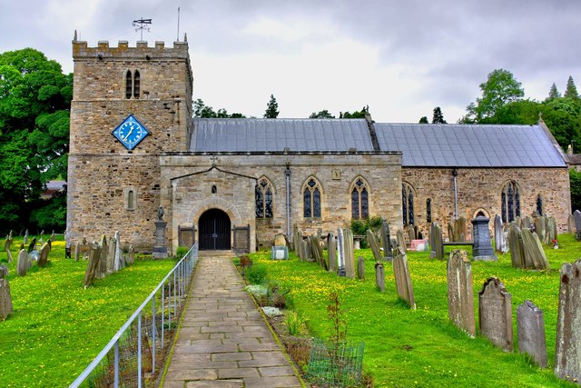
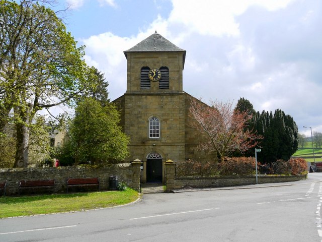
Church of St Thomas, Stanhope
- Overview Map Street View St Thomas' is the parish church in Stanhope, County Durham. The church was built in the 12th century, with the chancel and upper part of the …
Co-Curate Page
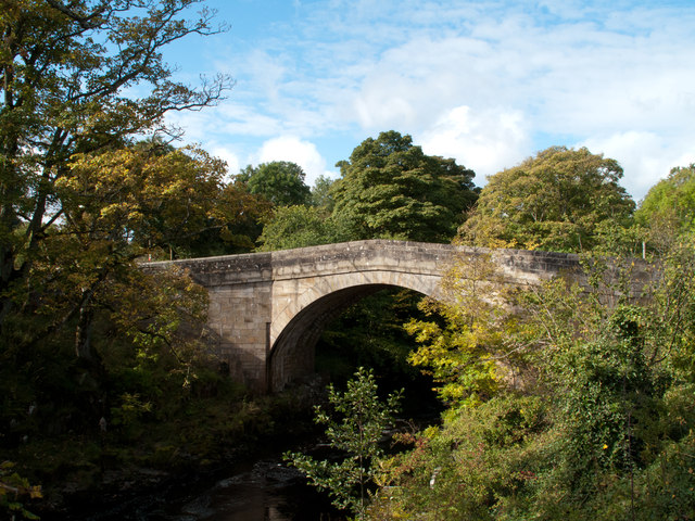
Bridge over the Wear
- Overview Map Street View This stone bridge over the River Wear just west of Stanhope dates from medieval times. The bridge now carries the B6278 road. It is Grade II* …
Co-Curate Page
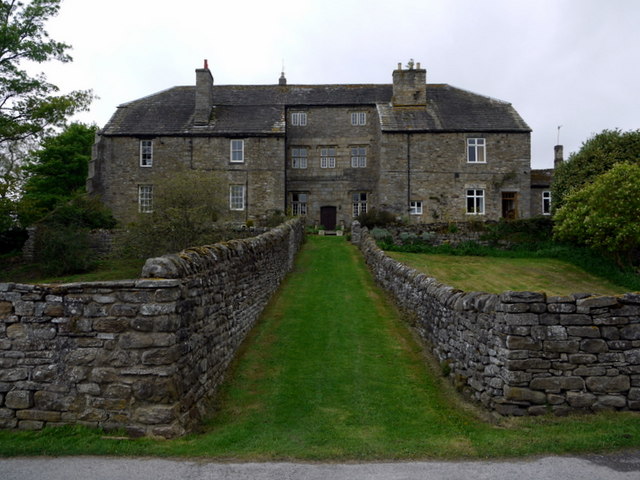
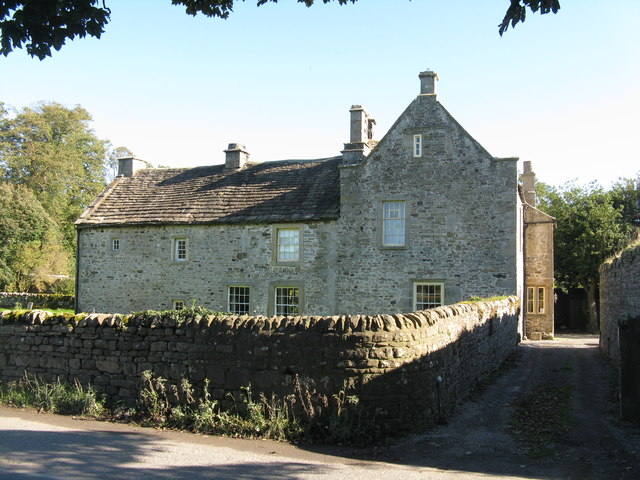
Unthank Hall
- Overview Map Unthank Hall is a 16th century manor house in Stanhope located near the south banks of the River Wear, close to Stanhope Ford. The hall is Grade II* …
Co-Curate Page
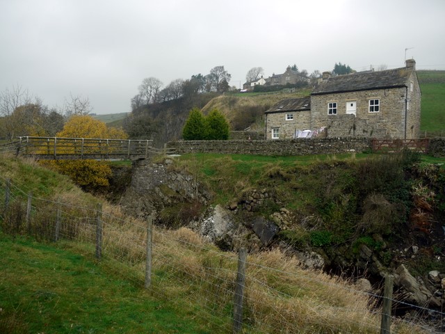
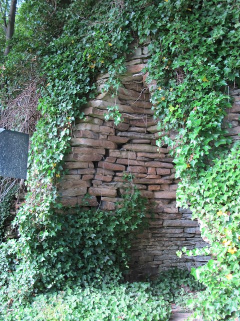
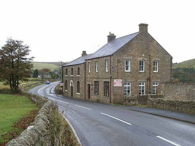
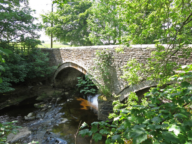
Bridge End, Cowshill
- Overview Map Bridge End Cottage in Cowshill, is located by a footbridge over Killhope Burn and immediately south of the flooded Copthill Quarry. The cottage is notable for being a …
Co-Curate Page
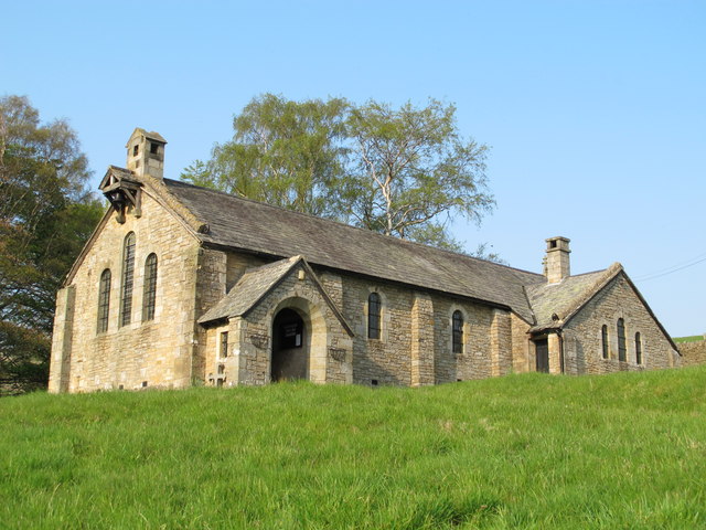
Church of St John the Baptist, St John's Chapel
- Overview Map Street View The Church of St John the Baptist in the village of St John's Chapel, County Durham, is Grade II listed on the National Heritage List for …
Co-Curate Page
Church of St. John the Evangelist, Rookhope
- Overview Map Street View The original St John’s in Rookhope was built in 1822, but at the end of the 19th Century it was pulled down and rebuilt in its …
Co-Curate Page
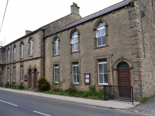
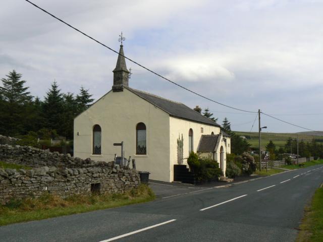
Old Primitive Methodist Chapel, Lanehead
- Overview Map Street View There is a former Primitive Methodist chapel on School Hill in Lanehead, now converted into a house. The church was built in 1858, and replaced a …
Co-Curate Page
Old Market Cross
- Overview Map The remains of the original Stanhope market cross of 1669 are located in the churchyard of St Thomas' Church. It was moved there after the 'new' market cross …
Co-Curate Page
John Wesley Memorial, Ireshopeburn
- A memorial to John Wesley, a founder of the Methodist movement, who used to preach here. The memorial is located in Ireshopeburn, County Durham, and is Grade 2 listed.
Co-Curate Page
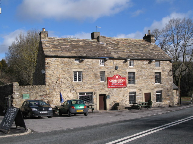
The Cross Keys, Eastgate
- Overview Map Street View The Cross Keys is a public house and resturant in Eastgate in Weardale. It was originally built as two houses in the early-mid 18th century, converted …
Co-Curate Page
War Memorial, St John's Chapel
- Overview Map Street View The War memorial in the village of St John's Chapel in Weardale, County Durham, has a 2 metre high pedestal supporting a life-size figure of soldier, …
Co-Curate Page
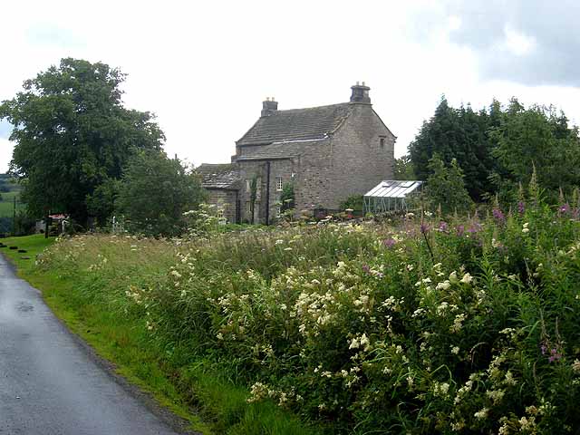
Greenhead, Stanhope
- Overview Map Street View Greenhead (aka Green Head) is a hamlet / farm located about 1 mile west of Stanhope, in County Durham. The farmhouse (Greehead Hall) here dates from …
Co-Curate Page
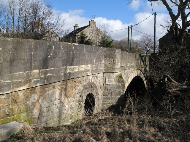
West Blackdene Bridge
- Overview Map Street View The stone bridge over the River Wear in West Blackdene dates from the 18th century. The bridge, with two segmental arches, is Grade II listed on …

Co-Curate Page
Church of St Thomas, Stanhope
- Overview Map Street View St Thomas' is the parish church in Stanhope, County Durham. The church was built in the 12th century, with the chancel and upper part of the …
Co-Curate Page
Bridge over the Wear
- Overview Map Street View This stone bridge over the River Wear just west of Stanhope dates from medieval times. The bridge now carries the B6278 road. It is Grade II* …
Co-Curate Page
Unthank Hall
- Overview Map Unthank Hall is a 16th century manor house in Stanhope located near the south banks of the River Wear, close to Stanhope Ford. The hall is Grade II* …
Co-Curate Page
Bridge End, Cowshill
- Overview Map Bridge End Cottage in Cowshill, is located by a footbridge over Killhope Burn and immediately south of the flooded Copthill Quarry. The cottage is notable for being a …
Co-Curate Page
Church of St John the Baptist, St John's Chapel
- Overview Map Street View The Church of St John the Baptist in the village of St John's Chapel, County Durham, is Grade II listed on the National Heritage List for …
Co-Curate Page
Church of St. John the Evangelist, Rookhope
- Overview Map Street View The original St John’s in Rookhope was built in 1822, but at the end of the 19th Century it was pulled down and rebuilt in its …
Co-Curate Page
Old Primitive Methodist Chapel, Lanehead
- Overview Map Street View There is a former Primitive Methodist chapel on School Hill in Lanehead, now converted into a house. The church was built in 1858, and replaced a …
Co-Curate Page
Old Market Cross
- Overview Map The remains of the original Stanhope market cross of 1669 are located in the churchyard of St Thomas' Church. It was moved there after the 'new' market cross …
Co-Curate Page
John Wesley Memorial, Ireshopeburn
- A memorial to John Wesley, a founder of the Methodist movement, who used to preach here. The memorial is located in Ireshopeburn, County Durham, and is Grade 2 listed.
Co-Curate Page
The Cross Keys, Eastgate
- Overview Map Street View The Cross Keys is a public house and resturant in Eastgate in Weardale. It was originally built as two houses in the early-mid 18th century, converted …
Co-Curate Page
War Memorial, St John's Chapel
- Overview Map Street View The War memorial in the village of St John's Chapel in Weardale, County Durham, has a 2 metre high pedestal supporting a life-size figure of soldier, …
Co-Curate Page
Greenhead, Stanhope
- Overview Map Street View Greenhead (aka Green Head) is a hamlet / farm located about 1 mile west of Stanhope, in County Durham. The farmhouse (Greehead Hall) here dates from …


 effigy/tomb lid in st James church, castle eden")


