Topics > Northumberland > Embleton > Embleton Parish, 1848
Embleton Parish, 1848
EMBLETON (St. Mary), a parish, in the union of Alnwick, S. division of Bambrough ward, N. division of Northumberland; comprising the townships of Broxfield, Brunton, Craster, Dunston, Embleton, Fallowdon, Newton-by-the-Sea, Rennington, Rock, and Stamford; and containing 2,030 inhabitants, of whom 525 are in the township of Embleton, 7¼ miles (N.E. by N.) from Alnwick. The township comprises about 2,000 acres, of which, with the exception of 600 acres of fine old grass-land, nearly the whole is arable, and in a high state of cultivation; the principal substrata are limestone and coal, both of which are found in great abundance, but the latter is of inferior quality. The village, which is about a mile to the west of the sea, is irregularly built at the base of a ridge of hills, and has a postoffice in connexion with that of Alnwick. The living is a vicarage, valued in the king's books at £11. 3. 4.; net income, £815; patrons and impropriators, the Warden and Fellows of Merton College, Oxford. The church is ancient. The townships of Rennington and Rock have each a chapel. There is a place of worship for members of the Kirk of Scotland; and a school for not less than ten, and not more than fourteen, children, is endowed with £20 per annum.
Extract from: A Topographical Dictionary of England comprising the several counties, cities, boroughs, corporate and market towns, parishes, and townships..... 7th Edition, by Samuel Lewis, London, 1848.
Co-Curate Page
Fallodon
- Overview Map Street View Fallodon (aka Followdon) is a hamlet in Northumberland, located about 2 miles west of Embleton and 6 miles north of Alnwick. Historically, Fallowon was a township …
Co-Curate Page
Broxfield
- Overview Map Street View Broxfield is a hamlet in Northumberland, located about 2 miles north-east of Alnwick. It consits of Broxfield Farm and Broxfield Farm Cottages. Broxfield is part of …

Co-Curate Page
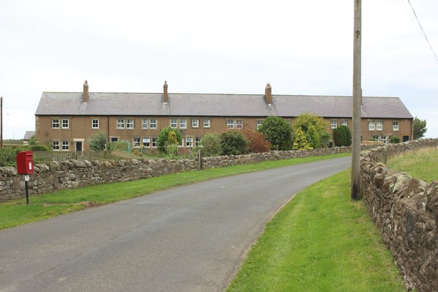
High and Low Brunton - Township, 1848
- BRUNTON, HIGH and LOW, a township, in the parish of Embleton, union of Alnwick, S. division of Bambrough ward, N. division of Northumberland, 8¾ miles (N. by E.) from Alnwick; …
Co-Curate Page
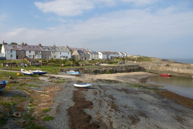
Craster
- Overview Further Information Map Street View Craster is a fishing village in Northumberland, famous for producing "Craster kippers". Craster has been a fishing haven since at least the 17th century. …
Co-Curate Page
Stamford
- Overview Map Street View Stamford is a hamlet in Northumberland located about 4 miles north-east of Alnwick and just over half a mile from the village of Rennington. Stamford is …
Co-Curate Page
Rennington, 1848
- RENNINGTON, a chapelry, in the parish of Embleton, union of Alnwick, S. division of Bambrough ward, N. division of Northumberland, 3¾ miles (N.E. by N.) from Alnwick; containing 245 inhabitants. …
Co-Curate Page
Rock, Northumberland, 1848
- ROCK, a chapelry, in the parish of Embleton, union of Alnwick, S. division of Bambrough ward, N. division of Northumberland, 4¾ miles (N.N.E.) from Alnwick; containing 227 inhabitants. It comprises …
Co-Curate Page
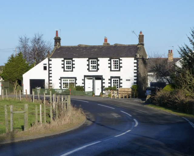
Dunstan
- Overview Map Street View Dunstan is a village in Northumberland located about half a mile from Craster and the coast. The village has a number of holiday cottages and a …
Co-Curate Page
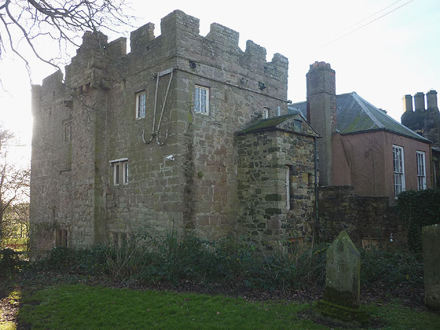
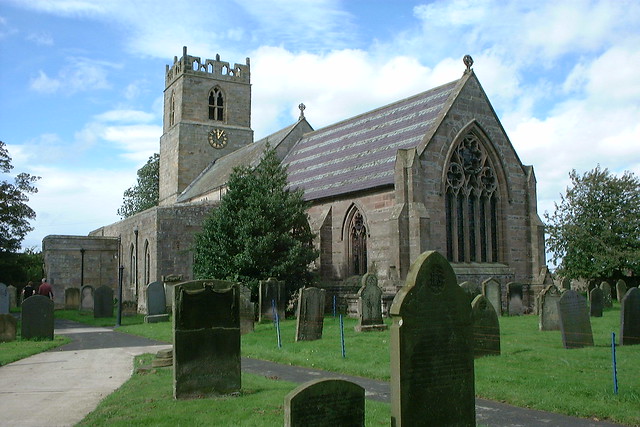
Church of the Holy Trinity
- Overview About the Church Map Street View Holy Trinity Church is the parish church in Embleton, Northumberland. The church dates from the late 11th or early 12th century. It's aisles …
Co-Curate Page
Newton-by-the-Sea, Township, 1848
- NEWTON, a township, in the parish of Embleton, union of Alnwick, S. division of Bambrough ward, N. division of Northumberland, 10 miles (N.N.E.) from Alnwick; containing 488 inhabitants. The township …

Co-Curate Page
Fallodon
- Overview Map Street View Fallodon (aka Followdon) is a hamlet in Northumberland, located about 2 miles west of Embleton and 6 miles north of Alnwick. Historically, Fallowon was a township …
Co-Curate Page
Broxfield
- Overview Map Street View Broxfield is a hamlet in Northumberland, located about 2 miles north-east of Alnwick. It consits of Broxfield Farm and Broxfield Farm Cottages. Broxfield is part of …
Co-Curate Page
High and Low Brunton - Township, 1848
- BRUNTON, HIGH and LOW, a township, in the parish of Embleton, union of Alnwick, S. division of Bambrough ward, N. division of Northumberland, 8¾ miles (N. by E.) from Alnwick; …
Co-Curate Page
Craster
- Overview Further Information Map Street View Craster is a fishing village in Northumberland, famous for producing "Craster kippers". Craster has been a fishing haven since at least the 17th century. …
Co-Curate Page
Stamford
- Overview Map Street View Stamford is a hamlet in Northumberland located about 4 miles north-east of Alnwick and just over half a mile from the village of Rennington. Stamford is …
Co-Curate Page
Rennington, 1848
- RENNINGTON, a chapelry, in the parish of Embleton, union of Alnwick, S. division of Bambrough ward, N. division of Northumberland, 3¾ miles (N.E. by N.) from Alnwick; containing 245 inhabitants. …
Co-Curate Page
Rock, Northumberland, 1848
- ROCK, a chapelry, in the parish of Embleton, union of Alnwick, S. division of Bambrough ward, N. division of Northumberland, 4¾ miles (N.N.E.) from Alnwick; containing 227 inhabitants. It comprises …
Co-Curate Page
Dunstan
- Overview Map Street View Dunstan is a village in Northumberland located about half a mile from Craster and the coast. The village has a number of holiday cottages and a …
Co-Curate Page
Church of the Holy Trinity
- Overview About the Church Map Street View Holy Trinity Church is the parish church in Embleton, Northumberland. The church dates from the late 11th or early 12th century. It's aisles …