Topics > Northumberland > Civil Parishes in Northumberland > Eglingham Civil Parish > Eglingham Parish, 1855
Eglingham Parish, 1855
Extract from: History, Topography, and Directory of Northumberland...Whellan, William, & Co, 1855.
EGLINGHAM PARISH
EGLINGHAM parish is bounded on the north by Glendale Ward, on the west by the parishes of Ingram and Ilderton, on the south by Alnwick, Edlingham, and Whittingham parishes, and on the east by Bambrough Ward. It is about nine miles in length, by four and a half in breadth, and comprises an area of 28,361 acres. Its population in 1801, was 1,536 ; in 1811, 1,538 ; in 1821, 1,666; in 1831, 1,805; in 1841, 1,832; and in 1851, 2,000 souls. It comprises 16 townships, which exhibit a great variety of soil and scenery, from the sterile moor to the fertile and highly cultivated valley, and possesses a mineral spring, tinctured with sulphuric acid, which issues from an old drift for the draining of coalpits; as also a lake covering nine acres, called Kimmet Lough, abounding in perch and pike, the latter of which attain to a great size. There are some vestiges of British and Roman encampments, and the ruins of an old border tower. Lime, freestone, and coal are abundant in this parish.
BASSINGTON is a township situated on the north side of the Aln, three and a half miles north-west by north of Alnwick. It comprises 234 acres, and its rateable value is £187 6s. 5d. The number of its inhabitants in 1801, was 9; in 1811, 17; in 1821, 12; in 1831, _ ; in 1841, 11; and in 1851, 8 souls. There are no farmers in this township, nor is it much cultivated, the greater portion abounding in rushes, from which the township is said to derive its name, as bassin, in the old British language, signifies rushy.
BEANLEY is a township and village, the property of the Duke of Northumberland. The area of the township is 2,341 acres, and its population in 1801, was 164; in 1811, 137; in 1821, 160; in 1831, 169; in 1841, 176; and in 1851, 166 souls. The rateable value is £1,366. Beanley was formerly the property of the Earls of Dunbar, who held it upon the condition of being surety for the peace of England and Scotland ; but being unable to fulfil their tenure, they forfeited this estate, which was granted by Edward III. to Henry Percy, from whom it has descended to the present proprietor. In this township are the remains of a British camp, surrounded with a double fosse and rampart, and on Hedgeley Moor, at a short distance from the village, is a cross erected in memory of Sir Ralph Percy, an adherent of the house of Lancaster, who fell in 1464, in a battle with the Yorkists. The impropriate tithes have been commuted for a rent charge of £143, and the vicarial tithes for £55 18s. This township is intersected by the river Breamish, which abounds in trout, etc., and Gallow Law, on the west side of the Breamish, is supposed to have been the place of execution for Beanley barony. THE VILLAGE of Beanley is situated upon an eminence about seven miles north-west by west of Alnwick.
DIRECTORY. John Lillie, blacksmith; and the farmers are John Moffatt, and Ralph Storey.
BEWICK (NEW) is a township and hamlet containing 1,125 acres, the property of A. J. B. Cresswell, Esq., who is also lord of the manor. The number of its inhabitants in 1801, was 63; in 1811, 92; in 1821, 93; in 1831, 106; in 1841, 121; and in 1851, 101 souls. THE HAMLET of New Bewick is two and a half miles west by north of Eglingham.
DIRECTORY. Ralph Morrison, Esq., who farms the whole township.
BEWICK (OLD) is a township and village, containing 6,487, acres, and its population in 1801, was 187; in 1811, 180; in 1821 247; in 1831, 227; in 1841, 176 ; and in 1851, 191 souls. A. J. B. Cresswell, Esq., is the sole landowner, and also lord of the manor. There are remains of several British entrenchments in this township, and on Bewick Moor is a natural cave, which, like the greater number of such places, is said to have been a haunt for robbers. THE VILLAGE of Old Bewickis pleasantly situated on the east bank of the river Till, three miles W. N. W. of Eglingham, and ten miles north west by north of Alnwick. The ancient chapel, which is now in ruins, stood at a little distance north-west of the village, and was dedicated to the Holy Trinity.
DIRECTORY. George Chreseson, Limeburner; Thomason Hall, cartwtight ; James Sheriff, blacksmith; John Taylor, bailiff to A. J. B. Cresswell, Esq. ; and the farmers are Robert Carr, Bewick Folly; J. C. Langlands, and Thomas Robson.
BRANDON, a township and hamlet, near the southern extremity of the Cheviot Hills, on the north side of the Breamish, is the property of H. L. Allgood, Esq. The population of the township in 1801, was 103; in 1811, 132; in 1821, 118; in 1831, 160; in 1841, 147; and in 1851, 173 souls. THE HAMLET of Brandon is situated eight miles south by east of Wooler. BRANDON WHITE HOUSE was formerly the residence of Sir Daniel Collingwood, a lineal descendent of the renowned border chieftain, Cuthbert Collingwood. Sir Daniel was its chaplain and afterwards sword bearer to King Charles II. This mansion is now occupied by John Davison, Esq.
DIRECTORY. John Davidson, Esq., Brandon White House; William Davidson, blacksmith ; Andrew Dodds, joiner; and Thomas James, farmer.
BRANTON is a township and hamlet, the property of Alexander Brown, Esq. The township comprises an area of 1147 acres, and number of its inhabitants in 1801,was 108; in 1811, 100; in 1821,111; in 1831, 110; in 1841, 119; and in 1851,102 souls. THE HAMLET of Branton is situated on the south side of the Breamish nine miles south by east of Wooler. Here is a Presbyterian Chapel, erected in 1781 ; it is a neat stone edifice, and will accommodate about 700 persons. The Rev. James Blythe, minister. Attached to this chapel, is a school which is respectably and numerously attended. George Davidson; teacher.
DIRECTORY. George Davidson, schoolmaster; Christopher Peary, grocer and general dealer; and the farmers are Rubert Clavering, William Cairns, East Side, and William Spink, Middle Farm.
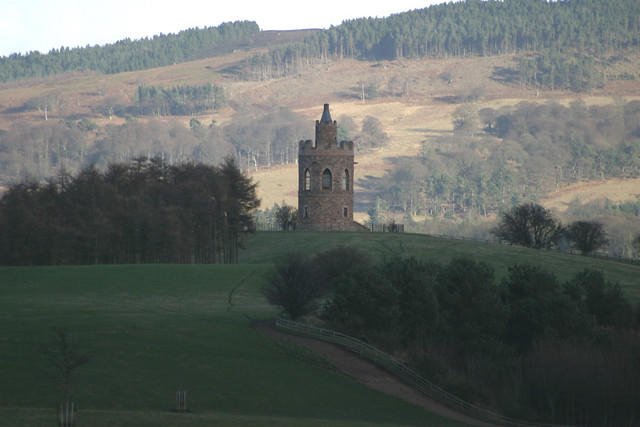
CRAWLEY is a township, eight miles W.N.W. of Alnwick. It comprises 314 acres, and its rateable value is £400. Population in 1801, 30; in 1811, 24 ; in 1821, 23; in 1831, 32; in 1841, 20; and in 1851, 25 souls. Sir Francis Blake, Bart., of Twizell House, is owner of this estate and lord of the manor. The tithes were commuted in 1839; Aggregate amount of vicarial 6s. 6d. and of impropriate £6 10s. 0d. This township was anciently designated Crawlawe, supposed to be a corruption of the Celtic Caelaw, a fortified hill. Crawlaw Tower, occupies the southern extremity of an old encampment, which is supposed to be the '' Alauna Arnnis" of the Romans, though some place that station at Alnwick. The entrenchment here is 290 feet in length, by 160 in breadth, and is encompassed by a fosse and rampart; the former of which is 30 feet, and the latter 20 feet wide. The situation occupied by this entrenchment is very lofty, commanding a most delightful view of the vale of Whittingham, with the river Breamish, and no fewer than seven British and Saxon entrenchments may be distinguished from this station, within a circuit of four miles. Grawley Tower is supposed by antiquarians to be a Roman structure, This township consists of one farm and a few cottages.
DIRECTORY. James Weir, farmer, Crawley Tower.
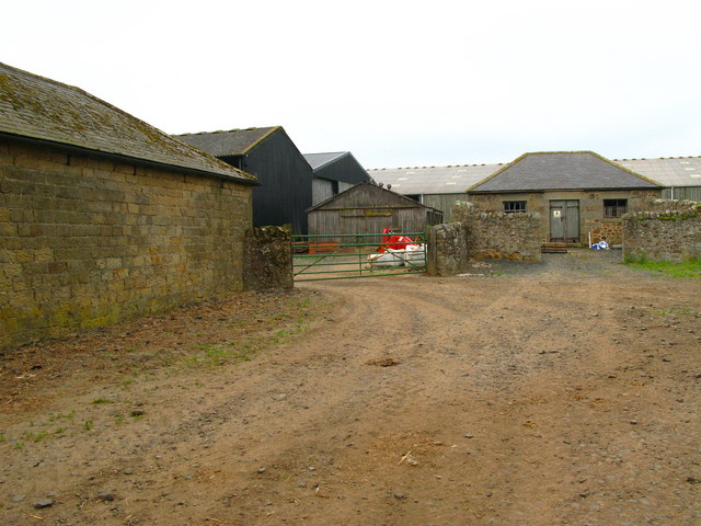
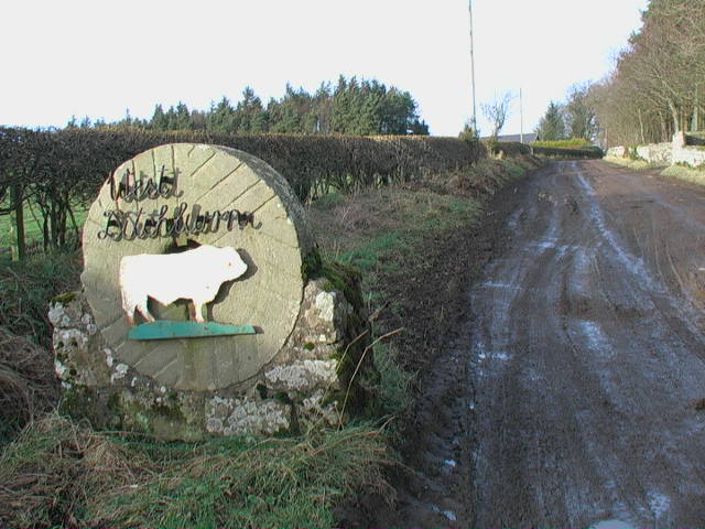
DITCHBURN, (EAST AND WEST), form a township in this parish, but are locally situated in the southern division of Bambrough Ward, six miles N.N.W. of Alnwick. The township comprises an area of 1,520 acres, and its rateable value is £502. Population in 1801, 87; in 1811, 86 ; in 1821, 97; in 1831, 77; in 1841, 60 ; and in 1851, 86 souls. Robert Dand, Esq., of Field House, Lesbury, is the proprietor and lord of the manor of East Ditchburn. and John F. Carr, Esq., is the owner and lord of the manor of west Ditchburn. There was formerly a fortified tower here, which served as a place of safety for cattle during the border raids.
DIRECTORY. John F. Carr, Esq., West Ditchburn; and Andrew Railston, farm steward to Robert Dand Esq., East Ditchburn.
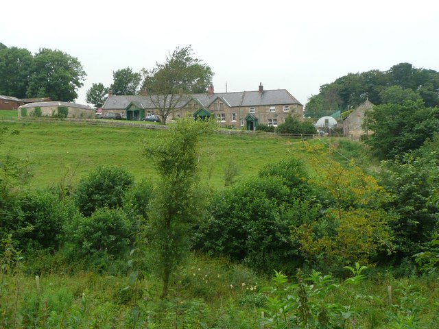
EGLINGHAM is a township and village giving name to the parish in which it is situated. The township contains 1,946 acres, and its rateable value is £1,695. The number of its inhabitants in 1801, was 204; in 1811, 191; in 1821, 184; in 1831, 221 ; in 1841, 304; and in 1851, 357 souls. The manor of Eglingham has been the seat and property of the Ogle famity for many centuries, and is now possessed by Major Robert Ogle. The Earl of Tankerville also owns some lands in this township.
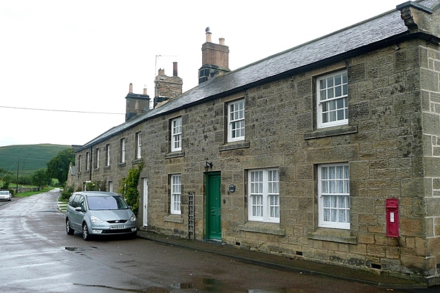
THE VILLAGE of Eglingham is situated on an eminence seven miles north west of Alnwick. THE PARISH CHURCH is dedicated to St. Maurice, and the register commences in 1662. The living, a vicarage in the archdeaconry of Lindisfarne, and deanery of Bambrough, is valued in the Liber Regis at £23 3s. lid., gross income, £906. Patron, the Bishop of Durham ; vicar, the Rev. Richard Charles Coxe, M.A. There were formerly four chapels of ease in this parish, but they have long been in ruins,
CHARITY. Margaret Hindmarsh, by her will, bearing date 9th March, 1704, bequeathed the sum of £50 to the poor of this parish, and directed that the interest should be distributed yearly among the poor inhabitants of the parish of Eglingham.
POST OFFICE, EGLINGHAM. Robert Robertson, Postmaster. Letters arrive here 11-0 a.m., and are despatched at 7-0 p.m.
|
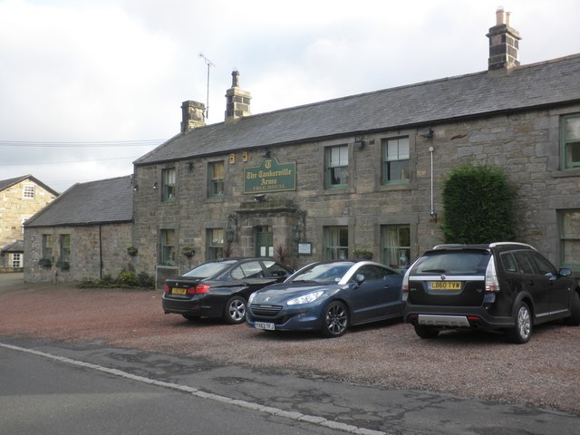
Blair Matthew, blacksmith Baird John, farmer, coal owner, & lime burner, Banna-moor, and Shipley Colliery Brown William, schoolmaster Burn Thomas, vict. & joiner, Tankerville Arms Buen William, joiner Chishohn, George, tailor Coxe Rev. Richard Charles, M.A. vicar, Vicarage Grey John, mason Green James, shoemaker Green John, shoemaker Harvey Mrs. schoolmistress Hewitt William, vict. Ogle Arms Hash Adam, tailor Knot William, joiner and cartwright Middlemiss Mark, cornmiller |
Mole Thomas, grocer Ogle Major Robert, The Hall Pringle William, joiner and cartwright Robertson Robert, grocer Thompson William, mason Vint John, lime burner and coalowner Wood James, blacksmith,
Farmers Baird John, Banna Moor Bolton John, Cock Hall Middlemiss Mark Robertsoii Robert Robson Matthew, Glebe Farm Short John, Eglingham Hall |
HAREHOPE, OR HAREUP, a township one mile north-west of Eglingham, contains 566 acres of land, and its rateable value is £231. Population in 1801, 44; in 1811, 36; in 1821, 46; in 1831, 50; in 1841, 49; and in 1851, 62 souls. The tithes were commuted in 1839; aggregate amount, £32 17s. 7d.; impropriate, and £24 3s. vicarial, The township contains but one farm, and HAREHOPE HOUSE, a handsome stone mansion, the residence of 0. A. Baker Creswell, Esq.
DIRECTORY. 0. A. Baker Creswell, Esq., Harehope House; and Edward Donkin, farmer.
HEDGELEY township is the property of Ralph Carr, Esq. It is situated eight miles W.N.W. of Alnwick, contains an area of 700 acres, and its rateable value is £700. The number of inhabitants in 1801, was 51~ in 1811, 42; in 1821, 36; in 1831, 43; in 1841, 72; and in 1851, 81 souls. This township extends on both sides of the river Breamish, that portion of the east side of the river being called High Hedgeley, and the other Low Hedgeley. A monument on Hedgeley Moor, called Percy's Cross, marks the spot where the brave Sir Ralph Percy fell, while bravely fighting for the cause of Henry VI., in the wars of York and Lancaster. It stands a little to the north-east of the twenty-fourth milestone on the Morpeth and Wooler road, and consists of a stone pillar, fixed on a pedestal, having the armorial bearings of Lucy and Percy rudely cut upon it in relief. HEDGELEY HOUSE is the seat of Ralph Carr, Esq.
DIRECTORY. Ralph Carr, Esq., Hedgeley House; George Bolam, farmer; John Anderson, joiner; Robert Green, shoemaker; and George Short, tailor.
LILBURN (EAST), a township four miles south-east by east of Wooler, contains 868 acres, the property of A. J. B. Creswell, Esq., and the number of its inhabitants in 1801, was 95 ; in 1811, 72; in 1821, 97; in 1831, 95 ; in 1841, 80; and in 1851, 100 souls. Tithes commuted in 1839; aggregate amount, £123 2s. 8d. due to the impropriator, and £57 6s. 3d. to the vicar of Eglingham. This township contains only one farm which is occupied by Ralph Atkinson, farmer.
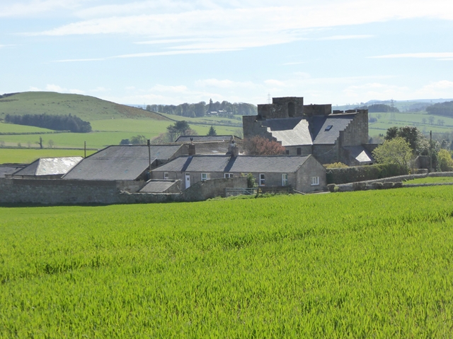
LILBURN (WEST) is a township and hamlet, the property of Edward John Collingwood, Esq. The township contains an area of 1,965 acres, and its population in 1801, was 164 ; in 1811, 140; in 1821, 171; in 1831, 235; in 1841, 226 ; and in 1851, 234 souls. The tithes were commuted in 1839; aggregate amount £268 7s 11d. This estate was anciently held under the barony of Wark, by the De Roos family, but in consequence of the revolt of Robert De Roos, it was forfeited, and we next find it in the possession of a family which bore the local name, who held it for many ages. At the west end of the hamlet are the ruins of an ancient mansion and tower, and also of a chapel of ease. THE HAMLET of West Lilburn is situated three miles south-east of Wooler. LILBURN TOWER, a neat modern building, is the residence of Edward John Collingwood, Esq.
POST OFFICE, WEST LILDURN.-John Deas, Postmaster. Letters arrive at 12 noon, and are despatched at 6 p.m.
|
Brown John, auctioneer and joiner, Haugh Stead Collingwood Edward John, Esq., Lilburn Tower Deas John, gardener Hindmarsh Matthew, gamekeeper Moffat Chas. land agent, Lilburn Cottage |
Farmers Brown John, Haugh Head Cock Thomas Purves Peter William, South Steads Smith Willium, Lilburn Hill Ramsay James, The Grange Stephenson William, Tower Farm |
SHIPLEY is a township in this parish, but locally situated in the southern division of Bambrough Ward. It comprises 1,991 acres, the property of Edward Collingwood, Esq., James H. H. Atkinson, Esq., William Baird, Esq., Lord Ellenborough, and Thomas Arthur, Esq. The number of its inhabitants in 1801, was 108; in 1811, 152; in 1821, 129 ; in 1831, 95; in 1841; 124 ; and in 1851, 14 7 souls. The rateable value is £1,176 10s., and the Earl of Tankerville, and James H. H. Atkinson, Esq., are the lords of the manor. THE HAMLET of Shipley is five miles N.N.W. of Alnwick.
DIRECTORY. John Baird, coalowner, Shipley Colliery; Roger Simpson and Son, corn millers; Richard Taylor, blacksmith; and the farmers are James Birkley, Small Burn; Michael Davison ; George Robson, The Mill; Thomas Scott, Lane-end; and Roger Simpson and Son.
TITLINGTON township is situated six miles west by north of Alnwick, and comprises an area of 2,234 acres. Its population in 1801, was 63; in 1811, 71; in 1821, 74 ; in 1831, 78 ; in 1841, 70; and in 1851, 81 souls. The sole land-owner is William J. Pawson, Esq., and the rateable value is £831 5s.
DIRECTORY. William J. Pawson, Esq., Titlington Hall; John F. Carr, Esq., farmer, The Mount; and Edward Haruottle, farmer.
WOOPERTON, a township comprising 923 acres, is situated six. miles S.S,E. of Wooler. Population in 1801, 56; in 1811, 66; in 1821, 68; in 1831, 107; in 1841, 77; and in 1851, 86 souls. Tithes commuted in 1839; aggregate amount £108 15s. to the impropriator, and £56 19s. 8d. to the vicar of Eglingham.
DIRECTORY. Mr. John Gray; and James Gray, farmer.