Topics > Northumberland > Civil Parishes in Northumberland > Whittington Civil Parish, Northumberland
Whittington Civil Parish, Northumberland
Parish boundaries may have changed - for the latest map see the Parish Council or Northumberland County Council.
About the Parish
Whittington Civil Parish in Northumberland is a rural parish, located about 2 miles north of Corbridge and 15 miles west of Newcastle. The parish was created in 1955 by a meger of the civil parishes of Great Whittington, Bingfield, Clarewood, Hallington, and Halton.
| Settlements: |
Great Whittington, Bingfield, Clarewood, Hallington, and Halton |
| Population: |
435 (2021 Census) 401 (2011 Census) 421 (2001 Census) |
| Area: | 30.0 km² |
| Parish Council: | Whittington Parish Council |
| Unitary Authority: | Northumberland County Council |
Historical |
|
| Ancient Townships (in the modern CP area): |
Townships became civil parishes in their own right in 1866 (see below). Great Whittinton (Corbridge Parish) Population: 172 in 1801, and 202 in 1851. Bingfield (St John Lee Parish) Population: 91 in 1801, and 125 in 1851. Clarewood (Corbridge Parish) Population: 38 in 1801, and 55 in 1851. Hallington (St John Lee Parish) Population: 128 in 1801, and 106 in 1851. Halton (Corbridge Parish) Population: 74 in 1801, and 48 in 1851. |
| Ancient Parishes: |
Corbridge (St Andrew) Population: 1,744 in 1801, rising to 2,163 in 1851. Gazetteers (directories):
St. John Lee (St. John of Beverley) St. John Lee was a parish from 1572 to 1866. The parish church was located south of Acomb. The parish covered a wide geographical area and included the townships of Acomb (west), Anick, Anick Grange, Bingfield, Cocklaw, Fallowfield, Hallington, Portgate, Sandhoe, and Wall. Population: 1,802 in 1801, rising to 2,073 in 1851. Gazetteers (directories):
Ancient parishes refer to the parishes before the split between ecclesiastical (church) and civil parishes in the 19th century. They had a parish church and often were composed of multiple townships and chapelries. In many cases, townships and parishes were originally based on the territory of manors from the feudal system during medieval times. Civil parishes were created following the Poor Law Amendment Act 1866, in which Church of England parishes, extra-parochial areas, townships and chapelries, became "civil parishes" which could set their own poor rate (tax). The reforms of Local Government Act 1894 established elected civil parish councils (or parish meetings for parishes with less than 300 residents) and created urban and rural districts. Boundaries of parishes and civil parishes may have changed over time. |
| Ancient District: |
Tynedale (ward) |
| Poor Law Union: |
Hexham Poor Law Union, formed in 1836. Hexham Union Workhouse was located on Dean Street in Hexham, opening in 1839. This replaced smaller existing workhouses in Corbridge, Hexham and Horsley. Under the Poor Law Amendment Act of 1834 parishes were grouped into Unions, each of which had to build a workhouse if they did not already have one. It ended the old system of locally provided poor relief which had come under strain as numbers out of work grew, following increasing mechanisation of agriculture and the economic downturn after the Napoleonic Wars, along with changing social attitudes. The workhouse provided those unable to support themselves financially with accommodation and work. Inmates were generally segregated into men, women, boys and girls. The workhouse system was abolished by the Local Government Act 1929, but many workhouses lived on as ‘Public Assistance Institutions’ until the National Assistance Act 1948. |
|
District Council: |
Hexham Rural District (1894 - 1974). The district was abolished in 1974, following the Local Government Act 1972. Tynedale District (1974 - 2009). Tynedale covered the area of 5 former districts (Hexham Urban District, Prudhoe Urban District, Bellingham Rural District, Haltwhistle Rural District, and Hexham Rural District). The borough council was abolished when Northumberland County Council became a unitary authority on the 1st of April 2009. |
|
County / Unitary Authority |
In 1572 Parliament passed a bill annexing Hexham and Hexamshire to the County of Northumberland. The ancient county of Northumberland was enlarged following the Counties (Detached Parts) Act 1844; Bedlingtonshire, Norhamshire, Islandshire, the Farne Islands and Monks' House all became part of Northumberland. Up to then they had been enclaves of County Durham. Northumberland County Council formed 1889. Major boundary changes came into effect on the 1st April 1974. This followed the Local Government Act 1972, which formed the non-metropolitan county of Northumberland. This excluded the City of Newcastle upon Tyne and North Tyneside, which up to then had been part of Northumberland, but now became part of the newly formed Tyne & Wear. Northumberland County Council became a unitary authority on the 1st of April 2009. |
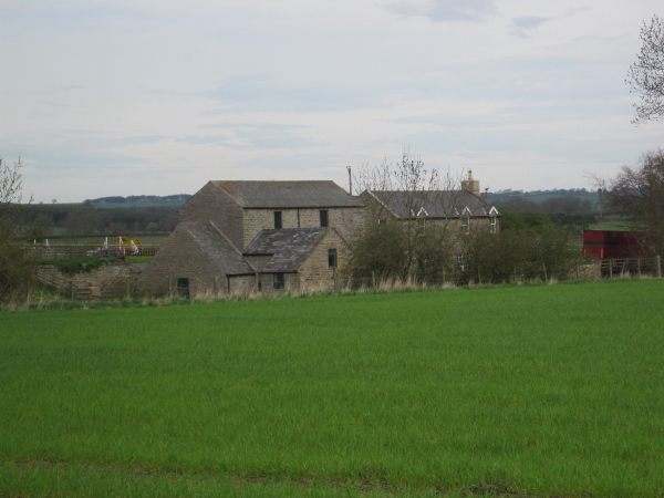
See also: ![]() Historic Buildings and Monuments in Whittington Civil Parish. Note: listed buildings are generally the responsibility of the county council / unitary authority, rather than the parish council.
Historic Buildings and Monuments in Whittington Civil Parish. Note: listed buildings are generally the responsibility of the county council / unitary authority, rather than the parish council.
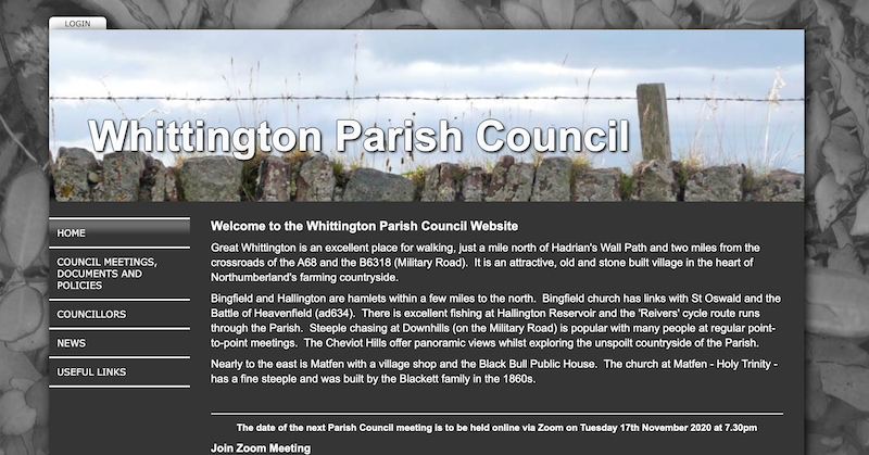
from https://www.whittingtonparish…
Whittington Parish Council
- "Great Whittington is an excellent place for walking, just a mile north of Hadrian's Wall Path and two miles from the crossroads of the A68 and the B6318 (Military Road). …
Added by
Peter Smith
Co-Curate Page
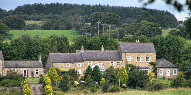
Bingfield
- BINGFIELD, a chapelry, in the parish of St. John Lee, union of Hexham, S. division of Tindale ward and of Northumberland, 6½ miles (N.N E.) from Hexham; containing 111 inhabitants. …
Co-Curate Page
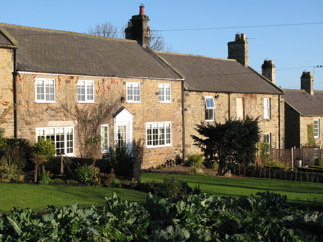
Hallington
- Overview Map Street View HALLINGTON, a township, in the parish of St. John Lee, union of Hexham, S. division of Tindale ward and of Northumberland, 11 miles (N.N.E.) from Hexham; …
Co-Curate Page
Great Whittington
- Overview About Great Whittington Map Street View Great Whittington is a village in Northumberland, England, 7 miles NE of Hexham with a population of 401, as of the 2011 …

Co-Curate Page
Halton
- Overview Map Street View Halton is a hamlet in Northumberland, located about 2¼miles NNE of Corbridge. It is the site of the Medieval village of Halton. Today, Halton includes a …
Co-Curate Page
Clarewood
- CLAREWOOD, a township, in the parish of Corbridge, union of Hexham, E. division of Tindale ward, S. division of Northumberland, 8½ miles (N.E. by E.) from Hexham; containing 55 inhabitants. …


Co-Curate Page
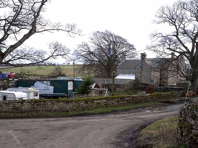
Todridge (Whittington)
- Todridge is a farm situated to the south of Todridge Fell in Northumberland. Historically, Toddtidge was part of Bingfield township in the ancient parish of St John Lee. Today, Todridge …

from https://www.whittingtonparish…
Whittington Parish Council
- "Great Whittington is an excellent place for walking, just a mile north of Hadrian's Wall Path and two miles from the crossroads of the A68 and the B6318 (Military Road). …
Added by
Peter Smith
Co-Curate Page
Bingfield
- BINGFIELD, a chapelry, in the parish of St. John Lee, union of Hexham, S. division of Tindale ward and of Northumberland, 6½ miles (N.N E.) from Hexham; containing 111 inhabitants. …
Co-Curate Page
Hallington
- Overview Map Street View HALLINGTON, a township, in the parish of St. John Lee, union of Hexham, S. division of Tindale ward and of Northumberland, 11 miles (N.N.E.) from Hexham; …
Co-Curate Page
Great Whittington
- Overview About Great Whittington Map Street View Great Whittington is a village in Northumberland, England, 7 miles NE of Hexham with a population of 401, as of the 2011 …
Co-Curate Page
Halton
- Overview Map Street View Halton is a hamlet in Northumberland, located about 2¼miles NNE of Corbridge. It is the site of the Medieval village of Halton. Today, Halton includes a …
Co-Curate Page
Clarewood
- CLAREWOOD, a township, in the parish of Corbridge, union of Hexham, E. division of Tindale ward, S. division of Northumberland, 8½ miles (N.E. by E.) from Hexham; containing 55 inhabitants. …


