Topics > Historical Periods > 20th Century > 1910s > 1913
1913
In Northern England:
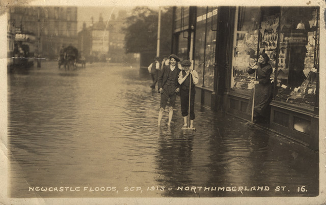
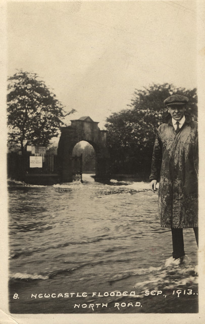
- 16th September 1913: Floods in Newcastle.
- 1st October 1913: opening of Darras Hall railway station.
from Newcastle libraries (flickr)
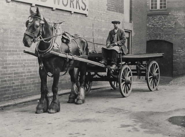
048083:A.P. Fox Carters Cluny Whiskey Newcastle upon Tyne Unknown post 1913
Pinned by Simon Cotterill

from Newcastle libraries (flickr)
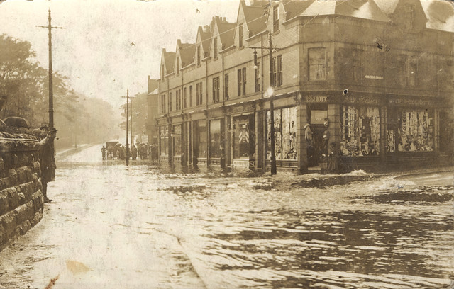
068305:Floods in Northumberland Street, Newcastle upon Tyne,1913
Pinned by Simon Cotterill
from Newcastle libraries (flickr)
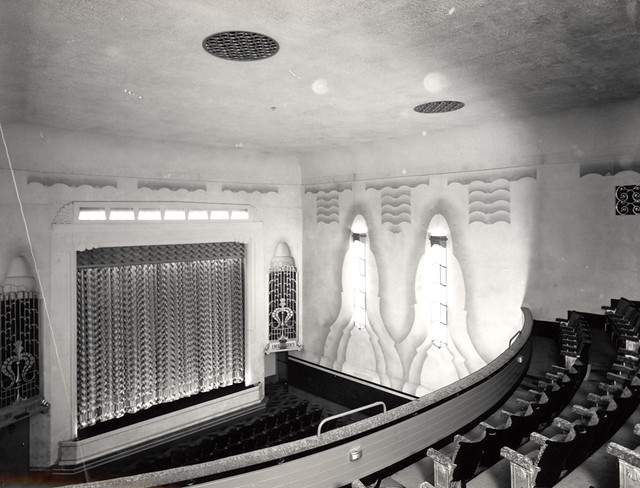
049838:Grainger cinema Grainger Street Newcastle upon Tyne Unknown 1937
Pinned by Simon Cotterill
from http://picturesofgateshead.co…
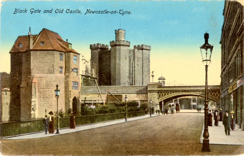
Black Gate and Old Castle, Newcastle-on-Tyne (1913)
- "Produced by W.H.S. & S.N. Posted from Newcastle to London on September 24th 1913". Postcard from 'Pictures of Gateshead and the Surrounding Area' by Andy Williamson. The images may be …
Added by
Simon Cotterill
Co-Curate Page
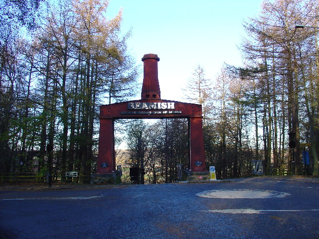
Beamish Museum
- Overview About Beamish Museum Map Street View Beamish Museum is an open-air museum located at Beamish in County Durham. Opened in 1972 it was the first regional open-air museum in …
Co-Curate Page
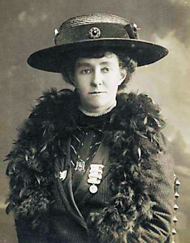
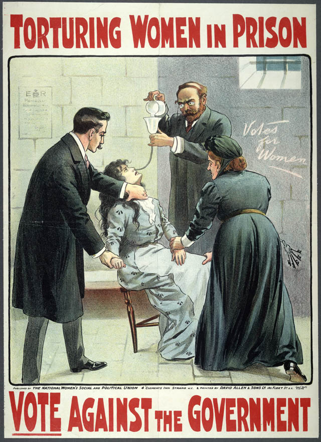
Emily Davison (1872 - 1913)
- Overview About Emily Davison Timeline Emily Wilding Davison was a militant suffragette campaigning for the right to vote for women in Britain. Davison joined the Women's Social and Political Union …
from Flickr (flickr)
L0076420 Front cover for booklet advertising Peps tablets
Pinned by Simon Cotterill

Co-Curate Page
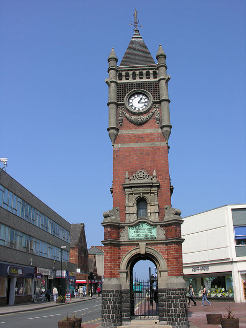
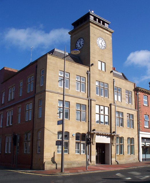
Town Clock
- Overview Map Street View The Town Clock in Redcar was completed in 1913. It is Grade II listed on the National Heritage List for England. "1901 E.R. 1910 IN GRATEFUL …
Co-Curate Page
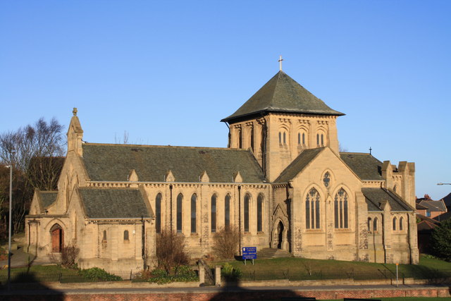
Church of St Mary, Horden
- Overview Map Street View St Mary's parish church on Blackhills Road in Horden was built by J.D. Potts and Son with funds from Colonel Roland Burdon, and opened in 1913.[1] …
from Newcastle libraries (flickr)
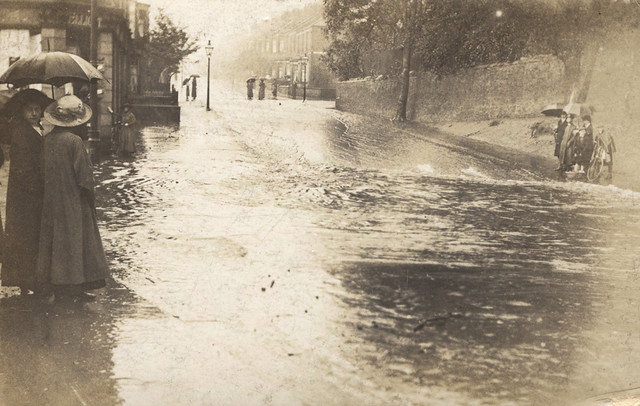
068303:Flooded Great North Road Unknown 1913
Pinned by Simon Cotterill
from Newcastle libraries (flickr)
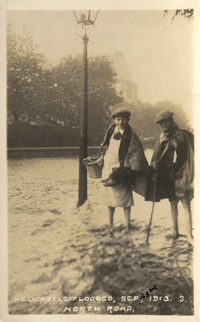
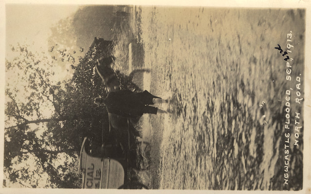
068307:Floods The North Road Unknown 1913
Pinned by Simon Cotterill
from Newcastle libraries (flickr)
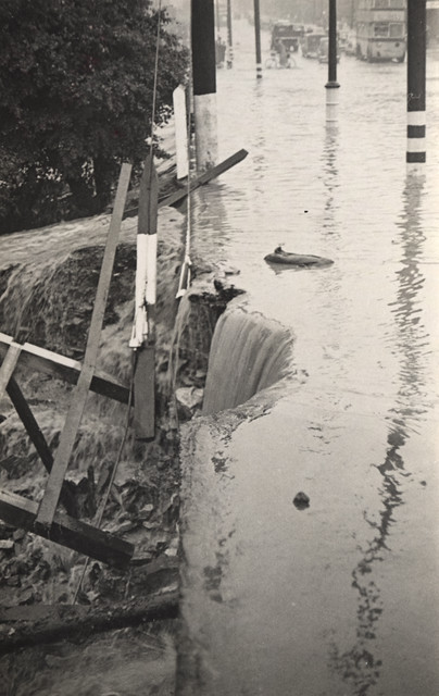
068309:Newcastle flooded the Great North Road Unknown 1913
Pinned by Simon Cotterill
Co-Curate Page
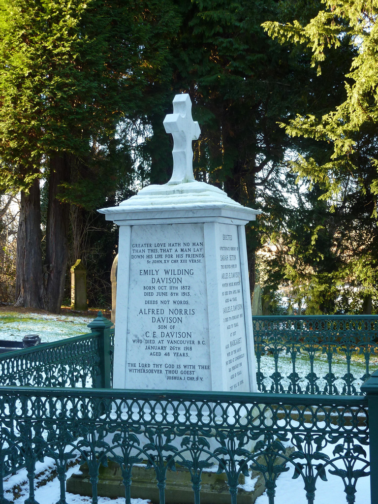
Grave of Emily Davison, St Mary's
- The grave of Emily Davison is located in the churchyard of St Mary's Church in Morpeth. Davison was buried in the family plot in the church following her death in …
Co-Curate Page
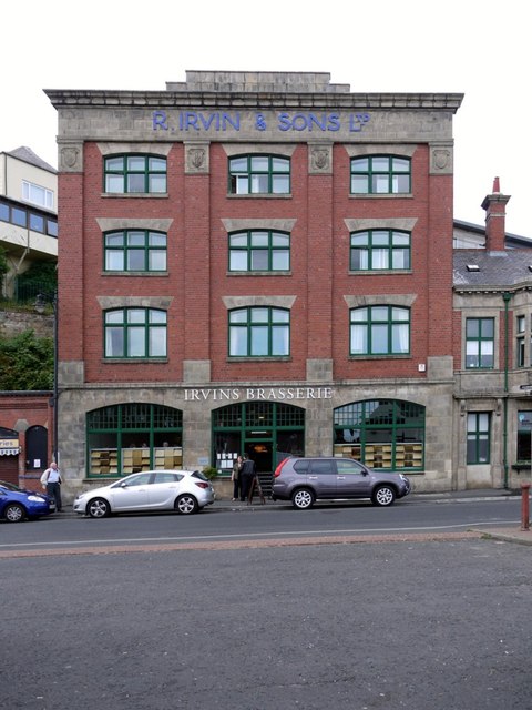
Irvin's Building
- Overview Map Street View The Irvin Building is located on Union Road on the North Shields Fish Quay. It was built in 1913 for Richard Irvin and Sons Ltd., who …
Co-Curate Page
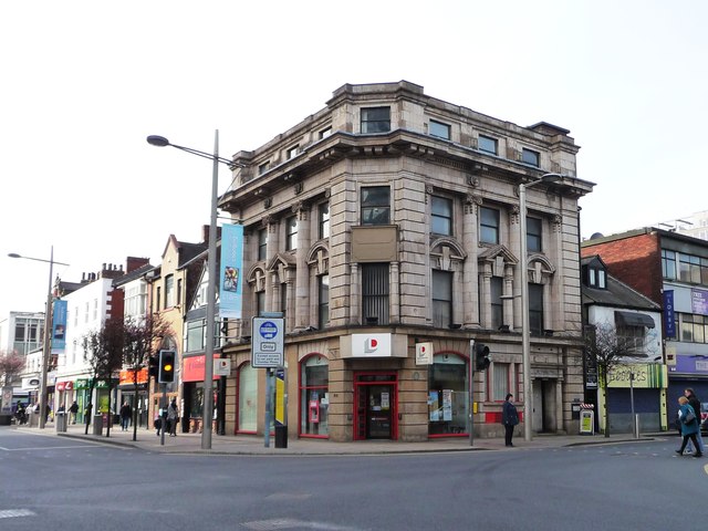
29-31, Corporation Road
- Overview Map Street View Located on the corner of Corporation Road and Albert Road in Middlesbrough, the building was originally built as a shop and hotel in 1912-1913. It was …
Co-Curate Page
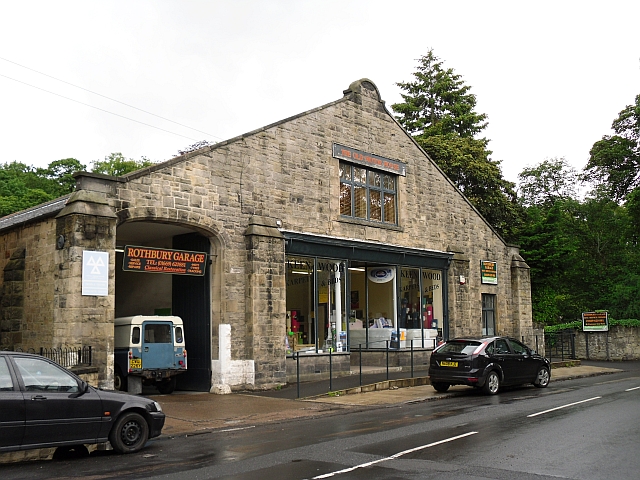
Old Motor House (Rothbury Garage)
- Overview Map Street View Rothbury Garage (now 'The Old Motor House') is located on Town Foot in Rothbury. It is a rare surviving, and relatively unaltered, pre-First World War garage. …
Co-Curate Page
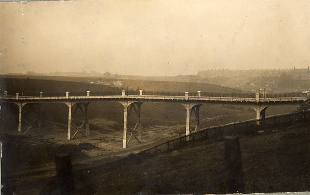
Burn Closes Bridge (1913 - 2008)
- The original Burn Closes Bridge was a reinforced concrete bridge, built in 1913, carrying St Peter's Road over Willington Dene (the lower part of the valley formed by Wallsend Burn). It …
Co-Curate Page
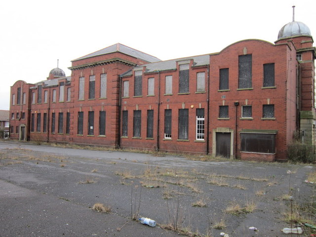
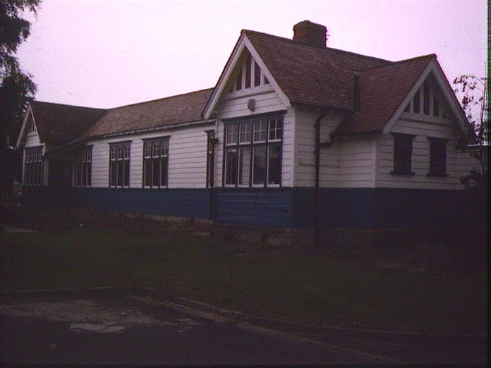
Old Easington Colliery School
- The former Easington Colliery Infant School and Easington Colliery Junior School were located on Seaside Lane in Easington Colliery. The two identical buildings were originally built 1911 - 1913 and were …
Co-Curate Page
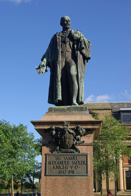
Statue of Samuel Sadler
- Overview Map Street View A statue of Sir Samuel Sadler stands on Centre Square in Middlesbrough. The statue, by Prof. Edward Lanteri, was erected in 1913. The statue is Grade II …
Co-Curate Page
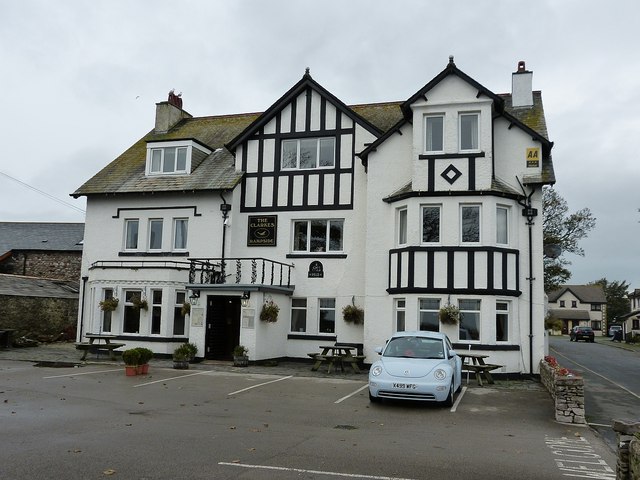
Clarke's Hotel
- Overview Map Street View The Clarkes is a hotel, restaurant and bar located off Roa Island Road in Rampside. A date stone above the door of The Clarkes shows two dates; …
Co-Curate Page
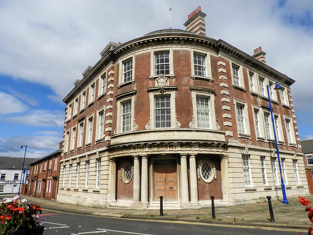
Former Harbour Commissioner's Offices
- Overview Map Street View The former Harbour Commissioner's Offices are located on the corner of Bridge Street and Plessey Road in Blyth. They were built in 1913 by Cackett and …
Co-Curate Page
Darras Hall Railway Station (1913 - 1954)
- The Gosforth to Ponteland railway line was developed by North Eastern Railway, and opened in 1905. A sub-branch line from Ponteland Station to Darras Hall was opened to passenger services on …
Co-Curate Page
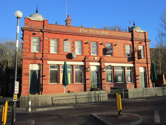
Rose Inn, Rosehill Bank
- Overview Map Street View The Rose Inn is a public house located on Rosehill Bank in the Rosehill area of Wallsend. The ornate terracotta two storey public house opened in …
Co-Curate Page
Ashington Town Hall
- Overview Map Street View Ashington Town Hall is located on Station Road, by the junction with Council Road, in Ashington. The foundation stone for the neoclassical-style building was laid by …

from Newcastle libraries (flickr)
048083:A.P. Fox Carters Cluny Whiskey Newcastle upon Tyne Unknown post 1913
Pinned by Simon Cotterill
from Newcastle libraries (flickr)
068305:Floods in Northumberland Street, Newcastle upon Tyne,1913
Pinned by Simon Cotterill
from Newcastle libraries (flickr)
049838:Grainger cinema Grainger Street Newcastle upon Tyne Unknown 1937
Pinned by Simon Cotterill
from http://picturesofgateshead.co…
Black Gate and Old Castle, Newcastle-on-Tyne (1913)
- "Produced by W.H.S. & S.N. Posted from Newcastle to London on September 24th 1913". Postcard from 'Pictures of Gateshead and the Surrounding Area' by Andy Williamson. The images may be …
Added by
Simon Cotterill
Co-Curate Page
Beamish Museum
- Overview About Beamish Museum Map Street View Beamish Museum is an open-air museum located at Beamish in County Durham. Opened in 1972 it was the first regional open-air museum in …
Co-Curate Page
Emily Davison (1872 - 1913)
- Overview About Emily Davison Timeline Emily Wilding Davison was a militant suffragette campaigning for the right to vote for women in Britain. Davison joined the Women's Social and Political Union …
from Flickr (flickr)
L0076420 Front cover for booklet advertising Peps tablets
Pinned by Simon Cotterill
Co-Curate Page
Town Clock
- Overview Map Street View The Town Clock in Redcar was completed in 1913. It is Grade II listed on the National Heritage List for England. "1901 E.R. 1910 IN GRATEFUL …
Co-Curate Page
Church of St Mary, Horden
- Overview Map Street View St Mary's parish church on Blackhills Road in Horden was built by J.D. Potts and Son with funds from Colonel Roland Burdon, and opened in 1913.[1] …
from Newcastle libraries (flickr)
068303:Flooded Great North Road Unknown 1913
Pinned by Simon Cotterill
from Newcastle libraries (flickr)
068307:Floods The North Road Unknown 1913
Pinned by Simon Cotterill
from Newcastle libraries (flickr)
068309:Newcastle flooded the Great North Road Unknown 1913
Pinned by Simon Cotterill
Co-Curate Page
Grave of Emily Davison, St Mary's
- The grave of Emily Davison is located in the churchyard of St Mary's Church in Morpeth. Davison was buried in the family plot in the church following her death in …
Co-Curate Page
Irvin's Building
- Overview Map Street View The Irvin Building is located on Union Road on the North Shields Fish Quay. It was built in 1913 for Richard Irvin and Sons Ltd., who …
Co-Curate Page
29-31, Corporation Road
- Overview Map Street View Located on the corner of Corporation Road and Albert Road in Middlesbrough, the building was originally built as a shop and hotel in 1912-1913. It was …
Co-Curate Page
Old Motor House (Rothbury Garage)
- Overview Map Street View Rothbury Garage (now 'The Old Motor House') is located on Town Foot in Rothbury. It is a rare surviving, and relatively unaltered, pre-First World War garage. …
Co-Curate Page
Burn Closes Bridge (1913 - 2008)
- The original Burn Closes Bridge was a reinforced concrete bridge, built in 1913, carrying St Peter's Road over Willington Dene (the lower part of the valley formed by Wallsend Burn). It …
Co-Curate Page
Old Easington Colliery School
- The former Easington Colliery Infant School and Easington Colliery Junior School were located on Seaside Lane in Easington Colliery. The two identical buildings were originally built 1911 - 1913 and were …
Co-Curate Page
Statue of Samuel Sadler
- Overview Map Street View A statue of Sir Samuel Sadler stands on Centre Square in Middlesbrough. The statue, by Prof. Edward Lanteri, was erected in 1913. The statue is Grade II …
Co-Curate Page
Clarke's Hotel
- Overview Map Street View The Clarkes is a hotel, restaurant and bar located off Roa Island Road in Rampside. A date stone above the door of The Clarkes shows two dates; …
Co-Curate Page
Former Harbour Commissioner's Offices
- Overview Map Street View The former Harbour Commissioner's Offices are located on the corner of Bridge Street and Plessey Road in Blyth. They were built in 1913 by Cackett and …
Co-Curate Page
Darras Hall Railway Station (1913 - 1954)
- The Gosforth to Ponteland railway line was developed by North Eastern Railway, and opened in 1905. A sub-branch line from Ponteland Station to Darras Hall was opened to passenger services on …
Co-Curate Page
Rose Inn, Rosehill Bank
- Overview Map Street View The Rose Inn is a public house located on Rosehill Bank in the Rosehill area of Wallsend. The ornate terracotta two storey public house opened in …


