Topics > Northumberland > Civil Parishes in Northumberland > Tillside Parish Council area
Tillside Parish Council area
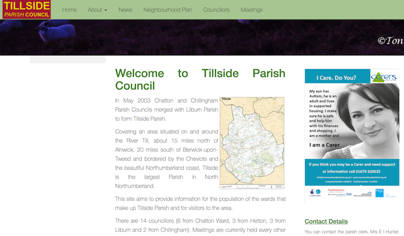
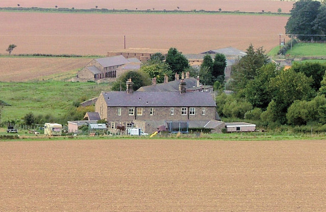
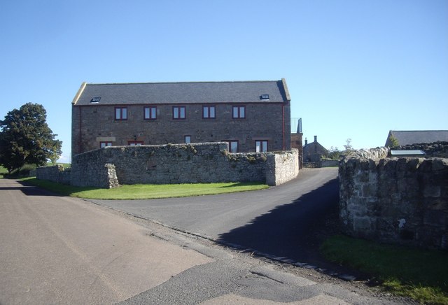
Tillside is a civil parish in the county of Northumberland, covering the area around the River Till. In May 2003 Chatton and Chillingham Parish Councils merged with Lilburn Parish to form Tillside Parish.[1] In the 2011 Census the population for Chatton was recorded as 338 and for Lilburn as 138.
from http://www.tillside.uk/
Tillside Parish Council
- "....Covering an area situated on and around the River Till, about 15 miles north of Alnwick, 20 miles south of Berwick-upon-Tweed and bordered by the Cheviots and the beautiful Northumberland …
Added by
Simon Cotterill
Co-Curate Page
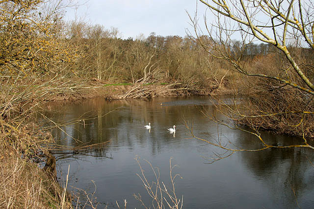
River Till
- Interactive map showing the river and catchment area - downstream of the information point it is known as the River Breamish and upstream as the River Till. The River Till …
Co-Curate Page
Chillingham
- Overview About Chillingham 1872 Description Map Street View Chillingham Castle Italian Gardens St Peter's Church West Lodge East Lodge Chillingham Park Wild Cattle Deer Sheds Fountain Hepburn Bastle Chillingham is …
Co-Curate Page
Chatton
- Overview About Chatton Map Street View Chatton is a village in Northumberland, in England. It is roughly 6km to the east of Wooler. History A rock overhang at nearby …
Co-Curate Page
Hepburn
- Overview Map Hepburn is a hamlet in Northumberland, historically within the parish of Chillingham, now Tillside . It had been a larger medieval village, but this was largely deserted by the …
Co-Curate Page
Horton (Wooler)
- Overview About Horton Map Street View Horton, 3 miles north-east of Wooler in Northumberland, is comprised of the hamlets of East Horton and West Horton, which are divided by Horton …
Co-Curate Page
Lilburn Civil Parish
- Area: 16.4 km2 Population: 106 (2001 Census), 138 (2011 Census), 130 (2021 Census)Main settlements: East Lilburn, Newtown, Lilburn Tower, Lilburn Grange LILBURN (EAST and WEST), two townships in Eglingham parish, Northumberland; on and near …
Co-Curate Page
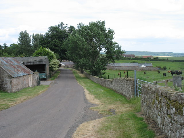
Fowberry
- Overview Map Street View Fowberry is a hamlet situated by the River Till in Northumberland, located about 3 miles east of Wooler and a mile north-west of Chatton. There was …
Co-Curate Page
Hazlerigg
- Overview Map Street View South Hazlerigg, Hazlerigg Mill and North Hazlerigg are farms / hamlets, which are located roughly 5 miles north-east of Wooler and 3 miles north of the …
Co-Curate Page
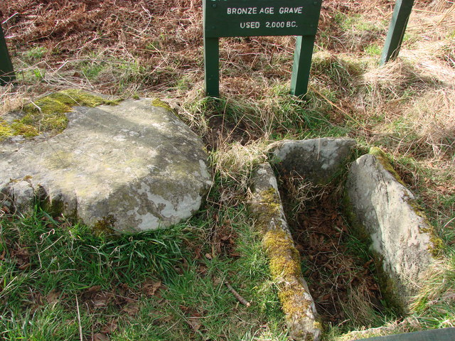
Amersidelaw
- Overview Map Street View Amersidelaw is a farm complex located about ½ mile south-east of Chatton in Northumberland. It is located near Amersidelaw Moor (aka Amerside Law). There are pre-historic …
Co-Curate Page
Newtown, Northumberland (near Chillingham)
- NEWTON, a township, in the parish of Chillingham, union of Glendale, E. division of Glendale ward, N. division of the county of Northumberland, 3½ miles (E.S E.) from Wooler; containing …

Co-Curate Page
Chatton Civil Parish
- Area: 46.8 km² Population: 375 (2021 Census) 338 (2011 Census) 301 (2001 Census)
Co-Curate Page
Chillingham Civil Parish
- Area: 15.7 km² Population: <100 (2021 Census)

from http://www.tillside.uk/
Tillside Parish Council
- "....Covering an area situated on and around the River Till, about 15 miles north of Alnwick, 20 miles south of Berwick-upon-Tweed and bordered by the Cheviots and the beautiful Northumberland …
Added by
Simon Cotterill
Co-Curate Page
River Till
- Interactive map showing the river and catchment area - downstream of the information point it is known as the River Breamish and upstream as the River Till. The River Till …
Co-Curate Page
Chillingham
- Overview About Chillingham 1872 Description Map Street View Chillingham Castle Italian Gardens St Peter's Church West Lodge East Lodge Chillingham Park Wild Cattle Deer Sheds Fountain Hepburn Bastle Chillingham is …
Co-Curate Page
Chatton
- Overview About Chatton Map Street View Chatton is a village in Northumberland, in England. It is roughly 6km to the east of Wooler. History A rock overhang at nearby …
Co-Curate Page
Hepburn
- Overview Map Hepburn is a hamlet in Northumberland, historically within the parish of Chillingham, now Tillside . It had been a larger medieval village, but this was largely deserted by the …
Co-Curate Page
Horton (Wooler)
- Overview About Horton Map Street View Horton, 3 miles north-east of Wooler in Northumberland, is comprised of the hamlets of East Horton and West Horton, which are divided by Horton …
Co-Curate Page
Lilburn Civil Parish
- Area: 16.4 km2 Population: 106 (2001 Census), 138 (2011 Census), 130 (2021 Census)Main settlements: East Lilburn, Newtown, Lilburn Tower, Lilburn Grange LILBURN (EAST and WEST), two townships in Eglingham parish, Northumberland; on and near …
Co-Curate Page
Fowberry
- Overview Map Street View Fowberry is a hamlet situated by the River Till in Northumberland, located about 3 miles east of Wooler and a mile north-west of Chatton. There was …
Co-Curate Page
Hazlerigg
- Overview Map Street View South Hazlerigg, Hazlerigg Mill and North Hazlerigg are farms / hamlets, which are located roughly 5 miles north-east of Wooler and 3 miles north of the …
Co-Curate Page
Amersidelaw
- Overview Map Street View Amersidelaw is a farm complex located about ½ mile south-east of Chatton in Northumberland. It is located near Amersidelaw Moor (aka Amerside Law). There are pre-historic …
Co-Curate Page
Newtown, Northumberland (near Chillingham)
- NEWTON, a township, in the parish of Chillingham, union of Glendale, E. division of Glendale ward, N. division of the county of Northumberland, 3½ miles (E.S E.) from Wooler; containing …
Co-Curate Page
Chatton Civil Parish
- Area: 46.8 km² Population: 375 (2021 Census) 338 (2011 Census) 301 (2001 Census)


