Topics > Newcastle City Centre > Streets > Stowell Street
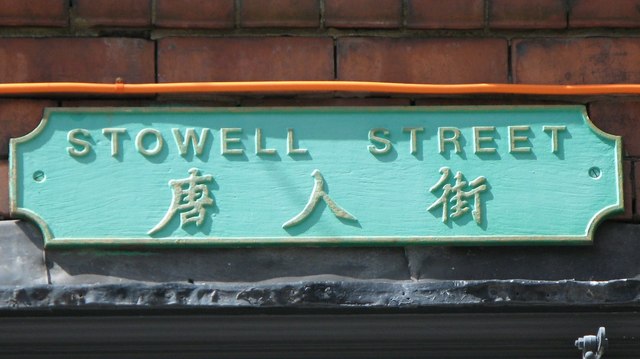
Stowell Street
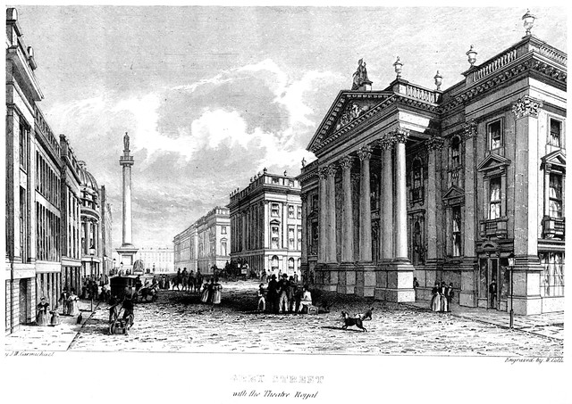
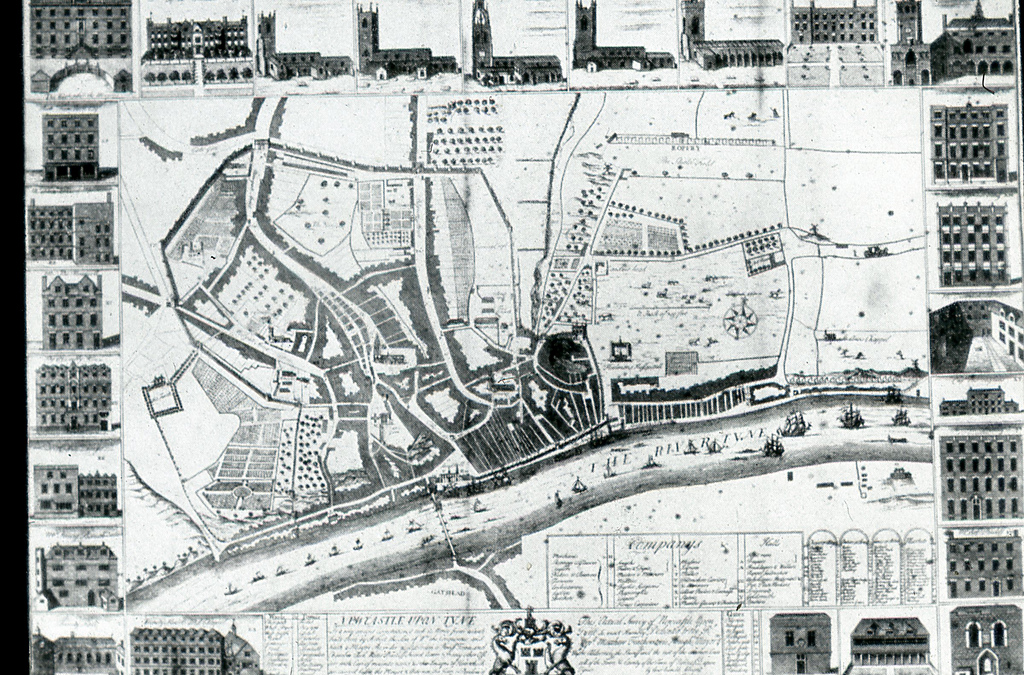
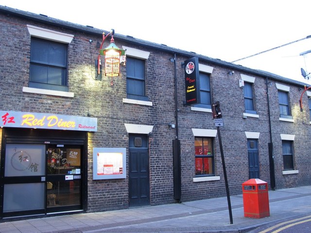
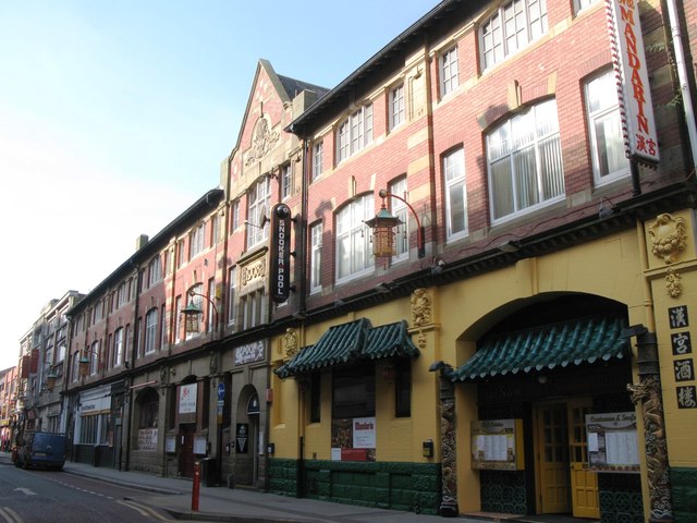
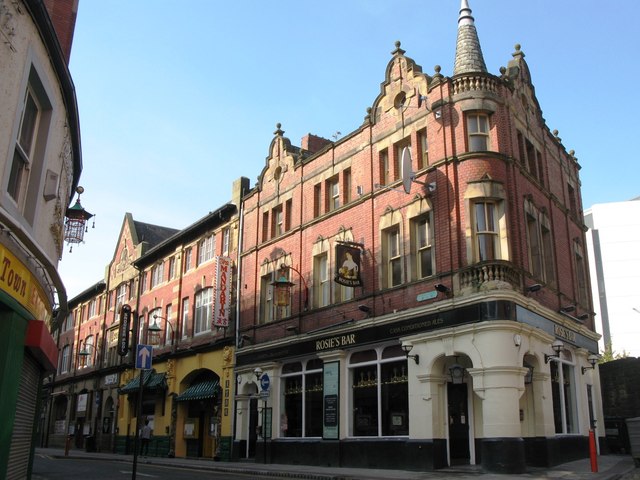
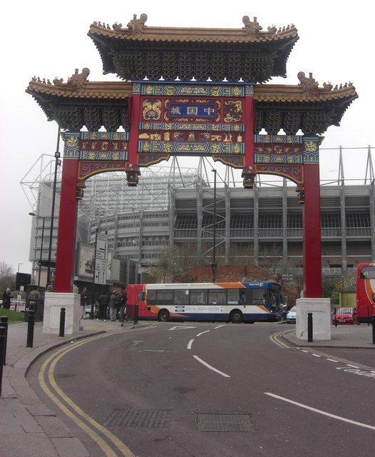
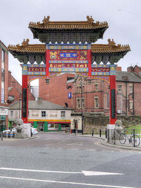
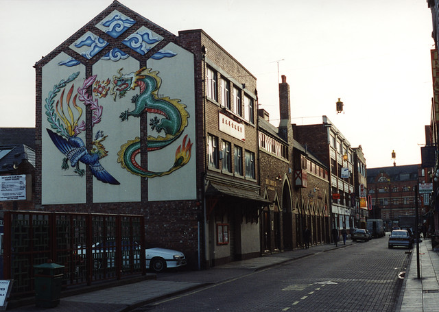
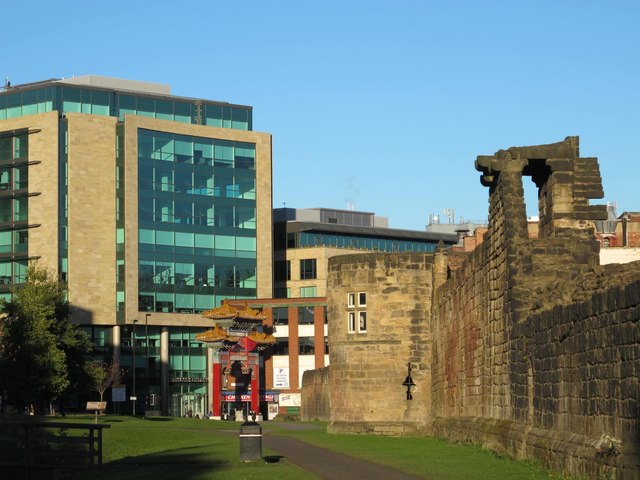
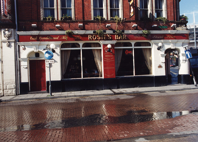
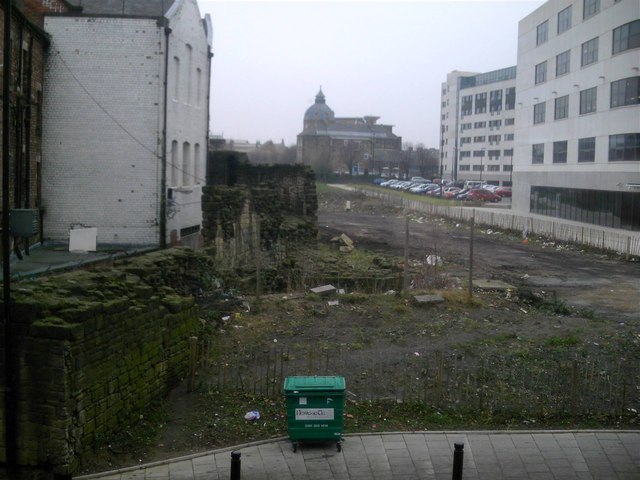
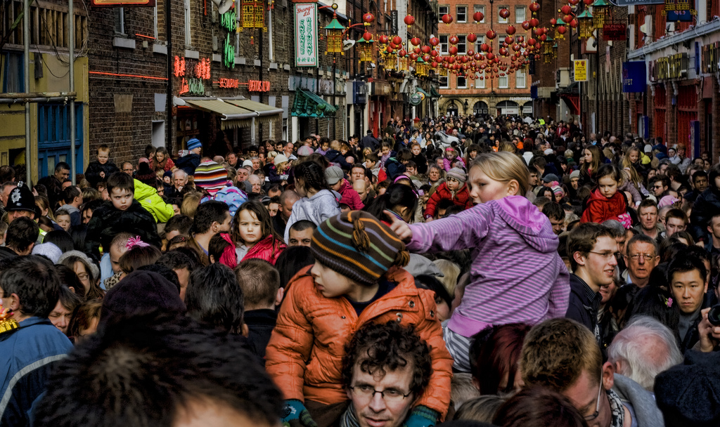
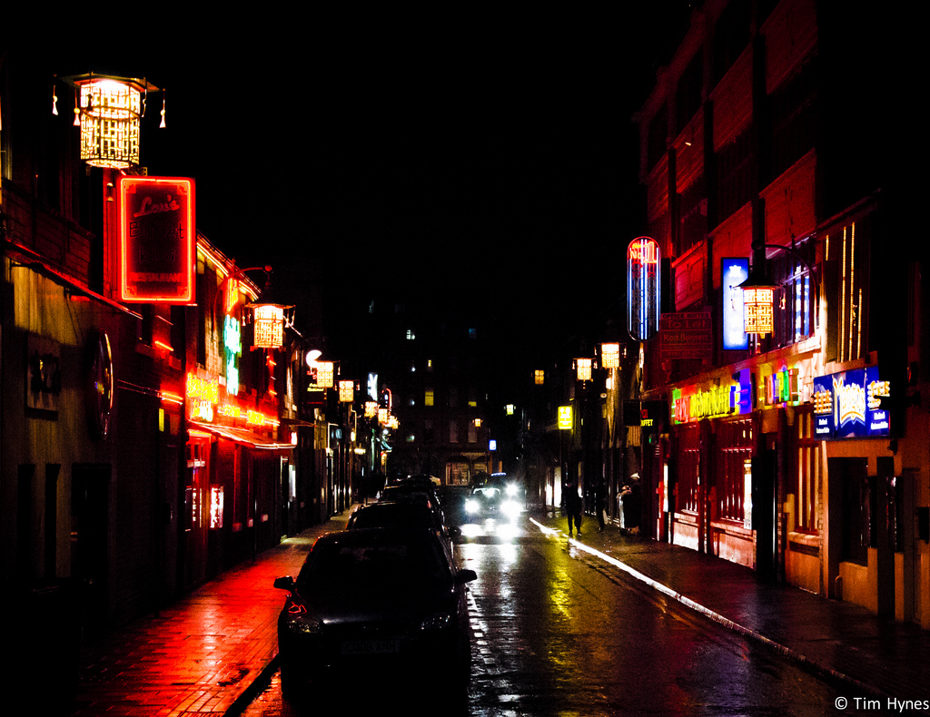
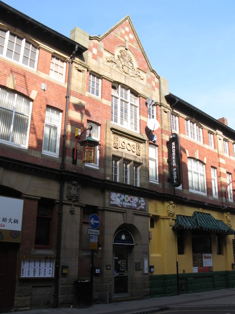
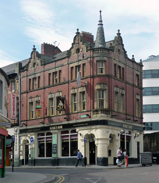
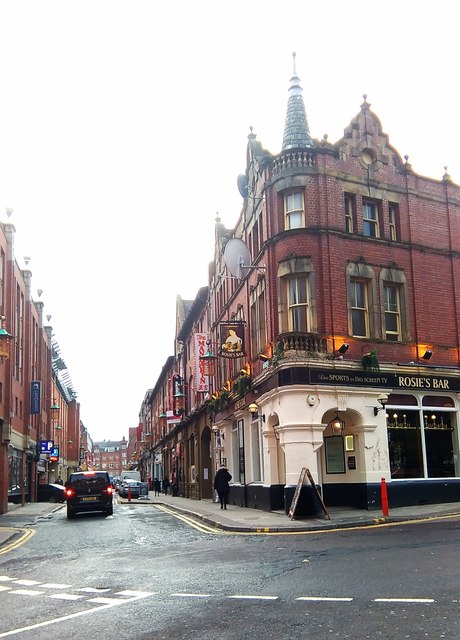
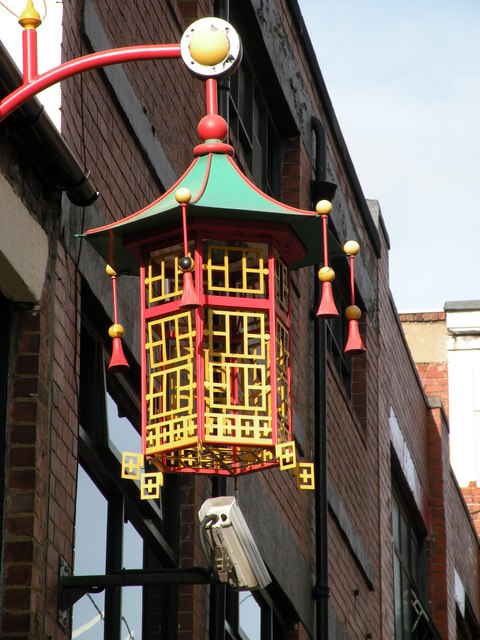
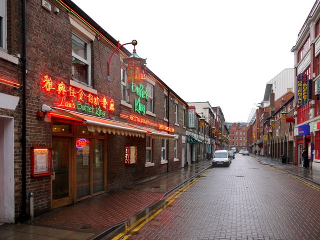
Stowell Street in Newcastle was originally built in 1824 with new residential town houses, and to provide a route through the Blackfriars precinct. The street was named after Lord Stowell (1745-1836), a prominent judge and elder brother of the Lord Chancellor, John Scott, Lord Eldon. In the 1850's a gap was made through the Town Wall, south of Heber Tower, to link Stowell Street with Bath Lane.[1] Today, Stowell Street is the heart of 'Chinatown' in Newcastle. In 1978, Wing Hong Chinese Supermarket was the first Chinese business to relocate to Stowell Street, three decades after the first Chinese immigrants came to settle in the North East.[2] Just a few of the original buildings of 1824 still remain at nos. 34-46 Stowell Street, now used as Chinese restaurants.[3] Rosie's Bar on the corner of Stowell Street and St Andrew's Street was built in 1890. The bar is in close proximity to the Chinese Arch, which marks the entrance to 'Chinatown'. Another notable building on Stowell Street is the former Co-Operative Warehouse of 1908.
from Newcastle libraries (flickr)
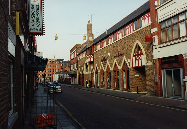
061062: Stowell Street, Newcastle upon Tyne, 1995
Pinned by Simon Cotterill
from Newcastle libraries (flickr)
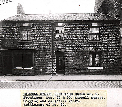
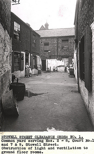
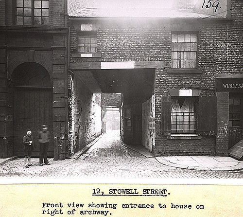
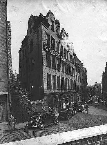
034683:Stowell Street Newcastle upon Tyne Dept of Environmental Health c.1935
Pinned by Simon Cotterill
from Newcastle libraries (flickr)
034686:Stowell Street Newcastle upon Tyne Dept of Environmental Health c.1935
Pinned by Simon Cotterill
from Newcastle libraries (flickr)
061150:Rosie's Bar, Stowell Street, Malcolm Maybury 1995
Pinned by Simon Cotterill
from Newcastle libraries (flickr)
061061: Stowell Street, Newcastle upon Tyne
Pinned by Simon Cotterill

from Newcastle libraries (flickr)
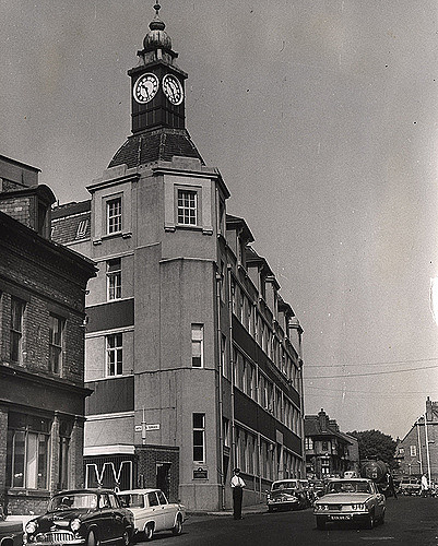
056363:Stowell Street Newcastle upon Tyne City Engineers c.1984
Pinned by Simon Cotterill
from Newcastle libraries (flickr)
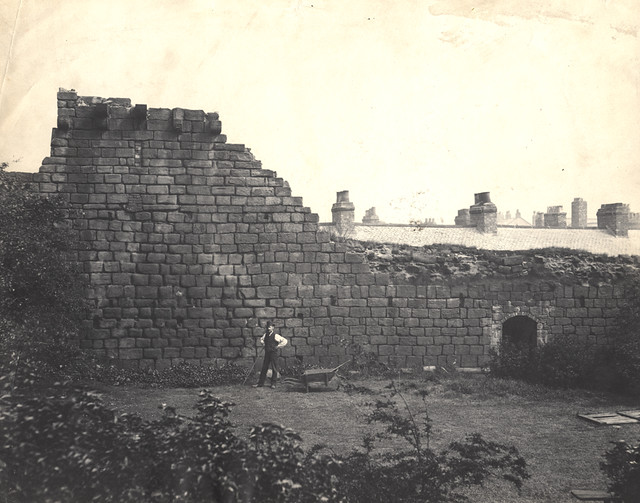
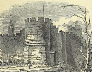
067321:Town Walls Stowell Street. Unknown. 1886.
Pinned by Simon Cotterill
from Newcastle libraries (flickr)
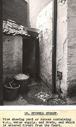
036141:Stowell Street Newcastle upon Tyne Dept of Environmental Health c.1935
Pinned by Simon Cotterill
Co-Curate Page
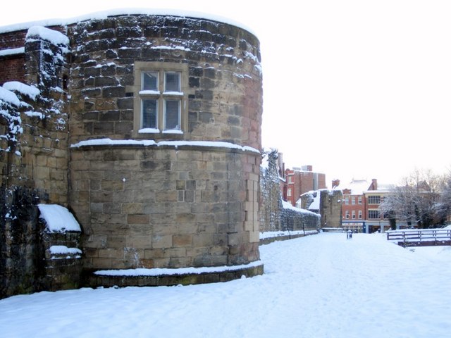
Morden Tower
- Overview About the Tower & Poetry Centre Map Morden Tower is a turret on the west section of the Town Walls in Newcastle dating from 1280. Eneas Mackenzie, wrote in …
from Newcastle libraries (flickr)
036585:Stowell Street Newcastle upon Tyne Dept of Environmental Health c.1935
Pinned by Simon Cotterill

from http://www.chroniclelive.co.u…
Chinese New Year 2017 Newcastle: Guide to shops and restaurants in Chinatown
- "Chinatown is at the heart of the Chinese community in Newcastle and will be the focal point of Chinese New Year celebrations.
The district is located to the west of …
Added by
Simon Cotterill

from http://twsitelines.info/SMR/6…
Tyne and Wear HER(6512): Newcastle, Stowell Street
- "This street, began in 1824, was built through the Blackfriars precinct. It was a dead end until the 1850s when a gap was made through the town wall south of …
Added by
Peter Smith
Co-Curate Page
Newcastle Town Walls
- Overview About the Town Walls Interactive Map The defensive Town Wall at Newcastle was built in the 13th and 14th centuries at a time when the North of England was …
Co-Curate Page
Bath Lane
- Overview Map Street View The street is named after Newcastle's earliest baths, built in 1781, at this location. The baths took water from Skinner Burn (now one of the city's 'hidden' …
Co-Curate Page
St Andrew's Street (Darn Crook)
- Now known as St Andrew's Street. "It was called Darn Crook (Darnecruke 1394) - dark secret place, until the 1980s. Darn Crook has long been a short lane south of the …

from Newcastle libraries (flickr)
061062: Stowell Street, Newcastle upon Tyne, 1995
Pinned by Simon Cotterill
from Newcastle libraries (flickr)
034683:Stowell Street Newcastle upon Tyne Dept of Environmental Health c.1935
Pinned by Simon Cotterill
from Newcastle libraries (flickr)
034686:Stowell Street Newcastle upon Tyne Dept of Environmental Health c.1935
Pinned by Simon Cotterill
from Newcastle libraries (flickr)
061150:Rosie's Bar, Stowell Street, Malcolm Maybury 1995
Pinned by Simon Cotterill
from Newcastle libraries (flickr)
061061: Stowell Street, Newcastle upon Tyne
Pinned by Simon Cotterill
from Newcastle libraries (flickr)
056363:Stowell Street Newcastle upon Tyne City Engineers c.1984
Pinned by Simon Cotterill
from Newcastle libraries (flickr)
067321:Town Walls Stowell Street. Unknown. 1886.
Pinned by Simon Cotterill
from Newcastle libraries (flickr)
036141:Stowell Street Newcastle upon Tyne Dept of Environmental Health c.1935
Pinned by Simon Cotterill
Co-Curate Page
Morden Tower
- Overview About the Tower & Poetry Centre Map Morden Tower is a turret on the west section of the Town Walls in Newcastle dating from 1280. Eneas Mackenzie, wrote in …
from Newcastle libraries (flickr)
036585:Stowell Street Newcastle upon Tyne Dept of Environmental Health c.1935
Pinned by Simon Cotterill
from http://www.chroniclelive.co.u…
Chinese New Year 2017 Newcastle: Guide to shops and restaurants in Chinatown
- "Chinatown is at the heart of the Chinese community in Newcastle and will be the focal point of Chinese New Year celebrations.
The district is located to the west of …
Added by
Simon Cotterill
from http://twsitelines.info/SMR/6…
Tyne and Wear HER(6512): Newcastle, Stowell Street
- "This street, began in 1824, was built through the Blackfriars precinct. It was a dead end until the 1850s when a gap was made through the town wall south of …
Added by
Peter Smith
Co-Curate Page
Newcastle Town Walls
- Overview About the Town Walls Interactive Map The defensive Town Wall at Newcastle was built in the 13th and 14th centuries at a time when the North of England was …
Co-Curate Page
Bath Lane
- Overview Map Street View The street is named after Newcastle's earliest baths, built in 1781, at this location. The baths took water from Skinner Burn (now one of the city's 'hidden' …
Co-Curate Page
St Andrew's Street (Darn Crook)
- Now known as St Andrew's Street. "It was called Darn Crook (Darnecruke 1394) - dark secret place, until the 1980s. Darn Crook has long been a short lane south of the …