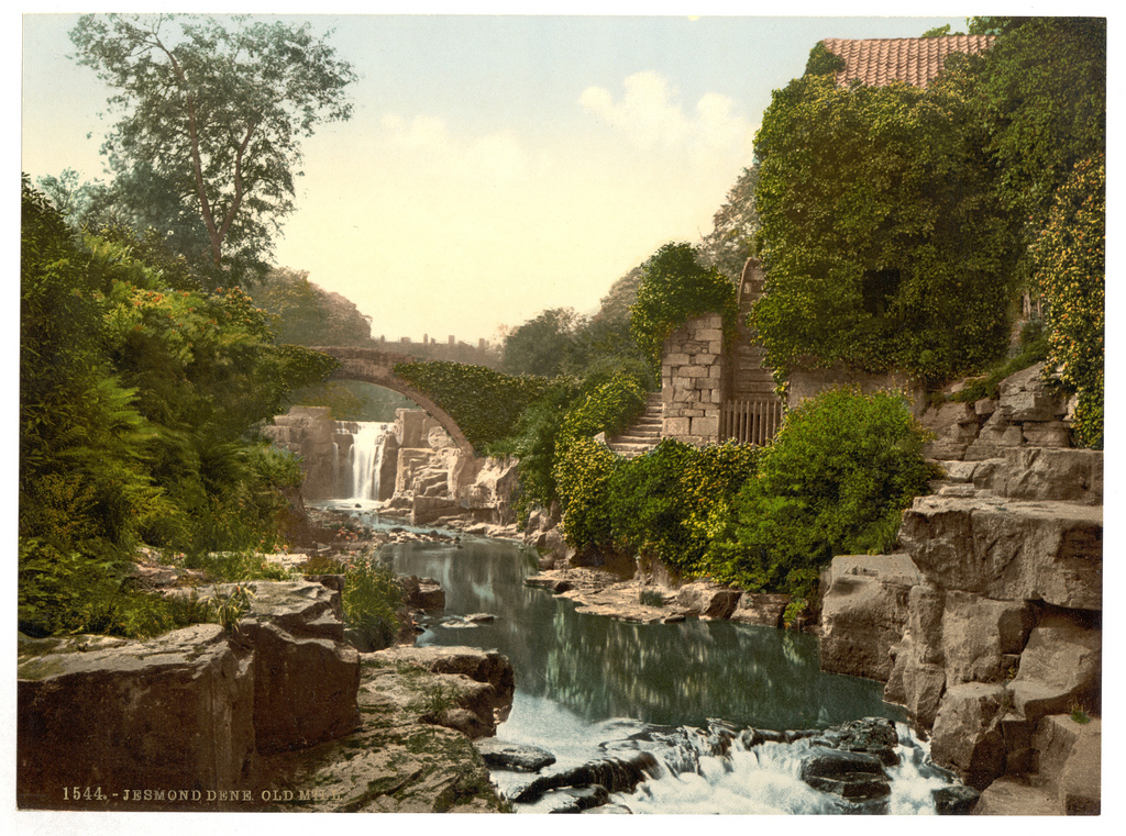
Topics > Tyne and Wear > Newcastle upon Tyne > Jesmond > St Mary's Chapel
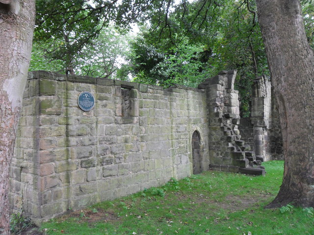
St Mary's Chapel
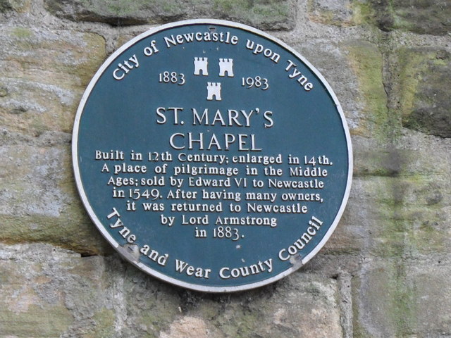
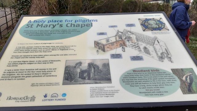
Pilgrim Street in Newcastle is so named because of the many pilgrims traveling that way to St Mary's Chapel in Jesmond; "THERE was an Inn in this Street, which the Pilgrims in their Journey were wont to call at, which occasioned their constant coming up this Street, and so it got it's Name of Pilgrim-street, as the Inn did that of the Pilgrims Inn." The ruins of St Mary's Chapel are Grade II* listed on the National Heritage List for England. The chapel and the wider area around it are also a Scheduled Monument (legally protected).
Scheduled Monument (#1018640): St Mary's Chapel, Jesmond
Click the headings below to expand (selected extracts from the Historic England scheduling)
St.Mary's Chapel is a well documented medieval chapel and legal documents involve both the Papacy and the Crown. The chapel was an important place of pilgrimage in the medieval period and may be associated with St.Mary's Well 100m to the west, which is the subject of a seperate scheduling. The chapel was also part of a larger complex which included a hospital, positioned by the first edition 10' Ordnance Survey map as 50m north west of the chapel.
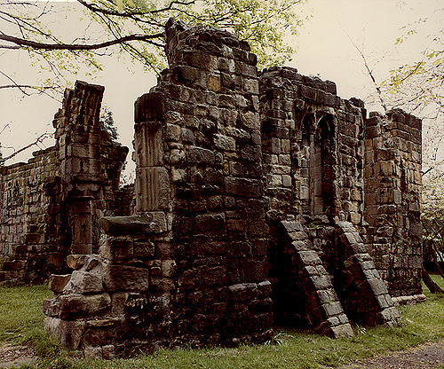
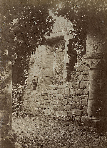
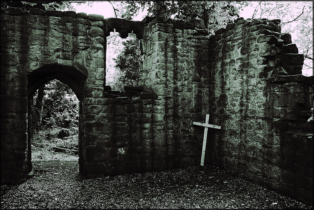
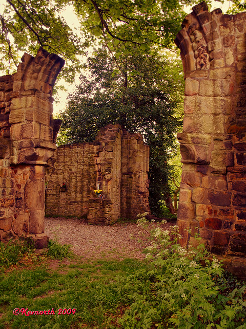
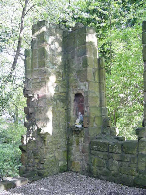
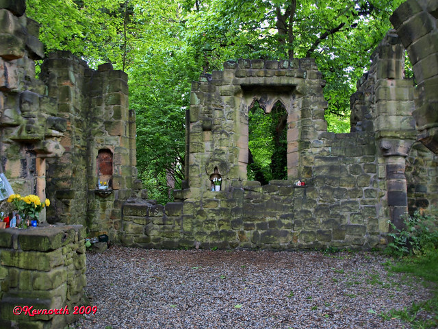
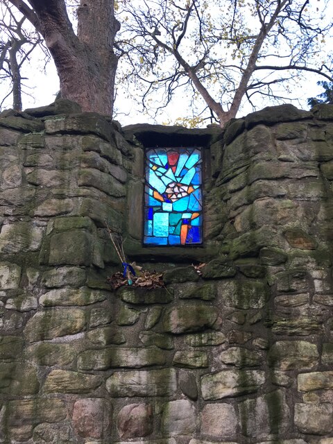
The monument includes the remains of St Mary's Chapel, located above a tributary dene to Jesmond Dene in the Jesmond Grove area of Jesmond. It was a medieval place of pilgrimage. The chapel is sited on a level area bounded to the south by a steep slope, with traces of a stone boundary wall along its top. The remains, which are Listed Grade II*, include the chancel, chantry chapel and nave, constructed of coarse grained sandstone blocks.
The chancel and chantry chapel survive to a height of about 6m. A 2m length of the north wall and a 3m length of the south wall of the nave survive at the chancel end. The original length of the nave, approximately 20m, is depicted on the 1859 Ordnance Survey 1:2500 map. The foundations of the nave survive up to the intersection with a residential road about 10m from the chancel arch.
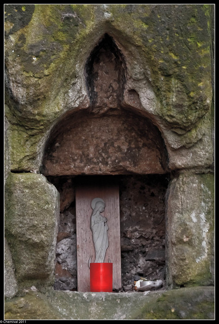
Three phases of construction are detectable. In the 12th century the chancel arch was built. The chancel was enlarged twice during 14th century and a chantry chapel was added in the 15th century. The earliest visible remains of the chapel are the chancel arch and semi-circular responds. The arch has some voussoirs with roll and chevron mouldings. The north respond has a cushion capital with a chamfered abacus and the south respond a scroll work. The 14th century enlargements to the chancel consist of an enlargement to the chancel arch and an eastward extension of the chancel. The arch is raised on three courses of stone blocks. The extension of the chancel is indicated by the presence of two piscinae in its southern wall. References to the discovery of human remains indicate that the chapel had a graveyard.
The first reference to the chapel is in 1272. Numerous legal documents in the 14th and 15th centuries mention the chapel due to disputes over the right to present to the living. These documents involve both the Papacy and the Crown. The site was an important place of pilgrimage. Gray, in 1649, states that the Pilgrim Inn in Pilgrim Street was so named because the pilgrims lodged there on their visits to St Mary's Chapel. It was dissolved in 1548. The chapel was part of a larger complex which included a hospital.
The site of the hospital is marked on the 2nd edition 1:1000 Ordnance Survey map of 1896 as approximately 50m west of the chapel and is now beneath a housing development. No known remains of the hospital are known to survive and it is not included in the scheduling.
from Newcastle libraries (flickr)
037682:St. Mary's Chapel Reid Park Road Jesmond City Engineers 1978
Pinned by Simon Cotterill
from Newcastle libraries (flickr)
003580:St. Mary's Chapel Reid Park Road Jesmond Unknown 1903
Pinned by Simon Cotterill


from https://historicengland.org.u…
St Mary's Chapel, Jesmond - List entry
- "....The monument includes the remains of St Mary's Chapel, located above a tributary dene to Jesmond Dene in the Jesmond Grove area of Jesmond. It was a medieval place of …
Added by
Simon Cotterill

from https://sitelines.newcastle.g…
Tyne and Wear HER(145): Jesmond, Chapel of St. Mary
- "The chapel, which fell within the parochial chapelry of St. Andrew, Newcastle, is first mentioned in 1272 and was a place of pilgrimage in the Middle Ages. It was dissolved …
Added by
Simon Cotterill

Co-Curate Page
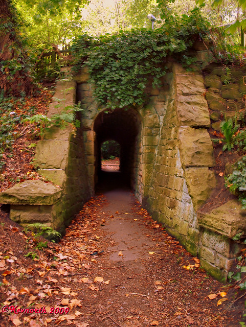
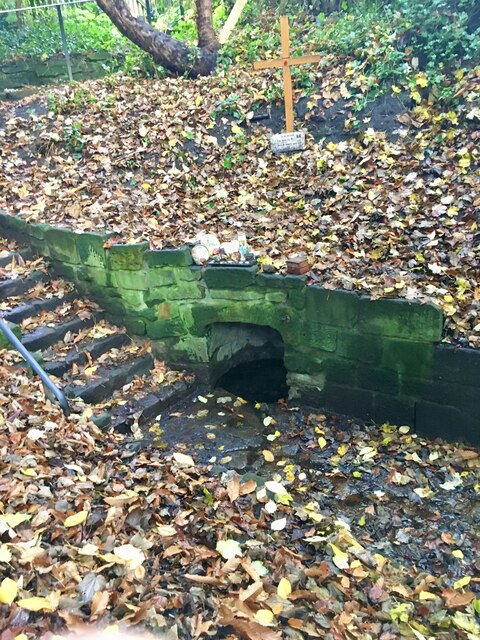
St Mary's Well, Jesmond
- Overview Map Street View St Mary's Well is located in a small fenced enclosure on the north side of The Grove in Jesmond. It as a holy well, probably dating …

from Newcastle libraries (flickr)
037682:St. Mary's Chapel Reid Park Road Jesmond City Engineers 1978
Pinned by Simon Cotterill
from Newcastle libraries (flickr)
003580:St. Mary's Chapel Reid Park Road Jesmond Unknown 1903
Pinned by Simon Cotterill
from https://historicengland.org.u…
St Mary's Chapel, Jesmond - List entry
- "....The monument includes the remains of St Mary's Chapel, located above a tributary dene to Jesmond Dene in the Jesmond Grove area of Jesmond. It was a medieval place of …
Added by
Simon Cotterill
from https://sitelines.newcastle.g…
Tyne and Wear HER(145): Jesmond, Chapel of St. Mary
- "The chapel, which fell within the parochial chapelry of St. Andrew, Newcastle, is first mentioned in 1272 and was a place of pilgrimage in the Middle Ages. It was dissolved …
Added by
Simon Cotterill
Co-Curate Page
St Mary's Well, Jesmond
- Overview Map Street View St Mary's Well is located in a small fenced enclosure on the north side of The Grove in Jesmond. It as a holy well, probably dating …