Topics > Civil Parishes in Cumbria > St Bees Civil Parish > St Bees (St. Bega) Parish, Historical Account, 1848
St Bees (St. Bega) Parish, Historical Account, 1848
BEES, ST. (St. Bega), a parish, in the union of Whitehaven, Allerdale ward above Derwent, W. division of Cumberland; comprising the town of Whitehaven, and the townships of St. Bees, Ennerdale, Eskdale, Wasdale-Head, Hensingham, Kinneyside, Lowside Quarter, Nether Wasdale, Preston Quarter, Rottington, Sandwith, and Weddiker; and containing 19,687 inhabitants, of whom 557 are in the township of St. Bees, 2¾ miles (W. by N.) from Egremont. The parish extends for about ten miles along the coast, which in some parts is rocky and precipitous; and contains coal, limestone, and freestone: lead-ore is obtained at Kinneyside, where there are smelting-furnaces; and iron-ore was formerly got in Eskdale. A lighthouse erected in 1717, and subsequently destroyed by fire, was rebuilt in 1822, on a promontory called St. Bees' Head; it is furnished with nine reflectors, affording a strong light, which, from its elevated position, is seen at a great distance. The living is a perpetual curacy; net income, £103; patron and impropriator, the Earl of Lonsdale, whose tithes in the township of St. Bees have been commuted for £166. There are four separate incumbencies at Whitehaven, and one each at Ennerdale, Eskdale, Hensingham, Lowswater, Wasdale-Head, and Nether Wasdale; nearly the whole of them in the gift of the Earl. The parish church was formerly the conventual church of a monastery founded about 650, by Bega, or Begogh, an Irish female, who subsequently received the honour of canonization. The monastery was destroyed by the Danes, but was restored in the reign of Henry I., by William de Meschines, lord of Copeland, as a cell to the abbey of St. Mary at York; and in 1219 was pillaged by the Scots. Its revenue, at the Dissolution, was estimated at £149. 19. 6. The church is cruciform, and has a strong tower of early Norman architecture, but the rest of the edifice is in the decorated English style: the nave is used for the celebration of divine service. The chancel, which had long lain in a ruinous state, was repaired in 1819, and fitted up as a school of divinity, in connexion with a clerical institution founded by Dr. Law, Bishop of Chester, for the benefit of young men intended for holy orders, who do not complete their studies at Oxford or Cambridge, but receive ordination after having studied for a certain period at this place; they can, however, only enter upon their ministry within the province of York.
In addition to this, there is a celebrated Free Grammar school, founded by letters-patent dated April 24th, 1583, obtained by Edmund Grindall, Archbishop of Canterbury, whereby its management is intrusted to a corporation of seven governors, of whom the provost of Queen's College, Oxford, and the rector of Egremont, are always two, the former enjoying the privilege of nominating the master, who chooses an usher. The annual income, arising from land, is £125; and the school enjoys the advantage of a fellowship and two scholarships at Queen's College, Oxford, with the privilege of sending a candidate to be examined for one of five exhibitions, founded at the same college by Lady Elizabeth Hastings; a fellowship and three scholarships at Pembroke College, Cambridge; a scholarship of £4 a year at Magdalen College, Cambridge; and, in failure of scholars from the school at Carlisle, eligibility to two exhibitions founded by Bishop Thomas, at Queen's College, Oxford.
Extract from: A Topographical Dictionary of England comprising the several counties, cities, boroughs, corporate and market towns, parishes, and townships..... 7th Edition, by Samuel Lewis, London, 1848.

from https://openlibrary.org/books…
A topographical dictionary of England, Samuel Lewis, 7th Ed., 1848
- A topographical dictionary of England
comprising the several counties, cities, boroughs, corporate and market towns, parishes, and townships, and the islands of Guernsey, Jersey, and Man, with historical and statistical …
Added by
Simon Cotterill
Co-Curate Page
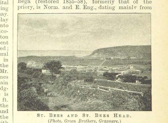
St Bees
- Overview About St Bees Map Street View St Bees is a coastal village, civil parish and electoral ward in the Copeland district of Cumbria, England, on the Irish Sea. …
Co-Curate Page
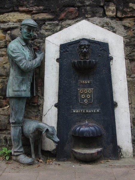
Whitehaven
- Overview About Whitehaven Map Street View Whitehaven is a town and port on the coast of Cumbria, England. Historically a part of Cumberland, it lies equidistant between Cumbria's two …

Co-Curate Page
Eskdale with Wasdale (St Bees), 1848
- ESKDALE, with Wasdale, a chapelry, in the parish of St. Bees, union of Bootle, Allerdale ward above Derwent, W. division of Cumberland, 7 miles (N.E. by E.) from Ravenglass; containing …

Co-Curate Page
Kinniside, 1848
- KINNEYSIDE, a township, in the parish of St. Bees, union of Whitehaven, Allerdale ward above Derwent, W. division of Cumberland, 3¾ miles (N.E. by N.) from Egremont; containing 223 inhabitants, …

Co-Curate Page
Ennerdale, 1848
- ENNERDALE, a parochial chapelry, in the parish of St. Bees, union of Whitehaven, Allerdale ward above Derwent, W. division of Cumberland, 5 miles (N.E.) from Egremont; containing, with Ennerdale High …

Co-Curate Page
Whitehaven, 1848
- WHITEHAVEN, a sea-port, market-town, newly enfranchised borough, and the head of a union, in the parish of St. Bees, Allerdale ward above Derwent, W. division of Cumberland, 40 miles (S.W.) …

Co-Curate Page
Wheddicar Township (St Bees), 1848
- WHEDDICAR, a township, in the parish of St. Bees, union of Whitehaven, Allerdale ward above Derwent, W. division of Cumberland, 2½ miles (E. by S.) from Whitehaven; containing 59 inhabitants. …

Co-Curate Page
Wasdale Head, 1848
- WASDALE-HEAD, with Eskdale, a chapelry, in the parish of St. Bees, union of Bootle, Allerdale ward above Derwent, W. division of Cumberland, 11 miles (S.W. by S.) from Keswick; containing …

Co-Curate Page
Nether Wasdale, 1848
- WASDALE, or Nether Wasdale, a chapelry, in the parish of St. Bees, union of Whitehaven, Allerdale ward above Derwent, W. division of Cumberland, 4 miles (E.) from Gosforth; containing 203 …
Co-Curate Page
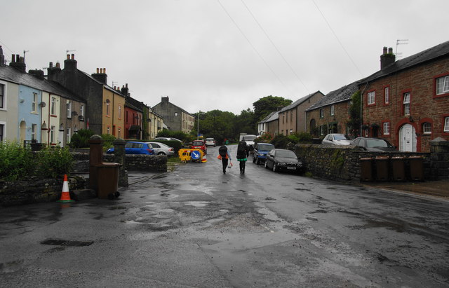
Sandwith
- Overview Map Street View Sandwith is a village in the Copeland district of Cumbria, located about 2 miles south of Whitehaven and 1.5 miles east of St Bees Head on …
Co-Curate Page
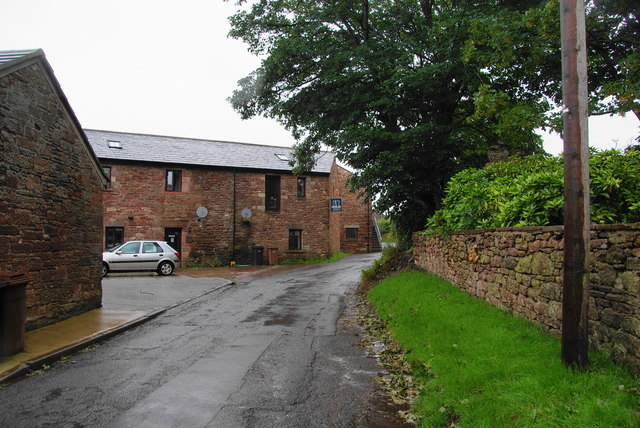
Rottington
- Overview About Rottington Map Street View Rottington is a hamlet in the Copeland district of Cumbria, located near the coast and about 1 mile north-west of the village of St …
Co-Curate Page
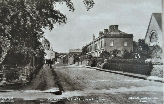
Hensingham
- Hensingham is a suburb of the town of Whitehaven; previously it was a seprate village before the growth of Whitehaven. Historically, Hensingham was a chapelry in the ancient parish of …


from https://openlibrary.org/books…
A topographical dictionary of England, Samuel Lewis, 7th Ed., 1848
- A topographical dictionary of England
comprising the several counties, cities, boroughs, corporate and market towns, parishes, and townships, and the islands of Guernsey, Jersey, and Man, with historical and statistical …
Added by
Simon Cotterill

Co-Curate Page
St Bees
- Overview About St Bees Map Street View St Bees is a coastal village, civil parish and electoral ward in the Copeland district of Cumbria, England, on the Irish Sea. …

Co-Curate Page
Whitehaven
- Overview About Whitehaven Map Street View Whitehaven is a town and port on the coast of Cumbria, England. Historically a part of Cumberland, it lies equidistant between Cumbria's two …

Co-Curate Page
Eskdale with Wasdale (St Bees), 1848
- ESKDALE, with Wasdale, a chapelry, in the parish of St. Bees, union of Bootle, Allerdale ward above Derwent, W. division of Cumberland, 7 miles (N.E. by E.) from Ravenglass; containing …

Co-Curate Page
Kinniside, 1848
- KINNEYSIDE, a township, in the parish of St. Bees, union of Whitehaven, Allerdale ward above Derwent, W. division of Cumberland, 3¾ miles (N.E. by N.) from Egremont; containing 223 inhabitants, …

Co-Curate Page
Ennerdale, 1848
- ENNERDALE, a parochial chapelry, in the parish of St. Bees, union of Whitehaven, Allerdale ward above Derwent, W. division of Cumberland, 5 miles (N.E.) from Egremont; containing, with Ennerdale High …

Co-Curate Page
Whitehaven, 1848
- WHITEHAVEN, a sea-port, market-town, newly enfranchised borough, and the head of a union, in the parish of St. Bees, Allerdale ward above Derwent, W. division of Cumberland, 40 miles (S.W.) …

Co-Curate Page
Wheddicar Township (St Bees), 1848
- WHEDDICAR, a township, in the parish of St. Bees, union of Whitehaven, Allerdale ward above Derwent, W. division of Cumberland, 2½ miles (E. by S.) from Whitehaven; containing 59 inhabitants. …

Co-Curate Page
Wasdale Head, 1848
- WASDALE-HEAD, with Eskdale, a chapelry, in the parish of St. Bees, union of Bootle, Allerdale ward above Derwent, W. division of Cumberland, 11 miles (S.W. by S.) from Keswick; containing …

Co-Curate Page
Nether Wasdale, 1848
- WASDALE, or Nether Wasdale, a chapelry, in the parish of St. Bees, union of Whitehaven, Allerdale ward above Derwent, W. division of Cumberland, 4 miles (E.) from Gosforth; containing 203 …

Co-Curate Page
Sandwith
- Overview Map Street View Sandwith is a village in the Copeland district of Cumbria, located about 2 miles south of Whitehaven and 1.5 miles east of St Bees Head on …

Co-Curate Page
Rottington
- Overview About Rottington Map Street View Rottington is a hamlet in the Copeland district of Cumbria, located near the coast and about 1 mile north-west of the village of St …


