Topics > Civil Parishes in Cumbria > Millom Town Council Area
Millom Town Council Area
About the Parish
Millom Civil Parish is located ion the west coast, by the mouth of the River Duddon, in the Copeland District of Cumbria.
| Main Settlements: | Millom, Haverigg, Steel Green |
|
7,240 (2021 Census) 7,829 (2011 Census) 7,894 (2001 Census) |
|
| Area: | 12.4 km² |
| Parish Council: | Millom Town Council |
| Unitary Authority: | Cumberland Council |
| Ceremonial County: | Cumbria |
Historical |
|
| Ancient Townships: |
Lower Millom (pop. 411 in 1848) Upper Millom (pop. 511 in 1848) Townships became civil parishes in their own right in 1866 (see below). |
| Ancient Parish: |
Prior to 1866, Millom Parish covered a much wider geographical area compared to todays Civil Parish / town council area. In addition to the townships of Upper and Lower Millom, the parish also included the chapelries of Thwaites and Ulpha, and the townships of Birker with Austhwaite and Chapel-Sucken. Ancient parishes refer to the parishes before the split between ecclesiastical (church) and civil parishes in the 19th century. They had a parish church and often were composed of multiple townships and chapelries. In many cases, townships and parishes were originally based on the territory of manors from the feudal system during medieval times. Civil parishes were created following the Poor Law Amendment Act 1866, in which Church of England parishes, extra-parochial areas, townships and chapelries, became "civil parishes" which could set their own poor rate (tax). Then the reforms of Local Government Act 1894 established elected civil parish councils (or parish meetings for parishes with less than 300 residents) and created urban and rural districts. Boundaries of parishes and civil parishes may have changed over time. |
| Poor Law Union: |
Bootle Poor Law Union, established on the 12th of June 1837. Initially the Union used two existing smaller workhouses in Bootle and Millom, until a new Union Workhouse was built to the west of Bootle in 1856. Under the Poor Law Amendment Act of 1834 parishes were grouped into Unions, each of which had to build a workhouse if they did not already have one. It ended the old system of locally provided poor relief which had come under strain as numbers out of work grew, following increasing mechanisation of agriculture and the economic downturn after the Napoleonic Wars, along with changing social attitudes. The workhouse provided those unable to support themselves financially with accommodation and work. Inmates were generally segregated into men, women, boys and girls. The workhouse system was abolished by the Local Government Act 1929, but many workhouses lived on as ‘Public Assistance Institutions’ until the National Assistance Act 1948. |
| County: |
Cumberland (~12th centurty to 1974) Cumbria - county established on 1st April 1974, by the Local Government Act 1972. Cumbria County Council was abolished in 2023 and replaced by 2 new Unitary authorities. Cumbria remains a ceremonial county; retaining ceremonial boundary and the roles and responsibilities of the Lord Lieutenant and High Sheriff of Cumbria - based on 'The Cumbria (Structural Changes) Order 2022'. |
| District: |
Allerdale above Derwent (ward) Millom Urban District Council (1894 to 1934) - established by the Local Government Act 1894 Millom Rural District Council (1934 to 1974) - which amalgamated Millom Urban District Council and Bootle Rural District Council . Millom Rural District was abolished in 1974, under the Local Government Act 1972. The former district area then formed part of the Borough of Copeland, which also incorporated Ennerdale Rural District Council and Whitehaven Municipal Borough Council areas. Copeland and the 5 other district councils of Cumbria, along with the county council, were abolished as part of local government reorganisation in 2023; and replaced by two unitary authorities on 1st April 2023. |
| Parish: |
Millom Town Council was established in 1974, at the time of local government reorganisation. |
| Unitary Authority: |
Cumberland Council was created on the 1st April 2023. The 'new' Cumberland unitary authority area includes most of the historic county, with the exception of Penrith and it's surrounding area, which is part the 'new' Westmorland and Furness unitary authority. |
See also: ![]() Historic Buildings and Monuments in Millom Civil Parish Note: listed buildings are generally the responsibility of the county council, rather than the parish/town council.
Historic Buildings and Monuments in Millom Civil Parish Note: listed buildings are generally the responsibility of the county council, rather than the parish/town council.
from https://millomtowncouncil.co.…
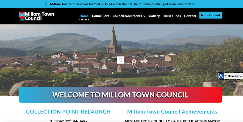
Millom Town Council
- Official Website of Millom Town Council. ".....Millom Town Council are responsible for Millom and Haverigg Parks and Public Toilets, Haverigg Foreshore and the Beach Cafe, Earl St and Lincoln St …
Added by
Simon Cotterill
Co-Curate Page
Millom
- Overview About Millom Map Street View Help build the Millom Timeline Millom is a town and civil parish on the north shore of the estuary of the River Duddon around …
Co-Curate Page
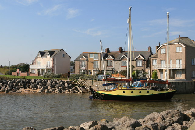
Haverigg
- Overview About Haverigg Map Street View Haverigg is a coastal village in the Copeland district of Cumbria, located about 1 mile south-west of Millom. Haverigg Pool, a small river, flows …
Co-Curate Page
Steel Green, Haverigg
- Overview Map Street View Steel Green is a small settlement located about half a mile south of Millom and immediately east of Haverigg. Port Haverigg Holiday Village is located here …

from https://www.cumbriacountyhist…
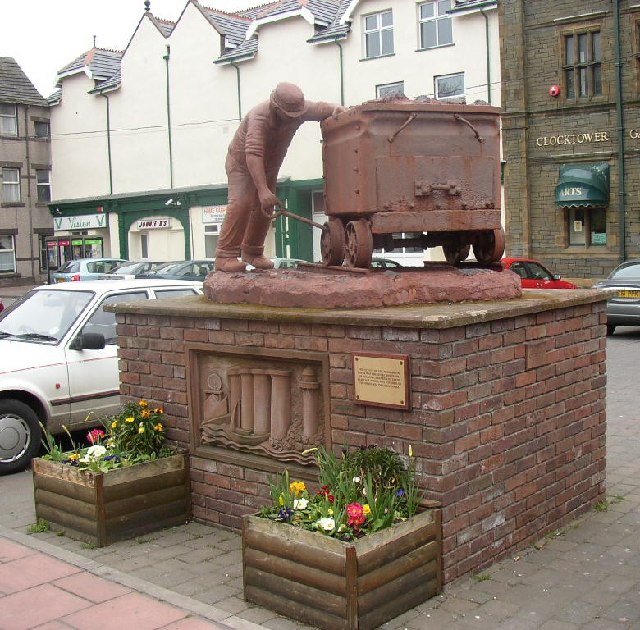
Millom
- "Industrial town in Millom parish, Allerdale above Derwent ward, Cumberland. Millom was UD from 1894 to 1934.....Hodbarrow iron mine, which was to become ‘the most productive haematite mine in the …
Added by
Simon Cotterill
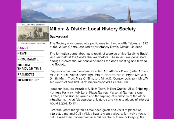
from https://www.millomhistory.org…
Millom and District Local History Society
- Millom and District Local History Society relaunched late in 2021 and here is our new website. As well as an introduction to the Society there are lots of useful links …
Added by
Simon Cotterill

from https://millomtowncouncil.co.…
Millom Town Council
- Official Website of Millom Town Council. ".....Millom Town Council are responsible for Millom and Haverigg Parks and Public Toilets, Haverigg Foreshore and the Beach Cafe, Earl St and Lincoln St …
Added by
Simon Cotterill
Co-Curate Page
Millom
- Overview About Millom Map Street View Help build the Millom Timeline Millom is a town and civil parish on the north shore of the estuary of the River Duddon around …
Co-Curate Page
Haverigg
- Overview About Haverigg Map Street View Haverigg is a coastal village in the Copeland district of Cumbria, located about 1 mile south-west of Millom. Haverigg Pool, a small river, flows …
Co-Curate Page
Steel Green, Haverigg
- Overview Map Street View Steel Green is a small settlement located about half a mile south of Millom and immediately east of Haverigg. Port Haverigg Holiday Village is located here …
from https://www.cumbriacountyhist…
Millom
- "Industrial town in Millom parish, Allerdale above Derwent ward, Cumberland. Millom was UD from 1894 to 1934.....Hodbarrow iron mine, which was to become ‘the most productive haematite mine in the …
Added by
Simon Cotterill
from https://www.millomhistory.org…
Millom and District Local History Society
- Millom and District Local History Society relaunched late in 2021 and here is our new website. As well as an introduction to the Society there are lots of useful links …
Added by
Simon Cotterill


