Topics > Northumberland > Civil Parishes in Northumberland > Stocksfield Civil Parish > Historic Buildings and Monuments in Stocksfield Civil Parish
Historic Buildings and Monuments in Stocksfield Civil Parish
Listed buildings and scheduled monuments in Stocksfield Civil Parish, Northumberland, from the National Heritage List for England[1]. Use the Search (below) if looking for a specific building / monument.
| Structure | List No. | Grade | Built~ | Notes |
|---|---|---|---|---|
| Apperley Farmhouse | 1045360 | II | C17th | Apperley |
| Batt Cottage | 1154624 | II | C18th | Painshawfield, Stocksfield |
| Beaumont House | 1045368 | II | 1851 | Stocksfield Former school |
| Blast Furnace on West Bank of Stocksfield Burn 150 Metres South of Wood Cottage | 1154816 | II | C16th | Wheelbirks |
| Boundary Stone at NGR NZ 04376112 | 1045358 | II | C19h | A695 |
| Boundary Stone at NGR NZ 04426112 | 1370283 | II | C19th | A695 |
| Boundary Stone at NGR NZ 04466112 | 1045359 | II | C19th | A695 |
| Boundary Stone at NGR NZ 04486112 | 1370246 | II | C19th | A695 |
| Boundary Stone at NGR NZ 04616054 | 1154684 | II | C18th | A695 |
| Boundary Stone at NGR NZ 04626055 on South of Fence, Beside Gate | 1045367 | II | C18th | Broomleyhope Wood |
| Boundary Stone at NGR NZ 04656059 on South Side of Fence | 1303709 | II | C18th | Broomleyhope Wood |
| Boundary Stone at NGR NZ 04666060 on South Side of Fence | 1045366 | II | C18th | Broomleyhope Wood |
| Boundary Stone at NGR NZ 04706066 on South Side of Fence | 1154648 | II | C18th | Broomleyhope Wood |
| Boundary Stone at NGR NZ 04716067 on South Side of Fence | 1370249 | II | C18th | Broomleyhope Wood |
| Boundary Stone at NGR NZ 04756069 1 Metre South of Fence | 1303737 | II | C18th | Broomleyhope Wood |
| Boundary Stone by Fence Corner | 1045357 | II | C19th | A695 |
| Bywell Bridge over River Tyne (That Part in Broomley and Stocksfield Parish) | 1154576 | II | 1838 | Bywell - Stocksfield |
| Cranford | 1370247 | II | 1903 | Painshawfield, Stocksfield. House. |
| Dovecote 100 Metres South-West of Hall | 1045371 | II | C18th | Old Ridley |
| Farmbuildings North-West of Stocksfield Hall Farmhouse | 1370251 | II | C19th | Stocksfield |
| Farmbuildings to North-West of Old Ridley Farmhouse | 1045373 | II | C18th | Old Ridley |
| Forge House and Adjacent Forge | 1370282 | II | c.1850 | Stocksfield |
| Garden Wall North-East of Hall | 1154778 | II | C18th | Old Ridley |
| Garden Walls and Gates to South of Apperley Farmhouse | 1045361 | II | c.1930 | Apperley |
| Gas Generator House to North of Cranford | 1303755 | II | c.1903 | Painshawfield, Stocksfield |
| Ha-Ha Wall 30 Metres North-East of Hall | 1045372 | II | C18th | Old Ridley |
| Merry Shield Farmhouse, Attached Cottage, Farmbuilding, House Occupied by Mr and Mrs Beattie and Garden Wall | 1045370 | II | C18th | Merry Shield, Stocksfield |
| Milestone 200 Metres East of Broomley Road Junction | 1045356 | II | C18th | A695 |
| Old Ridley Hall | 1303675 | II | C17th | Old Ridley |
| Pair of Boundary Stones at Ngr Nz 04636057 on South Side of Fence | 1370250 | II | C18th | Broomleyhope Wood |
| Ridley Mill House | 1303643 | II | C18th | Ridley Mill |
| Screen Wall Adjacent to North-West Corner of Hall | 1154782 | II | C18th | Old Ridley |
| South Cottage | 1370248 | II | C19th | Broomley |
| South Farm Cottage and Middle Cottage | 1045364 | II | C19th | Broomley |
| Stable 10 Metres North-East of South Cottage | 1303731 | II | C19th | Broomley |
| Stocksfield Hall Farmhouse | 1045375 | II | C18th | Stocksfield |
| Stocksfield House | 1154706 | II | 1832 | Stocksfield |
| Stocksfield War Memorial | 1396573 | II | 1921 | Stocksfield, A695 |
| Tansygarth Well, 140 Metres North of Apperley Farmhouse | 1045362 | II | C17th | Apperley |
| Terrace Walls to West of Cranford | 1045363 | II | 1907 | Painshawfield, Stocksfield |
| Wall on West Side of Stocksfield Hall Farmhouse Garden | 1154800 | II | C18th | Stocksfield |
| Wentworth Cottage | 1045369 | II | 1853 | Stocksfield |
| West Farmhouse | 1154643 | II | C18th | Broomley |
| Romano-British settlement, 490m SSE of Apperley Dene | 1006504 | n/a | Scheduled Monument. Apperley | |
| Wheelbirks furnace | 1002919 | n/a | C16th | Scheduled Monument. Wheelbirks |
| Broomley Conservation Area | - | n/a | Conservation Area |
Primary source: the National Heritage List for England - NHLE is the register of nationally protected historic buildings and sites in England, including listed buildings, scheduled monuments, protected wrecks, registered parks and gardens, and battlefields. The list is maintained by Historic England. Check NHLE for updates and new entries. Secondary sources: British Listed Buildings and Keys to the Past.
Co-Curate Page
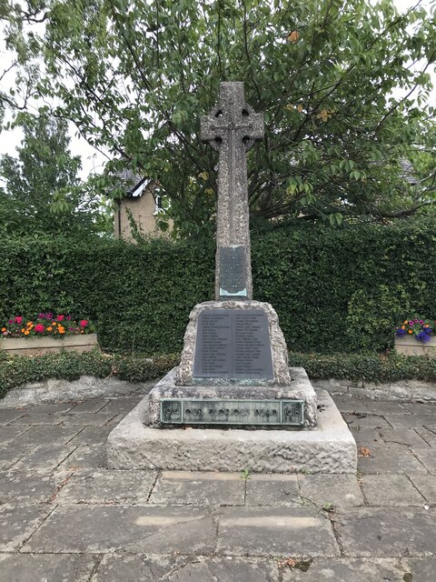
Stocksfield War Memorial
- Overview Map Street View The war memorial in Stocksfield was built by public subscription on a site given by Lord Allendale. It was designed by Dixon & Son Ltd of …
Co-Curate Page
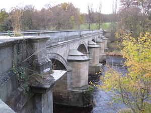
Bywell Bridge, over the Tyne
- Overview Map Street View Bywell bridge over the River Tyne was built 1836-1838, designed by George Basevi. The stone bridge carries the B6309 road over the Tyne, with Bywell on the north …
Co-Curate Page
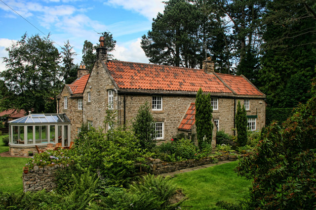
Batt Cottage, Stocksfield
- Overview Map Street View Batt Cottage on Batt House Road in Stocksfield was built in the 18th century. It was originallay a farmhouse known as Batt House. The building is …
Co-Curate Page
Stocksfield Hall
- Overview Map Stocksfield Hall is located near the River Tyne and Bywell Bridge, close to where Stocksfield Burn joins the Tyne. Historically, Stocksfield Hall was a township in the ancient …

Co-Curate Page
Beaumont House (former school)
- Overview Map Beumont House in Stocksfield is the former Bywell School, built in 1851, located in what was then Broomley township, in the ancient parish of Bywell St Peter. A …
Co-Curate Page
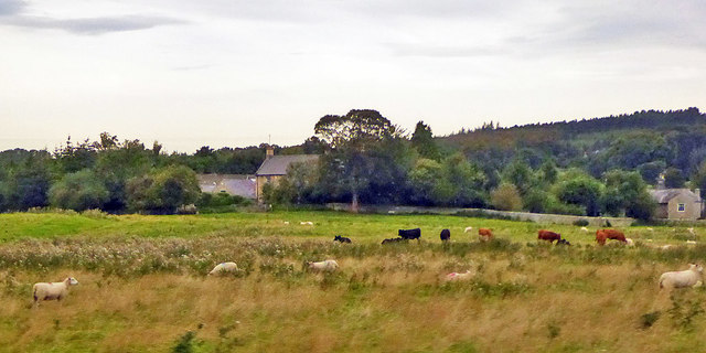
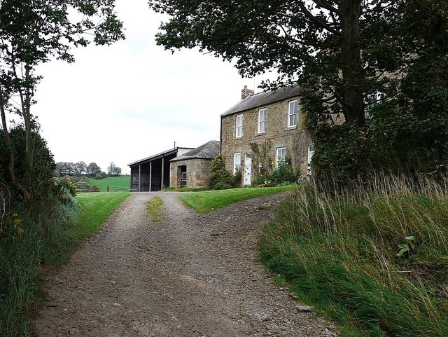
Merry Shield
- Overview Map Merry Shield is a farm located to the north-east of Stocksfield. The farmhouse here dates from the 18th century, with 19th century additions. Merry Shield farmhouse is Grade …
Co-Curate Page
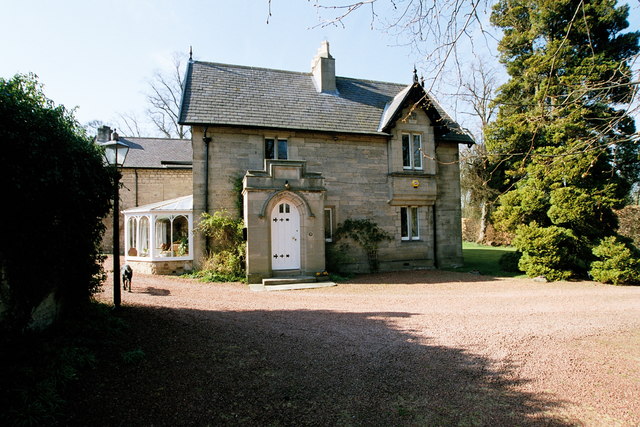
Stocksfield House
- Stocksfield House is the former headmaster's house to Bywell School, built in 1832. It is located in Stocksfield, next door to the former school building - now known as Beaumont …

Co-Curate Page
Stocksfield War Memorial
- Overview Map Street View The war memorial in Stocksfield was built by public subscription on a site given by Lord Allendale. It was designed by Dixon & Son Ltd of …
Co-Curate Page
Bywell Bridge, over the Tyne
- Overview Map Street View Bywell bridge over the River Tyne was built 1836-1838, designed by George Basevi. The stone bridge carries the B6309 road over the Tyne, with Bywell on the north …
Co-Curate Page
Batt Cottage, Stocksfield
- Overview Map Street View Batt Cottage on Batt House Road in Stocksfield was built in the 18th century. It was originallay a farmhouse known as Batt House. The building is …
Co-Curate Page
Stocksfield Hall
- Overview Map Stocksfield Hall is located near the River Tyne and Bywell Bridge, close to where Stocksfield Burn joins the Tyne. Historically, Stocksfield Hall was a township in the ancient …
Co-Curate Page
Beaumont House (former school)
- Overview Map Beumont House in Stocksfield is the former Bywell School, built in 1851, located in what was then Broomley township, in the ancient parish of Bywell St Peter. A …
Co-Curate Page
Merry Shield
- Overview Map Merry Shield is a farm located to the north-east of Stocksfield. The farmhouse here dates from the 18th century, with 19th century additions. Merry Shield farmhouse is Grade …

")
