Topics > Northumberland > Civil Parishes in Northumberland > Kirknewton Civil Parish > Kirknewton Parish, 1848
Kirknewton Parish, 1848
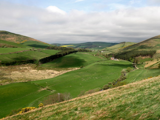
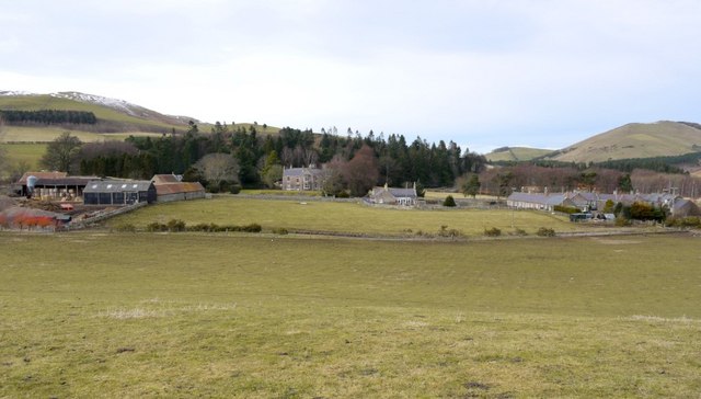
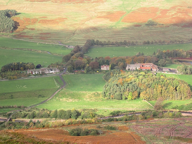
NEWTON, KIRK (St. Gregory), a parish, in the union of Glendale, W. division of Glendale ward, N. division of the county of Northumberland, 5¼ miles (W. by N.) from Wooler; containing 1,726 inhabitants, of whom 83 are in the township of Kirk-Newton. The parish consists of the townships of Akeld, Couldsmouth with Thompson's-Walls, Coupland, Crookhouse, Greys-Forest, Heath-Pool, Howtell, Kilham, Kirk-Newton, Lanton, Milfield, West Newton, Paston, Selby's-Forest, and Yeavering. In Kirk-Newton township are 2,218 acres of land; the surface is mountainous, and mostly in sheep-walks: there are quarries of whinstone. The rivers Beaumont and Colledge join here, and become the Glen, running down the valley eastward. The living is a vicarage, endowed with a portion of the rectorial tithes, valued in the king's books at £8. 13. 4., and in the patronage of Miss Davidson; net income, £491; impropriators, Mr. James and others. The vicarial tithes of the township of Kirk-Newton have been commuted for £25, and there are eleven acres of glebe. The church, a neat structure with a campanile tower, was repewed in 1810.
Extract from: A Topographical Dictionary of England comprising the several counties, cities, boroughs, corporate and market towns, parishes, and townships..... 7th Edition, by Samuel Lewis, London, 1848.

Co-Curate Page
Akeld Township, 1848
- AKELD, a township, in the parish of Kirk-Newton, union of Glendale, W. division of Glendale ward, N. division of Northumberland, 3 miles (N.W. by W.) from Wooler; containing 182 inhabitants. …
Co-Curate Page
Selby's-Forest Township, 1848
- SELBY'S-FOREST, a township, in the parish of Kirk-Newton, union, and W. division of the ward, of Glendale, N. division of Northumberland; containing 61 inhabitants. This district comprises 11,709 acres, of …
Co-Curate Page
Couldsmouth with Thompson's Walls, Township, 1848
- COULDSMOUTH, with Thompson's-Walls, a township, in the parish of Kirk-Newton, union of Glendale, W. division of Glendale ward, N. division of Northumberland, 7½ miles (W. by N.) from Wooler; containing …
Co-Curate Page
Kilham Township, 1848
- KILHAM, a township, in the parish of Kirk-Newton, union, and W. division of the ward, of Glendale, N. division of Northumberland, 6 miles (S.S.E.) from Coldstream; containing 279 inhabitants. The …
Co-Curate Page
Lanton
- Overview Map Street View Lanton in Northumberland is a small settlement located by the River Glen about 4 miles north-west of Wooler and half a mile west of Coupland. The …
Co-Curate Page
Yeavering Township, Historical Account, 1848
- YEAVERING, a township, in the parish of KirkNewton, union, and W. division of the ward, of Glendale, N. division of Northumberland, 4½ miles (W.N.W.) from Wooler; containing 68 inhabitants. It …
Co-Curate Page
Crookhouse
- CROOKHOUSE, a township, in the parish of KirkNewton, union of Glendale, W. division of Glendale ward, N. division of Northumberland, 7 miles (W.N.W.) from Wooler; containing 18 inhabitants. It is …
Co-Curate Page
Coupland
- Overview About Coupland Map Street View Coupland is a hamlet in Northumberland, located by the River Glen, about 4 miles north-west of Wooler and 4 miles south of Ford. There …
Co-Curate Page
Milfield
- Overview About Milfield Map Street View MILFIELD, a township, in the parish of KirkNewton, union of Glendale, W. division of Glendale ward, N. division of Northumberland, 5¾ miles (N.W.) from …
Co-Curate Page
Westnewton, Northumberland
- Overview Map Street View NEWTON, WEST, a township, in the parish of Kirk-Newton, union of Glendale, W. division of Glendale ward, N. division of Northumberland, 5¾ miles (W. by N.) …
Co-Curate Page
Howtel
- Overview Map Street View Howtel is a hamlet in Northumberland, located on the B6532 road, about 7 miles north-west of Wooler, near the border with Scotland. Howtel is the site …
Co-Curate Page
Hethpool
- Overview Map Street View HEATHPOOL, a township, in the parish of KirkNewton, union, and W. division of the ward, of Glendale, N. division of Northumberland; containing 51 inhabitants, and comprising …
Co-Curate Page
Pawston
- Overview Map Street View Pawston is a hamlet in Northumberland. Pawston incorporates the site of the deserted medieval village of Thornington, which was first recorded in 1296.[1] To the south-west …

Co-Curate Page
Akeld Township, 1848
- AKELD, a township, in the parish of Kirk-Newton, union of Glendale, W. division of Glendale ward, N. division of Northumberland, 3 miles (N.W. by W.) from Wooler; containing 182 inhabitants. …
Co-Curate Page
Selby's-Forest Township, 1848
- SELBY'S-FOREST, a township, in the parish of Kirk-Newton, union, and W. division of the ward, of Glendale, N. division of Northumberland; containing 61 inhabitants. This district comprises 11,709 acres, of …
Co-Curate Page
Couldsmouth with Thompson's Walls, Township, 1848
- COULDSMOUTH, with Thompson's-Walls, a township, in the parish of Kirk-Newton, union of Glendale, W. division of Glendale ward, N. division of Northumberland, 7½ miles (W. by N.) from Wooler; containing …
Co-Curate Page
Kilham Township, 1848
- KILHAM, a township, in the parish of Kirk-Newton, union, and W. division of the ward, of Glendale, N. division of Northumberland, 6 miles (S.S.E.) from Coldstream; containing 279 inhabitants. The …
Co-Curate Page
Lanton
- Overview Map Street View Lanton in Northumberland is a small settlement located by the River Glen about 4 miles north-west of Wooler and half a mile west of Coupland. The …
Co-Curate Page
Yeavering Township, Historical Account, 1848
- YEAVERING, a township, in the parish of KirkNewton, union, and W. division of the ward, of Glendale, N. division of Northumberland, 4½ miles (W.N.W.) from Wooler; containing 68 inhabitants. It …
Co-Curate Page
Crookhouse
- CROOKHOUSE, a township, in the parish of KirkNewton, union of Glendale, W. division of Glendale ward, N. division of Northumberland, 7 miles (W.N.W.) from Wooler; containing 18 inhabitants. It is …
Co-Curate Page
Coupland
- Overview About Coupland Map Street View Coupland is a hamlet in Northumberland, located by the River Glen, about 4 miles north-west of Wooler and 4 miles south of Ford. There …
Co-Curate Page
Milfield
- Overview About Milfield Map Street View MILFIELD, a township, in the parish of KirkNewton, union of Glendale, W. division of Glendale ward, N. division of Northumberland, 5¾ miles (N.W.) from …
Co-Curate Page
Westnewton, Northumberland
- Overview Map Street View NEWTON, WEST, a township, in the parish of Kirk-Newton, union of Glendale, W. division of Glendale ward, N. division of Northumberland, 5¾ miles (W. by N.) …
Co-Curate Page
Howtel
- Overview Map Street View Howtel is a hamlet in Northumberland, located on the B6532 road, about 7 miles north-west of Wooler, near the border with Scotland. Howtel is the site …
Co-Curate Page
Hethpool
- Overview Map Street View HEATHPOOL, a township, in the parish of KirkNewton, union, and W. division of the ward, of Glendale, N. division of Northumberland; containing 51 inhabitants, and comprising …


