Topics > Northumberland > Haltwhistle > Haltwhistle Parish, 1848
Haltwhistle Parish, 1848
HALTWHISTLE (Holy Cross), a town and parish, and the head of a union, in the W. division of Tindale ward, S. division of Northumberland; comprising the townships of Bellister, Blenkinsopp, East Coanwood, Featherstone, Haltwhistle, Hartley-Burn, Henshaw, Melkridge, Plainmellor, Ridley, Thirlwall, Thorngrafton, and Wall-Town; and containing 4,655 inhabitants, of whom 984 are in the township of Haltwhistle, 36 miles (W.) from Newcastle-upon-Tyne, and 315 (N.N.W.) from London. The place is of considerable antiquity, though mention of it does not occur at a very early period. About the year 1416, a tower existed here, which was perhaps the same as that described in 1542 as the inheritance of Sir William Musgrave; the Blenkinsopps also had a tower in 1568, and there are still remaining in the market-place two houses of this kind, partly modernised, and occupied as inns. Among the few events of importance connected with the history of the town, may be mentioned the sojourn of Edward I. in 1306, and it was probably during that monarch's stay in the neighbourhood that he granted to William de Roos, of Yolton, the privilege of a market and fair at Hautewysill. The town was anciently styled a borough, and governed by a bailiff. The manor seems to have been given by the kings of Scotland to the family of Roos, of Hamlake and Wark, and from them to have passed to the Musgraves, of Hartley Castle and Edenhall, who held it in the time of Elizabeth; in 1663 it belonged to Mr. William Pearson, and it was till lately the property of the Cuthbertson family.
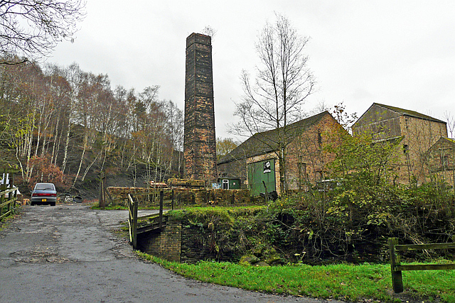
The parish is divided into two nearly equal parts by the South Tyne and its tributary the Tippal, or Tippalt, and is also intersected by two roads, both between Newcastle and Carlisle. It is about 12 miles in length, and of very irregular breadth, extending along the courses of the South Tyne, the Tippal, and Pow-Charney, which form gradually steep and narrowing valleys, principally in a direction from south-east to north-west. Along the streams are slips of arable land, but the moors and mountains produce scarcely any corn, and are mainly depastured by sheep and black cattle: the soil is clay in the higher grounds, and mostly gravel in the valleys, where the scenery in some places is luxuriant and beautiful, while, above, little else is seen than dark heathy fells, and a dreary and treeless waste. A series of whinstone crags commences from the top of the ascent above Glen-Whelt, near the Roman station CaerVoran, and stretches to the north-east almost across the county; as seen from Gilsland on the north, these crags present a singular and striking termination of the landscape, forming a continuous serrated line as far as the eye can reach. The geological features are peculiarly interesting in the pass between Greenhead and GlenWhelt, indicating some great convulsion of nature, supposed to have been the effect of internal fire at a remote and unknown era. Ironstone is found in abundance, and there are veins of lead-ore; but neither mineral is wrought. Extensive collieries have been long in operation; the principal are at Blenkinsopp, Hartley-Burn, Melkridge, Thorngrafton, Coanwood, and Fell-End. There are also several quarries of limestone and freestone, the latter used for building, and the former burnt for sale at Blenkinsopp. The manufacture of plaids, flannels, blankets, druggets, and coarse cloths, is carried on in two establishments, one of which has a branch at Bardon-Mill; but the sale being chiefly in the neighbourhood, the number of hands employed is not considerable. The Newcastle and Carlisle railway passes through the parish, and attains its summit level between the head of Pow-Charney and the river Irthing, near the farmhouse called the Gap; it has a station in the town, with a convenient carriage-shed, and other stations at Bardon-Mill, Greenhead, and Rose-Hill.
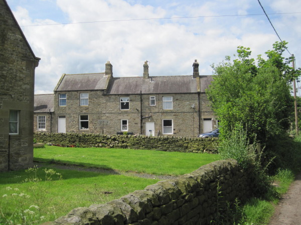
The town, formerly called Haltwesel, is pleasantly situated on an eminence, on the high road, and commands a fine prospect of the surrounding country, including the windings of the Tyne. The buildings are irregular, and there are but few good houses; the inhabitants are plentifully supplied with water from wells, and from brooks situated to the north. The town is overlooked by the remarkable feature called the Castle Hill, a natural bank cut off from the ground to the north-east by the glen of Haltwhistle burn, and having apparently had its west end made steep by human labour, and certainly a breast-work or dyke of gravelly earth, about 3 or 4 feet high, added round its margin on the east, north, and west. Its summit is a plain of about 190 feet from east to west, and 74 from north to south; on which last side the escarpment seems to have been terraced, probably for cultivation. The market, in which grain is sold, is on Thursday. Fairs are held on May 14th and November 22nd, for horses, cattle, and general merchandise; statute-fairs on the Thursday before 12th May, and on the 11th November; and a tryst, principally for sheep, and recently established, on 17th September. The powers of the county debt-court of Haltwhistle, established in 1847, extend over the greater part of the registration-district of Haltwhistle. The township comprises 2759 acres, of which 1350 are waste or common.
The living is a vicarage, valued in the king's books at £12. 3. 1½., and in the patronage of the Bishop of Durham, with a net income of £593, and a glebe; impropriator, Sir Edward Blackett, Bart. The vicarial tithes for the townships of Melkridge and Henshaw were commuted on the inclosure of common land upwards of 35 years ago, for a farm called the Vicar's Allotment. The church is an ancient structure in the decorated English style, situated on a slope, between which and the river an alluvial plain or haugh of no great breadth intervenes; it contains a monument to the memory of a crusader. At Beltingham is an ancient endowed chapel, a handsome edifice; and at Greenhead another chapel, erected in 1828: the livings of both are perpetual curacies in the patronage of the Vicar. There are places of worship in the parish for Independents, Presbyterians, Primitive Methodists, Wesleyans, and the Society of Friends. A school, now conducted on the national system, was endowed in 1721 by Lady Capel, with the twelfth part of an estate at Faversham, in Kent. The poor law union of Haltwhistle includes the whole of the western division of Tindale ward, and contains five parishes, comprising eighteen townships, with a population of 5949. The Roman wall intersects the parish from east to west, and in some places may be distinctly traced, with the ditches on both sides, on a line with the ancient road from Newcastle to Carlisle; it is carried along the verge of the crags before mentioned, its stations, castles, and towers once mingling with their saw-like and spiral forms. The martyred Bishop Ridley was a native of the parish.
Extract from: A Topographical Dictionary of England comprising the several counties, cities, boroughs, corporate and market towns, parishes, and townships..... 7th Edition, by Samuel Lewis, London, 1848.

Co-Curate Page
Beltingham, 1848
- BELTINGHAM, a hamlet, in the township of Ridley, parish and union of Haltwhistle, W. division of Tindale ward, S. division of Northumberland, 5½ miles (E. by S.) from Haltwhistle. This …
Co-Curate Page
East Coanwood, Township, 1848
- COANWOOD, EAST, a township, in the parish and union of Haltwhistle, W. division of Tindale ward, S. division of Northumberland, 5 miles (S.) from Haltwhistle; containing 139 inhabitants. The name …
Co-Curate Page
Wall Township (Haltwhistle Parish), 1848
- WALL-TOWN, a township, in the parish and union of Haltwhistle, W. division of Tindale ward, S. division of Northumberland, 3 miles (N.W. by W.) from Haltwhistle; containing 85 inhabitants. This …
Co-Curate Page
Thirlwall Township, 1848
- THIRLWALL, a township, in the parish and union of Haltwhistle, W. division of Tindale ward, S. division of Northumberland, 4 miles (W.N.W.) from Haltwhistle; containing 394 inhabitants. It has its …
Co-Curate Page
Featherstone Township, 1848
- FEATHERSTONE, a township, in the parish and union of Haltwhistle, W. division of Tindale ward, S. division of Northumberland, 3¾ miles (S.W.) from Haltwhistle; containing 265 inhabitants. It comprises, besides …
Co-Curate Page
Bellister, 1848
- BELLISTER, a township, in the parish and union of Haltwhistle, W. division of Tindale ward, S. division of Northumberland, 16 miles (W. by S.) from Hexham; containing 116 inhabitants. The …
Co-Curate Page
Blenkinsopp Township, 1848
- BLENKINSOPP, a township, in the parish and union of Haltwhistle, W. division of Tindale ward, S. division of Northumberland, 1½ mile (W.) from Haltwhistle; containing 845 inhabitants. This has long …
Co-Curate Page
Thorngrafton Township, 1848
- THORNGRAFTON, a township, in the parish and union of Haltwhistle, W. division of Tindale ward, S. division of Northumberland, 5 miles (E. by N.) from Haltwhistle; containing 272 inhabitants. The …
Co-Curate Page
Plenmeller
- Overview About Plenmeller Map Street View Plenmeller (aka Plainmellor) is a settlement near the north banks of the River South Tyne, south of Haltwistle. Historically, Plenmeller was a township within …
Co-Curate Page
Hartley Burn Township, 1848
- HARTLEY-BURN, a township, in the parish and union of Haltwhistle, W. division of Tindale ward, S. division of Northumberland, 4 miles (S.W.) from Haltwhistle; containing 288 inhabitants. The monks of …
Co-Curate Page
Henshaw Township, 1848
- HENSHAW, a township, in the parish and union of Haltwhistle, W. division of Tindale ward, S. division of Northumberland, 11 miles (W.) from Hexham; containing 569 inhabitants. This manor was …
Co-Curate Page
Melkridge Township, 1848
- MELKRIDGE, a township, in the parish and union of Haltwhistle, W. division of Tindale ward, S. division of Northumberland, 2 miles (E.) from Haltwhistle; containing 290 inhabitants. It belonged at …

Co-Curate Page
Beltingham, 1848
- BELTINGHAM, a hamlet, in the township of Ridley, parish and union of Haltwhistle, W. division of Tindale ward, S. division of Northumberland, 5½ miles (E. by S.) from Haltwhistle. This …
Co-Curate Page
East Coanwood, Township, 1848
- COANWOOD, EAST, a township, in the parish and union of Haltwhistle, W. division of Tindale ward, S. division of Northumberland, 5 miles (S.) from Haltwhistle; containing 139 inhabitants. The name …
Co-Curate Page
Wall Township (Haltwhistle Parish), 1848
- WALL-TOWN, a township, in the parish and union of Haltwhistle, W. division of Tindale ward, S. division of Northumberland, 3 miles (N.W. by W.) from Haltwhistle; containing 85 inhabitants. This …
Co-Curate Page
Thirlwall Township, 1848
- THIRLWALL, a township, in the parish and union of Haltwhistle, W. division of Tindale ward, S. division of Northumberland, 4 miles (W.N.W.) from Haltwhistle; containing 394 inhabitants. It has its …
Co-Curate Page
Featherstone Township, 1848
- FEATHERSTONE, a township, in the parish and union of Haltwhistle, W. division of Tindale ward, S. division of Northumberland, 3¾ miles (S.W.) from Haltwhistle; containing 265 inhabitants. It comprises, besides …
Co-Curate Page
Bellister, 1848
- BELLISTER, a township, in the parish and union of Haltwhistle, W. division of Tindale ward, S. division of Northumberland, 16 miles (W. by S.) from Hexham; containing 116 inhabitants. The …
Co-Curate Page
Blenkinsopp Township, 1848
- BLENKINSOPP, a township, in the parish and union of Haltwhistle, W. division of Tindale ward, S. division of Northumberland, 1½ mile (W.) from Haltwhistle; containing 845 inhabitants. This has long …
Co-Curate Page
Thorngrafton Township, 1848
- THORNGRAFTON, a township, in the parish and union of Haltwhistle, W. division of Tindale ward, S. division of Northumberland, 5 miles (E. by N.) from Haltwhistle; containing 272 inhabitants. The …
Co-Curate Page
Plenmeller
- Overview About Plenmeller Map Street View Plenmeller (aka Plainmellor) is a settlement near the north banks of the River South Tyne, south of Haltwistle. Historically, Plenmeller was a township within …
Co-Curate Page
Hartley Burn Township, 1848
- HARTLEY-BURN, a township, in the parish and union of Haltwhistle, W. division of Tindale ward, S. division of Northumberland, 4 miles (S.W.) from Haltwhistle; containing 288 inhabitants. The monks of …
Co-Curate Page
Henshaw Township, 1848
- HENSHAW, a township, in the parish and union of Haltwhistle, W. division of Tindale ward, S. division of Northumberland, 11 miles (W.) from Hexham; containing 569 inhabitants. This manor was …