Topics > County Durham > Civil Parishes in County Durham > Ancient Parishes of County Durham > Chester-Le-Street Parish, 1848
Chester-Le-Street Parish, 1848
CHESTER-LE-STREET (St. Mary and St. Cuthbert), a parish, and the head of a union (though a portion of the parish is in the union of Lanchester), partly in the N. division of Easington ward, but chiefly in the Middle division of Chester ward, N. division of the county of Durham; comprising the chapelries of Birtley, Lamesley, Pelton, and Tanfield, and the townships of Chester, Edmondsley, Harraton, Hedley, Kibblesworth, Lambton, Great and Little Lumley, Ouston, Plawsworth, Ravensworth, Urpeth, and Waldridge; the whole containing 16,359 inhabitants, of whom 2599 are in the township of Chester, 6 miles (N.) from Durham. This place occupies the site of the Roman station Condercum, and was called by the Saxons Coneceaster, from which its present appellation is derived, as is its adjunct from its position on the line of the Roman military way to Newcastle: several Roman coins (especially a Gordian in gold, in the possession of the family of the late Mr. Surtees, of Mainsforth), and an altar much defaced, have been found; and specimens of antiquity are still frequently turned up. It was made the head of the ancient see of Lindisfarne by Eardulph, eighteenth prelate, who in 882 removed hither the relics of St. Cuthbert, and founded a church which continued under a succession of eight bishops to be the cathedral of the diocese, till the removal of the see, in 995, to the city of Durham. At this period the church became parochial, and in 1286, Bishop Anthony Beck founded in it a collegiate establishment, consisting of a dean, seven prebendaries, three deacons, and other members, who remained till the Dissolution, when the dean's portion of the revenue was estimated at £77. 11. 8.
The parish comprises by measurement 23,852 acres, of which 2619 are in the township, where the soil is light and variable, and the scenery rich and beautiful; the neighbourhood abounds with coal, and there are some freestone-quarries. The town, which extends nearly a mile in length, is situated in a valley, on the western side of the Wear, and on the road to Newcastle; a more irregular line of buildings runs east and west, at right angles with the former. In 1771 it suffered from an inundation of the river, which greatly damaged many of the houses and destroyed considerable property. A bridge was built over the Cone or Cong, also called Chester brook, a branch of the Wear, in 1821; a mechanics' institute was established in 1825. Here are a large brewery, a tannery, a foundry and engine-building works employing about 125 hands, and manufactories for ropes, nails, and tiles; cannon were formerly cast in a foundry commenced about the close of the last century. A market which was held weekly has been discontinued. A court leet is holden twice in the year by the Bishop of Durham, as lord of the manor, at which small debts are recoverable; and the petty-sessions for Chester ward, for which a coroner is specially appointed, are held every alternate Thursday. The town is a polling-place for the northern division of the county. The Living is a perpetual curacy, in the gift, alternately, of Lady Byron and the Joliffe family, with a net income of £377: the patrons are also the impropriators. The church is partly in the early and partly in the later English style, with an enriched tower, square at the base and octangular in the second stage, and surmounted by a finely-proportioned spire 156 feet high, considered to be the handsomest in the north of England. In the north aisle is an interesting series of fourteen altar-tombs, with recumbent effigies of the family of Lumley, of Lumley Castle, from the time of the Conquest to the sixteenth century, the greater part of them set up by John, Lord Lumley, in the reign of Elizabeth. There are churches at Lamesley, Tanfield, and Pelton; and places of worship in the parish for Independents, Primitive Methodists, and Wesleyans. The poor law union of which this place is the head, comprises 20 parishes or places, and contains a population of 18,357.
Extract from: A Topographical Dictionary of England comprising the several counties, cities, boroughs, corporate and market towns, parishes, and townships..... 7th Edition, by Samuel Lewis, London, 1848.
Co-Curate Page
Chester-le-Street
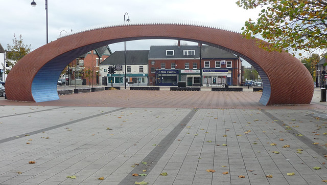
- Overview About Chester-le-Street Map Street View Chester-le-Street is a historic market town in County Durham, located about 4 miles north of Durham (city). It is situated on the River Wear, at …

Co-Curate Page
Edmondsley Township, 1848
- EDMONDSLEY, a township, in the parish and union of Chester-le-Street, Middle division of Chester ward, N. division of the county of Durham, 3 miles (S.W.) from Chester le-Street; containing 253 …

Co-Curate Page
Pelton district, 1848
- PELTON, an ecclesiastical district, in the parish and union of Chester-le-Street, Middle division of Chester ward, N. division of the county of Durham, 2 miles (W. by N.) from Chester-le-Street; …

Co-Curate Page
Waldridge Township, 1848
- Extract from: A Topographical Dictionary of England comprising the several counties, cities, boroughs, corporate and market towns, parishes, and townships..... 7th Edition, by Samuel Lewis, London, 1848. WALDRIDGE, a township, …

Co-Curate Page
Kibblesworth, 1848
- KIBBLESWORTH, a township, in the chapelry of Lamesley, parish and union of Chester-le-Street, Middle division of Chester ward, N. division of the county of Durham, 5 miles (S.) from Gateshead; …

Co-Curate Page
Urpeth Township, 1848
- Extract from: A Topographical Dictionary of England comprising the several counties, cities, boroughs, corporate and market towns, parishes, and townships..... 7th Edition, by Samuel Lewis, London, 1848. URPETH, a township, …

Co-Curate Page
Birtley Township (County Durham), 1848
- BIRTLEY, a township, in the parish and union of Chester-le-Street, Middle division of Chester ward, N. division of the county of Durham, 3 miles (N.) from Chester-le-Street; containing 1,759 inhabitants. …

Co-Curate Page
Tanfield, 1848
- TANFIELD, a chapelry, in the parish of Chester-le-Street, union of Lanchester, Middle division, of Chester ward, N. division of Durham, 7 miles (S.W.) from Gateshead; containing 3,000 inhabitants. This chapelry, …

Co-Curate Page
Ouston Township, County Durham, 1848
- OUSTON, a township, in the parish and union of Chester-le-Street, Middle division of Chester ward, N. division of the county of Durham, 3 miles (N.N.W.) from Chester-le-Street; containing 282 inhabitants. …
Co-Curate Page
Lintz Green
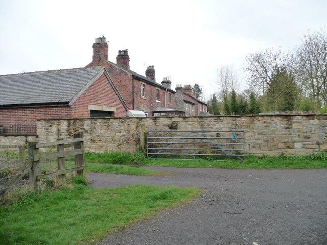
- Overview Map Lintz Green is a hamlet in County Durham which is situated beteen the villages of Hamsterly Colliery and Burnopfield. It is located about 11 miles north-west of Durham …
Co-Curate Page
Great Lumley
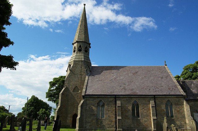
- Overview About Great Lumley Map Street View LUMLEY, GREAT, a township, in the parish and union of Chester-le-Street, N. division of Easington ward and of the county of Durham, 1½ …

Co-Curate Page
Little Lumley Township, 1848
- LUMLEY, LITTLE, a township, in the parish and union of Chester-le-Street, N. division of Easington ward and of the county of Durham, 1½ mile (S.E.) from Chester-le-Street; containing 381 inhabitants. …
Co-Curate Page
Harraton
- Overview About Harraton Map Street View Harraton is a district of Washington and within the City of Sunderland. Historically, Harraton was a village and township in the ancient Parish of …

Co-Curate Page
Ravensworth Township, 1848
- RAVENSWORTH, a township, in the chapelry of Lamesley, parish and union of Chester-le-Street, Middle division of Chester ward, N. division of the county of Durham, 4¼ miles (S.S.W.) from Gateshead; …

Co-Curate Page
Hedley, nr Marley Hill, County Durham
- Overview Map Street View Hedley is a former township in the chapelry of Lamesley, of the ancient parish of Chester-le-Street in County Durham. Hedley Hall Farm and cottages are in …
Co-Curate Page
Plawsworth Township, 1848
- PLAWSWORTH, a township, in the parish and union of Chester-le-Street, Middle division of Chester ward, N. division of the county of Durham, 2½ miles (S. by W.) from Chester-le-Street; containing …


Co-Curate Page
Chester-le-Street
- Overview About Chester-le-Street Map Street View Chester-le-Street is a historic market town in County Durham, located about 4 miles north of Durham (city). It is situated on the River Wear, at …

Co-Curate Page
Edmondsley Township, 1848
- EDMONDSLEY, a township, in the parish and union of Chester-le-Street, Middle division of Chester ward, N. division of the county of Durham, 3 miles (S.W.) from Chester le-Street; containing 253 …

Co-Curate Page
Pelton district, 1848
- PELTON, an ecclesiastical district, in the parish and union of Chester-le-Street, Middle division of Chester ward, N. division of the county of Durham, 2 miles (W. by N.) from Chester-le-Street; …

Co-Curate Page
Waldridge Township, 1848
- Extract from: A Topographical Dictionary of England comprising the several counties, cities, boroughs, corporate and market towns, parishes, and townships..... 7th Edition, by Samuel Lewis, London, 1848. WALDRIDGE, a township, …

Co-Curate Page
Kibblesworth, 1848
- KIBBLESWORTH, a township, in the chapelry of Lamesley, parish and union of Chester-le-Street, Middle division of Chester ward, N. division of the county of Durham, 5 miles (S.) from Gateshead; …

Co-Curate Page
Urpeth Township, 1848
- Extract from: A Topographical Dictionary of England comprising the several counties, cities, boroughs, corporate and market towns, parishes, and townships..... 7th Edition, by Samuel Lewis, London, 1848. URPETH, a township, …

Co-Curate Page
Birtley Township (County Durham), 1848
- BIRTLEY, a township, in the parish and union of Chester-le-Street, Middle division of Chester ward, N. division of the county of Durham, 3 miles (N.) from Chester-le-Street; containing 1,759 inhabitants. …

Co-Curate Page
Tanfield, 1848
- TANFIELD, a chapelry, in the parish of Chester-le-Street, union of Lanchester, Middle division, of Chester ward, N. division of Durham, 7 miles (S.W.) from Gateshead; containing 3,000 inhabitants. This chapelry, …

Co-Curate Page
Ouston Township, County Durham, 1848
- OUSTON, a township, in the parish and union of Chester-le-Street, Middle division of Chester ward, N. division of the county of Durham, 3 miles (N.N.W.) from Chester-le-Street; containing 282 inhabitants. …

Co-Curate Page
Lintz Green
- Overview Map Lintz Green is a hamlet in County Durham which is situated beteen the villages of Hamsterly Colliery and Burnopfield. It is located about 11 miles north-west of Durham …

Co-Curate Page
Great Lumley
- Overview About Great Lumley Map Street View LUMLEY, GREAT, a township, in the parish and union of Chester-le-Street, N. division of Easington ward and of the county of Durham, 1½ …

Co-Curate Page
Little Lumley Township, 1848
- LUMLEY, LITTLE, a township, in the parish and union of Chester-le-Street, N. division of Easington ward and of the county of Durham, 1½ mile (S.E.) from Chester-le-Street; containing 381 inhabitants. …

Co-Curate Page
Harraton
- Overview About Harraton Map Street View Harraton is a district of Washington and within the City of Sunderland. Historically, Harraton was a village and township in the ancient Parish of …

Co-Curate Page
Ravensworth Township, 1848
- RAVENSWORTH, a township, in the chapelry of Lamesley, parish and union of Chester-le-Street, Middle division of Chester ward, N. division of the county of Durham, 4¼ miles (S.S.W.) from Gateshead; …


