Topics > Civil Parishes in Cumbria > Lower Allithwaite Civil Parish > Cartmel Parish, 1848
Cartmel Parish, 1848
CARTMEL (St. Mary), a parish, in the union of Ulverston, hundred of Lonsdale north of the Sands, N. division of the county of Lancaster, containing 4,927 inhabitants: the town of Cartmel stands in the townships of Lower Allithwaite and Upper Holker, 14 miles (N.W. by N.) from Lancaster, and 254 (N.N.W.) from London. This place, which is supposed to have derived its name from the British words Kert, a camp, and mell, a fell, or small mountain, according to Camden was given to St. Cuthbert, in 677, by Egfrid, King of Northumbria, with all the Britons inhabiting it. In 782, Ethelred, upon his restoration to the throne of that kingdom, allured from their sanctuary at York the sons of Alfwold, who had been advanced to the crown upon his expulsion, and put them to death at Cartmel. In 1188, William Mareschall, Earl of Pembroke, founded a priory for Regular canons of the order of St. Augustine, dedicated to the Blessed Virgin, and endowed it with all his lands at "Kertmell," and with other possessions, besides many privileges, among which was the exclusive right of appointing guides to conduct travellers over the extensive sands that bound the parish on the south. The establishment, at the Dissolution, consisted of ten religious, and forty-eight servants, and the revenue was estimated at £212. 11. 10.: the conventual church, which was also parochial, was purchased by the parishioners.
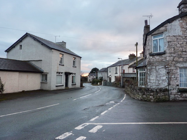
The town is situated in a vale surrounded by lofty hills of varied aspect, behind which the vast fells of Coniston rise majestically to the north; the houses, with the exception of a row erected some years since on the north side of the town, of modern and handsome appearance, are in general built of stone, rough-cast and white-washed. The environs abound with sceuery strikingly diversified by richly-wooded eminences and barren hills. The parish comprises the townships of Upper and Lower Allithwaite, East Broughton, Cartmel Fell, Upper and Lower Holker, and Staveley. It is bounded on the south by the bay of Morecambe, into which it extends for a considerable distance, and where, at low water, is a passage over the sands to Bolton. The longer course across is nine miles; the shorter, along that part called the Leven sands, is four: guides are usually waiting to conduct over both. The district abounds with rocks of limestone and marble, but very little trade is carried on; there are cotton-mills at Upper Holker. The market is on Tuesday: fairs are held on Whit-Monday and the Monday after October 23rd; and cattle-fairs on the Wednesday before Easter, and November 5th.
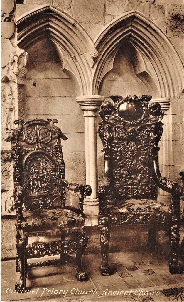
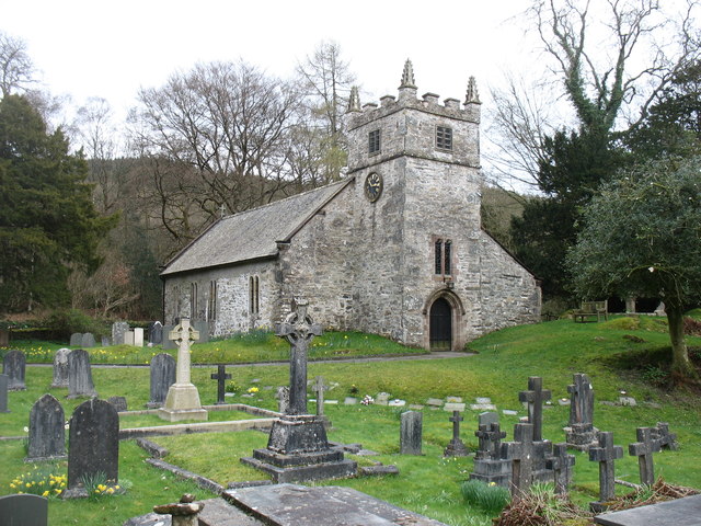
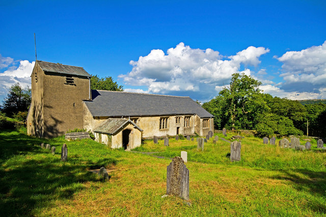
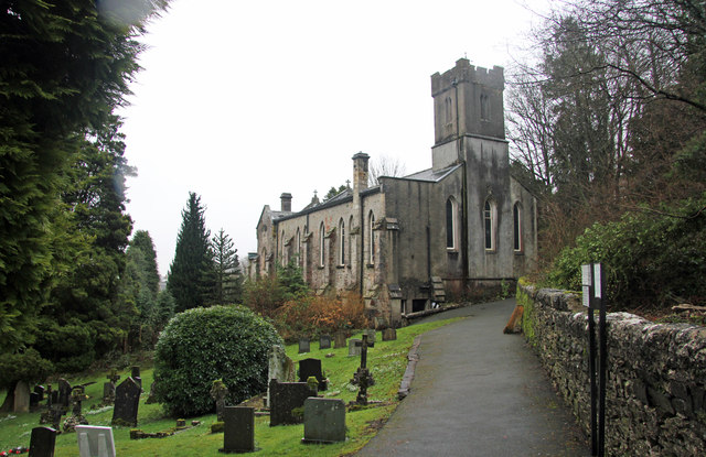
The living is a perpetual curacy, in the gift of the Earl of Burlington, with a net income of £113: the tithes were commuted for land in 1796. The church is a spacious cruciform structure, in the early English style, with a curious tower. After having been suffered to remain in a state of neglect for nearly a century from the dissolution of the priory, during which time the conventual buildings had been removed, it was substantially repaired, in 1640, by George Preston, of Holker. The chancel contains some richly-carved stalls and fine tabernacle work: on the north side of the altar is the tomb of William de Walton, one of the priors, and on the opposite side a magnificent altar-tomb with recumbent figures of one of the Harringtons and his lady, supposed to be Sir John Harrington, who accompanied Edward I. into Scotland; besides many other monuments. The Earl of Burlington also presents to the incumbencies of Broughton, Cartmel-Fell, Flookborough, Lindale, and Staveley. The free grammar school, built in 1790, in Upper Holker township, is supported by an endowment of £125 per annum, arising from donations and legacies. Dr. Edmund Law, Bishop of Carlisle, whose father was curate of one of the chapels in the parish for forty-nine years, received the rudiments of his education in the school. In a wood in the vicinity, about forty years ago, 680 Roman coins were dug up, dated from 193 to 253; and at Broughton, a coin of the Emperor Adrian has been discovered. Three miles to the south of the town is a spring, called Holy Well, the water of which is efficacious in gout, and in nephritic and cutaneous diseases; and at Pit Farm, in the parish, is an intermitting spring.
Extract from: A Topographical Dictionary of England comprising the several counties, cities, boroughs, corporate and market towns, parishes, and townships..... 7th Edition, by Samuel Lewis, London, 1848.
Co-Curate Page
Cartmel
- Overview About Cartmel Map Street View Cartmel is a village in Cumbria, England, 2.2 miles (3.5 km) north-west of Grange-over-Sands close to the River Eea. The village, once known as …
Co-Curate Page
Allithwaite
- Overview About Allithwaite Map Street View Allithwaite is a small village in Cumbria, England, located roughly 1.2 miles (1.9 km) west of Grange-over-Sands. Most of its residents commute to local …
Co-Curate Page
Staveley-in-Cartmel
- Overview About Staveley-in-Cartmel Map Street View Staveley-in-Cartmel is a village in the South Lakeland district of Cumbria, located about 9 miles south-west of Kendal. It lies just under half a …
Co-Curate Page
Cartmel Fell
- Overview About Cartmel Fell Map Street View Cartmel Fell is a hamlet in the South Lakeland district of Cumbria, which along with the wider area, forms Cartmel Fell Civil Parish. …

Co-Curate Page
East Broughton, 1848
- BROUGHTON, EAST, a chapelry, in the parish of Cartmel, union of Ulverston, hundred of Lonsdale north of the Sands, N. division of the county of Lancaster, 2 miles (N. by …
Co-Curate Page
Upper Allithwaite Township, 1848
- ALLITHWAITE, UPPER, a township, in the parish of Cartmel, union of Ulverston, hundred of Lonsdale north of the Sands, N. division of the county of Lancaster, 3¼ miles (N.E.) from …
Co-Curate Page
Cartmel Fell, Chapelry, 1848
- CARTMEL-FELL, a chapelry, in the parish of Cartmel, union of Ulverston, hundred of Lonsdale north of the Sands, N. division of the county of Lancaster, 8 miles (W.S.W.) from Kendal; …
Co-Curate Page
Lower Allithwaite Township, 1848
- ALLITHWAITE, LOWER, a township, in the parish of Cartmel, union of Ulverstone, hundred of Lonsdale north of the Sands, N. division of the county of Lancaster, 2 miles (S.) from …
from https://www.familysearch.org/…
Cartmel, Lancashire Genealogy
- "Guide to Cartmel, Lancashire ancestry, family history, and genealogy: parish register transcripts, census records, birth records, marriage records, and death records. See also Cartmel Fell, a chapel of ease serving …
Added by
Edmund Anon
Co-Curate Page
Lindale
- Overview About Lindale Map Street View LINDALE, a chapelry, in the township of Upper Allithwaite, parish of Cartmel, union of Ulverston, hundred of Lonsdale north of the Sands, N. division …
Co-Curate Page
Lower Holker, 1848
- HOLKER, LOWER, a township, in the parish of Cartmel, union of Ulverston, hundred of Lonsdale north of the Sands, N. division of the county of Lancaster, 1¾ mile (S.W.) from …

Co-Curate Page
Upper Holker
- HOLKER UPPER, a township, in the parish of Cartmel, union of Ulverston, hundred of Lonsdale north of the Sands, N. division of the county of Lancaster, 1¾ mile (N. by …

Co-Curate Page
Cartmel
- Overview About Cartmel Map Street View Cartmel is a village in Cumbria, England, 2.2 miles (3.5 km) north-west of Grange-over-Sands close to the River Eea. The village, once known as …
Co-Curate Page
Allithwaite
- Overview About Allithwaite Map Street View Allithwaite is a small village in Cumbria, England, located roughly 1.2 miles (1.9 km) west of Grange-over-Sands. Most of its residents commute to local …
Co-Curate Page
Staveley-in-Cartmel
- Overview About Staveley-in-Cartmel Map Street View Staveley-in-Cartmel is a village in the South Lakeland district of Cumbria, located about 9 miles south-west of Kendal. It lies just under half a …
Co-Curate Page
Cartmel Fell
- Overview About Cartmel Fell Map Street View Cartmel Fell is a hamlet in the South Lakeland district of Cumbria, which along with the wider area, forms Cartmel Fell Civil Parish. …
Co-Curate Page
East Broughton, 1848
- BROUGHTON, EAST, a chapelry, in the parish of Cartmel, union of Ulverston, hundred of Lonsdale north of the Sands, N. division of the county of Lancaster, 2 miles (N. by …
Co-Curate Page
Upper Allithwaite Township, 1848
- ALLITHWAITE, UPPER, a township, in the parish of Cartmel, union of Ulverston, hundred of Lonsdale north of the Sands, N. division of the county of Lancaster, 3¼ miles (N.E.) from …
Co-Curate Page
Cartmel Fell, Chapelry, 1848
- CARTMEL-FELL, a chapelry, in the parish of Cartmel, union of Ulverston, hundred of Lonsdale north of the Sands, N. division of the county of Lancaster, 8 miles (W.S.W.) from Kendal; …
Co-Curate Page
Lower Allithwaite Township, 1848
- ALLITHWAITE, LOWER, a township, in the parish of Cartmel, union of Ulverstone, hundred of Lonsdale north of the Sands, N. division of the county of Lancaster, 2 miles (S.) from …
from https://www.familysearch.org/…
Cartmel, Lancashire Genealogy
- "Guide to Cartmel, Lancashire ancestry, family history, and genealogy: parish register transcripts, census records, birth records, marriage records, and death records. See also Cartmel Fell, a chapel of ease serving …
Added by
Edmund Anon
Co-Curate Page
Lindale
- Overview About Lindale Map Street View LINDALE, a chapelry, in the township of Upper Allithwaite, parish of Cartmel, union of Ulverston, hundred of Lonsdale north of the Sands, N. division …
Co-Curate Page
Lower Holker, 1848
- HOLKER, LOWER, a township, in the parish of Cartmel, union of Ulverston, hundred of Lonsdale north of the Sands, N. division of the county of Lancaster, 1¾ mile (S.W.) from …


