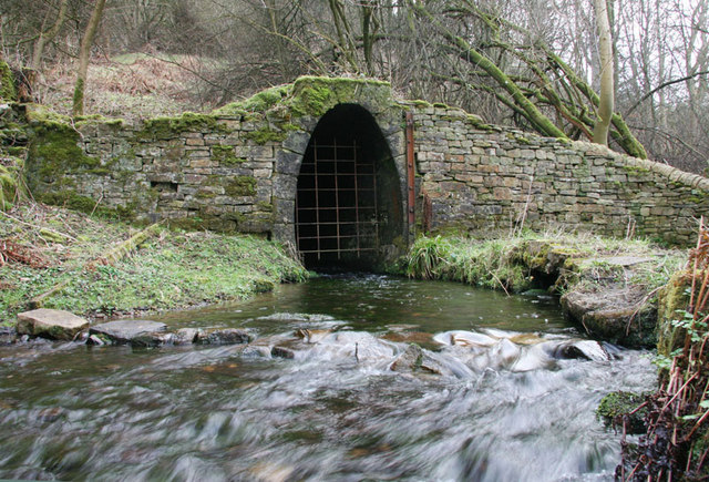
Blackett Level portal


-
Description
"A strong flow of water drains from the mouth of Blackett Level. This was a drainage and exploration level designed to run from Allendale to connect with the Gin Hill Shaft in Allenheads, to dewater the Allenheads mine and search for new mineral veins in the intervening ground. It was a major undertaking but lead prices slumped, Allenheads Mine closed and the driving was left off just past Spartylea. Veins worth working were discovered at Sipton and St Peter's and these were exploited until 1946 when both mines closed." Photo by Helen Wilkinson, 2009. -
Owner
Helen Wilkinson -
Source
Geograph (Geograph) -
License
What does this mean? Creative Commons License
-
Further information
Link: http://www.geograph.org.uk/photo/1182864
Resource type: Image
Added by: Pat Thomson
Last modified: 2 years ago
Viewed: 451 times
Picture Taken: 2009-02-28 -
Co-Curate tags


