Blackett Level Portal

-
Description
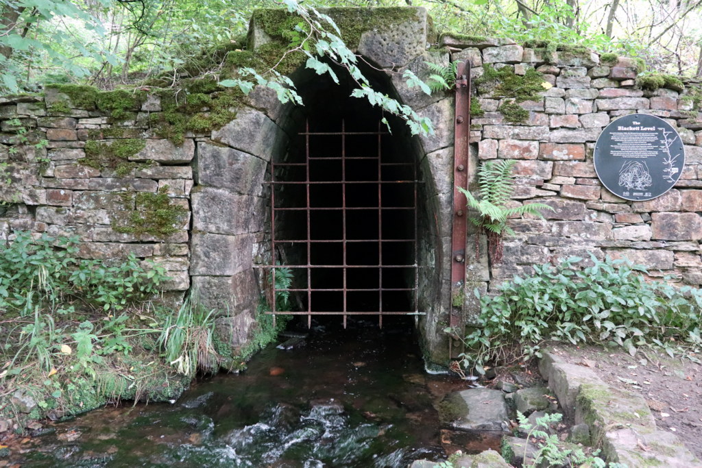
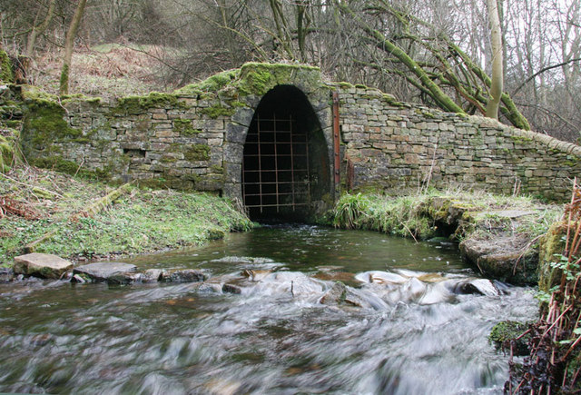
WB Lead's Blackett Level Project was designed to explore lead veins along the East Allen valley and also to provide drainage of the mines at Allenheads. From its entrance in Allendale, shafts along its proposed course were opened at Studdon, Holms Linn, Sipton and Bracken Holm. Sinking of the shaft at Holms Linn at the hands of its chief engineer, Thomas Sopwith, commenced in 1855. The portal at Allendale was constructed four years later, in 1859. The accuracy of planning of the level was demonstrated as a pin-hole of light from the entrance could be seen near Holms Linn, two miles distant. The project eventually proved to be a failure as the level never reached Allenheads, and apart from an area at Sipton, few profitable deposits of lead-ore were discovered. In addition, cheap sources of lead from overseas in the late 19th century made home production of lead relatively uneconomic. Photo by Andrew Curtis, 15 September, 2022. Geograph, CC-BY-SA 2.0 -
Owner
Geograph -
Source
Local (Co-Curate) -
License
What does this mean? Unknown license check permission to reuse
-
Further information
Link: https://www.geograph.org.uk/photo/7285287
Resource type: Text/Website
Added by: Simon Cotterill
Last modified: 1 month, 1 week ago
Viewed: 71 times
Picture Taken: Unknown -
Co-Curate tags


