Topics > Geography > Rivers > River Allen > River East Allen > Philip Burn (trib. River East Allen)
Philip Burn (trib. River East Allen)
Philip Burn is a small river which flows westwards through Allendale Town, where it joins the River East Allen. The Blackett Level, which drains former lead mines, feeds into Philip Burn close to it's confluence with the East Allen.
Co-Curate Page
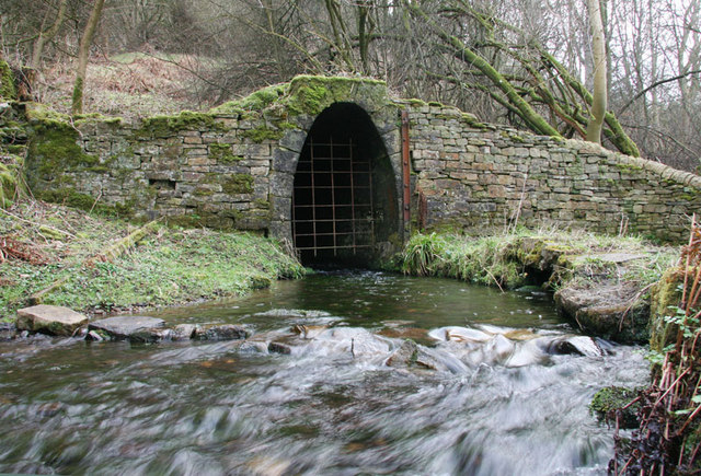
Blackett Level
- Map showing the location of the Blackett Level Portal in Allendale Town. The Blackett Level is a historic 4½ mile-long subterranean lead mine drainage tunnel and exploration adit in the …

from https://www.geograph.org.uk/p…
Waterfall on Philip Burn
- Photo by Mike Quinn, 5 December, 2007. Geograph, CC-BY-SA
Added by
Simon Cotterill
from https://www.geograph.org.uk/p…
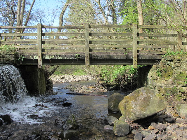
Footbridge over Philip Burn
- The water pouring into the burn on the left is from the Blackett Level.The River East Allen can be seen beyond the footbridge. Photo by Mike Quinn, 15 April, 2017. …
Added by
Simon Cotterill

from https://www.geograph.org.uk/p…
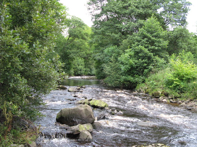
The Philip Burn in Deneholme Wood (5)
- Photo by Mike Quinn, 23 November, 2016, Geograph CC-BY-SA 2.0
Added by
Simon Cotterill
Co-Curate Page
Allendale Town
- Overview About Allendale Allendale in 1833 Map Street View What was written about Allendale in 1833: ALLENDALE a parochial chapelry in Northumberland with a population of 5540 inhabitants in …

Co-Curate Page
Blackett Level
- Map showing the location of the Blackett Level Portal in Allendale Town. The Blackett Level is a historic 4½ mile-long subterranean lead mine drainage tunnel and exploration adit in the …
from https://www.geograph.org.uk/p…
Waterfall on Philip Burn
- Photo by Mike Quinn, 5 December, 2007. Geograph, CC-BY-SA
Added by
Simon Cotterill
from https://www.geograph.org.uk/p…
Footbridge over Philip Burn
- The water pouring into the burn on the left is from the Blackett Level.The River East Allen can be seen beyond the footbridge. Photo by Mike Quinn, 15 April, 2017. …
Added by
Simon Cotterill
from https://www.geograph.org.uk/p…
The Philip Burn in Deneholme Wood (5)
- Photo by Mike Quinn, 23 November, 2016, Geograph CC-BY-SA 2.0
Added by
Simon Cotterill