Topics > Historical Periods > 19th Century > 1870s > 1879
1879
In Northern England:
- 3rd February 1879; Mosley Street was the worlds first public road to be lit by the incandescent light bulb.
- 17th October 1879; Sunderland Association Football Club founded by schoolmaster James Allan.
- 1879; the Winter Gardens open in Sunderland
from Newcastle libraries (flickr)
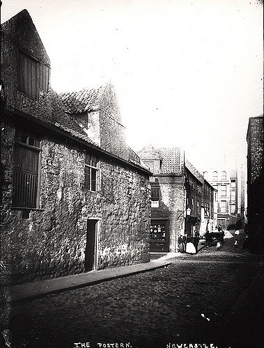
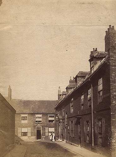
003970:The Postern Newcastle upon Tyne 1879
Pinned by Simon Cotterill
from Newcastle libraries (flickr)
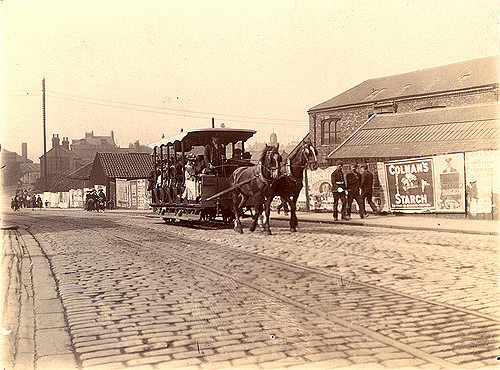
035438:Horse-drawn tram Station Road South Shields Unknown 1879
Pinned by Simon Cotterill

from Newcastle libraries (flickr)
071373:Baptist Chapel Tuthill Stairs Newcastle upon Tyne Unknown 1879
Pinned by Simon Cotterill
from Newcastle libraries (flickr)
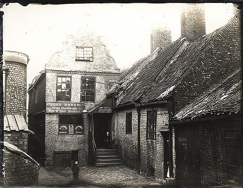
001516:Stone Cellers Inn St Lawrence Unknown 1879?
Pinned by Simon Cotterill
from Newcastle libraries (flickr)
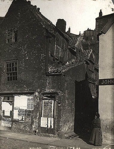
004214:Tuthill Stairs The Close Newcastle upon Tyne 1879
Pinned by Simon Cotterill
from Newcastle libraries (flickr)
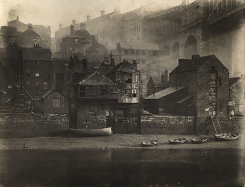
001159:Black-and-white photograph of Gateshead riverside by the High Level Bridge taken around 1879
Pinned by Simon Cotterill
from Newcastle libraries (flickr)
003957:Hanover Square Newcastle upon Tyne 1879
Pinned by Simon Cotterill
Co-Curate Page
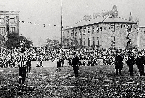
Sunderland AFC
- Overview History Sunderland Association Football Club was founded on 17th October 1879 by schoolmaster James Allan, originally under the name of 'Sunderland and District Teachers A.F.C.'. Sunderland first joined the …
Co-Curate Page
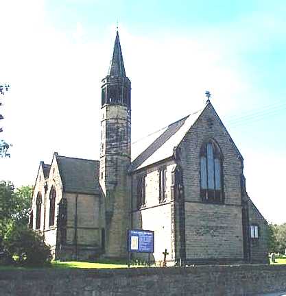
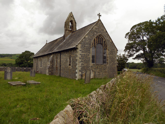
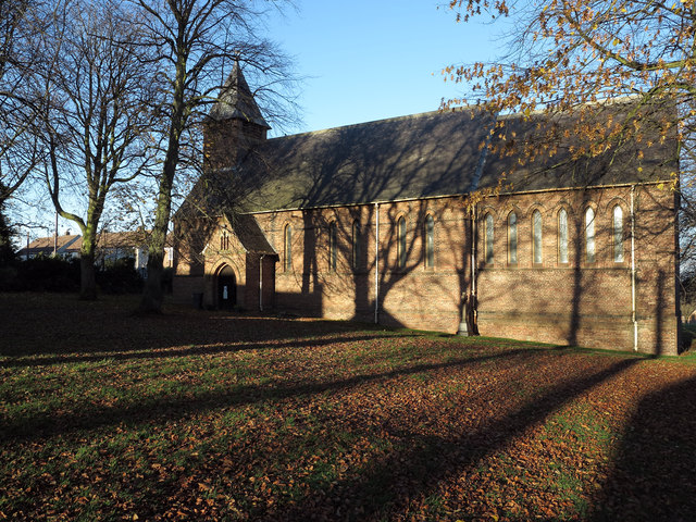
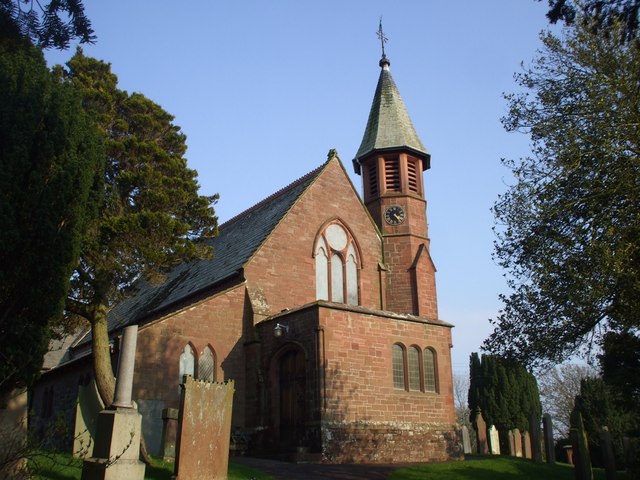
St George's Church, Harraton / Fatfield
- Overview Map Street View St George's Church is located on Vigo Lane, Harraton, Washington; close to Fatfield. The church was built in 1879 by Austin & Johnson. The church has …
Co-Curate Page
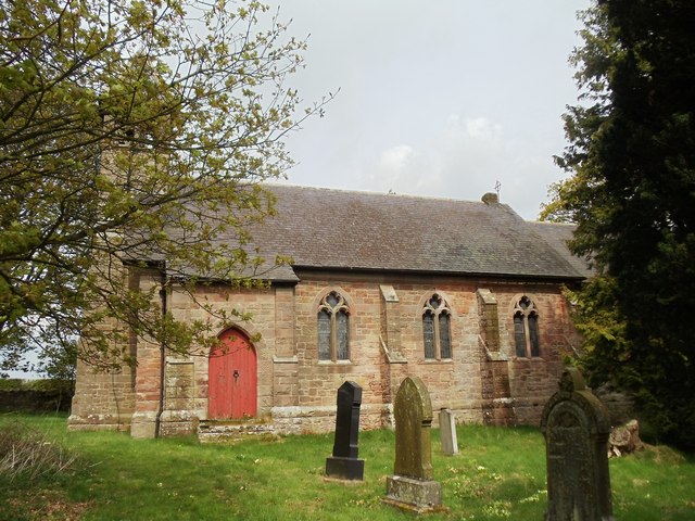
Former Church of All Saints, Duddo
- Overview Map Street View The former Parish Church of Duddo is located approximately half a mile north-west of the village. It was built in 1879 by F.R. Wilson of Alnwick.[1] The …
Co-Curate Page
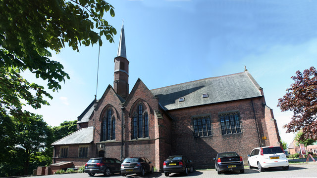
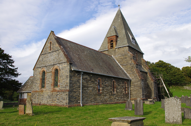
Church of St Paul, West Pelton
- Overview Map Street View St Paul's is a parish church, located on St Paul's Terrace in West Pelton, County Durham. The church was built in 1879 by Austin, Johnson and …
Co-Curate Page
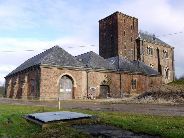
Dalton Pumping Station
- Overview Map Street View Dalton Water Pumping Station was built 1873-1879 by Thomas Hawksley in Venetian Gothic Revival style.[1] It is located in Cold Hesledon, near Dalton-le-Dale. The engine house …
Co-Curate Page
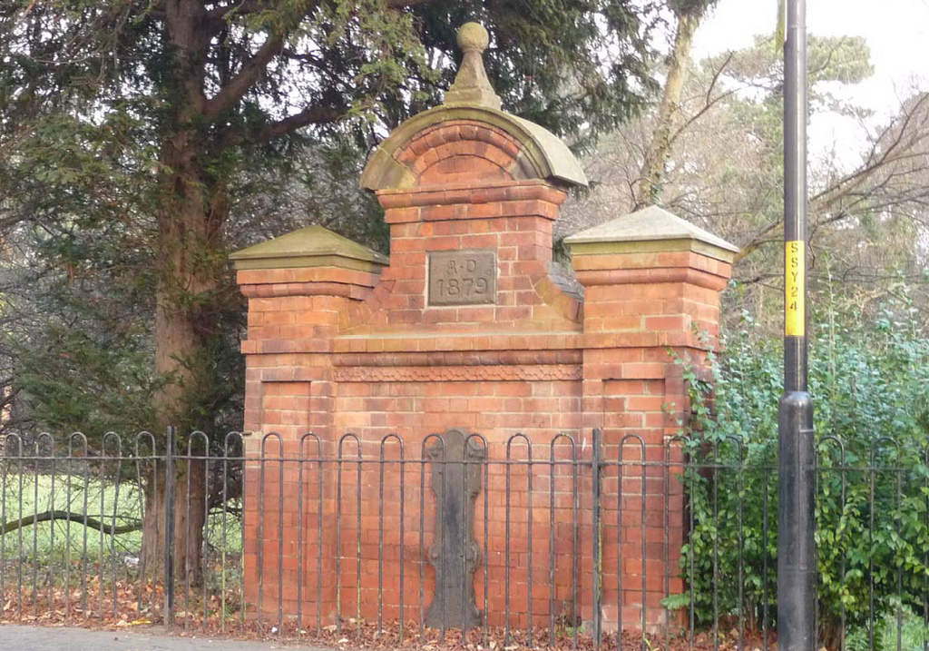
Drinking Fountain, Stokesley Road, Marton
- Overview Map Street View Dated 1879 and located on Stokesley Road, opposite St Cuthbert’s Church, and at the south-west corner of Stewart Park in Marton. The drinking fountain was built …
Co-Curate Page
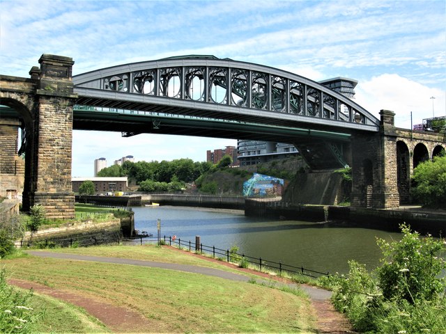
Monkwearmouth Railway Bridge
- Overview About Monkwearmouth Railway Bridge Map Street View Monkwearmouth Railway Bridge (officially Monkwearmouth Bridge, also called Wearmouth Railway Bridge or Sunderland Railway Bridge) is a railway bridge built in …
Co-Curate Page
Church of Holy Ghost, Middleton
- Overview Map Street View The Church of the Holy Ghost at Middleton in Cumbria was built from 1878 to 1879, designed by C.J. Ferguson.[1] It replaced an earlier church on this …
Co-Curate Page
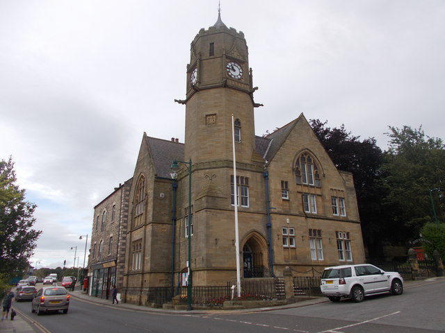
Loftus Town Hall
- Overview Map Street View The Town Hall is located on the High Street in Loftus. It was originally built for the Earl of Zetland and opened in 1879. The building …
Co-Curate Page
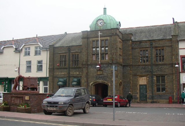
Old Town Hall, Millom
- The old town hall in Millom has a distinctive clocktower and overlooks the Market Square. The town hall was built in 1879. It's tower was reduced in height in the …
Co-Curate Page
Former Allendale First School
- Allendale First School closed in August 2013 when Allendale and the wider area switched from a three-tier to a two-tier education system. The children transfered to Allendale Primary School. The …

Co-Curate Page
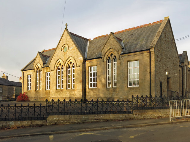
Rosa Street Primary School, Spennymoor
- Overview Map Street View Rosa Street Primary School is located in Spennymoor. The school became an academy in 2014 under Cleves Cross Learning Trust. The school has about 190 pupils …

Co-Curate Page
Dryderdale
- Overview Map Dryderdale Hall is located off Shull Bank (west side), about 2 miles north-west of Hamsterley in County Durham. It is dated 1879, designed in a French Renaissance style …

from Newcastle libraries (flickr)
003970:The Postern Newcastle upon Tyne 1879
Pinned by Simon Cotterill
from Newcastle libraries (flickr)
035438:Horse-drawn tram Station Road South Shields Unknown 1879
Pinned by Simon Cotterill
from Newcastle libraries (flickr)
071373:Baptist Chapel Tuthill Stairs Newcastle upon Tyne Unknown 1879
Pinned by Simon Cotterill
from Newcastle libraries (flickr)
001516:Stone Cellers Inn St Lawrence Unknown 1879?
Pinned by Simon Cotterill
from Newcastle libraries (flickr)
004214:Tuthill Stairs The Close Newcastle upon Tyne 1879
Pinned by Simon Cotterill
from Newcastle libraries (flickr)
001159:Black-and-white photograph of Gateshead riverside by the High Level Bridge taken around 1879
Pinned by Simon Cotterill
from Newcastle libraries (flickr)
003957:Hanover Square Newcastle upon Tyne 1879
Pinned by Simon Cotterill
Co-Curate Page
Sunderland AFC
- Overview History Sunderland Association Football Club was founded on 17th October 1879 by schoolmaster James Allan, originally under the name of 'Sunderland and District Teachers A.F.C.'. Sunderland first joined the …
Co-Curate Page
St George's Church, Harraton / Fatfield
- Overview Map Street View St George's Church is located on Vigo Lane, Harraton, Washington; close to Fatfield. The church was built in 1879 by Austin & Johnson. The church has …
Co-Curate Page
Former Church of All Saints, Duddo
- Overview Map Street View The former Parish Church of Duddo is located approximately half a mile north-west of the village. It was built in 1879 by F.R. Wilson of Alnwick.[1] The …
Co-Curate Page
Church of St Paul, West Pelton
- Overview Map Street View St Paul's is a parish church, located on St Paul's Terrace in West Pelton, County Durham. The church was built in 1879 by Austin, Johnson and …
Co-Curate Page
Dalton Pumping Station
- Overview Map Street View Dalton Water Pumping Station was built 1873-1879 by Thomas Hawksley in Venetian Gothic Revival style.[1] It is located in Cold Hesledon, near Dalton-le-Dale. The engine house …
Co-Curate Page
Drinking Fountain, Stokesley Road, Marton
- Overview Map Street View Dated 1879 and located on Stokesley Road, opposite St Cuthbert’s Church, and at the south-west corner of Stewart Park in Marton. The drinking fountain was built …
Co-Curate Page
Monkwearmouth Railway Bridge
- Overview About Monkwearmouth Railway Bridge Map Street View Monkwearmouth Railway Bridge (officially Monkwearmouth Bridge, also called Wearmouth Railway Bridge or Sunderland Railway Bridge) is a railway bridge built in …
Co-Curate Page
Church of Holy Ghost, Middleton
- Overview Map Street View The Church of the Holy Ghost at Middleton in Cumbria was built from 1878 to 1879, designed by C.J. Ferguson.[1] It replaced an earlier church on this …
Co-Curate Page
Loftus Town Hall
- Overview Map Street View The Town Hall is located on the High Street in Loftus. It was originally built for the Earl of Zetland and opened in 1879. The building …
Co-Curate Page
Old Town Hall, Millom
- The old town hall in Millom has a distinctive clocktower and overlooks the Market Square. The town hall was built in 1879. It's tower was reduced in height in the …
Co-Curate Page
Former Allendale First School
- Allendale First School closed in August 2013 when Allendale and the wider area switched from a three-tier to a two-tier education system. The children transfered to Allendale Primary School. The …
Co-Curate Page
Rosa Street Primary School, Spennymoor
- Overview Map Street View Rosa Street Primary School is located in Spennymoor. The school became an academy in 2014 under Cleves Cross Learning Trust. The school has about 190 pupils …