Topics > Historical Periods > 19th Century > 1870s > 1878
1878
In Northern England:
- 30th April 1878; opening of the Armstrong Bridge which spans Jesmond Dene.
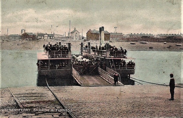
- 30th June 1878; the Walney Ferry, run by the Furness Railway Company, runs for the first time.
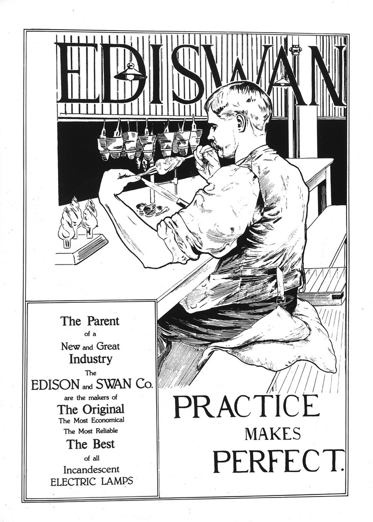
- 18th December 1878; Joseph Swan first demonstrated his incandescent light bulb in Newcastle.

Co-Curate Page
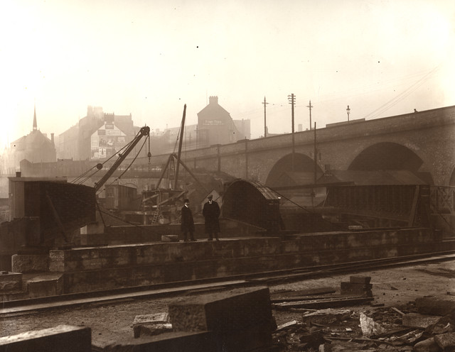
Armstrong Bridge
- Overview Map Armstrong Bridge is an iron bridge which spans Jesmond Dene. Originally open to traffic it is now restricted to pedestrians. The bridge hosts an arts and crafts fair …
Co-Curate Page
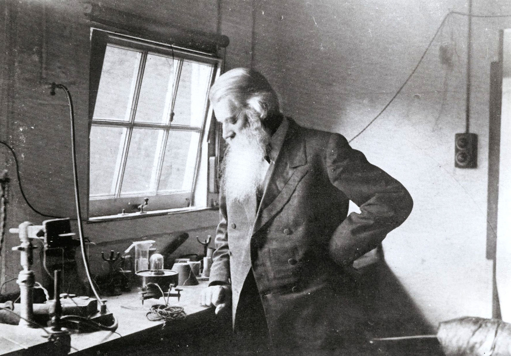
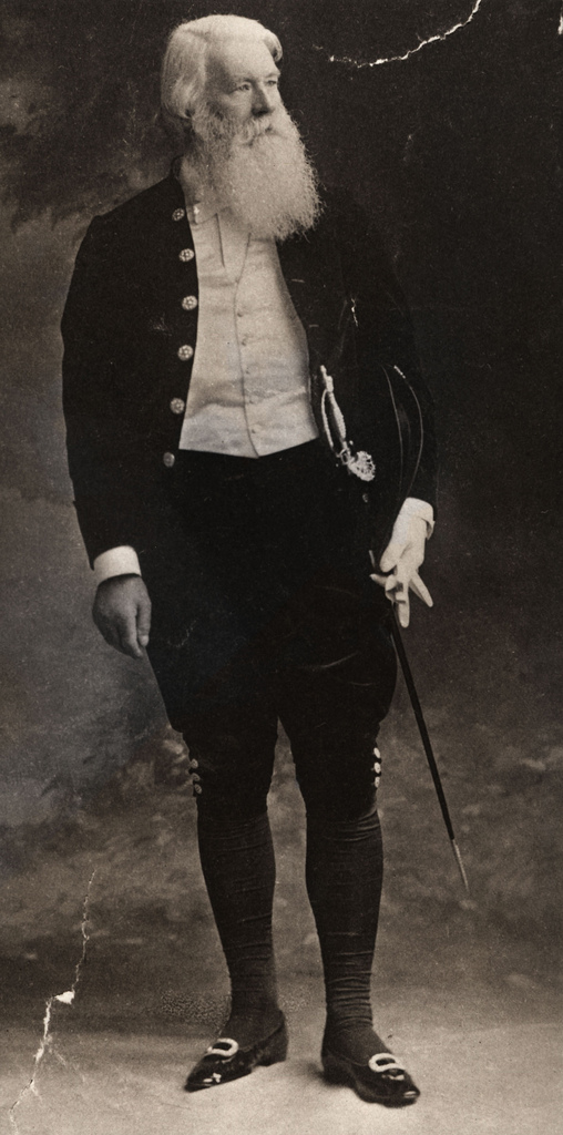
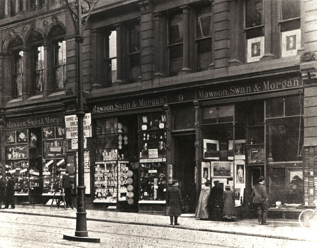
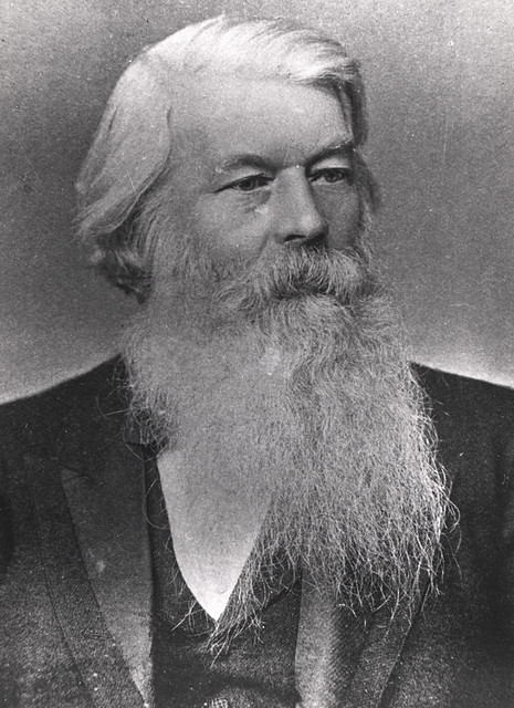
Joseph Swan (1828 -1914)
- Overview About Joseph Swan Joseph Swan was born in Bishopwearmouth on 31st October 1828. He was a physicist, chemist and inventor. He became a partner in Mawson, Swan and Morgan …
Co-Curate Page
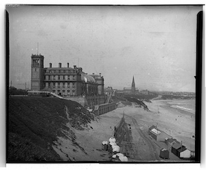
Tynemouth Plaza (1878 - 1996)
- Tynemouth Plaza was a prominent building which overlooked Tynemouth Long Sands, it was destroyed by a fire on the 10th February 1996. The building was opened in 1878 as 'Tynemouth Aquarium …
Co-Curate Page
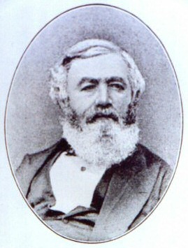
Henry Bolckow (1806-1878)
- Summary About Henry Bolckow Henry Bolckow, born 8th December 1806, is considered to be one of the founders of modern Middlesbrough. He was a successful industrialist, who founded the Bolckow …
Co-Curate Page
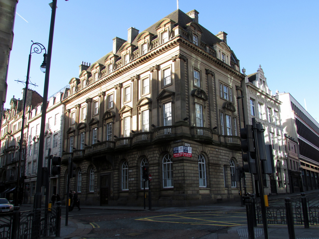
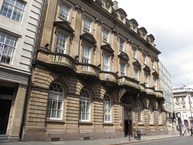
No. 2 Collingwood Street
- The Northern Assurance Building (No. 2 Collingwood Street, Newcastle) was built in 1878 by Austin, Johnson & Hicks [1]. It is located on the corner of Collingwood Street and Groat Market. …

Co-Curate Page
Church of All Saints, Great Stainton
- Overview Map All Saints - the parish church at Great Stainton stands on the site of a medieval church dating back to at least the 12th century. It was rebuilt …
Co-Curate Page
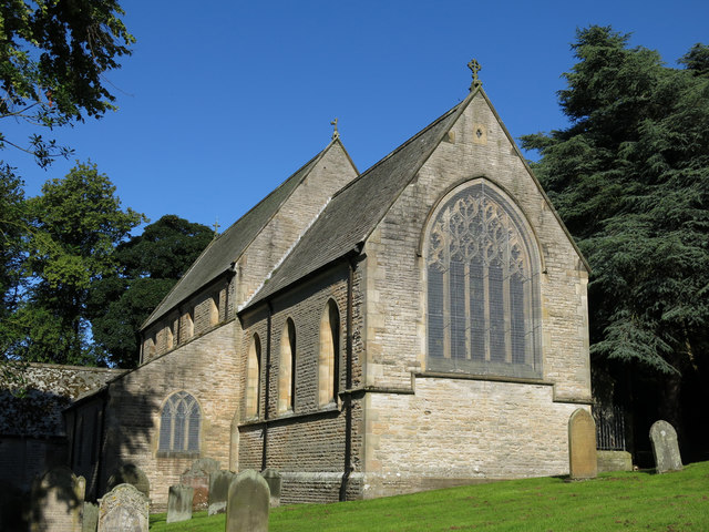
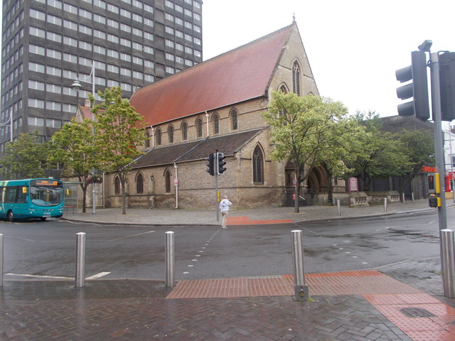
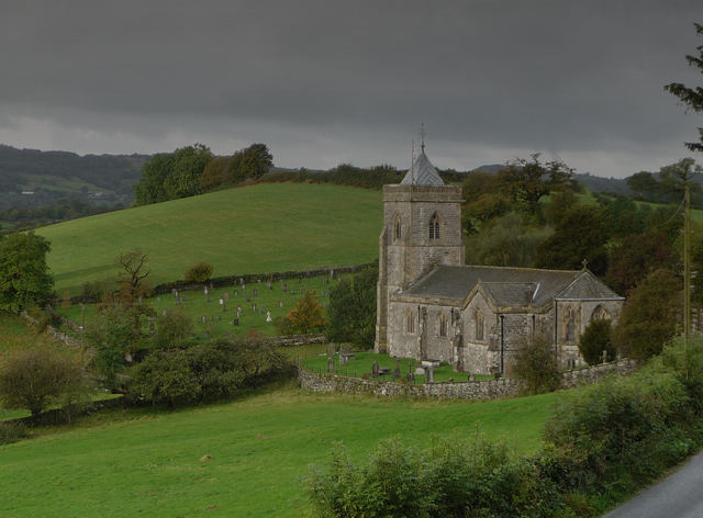
Church of St Mary
- Overview Map Street View Inside The Church of St Mary in Middleton-in-Teesdale was built in 1878 by C. Hodgson Fowler, on the site of a 13th century church.[1] The church has …
Co-Curate Page
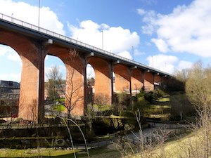
Byker Bridge
- Overview About Byker Bridge Map Street View The Byker Bridge is a 344.65m (1130 ft) long road bridge that carries the A193 road over the River Ouseburn in Newcastle …
Co-Curate Page
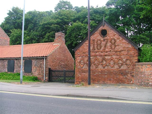
Danby House and Blacksmith’s Forge
- Overview Map Street View Danby House at 321 Acklam Road, is a former small holding and part of the former village of Acklam, before it became part of Middlesbrough. It …
Co-Curate Page
All Saints Church
- Overview Map Street View All Saints Church is located on the corner of Grange Road and Linthorpe Road in Middlesbrough. The church was built 1873 - 1878, designed by G.E. Street. …

Co-Curate Page
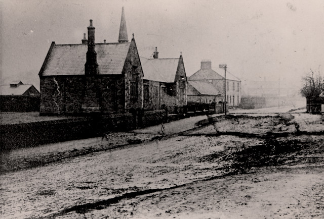
Arlecdon Primary School
- Overview Map Street View Arlecdon Primary School in Arlecdon has about 60 pupils from ages 2 to 11. The school building dates from 1878, when Arlecdon Board School was established.[1] It …
Co-Curate Page
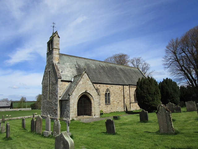
Church of John the Baptist, Croglin
- Overview Map Street View John the Baptist's Church in Croglin, Cumbria, was built in 1878 by J. Howison of Edinburgh, on the site of an earlier medieval church. The Church …
Co-Curate Page
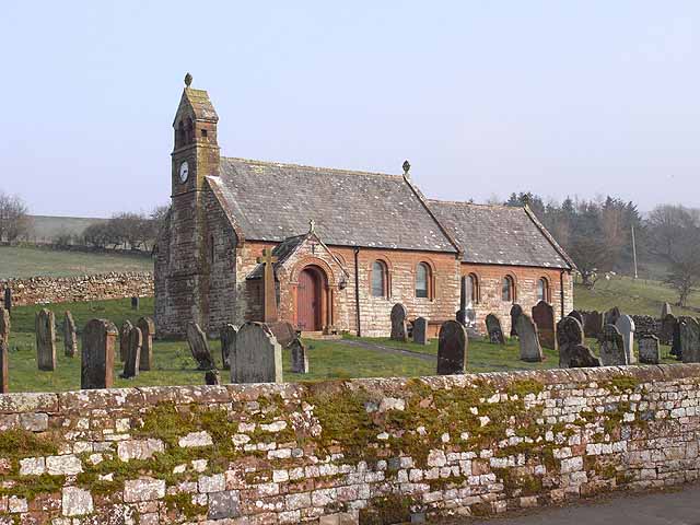
Church of St Mary, Hutton Magna
- Overview Map St Mary's is the Parish Church in Hutton Magna. The present church was built in 1878 by Austin, Johnson and Hicks, incorporating some features from the earlier 12th …
Co-Curate Page
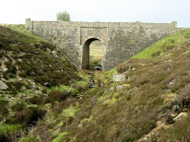
Bridge over Sipton Burn on the Long Drag
- Overview Map This bridge, dated 1878 and inscribed with the initials W.B.B., carries the Long Drag (road) over Sipton Burn. It is located about a mile north-east of Spartylea. The …
Co-Curate Page
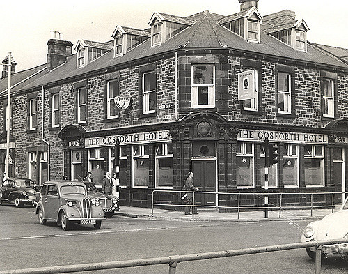
The Gosforth Hotel
- Overview Map Street View The Gosforth Hotel is a public house, located on the High Street, by the junction with Salters Road in Gosforth. It was built in 1878 and …
Co-Curate Page
Walney Ferry
- Historically, there were several fords and roads across the Walney Channel, passable at low tide, connecting Walney Island to Barrow Island and Piel Island. However, most of these became impassable …
Co-Curate Page
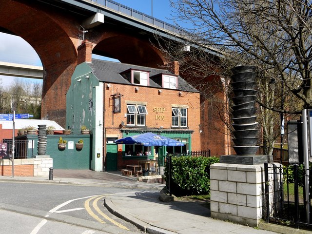
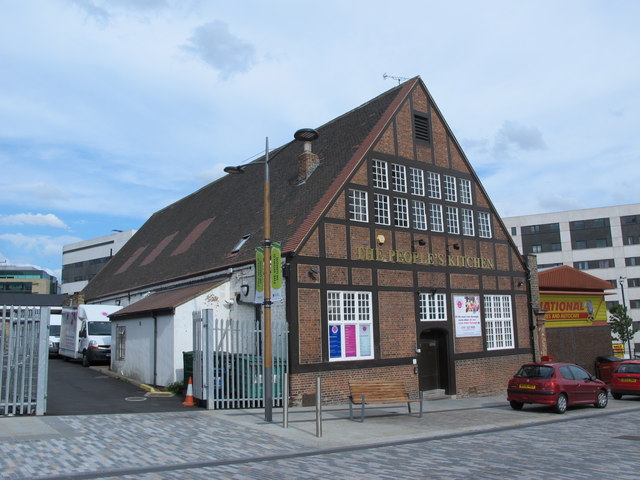
The People's Kitchen
- Overview Map Street View The People's Kitchen is located on Bath Lane / Wellington Street in Newcastle, by Newcastle Helix. This timber-framed building was originally a non-conformist church - a …
Co-Curate Page
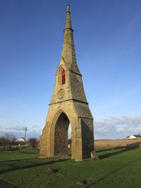
Cemetery Spire, Amble
- Overview Map Street View East Cemetery is located off Links Road in Amble. The spire here is a prominent local land mark. It was built in 1878 and was originally …
Co-Curate Page
Bardon Mill Pottery
- Overview Map Street View Errington Reay & Co. Ltd (aka Bardon Mill Pottery) is a family-run business, and the sole remaining UK commercial producer of salt-glazed pottery, selling directly from …

Co-Curate Page
Armstrong Bridge
- Overview Map Armstrong Bridge is an iron bridge which spans Jesmond Dene. Originally open to traffic it is now restricted to pedestrians. The bridge hosts an arts and crafts fair …
Co-Curate Page
Joseph Swan (1828 -1914)
- Overview About Joseph Swan Joseph Swan was born in Bishopwearmouth on 31st October 1828. He was a physicist, chemist and inventor. He became a partner in Mawson, Swan and Morgan …
Co-Curate Page
Tynemouth Plaza (1878 - 1996)
- Tynemouth Plaza was a prominent building which overlooked Tynemouth Long Sands, it was destroyed by a fire on the 10th February 1996. The building was opened in 1878 as 'Tynemouth Aquarium …
Co-Curate Page
Henry Bolckow (1806-1878)
- Summary About Henry Bolckow Henry Bolckow, born 8th December 1806, is considered to be one of the founders of modern Middlesbrough. He was a successful industrialist, who founded the Bolckow …
Co-Curate Page
No. 2 Collingwood Street
- The Northern Assurance Building (No. 2 Collingwood Street, Newcastle) was built in 1878 by Austin, Johnson & Hicks [1]. It is located on the corner of Collingwood Street and Groat Market. …
Co-Curate Page
Church of All Saints, Great Stainton
- Overview Map All Saints - the parish church at Great Stainton stands on the site of a medieval church dating back to at least the 12th century. It was rebuilt …
Co-Curate Page
Church of St Mary
- Overview Map Street View Inside The Church of St Mary in Middleton-in-Teesdale was built in 1878 by C. Hodgson Fowler, on the site of a 13th century church.[1] The church has …
Co-Curate Page
Byker Bridge
- Overview About Byker Bridge Map Street View The Byker Bridge is a 344.65m (1130 ft) long road bridge that carries the A193 road over the River Ouseburn in Newcastle …
Co-Curate Page
Danby House and Blacksmith’s Forge
- Overview Map Street View Danby House at 321 Acklam Road, is a former small holding and part of the former village of Acklam, before it became part of Middlesbrough. It …
Co-Curate Page
All Saints Church
- Overview Map Street View All Saints Church is located on the corner of Grange Road and Linthorpe Road in Middlesbrough. The church was built 1873 - 1878, designed by G.E. Street. …
Co-Curate Page
Arlecdon Primary School
- Overview Map Street View Arlecdon Primary School in Arlecdon has about 60 pupils from ages 2 to 11. The school building dates from 1878, when Arlecdon Board School was established.[1] It …
Co-Curate Page
Church of John the Baptist, Croglin
- Overview Map Street View John the Baptist's Church in Croglin, Cumbria, was built in 1878 by J. Howison of Edinburgh, on the site of an earlier medieval church. The Church …
Co-Curate Page
Church of St Mary, Hutton Magna
- Overview Map St Mary's is the Parish Church in Hutton Magna. The present church was built in 1878 by Austin, Johnson and Hicks, incorporating some features from the earlier 12th …
Co-Curate Page
Bridge over Sipton Burn on the Long Drag
- Overview Map This bridge, dated 1878 and inscribed with the initials W.B.B., carries the Long Drag (road) over Sipton Burn. It is located about a mile north-east of Spartylea. The …
Co-Curate Page
The Gosforth Hotel
- Overview Map Street View The Gosforth Hotel is a public house, located on the High Street, by the junction with Salters Road in Gosforth. It was built in 1878 and …
Co-Curate Page
Walney Ferry
- Historically, there were several fords and roads across the Walney Channel, passable at low tide, connecting Walney Island to Barrow Island and Piel Island. However, most of these became impassable …
Co-Curate Page
The People's Kitchen
- Overview Map Street View The People's Kitchen is located on Bath Lane / Wellington Street in Newcastle, by Newcastle Helix. This timber-framed building was originally a non-conformist church - a …
Co-Curate Page
Cemetery Spire, Amble
- Overview Map Street View East Cemetery is located off Links Road in Amble. The spire here is a prominent local land mark. It was built in 1878 and was originally …
Co-Curate Page
Bardon Mill Pottery
- Overview Map Street View Errington Reay & Co. Ltd (aka Bardon Mill Pottery) is a family-run business, and the sole remaining UK commercial producer of salt-glazed pottery, selling directly from …
Church of St Mary, Middleton-in-Teesdale
Church of St Mary, Hutton Magna
Church of St Mary, Crosthwaite
The People's Kitchen, Newcastle
Danby House and Blacksmith’s Forge
All Saints Church, Middlesbrough
Church of John the Baptist, Croglin
Bridge over Sipton Burn on the Long Drag


