Topics > Historical Periods > 19th Century > 1870s > 1875
1875
In Northern England:
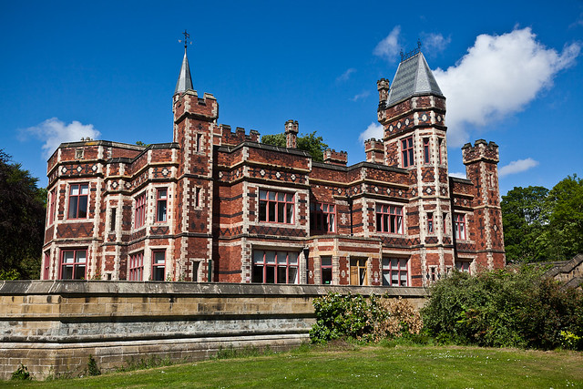
- 1875: William Wailes sold Saltwell Towers to Gateshead Corporation.
- 10th August 1875: Tynemouth Amateur Swimming Club established.
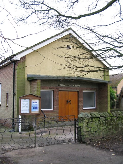
- 1875: Longhorsley Mission (Evangelical church) established.
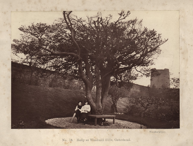
from Newcastle libraries (flickr)
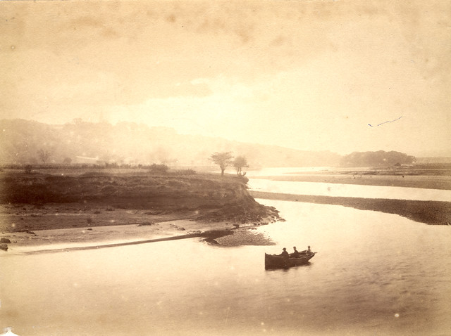
009086:Windmill Hills Gateshead unknown 1875
Pinned by Simon Cotterill
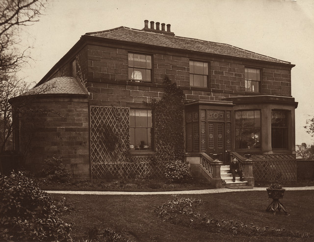
from Newcastle libraries (flickr)
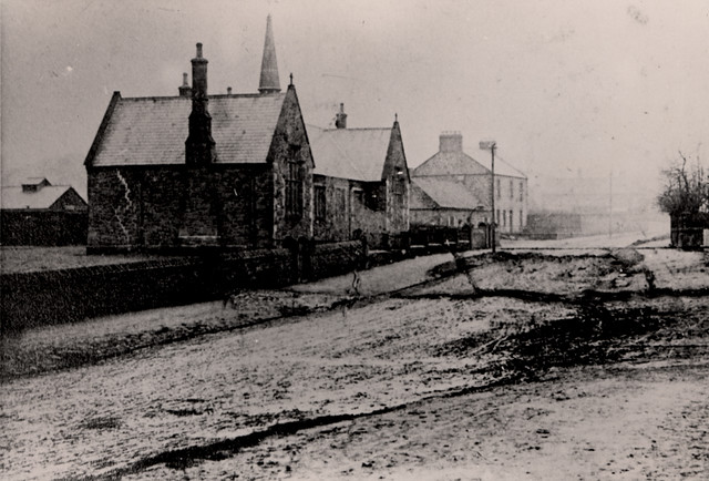
001127:Bensham Cottage Gateshead unknown 1875
Pinned by Simon Cotterill
Co-Curate Page
Saltwell Towers
- Saltwell Towers was built in 1862 by William Wailes a renound stained glass manufacturer. The Victorian mansion was bulit in a Gothic Revivalist style and is now the Saltwell Park Visitors Centre …
Co-Curate Page
Mission Free Church
- Overview Map Street View Longhorsley Mission s an independent Evangelical church in Longhorsley which was founded in 1875. The present building on Drummonds Close was opened in May 1962 and …
Co-Curate Page
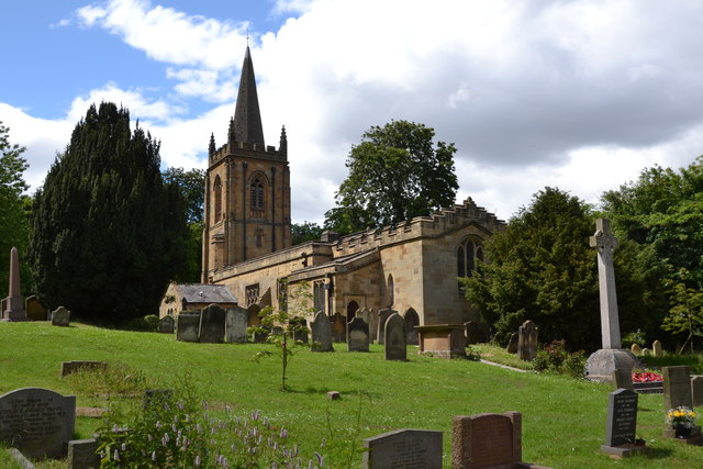
Church of St. Cuthbert, Ormesby
- Overview Map Street View St. Cuthbert's is the parish church in Ormesby, Middlesbrough. The church was largely rebuilt in 1875 by Hicks and Charlewood, but incorporates masonry from an earlier …
Co-Curate Page
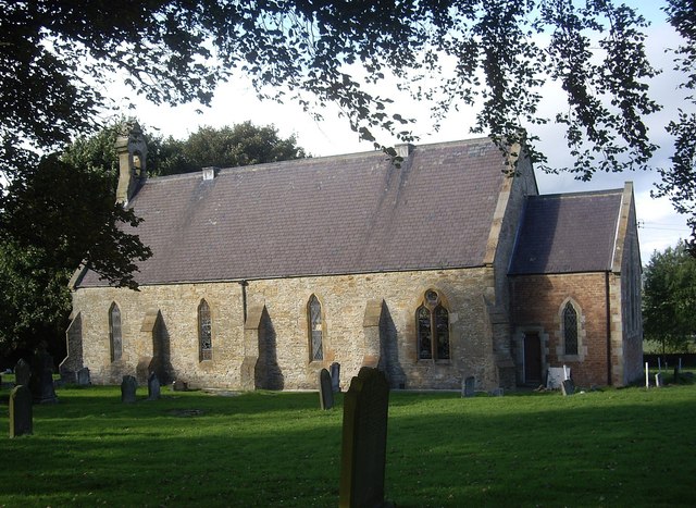
Former Church of St John the Baptist, Quebec
- Overview Map Street View Former Parish Church of St John the Baptist - now a private dwelling. The church was built in 1875 and located next to the former school‐house …
Co-Curate Page
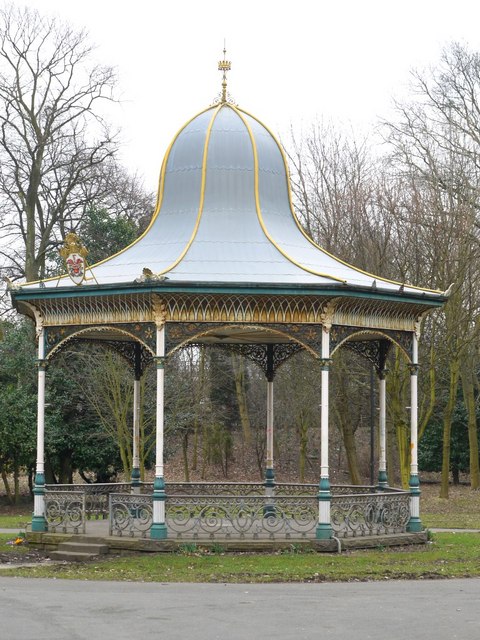
Bandstand, Exhibition Park
- Overview Map Street View The octagonal bandstand in Exhibition Park, Newcastle, was built c.1875. The bandstand was renovated as part of a wider restoration scheme for Exhibition Park in 2015. …
Co-Curate Page
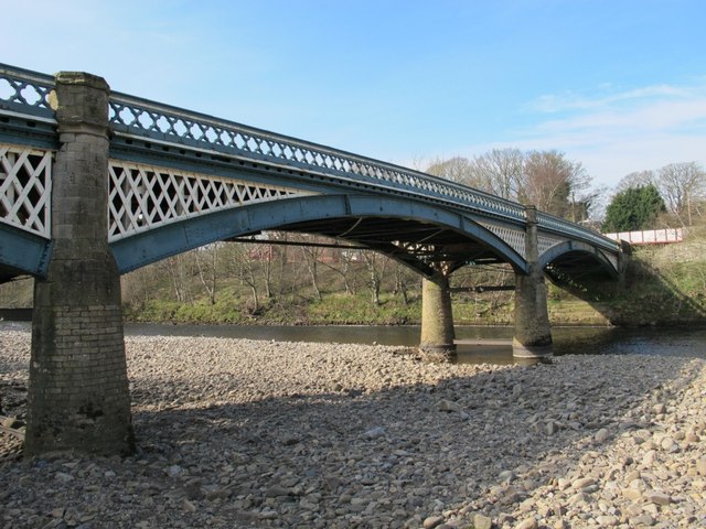
Haltwhistle Tyne Bridge
- Overview Map Street View The pedestrian bridge (a former road bridge) over the River South Tyne at Haltwhistle was built in 1875. It was constructed with wrought-iron arches and cast-iron …
Co-Curate Page
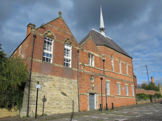
Sailors Bethel, Horatio Street
- Overview Map Street View This former seamen's non-conformist chapel was built in 1875 by Thomas Oliver. It is located on Horatio Street, by the junction with City Road in Newcastle. …
Co-Curate Page
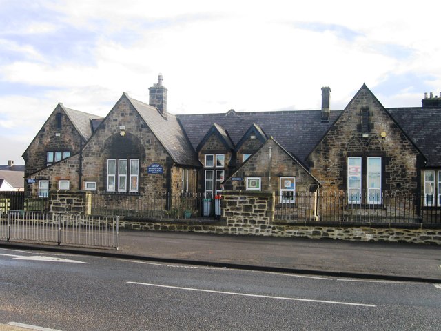
Annfield Plain Junior School
- Overview Map Street View The junior school in Annfield Plain is located on Front Street. It is a community school with about 140 pupils aged 7 to 11.[1] The school was …
Co-Curate Page
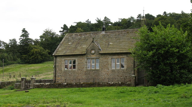
Village Hall
- Overview Map Street View The Village Hall in Barningham, County Durham, overlooks the village green. The building used to be the village school, built c.1875, and inscribed "ERECTED BY THE FAMILY …
Co-Curate Page
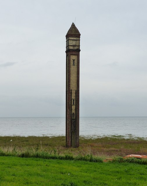
Lighthouse
- Overview About Rampside Lighthouse Map Street View The lighthouse on the foreshore at Rampside was built in 1875. It was number 4 of 13 leading light navigation beacons built in …
Co-Curate Page
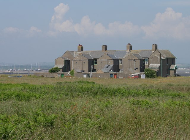
Trinity House Pilot Houses, Piel Island
- Overview Map Street View The Trinity House Pilot Houses on Piel Island are a terrace of 8 cottages, originally built in 1875 for the Duke of Buccleuch. They were used …
Co-Curate Page
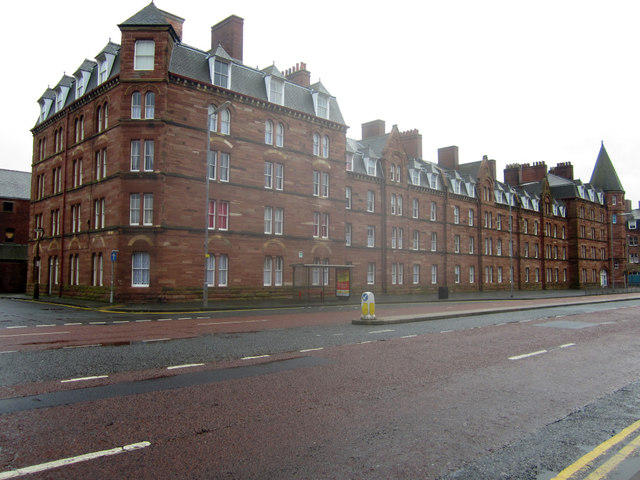
Devonshire Buildings, Barrow Island
- Overview Map Street View The Devonshire Buildings are two imposing sandstone tenement blocks located on Michaelson Road on Barrow Island. They were originally built in c.1875 to house workers at …
Co-Curate Page
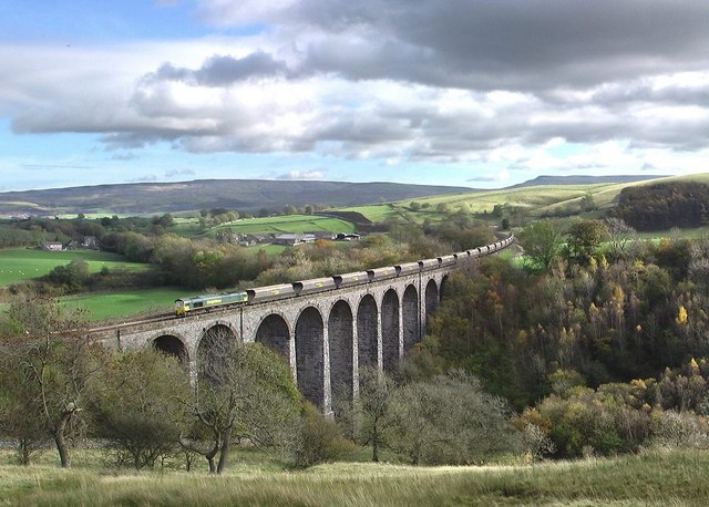
Smardale Viaduct
- Overview Map Street View Smardale Viaduct was built from 1870 to 1875 to carry the Settle to Carlisle railway line over the steep sided valley of Scandal Beck. It built …
Co-Curate Page
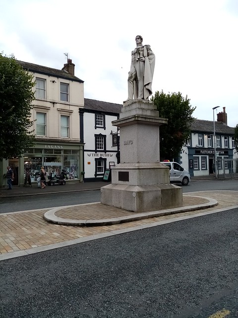
Statue of the Earl of Mayo
- The statue is a prominent landmark on Main Street in Cockermouth. It is a white stone statue of the sixth Earl of Mayo, who was MP for Cockermouth from 1857 …
Co-Curate Page
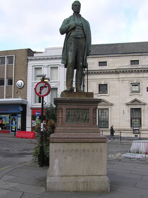
Statue of Statue of Joseph Pease
- Overview Map Street View The statue of Joseph Pease (1799 - 1872) is located at the east end of Prospect Place in Darlington, at the junction with Prebend Row, High …
Co-Curate Page
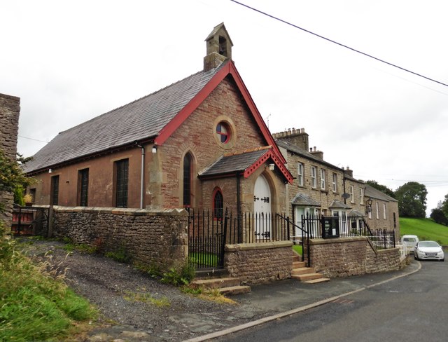
Nateby Methodist Church
- Overview Map Street View A Congregational chapel was built in Nateby in 1875. It remains in use as Nateby Methodist Church.[1] The church is part of the Kirkby Stephen, Appleby and …
Co-Curate Page
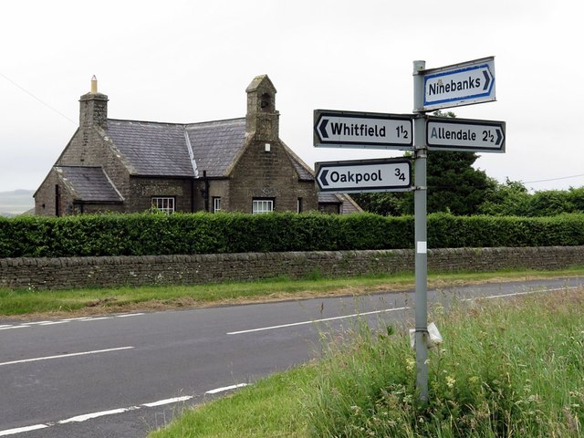
Old School, Keenley
- Overview Map Street View The school at Keenley Crossroads was built in 1875. It is now a private residence. The old school in Keenley is Grade II listed on the …
Co-Curate Page
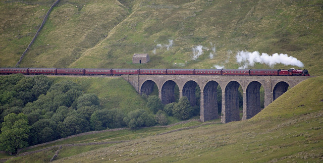
Artengill Viaduct
- Overview Map Street View Artengill Viaduct (aka Arten Gill Viaduct) carries the Settle and Carisle Railway line over the valley of Artengill Beck (stream). It is located to the north …
Co-Curate Page
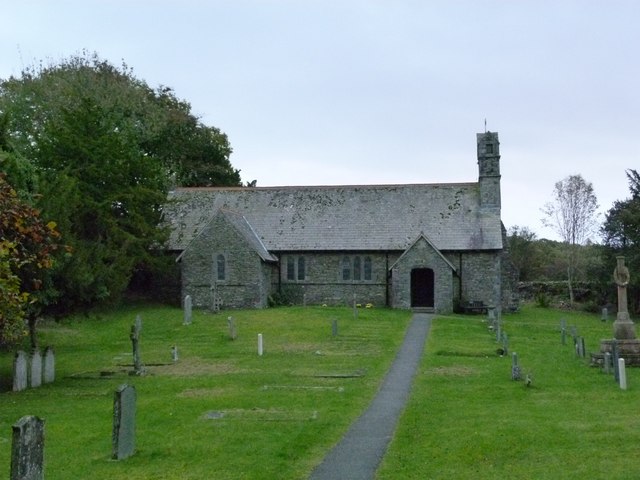
Church of the Holy Trinity, Winster
- Overview Map Street View Inside Holy Trinity Church is located south-west of the village of Winster in Cumbria. The present church was built 1874-1875. It replaced an earlier church (a …
Co-Curate Page
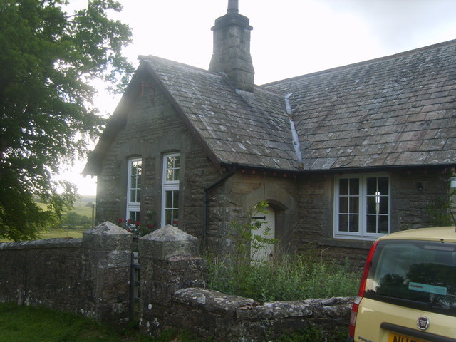
Former Caldbeck Board School
- The old school house in Branthwaite, now a private residence, was built in 1875 by Caldbeck School Board.
Co-Curate Page
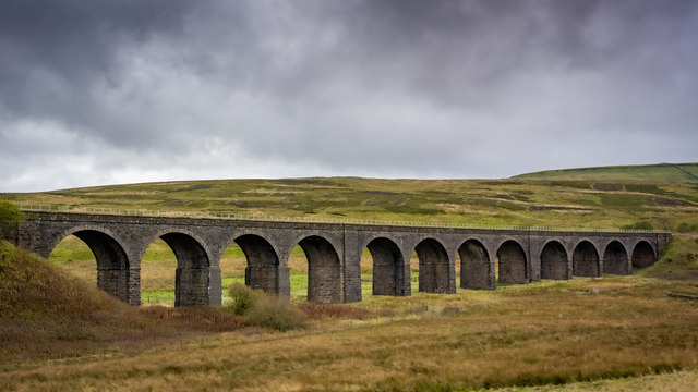
Dandrymire Viaduct
- Overview Map Street View Dandrymire Viaduct carries the Settle and Carlisle Railway line over Dandry Mire, a short distance north-east of Garsdale Station. The coursed sandstone viaduct is about 200m …
Co-Curate Page
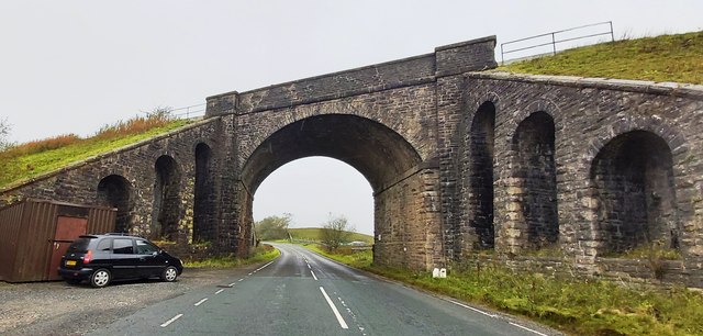
Railway Bridge, Garsdale Head
- Overview Map Street View This railway bridge carries the Settle and Carlisle Railway over Hawes Road (A684) near Garsdale Head in Cumbria, very close to the county boundary with North …
Co-Curate Page
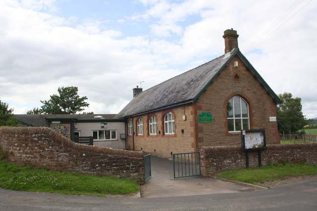
Kirkby Thore School
- Overview Map Street View Kirkby Thore School is a community primary school located near the junction of Priest Lane and Cross Street in the village of Kirkby Thore. The school …
Co-Curate Page
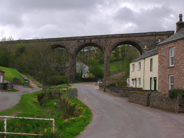
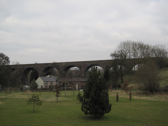
Crosby Garrett Viaduct
- Overview Map Street View Crosby Garrett Viaduct was built in 1875 by J. S Crossley (Engineer) for the Midland Railway, as part of the Settle and Carlisle line. Located at the …
Co-Curate Page
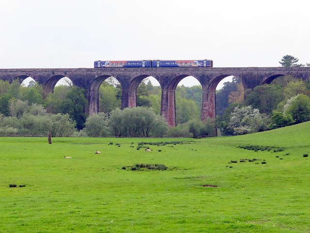
Little Salkeld Viaduct
- Overview Map Street View This railway viaduct, located about half mile south of Little Salkeld, was built for the Midland Railway in 1875. The viaduct has 7 arches and carries …
Co-Curate Page
Ormside Viaduct
- Overview Map Ormside Viaduct carries the Settle and Carlisle Railway over the River Eden, about ½ mile north-west of Great Ormside. The viaduct was built from 1870 to 1875.
Co-Curate Page
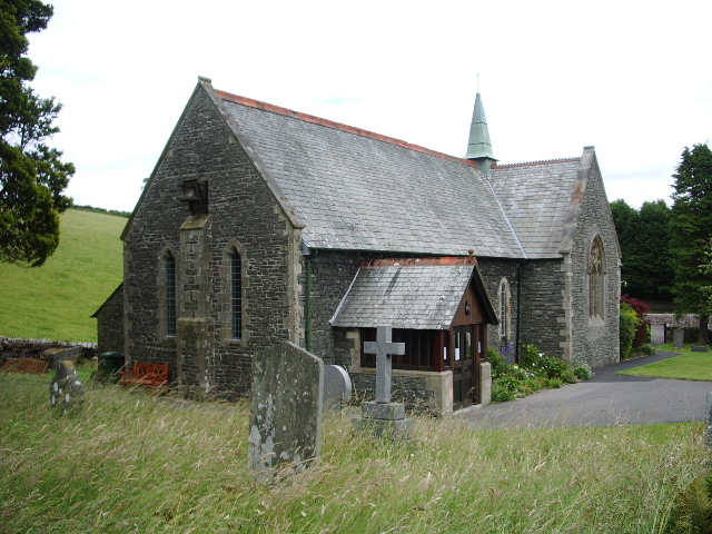
Church of St Thomas, Crosscrake
- Overview Map Street View St. Thomas' Church is located on Shyreakes Lane in Crosscrake. The church was rebuilt 1874 - 1875, designed by the Lancaster architects Paley & Austin, who had a …

Co-Curate Page
Barrow Raiders
- Barrow Rugby League Football Club ('Barrow Raiders') - the club's history can be traced back to 1875, when it was originsally formed as a Rugby Union club. In 1897, the …
Co-Curate Page
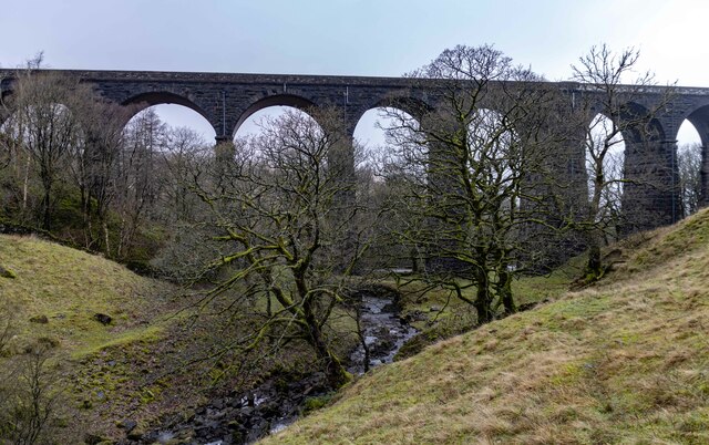
Dent Head Viaduct
- Overview Map Street View Dent Head Viaduct carryies the Settle to Carlisle Railway line over Fell End Gill. It was built c.1869-1875, for the Midland Railway Company, Chief Engineer John …

Co-Curate Page
Former Church of St Peter
- The former St Peter's Church is located on Princes Street in Bishop Auckland. The Parish church with parish hall was built 1873-1875 by R.J. Johnson. The building is Grade II …


from Newcastle libraries (flickr)
009086:Windmill Hills Gateshead unknown 1875
Pinned by Simon Cotterill

from Newcastle libraries (flickr)
001127:Bensham Cottage Gateshead unknown 1875
Pinned by Simon Cotterill

Co-Curate Page
Saltwell Towers
- Saltwell Towers was built in 1862 by William Wailes a renound stained glass manufacturer. The Victorian mansion was bulit in a Gothic Revivalist style and is now the Saltwell Park Visitors Centre …

Co-Curate Page
Mission Free Church
- Overview Map Street View Longhorsley Mission s an independent Evangelical church in Longhorsley which was founded in 1875. The present building on Drummonds Close was opened in May 1962 and …

Co-Curate Page
Church of St. Cuthbert, Ormesby
- Overview Map Street View St. Cuthbert's is the parish church in Ormesby, Middlesbrough. The church was largely rebuilt in 1875 by Hicks and Charlewood, but incorporates masonry from an earlier …

Co-Curate Page
Former Church of St John the Baptist, Quebec
- Overview Map Street View Former Parish Church of St John the Baptist - now a private dwelling. The church was built in 1875 and located next to the former school‐house …

Co-Curate Page
Bandstand, Exhibition Park
- Overview Map Street View The octagonal bandstand in Exhibition Park, Newcastle, was built c.1875. The bandstand was renovated as part of a wider restoration scheme for Exhibition Park in 2015. …

Co-Curate Page
Haltwhistle Tyne Bridge
- Overview Map Street View The pedestrian bridge (a former road bridge) over the River South Tyne at Haltwhistle was built in 1875. It was constructed with wrought-iron arches and cast-iron …

Co-Curate Page
Sailors Bethel, Horatio Street
- Overview Map Street View This former seamen's non-conformist chapel was built in 1875 by Thomas Oliver. It is located on Horatio Street, by the junction with City Road in Newcastle. …

Co-Curate Page
Annfield Plain Junior School
- Overview Map Street View The junior school in Annfield Plain is located on Front Street. It is a community school with about 140 pupils aged 7 to 11.[1] The school was …

Co-Curate Page
Village Hall
- Overview Map Street View The Village Hall in Barningham, County Durham, overlooks the village green. The building used to be the village school, built c.1875, and inscribed "ERECTED BY THE FAMILY …

Co-Curate Page
Lighthouse
- Overview About Rampside Lighthouse Map Street View The lighthouse on the foreshore at Rampside was built in 1875. It was number 4 of 13 leading light navigation beacons built in …

Co-Curate Page
Trinity House Pilot Houses, Piel Island
- Overview Map Street View The Trinity House Pilot Houses on Piel Island are a terrace of 8 cottages, originally built in 1875 for the Duke of Buccleuch. They were used …

Co-Curate Page
Devonshire Buildings, Barrow Island
- Overview Map Street View The Devonshire Buildings are two imposing sandstone tenement blocks located on Michaelson Road on Barrow Island. They were originally built in c.1875 to house workers at …

Co-Curate Page
Smardale Viaduct
- Overview Map Street View Smardale Viaduct was built from 1870 to 1875 to carry the Settle to Carlisle railway line over the steep sided valley of Scandal Beck. It built …

Co-Curate Page
Statue of the Earl of Mayo
- The statue is a prominent landmark on Main Street in Cockermouth. It is a white stone statue of the sixth Earl of Mayo, who was MP for Cockermouth from 1857 …

Co-Curate Page
Statue of Statue of Joseph Pease
- Overview Map Street View The statue of Joseph Pease (1799 - 1872) is located at the east end of Prospect Place in Darlington, at the junction with Prebend Row, High …

Co-Curate Page
Nateby Methodist Church
- Overview Map Street View A Congregational chapel was built in Nateby in 1875. It remains in use as Nateby Methodist Church.[1] The church is part of the Kirkby Stephen, Appleby and …

Co-Curate Page
Old School, Keenley
- Overview Map Street View The school at Keenley Crossroads was built in 1875. It is now a private residence. The old school in Keenley is Grade II listed on the …

Co-Curate Page
Artengill Viaduct
- Overview Map Street View Artengill Viaduct (aka Arten Gill Viaduct) carries the Settle and Carisle Railway line over the valley of Artengill Beck (stream). It is located to the north …

Co-Curate Page
Church of the Holy Trinity, Winster
- Overview Map Street View Inside Holy Trinity Church is located south-west of the village of Winster in Cumbria. The present church was built 1874-1875. It replaced an earlier church (a …

Co-Curate Page
Former Caldbeck Board School
- The old school house in Branthwaite, now a private residence, was built in 1875 by Caldbeck School Board.

Co-Curate Page
Dandrymire Viaduct
- Overview Map Street View Dandrymire Viaduct carries the Settle and Carlisle Railway line over Dandry Mire, a short distance north-east of Garsdale Station. The coursed sandstone viaduct is about 200m …

Co-Curate Page
Railway Bridge, Garsdale Head
- Overview Map Street View This railway bridge carries the Settle and Carlisle Railway over Hawes Road (A684) near Garsdale Head in Cumbria, very close to the county boundary with North …

Co-Curate Page
Kirkby Thore School
- Overview Map Street View Kirkby Thore School is a community primary school located near the junction of Priest Lane and Cross Street in the village of Kirkby Thore. The school …

Co-Curate Page
Crosby Garrett Viaduct
- Overview Map Street View Crosby Garrett Viaduct was built in 1875 by J. S Crossley (Engineer) for the Midland Railway, as part of the Settle and Carlisle line. Located at the …

Co-Curate Page
Little Salkeld Viaduct
- Overview Map Street View This railway viaduct, located about half mile south of Little Salkeld, was built for the Midland Railway in 1875. The viaduct has 7 arches and carries …

Co-Curate Page
Ormside Viaduct
- Overview Map Ormside Viaduct carries the Settle and Carlisle Railway over the River Eden, about ½ mile north-west of Great Ormside. The viaduct was built from 1870 to 1875.

Co-Curate Page
Church of St Thomas, Crosscrake
- Overview Map Street View St. Thomas' Church is located on Shyreakes Lane in Crosscrake. The church was rebuilt 1874 - 1875, designed by the Lancaster architects Paley & Austin, who had a …

Co-Curate Page
Barrow Raiders
- Barrow Rugby League Football Club ('Barrow Raiders') - the club's history can be traced back to 1875, when it was originsally formed as a Rugby Union club. In 1897, the …

Co-Curate Page
Dent Head Viaduct
- Overview Map Street View Dent Head Viaduct carryies the Settle to Carlisle Railway line over Fell End Gill. It was built c.1869-1875, for the Midland Railway Company, Chief Engineer John …

Co-Curate Page
Former Church of St Peter
- The former St Peter's Church is located on Princes Street in Bishop Auckland. The Parish church with parish hall was built 1873-1875 by R.J. Johnson. The building is Grade II …

Sailors Bethel, Horatio Street

Trinity House Pilot Houses, Piel Island

Mission Free Church, Longhorsley

Tynemouth Amateur Swimming Club

Statue of Statue of Joseph Pease, Darlington

Former Church of St Peter, Bishop Auckland

Devonshire Buildings, Michaelson Road, Barrow Island

Statue of the Earl of Mayo, Cockermouth
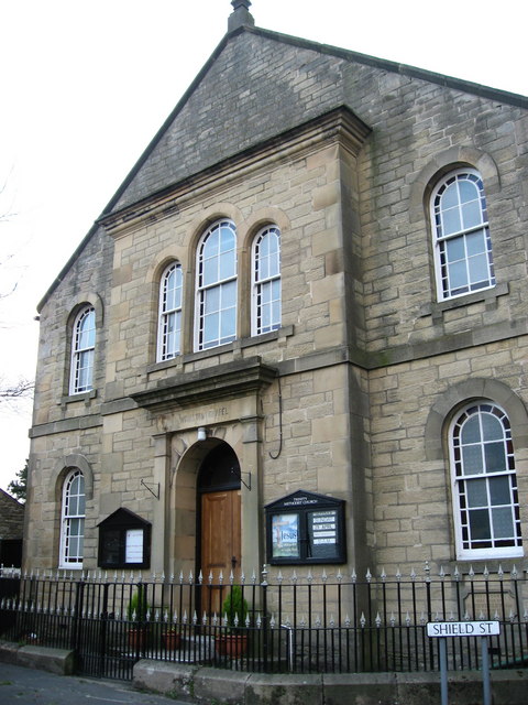
Trinity Methodist Church, Allendale

Church of St Thomas, Crosscrake

Church of St. Cuthbert, Ormesby

Church of the Holy Trinity, Winster

Former Church of St John the Baptist, Hamsteels
