Topics > Cumbria > Rampside > Lighthouse
Lighthouse
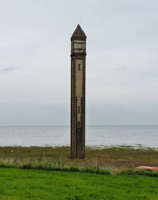
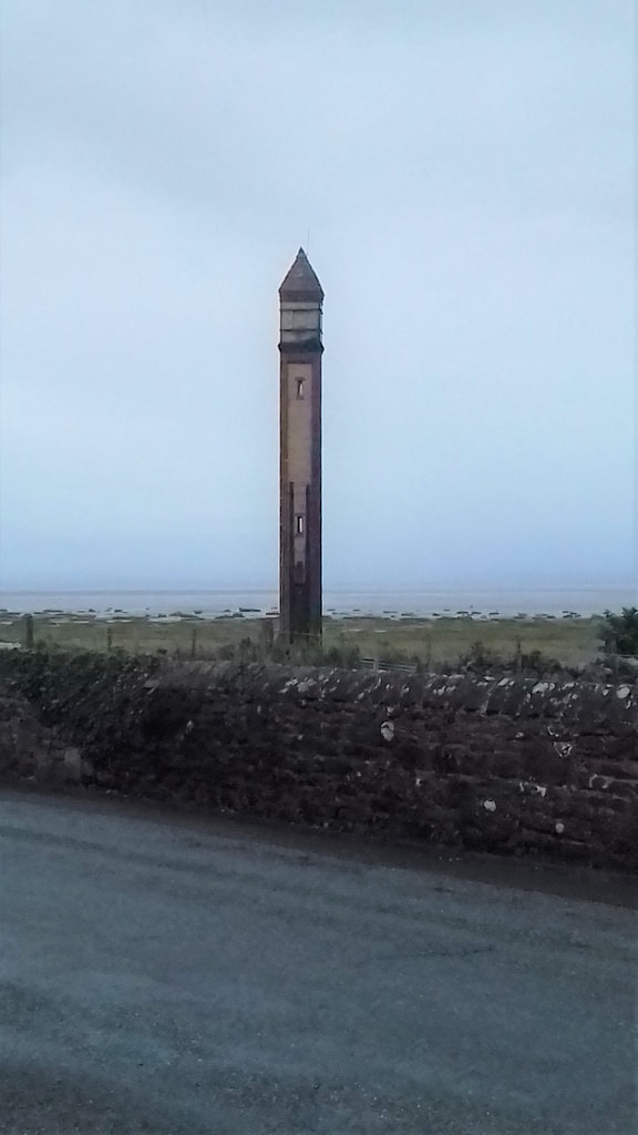
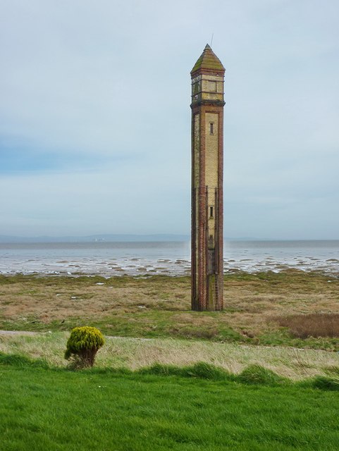
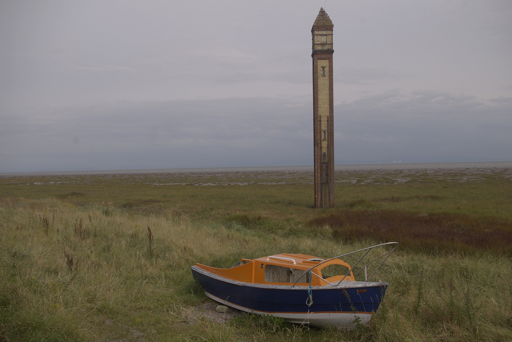
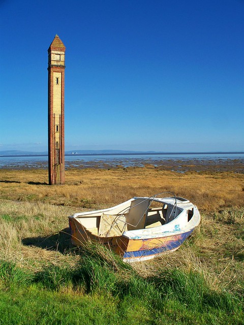
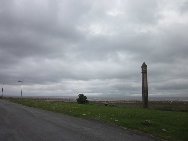
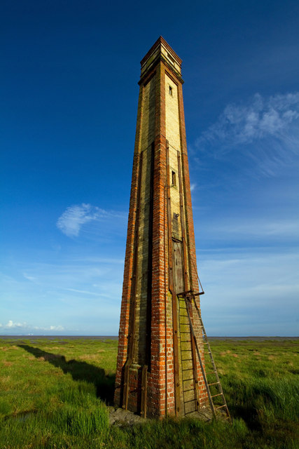
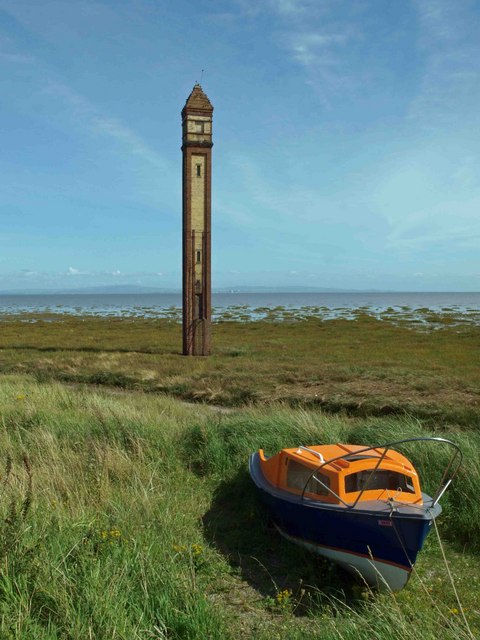
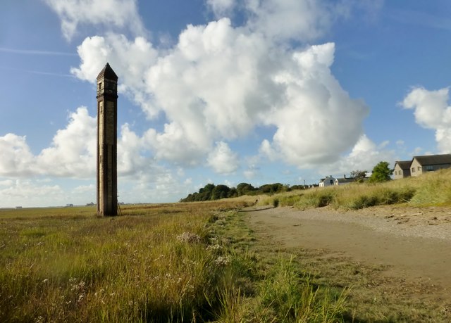
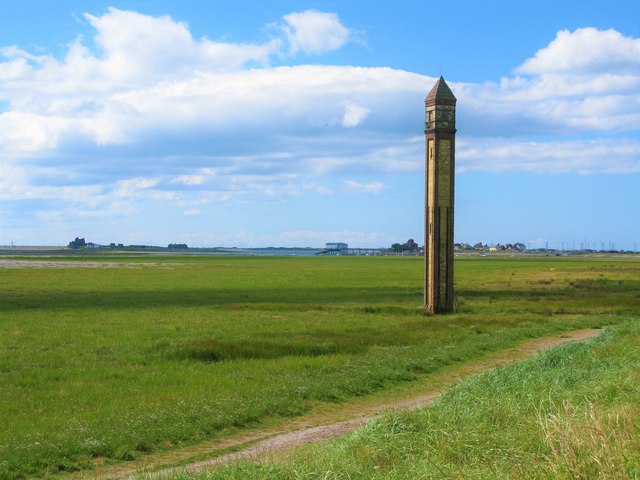
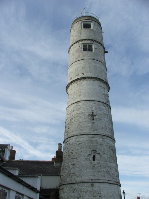
The lighthouse on the foreshore at Rampside was built in 1875. It was number 4 of 13 leading light navigation beacons built in the late 19th century, which aligned to guide vessels safely into the port at Barrow-in-Furness - and the only one of these surviving. The slender lighthouse, known as "The Needle", is about 20m tall and built from red and yellow bricks. The lighthouse is Grade II listed on the National Heritage List for England.
Rampside Lighthouse, also known as "The Needle", is a leading light (navigation beacon) located in the Rampside area of Barrow-in-Furness, Cumbria, England. Built in 1875, it is the only surviving example of 13 such beacons built around Barrow during the late 19th century to aid vessels into the town's port. It stands tall and is constructed from red and yellow bricks. Rampside Lighthouse was designated a Grade II listed building by English Heritage in 1991.
Text from Wikipedia, available under the Creative Commons Attribution-ShareAlike License (accessed: 21/09/2018).
Visit the page: Rampside Lighthouse for references and further details. You can contribute to this article on Wikipedia.
Visit the page: Rampside Lighthouse for references and further details. You can contribute to this article on Wikipedia.
from Geograph (geograph)
Rampside lighthouse (Walney channel middle range rear)
Pinned by Simon Cotterill

from https://historicengland.org.u…
NUMBER 4 LEADING LIGHT ON FORESHORE NEAR RAMPSIDE HALL - List Entry
- "Navigation beacon. c1875. Red and yellow brick. Slender, square tower approx 20m in height. Clasping, red brick pilaster strips and yellow brick side panels with iron straps that project up …
Added by
Simon Cotterill

from https://www.sankeyphotoarchiv…
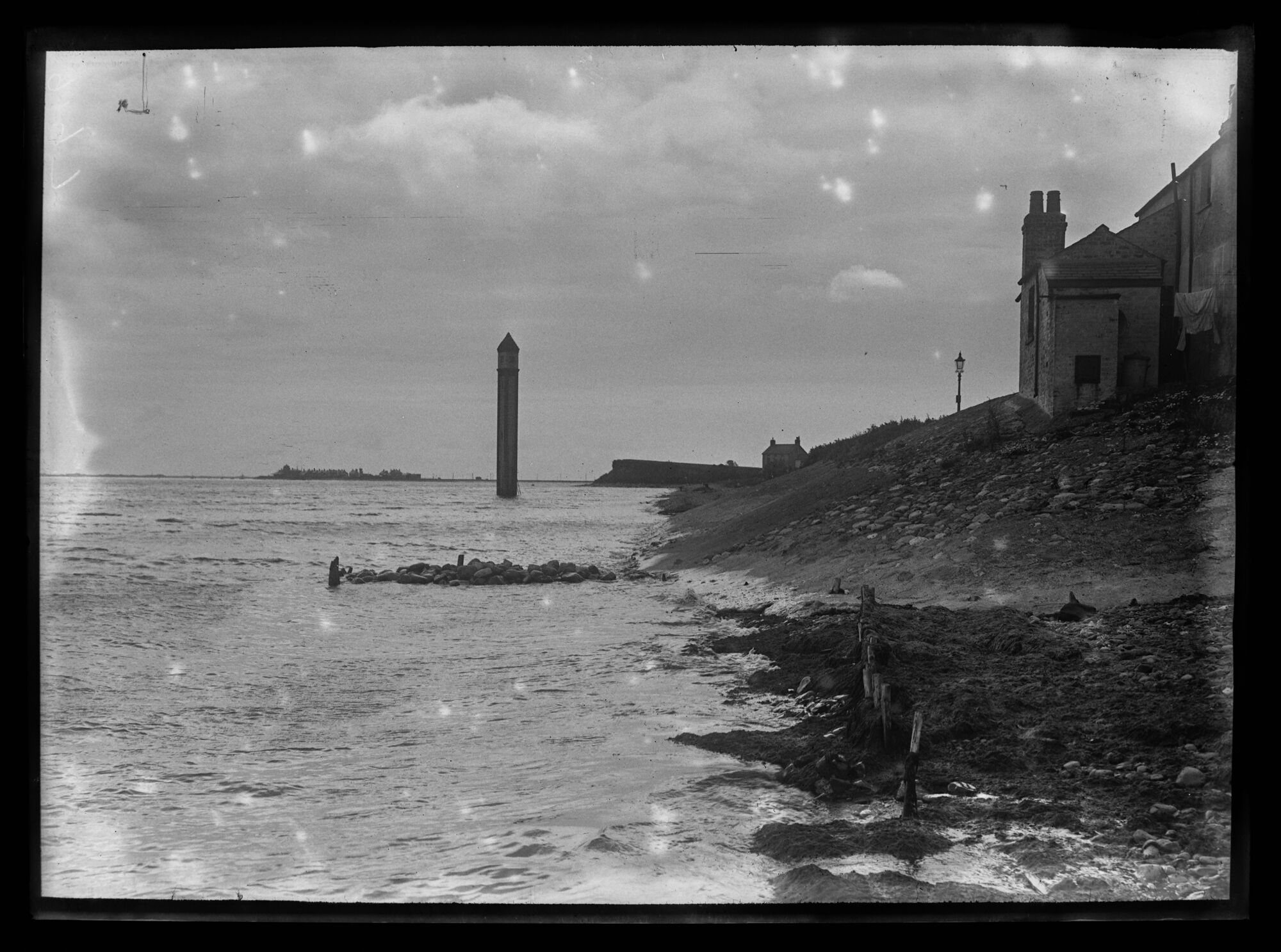
Rampside Light Tower
- Photo, early 20th century. Looking southwest from a position on the tideline at Rampside at the last remaining 1875 leading light standing in the tide. Houses on the right overlook …
Added by
Simon Cotterill
from https://www.sankeyphotoarchiv…
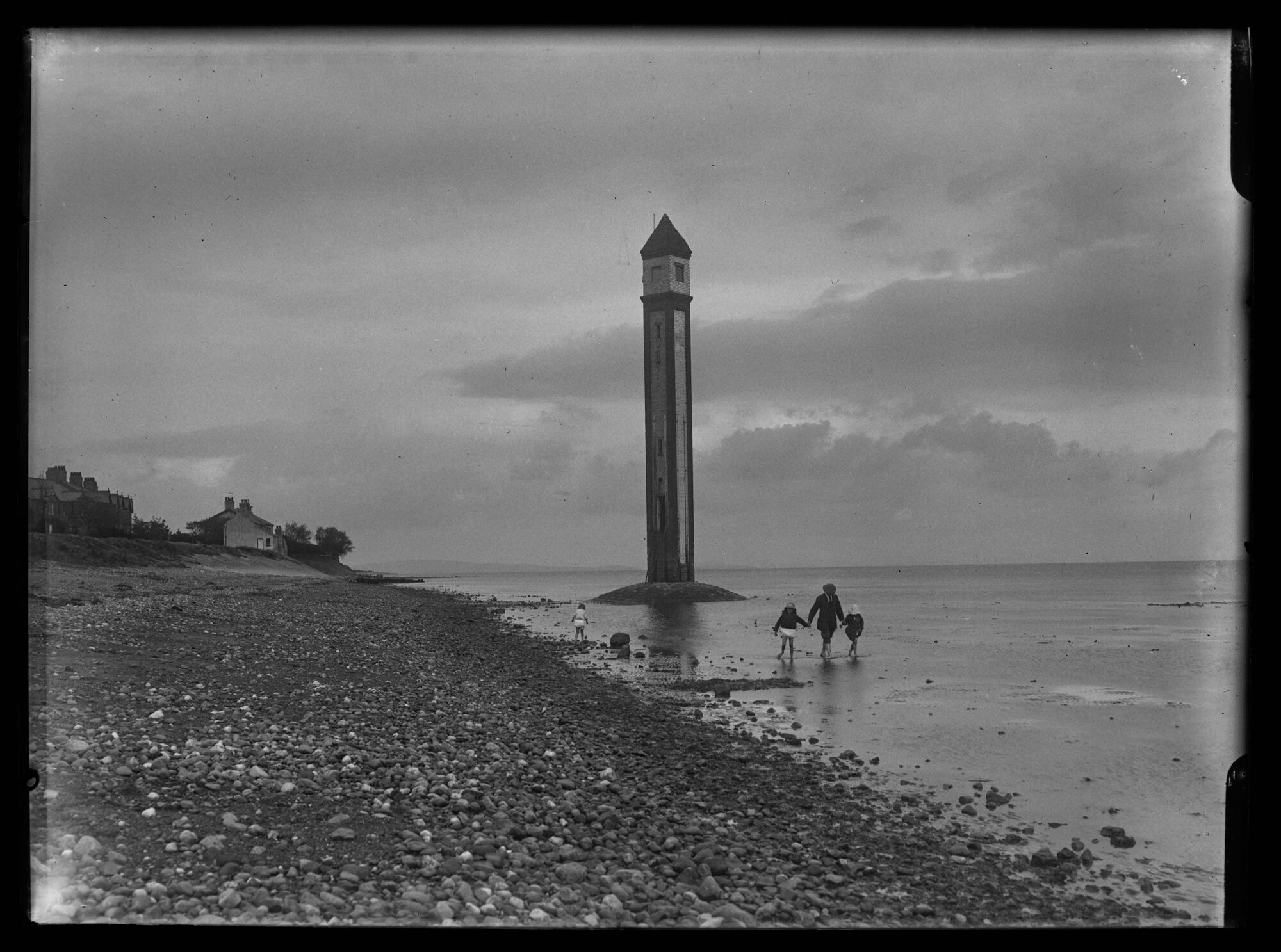
Rampside Light Tower
- Photo, early 20th century. Looking northeast along the shore at Rampside, the last remaining 1875 leading light stands upon the shore as darker clouds roll in from the south. Two …
Added by
Simon Cotterill

from Geograph (geograph)
Rampside lighthouse (Walney channel middle range rear)
Pinned by Simon Cotterill
from https://historicengland.org.u…
NUMBER 4 LEADING LIGHT ON FORESHORE NEAR RAMPSIDE HALL - List Entry
- "Navigation beacon. c1875. Red and yellow brick. Slender, square tower approx 20m in height. Clasping, red brick pilaster strips and yellow brick side panels with iron straps that project up …
Added by
Simon Cotterill
from https://www.sankeyphotoarchiv…
Rampside Light Tower
- Photo, early 20th century. Looking southwest from a position on the tideline at Rampside at the last remaining 1875 leading light standing in the tide. Houses on the right overlook …
Added by
Simon Cotterill
from https://www.sankeyphotoarchiv…
Rampside Light Tower
- Photo, early 20th century. Looking northeast along the shore at Rampside, the last remaining 1875 leading light stands upon the shore as darker clouds roll in from the south. Two …
Added by
Simon Cotterill

List number: 1197853
List grade: 2
County: Cumbria
Wikipedia: Rampside Lighthouse
Grid ref: SD2413966237
Unitary Auth: Westmorland & Furness
List grade: 2
County: Cumbria
Wikipedia: Rampside Lighthouse
Grid ref: SD2413966237
Unitary Auth: Westmorland & Furness
")


