Topics > Historical Periods > 19th Century > 1870s > 1870
1870
In Northern England:
- 1st January 1870; first edition of the Northern Echo newspaper, produced in Darlington.
- 29th June 1870: Bath Lane School in Newcastle founded by Dr John Hunter Rutherford.
- September 1870: opening of Garth Heads Improved Industrial Dwellings, Newcastle
- 1870: sinking of Skelton Park ironstone mine by the Bell brothers.
- 1870: opening of the Rothbury Branch Line of the Northumberland Central Railway.
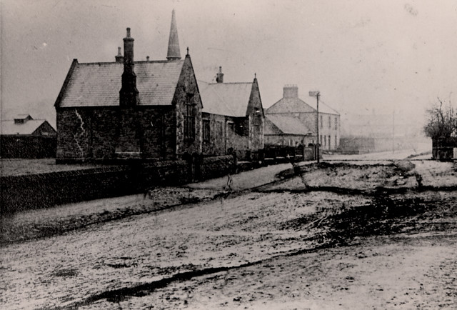
from Newcastle libraries (flickr)
060739:Benton National School Benton Unknown 1870
Pinned by Simon Cotterill
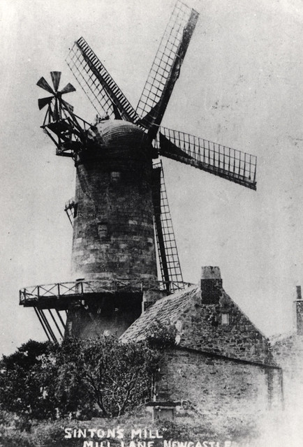
from Newcastle libraries (flickr)
043574:Sinton's Mill Westgate Road/Mill Lane Elswick Unknown c.1870
Pinned by Simon Cotterill

from https://commons.wikimedia.org…
Chromolithograph of Alnwick Castle, 1870
- From the book County Seats of The Noblemen and Gentlemen of Great Britain and Ireland, Alexander Francis Lydon (1836-1917)
Added by
Simon Cotterill
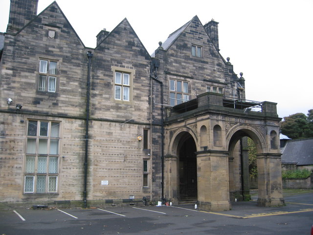
Co-Curate Page
Pendower Hall
- Overview Map Pendower Hall is a large house off West Road in Benwell. It was built c.1870, for J.W. Pease, a banker. During the First World War the hall was …
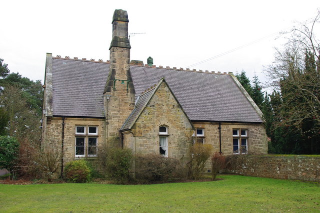
Co-Curate Page
Belsay School
- Overview Map Street View Belsay School was previously known as Belsay Primary School, Belsay First School, and before that: Belsay County First School. The school building was constructed in 1870, …
Co-Curate Page
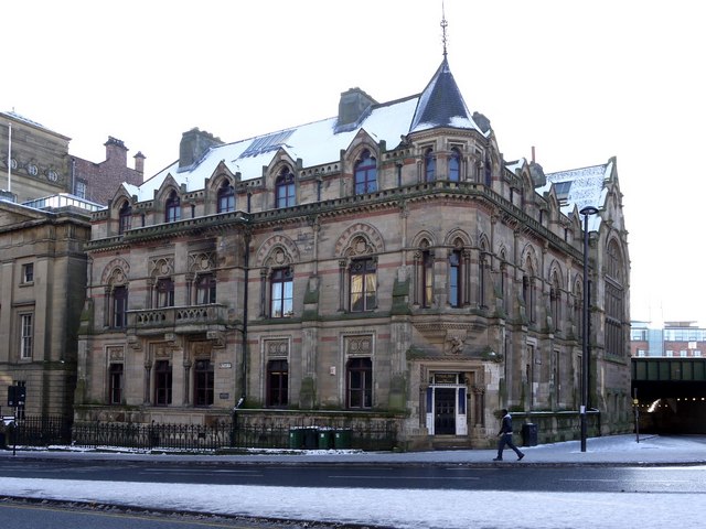
Neville Hall and Wood Memorial Hall
- Overview Map Street View Neville Hall is a distinctive gothic building on Westgate Road in Newcastle, near the junction with Neville Street. It was built 1869 - 1872 and designed …
Co-Curate Page
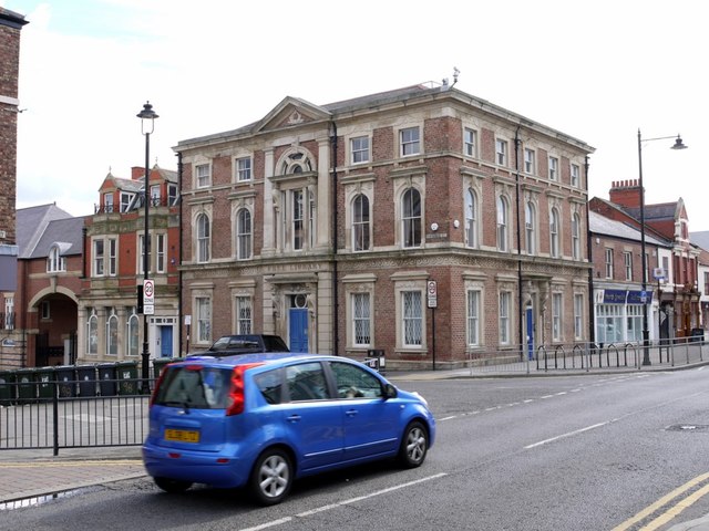
Mechanics Institute and Free Library
- Overview Map Street View The former Free Library is located on Howard Street by the junction with Saville Street, North Shields. The Mechanics Institute was built 1857-1858, designed by John …
from Newcastle libraries (flickr)
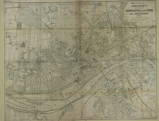
Christie's new plan of Newcastle upon Tyne and Gateshead, 1870
Pinned by Simon Cotterill
from Newcastle libraries (flickr)
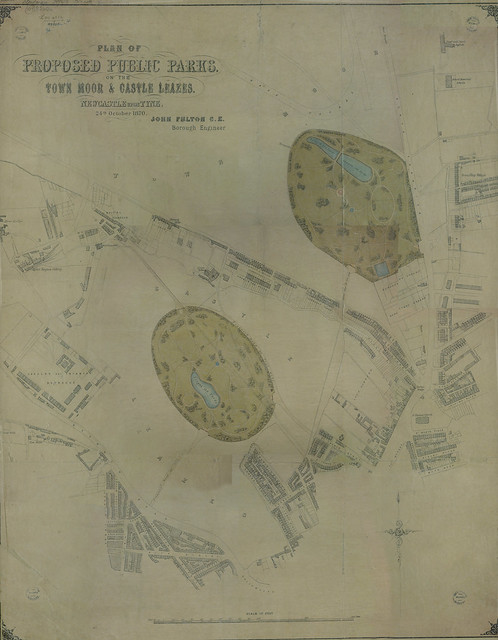
Plan of proposed public park on the Town Moor & Castle Leazes, 1870
Pinned by Simon Cotterill
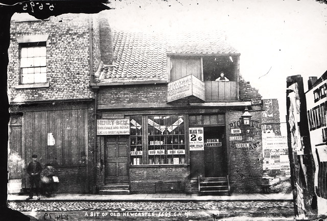
from Newcastle libraries (flickr)
034069:Westgate Road Newcastle upon Tyne C.1870
Pinned by Simon Cotterill

from Newcastle libraries (flickr)
022447:Henry George Percy Earl Percy 7th Duke of Northumberland Walker Samuel A. c.1870
Pinned by Simon Cotterill
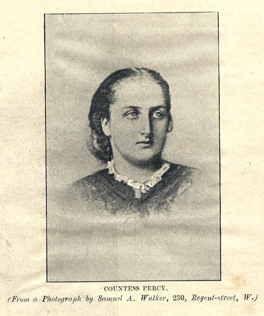
from Newcastle libraries (flickr)
022448:Countess Percy Walker Samuel A. c.1870
Pinned by Simon Cotterill
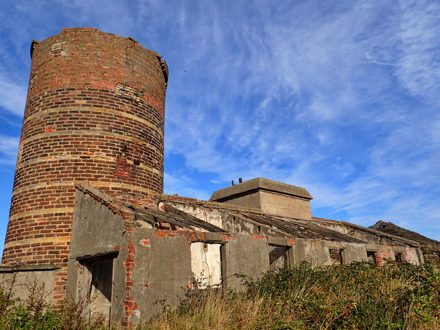
Co-Curate Page
Skelton Park Ironstone Mine (1870 - 1938)
- The sinking at Skelton Park ironstone mine started in 1870, by three brothers (Isaac Lowthian, Thomas and John Bell), to supply their ironworks at Port Clarence. The mineral rights and …
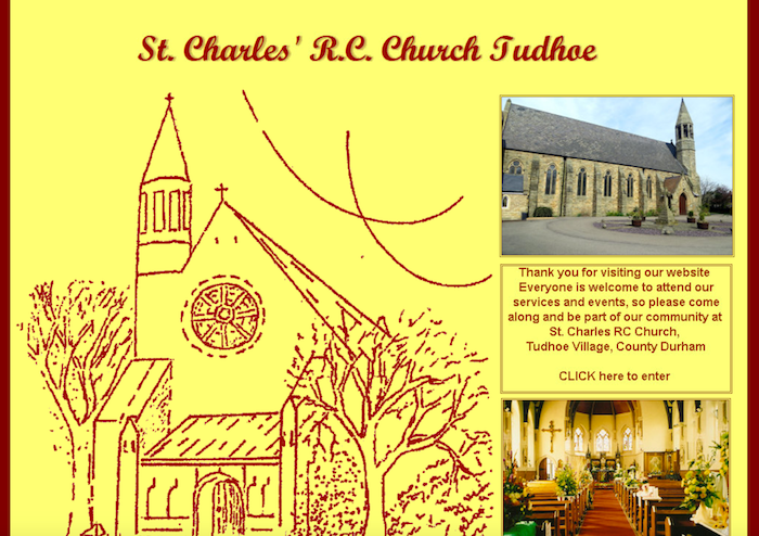
Co-Curate Page
RC Church of St Charles, Tudhoe
- Overview Map Street View The Roman Catholic parish church of St Charles in Tudhoe was built in 1870 by J.A. Hansom & Son.[1] The church tower was added in 1882. …
Co-Curate Page
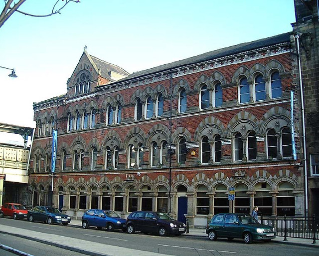
2-4 Exchange Place
- Overview Map Street View 2,3 & 4 Exchange Place in Middlesbrough were built in c.1870 as offices by W.H. Blessley (Middlesbrough).[1] The building is adjacent to Albert Bridge, near Middlesbrough …
Co-Curate Page
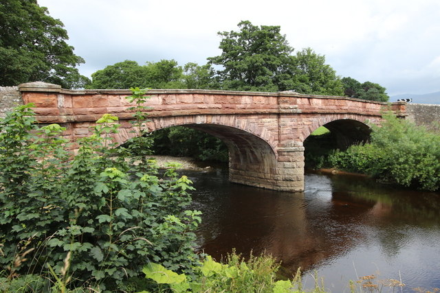
Bolton Bridge, Bolton
- Overview Map Street View The red sandstone bridge over the River Eden at Bolton in Cumbria is dated 1870.
Co-Curate Page
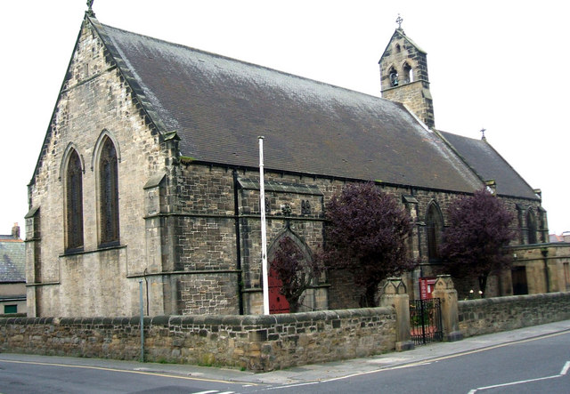
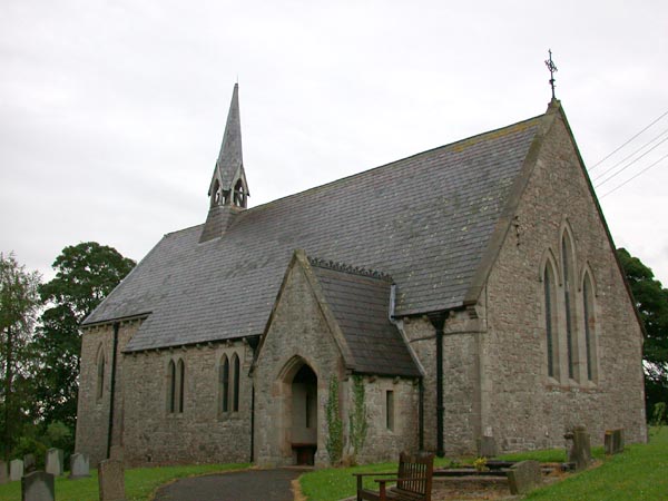
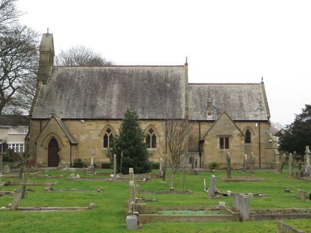
Church of St Matthew, Dinnington
- Overview Map Street View Saint Matthew's Church is located on Church Close in Dinnington, Newcastle. The church was built in c.1870 and is Grade II listed on the National Heritage …
Co-Curate Page
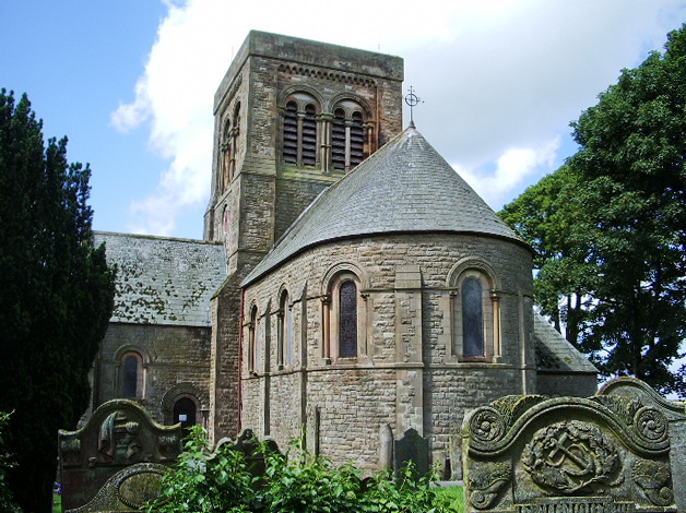
Church of St Bridget, Bridekirk
- Overview Map Street View St Bridget's Church in Bridekirk was built 1868 to 1870, designed by Cory and Ferguson of Carlisle.[1] It was built to replace an earlier parish church …
Co-Curate Page
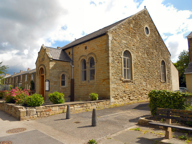
Tudhoe Methodist Church
- Overview Map Street View Tudhoe Methodist Church is located on Front Street, Tudhoe. It was built in c.1870 by local miners, originally a Primitive Methodist chapel, with a rear schoolroom. The …
Co-Curate Page
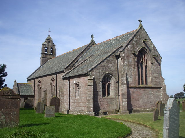
Church of St Michael, Lamplugh
- Overview About St Michael's Church Map Street View Inside St Michael is in Lamplugh, Cumbria, England. It is an active Anglican parish church in the deanery of Calder, and …
Co-Curate Page
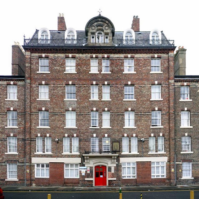
Garth Heads, Newcastle
- Overview Map Street View Garth Heads is a street, located a short distance off Melbourn Street, in Newcastle, and also the name of the main building on the street. Along …
Co-Curate Page
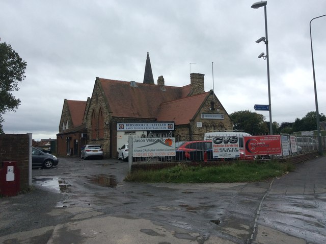
Bournmoor Cricket Club House
- Overview Map Street View Bournmoor Cricket Club House is located on Chester Road in Bournmoor. The building dates from 1870 and was originally built as a National School. Bournmoor Cricket …
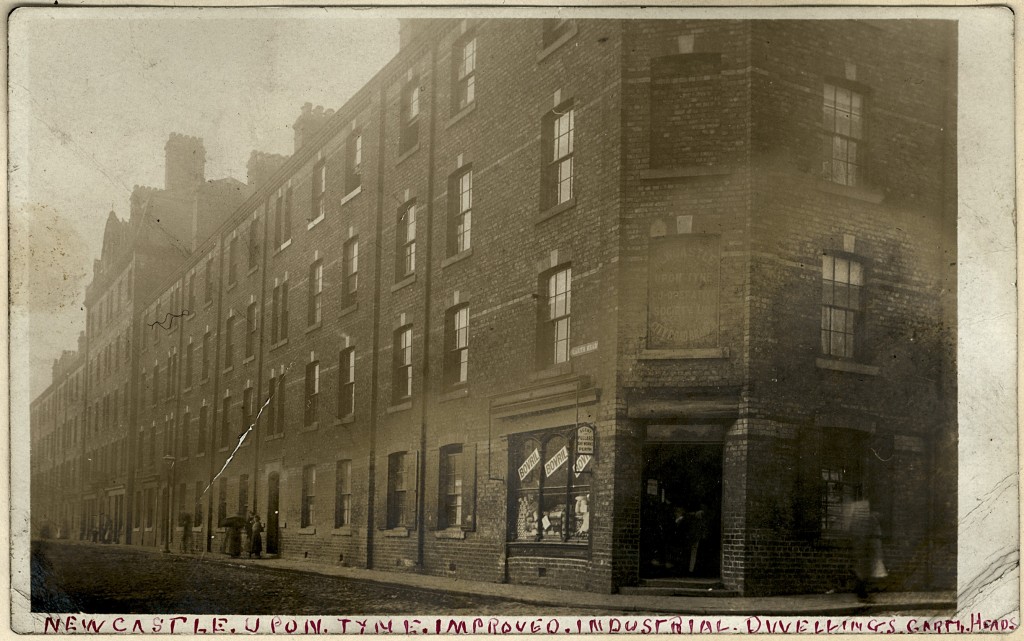
from https://blog.twmuseums.org.uk…
Newcastle Improved Industrial Dwellings
- TWAM Blog, August 6, 2012 . "....Newcastle Improved Industrial Dwellings Ltd was formed by James Hall, philanthropist and businessman, of Hall Bros Steamship Co. A prospectus was issued in 1869 …
Added by
Simon Cotterill
Co-Curate Page
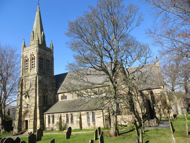
Church of St Augustine
- Overview Map Street View Inside The Church of St Augustine of Canterbury is located off Front Street in Alston. The Parish Church was built in 1870 by J.W. Walton, replacing …
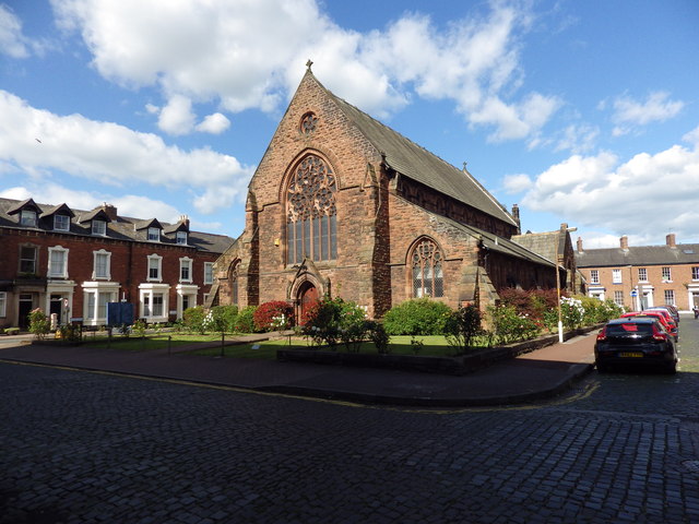
Co-Curate Page
Elim Community Church (St Paul's), Carlisle
- Overview Map Street View Elim Community Church stands on the corner of Lonsdale Street and Spencer Street, and around St Paul's Square, in Carlisle. The building was originally St Paul's …

Co-Curate Page
Old Wesleyan Chapel, Catton
- Overview Map Street View This former Wesleyan chapel, on the west side of the village green in Catton dates from 1870. The chapel closed in 1939 and was sold to …

Co-Curate Page
Church of St Cuthbert, Nether Denton
- Overview Map Street View St Cuthbert's Church is the parish church of Nether Denton and stands on the site of a Roman fort. It is located in an isolated position, …

Co-Curate Page
Howden-Le-Wear Methodist Church
- Overview Map Street View Howden-le-Wear Methodist Church is located on Bridge Street in Howden-le-Wear. It was originally built as a Primitive Methodist chapel in 1870. The building had extensions in …
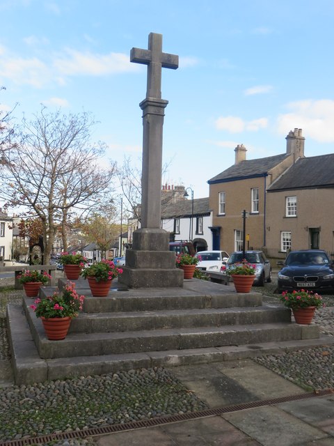
Co-Curate Page
Market Cross, Dalton-in-Furness
- Overview Map Street View The Market Cross stands in the Market Place in the heart of Dalton-in-Furness. It was built, along with a crescent shaped stone bench in 1869-1870. It …

Co-Curate Page
Church of St Mary, Walton
- Church. 1869-1870, by Paley of Lancaster, (on site of medieval church, rebuilt 1811 and extended 1843). Hammer dressed red sandstone, with ashlar chamfered plinth, quoins and string courses; graduated slate …


from Newcastle libraries (flickr)
060739:Benton National School Benton Unknown 1870
Pinned by Simon Cotterill

from Newcastle libraries (flickr)
043574:Sinton's Mill Westgate Road/Mill Lane Elswick Unknown c.1870
Pinned by Simon Cotterill

from https://commons.wikimedia.org…
Chromolithograph of Alnwick Castle, 1870
- From the book County Seats of The Noblemen and Gentlemen of Great Britain and Ireland, Alexander Francis Lydon (1836-1917)
Added by
Simon Cotterill

Co-Curate Page
Pendower Hall
- Overview Map Pendower Hall is a large house off West Road in Benwell. It was built c.1870, for J.W. Pease, a banker. During the First World War the hall was …

Co-Curate Page
Belsay School
- Overview Map Street View Belsay School was previously known as Belsay Primary School, Belsay First School, and before that: Belsay County First School. The school building was constructed in 1870, …

Co-Curate Page
Neville Hall and Wood Memorial Hall
- Overview Map Street View Neville Hall is a distinctive gothic building on Westgate Road in Newcastle, near the junction with Neville Street. It was built 1869 - 1872 and designed …

Co-Curate Page
Mechanics Institute and Free Library
- Overview Map Street View The former Free Library is located on Howard Street by the junction with Saville Street, North Shields. The Mechanics Institute was built 1857-1858, designed by John …

from Newcastle libraries (flickr)
Christie's new plan of Newcastle upon Tyne and Gateshead, 1870
Pinned by Simon Cotterill

from Newcastle libraries (flickr)
Plan of proposed public park on the Town Moor & Castle Leazes, 1870
Pinned by Simon Cotterill

from Newcastle libraries (flickr)
034069:Westgate Road Newcastle upon Tyne C.1870
Pinned by Simon Cotterill

from Newcastle libraries (flickr)
022447:Henry George Percy Earl Percy 7th Duke of Northumberland Walker Samuel A. c.1870
Pinned by Simon Cotterill

from Newcastle libraries (flickr)
022448:Countess Percy Walker Samuel A. c.1870
Pinned by Simon Cotterill

Co-Curate Page
Skelton Park Ironstone Mine (1870 - 1938)
- The sinking at Skelton Park ironstone mine started in 1870, by three brothers (Isaac Lowthian, Thomas and John Bell), to supply their ironworks at Port Clarence. The mineral rights and …

Co-Curate Page
RC Church of St Charles, Tudhoe
- Overview Map Street View The Roman Catholic parish church of St Charles in Tudhoe was built in 1870 by J.A. Hansom & Son.[1] The church tower was added in 1882. …

Co-Curate Page
2-4 Exchange Place
- Overview Map Street View 2,3 & 4 Exchange Place in Middlesbrough were built in c.1870 as offices by W.H. Blessley (Middlesbrough).[1] The building is adjacent to Albert Bridge, near Middlesbrough …

Co-Curate Page
Bolton Bridge, Bolton
- Overview Map Street View The red sandstone bridge over the River Eden at Bolton in Cumbria is dated 1870.

Co-Curate Page
Church of St Matthew, Dinnington
- Overview Map Street View Saint Matthew's Church is located on Church Close in Dinnington, Newcastle. The church was built in c.1870 and is Grade II listed on the National Heritage …

Co-Curate Page
Church of St Bridget, Bridekirk
- Overview Map Street View St Bridget's Church in Bridekirk was built 1868 to 1870, designed by Cory and Ferguson of Carlisle.[1] It was built to replace an earlier parish church …

Co-Curate Page
Tudhoe Methodist Church
- Overview Map Street View Tudhoe Methodist Church is located on Front Street, Tudhoe. It was built in c.1870 by local miners, originally a Primitive Methodist chapel, with a rear schoolroom. The …

Co-Curate Page
Church of St Michael, Lamplugh
- Overview About St Michael's Church Map Street View Inside St Michael is in Lamplugh, Cumbria, England. It is an active Anglican parish church in the deanery of Calder, and …

Co-Curate Page
Garth Heads, Newcastle
- Overview Map Street View Garth Heads is a street, located a short distance off Melbourn Street, in Newcastle, and also the name of the main building on the street. Along …

Co-Curate Page
Bournmoor Cricket Club House
- Overview Map Street View Bournmoor Cricket Club House is located on Chester Road in Bournmoor. The building dates from 1870 and was originally built as a National School. Bournmoor Cricket …

from https://blog.twmuseums.org.uk…
Newcastle Improved Industrial Dwellings
- TWAM Blog, August 6, 2012 . "....Newcastle Improved Industrial Dwellings Ltd was formed by James Hall, philanthropist and businessman, of Hall Bros Steamship Co. A prospectus was issued in 1869 …
Added by
Simon Cotterill

Co-Curate Page
Church of St Augustine
- Overview Map Street View Inside The Church of St Augustine of Canterbury is located off Front Street in Alston. The Parish Church was built in 1870 by J.W. Walton, replacing …

Co-Curate Page
Elim Community Church (St Paul's), Carlisle
- Overview Map Street View Elim Community Church stands on the corner of Lonsdale Street and Spencer Street, and around St Paul's Square, in Carlisle. The building was originally St Paul's …

Co-Curate Page
Old Wesleyan Chapel, Catton
- Overview Map Street View This former Wesleyan chapel, on the west side of the village green in Catton dates from 1870. The chapel closed in 1939 and was sold to …

Co-Curate Page
Church of St Cuthbert, Nether Denton
- Overview Map Street View St Cuthbert's Church is the parish church of Nether Denton and stands on the site of a Roman fort. It is located in an isolated position, …

Co-Curate Page
Howden-Le-Wear Methodist Church
- Overview Map Street View Howden-le-Wear Methodist Church is located on Bridge Street in Howden-le-Wear. It was originally built as a Primitive Methodist chapel in 1870. The building had extensions in …

Co-Curate Page
Market Cross, Dalton-in-Furness
- Overview Map Street View The Market Cross stands in the Market Place in the heart of Dalton-in-Furness. It was built, along with a crescent shaped stone bench in 1869-1870. It …

Co-Curate Page
Church of St Mary, Walton
- Church. 1869-1870, by Paley of Lancaster, (on site of medieval church, rebuilt 1811 and extended 1843). Hammer dressed red sandstone, with ashlar chamfered plinth, quoins and string courses; graduated slate …

Church of St Michael, Lamplugh

Market Cross, Dalton-in-Furness

Elim Community Church (St Paul's), Carlisle

Skelton Park Ironstone Mine (1870 - 1938)

2-4 Exchange Place, Middlesbrough

Church of St Mary, Walton, Cumbria

Howden-Le-Wear Methodist Church

Church of St Cuthbert, Nether Denton
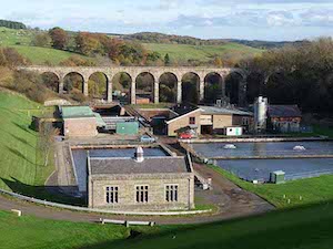
Railway Viaduct over River Font

Church of St Bridget, Bridekirk

Church of St Augustine, Alston
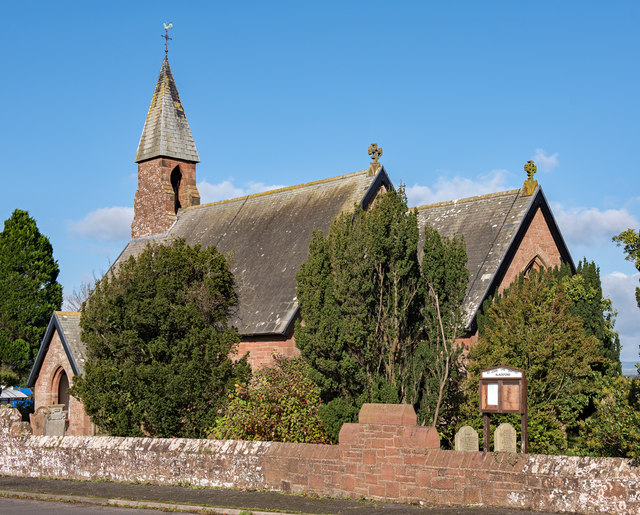
Church of St John the Baptist, Blackford

Bolton Bridge, Bolton, Cumbria

Neville Hall and Wood Memorial Hall
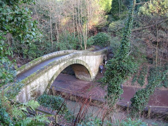
Footbridge by Banqueting Hall, Jesmond Dene
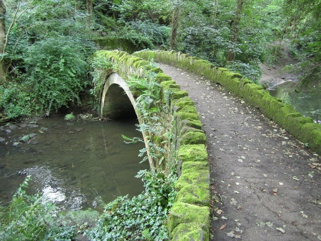
Footbridge South of Red Walk, Jesmond Dene

Church of St Matthew, Dinnington
