Topics > Northumberland > Civil Parishes in Northumberland > Whittingham Civil Parish
Whittingham Civil Parish
Parish boundaries may have changed - for the latest map see the Parish Council or Northumberland County Council.
About the Parish
| Settlements: | |
| Population: |
509 (2021 Census) 525 (2011 Census) 505 (2001 Census) |
| Area: | 84.3 km2 |
| Parish Council: |
Whittingham, Callaly & Alnham Parish Council |
| Unitary Authority: | Northumberland County Council |
Historical |
|
|
Ancient Townships: in modern CP area |
Townships became civil parishes in their own right in 1866 (see below). |
| Ancient Parishs: |
Whittingham Parish (St. Bartholomew) The ancient parish covered a much larger geographical area than the modern civil parish of Whittigham. As well as Whittingham it included the townships of Callaley with Yetlington, Glanton, Lorbottle, Great Ryle, Little Ryle, and Shawdon Ancient parishes refer to the parishes before the split between ecclesiastical (church) and civil parishes in the 19th century. They had a parish church and often were composed of multiple townships and chapelries. In many cases, townships and parishes were originally based on the territory of manors from the feudal system during medieval times. Civil parishes were created following the Poor Law Amendment Act 1866, in which Church of England parishes, extra-parochial areas, townships and chapelries, became "civil parishes" which could set their own poor rate (tax). Then the reforms of Local Government Act 1894 established elected civil parish councils (or parish meetings for parishes with less than 300 residents) and created urban and rural districts. Boundaries of parishes and civil parishes may have changed over time. |
| Ancient District: |
Coquetdale (ward) |
| Poor Law Union: |
Rothbury Poor Law Union, formed in 1836. Rothbury Poor Law Union used the existing workhouse at Town Foot at the east of Rothbury. A new workhouse at Silverton Lane in Rothbury opened in 1901, which could house up to 50 inmates. Under the Poor Law Amendment Act of 1834 parishes were grouped into Unions, each of which had to build a workhouse if they did not already have one. It ended the old system of locally provided poor relief which had come under strain as numbers out of work grew, following increasing mechanisation of agriculture and the economic downturn after the Napoleonic Wars, along with changing social attitudes. The workhouse provided those unable to support themselves financially with accommodation and work. Inmates were generally segregated into men, women, boys and girls. The workhouse system was abolished by the Local Government Act 1929, but many workhouses lived on as ‘Public Assistance Institutions’ until the National Assistance Act 1948. |
|
District Council: |
Rothbury Rural District (1894 - 1974). The district was abolished in 1974, following the Local Government Act 1972. Alnwick District (1974 - 2009). Alnwick covered the area of 4 former districts (Alnwick Urban District, Amble Urban District, Alnwick Rural District, Rothbury Rural District). The borough council was abolished when Northumberland County Council became a unitary authority on the 1st of April 2009. |
|
County / Unitary Authority |
The ancient county of Northumberland was enlarged following the Counties (Detached Parts) Act 1844; Bedlingtonshire, Norhamshire, Islandshire, the Farne Islands and Monks' House all became part of Northumberland. Up to then they had been enclaves of County Durham. Northumberland County Council formed 1889. Major boundary changes came into effect on the 1st April 1974. This followed the Local Government Act 1972, which formed the non-metropolitan county of Northumberland. This excluded the City of Newcastle upon Tyne and North Tyneside, which up to then had been part of Northumberland, but now became part of the newly formed Tyne & Wear. Northumberland County Council became a unitary authority on the 1st of April 2009. |
See also: ![]() Historic Buildings and Monuments in Whittingham Vale. Note: listed buildings are generally the responsibility of the county council / unitary authority, rather than the parish council.
Historic Buildings and Monuments in Whittingham Vale. Note: listed buildings are generally the responsibility of the county council / unitary authority, rather than the parish council.
Co-Curate Page
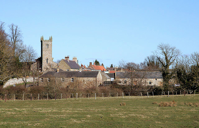
Whittingham
- Overview About Whittingham Map Street View Whittingham is a village and civil parish in Northumberland, England. It is situated on the banks of the River Aln, roughly 4.5 miles …
from https://northumberlandparishe…
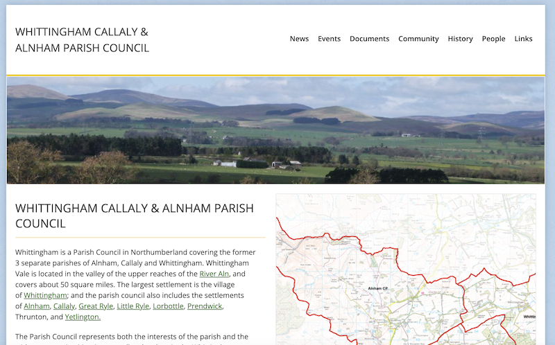
Whittingham, Callaly & Alnham Parish Council
- "Covering the parishes of Alnham, Callaly and Whittingham...." Previously known as Whittingham Vale Parish Council
Added by
Simon Cotterill

Co-Curate Page
Whittingham
- Overview About Whittingham Map Street View Whittingham is a village and civil parish in Northumberland, England. It is situated on the banks of the River Aln, roughly 4.5 miles …
from https://northumberlandparishe…
Whittingham, Callaly & Alnham Parish Council
- "Covering the parishes of Alnham, Callaly and Whittingham...." Previously known as Whittingham Vale Parish Council
Added by
Simon Cotterill


