Topics > Northumberland > Civil Parishes in Northumberland > West Allen Civil Parish
West Allen Civil Parish
Parish boundaries may have changed - for the latest map see the Parish Council or Northumberland County Council.
About the Parish
| Settlements: |
Carrshield, Coalcleugh, Limestone Brae, Ninebanks, Mohope |
| Population: |
280 (2021 Census) 279 (2011 Census) 282 (2001 Census) |
| Area: | 42.9 km2 |
| Parish Council: | West Allen Parish Council |
| Unitary Authority: | Northumberland County Council |
Historical |
|
| Ancient Parish: |
Allendale Parish (St Cuthbert) The ancient parish covered the areas of the modern civil parishes of Allendale and West Allen. The old parish had divisions (grieveships):
Ancient parishes refer to the parishes before the split between ecclesiastical (church) and civil parishes in the 19th century. They had a parish church and often were composed of multiple townships and chapelries. In many cases, townships and parishes were originally based on the territory of manors from the feudal system during medieval times. Civil parishes were created following the Poor Law Amendment Act 1866, in which Church of England parishes, extra-parochial areas, townships and chapelries, became "civil parishes" which could set their own poor rate (tax). Then the reforms of Local Government Act 1894 established elected civil parish councils (or parish meetings for parishes with less than 300 residents) and created urban and rural districts. Boundaries of parishes and civil parishes may have changed over time. |
| Ancient District: |
Tynedale (ward) |
| Poor Law Union: |
Hexham Poor Law Union, formed in 1836. Hexham Union Workhouse was located on Dean Street in Hexham, opening in 1839. This replaced smaller existing workhouses in Corbridge, Hexham and Horsley. Under the Poor Law Amendment Act of 1834 parishes were grouped into Unions, each of which had to build a workhouse if they did not already have one. It ended the old system of locally provided poor relief which had come under strain as numbers out of work grew, following increasing mechanisation of agriculture and the economic downturn after the Napoleonic Wars, along with changing social attitudes. The workhouse provided those unable to support themselves financially with accommodation and work. Inmates were generally segregated into men, women, boys and girls. The workhouse system was abolished by the Local Government Act 1929, but many workhouses lived on as ‘Public Assistance Institutions’ until the National Assistance Act 1948. |
|
Civil Parish Created: |
West Allen Civil Parish was created 1st April 1897 from the western area of Allendale Civil Parish. |
|
District Council: |
Hexham Rural District (1894 - 1974). The district was abolished in 1974, following the Local Government Act 1972. Tynedale District (1974 - 2009). Tynedale covered the area of 5 former districts (Hexham Urban District, Prudhoe Urban District, Bellingham Rural District, Haltwhistle Rural District, and Hexham Rural District). The borough council was abolished when Northumberland County Council became a unitary authority on the 1st of April 2009. |
|
County - pre 1572 |
Allendale was once part of 'The Regality of Hexhamshire' - an area probably relating to the land given by Queen Ethelreda to St. Wilfred in 674 to found the Priory of Hexham. Hexamshire included the ancient parishes of Hexham, Allendale and St John Lee. Up to the 12th century, Hexhamshire was part of the County Palantine of Durham, controlled by the powerful Prince Bishops of Durham. In the 12th century Hexhamshire was given full county status by Henry I, in an attempt to reduce the territory and power of the Prince Bishops of Durham. However, Hexhamshire was put under the control of the Archbishop of York, so in some respects could be considered to have been an 'enclave' of Yorkshire. |
|
County / Unitary Authority |
Allendale became part of Northumberland in 1572 when Parliament passed a bill annexing Hexham and Hexamshire to the County of Northumberland. The ancient county of Northumberland was enlarged following the Counties (Detached Parts) Act 1844; Bedlingtonshire, Norhamshire, Islandshire, the Farne Islands and Monks' House all became part of Northumberland. Up to then they had been enclaves of County Durham. Northumberland County Council formed 1889. Major boundary changes came into effect on the 1st April 1974. This followed the Local Government Act 1972, which formed the non-metropolitan county of Northumberland. This excluded the City of Newcastle upon Tyne and North Tyneside, which up to then had been part of Northumberland, but now became part of the newly formed Tyne & Wear. Northumberland County Council became a unitary authority on the 1st of April 2009. |
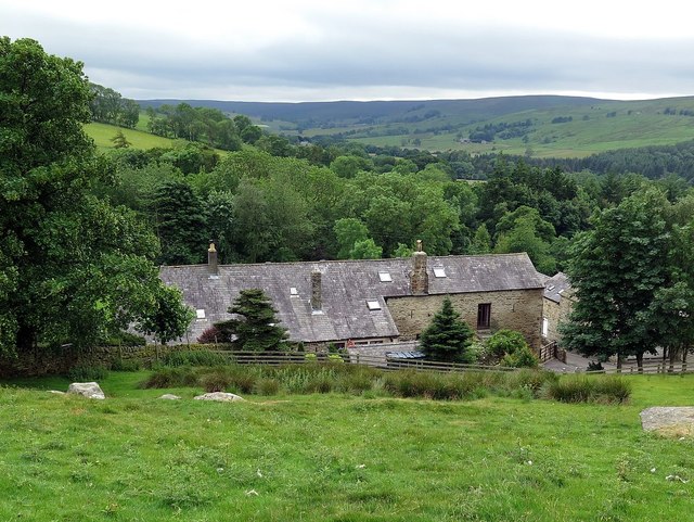
See also: ![]() Historic Buildings and Monuments in West Allen Civil Parish. Note: listed buildings are generally the responsibility of the county council / unitary authority, rather than the parish council.
Historic Buildings and Monuments in West Allen Civil Parish. Note: listed buildings are generally the responsibility of the county council / unitary authority, rather than the parish council.
from https://northumberlandparishe…
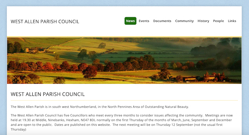
West Allen Parish Council
- "The West Allen Parish is in south west Northumberland, in the North Pennines Area of Outstanding Natural Beauty.
The West Allen Parish Council has five Councillors who meet every three …
Added by
Simon Cotterill
Co-Curate Page
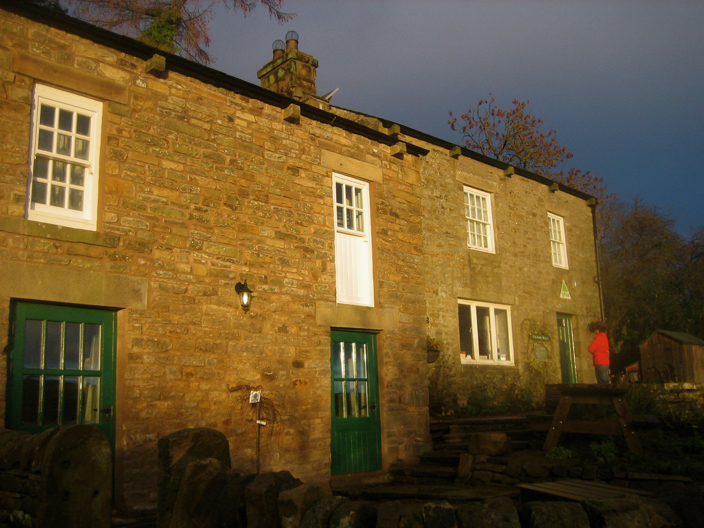
Ninebanks
- Overview About Ninebanks Map Street View NINEBANKS, a chapelry, in the parish of Allendale, union of Hexham, S. division of Tindale ward and of Northumberland, 10 miles (S. W.) from …
Co-Curate Page
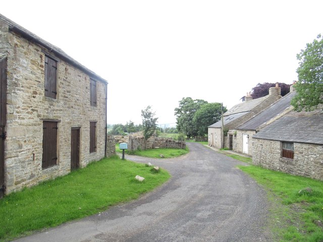
Carrshield
- Overview About Carrshield Map Street View Carrshield is a village situated by the River West Allen in Northumberland. It is part of West Allen Civil Parish. Carrshield is a village …
Co-Curate Page
Coalcleugh
- Overview Map Street View Coalcleugh is a distributed settlement in Northumberland, located near the county border with Cumbria, about 7 miles south of Allendale (town) and 5 miles east of …

Co-Curate Page
Limestone Brae, West Allen
- Overview Map Street View Limestone Brae is a hamlet situated by the River West Allen and located about 2 miles south of Ninebanks. There are a number of properties spread …
Co-Curate Page
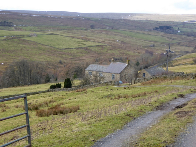
Nether House, West Allen
- Overview Map Nether House is a hamlet in West Allen Civil Parish in Northumberland, located about 1½ miles south-west of Ninebanks. It is situated by Mohope Burn, a little downstream …

Co-Curate Page
Hesleywell, West Allen
- Overview Map Hesleywell is a Farm / hamlet, located about 1½ miles south-west of Ninebanks in West Allen, Northumberland. It is situated to the east of Mohope Burn.

Co-Curate Page
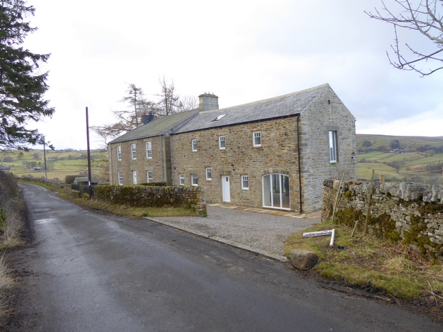
Farneyside, West Allen
- Overview Map Street View Farneyside (aka Farney Side) is a farm / hamlet situated by the River West Allen in Northumberland, about 1 mile south of Ninebanks. North of the …

Co-Curate Page
Farney Shield, West Allen
- Overview Map Farney Shield is a farm in West Allen, Northumberland. Whellan's 1855 directory of Northumberland lists Farney Shield under the grievship of High West Allen, in the ancient parish …

Co-Curate Page
High West Allen
- High West Allen was one of the eight "grieveships" (sub-divisions) of the ancient parish of Allendale in Northumberland. It covered a wide geographical area around the River West Allen, including …
Co-Curate Page
Low West Allen
- Low West Allen was one of the eight "grieveships" (sub-divisions) of the ancient parish of Allendale in Northumberland. It covered a wide geographical area around the River West Allen, including …
Co-Curate Page
Bates Hill, West Allen
- Overview Map Street View Bates Hill is a former(?) farm by the River West Allen in Northumberland. The farmhouse was renovated (sold in 2015) and the adjacent Bates Hill Barn …
Co-Curate Page
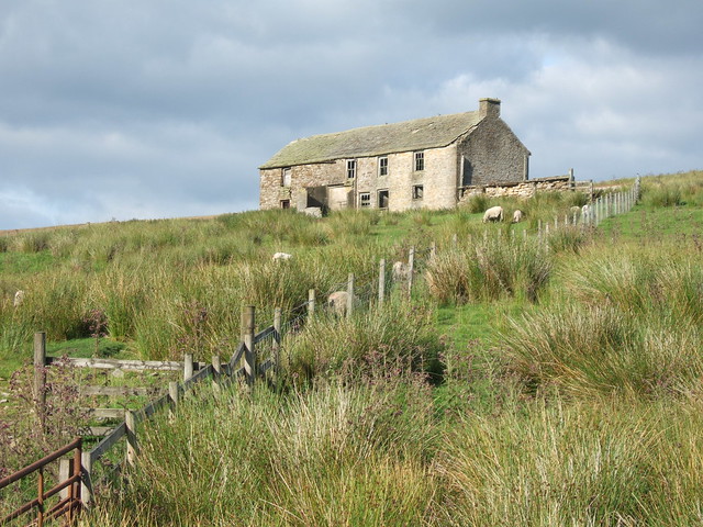
Spartywell
- Overview Map Street View Spartywell (aka Sparty Well) is located just under a mile south of Ninebanks in Northumberland .A medieval settlement was documented at Spartywell, but there are no …

Co-Curate Page
Wolfcleugh, West Allen
- Overview Map Street View Wolfcleugh (farm) and High Wolfcleugh are situated by the River West Allen, south of where the steep gorge of Wolf Cleugh (stream) joins the river. At …
Co-Curate Page
Turney Shield, West Allen
- Low Turney Shield and High Turney Shield are farms are located by the River West Allen, north of where Turney Cleugh joins the river. The farmhouse and outbuilding at Low …
Co-Curate Page
Gate House, West Allen
- Overview Map Gate House is a farm in Northumberland, situated by Gate House Burn, and located about 1 mile north of Ninebanks. Wellan's 1855 directory of Northumberland records Gate House …

Co-Curate Page
Leadgate, West Allen
- Overview Map Street View Leadgate Farm is located on Leadgate Bank (road) to the north-east of Ninebanks in Northumberland. It is one of many locations with the placename of Leadgate, …

Co-Curate Page
New Houses, West Allen
- Overview Map Street View New Houses is a short row of cottages located on Leadgate Bank (road), about 1 mile north-east of Ninebanks in Northumberland. They are close to High …

from https://northumberlandparishe…
West Allen Parish Council
- "The West Allen Parish is in south west Northumberland, in the North Pennines Area of Outstanding Natural Beauty.
The West Allen Parish Council has five Councillors who meet every three …
Added by
Simon Cotterill
Co-Curate Page
Ninebanks
- Overview About Ninebanks Map Street View NINEBANKS, a chapelry, in the parish of Allendale, union of Hexham, S. division of Tindale ward and of Northumberland, 10 miles (S. W.) from …
Co-Curate Page
Carrshield
- Overview About Carrshield Map Street View Carrshield is a village situated by the River West Allen in Northumberland. It is part of West Allen Civil Parish. Carrshield is a village …
Co-Curate Page
Coalcleugh
- Overview Map Street View Coalcleugh is a distributed settlement in Northumberland, located near the county border with Cumbria, about 7 miles south of Allendale (town) and 5 miles east of …
Co-Curate Page
Limestone Brae, West Allen
- Overview Map Street View Limestone Brae is a hamlet situated by the River West Allen and located about 2 miles south of Ninebanks. There are a number of properties spread …
Co-Curate Page
Nether House, West Allen
- Overview Map Nether House is a hamlet in West Allen Civil Parish in Northumberland, located about 1½ miles south-west of Ninebanks. It is situated by Mohope Burn, a little downstream …
Co-Curate Page
Hesleywell, West Allen
- Overview Map Hesleywell is a Farm / hamlet, located about 1½ miles south-west of Ninebanks in West Allen, Northumberland. It is situated to the east of Mohope Burn.
Co-Curate Page
Farneyside, West Allen
- Overview Map Street View Farneyside (aka Farney Side) is a farm / hamlet situated by the River West Allen in Northumberland, about 1 mile south of Ninebanks. North of the …
Co-Curate Page
Farney Shield, West Allen
- Overview Map Farney Shield is a farm in West Allen, Northumberland. Whellan's 1855 directory of Northumberland lists Farney Shield under the grievship of High West Allen, in the ancient parish …
Co-Curate Page
High West Allen
- High West Allen was one of the eight "grieveships" (sub-divisions) of the ancient parish of Allendale in Northumberland. It covered a wide geographical area around the River West Allen, including …
Co-Curate Page
Low West Allen
- Low West Allen was one of the eight "grieveships" (sub-divisions) of the ancient parish of Allendale in Northumberland. It covered a wide geographical area around the River West Allen, including …
Co-Curate Page
Bates Hill, West Allen
- Overview Map Street View Bates Hill is a former(?) farm by the River West Allen in Northumberland. The farmhouse was renovated (sold in 2015) and the adjacent Bates Hill Barn …
Co-Curate Page
Spartywell
- Overview Map Street View Spartywell (aka Sparty Well) is located just under a mile south of Ninebanks in Northumberland .A medieval settlement was documented at Spartywell, but there are no …
Co-Curate Page
Wolfcleugh, West Allen
- Overview Map Street View Wolfcleugh (farm) and High Wolfcleugh are situated by the River West Allen, south of where the steep gorge of Wolf Cleugh (stream) joins the river. At …
Co-Curate Page
Turney Shield, West Allen
- Low Turney Shield and High Turney Shield are farms are located by the River West Allen, north of where Turney Cleugh joins the river. The farmhouse and outbuilding at Low …
Co-Curate Page
Gate House, West Allen
- Overview Map Gate House is a farm in Northumberland, situated by Gate House Burn, and located about 1 mile north of Ninebanks. Wellan's 1855 directory of Northumberland records Gate House …
Co-Curate Page
Leadgate, West Allen
- Overview Map Street View Leadgate Farm is located on Leadgate Bank (road) to the north-east of Ninebanks in Northumberland. It is one of many locations with the placename of Leadgate, …


