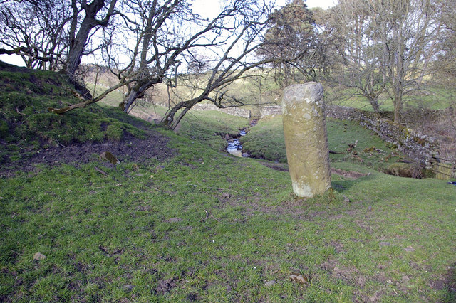
Pasture, Bradley Burn and Roman milestone, near Vindolanda


-
Description
"Just to the north of the line of the Stanegate Roman road. The fort at Vindolanda lies about 130m to the southwest. The mound to the left (only part of which can be seen) is shown on OS maps as a tumulus. The milestone indicates the 15th Roman mile west of Corbridge." Photo by Phil Champion, 2007, and licensed for reuse under a Creative Commons Licence. -
Owner
Geograph.org.uk -
Source
Geograph (Geograph) -
License
What does this mean? Attribution-ShareAlike 2.0 Generic (CC BY-SA 2.0)
-
Further information
Link: http://www.geograph.org.uk/photo/409042
Resource type: Text/Website
Added by: Simon Cotterill
Last modified: 10 years, 8 months ago
Viewed: 1184 times
Picture Taken: Unknown -
Co-Curate tags


