Topics > Tyne and Wear > Newcastle upon Tyne > Jesmond Vale
Jesmond Vale
Geography
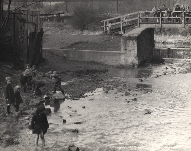
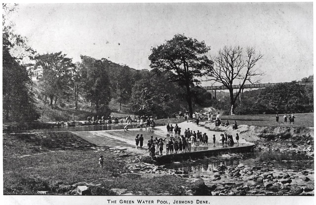
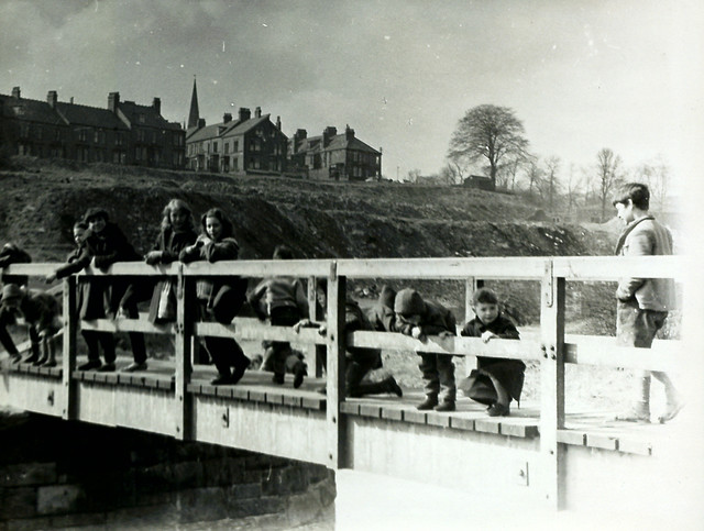
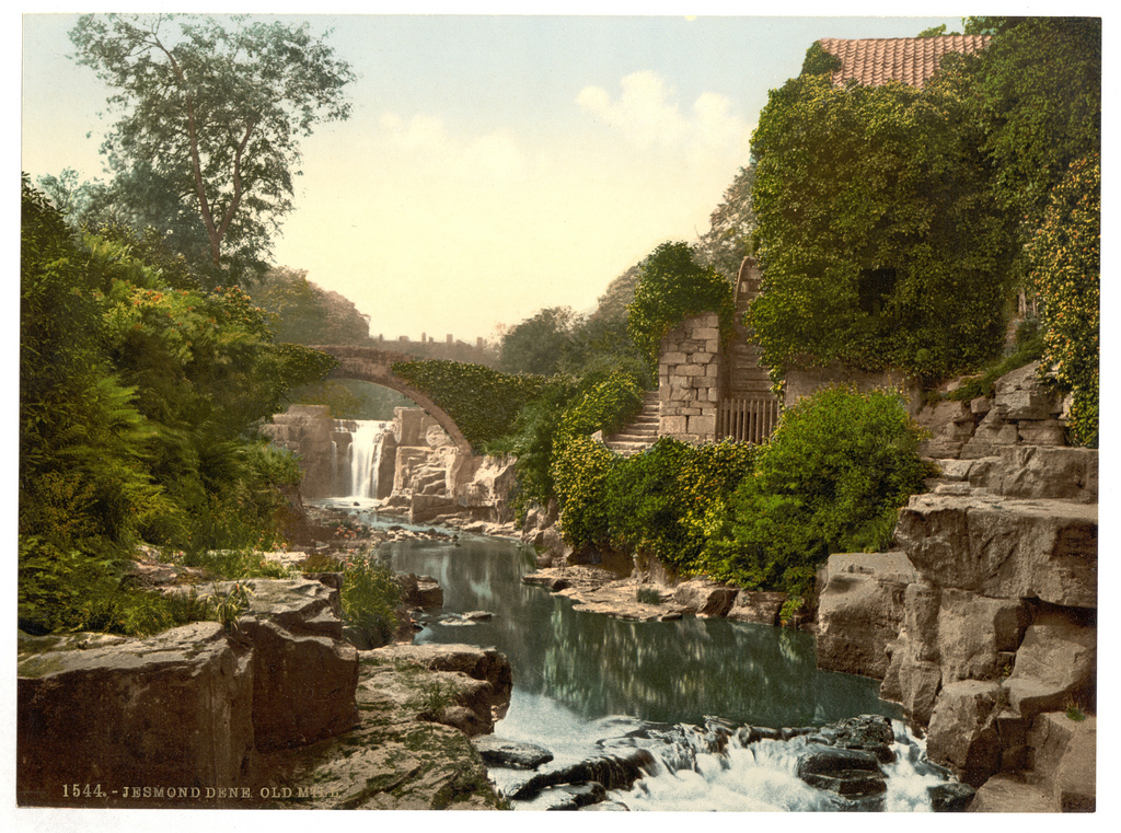
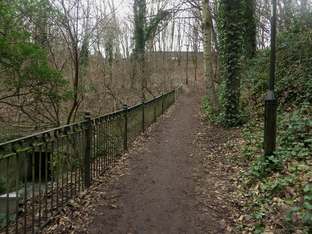
The area includes Armstrong Park, Heaton Park and Ouseburn Park. It has other recreational green areas, housing, allotment gardens and a pub. It also includes a street named 'Jesmond Vale'. The locality is a mainly wooded and grassed area between The Cradlewell and Armstrong Bridge to the north and Stratford Grove to the south. The Ouseburn flows through it and eventually into the River Tyne. It is mostly administered by the city council ward of South Jesmond. The Ouse Burn flows from the north, through Jesmond Dene then underneath the historic Armstrong Bridge where it enters Jesmond Vale. It then flows in between some allotment gardens alongside the lower edges of Armstrong Park and Heaton Park, flowing over a weir at the white bridge near Greenwater Pool. It then flows under an old stone bridge near The Bluebell pub, and on through Ouseburn Park, past the Newcastle music resource centre. It goes under another stone bridge, then it enters a culvert in Ouseburn Park where Jesmond Vale ends and the Lower Ouseburn Valley starts.
History
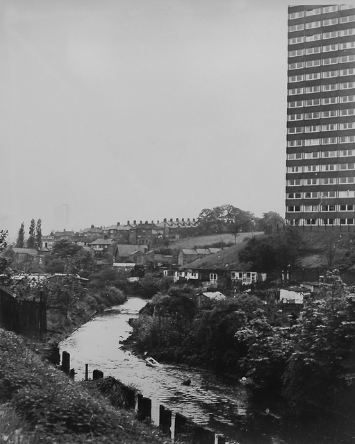
The use of Jesmond Vale changed from farming to industry to leisure and housing with an extensive slum demolition in the 1960s. The vale is now mostly given over to parks, allotments and routes used by recreational walkers.
Lost Village
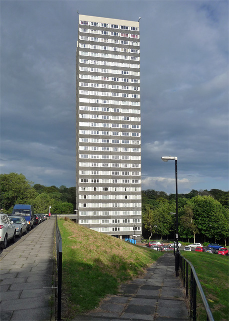
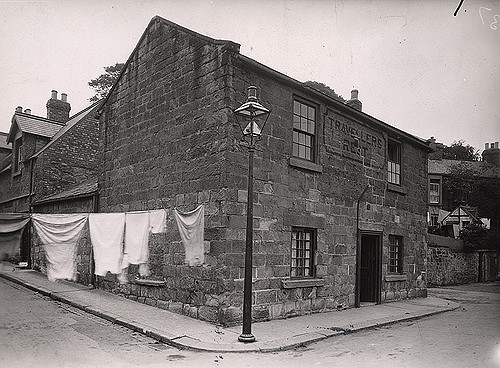
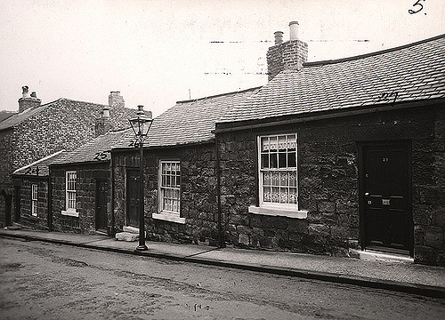
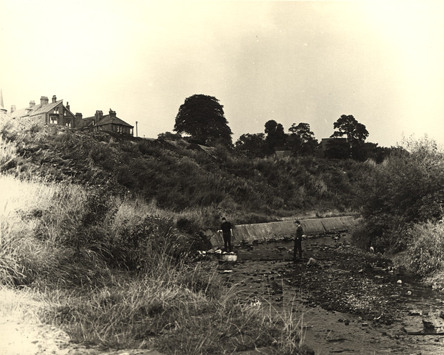
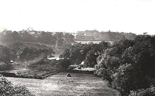
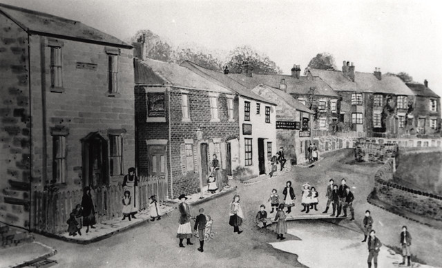
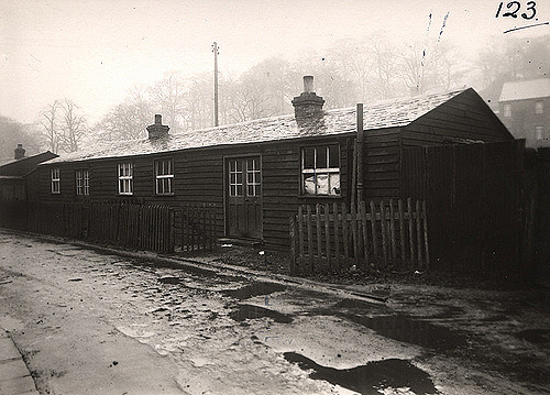
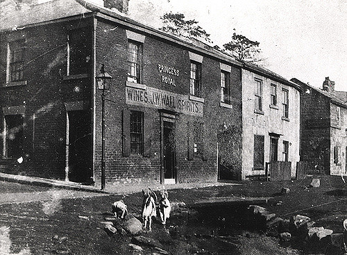
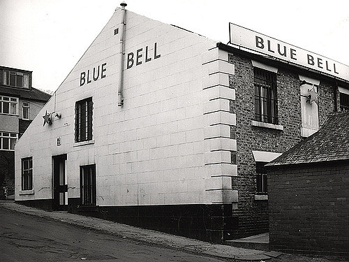
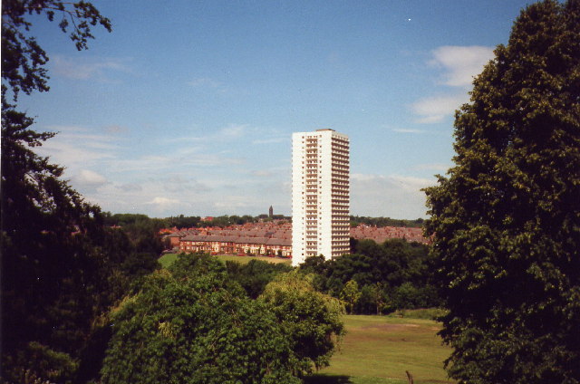
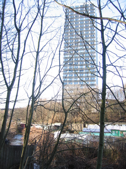
The old village of Jesmond Vale used to sit amongst fields in the bottom of the Ouseburn Valley, a tranquil haven away from the bustle of the city. The village had three pubs, a farm and a mill beside the river. The remains of the mill can still be seen, and the leat which fed it can be traced back to the mill dam at Greenwater Pool. Originally a corn mill, it was later adapted to grind flint for use as glaze in the pottery industry. Flint was brought into the Tyne as ballast on cargo ships and was then carted up to the mills on the Ouseburn. The bulk of the old village was demolished in the 1960s when the Vale was earmarked for redevelopment. Of the three pubs only the Bluebell Inn survives. Much of the housing was replaced in the 1960s by a residential tower block of 28 storeys.
Cradlewell Bypass
In the 1990s an ambitious road project bypassed the Cradlewell area of Jesmond replacing the steep gradients of Benton Bank and joining Jesmond Road with the Coast Road. In order to build it several ancient trees were cut down at the northern end of Jesmond Vale. Environmentalist protesters were drawn from all over the country and they delayed construction by constructing tree houses and camping in the tree-tops.
Prior to construction a large concrete pillar was built at Benton Bank as a test pillar. Even though it was no longer needed it remained there for some 20 years before it was finally removed.
Visit the page: Jesmond Vale for references and further details. You can contribute to this article on Wikipedia.
from Newcastle libraries (flickr)
035240:Jesmond Vale Jesmond Dept of Environmental Health 1937
Pinned by Simon Cotterill
from Newcastle libraries (flickr)
034929:Fore Street Jesmond Vale Jesmond Dept of Environmental Health 1937
Pinned by Simon Cotterill
from Newcastle libraries (flickr)
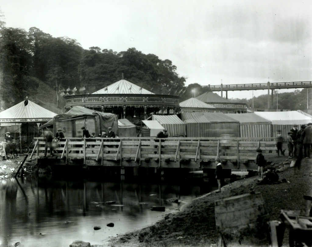
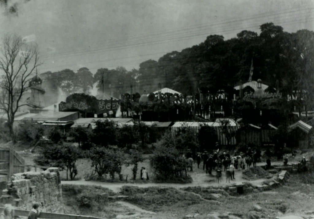
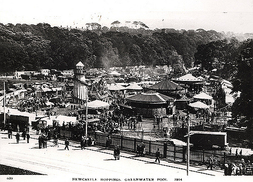
Jesmond Vale Hoppings, Newcastle upon Tyne, 1914
Pinned by Simon Cotterill
from Newcastle libraries (flickr)
Jesmond Vale Hoppings, Newcastle upon Tyne, 1914
Pinned by Simon Cotterill
from Newcastle libraries (flickr)
060272:Jesmond Vale Jesmond Torday L. c.1972
Pinned by Simon Cotterill
from Newcastle libraries (flickr)
058920:Jesmond Vale Jesmond Torday L. 1970
Pinned by Simon Cotterill
from Newcastle libraries (flickr)
032515:Jesmond Vale Jesmond Unknown c.1900
Pinned by Simon Cotterill
from Newcastle libraries (flickr)
014399:Newcastle Hoppings, Jesmond Vale, 1914
Pinned by Simon Cotterill
from Newcastle libraries (flickr)
053118:The Cundy Jesmond Vale Jesmond Unknown c.1890
Pinned by Simon Cotterill
from Newcastle libraries (flickr)
065057:Greenwater Pool Jesmond Vale Newcastle upon Tyne Unknown 1903
Pinned by Simon Cotterill
from Newcastle libraries (flickr)
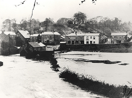
049448:Jesmond Vale during the floods of 1903 Unknown 1903
Pinned by Simon Cotterill
from Newcastle libraries (flickr)
036293:Flint Mill Cottages Jesmond Vale Jesmond Dept of Environmental Health c.1935
Pinned by Simon Cotterill
from Newcastle libraries (flickr)
Tor009, Jesmond Vale, Newcastle upon Tyne
Pinned by Simon Cotterill
from Newcastle libraries (flickr)
015795:Princess Royal Jesmond Vale Unknown c.1920
Pinned by Simon Cotterill
from Newcastle libraries (flickr)
Tor134, Jesmond Vale, Newcastle upon Tyne
Pinned by Simon Cotterill
from Newcastle libraries (flickr)
Tor008, Jesmond Vale, Newcastle upon Tyne
Pinned by Simon Cotterill
from Newcastle libraries (flickr)
013794:Apple Tree Inn Jesmond Vale c. 1887
Pinned by Simon Cotterill
Co-Curate Page
Jesmond Dene
- Overview About Jesmond Dene Map Street View Jesmond Dene is a public park in the valley of the Ouseburn river in Jesmond, Newcastle. The park was originally laid out in …
Co-Curate Page
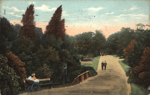
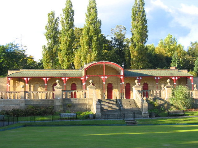
Armstrong Park
- Overview Map Street View Armstrong Park in Newcastle, connects with Jesmond Dene and Heaton Park to form a large green space, a short distance north-east of the city centre. Armstrong …
Co-Curate Page
Heaton Park
- Overview Map Street View Heaton Park has a network of footpaths and connects with Armstrong Park, Jesmond Dene and Ouseburn Park. The Pavilion building in the park was refurbished in …
from Newcastle libraries (flickr)
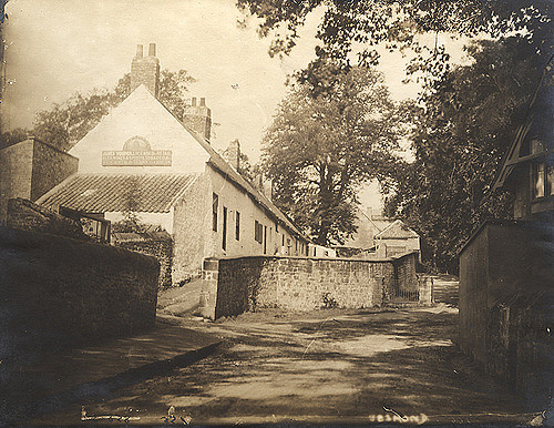
033948:Blue Bell Jesmond Vale Unknown c.1965
Pinned by Simon Cotterill
Co-Curate Page
Ouseburn (river)
- Overview About the Ouseburn The Ouseburn is a tributary to the River Tyne. Its source is at Callerton, near Newcastle Airport. It flows through Kingston Park, Newcastle Great Park, Gosforth …
from https://urbangreennewcastle.o…
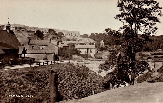
Jesmond Vale
- "...Jesmond Vale is a mix of woodland and grassland to the south of Jesmond Dene and Armstrong Bridge with a network of footpaths connecting it to Jesmond Dene, Armstrong Park …
Added by
Simon Cotterill
from Flickr (flickr)
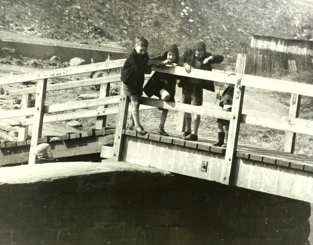
Jesmond Vale, near Newcastle upon Tyne - real photographic postcard
Pinned by Peter Smith

from Newcastle libraries (flickr)
035240:Jesmond Vale Jesmond Dept of Environmental Health 1937
Pinned by Simon Cotterill
from Newcastle libraries (flickr)
034929:Fore Street Jesmond Vale Jesmond Dept of Environmental Health 1937
Pinned by Simon Cotterill
from Newcastle libraries (flickr)
Jesmond Vale Hoppings, Newcastle upon Tyne, 1914
Pinned by Simon Cotterill
from Newcastle libraries (flickr)
Jesmond Vale Hoppings, Newcastle upon Tyne, 1914
Pinned by Simon Cotterill
from Newcastle libraries (flickr)
060272:Jesmond Vale Jesmond Torday L. c.1972
Pinned by Simon Cotterill
from Newcastle libraries (flickr)
058920:Jesmond Vale Jesmond Torday L. 1970
Pinned by Simon Cotterill
from Newcastle libraries (flickr)
032515:Jesmond Vale Jesmond Unknown c.1900
Pinned by Simon Cotterill
from Newcastle libraries (flickr)
014399:Newcastle Hoppings, Jesmond Vale, 1914
Pinned by Simon Cotterill
from Newcastle libraries (flickr)
053118:The Cundy Jesmond Vale Jesmond Unknown c.1890
Pinned by Simon Cotterill
from Newcastle libraries (flickr)
065057:Greenwater Pool Jesmond Vale Newcastle upon Tyne Unknown 1903
Pinned by Simon Cotterill
from Newcastle libraries (flickr)
049448:Jesmond Vale during the floods of 1903 Unknown 1903
Pinned by Simon Cotterill
from Newcastle libraries (flickr)
036293:Flint Mill Cottages Jesmond Vale Jesmond Dept of Environmental Health c.1935
Pinned by Simon Cotterill
from Newcastle libraries (flickr)
Tor009, Jesmond Vale, Newcastle upon Tyne
Pinned by Simon Cotterill
from Newcastle libraries (flickr)
015795:Princess Royal Jesmond Vale Unknown c.1920
Pinned by Simon Cotterill
from Newcastle libraries (flickr)
Tor134, Jesmond Vale, Newcastle upon Tyne
Pinned by Simon Cotterill
from Newcastle libraries (flickr)
Tor008, Jesmond Vale, Newcastle upon Tyne
Pinned by Simon Cotterill
from Newcastle libraries (flickr)
013794:Apple Tree Inn Jesmond Vale c. 1887
Pinned by Simon Cotterill
Co-Curate Page
Jesmond Dene
- Overview About Jesmond Dene Map Street View Jesmond Dene is a public park in the valley of the Ouseburn river in Jesmond, Newcastle. The park was originally laid out in …
Co-Curate Page
Armstrong Park
- Overview Map Street View Armstrong Park in Newcastle, connects with Jesmond Dene and Heaton Park to form a large green space, a short distance north-east of the city centre. Armstrong …
Co-Curate Page
Heaton Park
- Overview Map Street View Heaton Park has a network of footpaths and connects with Armstrong Park, Jesmond Dene and Ouseburn Park. The Pavilion building in the park was refurbished in …
from Newcastle libraries (flickr)
033948:Blue Bell Jesmond Vale Unknown c.1965
Pinned by Simon Cotterill
Co-Curate Page
Ouseburn (river)
- Overview About the Ouseburn The Ouseburn is a tributary to the River Tyne. Its source is at Callerton, near Newcastle Airport. It flows through Kingston Park, Newcastle Great Park, Gosforth …
from https://urbangreennewcastle.o…
Jesmond Vale
- "...Jesmond Vale is a mix of woodland and grassland to the south of Jesmond Dene and Armstrong Bridge with a network of footpaths connecting it to Jesmond Dene, Armstrong Park …
Added by
Simon Cotterill
from Flickr (flickr)
Jesmond Vale, near Newcastle upon Tyne - real photographic postcard
Pinned by Peter Smith