Topics > Northumberland > Civil Parishes in Northumberland > Stamfordham Civil Parish > Historic Buildings and Monuments in Stamfordham Civil Parish
Historic Buildings and Monuments in Stamfordham Civil Parish
Listed buildings and scheduled monuments in Stamfordham Civil Parish, Northumberland, from the National Heritage List for England[1]. In the absence of a published 'local list', some other public buildings of interest may also be included. Use the Search (below) if looking for a specific building / monument.
| Structure | List No. | Grade | Built~ | Notes |
|---|---|---|---|---|
| Nos. 1 and 2 Lane House Cottages, Bridge End | 1042679 | II | ||
| No. 1, North Side | 1042704 | II | ||
| Nos. 19 and 20, North Side | 1370764 | II | ||
| No. 2, North Side | 1178870 | II | ||
| No. 21, North Side | 1042665 | II | ||
| No. 23, North Side | 1042667 | II | ||
| No. 33, North Side | 1042669 | II | ||
| 8 Headstones 5-15 Yards South-East of Church of St Mary | 1302108 | II | C18th | Churchyard, St Mary's |
| 9 Headstones 5-10 Yards East of Church of St Mary | 1042674 | II | C18th | Churchyard, St Mary's |
| Bank House | 1042668 | II | ||
| Boswell, Dimin and One Other Tomb Approximately 5 Yards South of Church of St Mary | 1042673 | II | C18th | Churchyard, St Mary's |
| Broomy Hill Farmhouse and Attached Garden Walls | 1042697 | II | ||
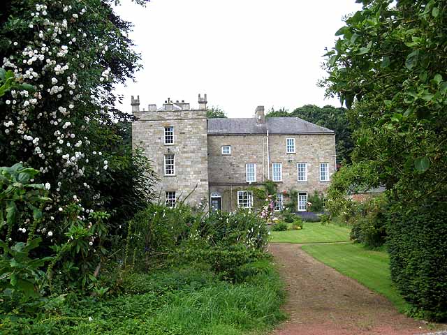
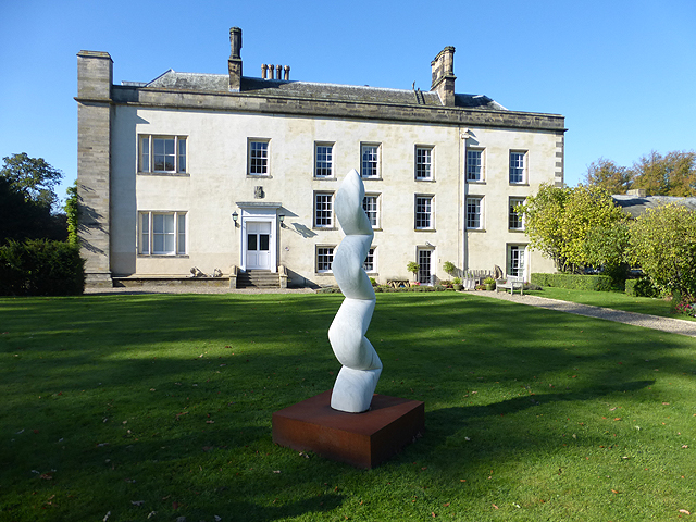
| Cheeseburn Grange | 1370742 | II* | 1813 | By John Dobson |
| Church House | 1370768 | II | ||
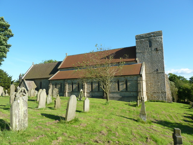
| Church of St Mary | 1370769 | I | Saxon | Extensively restored in 1847 |
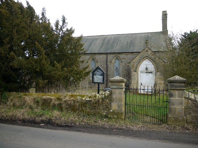
| Church of the Holy Trinity | 1042698 | II | 1836 | Dalton. By John Green. |
| Conduithead | 1370745 | II | ||
| Cross House | 1370765 | II | ||
| Dalton House | 1302275 | II | ||
| Dovecote and Pigsties Approximately 50 Yards North of Cheeseburn Grange | 1042694 | II | ||
| Eachwick Hall | 1302251 | II* | C18th | Eachwick |
| Eachwick House | 1370744 | II | ||
| Farmbuildings to North of Heatherslaw Farmhouse | 1042677 | II | ||
| Garden House | 1042675 | II | ||
| Garden Wall and Summerhouse Approximately 100 Yards North of Cheeseburn Grange | 1178718 | II | ||
| Garden Walls and Gatepiers South of Hawkwell House | 1179169 | II | ||
| Garden Walls Railings and Gate in Front of Number 22 | 1042666 | II | ||
| Gates, Gatepiers and Screen Walls Approximately 100 Yards South-West of Eachwick Hall | 1042701 | II | ||
| Gateway Approximately 200 Yards West of Cheeseburn Grange | 1042696 | II | ||
| Gingang and Barn East of Eachwick House | 1042702 | II | ||
| Grange House Farmhouse | 1042703 | II | ||
| Green, Brown, Bates and Twizell Headstones Approximately 5 Yards South of Church of St Mary | 1302101 | II | C18th | Churchyard, St Mary's |
| Hawkwell Farmhouse | 1302082 | II | ||
| Hawkwell House | 1370732 | II* | 1679 | Hawkwell. |
| Heatherslaw Farmhouse and Attatched Garden Shed | 1302069 | II | ||
| Heugh House | 1302043 | II | ||
| Heugh Mill Bridge | 1042678 | II | C19th | |
| Hill House | 1370766 | II | ||
| Keel, Fothergill, Smith and Collingwood Headstones Approximately 1 Foot South of Church of St Mary | 1179063 | II | C18th | Churchyard, St Mary's |
| Kennels Cottage | 1042680 | II | ||
| Lane House | 1302050 | II | ||
| Low Cross House | 1302178 | II | ||
| Mainsbank Farmhouse | 1179271 | II | ||
| Medburn Bridge | 1302236 | II | C19th | |
| Railings and Wall Approximately 30 Yards East of Eachwick Hall | 1042700 | II | ||
| Rose Cottage | 1302270 | II | ||
| Rutherford and Brown Headstones Approximately 5 Yards South of Church of St Mary | 1370731 | II | C18th | Churchyard, St Mary's |
| Scott, Harrison, Carwick and 3 Other Headstones Against West Wall of Church of St Mary | 1042672 | II | C18th | Churchyard, St Mary's |
| Stable and Carriage House Approximately 30 Yards North of Eachwick Hall | 1302257 | II | ||
| Stable Approximately 20 Yards East of Number 7 | 1042676 | II | ||
| Stable Cottage | 1302318 | II | ||
| Store House | 1042670 | II | ||
| Sundial in Walled Garden at Cheeseburn Grange | 1370743 | II | ||
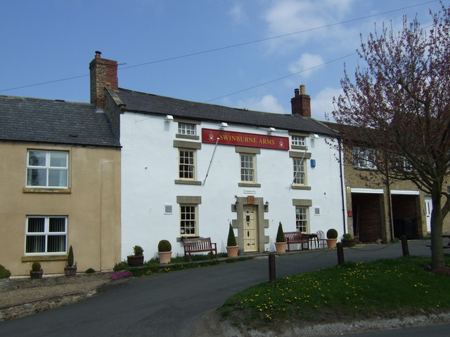
| Swinburne Arms | 1370767 | II | C18th | Stamfordham |
| Terrace Wall and Railings 2 Yards South of Eachwick House | 1302261 | II | ||
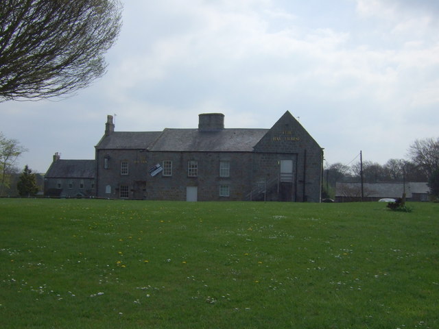
| The Bay Horse | 1178973 | II | C18th | Former inn. Closed 2015. |
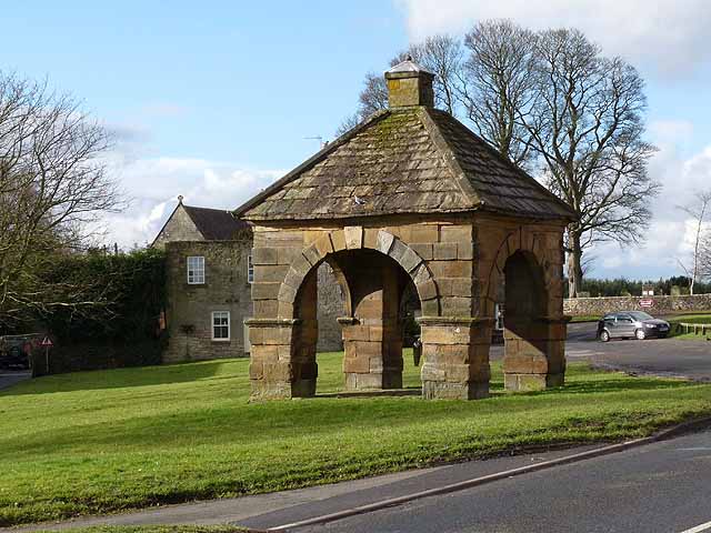
| The Butter Cross | 1178857 | II | 1735 | Stamfordham, village green. |
| The Croft | 1178958 | II | ||
| The Old Chapel | 1042663 | II | C19th | Stamfordham, North Side |
| The Old Manse | 1042664 | II | ||
| The Old Schoolhouse | 1042699 | II | 1843 | Dalton. |
| The Old Vicarage | 1302131 | II | ||
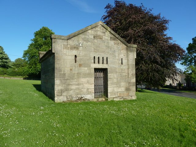
| Village Lock-Up | 1178865 | II | c.1838 | Stamfordham, village green. |
| Wall and Gateway North of Church of the Holy Trinity | 1302282 | II | ||
| Walled Garden Approximately 150 Yards North of Cheeseburn Grange | 1042695 | II | ||
| Wellhead Approximately 150 Yards North of Cheeseburn Grange | 1178739 | II | ||
| Widdrington House | 1042671 | II | ||
| Market cross | 1006576 | n/a | Scheduled Monument | |
| Shrunken medieval village, The Heugh | 1006428 | n/a | Scheduled Monument | |
| Hadrian's Wall from Oatens Bank, Harlow Hill, to Whittle Dene Watercourse in wall mile 16 | 1010620 | n/a | Scheduled Monument | |
| The vallum between Oatens Bank, Harlow Hill, and Whittle Dene Watercourse in wall mile 16 | 1010621 | n/a | Scheduled Monument | |
| Hadrian's Wall and vallum between the March Burn and Oatens Bank, Harlow Hill in wall miles 13,14 and 15 | 1010618 | n/a | Scheduled Monument | |
| Stamfordham Village Hall | not listed | n/a | 1880 | Former school |
| The Church on the Green | not listed | n/a | C19th | Stamfordham, Grange Road |
| Stamfordham Conservation Area | - | n/a | Conservation Area |
Primary source: the National Heritage List for England - NHLE is the register of nationally protected historic buildings and sites in England, including listed buildings, scheduled monuments, protected wrecks, registered parks and gardens, and battlefields. The list is maintained by Historic England. Check NHLE for updates and new entries. Secondary sources: British Listed Buildings and Keys to the Past.
Co-Curate Page
Swinburne Arms
- Overview Map Street View The Swinburne Arms is a public house located on North Side in Stamfordham, Northumberland. It was built as an inn in the mid 18th Century and …
Co-Curate Page
Church of St Mary the Virgin
- Overview Map Street View The Church of St Mary the Virgin in Stamfordham was extensively restored in 1847 by Benjamin Ferrey. Stone from the existing ancient church were reused in …
Co-Curate Page
Cheeseburn Grange
- Overview Map Street View CHEESEBURN-GRANGE, a township, in the parish of Stamfordham, union of Castle ward, N.E. division of Tindale ward, S. division of Northumberland, 12 miles (N.W. by W.) …
Co-Curate Page
Market Cross
- Overview Map Street View The Market Cross (aka "Butter Cross") is located on the western side of the village green in Stamfordham. It is a small square, single-storey building, with …
Co-Curate Page
Old Jail
- Overview Map Street View The old village lock-up on the village green in Stamfordham was built in the early 19th century, incorporating the core of an earlier building. It is a …
Co-Curate Page
Former Bay Horse Inn
- Overview Map Street View The Bay Horse on South Side, by the village green in Stamfordham, is a former public house, which closed in c.2015. The inn built in the 18th …
Co-Curate Page
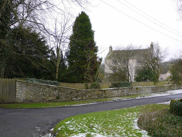
Hawkwell House
- Hawkwell House in Hawkwell, Northumberland, dates from 1679. The core of the building may be even older. Hawkwell House is Grade II* listed on the National Heritage List for England.
Co-Curate Page
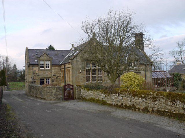
The Old School House, Dalton
- Overview Map The Old Schoolhouse in Dalton near Ponteland was originally built in 1843 as a school and schoolmaster's house. The building is Grade II listed on the National Heritage …
Co-Curate Page
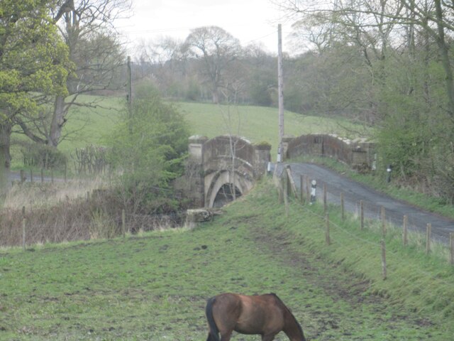
Eachwick Bridge
- Overview Map Street View The stone road bridge over the River Pont, to the east of Eachwick, was built in 1819. It is part of landscaped setting of Dissington Hall. …
Co-Curate Page
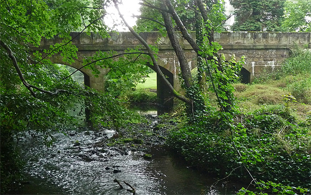
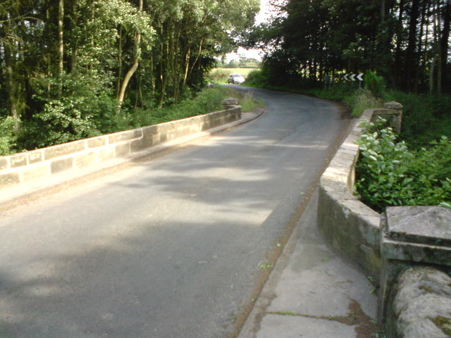
Heugh Mill Bridge, near Stamfordham
- Overview Map Street View Heugh Mill Bridge is a stone road bridge over the River Pont, located just over half mile east of the village of Stamfordham, in Northumberland. The …
Co-Curate Page
Medburn Bridge, near Stamfordham
- Overview Map Street View Medburn Bridge is a road bridge over the Med Burn, located about 2 miles south-east of the village of Stamfordham. The stone bridge dates from the …
Co-Curate Page
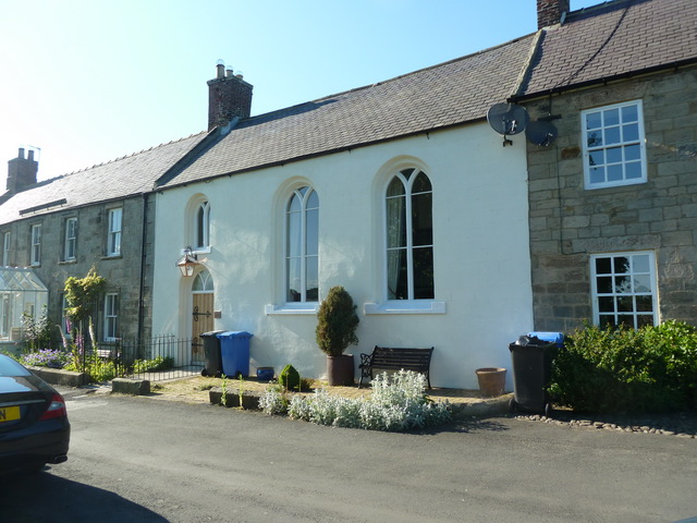
The Old Chapel, Stamfordham
- Overview Street View The Old Chapel is located on North Side (the road along the north edage of the village green) in Stamfordham. Originally a house, the building was converted …
Co-Curate Page
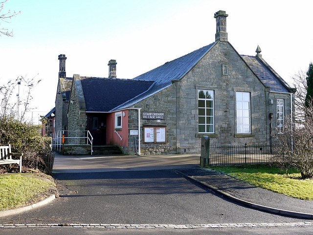
Stamfordham Village Hall
- Overview Map Street View The Village Hall in Stamfordham was originally built as the Village School in 1878 and officially opened in March 1880. A new school building opened in …
Co-Curate Page
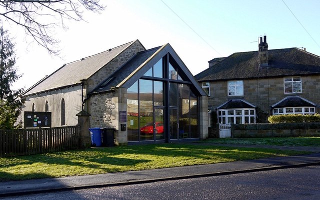
The Church on the Green, Stamfordham
- Overview Map Street View Stamfordham Uniting Church (known as 'The Church on the Green') is located on Grange Road at the east side of the Village Green in Stamfordham. It …


Co-Curate Page
Swinburne Arms
- Overview Map Street View The Swinburne Arms is a public house located on North Side in Stamfordham, Northumberland. It was built as an inn in the mid 18th Century and …

Co-Curate Page
Church of St Mary the Virgin
- Overview Map Street View The Church of St Mary the Virgin in Stamfordham was extensively restored in 1847 by Benjamin Ferrey. Stone from the existing ancient church were reused in …

Co-Curate Page
Cheeseburn Grange
- Overview Map Street View CHEESEBURN-GRANGE, a township, in the parish of Stamfordham, union of Castle ward, N.E. division of Tindale ward, S. division of Northumberland, 12 miles (N.W. by W.) …

Co-Curate Page
Market Cross
- Overview Map Street View The Market Cross (aka "Butter Cross") is located on the western side of the village green in Stamfordham. It is a small square, single-storey building, with …

Co-Curate Page
Old Jail
- Overview Map Street View The old village lock-up on the village green in Stamfordham was built in the early 19th century, incorporating the core of an earlier building. It is a …

Co-Curate Page
Former Bay Horse Inn
- Overview Map Street View The Bay Horse on South Side, by the village green in Stamfordham, is a former public house, which closed in c.2015. The inn built in the 18th …

Co-Curate Page
Hawkwell House
- Hawkwell House in Hawkwell, Northumberland, dates from 1679. The core of the building may be even older. Hawkwell House is Grade II* listed on the National Heritage List for England.

Co-Curate Page
The Old School House, Dalton
- Overview Map The Old Schoolhouse in Dalton near Ponteland was originally built in 1843 as a school and schoolmaster's house. The building is Grade II listed on the National Heritage …

Co-Curate Page
Eachwick Bridge
- Overview Map Street View The stone road bridge over the River Pont, to the east of Eachwick, was built in 1819. It is part of landscaped setting of Dissington Hall. …

Co-Curate Page
Heugh Mill Bridge, near Stamfordham
- Overview Map Street View Heugh Mill Bridge is a stone road bridge over the River Pont, located just over half mile east of the village of Stamfordham, in Northumberland. The …

Co-Curate Page
Medburn Bridge, near Stamfordham
- Overview Map Street View Medburn Bridge is a road bridge over the Med Burn, located about 2 miles south-east of the village of Stamfordham. The stone bridge dates from the …

Co-Curate Page
The Old Chapel, Stamfordham
- Overview Street View The Old Chapel is located on North Side (the road along the north edage of the village green) in Stamfordham. Originally a house, the building was converted …

Co-Curate Page
Stamfordham Village Hall
- Overview Map Street View The Village Hall in Stamfordham was originally built as the Village School in 1878 and officially opened in March 1880. A new school building opened in …

