Topics > Northumberland > Civil Parishes in Northumberland > Wallington Demesne Civil Parish > Historic Buildings and Monuments in Wallington Demesne Civil Parish
Historic Buildings and Monuments in Wallington Demesne Civil Parish
Listed buildings and scheduled monuments in Wallington Demesne Civil Parish, Northumberland, from the National Heritage List for England[1]. Use the Search (below) if looking for a specific building / monument.
| Structure | List No. | Grade | Built~ | Notes |
|---|---|---|---|---|
| Nos. 1-3, Middle Row | 1370669 | II | ||
| Nos. 2-5, Front Row | 1042890 | II | ||
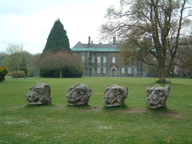
| 4 Stone Dragons Heads on Lawn East of Hall | 1154450 | II* | C16th | Wallington |
| Nos. 7-9, Front Row | 1042891 | II | ||
| Bolt Cottage and Outbuilding to North | 1154320 | II | ||
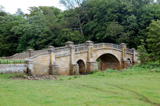
| Bridge over River Wansbeck | 1303956 | I | 1755 | South of Wallington |
| Calverley Cottage and The Vicarage | 1042853 | II | ||
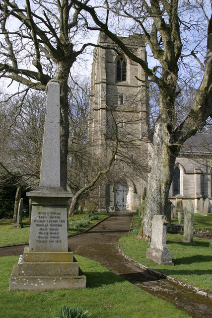
| Cambo War Memorial | 1434944 | II | 1920 | |
| Cartshed, Yard Walls and Attached Structures to Rear of No 1 | 1042889 | II | ||
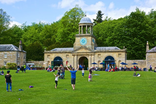
| Clock Tower Gate | 1042870 | I | 1754 | Wallington. By Daniel Garrett |
| Congregational Church | 1303907 | II | ||
| Conservatory in Walled Garden | 1042866 | II | ||
| Corridge Farmhouse | 1042856 | II | ||
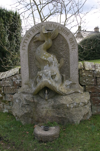
| Drinking Fountain 40 Metres East of Post Office | 1370671 | II | 1880 | Cambo |
| Eastern Cottage Adjacent to Manse | 1303892 | II | ||
| Farm Buildings to West of Prior's Hall Farmhouse | 1042864 | II | ||
| Footbridge over Middleton Burn 60 Metres South-West of Congregational Church | 1042861 | II | ||
| Forge House | 1154239 | II | ||
| Garden Wall Adjacent to West End of Corridge Farmhouse | 1154244 | II | ||
| Garden Wall and Dovecote/Privy to East of Corridge Farmhouse | 1370673 | II | ||
| Garden Walls to South of Prior's Hall Farmhouse | 1303865 | II | ||
| Garden/Forecourt and Terrace Walls to Congregational Church and Manse | 1303890 | II | ||
| Gate Piers 80 Metres North-West of Bridge over River Wansbeck (Q.v.) | 1042885 | II | ||
| Gate Piers and Gate to Churchyard with Adjacent Walls | 1042887 | II | ||
| Ha-Ha Wall 20 Metres South of Wallington Hall | 1303803 | II | ||
| Hartburn Grange Farmhouse and Adjacent Cartshed | 1042858 | II | Hartburn Grange | |
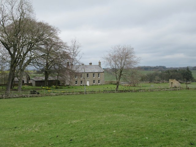
| Highlaws Farmhouse | 1042884 | II | 1728 | Highlaws |
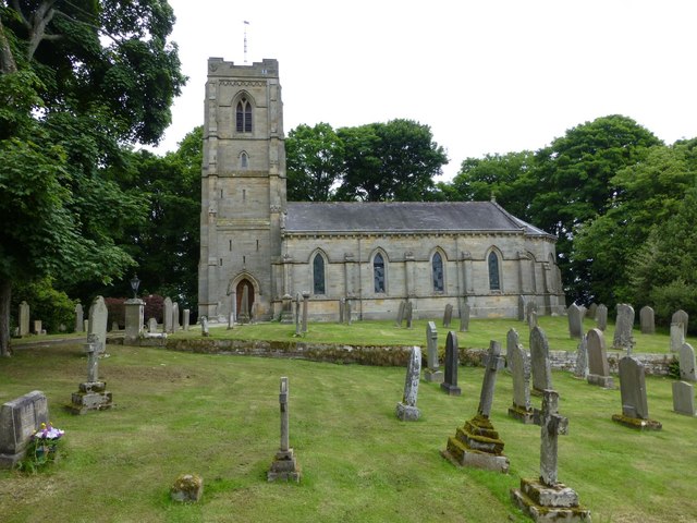
| Holy Trinity Church | 1154139 | II | 1842 | Cambo. By by J.&.B. Green |
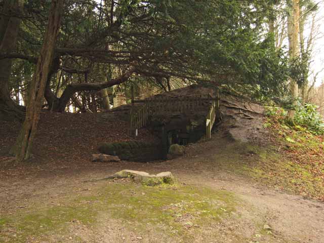
| Icehouse in West Wood | 1042832 | II | C18th | Wallington |
| Manse Adjacent to Congregational Church | 1042859 | II | ||
| Middleton Mill and Millers House | 1154314 | II | ||
| Milepost on West Side of Road Opposite Track to Corridge | 1154109 | II | ||
| Milestone 160 Metres North of Cambo School | 1370651 | II | ||
| Milestone 240 Metres West of Old Deanham | 1042886 | II | ||
| Milestone 40 Metres North of Crossroads | 1303959 | II | ||
| Milestone 50 Metres North of Gate to Wallington Car Park | 1154135 | II | ||
| Milestone on South Side of Road at Ngr Nz 03628419 | 1303862 | II | ||
| New Deanham Farmhouse | 1370650 | II | ||
| No. 10 (Cambo House) and Cambo House Cottage | 1042850 | II | ||
| North-East Courtyard Range and Courtyard Wall | 1154428 | II* | ||
| North-West Courtyard Range and Courtyard Wall | 1154425 | II* | ||
| Outbuilding East of Corridge Farmhouse | 1042857 | II | ||
| Outbuildings and Yard Walls to North of the Garden House | 1303859 | II | ||
| Outhouse Row to East of Nos 1-3 | 1042852 | II | ||
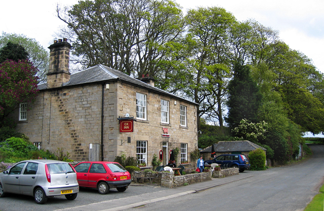
| Ox Inn | 1370637 | II | C19th | Middleton |
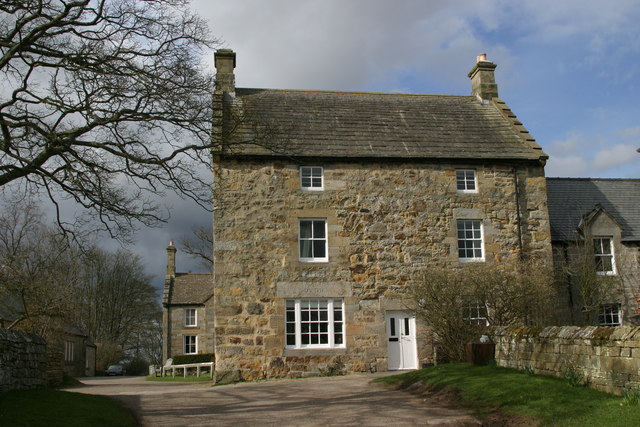
| Pele House | 1370670 | II | C16th | Cambo. Converted to a shop in 1818. |
| Piers and Screen Wall at Car Park Entrance | 1042830 | II | ||
| Piers and Screen Wall Opposite Garden Gate | 1370659 | II | ||
| Portico House and Terrace Walling | 1303871 | II | ||
| Priors Hall Farmhouse | 1370639 | II | ||
| Privy House 25 Metres to North-West of Owl House | 1042867 | II | ||
| Range of Farmbuildings South-West of Hartburn Grange Farmhouse | 1154256 | II | Hartburn Grange | |
| Roadside Wall to South and South-West of the Garden House | 1042863 | II | ||
| Sir Walter's Privy in East Wood | 1370640 | II | ||
| Stable Range to the North of No 1 | 1303935 | II | ||
| Standing Stone on East Side of Chinese Pond | 1042865 | II | ||
| Stone 60 Metres West of West Gate of Courtyard | 1154433 | II | ||
| Stone Walls Associated with Farm Buildings | 1370636 | II | ||
| Sundial 10 Metres South of Wallington Hall | 1042831 | II | ||
| Sundial in Walled Garden 100 Metres South-East of Owl House | 1154373 | II | ||
| Terrace Wall in Walled Garden | 1042868 | II | ||
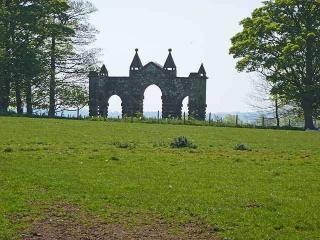
| The Arches | 1370638 | II* | 1735 | Wallington. Relocated in 1751. |
| The Chapel, Farmbuilding 70 Metres South-West of Corridge Farmhouse | 1154247 | II | ||
| The Garden House | 1042862 | II* | ||
| The Middle Stead | 1303941 | II | ||
| The Old Byre, Outbuilding North-West of No. 9 | 1042851 | II | ||
| The Owl House on North Side of Walled Garden | 1303845 | II | ||
| The Two Queens | 1042888 | II | ||
| Trevelyan Graves 9 Metres East of South Churchyard Gate | 1154153 | II | ||
| Urn 17 Metres South-East of Hall | 1154446 | II | ||
| Urn at West End of Terrace 160 Metres West of Hall | 1370660 | II | ||
| Urn in Walled Garden 60 Metres South of Owl House | 1154377 | II | ||
| Village Hall and Adjacent House | 1042855 | II | ||
| Wall and Gate Piers Between North Front of Hall and Main Courtyard | 1154415 | II | ||
| Wall and privy houses 40 metres south-east of Pele House | 1042854 | II | ||
| Walled Garden with Gateways | 1154358 | II* | ||
| Wallington Hall | 1042869 | I | 1688 | Built for Sir William Blackett on site of earlier house. |
| West House and West End | 1370672 | II | ||
| Western Cottage Adjacent to Manse | 1042860 | II | ||
| Bob Gin Pitt mine drainage system 520m south east of Wallington Hall | 1020739 | n/a | Scheduled Monument | |
| Wallington - Grounds | 1001054 | II* | Listed park and garden | |
| Wallington Bridge | 1002903 | n/a | Scheduled Monument | |
| Standing stone, 700m south west of Middleton South | 1015523 | n/a | Scheduled Monument | |
| South Middleton medieval village and open field system | 1017738 | n/a | Scheduled Monument | |
| Romano-British settlement and Iron Age defended settlement, 550m north east of Shaftoe Grange | 1013757 | n/a | Scheduled Monument | |
| Cambo Conservation Area | - | n/a | Conservation Area | |
| Middleton Conservation Area | - | n/a | Conservation Area |
Primary source: the National Heritage List for England - NHLE is the register of nationally protected historic buildings and sites in England, including listed buildings, scheduled monuments, protected wrecks, registered parks and gardens, and battlefields. The list is maintained by Historic England. Check NHLE for updates and new entries. Secondary sources: British Listed Buildings and Keys to the Past.
Co-Curate Page
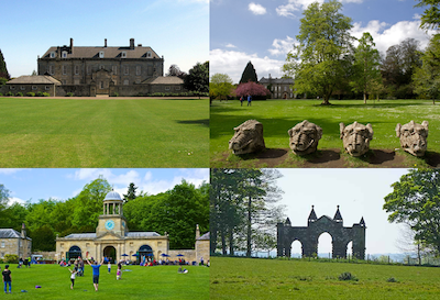
Wallington
- Overview About Wallington Map Street View Wallington is a country house and gardens located about 12 miles (19 km) west of Morpeth, Northumberland, England, near the village of Cambo. It …
Co-Curate Page
Dragons' Heads
- Overview Map Street View A group of 4 carved dragons' heads is located on the lawns to the east of Wallington, and can be seen from the on the approach …
Co-Curate Page
The Arches
- "The Arches" were originally built in 1735 as the courtyard gateway to Wallington Hall. However, later they proved too narrow for coaches and were moved and re-erected as an eyecatcher …
Co-Curate Page
Holy Trinity Church, Cambo
- Overview Map Street View The Parish Church at Cambo in Northumberland was built in 1842 by John &.Benjamin Green, near the site of an earlier medieval chapel which had been …
Co-Curate Page
Bastle House, Cambo
- Overview Street View A 16th century bassle house in Cambo, Northumberland. In 1818 it was converted into shop and still has a lintel above the former shop window inscribed "J.T. …
Co-Curate Page
Drinking Fountain, Cambo
- Overview Map Street View A carved granite drinking fountain in Cambo, built c.1880 as part of Sir Charles Trevelyan's remodelling of the village. The fountain has a life-size sculpture of …
Co-Curate Page
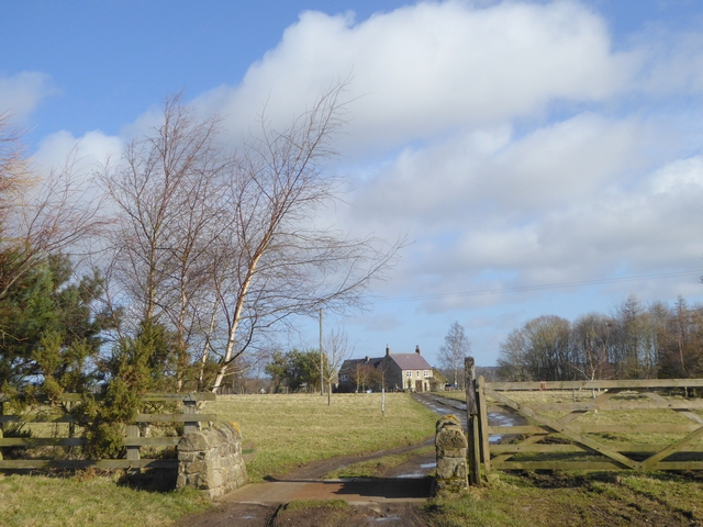
Highlaws, Northumberland
- Overview Map Highlaws is a hamlet/farm in Northumberland, located near the River Wansbeck and about 8 miles west of Morpeth. Highlaws Farmhouse is dated 1728 with the initials W.D.A. (William and …
Co-Curate Page
Bridge over the Wansbeck, south of Wallington
- Overview History Map Street View This bridge is located about ¼ mile south-east of Wallington Hall, carries the B6342 road over the River Wansbeck. The bridge was built in 1755 …
Co-Curate Page
War Memorial, Cambo
- Obelisk in the churchyard of Holy Trinity Church in Cambo. The memorial commemorates 22 local men who died during the First World War. It was unveiled at a ceremony on the …
Co-Curate Page
Ox Inn, Middleton (Morpeth)
- Overview Map Street View The Ox Inn in Middleton is a Grade II listed building; a former house, dating from the early 19th century.

Co-Curate Page
Wallington
- Overview About Wallington Map Street View Wallington is a country house and gardens located about 12 miles (19 km) west of Morpeth, Northumberland, England, near the village of Cambo. It …
Co-Curate Page
Dragons' Heads
- Overview Map Street View A group of 4 carved dragons' heads is located on the lawns to the east of Wallington, and can be seen from the on the approach …
Co-Curate Page
The Arches
- "The Arches" were originally built in 1735 as the courtyard gateway to Wallington Hall. However, later they proved too narrow for coaches and were moved and re-erected as an eyecatcher …
Co-Curate Page
Holy Trinity Church, Cambo
- Overview Map Street View The Parish Church at Cambo in Northumberland was built in 1842 by John &.Benjamin Green, near the site of an earlier medieval chapel which had been …
Co-Curate Page
Bastle House, Cambo
- Overview Street View A 16th century bassle house in Cambo, Northumberland. In 1818 it was converted into shop and still has a lintel above the former shop window inscribed "J.T. …
Co-Curate Page
Drinking Fountain, Cambo
- Overview Map Street View A carved granite drinking fountain in Cambo, built c.1880 as part of Sir Charles Trevelyan's remodelling of the village. The fountain has a life-size sculpture of …
Co-Curate Page
Highlaws, Northumberland
- Overview Map Highlaws is a hamlet/farm in Northumberland, located near the River Wansbeck and about 8 miles west of Morpeth. Highlaws Farmhouse is dated 1728 with the initials W.D.A. (William and …
Co-Curate Page
Bridge over the Wansbeck, south of Wallington
- Overview History Map Street View This bridge is located about ¼ mile south-east of Wallington Hall, carries the B6342 road over the River Wansbeck. The bridge was built in 1755 …
Co-Curate Page
War Memorial, Cambo
- Obelisk in the churchyard of Holy Trinity Church in Cambo. The memorial commemorates 22 local men who died during the First World War. It was unveiled at a ceremony on the …