Topics > Historical Periods > Iron Age > Hillfort
Hillfort
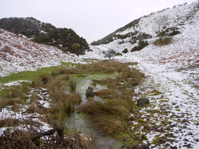
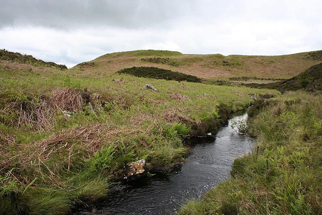
Hillforts were fortified settlements, usually built on hilltops, ridges, or rocky outcrops. They were protected by one or more layers of earthen banks and ditches. While most were elevated on high ground, there were also "marsh forts", built in low-lying wetlands. Hillforts were originally constructed and inhabited between 900 and 100 BC. Later, some hillfort sites were repurposed for other uses, such as medieval castles.
Co-Curate Page
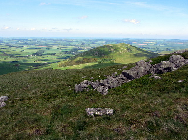
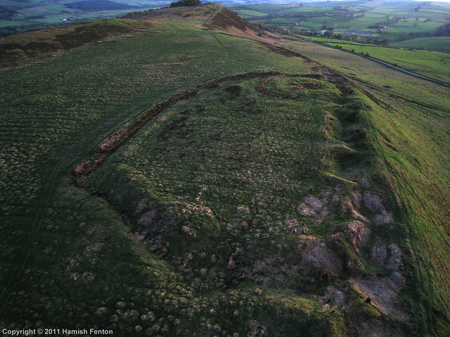
Hillfort, Yeavering Bell
- Overview Map Aerial view of Yeavering Bell hillfort on Google Maps. The walls (originally 2+m high, now collapsed with a spread of 8-9m) are clearly visible. The remains of a …

Co-Curate Page
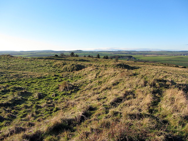
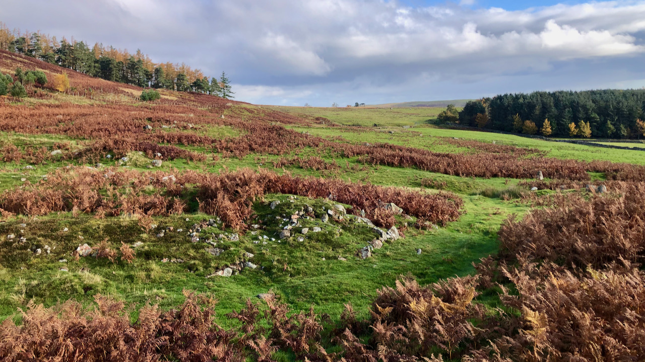
Pawston Hill - Iron Age Hillfort
- The remains of an Iron Age hillfort are located on Pawston Hill, located to the south-west of the hamlet of Pawston and just to the north-west of Pawston Lake in …
Co-Curate Page
Hillfort and Roman signal station, Barcombe Hill
- Overview Map Scheduled Monument area - based on Historic England data (Open Government Licence). The remains of an Iron Age defended settlement and Roman signal station are located on Barcombe …
Co-Curate Page
Castle Hill camp, near Alnham
- Overview Map Castle Hill is located about ¼ mile north-east of Old Hazeltonrig and 1½ miles west of the hamlet of Alnham in Northumberland. At the summit of the hill …
Co-Curate Page
Kettles Hillfort, near Wooler
- The Kettles is the earwork remains of an Iron Age and Roman hill fort and settlement near Earle and Wooler in Northumberland.[1] The fort occupies a natural ridge protected on …

Co-Curate Page
Bewick Hill Camp
- Scheduled Monument area - based on Historic England data (Open Government Licence). Bewick Hill Camp is a hillfort, located to the east of Old Bewick in Northumberland. It is presumed …
Co-Curate Page
Bewick Hill Moor Camp
- Scheduled Monument area - based on Historic England data (Open Government Licence). Bewick Hill Moor Camp is located about 2km ENE of Old Bewick in Northumberland. It is a multivallate …
Co-Curate Page
Slate Hill Settlement Earthworks, Bolam
- Overview Map Remains of a defended Iron Age settlement around the top of Slate Hill, just north of Bolam Lake in Northumberland. The ruins are a Sheduled Monument.
Co-Curate Page
Site of Iron Age Settlement, Houghton
- Overview Aerial View To the south-west of Houghton in Northumberland, by Broomy Hill, are the remains of an Iron Age defended settlement. The remains are not easily visible as most of the defensive …

from https://historicengland.org.u…
Introductions to Heritage Assets - Hillforts
- Historic England, October 2018. "An introduction to hillforts. As the name implies, hillforts are defended places, surrounded by one or more circuits of banks and ditches, and generally placed on …
Added by
Simon Cotterill

Co-Curate Page
Ringses multivallate hillfort, Doddington Moor
- Scheduled Monument area - based on Historic England data (Open Government Licence). The Ringses is the site of a multivallate hillfort, located on Doddington Moor, about 1 mile ENE of …
Co-Curate Page
Standing Stones Camp, Horton Moor
- Map showing Doddington (village) and the site of Standing Stones Camp (to the south-east). Zoom in to see the Scheduled Monument area. Standing Stones Camp is located on the edge …

Co-Curate Page
Dod Law Hillforts
- Scheduled Monument area - based on Historic England data (Open Government Licence). Dod Law is a prominent ridge, which rises to the highest point of Doddington Moor (trig point at …
Co-Curate Page
Greaves Ash camp
- Scheduled Monument area - based on Historic England data (Open Government Licence). Greaves Ash camp is the site of a large Iron Age and Romano-British settlement, situated onhigh ground by …

Co-Curate Page
The Ringses camp, burial mounds and cairns, Beanley Moor
- Scheduled Monument areas - based on Historic England data (Open Government Licence). The Ringses is located on Beanley Moor in Northumberland, about east of Beanley and 1km south-west of Eglingham. …

Co-Curate Page
Bivallate Defended Settlement WNW of Craghead
- Scheduled Monument area - based on Historic England data (Open Government Licence). The site of this bivallate (two line of ramparts) hillfort, located to the south-east of Wagtail Farm, about …

Co-Curate Page
Gunnerton Crag camps
- Scheduled Monument area - based on Historic England data (Open Government Licence). Gunnerton Crags, located to the east of the village of Gunnerton in Northumberland, are the site of a …
Co-Curate Page
Springhill Camp
- Scheduled Monument areas - based on Historic England data (Open Government Licence). This site is located close to Spring Hill, to the south of Tweedmouth in Northumberland. It is scheduled …
Co-Curate Page
Camphill Iron Age Settlement
- On Camp Hill, to the north-west of Berwick-upon-Tweed, are the remains of an Iron Age defended settlement. The site, which is heavily farmed, is a Scheduled Monument (legally protected). Nearby, …

Co-Curate Page
Halidon Hill Iron Age Settlement
- Scheduled Monument areas - based on Historic England data (Open Government Licence). To the north-west of Berwick-upon-Tweed is Halidon Hill; by its summit, on it's south-facing slope is the site …
Co-Curate Page
Defended settlement on White Hill, SE of Kimmerston
- Map showing Kimmerson with the Scheduled Monument area to the south east. The cropmarked remains of a multivallate defended settlement are located 590m south-east of Kimmerston in Northumberland. Situated on …

Co-Curate Page
Roughting Linn camp
- Map showing the Scheduled Monument area of the camp (Historic England data), with Roughting Linn Waterfall to the west and Cup & Ring marke stone to the east. Roughting Linn …
Co-Curate Page
Murton High Crags Settlements
- Scheduled Monument area - based on Historic England data (Open Government Licence). Murton High Crags are located between Murton and Longridge in Northumberland. The earthwork remains of an Iron Age …

Co-Curate Page
Palisaded settlement on Hart Law
- Hart Law is a hill in the Cheviots, located about 1¼km noeth-west of Prendwick in Northumberland. On the hill are the earthwork remains of a palisaded settlement, featuring rock-cut trenches …

Co-Curate Page
Univallate hillfort and medieval tower, East of Callaly Castle
- Scheduled Monument area - based on Historic England data (Open Government Licence) - to the east of Callaly. Castle Hill to the east of Callaly in Northumberland, is a well-preserved …

Co-Curate Page
Tosson Burgh univallate hillfort
- Scheduled Monument area - based on Historic England data (Open Government Licence) - to the west of Great Tosson. LIDAR - Image from opendata.hillforts.eu (CC-BY-SA), based on data from the …

Co-Curate Page
Tinkler's Dene univallate hillfort
- Scheduled Monument area - based on Historic England data (Open Government Licence) LIDAR - Image from opendata.hillforts.eu (CC-BY-SA), based on data from the Environment Agency - National LIDAR programme. Scheduled …

Co-Curate Page
Multivallate hillfort, north of Callaly
- Scheduled Monument area - based on Historic England data (Open Government Licence) - to the north of Callaly. LIDAR - Image from opendata.hillforts.eu (CC-BY-SA), based on data from the Environment …
Co-Curate Page
Multivallate hillfort, Catcherside (Camp Hill)
- Scheduled Monument area - based on Historic England data (Open Government Licence) . Scheduled Monument (#1011100): Multivallate hillfort, 420m SSW of Catcherside Click the headings below to expand (selected extracts …

Co-Curate Page
Univallate hillfort on Great Wanney Crag
- Scheduled Monument area - based on Historic England data (Open Government Licence) LIDAR - Image from opendata.hillforts.eu (CC-BY-SA), based on data from the Environment Agency - National LIDAR programme. Scheduled …
Co-Curate Page
Multivallate hillfort, E of Campville
- Scheduled Monument (#1011394): Multivallate hillfort, 70m east of Campville Click the headings below to expand (selected extracts from the Historic England scheduling) Significance The hillfort at Campville is reasonably well …

Co-Curate Page
Multivallate hillfort, west of Harehaugh
- Scheduled Monument area - based on Historic England data (Open Government Licence) LIDAR - Image from opendata.hillforts.eu (CC-BY-SA), based on data from the Environment Agency - National LIDAR programme. Scheduled …

Co-Curate Page
Blue Crags hillfort, NW of Colwell
- Scheduled Monument area - based on Historic England data (Open Government Licence) - to the north-west of Colwell. LIDAR - Image from opendata.hillforts.eu (CC-BY-SA), based on data from the Environment …

Co-Curate Page
Hillfort, Yeavering Bell
- Overview Map Aerial view of Yeavering Bell hillfort on Google Maps. The walls (originally 2+m high, now collapsed with a spread of 8-9m) are clearly visible. The remains of a …
Co-Curate Page
Pawston Hill - Iron Age Hillfort
- The remains of an Iron Age hillfort are located on Pawston Hill, located to the south-west of the hamlet of Pawston and just to the north-west of Pawston Lake in …
Co-Curate Page
Hillfort and Roman signal station, Barcombe Hill
- Overview Map Scheduled Monument area - based on Historic England data (Open Government Licence). The remains of an Iron Age defended settlement and Roman signal station are located on Barcombe …
Co-Curate Page
Castle Hill camp, near Alnham
- Overview Map Castle Hill is located about ¼ mile north-east of Old Hazeltonrig and 1½ miles west of the hamlet of Alnham in Northumberland. At the summit of the hill …
Co-Curate Page
Kettles Hillfort, near Wooler
- The Kettles is the earwork remains of an Iron Age and Roman hill fort and settlement near Earle and Wooler in Northumberland.[1] The fort occupies a natural ridge protected on …
Co-Curate Page
Bewick Hill Camp
- Scheduled Monument area - based on Historic England data (Open Government Licence). Bewick Hill Camp is a hillfort, located to the east of Old Bewick in Northumberland. It is presumed …
Co-Curate Page
Bewick Hill Moor Camp
- Scheduled Monument area - based on Historic England data (Open Government Licence). Bewick Hill Moor Camp is located about 2km ENE of Old Bewick in Northumberland. It is a multivallate …
Co-Curate Page
Slate Hill Settlement Earthworks, Bolam
- Overview Map Remains of a defended Iron Age settlement around the top of Slate Hill, just north of Bolam Lake in Northumberland. The ruins are a Sheduled Monument.
Co-Curate Page
Site of Iron Age Settlement, Houghton
- Overview Aerial View To the south-west of Houghton in Northumberland, by Broomy Hill, are the remains of an Iron Age defended settlement. The remains are not easily visible as most of the defensive …
from https://historicengland.org.u…
Introductions to Heritage Assets - Hillforts
- Historic England, October 2018. "An introduction to hillforts. As the name implies, hillforts are defended places, surrounded by one or more circuits of banks and ditches, and generally placed on …
Added by
Simon Cotterill
Co-Curate Page
Ringses multivallate hillfort, Doddington Moor
- Scheduled Monument area - based on Historic England data (Open Government Licence). The Ringses is the site of a multivallate hillfort, located on Doddington Moor, about 1 mile ENE of …
Co-Curate Page
Standing Stones Camp, Horton Moor
- Map showing Doddington (village) and the site of Standing Stones Camp (to the south-east). Zoom in to see the Scheduled Monument area. Standing Stones Camp is located on the edge …
Co-Curate Page
Dod Law Hillforts
- Scheduled Monument area - based on Historic England data (Open Government Licence). Dod Law is a prominent ridge, which rises to the highest point of Doddington Moor (trig point at …
Co-Curate Page
Greaves Ash camp
- Scheduled Monument area - based on Historic England data (Open Government Licence). Greaves Ash camp is the site of a large Iron Age and Romano-British settlement, situated onhigh ground by …
Co-Curate Page
The Ringses camp, burial mounds and cairns, Beanley Moor
- Scheduled Monument areas - based on Historic England data (Open Government Licence). The Ringses is located on Beanley Moor in Northumberland, about east of Beanley and 1km south-west of Eglingham. …
Co-Curate Page
Bivallate Defended Settlement WNW of Craghead
- Scheduled Monument area - based on Historic England data (Open Government Licence). The site of this bivallate (two line of ramparts) hillfort, located to the south-east of Wagtail Farm, about …
Co-Curate Page
Gunnerton Crag camps
- Scheduled Monument area - based on Historic England data (Open Government Licence). Gunnerton Crags, located to the east of the village of Gunnerton in Northumberland, are the site of a …
Co-Curate Page
Springhill Camp
- Scheduled Monument areas - based on Historic England data (Open Government Licence). This site is located close to Spring Hill, to the south of Tweedmouth in Northumberland. It is scheduled …
Co-Curate Page
Camphill Iron Age Settlement
- On Camp Hill, to the north-west of Berwick-upon-Tweed, are the remains of an Iron Age defended settlement. The site, which is heavily farmed, is a Scheduled Monument (legally protected). Nearby, …
Co-Curate Page
Halidon Hill Iron Age Settlement
- Scheduled Monument areas - based on Historic England data (Open Government Licence). To the north-west of Berwick-upon-Tweed is Halidon Hill; by its summit, on it's south-facing slope is the site …
Co-Curate Page
Defended settlement on White Hill, SE of Kimmerston
- Map showing Kimmerson with the Scheduled Monument area to the south east. The cropmarked remains of a multivallate defended settlement are located 590m south-east of Kimmerston in Northumberland. Situated on …
Co-Curate Page
Roughting Linn camp
- Map showing the Scheduled Monument area of the camp (Historic England data), with Roughting Linn Waterfall to the west and Cup & Ring marke stone to the east. Roughting Linn …
Co-Curate Page
Murton High Crags Settlements
- Scheduled Monument area - based on Historic England data (Open Government Licence). Murton High Crags are located between Murton and Longridge in Northumberland. The earthwork remains of an Iron Age …
Co-Curate Page
Palisaded settlement on Hart Law
- Hart Law is a hill in the Cheviots, located about 1¼km noeth-west of Prendwick in Northumberland. On the hill are the earthwork remains of a palisaded settlement, featuring rock-cut trenches …
Co-Curate Page
Univallate hillfort and medieval tower, East of Callaly Castle
- Scheduled Monument area - based on Historic England data (Open Government Licence) - to the east of Callaly. Castle Hill to the east of Callaly in Northumberland, is a well-preserved …
Co-Curate Page
Tosson Burgh univallate hillfort
- Scheduled Monument area - based on Historic England data (Open Government Licence) - to the west of Great Tosson. LIDAR - Image from opendata.hillforts.eu (CC-BY-SA), based on data from the …
Co-Curate Page
Tinkler's Dene univallate hillfort
- Scheduled Monument area - based on Historic England data (Open Government Licence) LIDAR - Image from opendata.hillforts.eu (CC-BY-SA), based on data from the Environment Agency - National LIDAR programme. Scheduled …
Co-Curate Page
Multivallate hillfort, north of Callaly
- Scheduled Monument area - based on Historic England data (Open Government Licence) - to the north of Callaly. LIDAR - Image from opendata.hillforts.eu (CC-BY-SA), based on data from the Environment …
Co-Curate Page
Multivallate hillfort, Catcherside (Camp Hill)
- Scheduled Monument area - based on Historic England data (Open Government Licence) . Scheduled Monument (#1011100): Multivallate hillfort, 420m SSW of Catcherside Click the headings below to expand (selected extracts …
Co-Curate Page
Univallate hillfort on Great Wanney Crag
- Scheduled Monument area - based on Historic England data (Open Government Licence) LIDAR - Image from opendata.hillforts.eu (CC-BY-SA), based on data from the Environment Agency - National LIDAR programme. Scheduled …
Co-Curate Page
Multivallate hillfort, E of Campville
- Scheduled Monument (#1011394): Multivallate hillfort, 70m east of Campville Click the headings below to expand (selected extracts from the Historic England scheduling) Significance The hillfort at Campville is reasonably well …
Co-Curate Page
Multivallate hillfort, west of Harehaugh
- Scheduled Monument area - based on Historic England data (Open Government Licence) LIDAR - Image from opendata.hillforts.eu (CC-BY-SA), based on data from the Environment Agency - National LIDAR programme. Scheduled …


