Topics > Historical Periods > Iron Age
Co-Curate Page
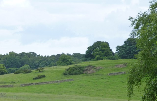
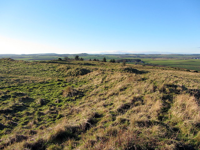
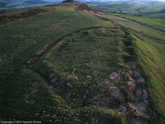
Slate Hill Settlement Earthworks, Bolam
- Overview Map Remains of a defended Iron Age settlement around the top of Slate Hill, just north of Bolam Lake in Northumberland. The ruins are a Sheduled Monument.

Co-Curate Page
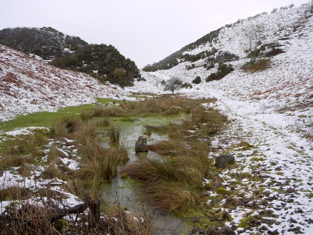
Kettles Hillfort, near Wooler
- The Kettles is the earwork remains of an Iron Age and Roman hill fort and settlement near Earle and Wooler in Northumberland.[1] The fort occupies a natural ridge protected on …
Co-Curate Page
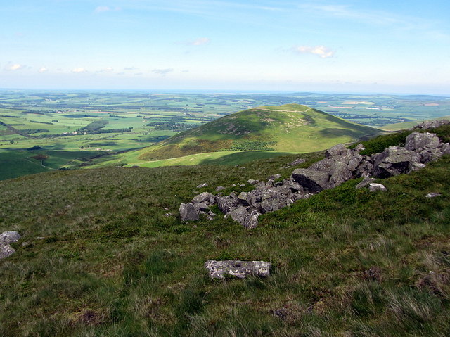
Hillfort, Yeavering Bell
- Overview Map Aerial view of Yeavering Bell hillfort on Google Maps. The walls (originally 2+m high, now collapsed with a spread of 8-9m) are clearly visible. The remains of a …
Co-Curate Page
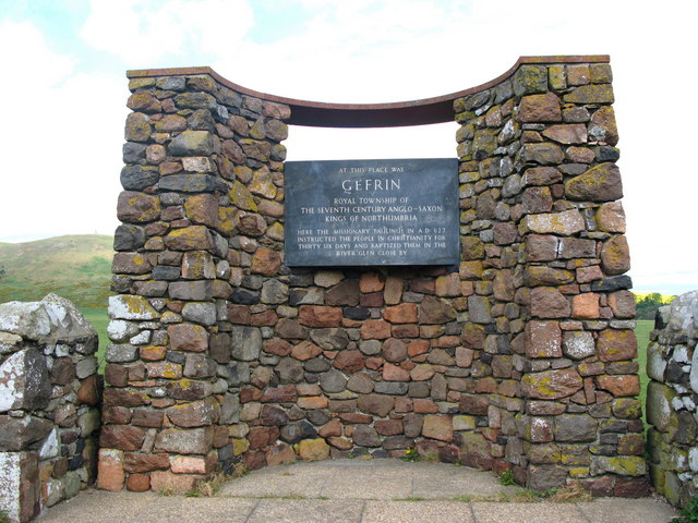
Ad Gefrin
- Overview Map Street View Between Kirknewton and Yeavering in Northumberland are the extensive remains of the Anglo-Saxon royal township of Ad Gefrin. It was a large settlement covering an area …

Co-Curate Page
Pawston Hill - Iron Age Hillfort
- The remains of an Iron Age hillfort are located on Pawston Hill, located to the south-west of the hamlet of Pawston and just to the north-west of Pawston Lake in …
Co-Curate Page
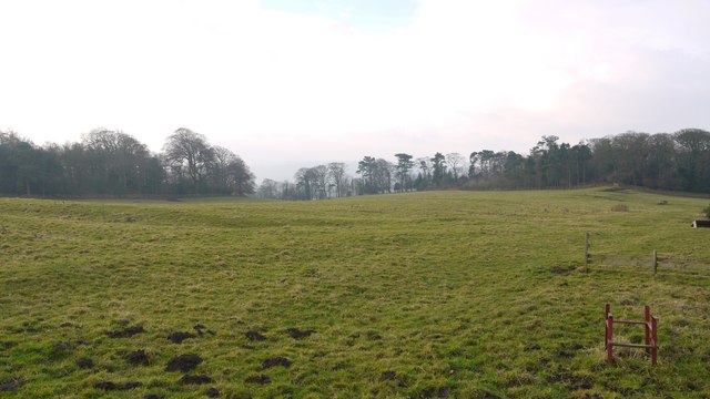
Site of Iron Age Settlement, Houghton
- Overview Aerial View To the south-west of Houghton in Northumberland, by Broomy Hill, are the remains of an Iron Age defended settlement. The remains are not easily visible as most of the defensive …
Co-Curate Page
Castle Hill camp, near Alnham
- Overview Map Castle Hill is located about ¼ mile north-east of Old Hazeltonrig and 1½ miles west of the hamlet of Alnham in Northumberland. At the summit of the hill …
Co-Curate Page
Kyloe Hills promontory fort
- "The monument includes the remains of an Iron Age promontory fort abutting a steep cliff to the south. The promontory fort is visible as a semi-circular enclosure measuring about 109m …
Co-Curate Page
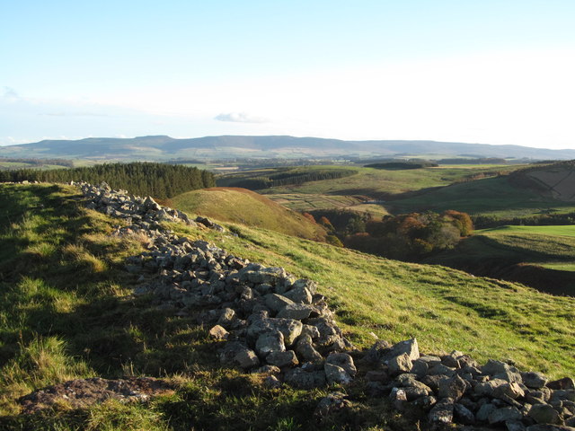
Hillfort and Roman signal station, Barcombe Hill
- Overview Map Scheduled Monument area - based on Historic England data (Open Government Licence). The remains of an Iron Age defended settlement and Roman signal station are located on Barcombe …

Co-Curate Page
Bewick Hill Camp
- Scheduled Monument area - based on Historic England data (Open Government Licence). Bewick Hill Camp is a hillfort, located to the east of Old Bewick in Northumberland. It is presumed …
Co-Curate Page
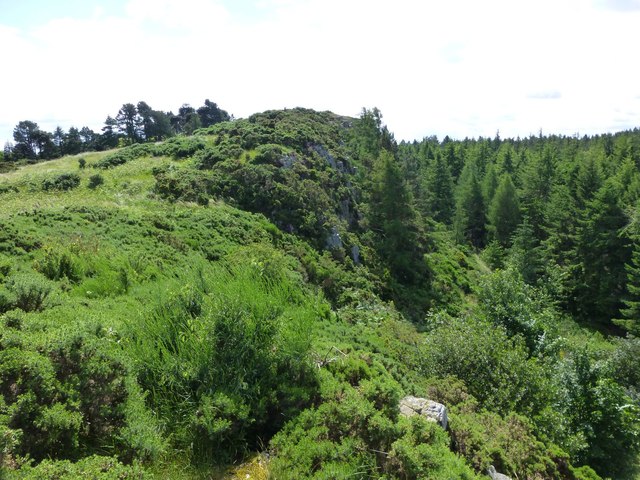
Greaves Ash camp
- Scheduled Monument area - based on Historic England data (Open Government Licence). Greaves Ash camp is the site of a large Iron Age and Romano-British settlement, situated onhigh ground by …
Co-Curate Page
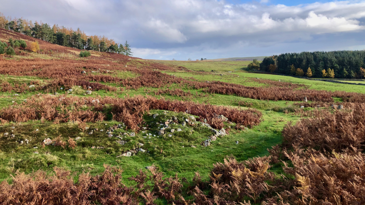
Enclosures on Meggrim's Knowe
- Map showing the Scheduled Monument area of Meggrim's Knowe enclosure, with Linhope and the site of Greaves Ash, to the north. Meggrim's Knowe, located south of Linhope in Northumberland, has …

Co-Curate Page
The Ringses camp, burial mounds and cairns, Beanley Moor
- Scheduled Monument areas - based on Historic England data (Open Government Licence). The Ringses is located on Beanley Moor in Northumberland, about east of Beanley and 1km south-west of Eglingham. …

Co-Curate Page
Defended settlement, SW of Sandy House
- Scheduled Monument area - based on Historic England data (Open Government Licence). The site of an Iron Age defended settlement is located south-owest of Sandy House, about 1km north-east of …
Co-Curate Page
Defended settlement, SW of Nesbit, Northumberland
- Scheduled Monument area - based on Historic England data (Open Government Licence). The buried remains of an Iron Age multivallate defended settlement are located to the south-west of Nesbit, near …
Co-Curate Page
Roundabouts camp, east of Bellshill
- Map showing Bellshill, with the Roundabouts camp Scheduled Monument area to the east. About 800m ENE of Bellshill in Northumberland is the site, identified by crop marks, of probable Iron …
Co-Curate Page
Camp NW of Chesterhill
- Scheduled Monument area - based on Historic England data (Open Government Licence). Scheduled Monument (#1003764): Camp 500yds (460m) NW of Chesterhill Click the headings below to expand (selected extracts from …

Co-Curate Page
Halidon Hill Iron Age Settlement
- Scheduled Monument areas - based on Historic England data (Open Government Licence). To the north-west of Berwick-upon-Tweed is Halidon Hill; by its summit, on it's south-facing slope is the site …
Co-Curate Page
Defended settlement on White Hill, SE of Kimmerston
- Map showing Kimmerson with the Scheduled Monument area to the south east. The cropmarked remains of a multivallate defended settlement are located 590m south-east of Kimmerston in Northumberland. Situated on …
Co-Curate Page
Defended settlement SW of Broomhouse
- Map showing Broomhouse and the Scheduled Monument area to the south-west. To the south-west of Broomhouse in Tillside are the buried remains of an Iron Age defended settlement. It is …
Co-Curate Page
Enclosed settlement, SE of Cornhill Castle
- Map showing the enclosed settlement Scheduled Monument area, with Cornhill-on-Tweed to the south and Cornhill Castle to the north-west. About 700m north of Cornhill-on-Tweed is the site on an enclosed …

Co-Curate Page
Palisaded settlement, NW of Northfieldhead
- Scheduled Monument area, to the north-west of Alnham - based on Historic England data (Open Government Licence). On Northfield Hill, near Northfieldhead, about 1½km north-west of Alnham in Northumberland, is …

Co-Curate Page
Iron Age / Romano-British settlement, Hazlerigg
- Scheduled Monument area - based on Historic England data (Open Government Licence). To the south of Hezlerigg in Newcastle are the sites of two enclosed settlements of late Iron Age …

Co-Curate Page
Slate Hill Settlement Earthworks, Bolam
- Overview Map Remains of a defended Iron Age settlement around the top of Slate Hill, just north of Bolam Lake in Northumberland. The ruins are a Sheduled Monument.
Co-Curate Page
Kettles Hillfort, near Wooler
- The Kettles is the earwork remains of an Iron Age and Roman hill fort and settlement near Earle and Wooler in Northumberland.[1] The fort occupies a natural ridge protected on …
Co-Curate Page
Hillfort, Yeavering Bell
- Overview Map Aerial view of Yeavering Bell hillfort on Google Maps. The walls (originally 2+m high, now collapsed with a spread of 8-9m) are clearly visible. The remains of a …
Co-Curate Page
Ad Gefrin
- Overview Map Street View Between Kirknewton and Yeavering in Northumberland are the extensive remains of the Anglo-Saxon royal township of Ad Gefrin. It was a large settlement covering an area …
Co-Curate Page
Pawston Hill - Iron Age Hillfort
- The remains of an Iron Age hillfort are located on Pawston Hill, located to the south-west of the hamlet of Pawston and just to the north-west of Pawston Lake in …
Co-Curate Page
Site of Iron Age Settlement, Houghton
- Overview Aerial View To the south-west of Houghton in Northumberland, by Broomy Hill, are the remains of an Iron Age defended settlement. The remains are not easily visible as most of the defensive …
Co-Curate Page
Castle Hill camp, near Alnham
- Overview Map Castle Hill is located about ¼ mile north-east of Old Hazeltonrig and 1½ miles west of the hamlet of Alnham in Northumberland. At the summit of the hill …
Co-Curate Page
Kyloe Hills promontory fort
- "The monument includes the remains of an Iron Age promontory fort abutting a steep cliff to the south. The promontory fort is visible as a semi-circular enclosure measuring about 109m …
Co-Curate Page
Hillfort and Roman signal station, Barcombe Hill
- Overview Map Scheduled Monument area - based on Historic England data (Open Government Licence). The remains of an Iron Age defended settlement and Roman signal station are located on Barcombe …
Co-Curate Page
Bewick Hill Camp
- Scheduled Monument area - based on Historic England data (Open Government Licence). Bewick Hill Camp is a hillfort, located to the east of Old Bewick in Northumberland. It is presumed …
Co-Curate Page
Greaves Ash camp
- Scheduled Monument area - based on Historic England data (Open Government Licence). Greaves Ash camp is the site of a large Iron Age and Romano-British settlement, situated onhigh ground by …
Co-Curate Page
Enclosures on Meggrim's Knowe
- Map showing the Scheduled Monument area of Meggrim's Knowe enclosure, with Linhope and the site of Greaves Ash, to the north. Meggrim's Knowe, located south of Linhope in Northumberland, has …
Co-Curate Page
The Ringses camp, burial mounds and cairns, Beanley Moor
- Scheduled Monument areas - based on Historic England data (Open Government Licence). The Ringses is located on Beanley Moor in Northumberland, about east of Beanley and 1km south-west of Eglingham. …
Co-Curate Page
Defended settlement, SW of Sandy House
- Scheduled Monument area - based on Historic England data (Open Government Licence). The site of an Iron Age defended settlement is located south-owest of Sandy House, about 1km north-east of …
Co-Curate Page
Defended settlement, SW of Nesbit, Northumberland
- Scheduled Monument area - based on Historic England data (Open Government Licence). The buried remains of an Iron Age multivallate defended settlement are located to the south-west of Nesbit, near …
Co-Curate Page
Roundabouts camp, east of Bellshill
- Map showing Bellshill, with the Roundabouts camp Scheduled Monument area to the east. About 800m ENE of Bellshill in Northumberland is the site, identified by crop marks, of probable Iron …
Co-Curate Page
Camp NW of Chesterhill
- Scheduled Monument area - based on Historic England data (Open Government Licence). Scheduled Monument (#1003764): Camp 500yds (460m) NW of Chesterhill Click the headings below to expand (selected extracts from …
Co-Curate Page
Halidon Hill Iron Age Settlement
- Scheduled Monument areas - based on Historic England data (Open Government Licence). To the north-west of Berwick-upon-Tweed is Halidon Hill; by its summit, on it's south-facing slope is the site …
Co-Curate Page
Defended settlement on White Hill, SE of Kimmerston
- Map showing Kimmerson with the Scheduled Monument area to the south east. The cropmarked remains of a multivallate defended settlement are located 590m south-east of Kimmerston in Northumberland. Situated on …
Co-Curate Page
Defended settlement SW of Broomhouse
- Map showing Broomhouse and the Scheduled Monument area to the south-west. To the south-west of Broomhouse in Tillside are the buried remains of an Iron Age defended settlement. It is …
Co-Curate Page
Enclosed settlement, SE of Cornhill Castle
- Map showing the enclosed settlement Scheduled Monument area, with Cornhill-on-Tweed to the south and Cornhill Castle to the north-west. About 700m north of Cornhill-on-Tweed is the site on an enclosed …
Co-Curate Page
Palisaded settlement, NW of Northfieldhead
- Scheduled Monument area, to the north-west of Alnham - based on Historic England data (Open Government Licence). On Northfield Hill, near Northfieldhead, about 1½km north-west of Alnham in Northumberland, is …


