Topics > County Durham > Farms in County Durham
Farms in County Durham
A few of the many farms (extant and historic) in County Durham. Work in progress (barely started!).
| Name | Locality | Civil Parish | Notes |
|---|---|---|---|
| Bar Gap | Bowes | ||
| Bowes Cross | Bowes | ||
| Bracken Hill Farm | Bedburn | South Bedburn | |
| Broomielaw Farm | Broomielaw | Streatlam and Stainton | Listed |
| Dryderdale Farm | North of Hamsterley | South Bedburn | |
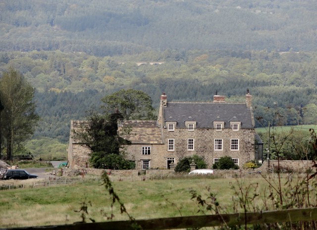
| Great Isle Farm | Great Isle | Bradbury and the Isle | Listed |
| High Knitsley Farm | Consett | Healyfield | Listed |
| Little Isle Farm | Little Isle | Bradbury and the Isle | |
| East Mellwaters | Bowes | ||
| Pontop Hall | Dipton | unparished | Listed |
| Sleightholme | Bowes | ||
| Trough Heads | Bowes | ||
| Tursdale House Farm | Tursdale | Cassop-cum-Quarrington | Listed |
| West Hope Farm | Hope | Hope | |
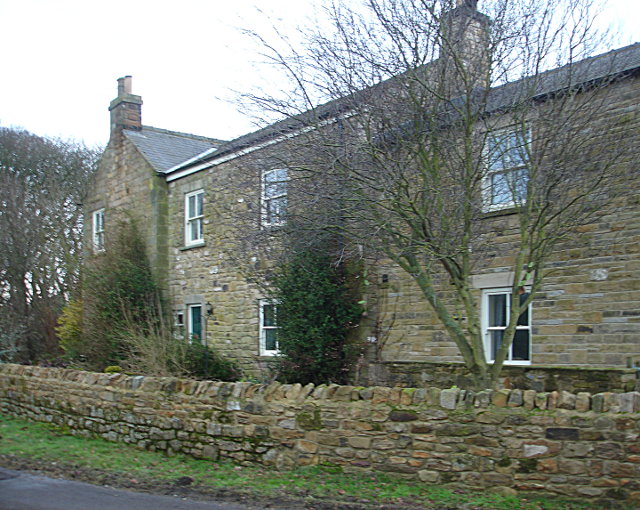
| West Shipley Farm | North of Hamsterley | South Bedburn |

Co-Curate Page
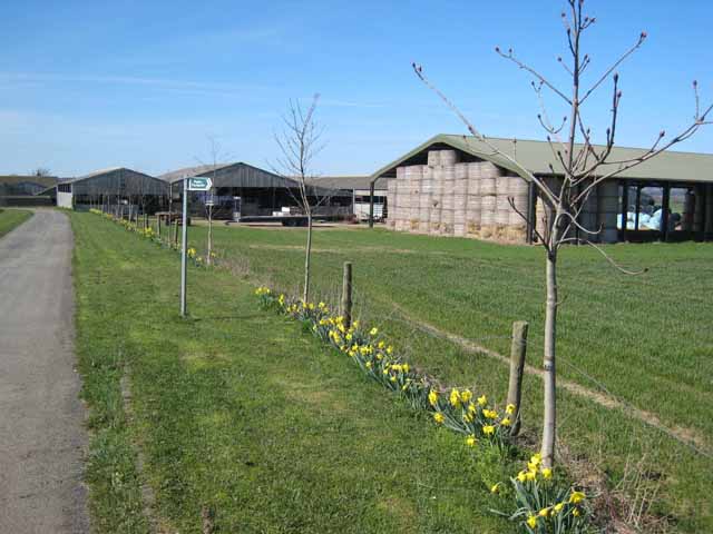
West Shipley Farm
- Overview Map Street View West Shipley Farm, near Hamsterley, County Durham
Co-Curate Page
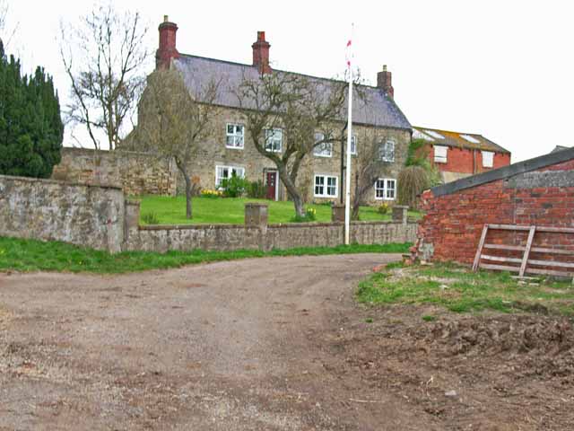
Great Isle, County Durham
- Overview Map Great Isle Farm in County Durham is located about 1½ miles north east of Newton Aycliffe and 3 miles south-west of Sedgefield. In medieval times, Great Isle was the …
Co-Curate Page
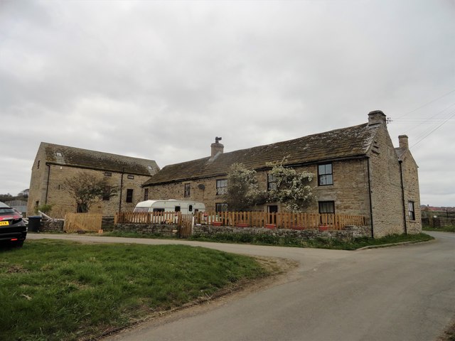
High Knitsley Farmhouse
- Overview Map Street View High Knitsley is located about 1 mile south of Consett in County Durham. The farmhouse here dates from the 18th century and is Grade II listed …
Co-Curate Page
Tursdale House Farm
- Overview Map Tursdale House, was the manor house of the medieval village of Tursdale in the 12th century.[1] The current building at Tursdale House Farm dates from the 17th century, with …
Co-Curate Page
Broomielaw
- Overview Map Street View Broomielaw is a hamlet loacted about 2 miles north-west of Barnard Castle in County Durham, within the Civil Parish Stainton and Streatlam. It is notable that …
Co-Curate Page
Pontop Hall
- Overview Map Street View Pontop Hall, located a short distance north of Dipton, is a farmhouse which dates from the late 17th century, with later alterantions. The building is Grade II* …


Co-Curate Page
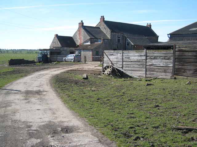
Sleightholme
- Overview Map Street View Sleightholme is a hamlet / farm in County Durham, located about 3 miles south-west of the village of Bowes. It is situated near Sleightholme Beck, and …


Co-Curate Page
Bowes Cross
- Overview Map Street View Bowes Cross Farm is located on the A66 road, opposite the Holcim Durham plant, about 1½ miles east of Bowes.

Co-Curate Page
West Shipley Farm
- Overview Map Street View West Shipley Farm, near Hamsterley, County Durham
Co-Curate Page
Great Isle, County Durham
- Overview Map Great Isle Farm in County Durham is located about 1½ miles north east of Newton Aycliffe and 3 miles south-west of Sedgefield. In medieval times, Great Isle was the …
Co-Curate Page
High Knitsley Farmhouse
- Overview Map Street View High Knitsley is located about 1 mile south of Consett in County Durham. The farmhouse here dates from the 18th century and is Grade II listed …
Co-Curate Page
Tursdale House Farm
- Overview Map Tursdale House, was the manor house of the medieval village of Tursdale in the 12th century.[1] The current building at Tursdale House Farm dates from the 17th century, with …
Co-Curate Page
Broomielaw
- Overview Map Street View Broomielaw is a hamlet loacted about 2 miles north-west of Barnard Castle in County Durham, within the Civil Parish Stainton and Streatlam. It is notable that …
Co-Curate Page
Pontop Hall
- Overview Map Street View Pontop Hall, located a short distance north of Dipton, is a farmhouse which dates from the late 17th century, with later alterantions. The building is Grade II* …
Co-Curate Page
Sleightholme
- Overview Map Street View Sleightholme is a hamlet / farm in County Durham, located about 3 miles south-west of the village of Bowes. It is situated near Sleightholme Beck, and …

