Topics > Historical Periods > Bronze Age
from https://commons.wikimedia.org…
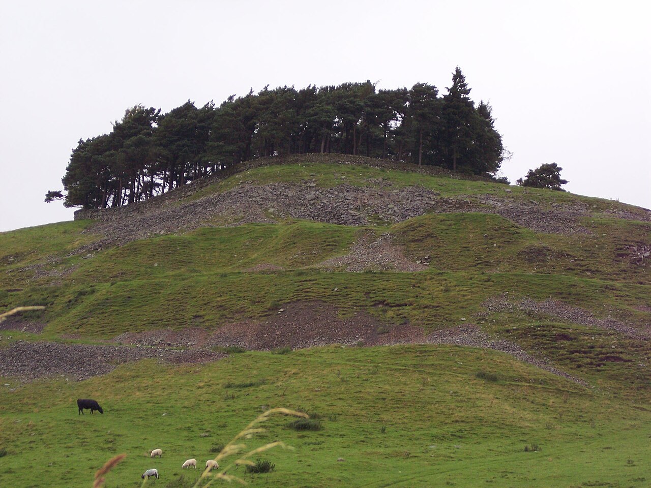
Kirkcarrion
- "Kirkcarrion is a copse of pine trees, surrounded by a stone wall, on a hilltop near Middleton-in-Teesdale, County Durham, England. The trees cover a tumulus which is said to be …
Added by
Pat Thomson

Co-Curate Page
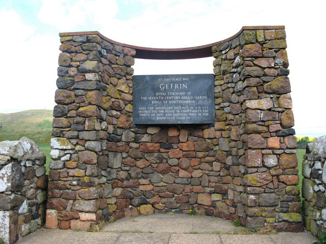
Ad Gefrin
- Overview Map Street View Between Kirknewton and Yeavering in Northumberland are the extensive remains of the Anglo-Saxon royal township of Ad Gefrin. It was a large settlement covering an area …
Co-Curate Page
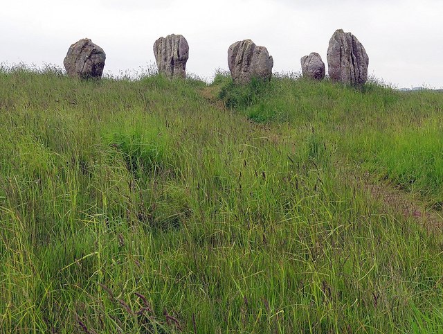
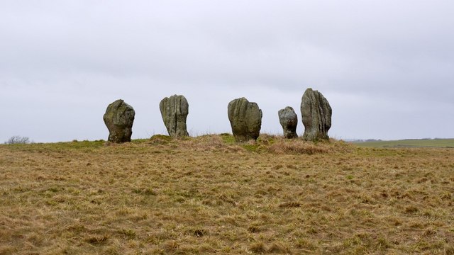
Duddo Stone Circle
- Overview About Duddo Stone Circle Map Street View Northumberland's answer to Stonehenge! The stone circle is located just under a mile north of Duddo, close to the border with Scotland. …
Co-Curate Page
Standing Stones, Doddington Moor
- Map showing Doddington (village) and the Standing Stones (to the south-east). Zoom in to see the Scheduled Monument area. This group of standing stones are located on the high moorland, …
Co-Curate Page
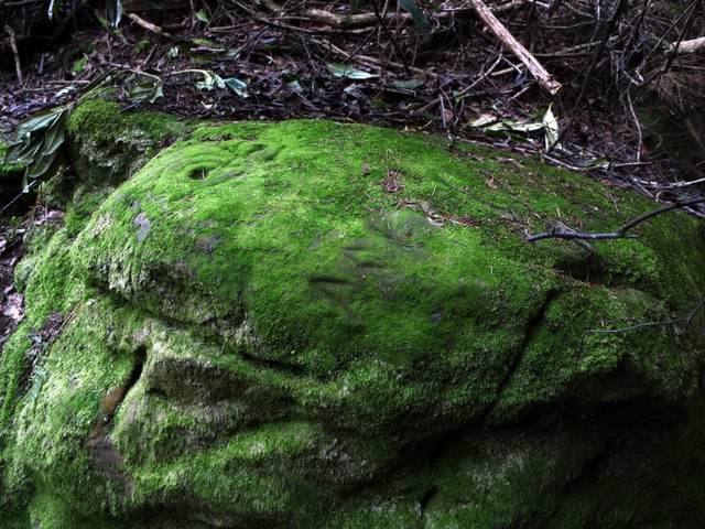
Prehistoric Rock Art in Lemmington Wood
- Deep in Lemmington Woods is a rock with 'cup and rings' carvings, thought to date from the early Bronze Age. The rock is very unusual as it also has later Anglo-Saxon …
Co-Curate Page
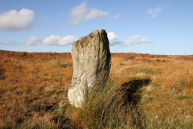
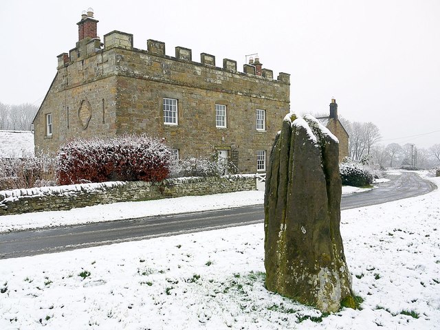
Stob Stone
- Overview Map Street View Stob Stone is a Bronze Age standing stone, located by the roadside at Standing Stone Farm, about half a mile south of Matfen in Northumberland. The …

Co-Curate Page
Palisaded Settlement
- Palisaded settlements were small timber-fortified domestic sites dating to the Late Bronze Age and Early Iron Age (c. 550–440 BC). They were located primarily in northern England and southern Scotland. …

from https://commons.wikimedia.org…
Kirkcarrion
- "Kirkcarrion is a copse of pine trees, surrounded by a stone wall, on a hilltop near Middleton-in-Teesdale, County Durham, England. The trees cover a tumulus which is said to be …
Added by
Pat Thomson
Co-Curate Page
Ad Gefrin
- Overview Map Street View Between Kirknewton and Yeavering in Northumberland are the extensive remains of the Anglo-Saxon royal township of Ad Gefrin. It was a large settlement covering an area …
Co-Curate Page
Duddo Stone Circle
- Overview About Duddo Stone Circle Map Street View Northumberland's answer to Stonehenge! The stone circle is located just under a mile north of Duddo, close to the border with Scotland. …
Co-Curate Page
Standing Stones, Doddington Moor
- Map showing Doddington (village) and the Standing Stones (to the south-east). Zoom in to see the Scheduled Monument area. This group of standing stones are located on the high moorland, …
Co-Curate Page
Prehistoric Rock Art in Lemmington Wood
- Deep in Lemmington Woods is a rock with 'cup and rings' carvings, thought to date from the early Bronze Age. The rock is very unusual as it also has later Anglo-Saxon …
Co-Curate Page
Stob Stone
- Overview Map Street View Stob Stone is a Bronze Age standing stone, located by the roadside at Standing Stone Farm, about half a mile south of Matfen in Northumberland. The …


