Topics > Landmarks, Parks and Buildings > Standing Stones
Standing Stones
Standing stones are prehistoric ritual or ceremonial monuments, typically dating from the Late Neolithic to the end of the Bronze Age.
Co-Curate Page
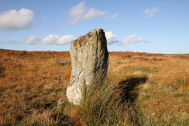
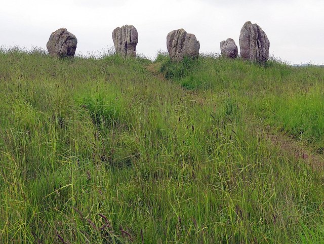
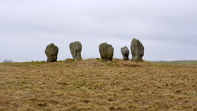
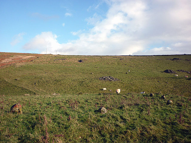
Standing Stones, Doddington Moor
- Map showing Doddington (village) and the Standing Stones (to the south-east). Zoom in to see the Scheduled Monument area. This group of standing stones are located on the high moorland, …
Co-Curate Page
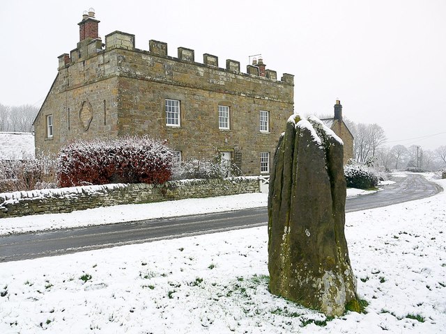
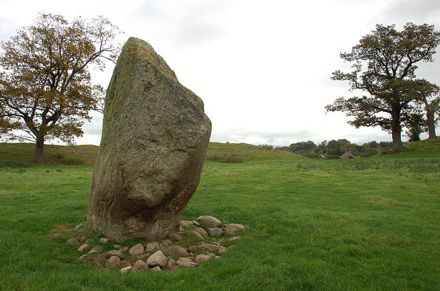
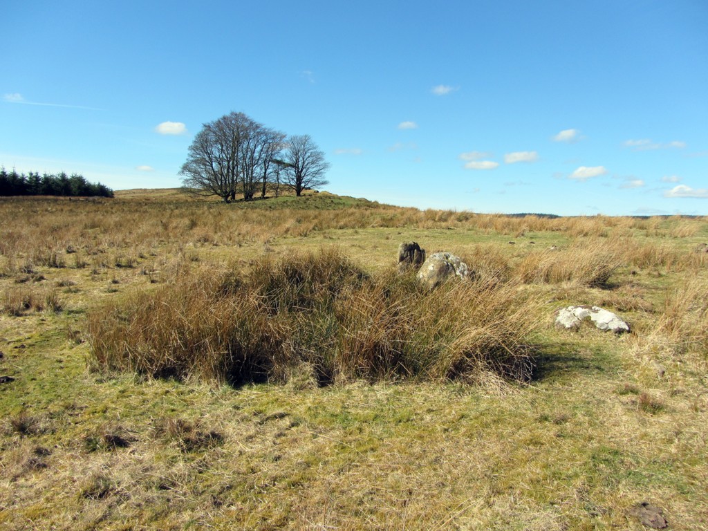
Stob Stone
- Overview Map Street View Stob Stone is a Bronze Age standing stone, located by the roadside at Standing Stone Farm, about half a mile south of Matfen in Northumberland. The …
Co-Curate Page
Long Meg and Her Daughters (stone circle)
- Overview About Long Meg and Her Daughters Map Street View Long Meg and Her Daughters is a stone circle in Cumbria, located about half a mile north-east of the village …
Co-Curate Page
Castlerigg Stone Circle
- Overview About Castlerigg Stone Circle Map Street View Castlerigg Stone Circle, located just over a mile east of Keswick, is one of the earliest stone circles in the UK, thought …

Co-Curate Page
Swinside Stone Circle
- Overview About Swinside Stone Circle Map Street View Swinside Stone Circle (also known as Sunkenkirk Stone Circle) is a stone circle from either the Neolithic or Bronze Age date, located …
Co-Curate Page
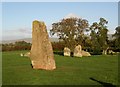
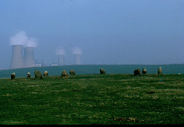
Duddo Stone Circle
- Overview About Duddo Stone Circle Map Street View Northumberland's answer to Stonehenge! The stone circle is located just under a mile north of Duddo, close to the border with Scotland. …
Co-Curate Page
Neolithic Period
- Overview About the Neolithic British Isles 4000 BC - 2,500 BC The Neolithic British Isles refers to the period of British, Irish and Manx history that spanned from circa 4000 to …
Co-Curate Page
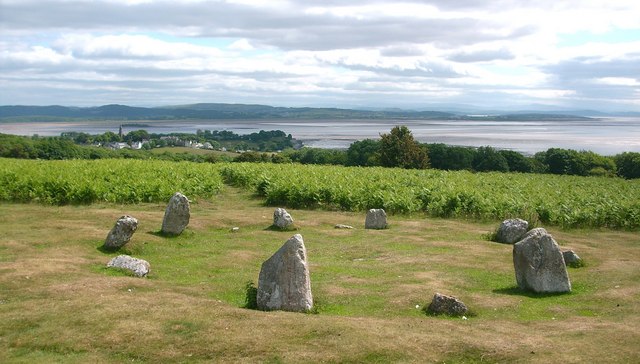
Birkrigg Stone Circle
- Overview About Birkrigg Stone Circle Map Street View Birkrigg Stone Circle (also known as the Druid's Circle) is located on Birkrigg Common in Cumbria, located about 2 miles south of …
Co-Curate Page
Casterton Stone Circle
- Overview Map An embanked circle of 17 relatively small stones, probably dating from the Bronze Age. The stone circle is located near Langthwaite Gill Plantation and about 1 mile east …
Co-Curate Page
Mayburgh Henge
- Overview About Mayburgh Henge Map Street View Henges are ritual or ceremonial sites which date to the Late Neolithic period (2800-2000 BC). Mayburgh Henge is located close to the confluence …
Co-Curate Page
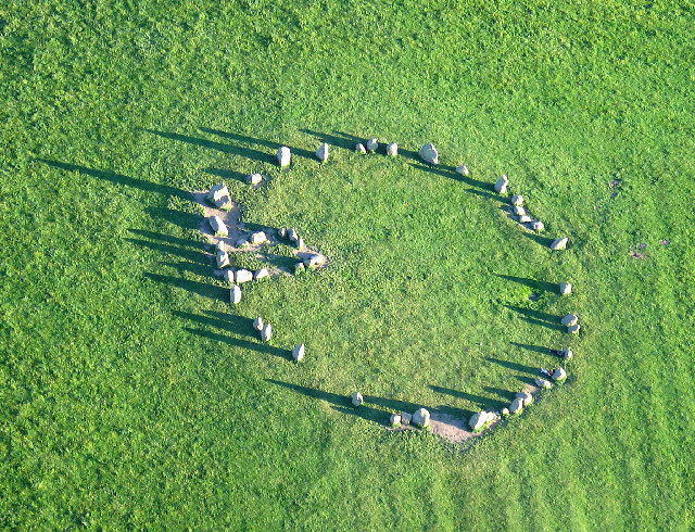
Grey Croft Stone Circle, near Seascale
- Overview About Grey Croft Stone Circle Map Aerial View Grey Croft Stone Circle (aka Greycroft) is located about half a mile north of the village of Seascale. It was originally …
Co-Curate Page
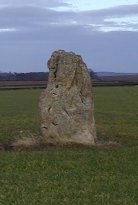
The King's Stone NW of Crookham Westfield
- The King's Stone, to the north-west of Crookham Westfield in Northumberland, is a standing stone of either late Neolithic or early Bronze Age date. It is formed from cherty magnesium …
Co-Curate Page
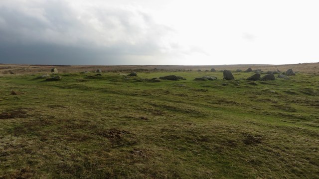
Stone circle, east of King's Crags
- Scheduled Monument (#1011076): Stone circle, 380m east of King's Crags Click the headings below to expand (selected extracts from the Historic England scheduling) Significance The stone circle east of King's …

Co-Curate Page
Standing Stones, Doddington Moor
- Map showing Doddington (village) and the Standing Stones (to the south-east). Zoom in to see the Scheduled Monument area. This group of standing stones are located on the high moorland, …
Co-Curate Page
Stob Stone
- Overview Map Street View Stob Stone is a Bronze Age standing stone, located by the roadside at Standing Stone Farm, about half a mile south of Matfen in Northumberland. The …
Co-Curate Page
Long Meg and Her Daughters (stone circle)
- Overview About Long Meg and Her Daughters Map Street View Long Meg and Her Daughters is a stone circle in Cumbria, located about half a mile north-east of the village …
Co-Curate Page
Castlerigg Stone Circle
- Overview About Castlerigg Stone Circle Map Street View Castlerigg Stone Circle, located just over a mile east of Keswick, is one of the earliest stone circles in the UK, thought …
Co-Curate Page
Swinside Stone Circle
- Overview About Swinside Stone Circle Map Street View Swinside Stone Circle (also known as Sunkenkirk Stone Circle) is a stone circle from either the Neolithic or Bronze Age date, located …
Co-Curate Page
Duddo Stone Circle
- Overview About Duddo Stone Circle Map Street View Northumberland's answer to Stonehenge! The stone circle is located just under a mile north of Duddo, close to the border with Scotland. …
Co-Curate Page
Neolithic Period
- Overview About the Neolithic British Isles 4000 BC - 2,500 BC The Neolithic British Isles refers to the period of British, Irish and Manx history that spanned from circa 4000 to …
Co-Curate Page
Birkrigg Stone Circle
- Overview About Birkrigg Stone Circle Map Street View Birkrigg Stone Circle (also known as the Druid's Circle) is located on Birkrigg Common in Cumbria, located about 2 miles south of …
Co-Curate Page
Casterton Stone Circle
- Overview Map An embanked circle of 17 relatively small stones, probably dating from the Bronze Age. The stone circle is located near Langthwaite Gill Plantation and about 1 mile east …
Co-Curate Page
Mayburgh Henge
- Overview About Mayburgh Henge Map Street View Henges are ritual or ceremonial sites which date to the Late Neolithic period (2800-2000 BC). Mayburgh Henge is located close to the confluence …
Co-Curate Page
Grey Croft Stone Circle, near Seascale
- Overview About Grey Croft Stone Circle Map Aerial View Grey Croft Stone Circle (aka Greycroft) is located about half a mile north of the village of Seascale. It was originally …
Co-Curate Page
The King's Stone NW of Crookham Westfield
- The King's Stone, to the north-west of Crookham Westfield in Northumberland, is a standing stone of either late Neolithic or early Bronze Age date. It is formed from cherty magnesium …


