Topics > Historical Periods > 19th Century > 1850s > 1857
1857
In Northern England:
- 1st April 1857; opening of the Newton Cap Viaduct over the River Wear at Bishop Auckland.
- 21st May 1857; Mowbray Park in Sunderland opened by John Candlish, MP
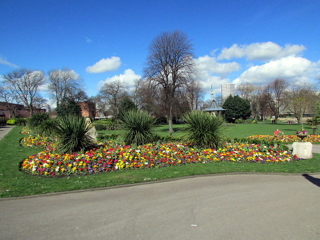
- 1857: creation of Wharton Park in Durham
from http://books.google.co.uk/boo…
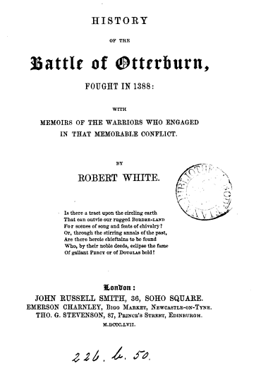
History of the battle of Otterburn fought in 1388. Robert White (1857)
- Book from 1857 available as a free eBook, digitised by Google.
Added by
Simon Cotterill
Co-Curate Page
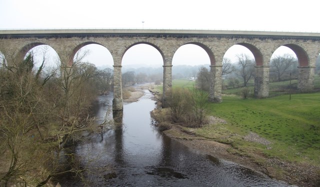
Newton Cap Viaduct
- Overview Map Street View Newton Cap Viaduct was built in 1857 to carry the Bishop Auckland to Durham City railway across the River Wear and Newton Cap Bank, which leads …
Co-Curate Page
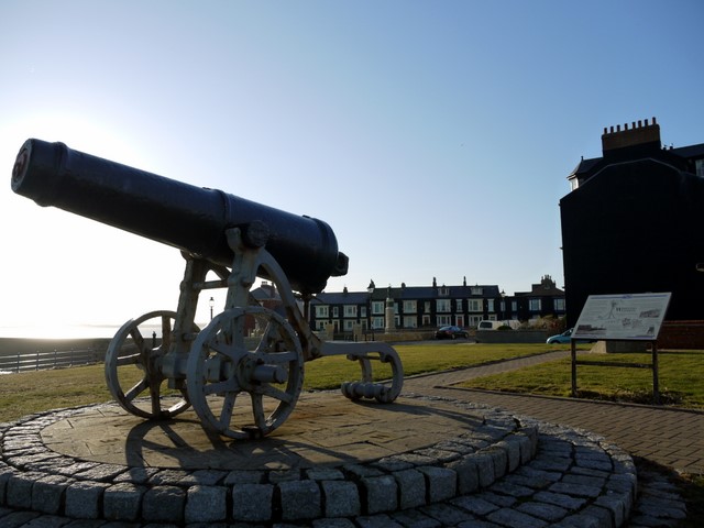
Sebastopol Cannon
- Overview Map Street View The Sebastopol Cannon is located on the Headland at Hartlepool, near the Heugh Battery and Heugh Lighthouse. The cannon was captured from the Russian army at …
Co-Curate Page
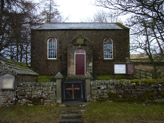
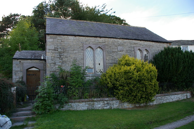
Methodist Chapel, Whiteley Shield
- Overview Map Street View The Primitive Methodist Chapel in Whiteley Shield was built in 1857. The final service in the chapel was held in September 2015. The building is Grade …
Co-Curate Page
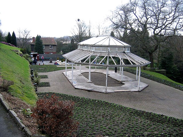
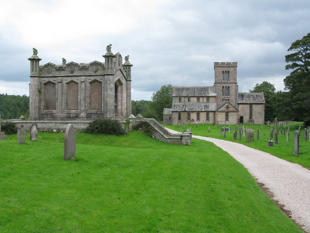
Wharton Park
- Overview Map Street View Wharton Park is a public park situated immediately south of the Railway Station in Durham. The park was created in 1857, by William Lloyd Wharton (1789-1867) …
Co-Curate Page
Helton Methodist Chapel
- Overview Map Street View This former Wesleyan Chapel in Helton in Cumbria was built in the mid 19th Century. In 1873 it had 120 sittings; by 1940 these had been …
Co-Curate Page
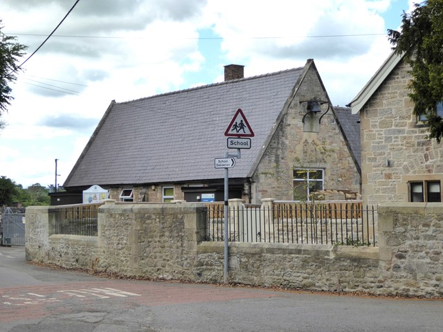
Gainford CofE Primary School
- Overview Map Street View Gainford CofE Primary School on Low Road in Gainford was originally built in 1857 as a National School linked with the close by St Mary's Church. …
Co-Curate Page
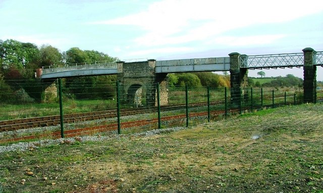
East Thickley Bridge
- Overview Map East Thickley Bridge (footbridge) is located a short distance east of Locomotion: the National Railway Museum at Shildon. The accommodation bridge crosses Shildon sidings and the former Stockton and …
Co-Curate Page
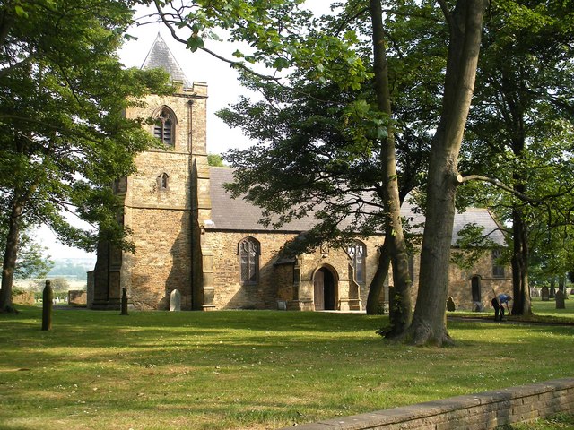
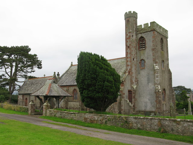
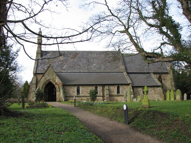
Church of St Stephen, Willington
- Overview Map Street View St. Stephen's is the parish church in Willington. The church was built in 1857, designed by J.A. Cory. It was extended in 1868 and again in …
Co-Curate Page
Church of St Paul, Irton
- Overview About St Paul's Church Map Street View Inside St Paul's Church is in an isolated location about 1 mile north-east of the village of Holmrook and ¾ mile west …
Co-Curate Page
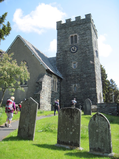
Church of the Holy Trinity, Chapel Stile
- Overview Map Street View Inside Holy Trinity Church is located in the village of Chapel Stile in the South Lakeland district of Cumbria. The Parish Church, sometimes referred to as …
Co-Curate Page
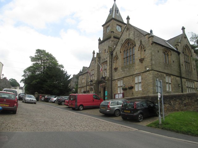
Alston Town Hall
- Overview Map Street View Alston Town Hall is located on the corner of Front Street and Station Road in Alston. The Gothic-style building was built in 1857, designed by A.B. …
Co-Curate Page
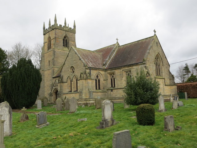
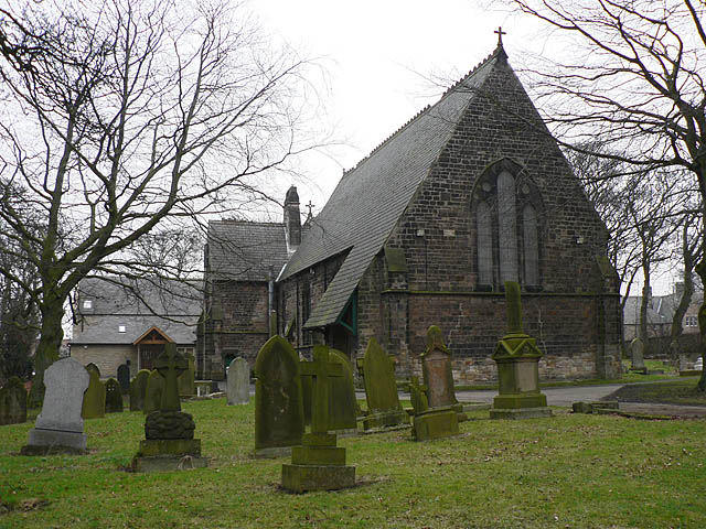
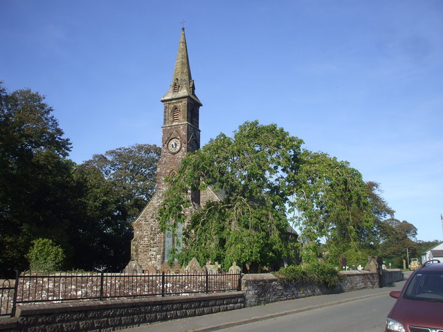
Church of St Mary, Longnewton
- Overview Map Street View St Mary's Church is located off Darlington Road in Longnewton. The Early English style church was built 1856-1857 by S. S. Tenlon. The church is a …
Co-Curate Page
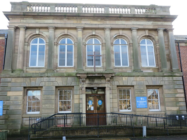
Church of St. Columba, North Shields
- Overview Map Street View St Columba's United Reformed Church is located on Northumberland Square (no. 30) in North Shields. It was originally built as a Presbyterian Church, designed in an …
Co-Curate Page
Church of St Matthew, Westnewton
- Overview Map Street View St Matthew's Church in Westnewton Cumbria was built in 1857. It was built at the expence of John Todd, a Manchester merchant, who was a native …
Co-Curate Page
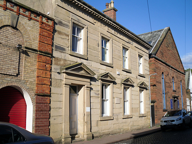
Old Dispensary, Carlisle
- Overview Map Street View The Dispensary is located at No. 6, Chapel Street, Carlisle. It was built in 1857, deigned by John Hodgson of Carlisle, to rehouse the Dispensary (a …

Co-Curate Page
Kearstwick Lodge
- Overview Map Street View Kearstwick Lodge is located on the 6254 road, by the junction with Phil Lane to Underlay. This house, at the south end of Kearstwick, was built …
Co-Curate Page
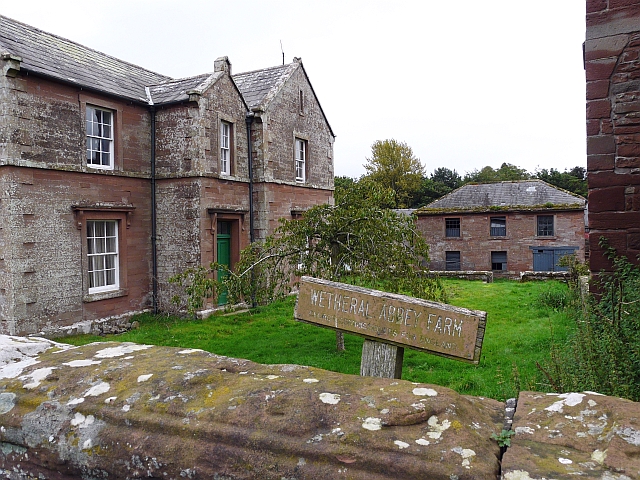
Wetheral Abbey Farm
- This is a Model farm, built in 1857 by James Stewart of Carlisle, incorporating parts of a medieval priory and a post-medieval farmstead. It is Grade II listed on the …

from http://books.google.co.uk/boo…
History of the battle of Otterburn fought in 1388. Robert White (1857)
- Book from 1857 available as a free eBook, digitised by Google.
Added by
Simon Cotterill
Co-Curate Page
Newton Cap Viaduct
- Overview Map Street View Newton Cap Viaduct was built in 1857 to carry the Bishop Auckland to Durham City railway across the River Wear and Newton Cap Bank, which leads …
Co-Curate Page
Sebastopol Cannon
- Overview Map Street View The Sebastopol Cannon is located on the Headland at Hartlepool, near the Heugh Battery and Heugh Lighthouse. The cannon was captured from the Russian army at …
Co-Curate Page
Methodist Chapel, Whiteley Shield
- Overview Map Street View The Primitive Methodist Chapel in Whiteley Shield was built in 1857. The final service in the chapel was held in September 2015. The building is Grade …
Co-Curate Page
Wharton Park
- Overview Map Street View Wharton Park is a public park situated immediately south of the Railway Station in Durham. The park was created in 1857, by William Lloyd Wharton (1789-1867) …
Co-Curate Page
Helton Methodist Chapel
- Overview Map Street View This former Wesleyan Chapel in Helton in Cumbria was built in the mid 19th Century. In 1873 it had 120 sittings; by 1940 these had been …
Co-Curate Page
Gainford CofE Primary School
- Overview Map Street View Gainford CofE Primary School on Low Road in Gainford was originally built in 1857 as a National School linked with the close by St Mary's Church. …
Co-Curate Page
East Thickley Bridge
- Overview Map East Thickley Bridge (footbridge) is located a short distance east of Locomotion: the National Railway Museum at Shildon. The accommodation bridge crosses Shildon sidings and the former Stockton and …
Co-Curate Page
Church of St Stephen, Willington
- Overview Map Street View St. Stephen's is the parish church in Willington. The church was built in 1857, designed by J.A. Cory. It was extended in 1868 and again in …
Co-Curate Page
Church of St Paul, Irton
- Overview About St Paul's Church Map Street View Inside St Paul's Church is in an isolated location about 1 mile north-east of the village of Holmrook and ¾ mile west …
Co-Curate Page
Church of the Holy Trinity, Chapel Stile
- Overview Map Street View Inside Holy Trinity Church is located in the village of Chapel Stile in the South Lakeland district of Cumbria. The Parish Church, sometimes referred to as …
Co-Curate Page
Alston Town Hall
- Overview Map Street View Alston Town Hall is located on the corner of Front Street and Station Road in Alston. The Gothic-style building was built in 1857, designed by A.B. …
Co-Curate Page
Church of St Mary, Longnewton
- Overview Map Street View St Mary's Church is located off Darlington Road in Longnewton. The Early English style church was built 1856-1857 by S. S. Tenlon. The church is a …
Co-Curate Page
Church of St. Columba, North Shields
- Overview Map Street View St Columba's United Reformed Church is located on Northumberland Square (no. 30) in North Shields. It was originally built as a Presbyterian Church, designed in an …
Co-Curate Page
Church of St Matthew, Westnewton
- Overview Map Street View St Matthew's Church in Westnewton Cumbria was built in 1857. It was built at the expence of John Todd, a Manchester merchant, who was a native …
Co-Curate Page
Old Dispensary, Carlisle
- Overview Map Street View The Dispensary is located at No. 6, Chapel Street, Carlisle. It was built in 1857, deigned by John Hodgson of Carlisle, to rehouse the Dispensary (a …
Co-Curate Page
Kearstwick Lodge
- Overview Map Street View Kearstwick Lodge is located on the 6254 road, by the junction with Phil Lane to Underlay. This house, at the south end of Kearstwick, was built …