Topics > Civil Parishes in Cumbria > Milburn Civil Parish > Silverband Mine > Silverband Mine aerial ropeway
Silverband Mine aerial ropeway
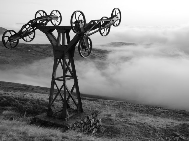
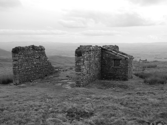
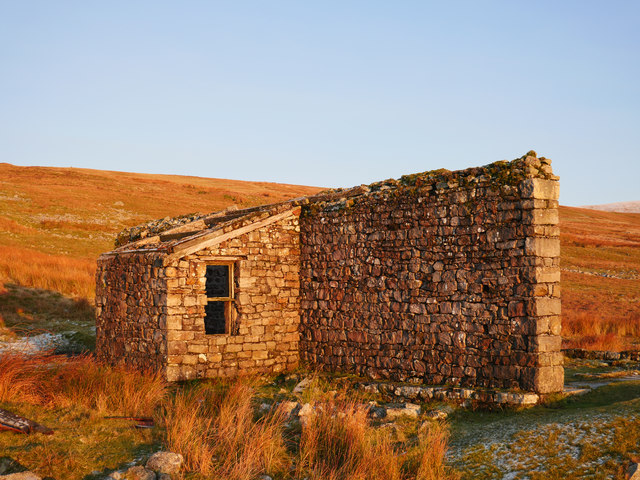
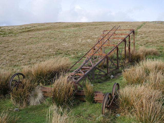
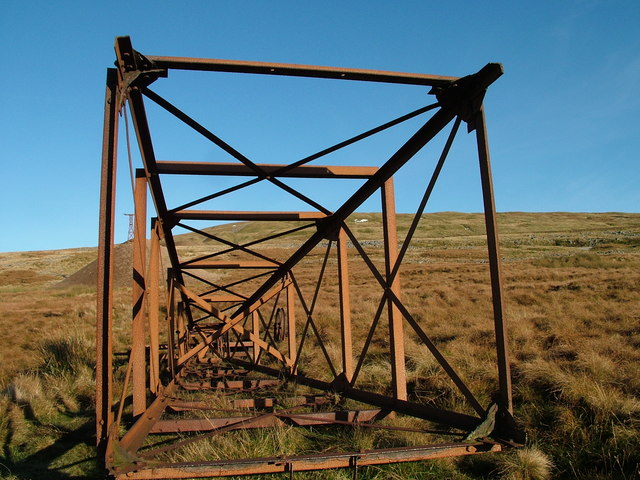
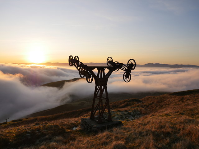
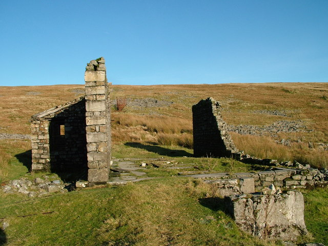
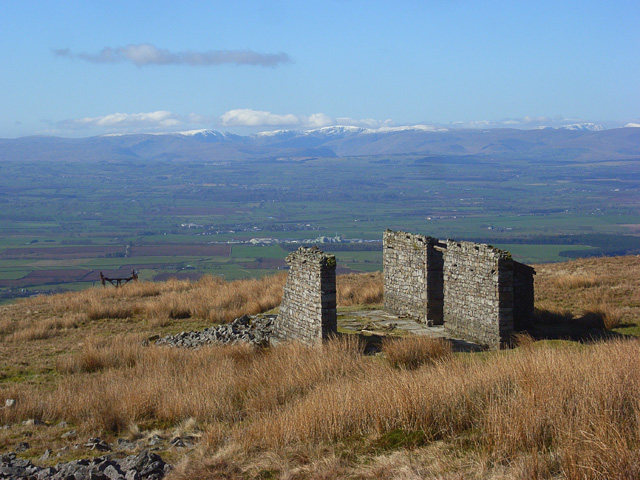
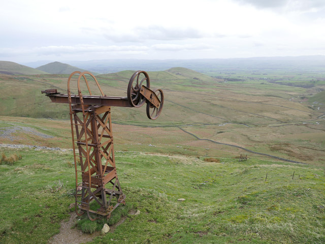
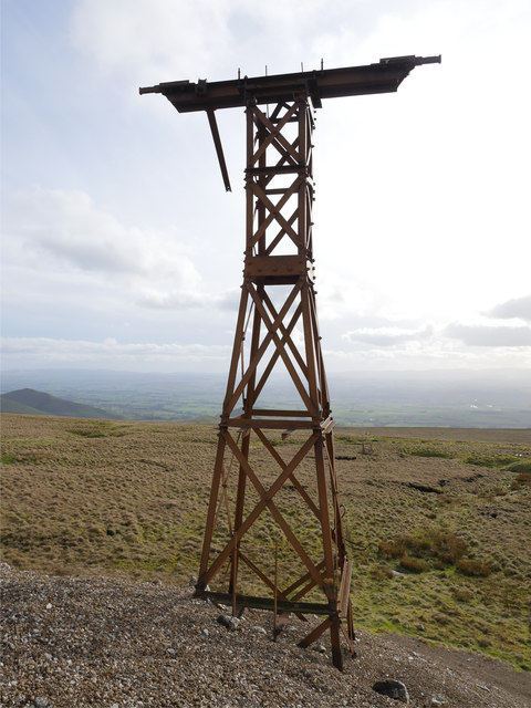
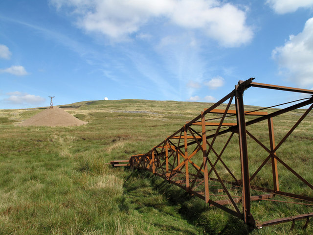
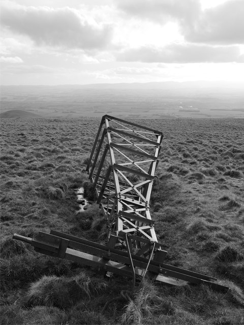
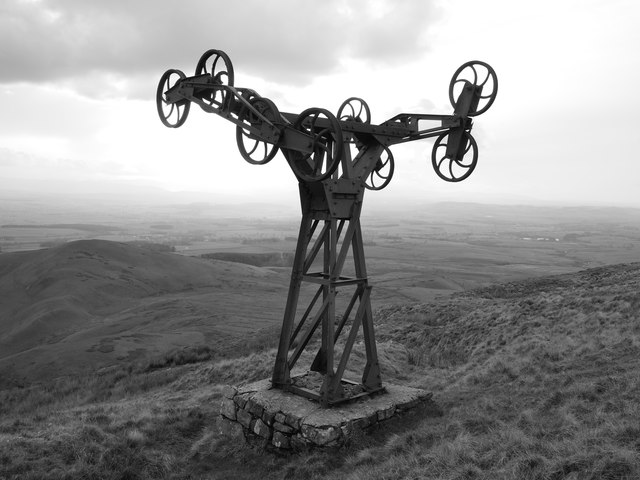
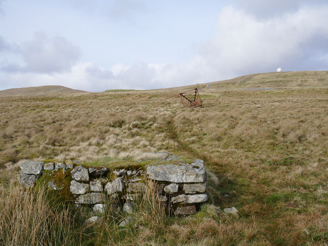
On the south western slopes of Great Dun Fell in Cumbria are the remains of an aerial ropeway built to transport ore from Silverband Mine. The ropeway was 1.75km long , running down the steep fellside, dropping 700m, after which the ore was transported to processing works at Milburn Grange, approximately 5km away. The ropeway was built in c.1939 by the La Porte Chemical Company when they took over Silverband Mine (the mine was established in the 19th century for lead and later barytes). Buckets suspended from cables passed over 17 or so metal pylons. Between 1939 and 1963 Siverband produced 215,000 tons of dressed barytes ore. After the closure of the mine in 1966 the aerial ropeway was dismantled. The break house and several of the pylons remain and are a Scheduled Monument. (Source: Historic England).
from Geograph (geograph)
Aerial ropeway pylon on the lower slopes of Great Dun Fell
Pinned by Simon Cotterill
from Geograph (geograph)
Approaching sunset on the lower slopes of Great Dun Fell
Pinned by Simon Cotterill
from Geograph (geograph)
Silverband Mine aerial ropeway pylon and spoil heap
Pinned by Simon Cotterill

from https://historicengland.org.u…
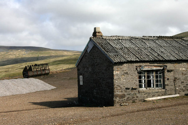
Silverband mine aerial ropeway, brake house and inclined plane
- "The monument includes an approximately 1.75km length of Silverband mine aerial ropeway, an associated brake house, and the remains of an inclined plane located high on the south western slopes …
Added by
Simon Cotterill
from Geograph (geograph)
Rusting remains of the Silverband Mine aerial ropeway
Pinned by Simon Cotterill

from Geograph (geograph)
Aerial ropeway pylon on the lower slopes of Great Dun Fell
Pinned by Simon Cotterill
from Geograph (geograph)
Approaching sunset on the lower slopes of Great Dun Fell
Pinned by Simon Cotterill
from Geograph (geograph)
Silverband Mine aerial ropeway pylon and spoil heap
Pinned by Simon Cotterill
from https://historicengland.org.u…
Silverband mine aerial ropeway, brake house and inclined plane
- "The monument includes an approximately 1.75km length of Silverband mine aerial ropeway, an associated brake house, and the remains of an inclined plane located high on the south western slopes …
Added by
Simon Cotterill
from Geograph (geograph)
Rusting remains of the Silverband Mine aerial ropeway
Pinned by Simon Cotterill