Topics > Tyne and Wear > Newcastle upon Tyne > Jesmond > Jesmond Road
Jesmond Road
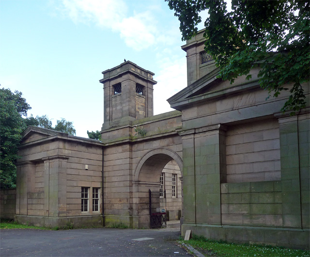
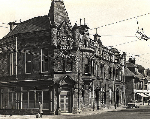
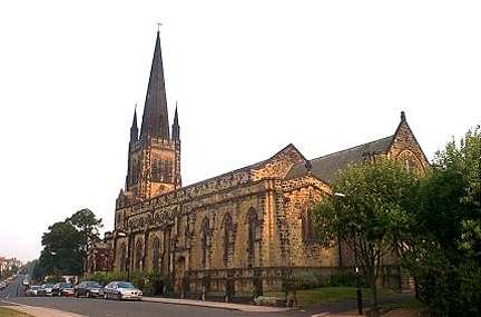
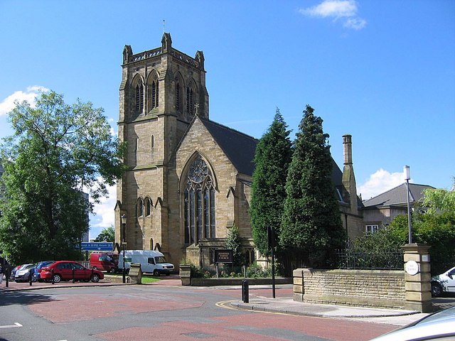
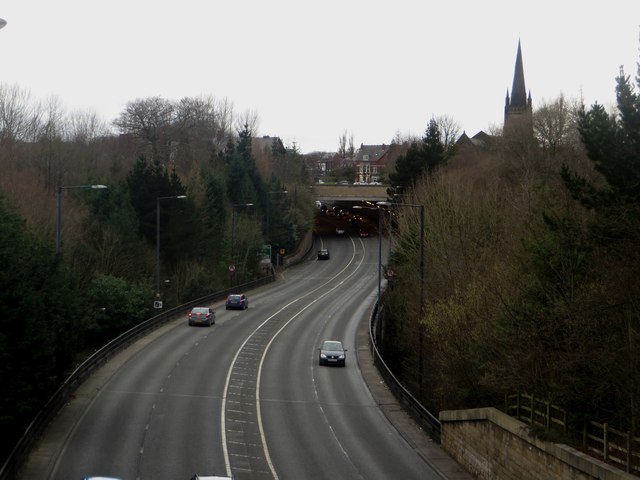
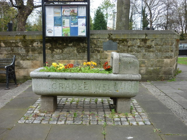
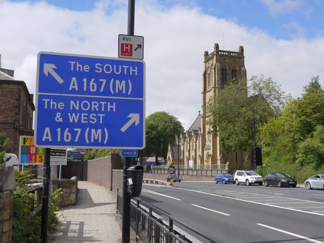
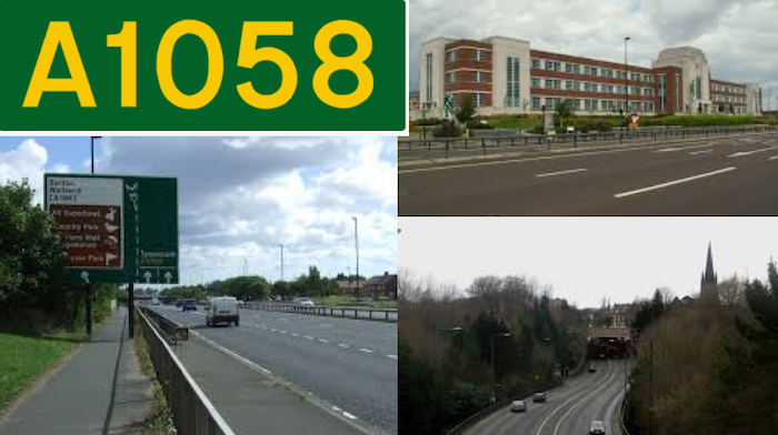
 Jesmond Road runs from the centre of Newcastle to Jesmond as far as its junction with Benton Bank and Jesmond Dene Road, at the edge of Jesmond Dene. Jesmond Road has some notable 19th century buildings, including Jesmond Parish Church, Shiners, and the gothic-style Punch Bowl pub, and also for the gothic entrances to Jesmond Cemetery and All Saints Cemetery. The layout of Jesmond Road changed significantly in 1973, with the building of the central motorway (A167), which cut off what is now Jesmond Road West. Part of Jesmond Road now forms a section of the A1058 route which runs from Newcastle out to Tynemouth. The final eastern section of Jesmond Road is seperate to the A1058 and runs from the former Cradlewell pub to Holy Trinity Church; there are numerous shops and resturants along this section of the road.

from Newcastle libraries (flickr)
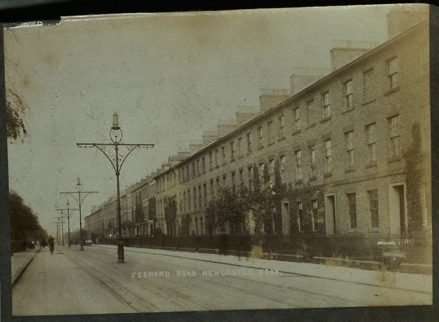
025550:Jesmond Road Jesmond Unknown c.1930
Pinned by Simon Cotterill
from Newcastle libraries (flickr)
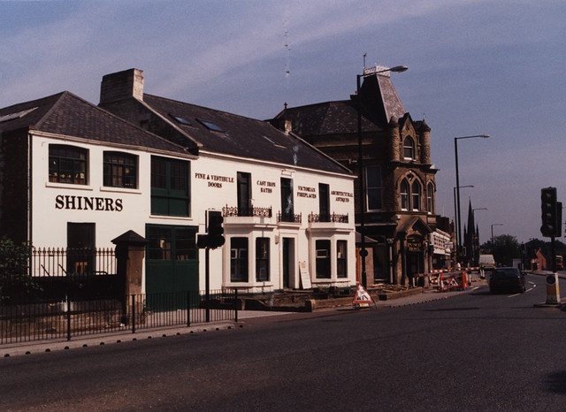
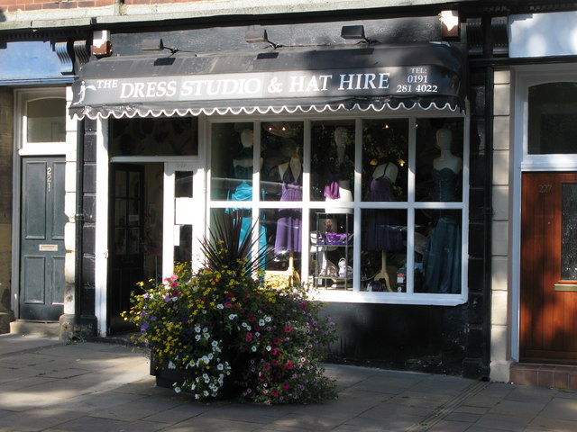
063440:Shiners Architectural Reclamation Ltd no.123 Jesmond Road Jesmond Maybury Malcolm 1996
Pinned by Simon Cotterill
from Newcastle libraries (flickr)
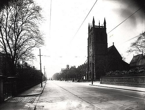
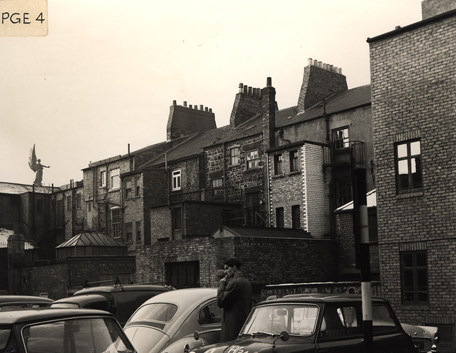
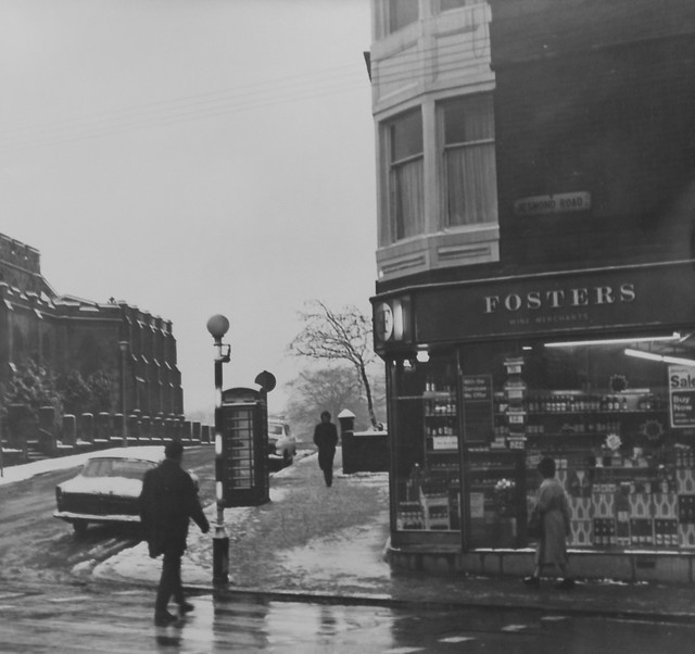
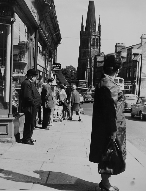
066109:Jesmond Road Jesmond Unknown after 1959
Pinned by Simon Cotterill
from Newcastle libraries (flickr)
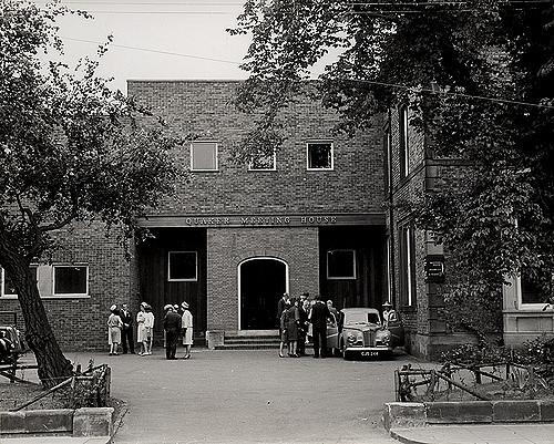
014158:Quaker Meeting House Jesmond Road Jesmond 1964
Pinned by Simon Cotterill
from Newcastle libraries (flickr)
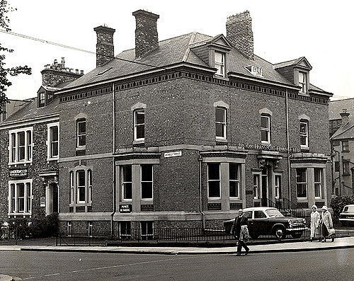
015590:Union Transport Finance Co. Jesmond Road/Archbold Terrace Jesmond 1966
Pinned by Simon Cotterill
from Newcastle libraries (flickr)
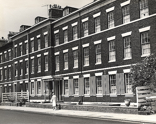
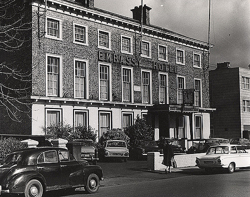
015270:Windsor Hotel Jesmond Road Unknown 1966
Pinned by Simon Cotterill
from Newcastle libraries (flickr)
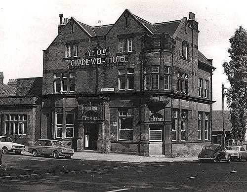
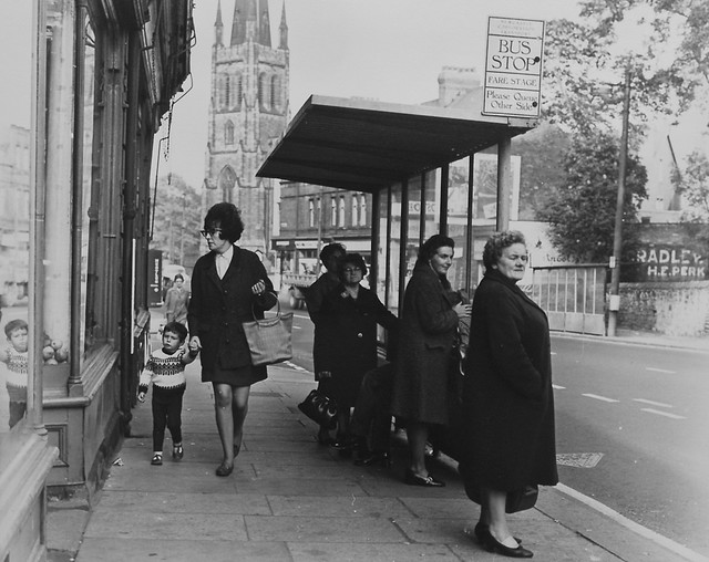
021120:Ye Old Cradlewell Hotel Jesmond Road/Deuchar Street 1971
Pinned by Simon Cotterill
from Newcastle libraries (flickr)
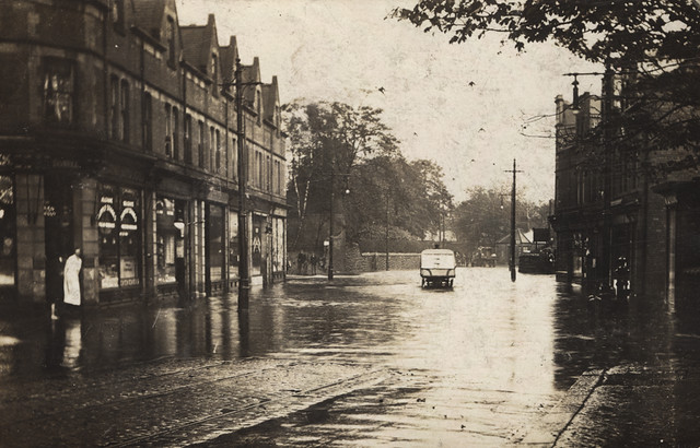
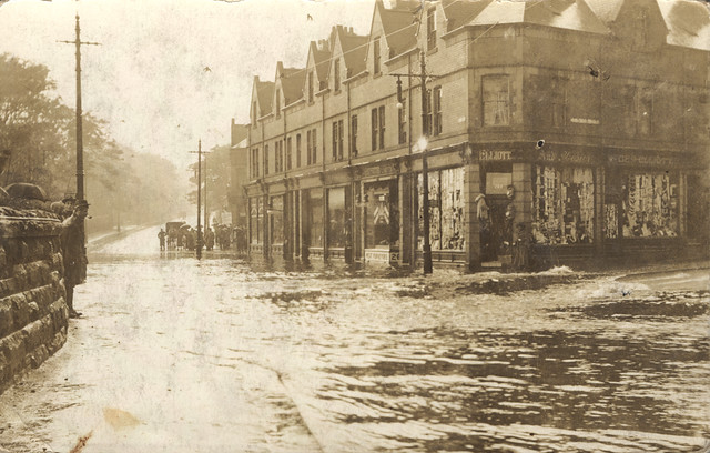
068302:Flooded Jesmond Road Unknown 1913
Pinned by Simon Cotterill
from Newcastle libraries (flickr)
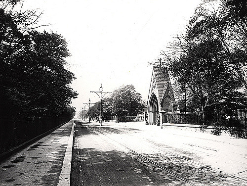
023541:Jesmond Road Jesmond; lantern slide; around 1910
Pinned by Simon Cotterill
from Newcastle libraries (flickr)
Tor571, Jesmond Road, Newcastle upon Tyne
Pinned by Simon Cotterill

from Newcastle libraries (flickr)
Tor857, Jesmond Road, Newcastle upon Tyne
Pinned by Simon Cotterill
from Newcastle libraries (flickr)
Tor744, Jesmond Road, Newcastle upon Tyne
Pinned by Simon Cotterill
from Newcastle libraries (flickr)
Tor740, Jesmond Road, Newcastle upon Tyne
Pinned by Simon Cotterill
from Newcastle libraries (flickr)
Tor064, Jesmond Road, Newcastle upon Tyne
Pinned by Simon Cotterill
from Newcastle libraries (flickr)
Tor063, Jesmond Road, Newcastle upon Tyne
Pinned by Simon Cotterill
from Newcastle libraries (flickr)
Tor057, Jesmond Road, Newcastle upon Tyne
Pinned by Simon Cotterill

from Newcastle libraries (flickr)
Tor949, Jesmond Road, Newcastle upon Tyne
Pinned by Simon Cotterill
Co-Curate Page
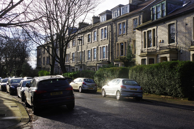
Granville Road
- Overview Map Street View Granville Road is a residential street in Jesmond, Newcastle. It runs north-west off Jesmond Road and then branches west to join Fernwood Road, near the Mansion …
Co-Curate Page
Jesmond Parish Church
- Summary Map Street View Jesmond Parish Church is located in Brandling Village in the suburb of Jesmond in Newcastle. The Gothic style church was designed by John Dobson and consecrated …
Co-Curate Page
Cradlewell Bypass
- In 1987 plans were approved to build a bypass for the Cradlewell area of Jesmond, to replace the steep road down Benton Bank with dual carriage way to join the A1058 …
Co-Curate Page
A1058 Coast Road
- Overview History Map Street View The A1058 route runs 12.1k (7.5 miles) from Newcastle city centre to Tynemouth. The original 4½ mile stretch of the Coast Road was opened in …

from Newcastle libraries (flickr)
025550:Jesmond Road Jesmond Unknown c.1930
Pinned by Simon Cotterill
from Newcastle libraries (flickr)
063440:Shiners Architectural Reclamation Ltd no.123 Jesmond Road Jesmond Maybury Malcolm 1996
Pinned by Simon Cotterill
from Newcastle libraries (flickr)
066109:Jesmond Road Jesmond Unknown after 1959
Pinned by Simon Cotterill
from Newcastle libraries (flickr)
014158:Quaker Meeting House Jesmond Road Jesmond 1964
Pinned by Simon Cotterill
from Newcastle libraries (flickr)
015590:Union Transport Finance Co. Jesmond Road/Archbold Terrace Jesmond 1966
Pinned by Simon Cotterill
from Newcastle libraries (flickr)
015270:Windsor Hotel Jesmond Road Unknown 1966
Pinned by Simon Cotterill
from Newcastle libraries (flickr)
021120:Ye Old Cradlewell Hotel Jesmond Road/Deuchar Street 1971
Pinned by Simon Cotterill
from Newcastle libraries (flickr)
068302:Flooded Jesmond Road Unknown 1913
Pinned by Simon Cotterill
from Newcastle libraries (flickr)
023541:Jesmond Road Jesmond; lantern slide; around 1910
Pinned by Simon Cotterill
from Newcastle libraries (flickr)
Tor571, Jesmond Road, Newcastle upon Tyne
Pinned by Simon Cotterill
from Newcastle libraries (flickr)
Tor857, Jesmond Road, Newcastle upon Tyne
Pinned by Simon Cotterill
from Newcastle libraries (flickr)
Tor744, Jesmond Road, Newcastle upon Tyne
Pinned by Simon Cotterill
from Newcastle libraries (flickr)
Tor740, Jesmond Road, Newcastle upon Tyne
Pinned by Simon Cotterill
from Newcastle libraries (flickr)
Tor064, Jesmond Road, Newcastle upon Tyne
Pinned by Simon Cotterill
from Newcastle libraries (flickr)
Tor063, Jesmond Road, Newcastle upon Tyne
Pinned by Simon Cotterill
from Newcastle libraries (flickr)
Tor057, Jesmond Road, Newcastle upon Tyne
Pinned by Simon Cotterill
from Newcastle libraries (flickr)
Tor949, Jesmond Road, Newcastle upon Tyne
Pinned by Simon Cotterill
Co-Curate Page
Granville Road
- Overview Map Street View Granville Road is a residential street in Jesmond, Newcastle. It runs north-west off Jesmond Road and then branches west to join Fernwood Road, near the Mansion …
Co-Curate Page
Jesmond Parish Church
- Summary Map Street View Jesmond Parish Church is located in Brandling Village in the suburb of Jesmond in Newcastle. The Gothic style church was designed by John Dobson and consecrated …
Co-Curate Page
Cradlewell Bypass
- In 1987 plans were approved to build a bypass for the Cradlewell area of Jesmond, to replace the steep road down Benton Bank with dual carriage way to join the A1058 …