Topics > Civil Parishes in Cumbria > Lakes Civil Parish > Historic Buildings and Monuments in Lakes Civil Parish
Historic Buildings and Monuments in Lakes Civil Parish
Listed buildings and scheduled monuments in Lakes Civil Parish, Cumbria, from the National Heritage List for England[1]. Use the Search (below) if looking for a specific building / monument.
| Structure | List No. | Grade | Built~ | Note |
|---|---|---|---|---|
| Nos. 1-3, Smithy Brow | 1272009 | II | ||
| Nos. 1-6, Main Street | 1245274 | II | ||
| Nos. 1-7, Mill Street | 1245275 | II | ||
| Nos. 2 and 3, Bridge Street | 1272215 | II | ||
| No. 2, Cheapside | 1244945 | II | ||
| Nos. 2-11, Church Street | 1245006 | II | ||
| Nos. 3 and 4, Cheapside | 1244793 | II | ||
| No. 4, Bridge Street | 1244790 | II | ||
| Nos. 5 and 6, Bridge Street | 1272216 | II | ||
| AA Telephone Call Box No 487 | 1367182 | II | ||
| Albert Moore's Barn | 1245582 | II | ||
| Allan Bank | 1272018 | II | ||
| Arbour in Garden at Dove Nest | 1245155 | II | ||
| Ash Tree Cottage | 1272217 | II | ||
| Ashton Cottage, Little Beck and Raesbeck | 1245117 | II | ||
| Barn Adjacent to the Bield | 1271944 | II* | ||
| Barn and Cottage Belonging to the Red Lion to South of Hotel | 1245185 | II | ||
| Barn and Stable Attached to Forest Side Cottage | 1054624 | II | ||
| Barn at Rear of Church Stile Studio | 1245161 | II | ||
| Barn at Town End | 1245541 | II* | 1666 | Townend, Troutbeck |
| Barn to East of Howe Top Farmhouse | 1271871 | II | ||
| Barn to North of Underhelm Farmhouse | 1272001 | II | ||
| Barn to South West of Gillside | 1245257 | II | ||
| Barn to West of Low Fold Farmhouse | 1245511 | II | ||
| Barns Attached to Mill Brow Farmhouse | 1271826 | II | ||
| Barns Etc to North of Low House | 1245508 | II | ||
| Barns, Stables Etc to North and East of Rydal Hall | 1245500 | II* | ||
| Beckside | 1271818 | II | ||
| Becksteps | 1245201 | II | ||
| Belle Hill | 1271816 | II | ||
| Birk Howe Farmhouse | 1245286 | II | ||
| Blea Tarn House | 1245283 | II | C17th | Little Langdale |
| Blindtarn Gill | 1245188 | II | ||
| Borran's Field (Galava Roman Fort) | 1244785 | I | C2nd | Ambleside |
| Bridge Beside St Oswalds Church | 1245158 | II | ||
| Bridge End | 1271954 | II | ||
| Bridge House | 1245148 | I | C17th | Ambleside |
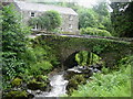
| Bridge over Rydal Beck in Grounds of Rydal Hall | 1245408 | II* | 1682 | Rydal |
| Bridge Syke | 1245270 | II | ||
| Brimmer Head Farmhouse with Adjoining Farm Building | 1272005 | I | 1574 | Near Grasmere |
| Britannia Inn | 1245200 | II | C17th | Elterwater |
| Brow Head | 1245399 | II | ||
| Buildings Attached to Walthwaite | 1245269 | II* | ||
| Buttments Farmhouse | 1245509 | II | ||
| Calgarth Park | 1245505 | II | ||
| Church Cottage | 1245406 | II | ||
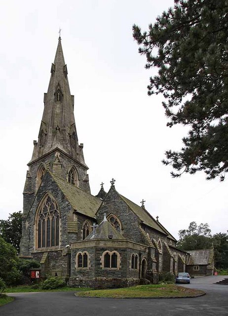
| Church of St Mary | 1244784 | II* | 1854 | Ambleside |
| Church of St Mary | 1245403 | II* | 1824 | Rydal |
| Church of St Oswald | 1245157 | I | C14th | Grasmere |
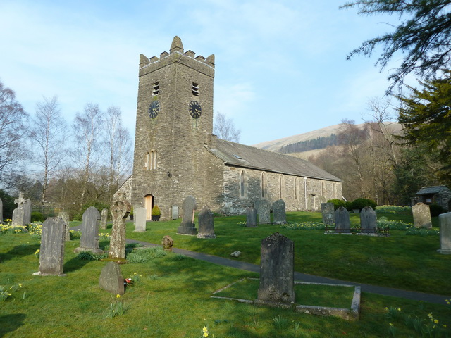
| Church of the Holy Trinity | 1245198 | II | 1857 | Chapel Stile |
| Church Stile Cottage | 1245162 | II | ||
| Church Stile Studio | 1245160 | II | ||
| Cobbled Courtyard with Mounting Block and Pump | 1271873 | II | ||
| Corbrig, | 1245149 | II | ||
| Cote How | 1271836 | II | ||
| Cottage Adjoining Kirkstone Foot Cottage | 1245172 | II | ||
| Crag Head | 1245401 | II | ||
| Cross Brow | 1272010 | II | ||
| Cross in Front of the Salutation Inn | 1245151 | II | ||
| Dale End with Adjacent Barn | 1271945 | II | ||
| Dockray Cottage | 1245187 | II | ||
| Dove Cottage at Town End | 1272002 | I | C17th | Grasmere. Wordworth Museum |
| Dove Nest | 1245154 | II | ||
| Eltermere Hotel | 1271958 | II | ||
| Elterwater Bridge | 1271955 | II | 1702 | Elterwater |
| Fairview Cottage, the Cottage and Nos 3-6 | 1244795 | II | ||
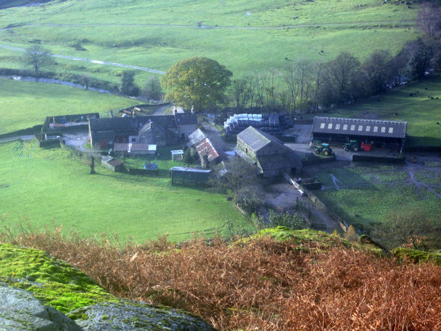
| Farm Buildings at Fell Foot | 1245297 | II | C16th | |
| Fir Bank | 1271957 | II | ||
| Forest Side Cottage | 1271951 | II | ||
| Former Croft Hotel | 1271856 | II | ||
| Former Friends Meeting House | 1245150 | II | ||
| Fox Ghyll | 1245398 | II | ||
| Fox How | 1271870 | II* | ||
| Game Larder in Grounds of Rydal Hall | 1245409 | II* | ||
| Gatehouse at Croft Hotel | 1245480 | II* | ||
| Ghyll Foot | 1271974 | II | ||
| Ghyll Side | 1244791 | II | ||
| Gillside | 1245194 | II | ||
| Glen Rothay Hotel | 1245404 | II | ||
| Golden Rule Hotel | 1245152 | II | ||
| Goodybridge House and Attached Barn to North East | 1272006 | II* | ||
| Grasmere War Memorial | 1441481 | II | 1921 | By W.G. Collingwood |
| Great House Barn | 1409301 | II | ||
| Greenend | 1271956 | II | ||
| Hall Bank | 1254495 | II | ||
| Hart Head | 1245503 | II | ||
| High Broadrayn Cottage | 1245195 | II | ||
| High Colwith | 1245293 | II | ||
| High Fold | 1271817 | II | ||
| High Fold Farmhouse with Iron Railings in Front | 1271830 | II | ||
| High Green (House to the East) | 1245568 | II | ||
| High Green (House to the North) | 1271833 | II | ||
| High Green Farmhouse and Attached Buildings | 1271832 | II | ||
| High Scorecrag Farmhouse with Attached Farm Building | 1245268 | II | ||
| High Sweden Bridge | 1244787 | II | C17th | Ambleside. Packhorse bridge |
| Howe Top Farmhouse | 1245396 | II | ||
| Howsley Cottage | 1245400 | II | ||
| Ice House in Grounds of Rydal Hall | 1245501 | II* | ||
| Jaunie Wife House and Attached Barn to North West | 1376753 | II | ||
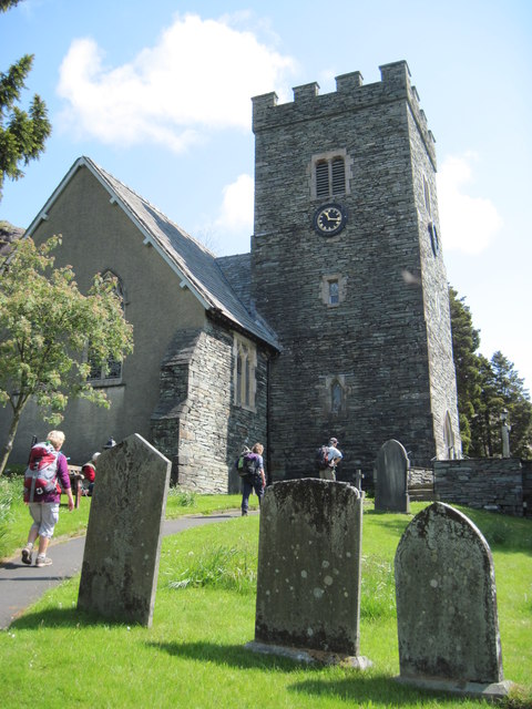
| Jesus Church | 1271827 | II* | 1562 | Troutbeck |
| Kitty Hall | 1245273 | II | ||
| Knott House Farmhouse with Adjoining Farm Building to North. | 1271950 | II | ||
| Lancrigg | 1245190 | II | ||
| Lane Foot Farm bank barn, attached possible smithy and cartshed and detached former wash house | 1416818 | II | ||
| Langdale Chase Hotel | 1245506 | II | ||
| Langdale War Memorial | 1457094 | II | 1920 | Chapel Stile |
| Loughrigg Brow | 1245455 | II | ||
| Loughrigg Cottage | 1245397 | II | ||
| Loughrigg Fold | 1245481 | II | ||
| Loughrigg Holme with Attached Building to South | 1271872 | II | ||
| Loughrigg How (House to North West) | 1245402 | II | ||
| Loughrigg How (House to South East) | 1245482 | II | ||
| Low Broadrayn Farmhouse and Attached Building to North | 1272003 | II | ||
| Low Colwith with Attached Farm Buildings | 1245284 | II | ||
| Low Fold | 1245510 | II | ||
| Low Fold | 1245512 | II | ||
| Low House | 1271829 | II | ||
| Low Scorecrag | 1245196 | II | ||
| Low Sweden Bridge | 1244786 | II | C17th | Ambleside |
| Low Wood Hotel | 1272015 | II | ||
| Lowfield with Former Cottage Adjoining to North East | 1245146 | II | ||
| Maple Tree Cafe | 1245272 | II | C19th | Elterwater |
| Market Hall (Occupied by Mountain Restaurant and Offices) | 1245141 | II | ||
| Mathew How | 1246648 | II | ||
| Middlefell Place Farmhouse | 1245276 | II | ||
| Mill Cottage | 1272012 | II | ||
| Millbeck Farmhouse with Attached Farm Building | 1271943 | II | ||
| Miller Bridge | 1244788 | II | ||
| Mortal Man Inn | 1245513 | II | C19th | Troutbeck. Established c.1689 |
| Moss Side | 1272016 | II | ||
| New Dungeon Ghyll Hotel | 1245278 | II | ||
| No. 1 Cheapside | 1244792 | II | ||
| No. 22 Lake Road | 1245140 | II | ||
| Nook End Farmhouse and Attached Farm Building | 1244798 | II | ||
| North Syke | 1272221 | II | ||
| North View | 1272014 | II | ||
| Nos. 1-4, Tom Fold | 1245153 | II | ||
| Oaks Farmhouse | 1245483 | II | ||
| Old Farm Cottage | 1271953 | II | ||
| Old Mill Studios | 1244789 | II | ||
| Old School House and Barn Attached to Old School House | 1244926 | II | ||
| Old Stamp House | 1245110 | II | ||
| Outbuilding to South of Low House | 1271820 | II | ||
| Pavement End Farmhouse | 1245164 | II | ||
| Pearson's Lane | 1245567 | II | ||
| Pelter Bridge | 1245484 | II | ||
| Premises Occupied by Browns Booking Office | 1272220 | II | ||
| Premises occupied by Stoneage, The Priest Hole Restaurant, Oxfam | 1244794 | II | ||
| Pye Howe | 1245280 | II | ||
| Queens Head Inn | 1271819 | II | ||
| Raw Head Farmhouse | 1245279 | II | ||
| Rectory | 1245159 | II | ||
| Red Lion Hotel (Old Portion Only) | 1245163 | II | ||
| Robin Ghyll | 1245282 | II | ||
| Robin Lane Cottages | 1245507 | II | ||
| Robinson Place | 1271948 | II | ||
| Rock Cottage | 1271874 | II | ||
| Rose Cottage | 1245271 | II | ||
| Rosebank Barn | 1417647 | II | ||
| Rossett Farmhouse with Attached Barn | 1271960 | II | ||
| Rothay Bridge | 1245147 | II | ||
| Rothay Manor Hotel | 1272011 | II | ||
| Royal Oak Hotel | 1272218 | II | ||
| Rydal Cottages | 1245498 | II | ||
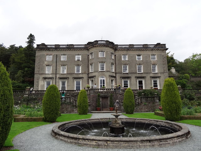
| Rydal Hall | 1245499 | II* | C16th | Rydal |
| Rydal Lodge | 1245405 | II | ||
| Rydal Mount | 1271835 | I | C16th | Rydal. Home of Wordsworth |
| Scale How (Part of Charlotte Mason College) | 1244797 | II | ||
| Scroggs | 1271875 | II | ||
| Side House Farmhouse | 1245277 | II | ||
| Skelwith Bridge | 1245504 | II | Partly in this parish | |
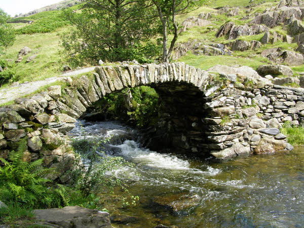
| Slaters Bridge | 1245295 | II* | C17th | Little Langdale. Partly in this Parish. |
| St Anne's Court | 1313425 | II | ||
| St Oswalds | 1272017 | II | ||
| Stock Cottage | 1245144 | II | ||
| Stool End Farmhouse, Barn to South East of Farmhouse and Barn to North East of Farmhouse | 1245281 | II | ||
| Storeythwaite | 1271831 | II | ||
| Summer House in Grounds of Rydal Hall | 1271834 | II* | 1668 | 'The Grot' described by Wordsworth |
| Swan Hotel | 1272004 | II | ||
| Syke Barn | 1456487 | II | ||
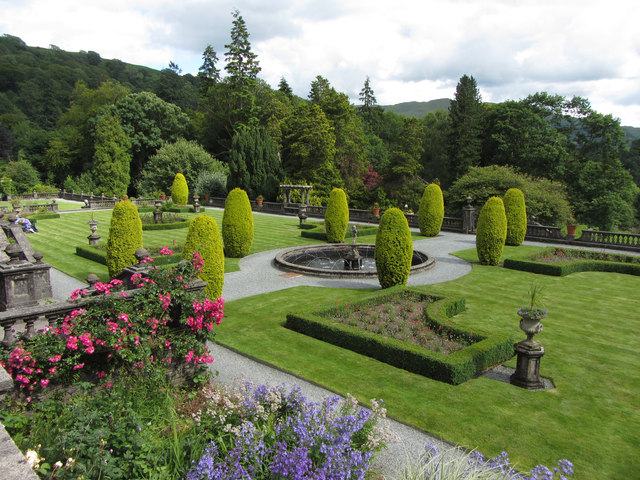
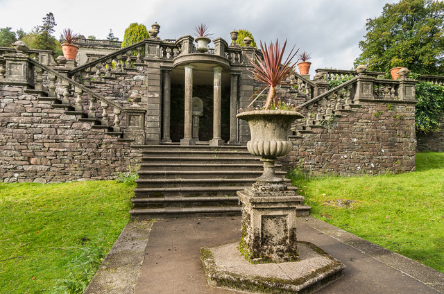
| Terraces to South of Rydal Hall | 1245407 | II* | Rydal | |
| The Haven | 1244796 | II | ||
| The Knoll | 1272013 | II | ||
| The Mount | 1245502 | II | C17th | Rydal |
| The Nab | 1271876 | II* | 1702 | By Rydal Water |
| The Nook Cottage | 1245143 | II | ||
| The Old House | 1245171 | II | ||
| The Thrang, Thrang Barn | 1245199 | II | ||
| The Toft | 1403725 | II | ||
| The Travellers Rest | 1271973 | II | C16th? | Grasmere. Former coaching inn |
| The Wray | 1245186 | II | ||
| Thickholme Bridge (Thirlmere Aqueduct) | 1332570 | II | ||
| Thorney Howe Youth Hostel | 1245189 | II | ||
| Thornthwaite, Town Head | 1245569 | II | ||
| Thrang Farmhouse with Attached Barn | 1271952 | II | ||
| Three Shires Inn | 1245294 | II | C18th | Little Langdale |
| Town End Boathouse | 1271460 | II | ||
| Town End with Attached Farm Buildings | 1271828 | I | 1626 | Troutbeck. House, Nationl Trust |
| Town Foot Farmhouse | 1245540 | II | ||
| Town Head Cottage | 1245192 | II | ||
| Town Head Farmhouse | 1245253 | II | ||
| Underhelm Cottage | 1272000 | II | ||
| Underhelm Farmhouse | 1245191 | II | ||
| Undermount | 1393595 | II | ||
| Wall End Farmhouse with Barns to South East and North | 1271959 | II | ||
| Wansfell Holme | 1272007 | II | ||
| Wateredge Hotel | 1272219 | II | ||
| Willy Goodwaller Bridge | 1245197 | II | ||
| Wilsons Place | 1245285 | II | ||
| Wood Farmhouse | 1245538 | II* | ||
| Wordsworth Group of Graves in Churchyard of Church of St Oswald | 1272008 | II* | ||
| Wordsworth Museum, Town End | 1245193 | II | ||
| Yew Tree Cottage | 1245514 | II | ||
| Prehistoric rock art, 150m south west of Nook End | 1424947 | n/a | Scheduled Monument | |
| Brockhole - Grounds | 1001463 | II | Listed Park and Garden | |
| Low Kingate concentric stone circle | 1011350 | n/a | Scheduled Monument | |
| Mickleden Beck prehistoric cairnfield and field system, funerary cairn and a medieval dispersed settlement centred 840m south west of Pike of Stickle | 1021143 | n/a | Scheduled Monument | |
| Seven Intakes medieval dispersed settlement 210m south west of Fell Foot | 1021186 | n/a | Scheduled Monument | |
| Rydal Mount - Grounds | 1000672 | II | C18th | Listed Park and Garden |
| Ambleside Roman fort, associated vicus and Roman road | 1009348 | n/a | C2nd | Scheduled Monument |
| Round cairn 75m east of Hagg Gill | 1011357 | n/a | Scheduled Monument | |
| Round cairn 200m south-south-west of Bluegill Fold | 1011348 | n/a | Scheduled Monument | |
| Round cairn 60m east of Hagg Gill | 1011355 | n/a | Scheduled Monument | |
| Northern round cairn on north end of The Tongue, Troutbeck Park | 1011594 | n/a | Scheduled Monument | |
| Round cairn 180m east of Rydal Beck | 1011352 | n/a | Scheduled Monument | |
| Round cairn 80m east of Hagg Gill | 1011356 | n/a | Scheduled Monument | |
| Round cairn 15m east of Hagg Gill | 1011358 | n/a | Scheduled Monument | |
| Three round cairns 70m east of Rydal Beck | 1011351 | n/a | Scheduled Monument | |
| Moot mound at Fell Foot Farm, Little Langdale | 1011354 | n/a | Scheduled Monument | |
| Medieval shieling 150m west of Trout Beck | 1011136 | n/a | Scheduled Monument | |
| Medieval shieling 70m west of Trout Beck | 1011137 | n/a | Scheduled Monument | |
| Rydal Hall - Grounds | 1000671 | II* | Listed Park and Garden | |
| Round cairn on Dunmail Raise | 1011353 | n/a | Scheduled Monument | |
| The Langdale Boulders, two prehistoric rock art sites in Great Langdale 250m south of Harry Place | 1019434 | n/a | Scheduled Monument | |
| Two rifle ranges on Silver How | 1453320 | n/a | Scheduled Monument | |
| Rifle Range target and Marker's Hut, 150m north west of Blea Moss | 1455816 | n/a | Scheduled Monument | |
| Roman road up Wrynose Pass | 1007173 | n/a | Scheduled Monument | |
| Settlement on W slope of The Tongue, Troutbeck Park | 1007201 | n/a | Scheduled Monument | |
| Medieval shieling 100m west of Trout Beck | 1011135 | n/a | Scheduled Monument | |
| Round cairn 250m south-south-west of Bluegill Fold | 1011349 | n/a | Scheduled Monument | |
| Southern round cairn on north end of The Tongue, Troutbeck Park | 1011593 | n/a | Scheduled Monument | |
| Medieval shieling 640m north of Troutbeck Park Farm | 1011677 | n/a | Scheduled Monument | |
| Lead mine and ore works at Greenhead Gill, Grasmere | 1015651 | n/a | Scheduled Monument | |
| Castle Howe hillfort, Little Langdale | 1019747 | n/a | Scheduled Monument | |
| Roman road in Wrynose Bottom | 1007188 | n/a | ||
| High Street, Roman road | 1003275 | n/a | ||
| Ambleside Conservation Area | - | n/a | Conservation Area | |
| Grasmere Town End Conservation Area | - | n/a | Conservation Area | |
| Grasmere Village Conservation Area | - | n/a | Conservation Area | |
| Rydal Conservation Area | - | n/a | Conservation Area | |
| Troutbeck Conservation Area | - | n/a | Conservation Area |
Primary source: the National Heritage List for England - NHLE is the register of nationally protected historic buildings and sites in England, including listed buildings, scheduled monuments, protected wrecks, registered parks and gardens, and battlefields. The list is maintained by Historic England. Check NHLE for updates and new entries. Secondary sources: British Listed Buildings.
Co-Curate Page
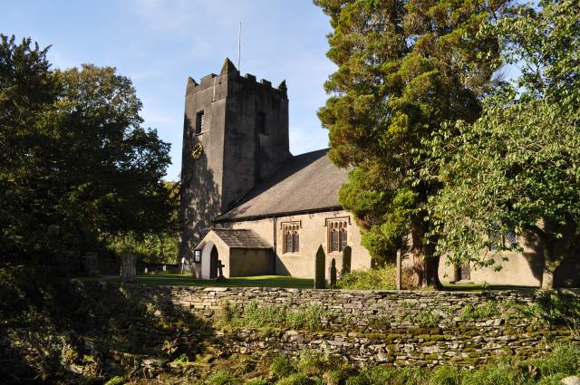
Church of St Oswald, Grasmere
- Overview About St Oswald's Church Map Street View St Oswald's Church is in the village of Grasmere, in the Lake District, Cumbria, England. It is an active Anglican parish …
Co-Curate Page
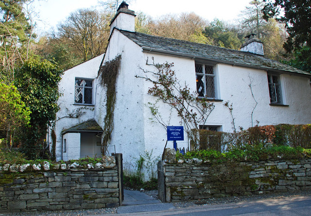
Dove Cottage and Wordsworth Museum
- Overview About Dove Cottage Map Street View Dove Cottage is a house on the edge of Grasmere in the Lake District of England. It is best known as the …
Co-Curate Page
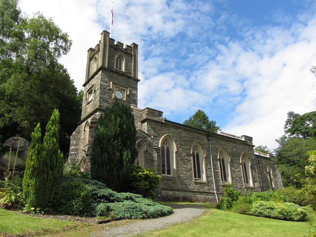
Church of St Mary, Rydal
- Overview Map Street View St Mary's is the parish church in Rydal. It was originally built as a chapel-of-ease in 1824, under the patronage of Lady le Fleming of Rydal …
Co-Curate Page
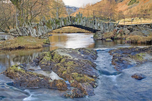
Slater's Bridge, Little Langdale
- Overview Map Street View Slater's Bridge is a 17th century packhorse bridge that crosses the River Brathay in Little Langdale. It is built of slate and natural boulders. A large …
Co-Curate Page
Rydal Hall
- Overview About Rydal Hall Map Rydal Hall is located in Rydal, near the south end of Rydal Water in Cumbria. The core or the building dates from the 16th century. …
Co-Curate Page
Bridge over Rydal Beck, Rydal Hall
- The stone rubble bridge over Rydal Beck is located in the grounds of Rydal Hall. The single segmental arch bridge was built in 1682 by Sir Daniel Fleming, probably replacing …
Co-Curate Page
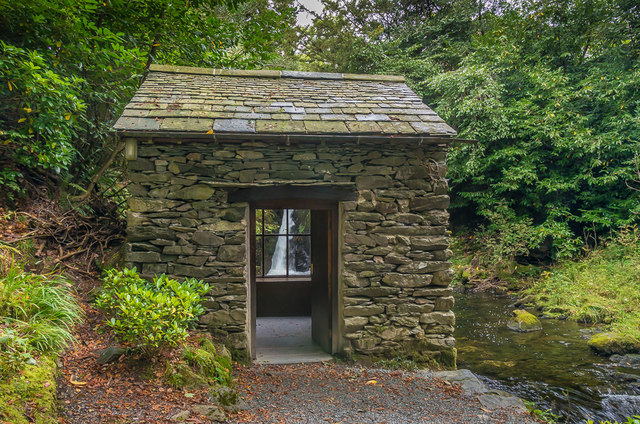
The Grot, Rydal Hall
- "The Grot" (a grotto or summerhouse) overlooks Rydal Falls on Rydal Beck in the grounds of Rydal Hall. It was built in 1668 and is one of the first purpose-built viewing …
Co-Curate Page
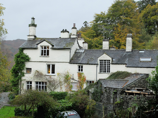
Rydal Mount
- Overview About Rydal Mount Map Street View Rydal Mount is a large house in Rydal, near Ambleside in Cumbria. It was built in the 16th century, with extensions in the …

Co-Curate Page
Rydal Mount - Gardens
- Overview Map Street View The gardens were laid out by John Knott who owned Rydal Mount in the 18th century. The gardens were substantially modified by William Wordsworth who lived …
Co-Curate Page
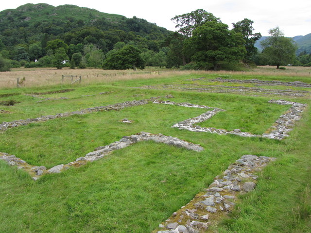
Ambleside Roman Fort (Galava)
- Overview About Ambleside Roman Fort Map Street View The remains of Ambleside Roman Fort (Galava) are located in a field by the shores of Lake Windermere in Ambleside. The stone …
Co-Curate Page
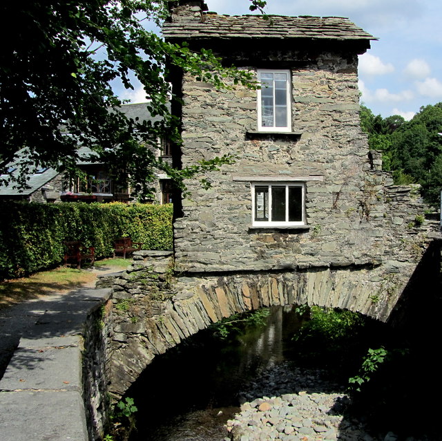
Bridge House, Ambleside
- Overview Map Street View Bridge House by Rydal Road in Ambleside was originally built in the late 17th century by the Braithwaite family to access their lands on the other …
Co-Curate Page
Church of St Mary, Ambleside
- Overview About St Mary's Church Map Street View St Mary's Church in Ambleside was built 1850-1854, designed by Sir George Gilbert Scott in the Early Gothic Decorated style.[1] The church is Grade …
Co-Curate Page
Church of the Holy Trinity, Chapel Stile
- Overview Map Street View Inside Holy Trinity Church is located in the village of Chapel Stile in the South Lakeland district of Cumbria. The Parish Church, sometimes referred to as …
Co-Curate Page
Jesus Church, Troutbeck
- Overview Map About Jesus Church Street View Inside Jesus Church in Troutbeck dates from the 16th century and is said to have been consecrated in 1562. It's west tower added …
Co-Curate Page
Low Sweden Bridge, Ambleside
- Overview Map Street View Low Sweden Bridge over Scandale Beck is located north of Ambleside, near Nook End Farm. The bridge was built in the late 17th century, now with a modern …
Co-Curate Page
High Sweden Bridge, Ambleside
- Overview Map Street View High Sweden Bridge is a 17th century packhorse bridge over Scandale Beck, located just over 1 mile north of Ambleside. A road named Sweden Bridge Lane …
Co-Curate Page
Brimmer Head Farmhouse, near Grasmere
- Overview Map Brimmer Head Farm is located by Eskdale Beck, about 1 mile north-west of Grasmere. The farmhouse was built in 1574 and extended in 1870. Reputedly, it is the …
Co-Curate Page
Townend, Troutbeck
- Overview About Townend Map Street View Townend is a large house and farm located on Holbeck Lane to the south of Troutbeck. It was built in 1626 for George Browne, …
Co-Curate Page
Old Barn, Townend
- Overview Map Street View The old wool barn at Townend Farmhouse in Troutbeck is dated 1666. The barn is a Grade II* listed building on the National Heritage List for …
Co-Curate Page
Elterwater Bridge
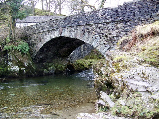
- Overview Map Street View Elterwater Bridge is a road bridge over Great Langdale Beck at the village of Elterwater. The bridge was built in 1702, replacing an earlier bridge here. Later, …
Co-Curate Page
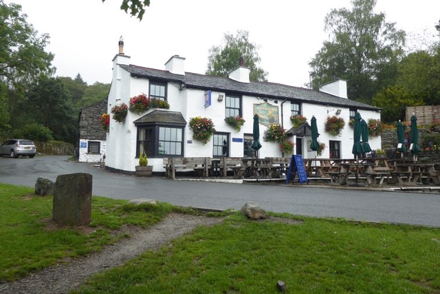
The Britannia Inn, Elterwater
- Overview Map Street View The Britannia Inn at Elterwater is a public house, restaurant and provides accommodation. The building dates from around the 17th century, with substantial modifications over the …
Co-Curate Page
Elterwater Cafe
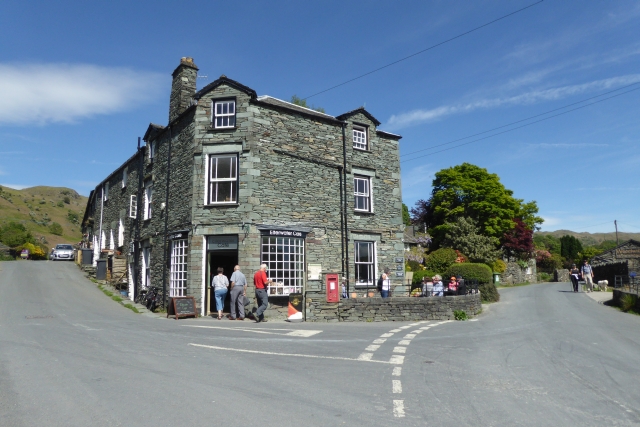
- Overview Map Street View The Elterwater Cafe is located on Maple Tree Corner in Elterwater. The cafe was previously known as the Maple Tree Cafe and before that the building …
Co-Curate Page
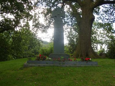
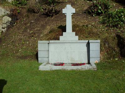
War Memorial, Grasmere
- Overview Map Street View Grasmere War Memorial is located in Recreation Park on the northern outskirts of Grasmere. The memorial is a Celtic cross in Westmorland green slate, designed by …
Co-Curate Page
Langdale War Memorial
- Langdale War Memorial is located in the churchyard of Holy Trinity Church at Chapel Stile. The memorial is a Latin cross on a 2 stage base, surmounting a wall inscribed …
Co-Curate Page
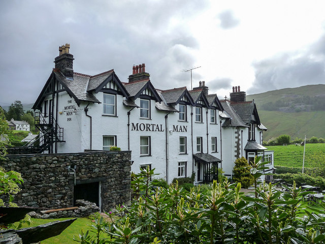
Mortal Man Inn, Troutbeck
- Overview Map Street View The Mortal Man Inn in Troutbeck is a pub, restaurant and provides accommodation. The inn is located on the old coaching route between Windermere and Ullswater, …
Co-Curate Page
Nab Cottage, by Rydal Water
- Overview Map Street View The Nab is a cottage overlooking Rydal Water. It is said to have been originally built in 1565, and then rebuilt in 1702. The poet Hartley …
Co-Curate Page
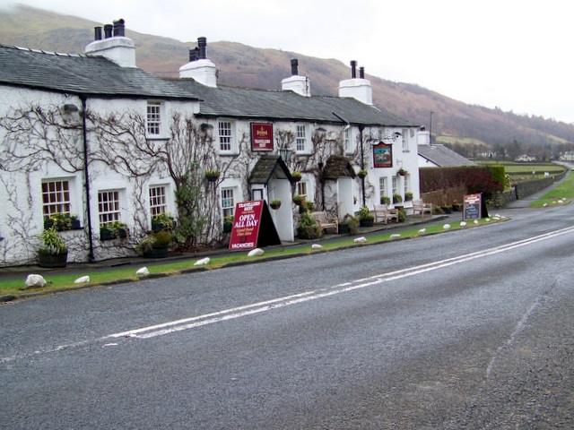
The Travellers Rest, nr Grasmere
- Overview Map Street View The Travellers Rest Inn is a hotel, restaurant and bar located on the A591 road by the foot of Dunmail Raise, at the northern edge of …
Co-Curate Page
The Mount, Rydal
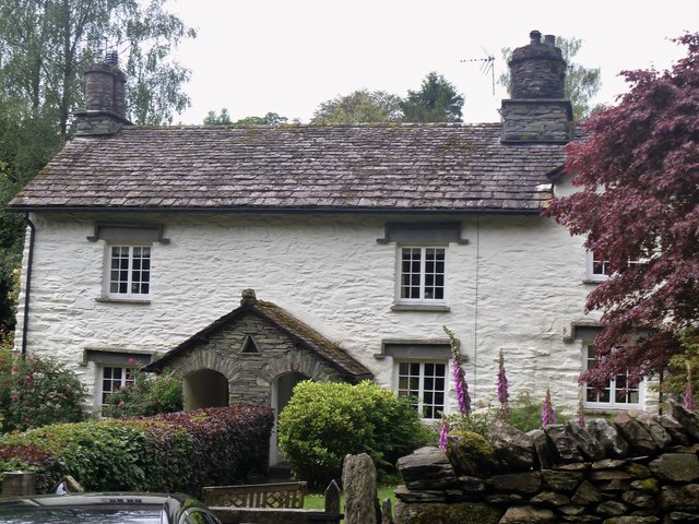
- The Mount is a c.17th century stone rubble cottage in Rydal. It is a Grade II listed building on the National Heritage List for England. Not to be confused with Rydal …
Co-Curate Page
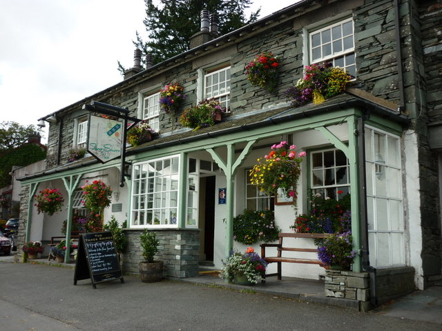
Three Shires Inn, Little Langdale
- Overview Map Street View Inside The Three Shires Inn is a hotel, restaurant and public bar in Little Langdale. It is named after the historic boundary of the old counties of …
Co-Curate Page
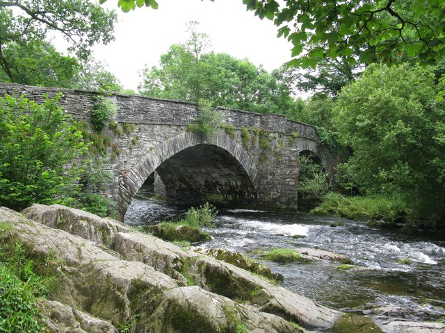
Skelwith Bridge (bridge)
- Overview Map Street View The slate bridge over the River Brathay is at the south of the settlement of Skelwith Bridge. The bridge, with two segmental arches, carries the A593 …

Co-Curate Page
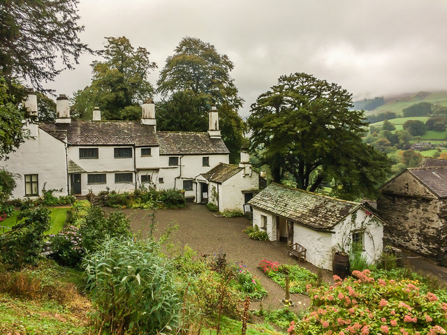
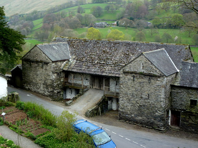
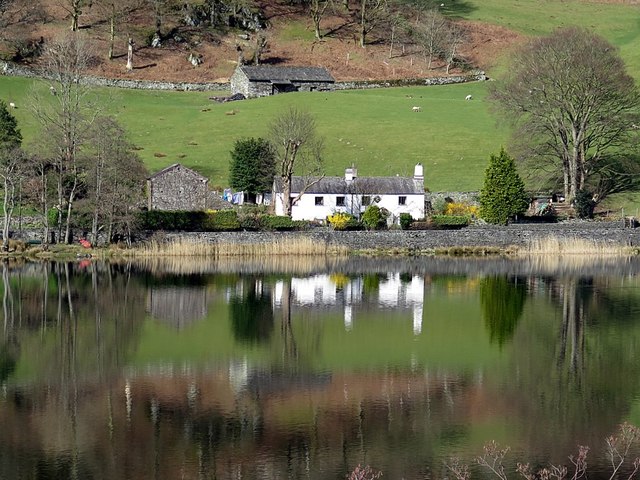
Fell Foot Farm, Little Langdale
- Overview Map Street View Fell Foot Farm is located by the River Brathay, at the foot of Wrynose Pass in Little Langdale. The farmhouse is of white-washed stone rubble. The …

Co-Curate Page
Blea Tarn House, Langdale
- Overview Map Street View Blea Tarn House (aka Bleatarn House) is located to the north-east of Blea Tarn, situated between Little Langdale and Great Langdale. The former farmhouse dates from …

Co-Curate Page
Church of St Oswald, Grasmere
- Overview About St Oswald's Church Map Street View St Oswald's Church is in the village of Grasmere, in the Lake District, Cumbria, England. It is an active Anglican parish …
Co-Curate Page
Dove Cottage and Wordsworth Museum
- Overview About Dove Cottage Map Street View Dove Cottage is a house on the edge of Grasmere in the Lake District of England. It is best known as the …
Co-Curate Page
Church of St Mary, Rydal
- Overview Map Street View St Mary's is the parish church in Rydal. It was originally built as a chapel-of-ease in 1824, under the patronage of Lady le Fleming of Rydal …
Co-Curate Page
Slater's Bridge, Little Langdale
- Overview Map Street View Slater's Bridge is a 17th century packhorse bridge that crosses the River Brathay in Little Langdale. It is built of slate and natural boulders. A large …
Co-Curate Page
Rydal Hall
- Overview About Rydal Hall Map Rydal Hall is located in Rydal, near the south end of Rydal Water in Cumbria. The core or the building dates from the 16th century. …
Co-Curate Page
Bridge over Rydal Beck, Rydal Hall
- The stone rubble bridge over Rydal Beck is located in the grounds of Rydal Hall. The single segmental arch bridge was built in 1682 by Sir Daniel Fleming, probably replacing …
Co-Curate Page
The Grot, Rydal Hall
- "The Grot" (a grotto or summerhouse) overlooks Rydal Falls on Rydal Beck in the grounds of Rydal Hall. It was built in 1668 and is one of the first purpose-built viewing …
Co-Curate Page
Rydal Mount
- Overview About Rydal Mount Map Street View Rydal Mount is a large house in Rydal, near Ambleside in Cumbria. It was built in the 16th century, with extensions in the …
Co-Curate Page
Rydal Mount - Gardens
- Overview Map Street View The gardens were laid out by John Knott who owned Rydal Mount in the 18th century. The gardens were substantially modified by William Wordsworth who lived …
Co-Curate Page
Ambleside Roman Fort (Galava)
- Overview About Ambleside Roman Fort Map Street View The remains of Ambleside Roman Fort (Galava) are located in a field by the shores of Lake Windermere in Ambleside. The stone …
Co-Curate Page
Bridge House, Ambleside
- Overview Map Street View Bridge House by Rydal Road in Ambleside was originally built in the late 17th century by the Braithwaite family to access their lands on the other …
Co-Curate Page
Church of St Mary, Ambleside
- Overview About St Mary's Church Map Street View St Mary's Church in Ambleside was built 1850-1854, designed by Sir George Gilbert Scott in the Early Gothic Decorated style.[1] The church is Grade …
Co-Curate Page
Church of the Holy Trinity, Chapel Stile
- Overview Map Street View Inside Holy Trinity Church is located in the village of Chapel Stile in the South Lakeland district of Cumbria. The Parish Church, sometimes referred to as …
Co-Curate Page
Jesus Church, Troutbeck
- Overview Map About Jesus Church Street View Inside Jesus Church in Troutbeck dates from the 16th century and is said to have been consecrated in 1562. It's west tower added …
Co-Curate Page
Low Sweden Bridge, Ambleside
- Overview Map Street View Low Sweden Bridge over Scandale Beck is located north of Ambleside, near Nook End Farm. The bridge was built in the late 17th century, now with a modern …
Co-Curate Page
High Sweden Bridge, Ambleside
- Overview Map Street View High Sweden Bridge is a 17th century packhorse bridge over Scandale Beck, located just over 1 mile north of Ambleside. A road named Sweden Bridge Lane …
Co-Curate Page
Brimmer Head Farmhouse, near Grasmere
- Overview Map Brimmer Head Farm is located by Eskdale Beck, about 1 mile north-west of Grasmere. The farmhouse was built in 1574 and extended in 1870. Reputedly, it is the …
Co-Curate Page
Townend, Troutbeck
- Overview About Townend Map Street View Townend is a large house and farm located on Holbeck Lane to the south of Troutbeck. It was built in 1626 for George Browne, …
Co-Curate Page
Old Barn, Townend
- Overview Map Street View The old wool barn at Townend Farmhouse in Troutbeck is dated 1666. The barn is a Grade II* listed building on the National Heritage List for …
Co-Curate Page
Elterwater Bridge
- Overview Map Street View Elterwater Bridge is a road bridge over Great Langdale Beck at the village of Elterwater. The bridge was built in 1702, replacing an earlier bridge here. Later, …
Co-Curate Page
The Britannia Inn, Elterwater
- Overview Map Street View The Britannia Inn at Elterwater is a public house, restaurant and provides accommodation. The building dates from around the 17th century, with substantial modifications over the …
Co-Curate Page
Elterwater Cafe
- Overview Map Street View The Elterwater Cafe is located on Maple Tree Corner in Elterwater. The cafe was previously known as the Maple Tree Cafe and before that the building …
Co-Curate Page
War Memorial, Grasmere
- Overview Map Street View Grasmere War Memorial is located in Recreation Park on the northern outskirts of Grasmere. The memorial is a Celtic cross in Westmorland green slate, designed by …
Co-Curate Page
Langdale War Memorial
- Langdale War Memorial is located in the churchyard of Holy Trinity Church at Chapel Stile. The memorial is a Latin cross on a 2 stage base, surmounting a wall inscribed …
Co-Curate Page
Mortal Man Inn, Troutbeck
- Overview Map Street View The Mortal Man Inn in Troutbeck is a pub, restaurant and provides accommodation. The inn is located on the old coaching route between Windermere and Ullswater, …
Co-Curate Page
Nab Cottage, by Rydal Water
- Overview Map Street View The Nab is a cottage overlooking Rydal Water. It is said to have been originally built in 1565, and then rebuilt in 1702. The poet Hartley …
Co-Curate Page
The Travellers Rest, nr Grasmere
- Overview Map Street View The Travellers Rest Inn is a hotel, restaurant and bar located on the A591 road by the foot of Dunmail Raise, at the northern edge of …
Co-Curate Page
The Mount, Rydal
- The Mount is a c.17th century stone rubble cottage in Rydal. It is a Grade II listed building on the National Heritage List for England. Not to be confused with Rydal …
Co-Curate Page
Three Shires Inn, Little Langdale
- Overview Map Street View Inside The Three Shires Inn is a hotel, restaurant and public bar in Little Langdale. It is named after the historic boundary of the old counties of …
Co-Curate Page
Skelwith Bridge (bridge)
- Overview Map Street View The slate bridge over the River Brathay is at the south of the settlement of Skelwith Bridge. The bridge, with two segmental arches, carries the A593 …
Co-Curate Page
Fell Foot Farm, Little Langdale
- Overview Map Street View Fell Foot Farm is located by the River Brathay, at the foot of Wrynose Pass in Little Langdale. The farmhouse is of white-washed stone rubble. The …


