Topics > Landmarks, Parks and Buildings > Buildings > Bastle House
Bastle House
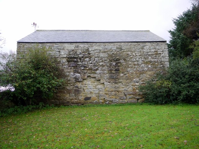
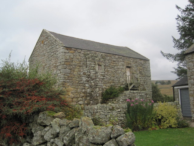
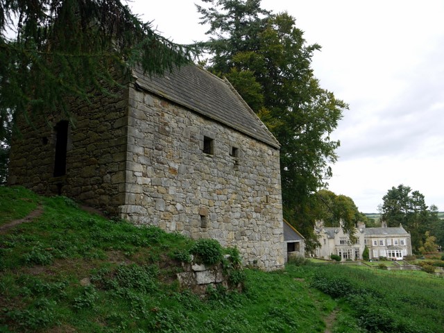
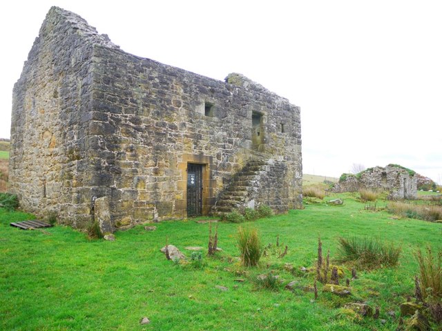
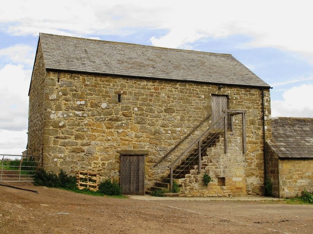
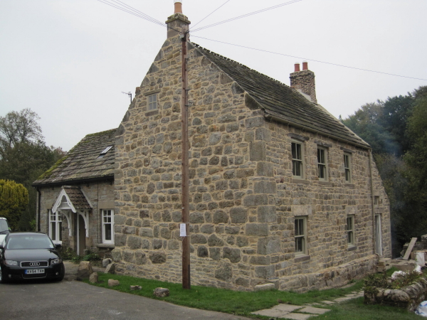
Bastle Houses are generally two-storey fortified farmhouses, with living accommodation on the first floor and shelter for cattle and sheep on the ground floor. They were built around the Anglo-Scottish border areas, during times of frequent attacks and raids by the Border Reivers, and hostilities between England and Scotland. Typically, Bastle Houses were homes and refuges for rich freeholders, lairds and heads of Border clans. Bastles were often built in clusters, so that the inhabitants were within easy reach of their neighbours, providing support for each other. Some of the more wealthy landowners had Pele Towers, which were taller than bastles, usually with three or four storeys.
Co-Curate Page
Bastle House, Cambo
- Overview Street View A 16th century bassle house in Cambo, Northumberland. In 1818 it was converted into shop and still has a lintel above the former shop window inscribed "J.T. …
Co-Curate Page
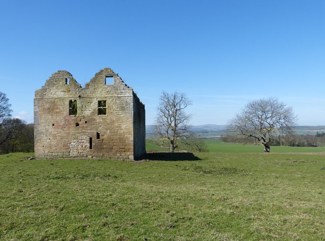
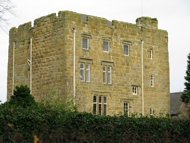
Pele Tower
- Pele towers were fortified houses built along both sides of the English and Scottish borders, mostly in settlements which did not have a castle. An English Act of Parliament in …
Co-Curate Page
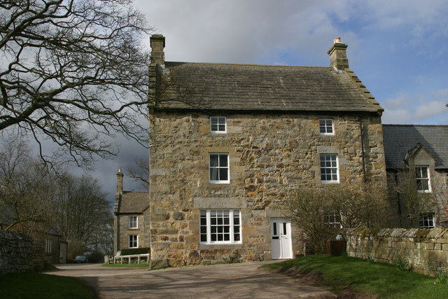
Rebellion House, High Callerton
- Overview Map Street View Rebellion House is a 16th century bastle house in High Callerton, near Ponteland. The ground floor was converted for use as accommodation in the early-mid 17th century. …
Co-Curate Page
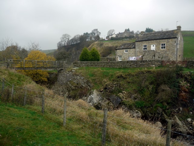
Bridge End, Cowshill
- Overview Map Bridge End Cottage in Cowshill, is located by a footbridge over Killhope Burn and immediately south of the flooded Copthill Quarry. The cottage is notable for being a …
Co-Curate Page
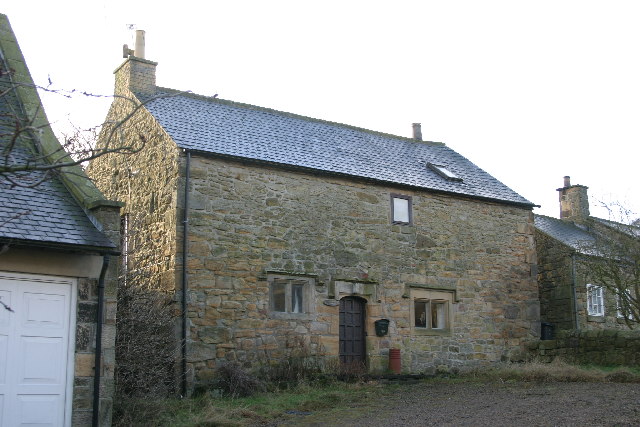
Redheugh Farmhouse, nr Thorneyburn
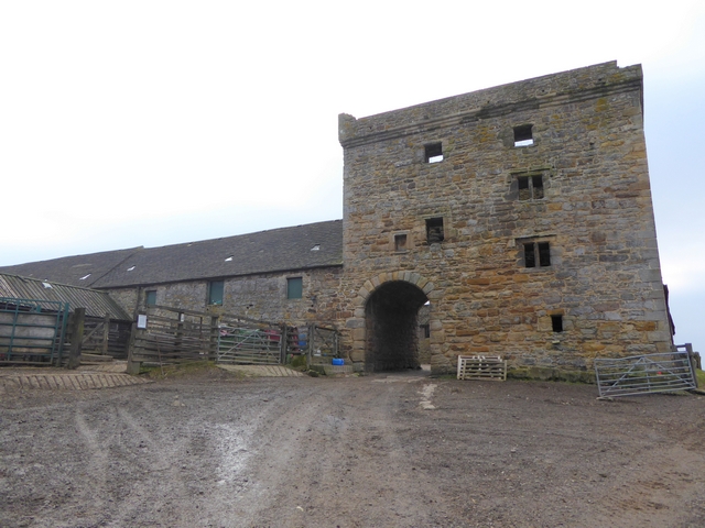
- A 16/17th century bastle house, later remodelled in 1732, for William Charlton. Redheugh Farmhouse is Grade II listed on the National Heritage List for England.
Co-Curate Page
Black Middens Bastle House
- Overview About Black Middens Bastle Map Street View Black Middens Bastle House is at an isolated location on the north side of the Tarset Valley, about 2 miles north-west of …
Co-Curate Page
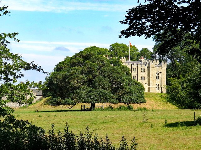
Bellister Castle
- Overview Map Street View Bellister Castle is a ruined tower house dating from the 13th century with an attached occupied house which is dated 1669.[1] It is located about half …
Co-Curate Page
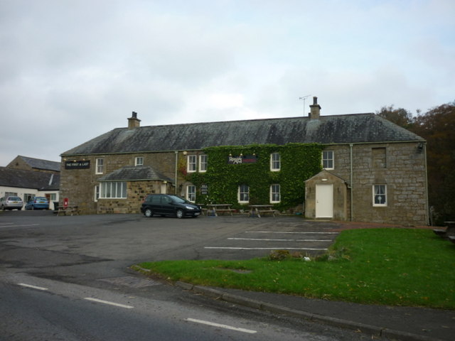
Redesdale Arms
- Overview Map Street View The Redesdale Arms is a hotel and restaurant located on the A68 road at Horsley, about 3½ miles north-west of Otterburn and 1 mile south-east of …
Co-Curate Page
Clarghyll Hall
- Overview Map Clarghyll Hall is a country house located about 2 miles north east of Alston in Cumbria, close to the county border with Northumberland. The house incorporates a 16th …
Co-Curate Page
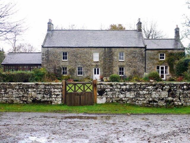
Monk Farm
- Overview Map The Monk Farm stands on the east side of the valley of the River West Allen in Northumberland, at the head of a steep slope. It is about …
Co-Curate Page
White Heather Cottage, Beltingham
- Overview Map Street View White Heather Cottage, no.2 Beltingham Village, is a former Bastle House, dating from the late 16th or early 17th century. It was remodelled in the 18th …

Co-Curate Page
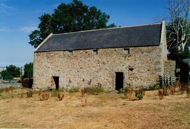
Bastle at Upper Denton
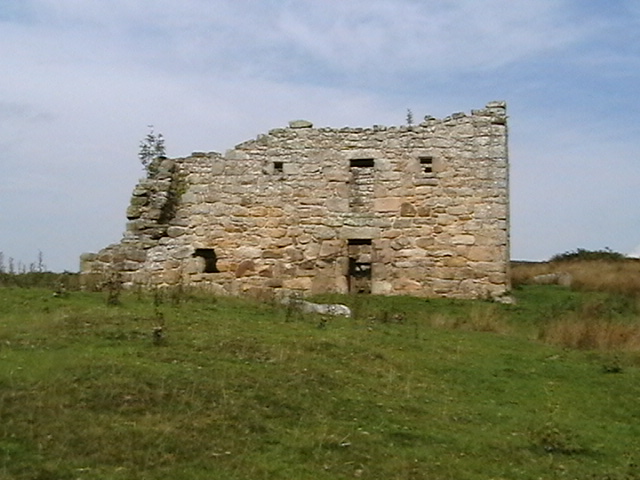
- There is roofless bastle standing two storeys high located at the northern end of the village of Upper Denton. It is constructed of squared coursed rubble with red sandstone dressings. …
Co-Curate Page
Staward Manor
- Overview Map Street View Staward Manor (Low Staward) is a large house, set back from the A686 road, about 7½ miles west of Hexham. It is situated by Dewey Syke, …

Co-Curate Page
Craig, Rothbury
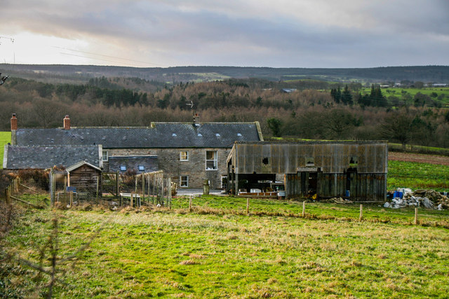
- Overview Map Street View Craig Farm in Northumberland is located about 8 miles west of Rothbury and 5 miles north-east of Otterburn. The farm includes the substantive ruins of a …


Co-Curate Page
Old Town (South), Allendale
- Nearby is Old Town (North Farm). aka Wester Old Town?

Co-Curate Page
Oakpool, Allendale
- Overview Map Street View Oakpool (aka Oak Pool) is located on Appletree Bank (road), by the west bank of River East Allen, about 2 miles north-west of Allendale Town. Whellan's …

Co-Curate Page
Lanehead, Allendale
- Overview Map Street View Lanehead (aka Lane Head) is located about 2¾ miles north-west of Allendale Town and 1 mile east of Bearsbridge. Originally, there was a bastle here, built …

Co-Curate Page
Tow House Bastle
- There is a 16th century bastle (fortified tower house) in Tow House, near Henshaw, built at a time of hostilities with Scotland and frequent border raids. The building has altered …

Co-Curate Page
The Knowe, Bardon Mill
- Overview Map Street View The Knowe (aka Grandy's Knowe) is a former farm in Northumberland, located on Hallstile Bank, about 3 miles north of Bardon Mill, to the south of …

Co-Curate Page
Bastle House, Cambo
- Overview Street View A 16th century bassle house in Cambo, Northumberland. In 1818 it was converted into shop and still has a lintel above the former shop window inscribed "J.T. …
Co-Curate Page
Pele Tower
- Pele towers were fortified houses built along both sides of the English and Scottish borders, mostly in settlements which did not have a castle. An English Act of Parliament in …
Co-Curate Page
Rebellion House, High Callerton
- Overview Map Street View Rebellion House is a 16th century bastle house in High Callerton, near Ponteland. The ground floor was converted for use as accommodation in the early-mid 17th century. …
Co-Curate Page
Bridge End, Cowshill
- Overview Map Bridge End Cottage in Cowshill, is located by a footbridge over Killhope Burn and immediately south of the flooded Copthill Quarry. The cottage is notable for being a …
Co-Curate Page
Redheugh Farmhouse, nr Thorneyburn
- A 16/17th century bastle house, later remodelled in 1732, for William Charlton. Redheugh Farmhouse is Grade II listed on the National Heritage List for England.
Co-Curate Page
Black Middens Bastle House
- Overview About Black Middens Bastle Map Street View Black Middens Bastle House is at an isolated location on the north side of the Tarset Valley, about 2 miles north-west of …
Co-Curate Page
Bellister Castle
- Overview Map Street View Bellister Castle is a ruined tower house dating from the 13th century with an attached occupied house which is dated 1669.[1] It is located about half …
Co-Curate Page
Redesdale Arms
- Overview Map Street View The Redesdale Arms is a hotel and restaurant located on the A68 road at Horsley, about 3½ miles north-west of Otterburn and 1 mile south-east of …
Co-Curate Page
Clarghyll Hall
- Overview Map Clarghyll Hall is a country house located about 2 miles north east of Alston in Cumbria, close to the county border with Northumberland. The house incorporates a 16th …
Co-Curate Page
Monk Farm
- Overview Map The Monk Farm stands on the east side of the valley of the River West Allen in Northumberland, at the head of a steep slope. It is about …
Co-Curate Page
White Heather Cottage, Beltingham
- Overview Map Street View White Heather Cottage, no.2 Beltingham Village, is a former Bastle House, dating from the late 16th or early 17th century. It was remodelled in the 18th …
Co-Curate Page
Bastle at Upper Denton
- There is roofless bastle standing two storeys high located at the northern end of the village of Upper Denton. It is constructed of squared coursed rubble with red sandstone dressings. …
Co-Curate Page
Staward Manor
- Overview Map Street View Staward Manor (Low Staward) is a large house, set back from the A686 road, about 7½ miles west of Hexham. It is situated by Dewey Syke, …
Co-Curate Page
Craig, Rothbury
- Overview Map Street View Craig Farm in Northumberland is located about 8 miles west of Rothbury and 5 miles north-east of Otterburn. The farm includes the substantive ruins of a …
Co-Curate Page
Old Town (South), Allendale
- Nearby is Old Town (North Farm). aka Wester Old Town?
Co-Curate Page
Oakpool, Allendale
- Overview Map Street View Oakpool (aka Oak Pool) is located on Appletree Bank (road), by the west bank of River East Allen, about 2 miles north-west of Allendale Town. Whellan's …
Co-Curate Page
Lanehead, Allendale
- Overview Map Street View Lanehead (aka Lane Head) is located about 2¾ miles north-west of Allendale Town and 1 mile east of Bearsbridge. Originally, there was a bastle here, built …
Co-Curate Page
Tow House Bastle
- There is a 16th century bastle (fortified tower house) in Tow House, near Henshaw, built at a time of hostilities with Scotland and frequent border raids. The building has altered …