River Gaunless


-
Description
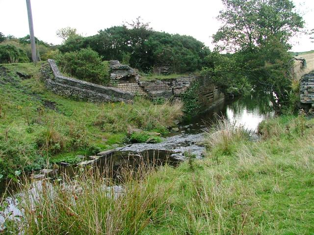
"Looking downstream just above a ruined weir. This is the remains of Lands Mill, which was shown as a Corn Mill c.1874. It was connected to the Haggerleases (Butterknowles) Branch Line between 1910 & 1921, but was shown to be disused by 1939. It had been demolished by 1954. The Branch Line shut in 1963, and all the track had gone by 1965. Most of this info was gleemed from various internet sites & a few pictures of the railway yards. Behind the Mill stood Lands Mill Cottages from 1885-1945, but they had also been completely removed from the 1974 OS.Map. (Thanks to Matthew Hatton for this info.)" Photo by Mick Garratt, 2005. -
Owner
Mick Garratt -
Source
Geograph (Geograph) -
License
What does this mean? Creative Commons License
-
Further information
Link: http://www.geograph.org.uk/photo/60534
Resource type: Image
Added by: Simon Cotterill
Last modified: 8 years, 6 months ago
Viewed: 1027 times
Picture Taken: 2005-10-02 -
Co-Curate tags


