Topics > Northumberland > Civil Parishes in Northumberland > Slaley Civil Parish > Old Boundary Marker, Coalpits Fell, Slaley
Old Boundary Marker, Coalpits Fell, Slaley
Map showing the location of this old boundary marker on the border of Slaley and Healey parishes.
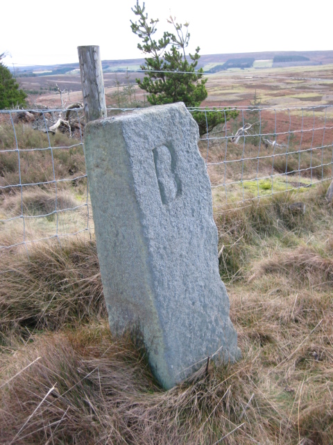
This old boundary Marker is located on Coalpits Fell in what is now Slaley Forest. It dates from around the 18th century and sits on the border of Slaley and Healey parishes. The stone marker is inscribed B and C on opposite faces - probably denoting the land owners at that time (Baker? and Crewe? [1]). The old boundary marker is Grade II listed on the National Heritage List for England.
from https://www.geograph.org.uk/p…
Old Boundary Marker
- Estate Boundary Marker against a wire fence on Coalpits Fell in Slaley Forest. On the boundary of Slaley and Healey parishes. Inscribed B (Baker?) and C (Crewe?) on opposite faces. …
Added by
Simon Cotterill

from https://historicengland.org.u…
Boundary Stone at NGR NY 97255421 - List Entry
- Boundary stone, probably C18. Sandstone. Rectangular pillar 1.0 metre high. Incised B on west, C on east. On Healey/Slaley boundary.....
Added by
Simon Cotterill

from https://www.geograph.org.uk/p…
Old Boundary Marker
- Estate Boundary Marker against a wire fence on Coalpits Fell in Slaley Forest. On the boundary of Slaley and Healey parishes. Inscribed B (Baker?) and C (Crewe?) on opposite faces. …
Added by
Simon Cotterill
from https://historicengland.org.u…
Boundary Stone at NGR NY 97255421 - List Entry
- Boundary stone, probably C18. Sandstone. Rectangular pillar 1.0 metre high. Incised B on west, C on east. On Healey/Slaley boundary.....
Added by
Simon Cotterill


