Topics > Northumberland > Civil Parishes in Northumberland > Slaley Civil Parish > Historic Buildings and Monuments in Slaley Civil Parish
Historic Buildings and Monuments in Slaley Civil Parish
Listed buildings and scheduled monuments in Slaley Civil Parish, Northumberland, from the National Heritage List for England[1]. In the absence of a published 'local list', some other public buildings of interest may also be included. Use the Search (below) if looking for a specific building / monument.
| Structure | List No. | Grade | Built~ | Notes |
|---|---|---|---|---|
| Boundary stone at NGR NY94005482, on west of fence | 1302782 | II | C18th | |
| Boundary stone at NGR NY 94045475, on east of fence | 1045281 | II | C18th | Slaley Forest |
| Boundary Stone at NGR NY95415487, 8 Metres South of C20 Gate | 1045283 | II | C18th | |
| Boundary Stone at NGR NY97255421 | 1155234 | II | C18th | Slaley Forest |
| Boundary Stone at NGR NY97305443 | 1045346 | II | C18th | |
| Boundary Stone at NGR NY98635454 | 1370278 | II | C18th | |
| Boundary Stone at NGR NY97365466 | 1155209 | II | C18th | |
| Boundary Stone on East Side of Fence at NGR NY99615606 | 1370272 | II | C18th | |
| Bridge over Flothers Burn 50 Metres South-East of Flothers Farmhouse | 1370320 | II | C18th | |
| Burnside Bridge | 1302818 | II | C18th | Strothers Bank Road |
| Church of St Mary | 1045284 | II | 1832 | On medieval site, Slaley village |
| Church View | 1302725 | II | C17th | Slaley village |
| East Woodfoot Farmhouse | 1045288 | II | c.1840 | |
| Holly Hill Cottage and Adjacent Outbuilding | 1302795 | II | C18th | |
| Jamesons Well | 1389608 | II | c.1800 | B6306 |
| North Cottage with Quadrant Walls and Gate Piers Adjacent | 1156579 | II | 1860 | |
| Outbuilding 10 Metres North-West of Stanegarth | 1045285 | II | C18th | |
| Rose and Crown Inn, Garden Cottage and Cautley Cottage | 1045286 | II | C18th | |
| Sheild Hall Farmhouse | 1370321 | II | C18th | |
| Slaley House | 1302742 | II | C18th | Former vicarage |
| South Farm Farmhouse and Adjacent Farmbuilding to West | 1302718 | II | C18th | Slaley village |
| Stanegarth and Adjacent Farmbuilding to East | 1156714 | II | 1728 | Slaley village |
| The Hare Stone | 1370318 | II | C18th | Boundary stone |
| Todburn Steel Farmhouse | 1045287 | II | C16th | |
| Travellers' Rest Inn | 1045276 | II | C19th | B6306 |
| Wing of Medieval House and Adjacent Later Outbuildings | 1302809 | II* | C14th | Shield Hall |
| Yard and Forecourt Walls to Holly Hill Cottage | 1045279 | II | C19th | |
| Slaley Hall | not listed | n/a | 1912 |
Primary source: the National Heritage List for England - NHLE is the register of nationally protected historic buildings and sites in England, including listed buildings, scheduled monuments, protected wrecks, registered parks and gardens, and battlefields. The list is maintained by Historic England. Check NHLE for updates and new entries. Secondary sources: British Listed Buildings and Keys to the Past.
Co-Curate Page
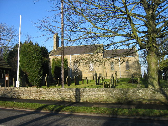
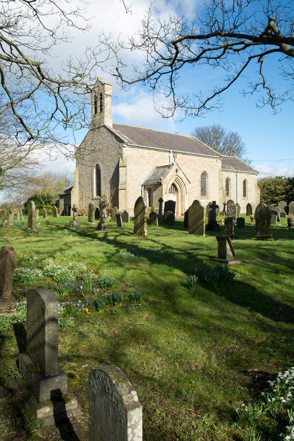
Church of St Mary, Slaley
- Overview Map Street View The Church of St. Mary the Virgin in Slaley in Northumberland was built in 1832, designed by Milton Carr.[1] The Parish Church occupies the site of an …
Co-Curate Page
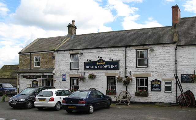
Rose and Crown Inn, Slaley
- Overview Map Street View The Rose and Crown Inn, on Main Street in the village of Slaley dates from the mid 18th century. Along with two adjacent houses, the inn …

Co-Curate Page
Travellers Rest, near Slaley
- Overview Map Street View The Travellers Rest is an inn, located on the B6306 road, about 1 mile north-west of the village of Slaley. The inn dates from the early …
Co-Curate Page
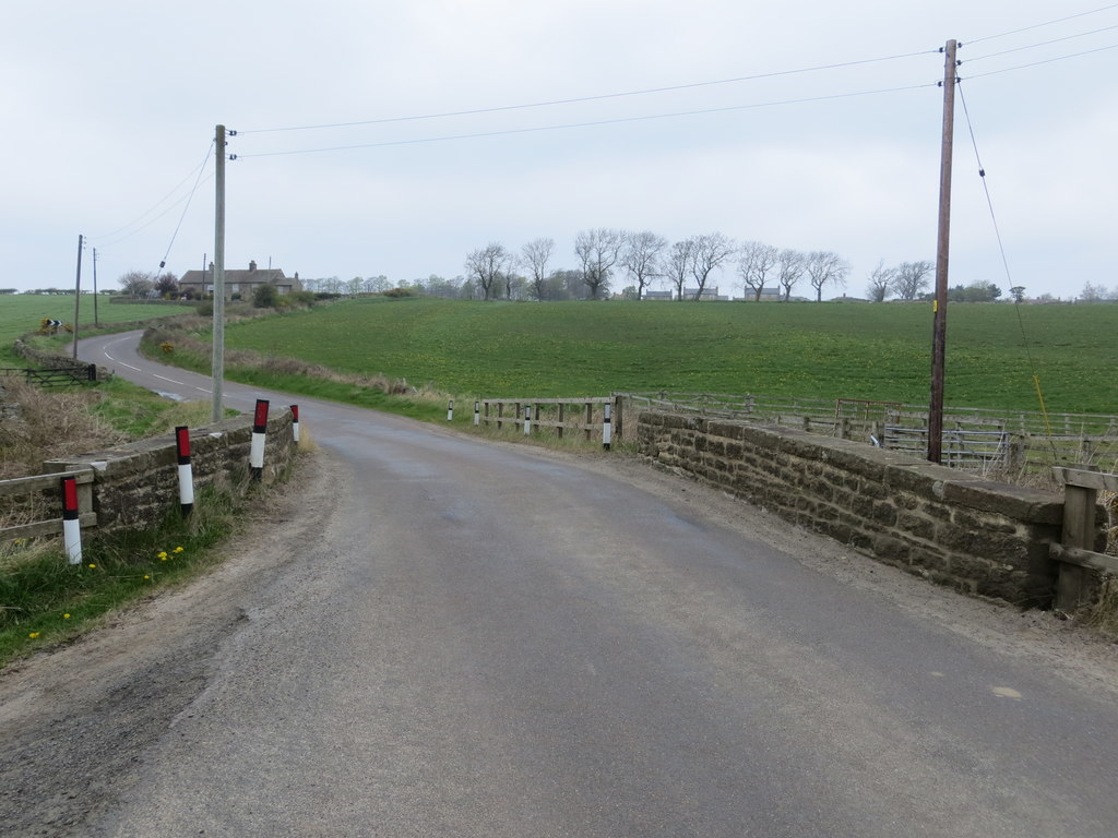
Burnside Bridge, Slaley
- Overview Map Street View Burnside Bridge, to the south-west of Slaley, carries Strothers Bank Road (the B6306) over Strothers Burn. The stone segmental arch bridge date from the late 18th …
Co-Curate Page
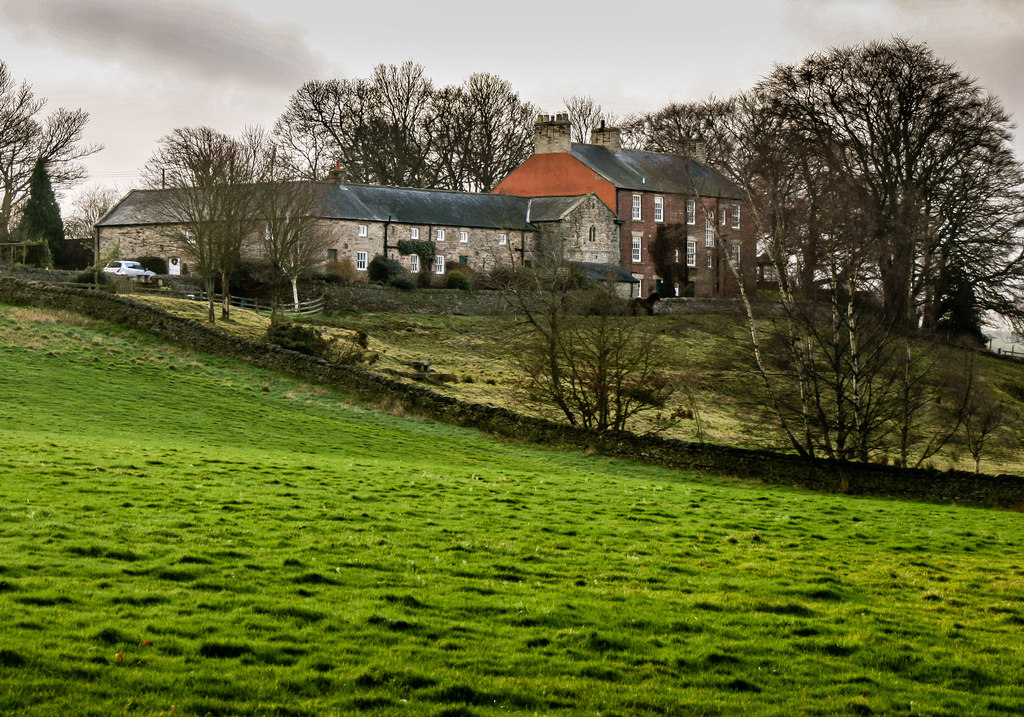
Shield Hall, Slaley
- Overview Map Shield Hall is a farm in Northumberland, located about 1½ miles north-west of Slaley and 1 mile east of Juniper. Shield Hall mostly dates from 18th century. A …
Co-Curate Page
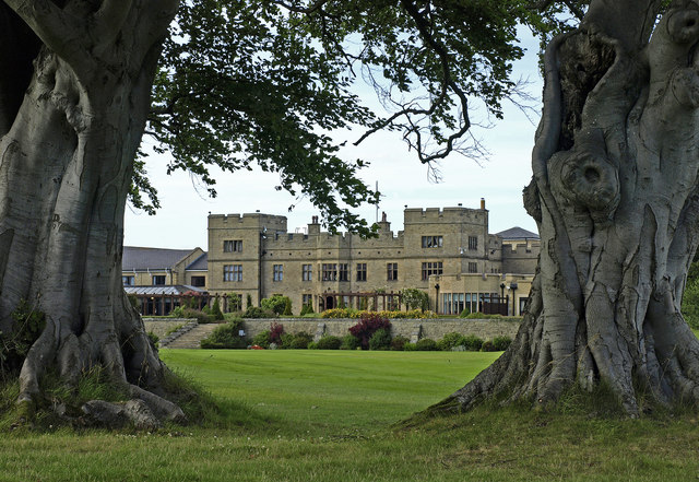
Slaley Hall
- Overview About Slaley Hall Map Street View Slaley Hall is an Edwardian mansion, with significant later extensions for it's current use as a hotel and golf resort. It was built …
Co-Curate Page
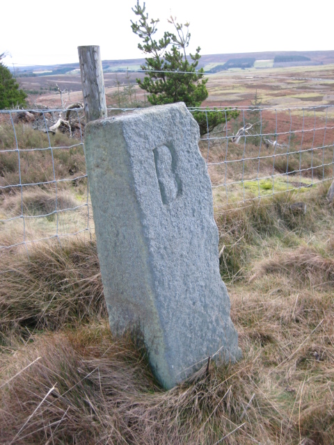
Old Boundary Marker, Coalpits Fell, Slaley
- Map showing the location of this old boundary marker on the border of Slaley and Healey parishes. This old boundary Marker is located on Coalpits Fell in what is now …
Co-Curate Page
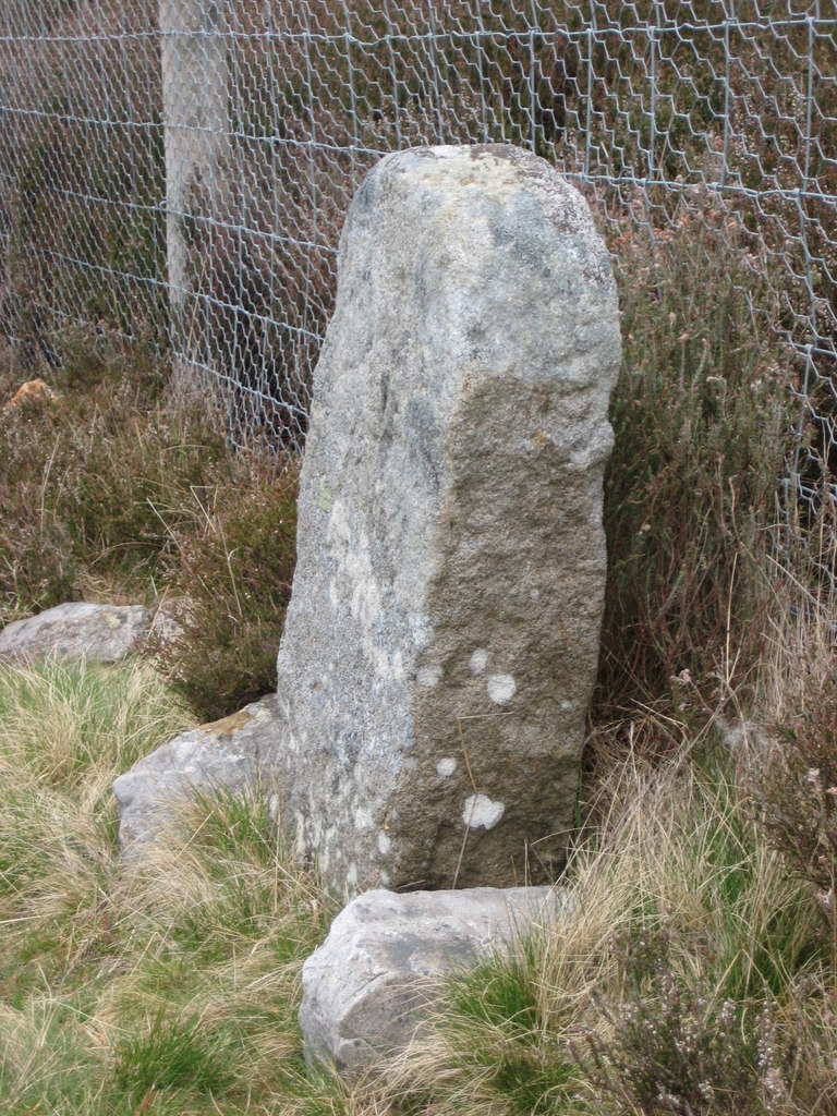
Old Boundary Marker, Dukesfield Fell, Slaley
- Overview Map This old estate boundary marker is located on Dukesfield Fell, on the edge of Slaley Forest. It dates from around the 18th century, and sits on the boundary …

Co-Curate Page
Church of St Mary, Slaley
- Overview Map Street View The Church of St. Mary the Virgin in Slaley in Northumberland was built in 1832, designed by Milton Carr.[1] The Parish Church occupies the site of an …
Co-Curate Page
Rose and Crown Inn, Slaley
- Overview Map Street View The Rose and Crown Inn, on Main Street in the village of Slaley dates from the mid 18th century. Along with two adjacent houses, the inn …
Co-Curate Page
Travellers Rest, near Slaley
- Overview Map Street View The Travellers Rest is an inn, located on the B6306 road, about 1 mile north-west of the village of Slaley. The inn dates from the early …
Co-Curate Page
Burnside Bridge, Slaley
- Overview Map Street View Burnside Bridge, to the south-west of Slaley, carries Strothers Bank Road (the B6306) over Strothers Burn. The stone segmental arch bridge date from the late 18th …
Co-Curate Page
Shield Hall, Slaley
- Overview Map Shield Hall is a farm in Northumberland, located about 1½ miles north-west of Slaley and 1 mile east of Juniper. Shield Hall mostly dates from 18th century. A …
Co-Curate Page
Slaley Hall
- Overview About Slaley Hall Map Street View Slaley Hall is an Edwardian mansion, with significant later extensions for it's current use as a hotel and golf resort. It was built …
Co-Curate Page
Old Boundary Marker, Coalpits Fell, Slaley
- Map showing the location of this old boundary marker on the border of Slaley and Healey parishes. This old boundary Marker is located on Coalpits Fell in what is now …