Topics > Tyne and Wear > Newcastle upon Tyne > Civil Parishes in Newcastle > Dinnington Civil Parish > Historic Buildings and Monuments in Dinnington Civil Parish
Historic Buildings and Monuments in Dinnington Civil Parish
About the Parish. Listed buildings and scheduled monuments from the National Heritage List for England:
| Structure | List No. | Grade | Built~ | Locality | Note |
|---|---|---|---|---|---|
| Gardner's Houses prehistoric settlement | 1003496 | n/a | Scheduled Monument | ||
| Church of St Matthew | 1355215 | II | c.1870 | Dinnington | |
| Former School | 1024965 | II | 1874 | Dinnington | Patron: Matthew Bell |
| Gingang on West Side of Farm buildings at Seven Mile Farm | 1237367 | II | C19th | Seven Mile House Farm | |
| Granary, Byres and Lofts to East of North Farmhouse | 1024964 | II | C18th | Brenkley | Late C18/early C19 |
| Piers, Walls and Railings, East of Church of St Matthew and Former School | 1024966 | II | c.1880 | Dinnington | |
| South Shotton Edge House | 1237343 | II | C19th | South Shotton | Formerly the Red Lion Inn, on the Great North Road |
| South Shotton Edge Cottage and adjacent outbuildings | 1264152 | II | C19th | South Shotton | Originally built as stables/outbuildings to Red Lion Inn |
Co-Curate Page
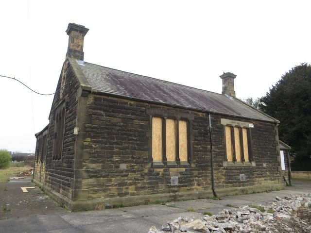
Old School, Dinnington
- Overview Map Street View The former school is based on Main Road in Dinnington. It was built in 1871 as a boy’s school (replacing an earlier boys school of 1825, …
Co-Curate Page
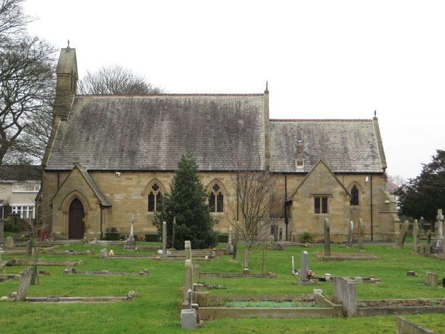
Church of St Matthew, Dinnington
- Overview Map Street View Saint Matthew's Church is located on Church Close in Dinnington, Newcastle. The church was built in c.1870 and is Grade II listed on the National Heritage …
Co-Curate Page
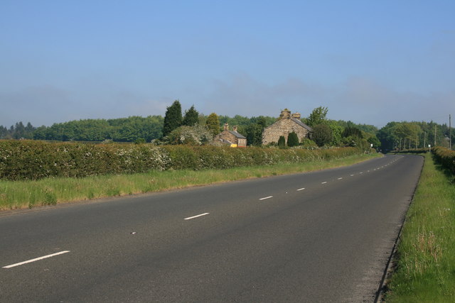
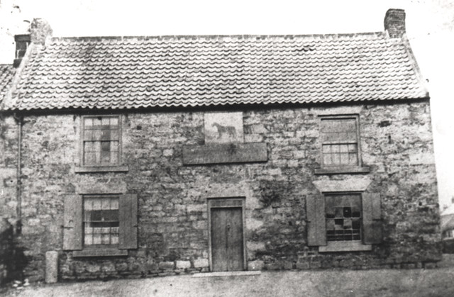
South Shotton Edge
- Overview Map Street View South Shotton Edge is a hamlet by the Old Great North Road consisting of a large house built early 19th century (formerly the Red Lion Inn) …

Co-Curate Page
Gardner's Houses Prehistoric Settlement
- There is evidence of a prehistoric settlement near Gardener's House Farm, which is located to the north of Dinnington village.
Co-Curate Page
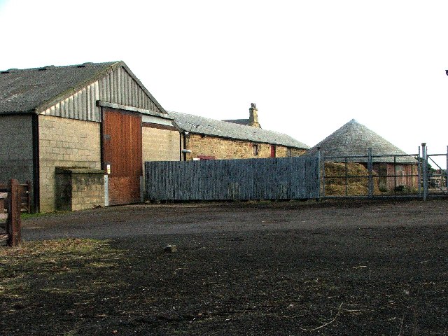
Gin Gang, Seven Mile House Farm
- Overview Map The round building at the side of Seven Mile House Farm is an early 19th century gin-gang (horse-engine house). It is Grade II listed on the National Heritage List …
Co-Curate Page
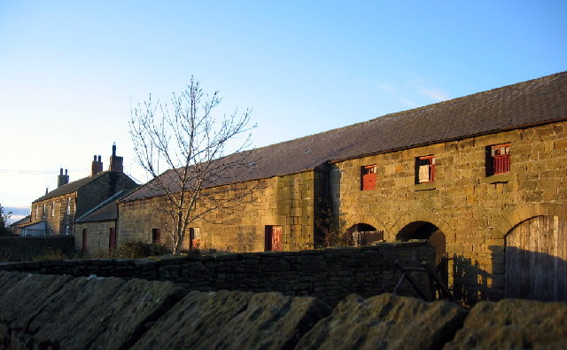
Granary, North Farm, Brenkley
- Overview Map Street View The granary, byres and lofts of the north farmhouse in Brenkley date from the late 18th of early 19th century. This is a grade II listed …
Co-Curate Page
Dinnington
- Overview About Dinnington Map Street View Dinnington is a village and civil parish in the city of Newcastle upon Tyne in Tyne and Wear, England. It is about 5 …

Co-Curate Page
Old School, Dinnington
- Overview Map Street View The former school is based on Main Road in Dinnington. It was built in 1871 as a boy’s school (replacing an earlier boys school of 1825, …
Co-Curate Page
Church of St Matthew, Dinnington
- Overview Map Street View Saint Matthew's Church is located on Church Close in Dinnington, Newcastle. The church was built in c.1870 and is Grade II listed on the National Heritage …
Co-Curate Page
South Shotton Edge
- Overview Map Street View South Shotton Edge is a hamlet by the Old Great North Road consisting of a large house built early 19th century (formerly the Red Lion Inn) …
Co-Curate Page
Gardner's Houses Prehistoric Settlement
- There is evidence of a prehistoric settlement near Gardener's House Farm, which is located to the north of Dinnington village.
Co-Curate Page
Gin Gang, Seven Mile House Farm
- Overview Map The round building at the side of Seven Mile House Farm is an early 19th century gin-gang (horse-engine house). It is Grade II listed on the National Heritage List …
Co-Curate Page
Granary, North Farm, Brenkley
- Overview Map Street View The granary, byres and lofts of the north farmhouse in Brenkley date from the late 18th of early 19th century. This is a grade II listed …


