Topics > Organisations > Councils > Borough of Darlington > Historic Buildings and Monuments in the Borough of Darlington
Historic Buildings and Monuments in the Borough of Darlington
Listed buildings and scheduled monuments in the Borough of Darlington, from the National Heritage List for England[1]. Use the Search (below) if looking for a specific building / monument.
| Structure | List No. | Grade | Built~ | Ward~ | Note |
|---|---|---|---|---|---|
| Nos. 11 and 12, Horsemarket | 1121274 | II | Park East Ward | ||
| No. 11, Houndgate | 1160777 | II | Park East Ward | ||
| No. 11, Skinnergate | 1121256 | II | Park East Ward | ||
| No. 12, Skinnergate | 1121257 | II | Park East Ward | ||
| Nos. 12,14,15 and 16, High Row | 1322926 | II | Park East Ward | ||
| No. 13, High Row | 1121268 | II | Park East Ward | ||
| No. 13, Horsemarket | 1322931 | II | Park East Ward | ||
| No. 14, Horsemarket | 1121275 | II* | Park East Ward | ||
| No. 16, Horsemarket | 1160746 | II | Park East Ward | ||
| Nos. 16a and 17, Post House Wynd | 1322957 | II | Park East Ward | ||
| Nos. 17 and 18, High Row | 1322927 | II | Park East Ward | ||
| Nos. 19 and 20, High Row | 1121269 | II | Park East Ward | ||
| No. 2, Mechanic's Yard | 1310388 | II | Park East Ward | ||
| Nos. 2-5, Friends' School Yard | 1121293 | II | Park East Ward | ||
| No. 20, Skinnergate | 1161303 | II | Park East Ward | ||
| No. 21, Skinnergate | 1121258 | II | Park East Ward | ||
| No. 22, Post House Wynd | 1121247 | II | Park East Ward | ||
| No. 24, Blackwellgate | 1322890 | II | Park East Ward | ||
| No. 25, Post House Wynd | 1258064 | II | Park East Ward | ||
| No. 26, Coniscliffe Road | 1310814 | II | Park East Ward | ||
| Nos. 3-7, Crown Street | 1121291 | II | Park East Ward | ||
| Nos. 30, 32 and 33, Blackwellgate | 1121352 | II | Park East Ward | ||
| Nos. 31 and 32, Bondgate | 1322908 | II | Park East Ward | ||
| Nos. 32 and 33, High Row | 1121271 | II | Park East Ward | ||
| No. 34, Priestgate | 1121250 | II | Park East Ward | ||
| Nos. 35 and 36, Blackwellgate | 1322891 | II | Park East Ward | ||
| No. 35, Priestgate | 1322959 | II | Park East Ward | ||
| No. 35, Tubwell Row | 1322924 | II | Park East Ward | ||
| No. 36, Coniscliffe Road | 1121329 | II | Park East Ward | ||
| Nos. 38 and 40, Coniscliffe Road | 1310820 | II | Park East Ward | ||
| Nos. 38 and 40, High Row | 1121272 | II | Park East Ward | ||
| Nos. 39 and 40, Priestgate | 1161103 | II | Park East Ward | ||
| No. 44, Bondgate | 1258066 | II | Park East Ward | ||
| Nos. 45 and 47, Bondgate | 1121313 | II | Park East Ward | ||
| No. 49, Bondgate | 1322910 | II | Park East Ward | ||
| Nos. 5-8, Horsemarket | 1121273 | II | Park East Ward | ||
| No. 53, Bondgate | 1322911 | II | Park East Ward | ||
| No. 6, Bakehouse Hill | 1322888 | II | Park East Ward | ||
| Nos. 67 and 69, Stanhope Road | 1121261 | II | Park East Ward | ||
| Nos. 7 and 8, Prebend Row | 1121249 | II | Park East Ward | ||
| No. 74, Skinnergate | 1161332 | II | Park East Ward | ||
| Nos. 75, 75a, 76 and 76a, Skinnergate | 1121260 | II | Park East Ward | ||
| Nos. 78 and 79, Skinnergate | 1310133 | II | Park East Ward | ||
| Nos. 8, 8a and 9, Post House Wynd | 1121248 | II | Park East Ward | ||
| No. 8, High Row | 1121267 | II | Park East Ward | ||
| Nos. 9 and 10, Horsemarket | 1160692 | II | Park East Ward | ||
| No. 92, Bondgate | 1121317 | II | Park East Ward | ||
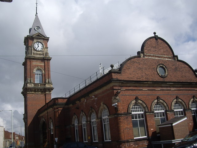
| Bank Top Railway Station (Main Building) | 1310079 | II* | 1887 | Park East Ward | |
| Barclays Bank | 1322928 | II* | Park East Ward | ||
| Blackwellgate Post Office | 1121353 | II | Park East Ward | ||
| Bondgate Methodist Church | 1121254 | II* | Park East Ward | ||
| Bondgate Motors | 1121315 | II | Park East Ward | ||
| Central Hall | 1310904 | II | Park East Ward | ||
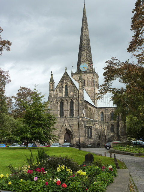
| Church of St Cuthbert | 1121280 | I | C12th | Park East Ward | |
| Church of St Hilda | 1322955 | II | Park East Ward | ||
| Crown Street Chambers | 1121292 | II | Park East Ward | ||
| Darlington Civic Theatre | 1392707 | II | Park East Ward | ||
| Doric House | 1121265 | II | Park East Ward | ||
| Edward Pease Public Library and Darlington Art Gallery | 1322938 | II | Park East Ward | ||
| Forecourt Wall to No 36 | 1322917 | II | Park East Ward | ||
| Forecourt Walls to Numbers 67 and 69 | 1310105 | II | Park East Ward | ||
| Fountain in South East Corner of Public Garden | 1121277 | II | Park East Ward | ||
| Friends Meeting House | 1121255 | II* | 1846 | Park East Ward | Skinnergate |
| Gate Piers, Gates and Wall to West of St Cuthbert's Churchyard | 1121281 | II | Park East Ward | ||
| Gift Shop and Market Tavern | 1121349 | II | Park East Ward | ||
| Gold Case Travel Agency | 1161484 | II | Park East Ward | ||
| Head Post Office and Sorting Office | 1160864 | II | Park East Ward | ||
| K6 Telephone Kiosk Outside Friends Meeting House | 1121230 | II | Park East Ward | ||
| Lloyd's Bank | 1121328 | II | Park East Ward | ||
| Museum | 1322925 | II | Park East Ward | ||
| No 12 Including Wall Running from Corner of House | 1121278 | II | Park East Ward | ||
| No 18 (Northernmost Bay of Woolworth's) | 1121284 | II | Park East Ward | ||
| Nos 4 to 16 (Even) and the King's Head Hotel Above Shops | 1310393 | II | Park East Ward | ||
| Number 39 Including Rear Premises Fronting on to Burns' Yard | 1121259 | II | Park East Ward | ||
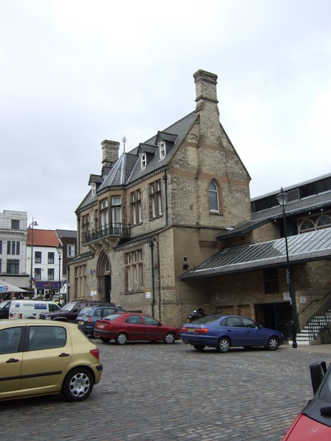
| Old Town Hall | 1121276 | II | 1864 | Park East Ward | Darlington, Horsemarket |
| Pease's House | 1310453 | II | Park East Ward | ||
| Polam Lane Bridge | 1391730 | II | Park East Ward | ||
| Rear Boundary Wall (Part) of Nag's Head Hotel (Approximately 10 Yards in Length) | 1121319 | II | Park East Ward | ||
| Roman Catholic Church of St Augustine | 1242908 | II | Park East Ward | ||
| South African War Memorial within St Cuthbert's Churchyard | 1160823 | II | Park East Ward | ||
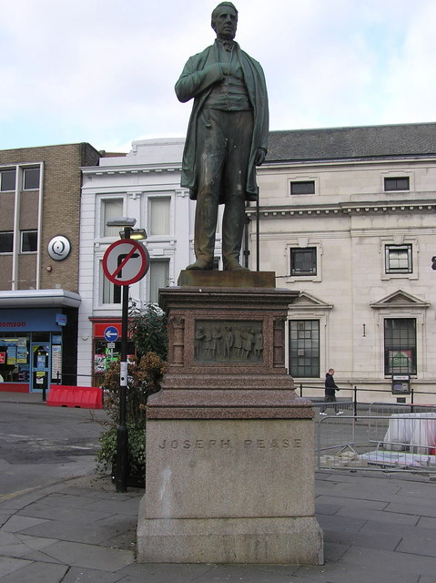
| Statue of Joseph Pease | 1322930 | II | 1875 | Park East Ward | Prospect Place |
| The Boot and Shoe Public House | 1121320 | II | Park East Ward | ||
| The Clock Tower | 1121224 | II | Park East Ward | ||
| The George Public House | 1322913 | II | Park East Ward | ||
| The Golden Cock Public House | 1161463 | II | Park East Ward | ||
| The Market Building | 1322944 | II | Park East Ward | ||
| The Mechanics' Institute | 1322961 | II | Park East Ward | ||
| The Midland Bank | 1121252 | II | Park East Ward | ||
| The National Westminster Bank | 1121270 | II | Park East Ward | ||
| The Presbytery | 1140124 | II | Park East Ward | ||
| The Quaker Coffee House | 1121283 | II | Park East Ward | ||
| The Queen's Head Hotel | 1121264 | II | Park East Ward | ||
| The Red Lion Hotel | 1121251 | II | Park East Ward | ||
| The Slaters Arms | 1121314 | II | Park East Ward | ||
| The Turks Head Public House | 1322892 | II | Park East Ward | ||
| The Yorkshire Bank | 1322929 | II | Park East Ward | ||
| Wall | 1159777 | II | Park East Ward | ||
| Walls of the Friends Meeting House Around South West Corner of Quaker Burial Ground | 1161282 | II | Park East Ward | ||
| Nos. 1 and 2, Harewood Hill | 1322942 | II | Park West Ward | ||
| Nos. 1-8, Harewood Grove | 1121296 | II* | Park West Ward | ||
| No. 102, Coniscliffe Road | 1310827 | II | Park West Ward | ||
| No. 104, Coniscliffe Road | 1121331 | II | Park West Ward | ||
| Nos. 111-117, Coniscliffe Road | 1121290 | II | Park West Ward | ||
| Nos. 122 and 124, Coniscliffe Road | 1159915 | II | Park West Ward | ||
| No. 126, Coniscliffe Road | 1322919 | II | Park West Ward | ||
| No. 14, Harewood Hill | 1121300 | II | Park West Ward | ||
| No. 140, Coniscliffe Road | 1121332 | II | Park West Ward | ||
| Nos. 2,4 and 6, Northumberland Street | 1160990 | II | Park West Ward | ||
| No. 21, Cleveland Terrace | 1121321 | II | Park West Ward | ||
| Nos. 27-33, Cleveland Terrace | 1121322 | II | Park West Ward | ||
| Nos. 3 and 4, Harewood Hill | 1160202 | II | Park West Ward | ||
| No. 4, Cleveland Avenue | 1310853 | II | Park West Ward | ||
| Nos. 41-61, Coniscliffe Road | 1322936 | II | Park West Ward | ||
| Nos. 5 and 6, Harewood Hill | 1121298 | II | Park West Ward | ||
| Nos. 7 and 8, Harewood Hill | 1121299 | II | Park West Ward | ||
| No. 83, Blackwell | 1121350 | II | Park West Ward | ||
| Nos. 94 and 96, Coniscliffe Road | 1121330 | II | Park West Ward | ||
| Nos. 98 and 100, Coniscliffe Road | 1322918 | II | Park West Ward | ||
| Bandstand in South Park | 1121246 | II | Park West Ward | ||
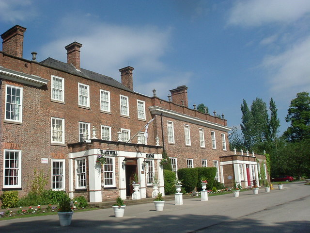
| Blackwell Grange Hotel | 1322941 | II* | 1693 | Park West Ward | |
| Forecourt Wall and Piers to No 205 (Neasham House) | 1121295 | II | Park West Ward | ||
| Forecourt Wall to No 19 and to Sheraton Park | 1121351 | II | Park West Ward | ||
| Forecourt Wall to Number 3 | 1121297 | II | Park West Ward | ||
| Fountain to North East of Bandstand in South Park | 1322956 | II | Park West Ward | ||
| Garden Walls to West and South of Number 6 | 1160217 | II | Park West Ward | ||
| Neasham House | 1322940 | II | Park West Ward | ||
| No 21 (Including Wrought Iron Hand and Area Railings) | 1121333 | II | Park West Ward | ||
| Outbuilding to North East of Blackwell Grange | 1160162 | II | Park West Ward | ||
| Polam Hall | 1121294 | II | Park West Ward | ||
| Robertsons Furniture Store | 1310697 | II | Park West Ward | ||
| The Grange Hotel | 1121289 | II | Park West Ward | ||
| Barn 100 Metres East of Hall Farmhouse | 1322949 | II* | Archdeacon Newton | ||
| Nos. 152 and 154, Yarm Road | 1322948 | II | Bank Top & Lascelles Ward | ||
| Church of St John the Evangelist | 1322932 | II | Bank Top & Lascelles Ward | ||
| Barmpton Hall | 1185894 | II | C18th | Barmpton | Farmhouse |
| Low Skerningham | 1299482 | II | Barmpton | ||
| Skerningham Farmhouse | 1185895 | II | Barmpton | ||
| Blackwell Bridge | 1121318 | II | Barton Ward | ||
| Blackwell Bridge | 1131341 | II | Barton Ward | ||
| Bishopton War Memorial | 1433639 | II | Bishopton | ||
| Church of St Peter | 1185897 | II | Bishopton | ||
| Manor Farmhouse | 1185896 | II | Bishopton | ||
| Musgrave Headstone 7 Metres West of Church of St Peter | 1185898 | II | Bishopton | ||
| Remains of Village Cross 15 Metres West of Church of St Peter | 1185899 | II | Bishopton | ||
| Springfield House with Farm Building on Right Return | 1185900 | II | Bishopton | ||
| St John's House | 1185901 | II | Bishopton | ||
| Ketton Hall | 1186113 | II | Bafferton | ||
| Ketton Packhorse Bridge | 1185904 | II | C17th | Bafferton | Ketton |
| Manor Farmhouse and Adjoining Farmbuilding | 1185903 | II | Bafferton | ||
| Peartree House | 1186119 | II | Bafferton | ||
| Threshing Barn and Gin Gang 10 Metres West of Number 24 (Manor Farmhouse) | 1186094 | II | Bafferton | ||
| U Plan Farmbuildings and Gin Gang North of Peartree House | 1299443 | II | Bafferton | ||
| Stooperdale Offices | 1389488 | II | Brinkburn & Faverdale Ward | ||
| Coatham Hall | 1121234 | II | Coatham Mundeville | ||
| Coatham Hall Farmhouse | 1121235 | II | Coatham Mundeville | ||
| Coatham Mill | 1121232 | II | Coatham Mundeville | ||
| Crossing Keeper's Cottage | 1121236 | II | Coatham Mundeville | ||
| Curved Wall to South East of Coatham Hall | 1186144 | II | Coatham Mundeville | ||
| Deer House South of Hall Garth | 1186127 | II | Coatham Mundeville | ||
| Farmbuildings to North West of Coatham Hall Farmhouse | 1299334 | II | Coatham Mundeville | ||
| Foresters Arms | 1241145 | II | Coatham Mundeville | ||
| Glebe Farmhouse and Front Garden Wall | 1121237 | II | Coatham Mundeville | ||
| Hall Garth | 1299345 | II | C17th | Coatham Mundeville | Now hotel & spa |
| Mill Bridge | 1121231 | II | Coatham Mundeville | ||
| Mill Bridge | 1185902 | II | 1861 | Coatham Mundeville | Over the River Skerne |
| The Stables Bar and Restaurant, Front Wall and Piers to East of Hall Garth | 1121233 | II | Coatham Mundeville | ||
| No. 103, Cockerton Green | 1121327 | II | Cockerton Ward | ||
| Nos. 107, 109 and 109, Cockerton Green | 1159861 | II | Cockerton Ward | ||
| No. 19, Cockerton Green | 1159805 | II | Cockerton Ward | ||
| Nos. 39 and 39a, Cockerton Green | 1121324 | II | Cockerton Ward | ||
| No. 43, Cockerton Green | 1121325 | II | Cockerton Ward | ||
| Nos. 59 and 61, Cockerton Green | 1159815 | II | Cockerton Ward | ||
| Nos. 63-67, Cockerton Green | 1121326 | II | Cockerton Ward | ||
| No. 79, Cockerton Green | 1159832 | II | Cockerton Ward | ||
| Nos. 80 and 82, Cockerton Green | 1121323 | II | Cockerton Ward | ||
| Fountain Near West End of Green | 1322916 | II | Cockerton Ward | ||
| Number 76 Incorporating Number 74 | 1159794 | II | Cockerton Ward | ||
| Church of Holy Trinity | 1121226 | II* | College Ward | ||
| Danesmoor | 1322914 | II | College Ward | ||
| Drinking Fountain on West Corner of Milbank Road | 1322947 | II | College Ward | ||
| Inglenook | 1140082 | II | College Ward | ||
| St Clare's Abbey, Lodge, Walls and Ancillary Garden Buildings | 1393423 | II | College Ward | ||
| Steps, Ramp, Rail and Lampholder to North of Holy Trinity Church | 1121227 | II | College Ward | ||
| The Woodlands | 1121228 | II | College Ward | ||
| Walls, Gates and Piers to North and West of Church of Holy Trinity | 1322946 | II | College Ward | ||
| Denton Hall | 1121239 | II | Denton | ||
| Glebe House | 1121238 | II | Denton | ||
| Hall Headstone 20 Metres South of Church of St Mary | 1322950 | II | Denton | ||
| Limekiln 140 Metres East of Limeklin Bank Cottage | 1116547 | II | Denton | ||
| Milepost 700 Metres South East of Junction with New Lane | 1186215 | II | Denton | ||
| Stone Coffin Against South Nave Wall of Church of St Mary | 1186231 | II | Denton | ||
| Thompson Headstone 25 Metres South of Church of St Mary | 1186238 | II | Denton | ||
| High Firth Moor Farmhouse | 1121253 | II | Eastbourne Ward | ||
| Barn on Left Rear of Close Farmhouse | 1186154 | II | Great Burdon | ||
| Burdon House | 1185905 | II | Great Burdon | ||
| Cargott Farm Threshing Barn 20 Metres East of Glendor | 1299356 | II | Great Burdon | ||
| Close Farmhouse | 1299445 | II | Great Burdon | ||
| Cottage and Smithy to Left of Number 9 | 1185906 | II | Great Burdon | ||
| Farmbuildings on Left of Great Burdon Farmhouse | 1299446 | II | Great Burdon | ||
| Great Burdon Farmhouse | 1185907 | II | Great Burdon | ||
| Ivy Cottage | 1299355 | II | Great Burdon | ||
| Milepost and Milestone 15 Metres West of Number 2 | 1299444 | II | Great Burdon | ||
| Water Mill on Left Return of Mill Batts Farmhouse | 1186138 | II | Great Burdon | ||
| Church of All Saints | 1185908 | II | Great Stainton | ||
| Stainton Grange | 1299447 | II | Great Stainton | ||
| The King's Arms Public House | 1299448 | II | Great Stainton | ||
| The Old Rectory | 1185910 | II | Great Stainton | ||
| Water Pump and Railings About 5 Metres North of Meridian House | 1185911 | II | Great Stainton | ||
| Water Pump at Rear of Stainton Grange | 1185909 | II | Great Stainton | ||
| Huntershaw | 1322945 | II | Harrowgate Hill Ward | ||
| (Bewick) Outbuilding to South West of No 76 | 1121310 | II | Haughton & Springfield Ward | ||
| No. 11, Haughton Green | 1160286 | II | Haughton & Springfield Ward | ||
| Nos. 17 and 19, Haughton Green | 1160299 | II | Haughton & Springfield Ward | ||
| Nos. 33-37, Haughton Green | 1121307 | II | Haughton & Springfield Ward | ||
| Nos. 38 and 40, Haughton Green | 1121308 | II | Haughton & Springfield Ward | ||
| Nos. 42 and 44, Haughton Green | 1310597 | II | Haughton & Springfield Ward | ||
| No. 5, Haughton Green | 1160278 | II | Haughton & Springfield Ward | ||
| No. 50, Haughton Green | 1121309 | II | Haughton & Springfield Ward | ||
| No. 53, Haughton Green | 1310624 | II | Haughton & Springfield Ward | ||
| Nos. 58 and 60, Haughton Green | 1310604 | II | Haughton & Springfield Ward | ||
| No. 7, Haughton Green | 1322943 | II | Haughton & Springfield Ward | ||
| No. 76, Haughton Green | 1322907 | II | Haughton & Springfield Ward | ||
| No. 9, Haughton Green | 1121304 | II | Haughton & Springfield Ward | ||
| Archway House | 1121305 | II | Haughton & Springfield Ward | ||
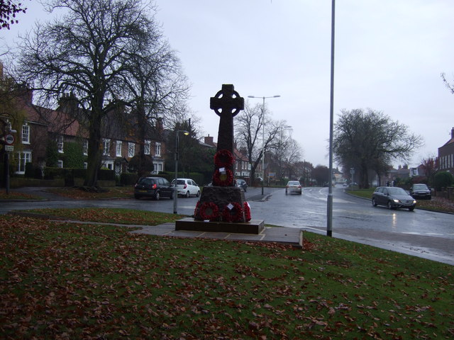
| Barmpton, Great Burdon and Haughton-le-Skerne War Memorial | 1437911 | II | 1920 | Haughton & Springfield Ward | |
| Butler House and the Rectory | 1121301 | I | C15th | Haughton & Springfield Ward | With later additions |
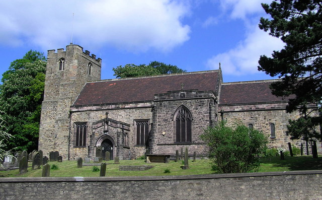
| Church of St Andrew | 1160229 | I | c.1125 | Haughton & Springfield Ward | |
| Haughton Methodist Church | 1121306 | II | Haughton & Springfield Ward | ||
| Haughton Villa | 1322905 | II | Haughton & Springfield Ward | ||
| Sherne Cottage | 1322906 | II | Haughton & Springfield Ward | ||
| Skerne Lodge | 1160332 | II | Haughton & Springfield Ward | ||
| South Garden Wall and Piers of Butler House and the Rectory | 1121302 | II | Haughton & Springfield Ward | ||
| St Andrew's Church Hall | 1160257 | II | Haughton & Springfield Ward | ||
| Wall to East of Drive of Butler House and the Rectory | 1121303 | II | Haughton & Springfield Ward | ||
| No. 1, West Green | 1121217 | II | Heighington | ||
| No. 16, East Green | 1116243 | II | Heighington | ||
| No. 17, Darlington Road | 1322976 | II | Heighington | ||
| Nos. 38 and 39, West Green | 1115742 | II | Heighington | ||
| No. 39, Church View | 1322951 | II | Heighington | ||
| No. 42, West Green | 1322981 | II | Heighington | ||
| No. 7, West Green | 1322980 | II | Heighington | ||
| Cart Shed on Rear of Middridge Grange Farmhouse | 1116090 | II | Heighington | ||
| Carter Headstone 30 Metres South West of Church of St Michael | 1121244 | II | Heighington | ||
| Church of St Michael | 1322953 | I | c.1130 | Heighington | |
| Churchyard Wall and Gate Piers to East Number 10 | 1121203 | II | Heighington | ||
| Churchyard Wall, Gate and Gate Piers to North of Village Hall | 1322974 | II | Heighington | ||
| Coatsay Moor Farmhouse | 1322975 | II | Heighington | ||
| Cock Inn Farmhouse and Attached Farmbuildings | 1322979 | II | Heighington | ||
| Dovecote and Outbuildings North West of Trafalgar House | 1320050 | II | Heighington | ||
| Dovecote West of Dovecote Cottage | 1121209 | II | Heighington | ||
| East and North Garden Walls to South East of Number 7 | 1322978 | II | Heighington | ||
| Eldon House | 1121207 | II | Heighington | ||
| Garden Screen Wall North East of Heighington Hall | 1121241 | II | Heighington | ||
| Garden Wall and Gate Piers South of Number 16 and Number 18 | 1320032 | II | Heighington | ||
| Gates and Posts to South of Redworth Hall Lodge | 1320071 | II | Heighington | ||
| Gates to Redworth Hall | 1392339 | II | Heighington | ||
| Gazebo and Walls to Rear of Number 43 | 1121242 | II | Heighington | ||
| Gazebo, Terrace Wall and Sheds South-East of Number 7 | 1116286 | II | Heighington | ||
| Greenbank | 1121219 | II | Heighington | ||
| Hearse House 35 Metres North East of Church of St Michael | 1121202 | II | Heighington | ||
| Heighington Hall | 1121240 | II* | Heighington | ||
| Heighington War Memorial | 1438087 | II | Heighington | ||
| Highside | 1121212 | II | Heighington | ||
| Hodgson Tomb 3 Metres North of Church of St Michael | 1121201 | II | Heighington | ||
| Holly House | 1121218 | II | Heighington | ||
| Ivy House | 1115747 | II | Heighington | ||
| Lawn House | 1121208 | II | Heighington | ||
| Manor Farm House | 1322977 | II | Heighington | ||
| Middridge Grange Farmhouse | 1121214 | II* | Heighington | ||
| Northcott | 1115778 | II | Heighington | ||
| Number 45 and Former Smithy | 1116500 | II | Heighington | ||
| Outer Walls and Gate Piers to East of Middridge Grange Farmhouse | 1121216 | II | Heighington | ||
| Pigeon Cote West of Coatsay Moor Farmhouse | 1121204 | II | Heighington | ||
| Redworth Hall | 1121213 | II | Heighington | ||
| Rutter Headstone 12metres South of Church of St Michael | 1121243 | II | Heighington | ||
| Surtees Table Tomb 2.5 Metres North of Church of St Michael | 1319974 | II | Heighington | ||
| The Bay Horse Public House | 1320296 | II | Heighington | ||
| The Cottage | 1319919 | II | Heighington | ||
| The Manor House | 1121206 | II | Heighington | ||
| The Old Hall | 1322952 | II | Heighington | ||
| The Pump House | 1115768 | II | Heighington | ||
| The Village Hall | 1121205 | II | Heighington | ||
| Todd Fall Farmhouse and Attached Farmbuildings | 1116097 | II | Heighington | ||
| Toytop Farmhouse and Farmbuildings | 1320125 | II | Heighington | ||
| Trafalgar House and Garden Wall Attached to North | 1121210 | II | Heighington | ||
| Wall and Gate Piers in Front of Number 43 | 1319904 | II | Heighington | ||
| Wall to East of Heighington Hall | 1116514 | II | Heighington | ||
| Walls and Gate Piers to East of Middridge Grange Farmhouse | 1121215 | II | Heighington | ||
| Walls Gate Piers and Pigsty to West and North of Trafalgar House | 1121211 | II | Heighington | ||
| Water Pump 20 Metres South of Number 12 | 1116160 | II | Heighington | ||
| Wilkinson Headstone 14 Metres South of Church of St Michael | 1116409 | II | Heighington | ||
| Young Headstone 10 Metres West of Church of St Michael | 1116441 | II | Heighington | ||
| Nos. 1 and 2, Carlbury Vale | 1322983 | II | High Coniscliffe | ||
| Nos. 24 and 25, the Green | 1121183 | II | High Coniscliffe | ||
| Braemar Cottage | 1121184 | II | High Coniscliffe | ||
| Church of St Edwin | 1115562 | II* | c.1170 | High Coniscliffe | |
| Garden Wall and End Piers in Front of Number 23 (The Old Hall) | 1121182 | II | High Coniscliffe | ||
| Garden Wall to East of High Carlbury Farmhouse | 1121181 | II | High Coniscliffe | ||
| Garden Walls and Gate Piers in Front of Numbers 24 and 25 | 1322965 | II | High Coniscliffe | ||
| Garden Walls and Gate Piers to South of Thornton Hall | 1121222 | II | High Coniscliffe | ||
| Garden Walls Enclosing Three Paddocks to North, South and East of Thornton Hall | 1320337 | II | High Coniscliffe | ||
| Garden Walls in Front of Ulnaby Hall | 1121189 | II | High Coniscliffe | ||
| Garden Walls, Farmbuilding and Smithy to North and East of Ulnaby Hall | 1115489 | II | High Coniscliffe | ||
| Headstone to Dorothy Robinson 5.0 Metres East of Church of St Edwin | 1115547 | II | High Coniscliffe | ||
| High Carlbury Farmhouse | 1323003 | II | High Coniscliffe | ||
| K6 Telephone Kiosk Opposite Old Hall | 1121180 | II | High Coniscliffe | ||
| Milepost 600 Metres West of Thornton Hall | 1320326 | II | High Coniscliffe | ||
| Milepost at High Coniscliffe Bridge | 1121220 | II | High Coniscliffe | ||
| Milepost South of Carlbury Hall | 1322982 | II | High Coniscliffe | ||
| Robinson Chest Tomb 3.0 Metres East of Church of St Edwin | 1322967 | II | High Coniscliffe | ||
| The Mill House | 1115499 | II | C18th | High Coniscliffe | Former water mill. |
| The Old Hall | 1322964 | II* | High Coniscliffe | ||
| The Old Vicarage | 1121185 | II | 1860 | High Coniscliffe | |
| Thornton Hall | 1121221 | I | C16th | High Coniscliffe | |
| Ulnaby Hall | 1121188 | II | High Coniscliffe | ||
| Valley House with Conservatory on Left | 1121187 | II | High Coniscliffe | ||
| Wall and Tower to East of Number 46a | 1322966 | II | High Coniscliffe | ||
| Wall and Tower to West of Number 48 (The Old Vicarage) | 1121186 | II | High Coniscliffe | ||
| Wall with Two Light Traceried Window 40 Metres West of Carlbury Hall | 1115695 | II | High Coniscliffe | ||
| Barn and Privy on Right Return of Manor House | 1115421 | II | Houghton le Side | ||
| Dovecote 45 Metres East of Manor House | 1121194 | II* | Houghton le Side | ||
| Former Stable and Shed 15 Metres North East of Manor House | 1121193 | II | Houghton le Side | ||
| Garden House | 1121190 | II | Houghton le Side | ||
| Garden Wall to West and South of Manor House | 1121192 | II | Houghton le Side | ||
| Manor House | 1121191 | II | Houghton le Side | ||
| Outbuilding and Linking Wall 5.0 Metres to Rear of Garden House | 1115415 | II | Houghton le Side | ||
| Single Storey Farmbuilding 6.0 Metres South East of Manor House | 1320591 | II | Houghton le Side | ||
| Single Storey Outbuildings 7.0 Metres North of Manor House | 1115398 | II | Houghton le Side | ||
| Two Storey Farmbuilding 4.5 Metres East of Manor House | 1322968 | II | Houghton le Side | ||
| Nos. 478 and 480, Coniscliffe Road | 1159922 | II | Hummersknott Ward | ||
| Barn to East of Hillclose Farm House | 1121245 | II | Hummersknott Ward | ||
| Carmel House Convent | 1322935 | II | Hummersknott Ward | ||
| Carmel House to North East of Carmel House Convent | 1161014 | II | Hummersknott Ward | ||
| Carmel Lodge (To North-West of Carmel House Convent) | 1121288 | II | Hummersknott Ward | ||
| Hillclose Farm House | 1322954 | II* | Hummersknott Ward | ||
| St Clare's Abbey Chapel | 1393424 | II* | Hummersknott Ward | ||
| Tees Bank House | 1322937 | II | Hummersknott Ward | ||
| Woodburn Gardeners' Cottage | 1393710 | II | Hummersknott Ward | ||
| Nos. 34 and 35, the Green | 1319897 | II | Hurworth | ||
| No. 41, the Green | 1116534 | II | Hurworth | ||
| No. 42, the Green | 1185919 | II | Hurworth | ||
| No. 51, the Green | 1116475 | II | Hurworth | ||
| Aquila Cottage | 1116430 | II | Hurworth | ||
| Barn and Link Section on Left Rear of Springfield Farmhouse | 1299451 | II | Hurworth | ||
| Bay Horse Cottage | 1319940 | II | Hurworth | ||
| Beech Cottage | 1319911 | II | Hurworth | ||
| Church of All Saints | 1299450 | II | Hurworth | ||
| Colling Chest Tomb 3 Metres South of Church of All Saints | 1185914 | II | Hurworth | ||
| Danby Cottage | 1185915 | II | Hurworth | ||
| Dovecote and Adjacent Pigsty, 10 Metres West of Number 4 (The Old House) | 1299314 | II | Hurworth | ||
| Eden House | 1116545 | II | Hurworth | ||
| Emerson Table Tomb 3 Metres West of Church of All Saints | 1299285 | II | Hurworth | ||
| Font Bowl and Stem 2 Metres North of Church of All Saints | 1186227 | II | Hurworth | ||
| Fountain and Trough 20 Metres South of Number 2 | 1116452 | II | Hurworth | ||
| Garden Walls and Gate Piers to North and West of Number 44 | 1185921 | II | Hurworth | ||
| Gate Piers and Forecourt Walls to Number 38 | 1116530 | II | Hurworth | ||
| Greenways | 1185916 | II | Hurworth | ||
| Greenwells and the Surgery | 1299452 | II | Hurworth | ||
| Hurworth and Neasham War Memorial | 1438706 | II | Hurworth | ||
| Hurworth Hall West | 1185923 | II | Hurworth | ||
| Hurworth House Boys' Preparatory School | 1185917 | II | Hurworth | ||
| Little Breckon | 1299455 | II | Hurworth | ||
| Newbus Arms Hotel | 1319928 | II | Hurworth | ||
| No. 1 (Merrydale Rest Home), No. 2 (Banks House) and Nos. 3 to 12 Bank Terrace | 1299449 | II | Hurworth | ||
| Outbuilding on Left Return of Number 4 (The Old House) | 1185913 | II | Hurworth | ||
| Outbuilding on Right Return of Number 44 | 1116518 | II | Hurworth | ||
| Oxney Flatt Farmhouse | 1186241 | II | Hurworth | ||
| Red House | 1185918 | II | Hurworth | ||
| Rockliffe Hall in Rockliffe Park | 1185949 | II | Hurworth | ||
| Rose Cottage | 1299453 | II | Hurworth | ||
| Springfield Farmhouse and Farmbuilding on Right Return | 1242203 | II | Hurworth | ||
| Strawberry Cottage | 1186764 | II | Hurworth | ||
| Sundial House | 1186243 | II | Hurworth | ||
| Tees Bridge | 1131366 | II | Hurworth | ||
| The Comet Public House | 1185925 | II | Hurworth | ||
| The Manor House | 1185920 | II | Hurworth | ||
| The Old Church School | 1185912 | II | Hurworth | ||
| The Old Hall | 1185922 | II* | Hurworth | ||
| The Old Parsonage | 1185924 | II | Hurworth | ||
| Detached Farmbuilding 20 Metres South East of Killerby Grange | 1121196 | II | Killerby | ||
| Dovecote at Killerby Grange | 1393673 | II | Killerby | ||
| Farmbuildings Attached to Left of Killerby Grange | 1115138 | II | Killerby | ||
| Garden Walls and Detached Gate Piers in Front of Killerby Grange | 1322969 | II | Killerby | ||
| Killerby Grange | 1121195 | II | Killerby | ||
| Killerby Hall | 1139031 | II | Killerby | ||
| The Old Granary | 1115136 | II | Killerby | ||
| Water Pump and Trough 7.0 Metres to Rear of Killerby Grange | 1139025 | II | Killerby | ||
| Longpasture House with Barn on Left Return | 1116414 | II | Little Stainton | ||
| Nos. 55 and 57, Low Coniscliffe | 1139006 | II | Low Coniscliffe and Merrybent | ||
| Milepost in Front of Number 12 (Cedar Ridge) | 1322970 | II | Low Coniscliffe and Merrybent | ||
| Well Bank House | 1121197 | II | Low Coniscliffe and Merrybent | ||
| Nos. 15, the Front | 1185934 | II | Middleton St George | ||
| 2 Arched Stone Doorways in Garden Left of Number 64 (Mown Meadows) | 1116304 | II | Middleton St George | ||
| Castle Hill | 1319981 | II | Middleton St George | ||
| Church of St George | 1299460 | II | C13th | Middleton St George | |
| Church of St Lawrence | 1185932 | II | Middleton St George | ||
| Deanery Cottage | 1116326 | II | Middleton St George | ||
| Dovecote at Low Middleton Farm About 150 Metres South of Woodstock | 1299462 | II | Middleton St George | ||
| Garden Wall and Privy on Left Return of Low Middleton Hall | 1116338 | II | Middleton St George | ||
| Jessamine House | 1319996 | II | Middleton St George | ||
| Low Middleton Hall and Former Stable on Rear | 1185935 | II* | Middleton St George | ||
| Middleton Hall | 1299459 | II | Middleton St George | ||
| Middleton One Row St Laurence's War Memorial | 1440044 | II | Middleton St George | ||
| Oak Tree Farmhouse | 1185931 | II | Middleton St George | ||
| South View | 1185933 | II | Middleton St George | ||
| Tees View | 1320001 | II | Middleton St George | ||
| Yohn House | 1299461 | II | Middleton St George | ||
| Kerbstones Surrounding Pool in Front of Cummins Engine Factory | 1299427 | II* | Morton Palms | ||
| Little Burdon Cottage | 1320019 | II | Morton Palms | ||
| Little Burdon Farmhouse | 1185936 | II | Morton Palms | ||
| Security Fence at Cummins Engine Factory | 1335834 | II* | Morton Palms | ||
| The Cummins Engine Factory Including Chimney | 1185948 | II* | Morton Palms | ||
| Mowden Hall | 1322889 | II | Mowden Ward | ||
| Nos. 1 and 3, Neasham Hill | 1320035 | II | Neasham | ||
| Bridge About 30 Metres South of the Manor House | 1299458 | II | Neasham | ||
| Carved Stone Fragment, 25 Metres South of Neasham Hill | 1116260 | II | Neasham | ||
| Church of All Saints | 1185947 | I | C12th | Neasham | Ruins. |
| Church of St John the Baptist | 1319947 | II | C12th | Neasham | Low Dinsdale. Restored 1876 |
| Cliffe Cottage | 1185940 | II | Neasham | ||
| Cross Shaft Fragment About 5 Metres South West of Church of St John the Baptist | 1299456 | II* | Neasham | ||
| Dinsdale Park Residential School | 1185930 | II | Neasham | ||
| Dovecote 10 Metres North of Sockburn Farmhouse | 1116131 | II | Neasham | ||
| Former Coach House 30 Metres North West of Sockburn Hall | 1185946 | II | Neasham | ||
| High Holme with Coach House/Stables on Right Return | 1116229 | II | Neasham | ||
| Manor House Farmhouse | 1299457 | II | Neasham | ||
| Mounting Block About 15 Metres South West of Church of St John the Baptist | 1185928 | II | Neasham | ||
| Neasham Abbey | 1320007 | II | Neasham | ||
| Neasham Grange Farmhouse | 1185939 | II | Neasham | ||
| Neasham Hall Bridge | 1299423 | II | Neasham | ||
| Neasham Hill | 1185938 | II | Neasham | ||
| Pigeon Cote About 120 Metres South East of Neasham Hall | 1299424 | II | Neasham | ||
| Public Shelter About 8 Metres South of Numbers 1 and 3 Neasham Hill | 1185937 | II | Neasham | ||
| Sockburn Farmhouse | 1320072 | II | Neasham | ||
| Sockburn Hall | 1116156 | II* | 1834 | Neasham | On the site of earlier building. |
| Stone Coffin and Lid About 3.5 Metres West of Church of St John the Baptist | 1185927 | II* | Neasham | ||
| The Manor House | 1185929 | II* | Medieval | Neasham | Low Dinsdale |
| Cemetery chapels and porte-cochere | 1465676 | II | North Road Ward | ||
| Cemetery commemorative column | 1466365 | II | North Road Ward | ||
| Cemetery keeper's house | 1466267 | II | North Road Ward | ||
| Cemetery lodge, gate piers, gates and flanking walls | 1466268 | II | North Road Ward | ||
| Honey Pot House | 1121279 | II | North Road Ward | ||
| Railway Viaduct | 1121286 | II | North Road Ward | ||
| Rise Carr County Primary School | 1322939 | II | North Road Ward | ||
| Wall to North of Number 279 | 1310408 | II | North Road Ward | ||
| Nos. 1 and 2, Mcnay Street | 1121282 | II | Northgate Ward | ||
| Nos. 138-148 Northgate | 1322933 | II | Northgate Ward | ||
| No. 30, Archer Street | 1322887 | II | Northgate Ward | ||
| No. 33, Bondgate | 1121311 | II | Northgate Ward | ||
| No. 34, Bondgate | 1322909 | II | Northgate Ward | ||
| No. 35, Bondgate | 1121312 | II | Northgate Ward | ||
| Nos. 37 and 39, Russell Street | 1310256 | II | Northgate Ward | ||
| No. 67, Bondgate | 1322912 | II | Northgate Ward | ||
| No. 81, Bondgate | 1121316 | II* | Northgate Ward | ||
| Bandstand to West of Bowling Green | 1121287 | II | Northgate Ward | ||
| Bridge over River Skerne | 1242992 | II | Northgate Ward | ||
| Bridge over the River Skerne | 1329402 | II | Northgate Ward | ||
| Central School (East Block) | 1160912 | II | Northgate Ward | ||
| Central School Annexe | 1242805 | II* | Northgate Ward | ||
| Forecourt Railings and Gate Piers to Northgate United Reformed Church | 1258171 | II | Northgate Ward | ||
| Front Garden Wall to North Lodge | 1322934 | II | Northgate Ward | ||
| Goods Shed East South East of North Road Station | 1121262 | II* | Northgate Ward | ||
| North Lodge (Education Offices) | 1121285 | II | Northgate Ward | ||
| North Road Railway Station (Now Railway Museum) | 1322962 | II* | Northgate Ward | ||
| Northgate United Reformed Church | 1258167 | II | Northgate Ward | ||
| Numbers 31 to 35 (Odd) (Including Plain Wrought Iron Railings) | 1322960 | II | Northgate Ward | ||
| The Britannia Public House | 1121348 | II | Northgate Ward | ||
| No. 2, the Green | 1121200 | II | Piercebridge | ||
| No. 28, the Green | 1121157 | II | Piercebridge | ||
| No. 29, the Green | 1121158 | II | Piercebridge | ||
| Carlbury Bridge | 1320318 | II | Piercebridge | ||
| Church of St Mary | 1322973 | II | Piercebridge | ||
| Farmbuildings to Rear of White Cross Farmhouse | 1329711 | II | Piercebridge | ||
| Front Range of Farmbuildings and Gin Gang to West of Piercebridge Grange Farmhouse | 1121199 | II | Piercebridge | ||
| Garden Wall, Gate Piers and Railings in Front of White Cross Farmhouse | 1322971 | II | Piercebridge | ||
| Ivy House | 1322993 | II | Piercebridge | ||
| Medieval Chapel Ruins on Roman Foundations in Rear Garden of Bath House, Tees View | 1322972 | II* | Piercebridge | ||
| Pierce Bridge | 1131363 | II* | Piercebridge | ||
| Piercebridge Bridge | 1145843 | II* | Piercebridge | ||
| Piercebridge Grange Farmhouse and Front Garden Wall, Railings and Gate | 1145830 | II | Piercebridge | ||
| The Bridge House | 1318900 | II | Piercebridge | ||
| Wall, Gate Piers, Overthrow and Lantern to West of Church of St Mary | 1322992 | II | Piercebridge | ||
| White Cross Cottage | 1121198 | II | Piercebridge | ||
| White Cross Farmhouse | 1139015 | II | Piercebridge | ||
| Elm Court Pierremont, Dentdale East, Dentdale West, Tower House, Pierrement Hall. | 1121263 | II | Pierremont Ward | ||
| Gates, Piers and Forecourt Wall to Elm Court, Pierremont, Dentdale East, Dentdale West, Tower House | 1161440 | II | Pierremont Ward | ||
| Lime Cells | 1391819 | II | Pierremont Ward | ||
| Memorial Hall at Darlington Memorial Hospital | 1259261 | II | Pierremont Ward | ||
| Obelisk at Darlington Memorial Hospital | 1259263 | II | Pierremont Ward | ||
| Pierremont Lodge | 1310113 | II | Pierremont Ward | ||
| Stockton and Darlington Railway Carriage Works | 1121229 | II | Pierremont Ward | ||
| The Clock Tower | 1322963 | II | Pierremont Ward | ||
| Walls, Gatepiers and Gates to Stooperdale Offices | 1389487 | II | Pierremont Ward | ||
| West Lodge | 1121223 | II | Pierremont Ward | ||
| Woodland Road | 1121225 | II | Pierremont Ward | ||
| Nos. 4 and 5, Chapel Row | 1116202 | II | Sadberge | ||
| Church of St Andrew | 1185943 | II | Sadberge | ||
| Lych Gate and Churchyard Wall of Church of St Andrew | 1116208 | II | Sadberge | ||
| Milepost Between Numbers 8 and 9 | 1116237 | II | Sadberge | ||
| Raby House | 1185941 | II | Sadberge | ||
| Sadberge Hall | 1185945 | II | Sadberge | ||
| The Three Tuns Public House | 1299425 | II | Sadberge | ||
| Thithe House | 1185944 | II | Sadberge | ||
| Thorn Cottage | 1116220 | II | Sadberge | ||
| White House | 1185942 | II | Sadberge | ||
| Church of St James | 1121347 | II | Stephenson Ward | ||
| Former Gner Engine Shed | 1392356 | II | Stephenson Ward | ||
| Red Barns | 1121266 | II | Stephenson Ward | ||
| Roman Catholic School-Church of St William of York and St Francis de Sales | 1431011 | II | Stephenson Ward | ||
| 8, Summerhouse | 1322996 | II | Summerhouse | ||
| Farmbuildings South-East of the Grange | 1121165 | II | Summerhouse | ||
| Farmbuildings to Rear of Number 12 | 1322995 | II | Summerhouse | ||
| Farmbuildings West of Raby Hunt Inn | 1322997 | II | Summerhouse | ||
| Former Forge, Wall and Shed to Rear of South View | 1322994 | II | Summerhouse | ||
| K6 Telephone Kiosk | 1335916 | II | Summerhouse | ||
| Numbers 11 and 12 and Flanking Farmbuildings | 1121160 | II | Summerhouse | ||
| Raby Hunt Inn | 1121163 | II | c.1835 | Summerhouse | With older C18th side wing. |
| Sandforth Moor Farmhouse and Flanking Farmbuildings | 1121167 | II | Summerhouse | ||
| South View | 1121159 | II | Summerhouse | ||
| Stable 40 Metres South East of the Grange | 1121166 | II | Summerhouse | ||
| T Plan Farmbuildings 30 Metres South East of Number 12 | 1121161 | II | Summerhouse | ||
| The Grange and Attached Farmbuilding to South | 1121164 | II | Summerhouse | ||
| The Old Post Office, Front and Rear Walls, Gate Piers and Garage | 1121162 | II | Summerhouse | ||
| Barn and Flanking Shelter Sheds to South of Parkside Farmhouse | 1322998 | II | Walworth | ||
| Barn to North of North Farm Farmhouse | 1323001 | II | Walworth | ||
| Dovecote and Single Storey Range to South of Parkside Farmhouse | 1322999 | II | Walworth | ||
| Farmbuildings to North of Low Walworth Farmhouse | 1121170 | II | Walworth | ||
| Garden Wall and Gate Piers in Front of Parkside Farmhouse | 1121173 | II | Walworth | ||
| Garden Walls South West of Low Walworth Hall | 1121171 | II | Walworth | ||
| Garden Walls, Gate Piers and Greenhouse North of Walworth Castle | 1323000 | II | Walworth | ||
| Haybarn and Attached Shed South of Parkside Farmhouse | 1121174 | II | Walworth | ||
| Ice House to East of Quarry End | 1121177 | II | Walworth | ||
| Low Walworth Hall | 1121168 | II | Walworth | ||
| Outbuildings to North of Low Walworth Hall | 1121169 | II | Walworth | ||
| Parkside Farmhouse | 1121172 | II | Walworth | ||
| The Lodge, Linking Walls and Gate Piers to West of Walworth Castle | 1121176 | II | Walworth | ||
| Threshing Barn and Gin Gang East of Walworth Grange Farmhouse | 1121178 | II | Walworth | ||
| Walworth Castle | 1121175 | I | C16th | Walworth | |
| Cart Shed with Loose Box and Pigsty 5 Metres North of High Beaumont Hill Farmhouse | 1323002 | II | Whessoe | ||
| Manor House Ruins and Wall, 70 Metres South East of Whessoe Grange Farmhouse | 1121179 | II | Whessoe | ||
| Stable 30 Metres North of High Beaumont Hill Farmhouse | 1087005 | II | Whessoe | ||
| South Park, Darlington | 1001278 | II | Listed Park & Garden | ||
| West Cemetery, Darlington | 1001562 | II | Listed Park & Garden | ||
| Skerne Railway bridge, 320m south east of Darlington Railway Museum | 1002331 | n/a | Scheduled Monument | ||
| World War II bombing decoy control shelter 600m south east of Great Burdon Farm | 1020759 | n/a | Great Burdon | Scheduled Monument | |
| Coniscliffe Road waterworks | 1002300 | n/a | Scheduled Monument | ||
| Smotherlaw round barrow | 1002327 | n/a | High Coniscliffe | Scheduled Monument | |
| Pre-Conquest and post-Conquest church and graveyard and medieval and post-medieval manors at Sockburn | 1002340 | n/a | Sockburn | Scheduled Monument | |
| Ketton Bridge | 1002345 | n/a | C17th | Brafferton | Scheduled Monument |
| Piercebridge Roman fort | 1002365 | n/a | Piercebridge | Scheduled Monument | |
| Medieval moated manorial site of Low Dinsdale at the Manor House | 1007715 | n/a | Low Dinsdale | Scheduled Monument | |
| Anglo-Saxon cross in St John the Baptist's churchyard | 1019025 | n/a | Low Dinsdale | Scheduled Monument | |
| Motte and bailey castle 400m south east of Bishopton | 1008668 | n/a | Bishopton | Scheduled Monument | |
| Deserted medieval village of Ulnaby | 1008972 | n/a | High Coniscliffe | Scheduled Monument | |
| Tower Hill motte castle, 370m north-east of Dinsdale Spa | 1011072 | n/a | Middleton St. George | Scheduled Monument | |
| Shrunken medieval village at Sadberge | 1011073 | n/a | Sadberge | Scheduled Monument | |
| Deserted medieval village at Walworth | 1011256 | n/a | Walworth | Scheduled Monument | |
| Deserted medieval village of West Hartburn, 100m north-east of Foster House | 1011257 | n/a | Middleton St. George | Scheduled Monument | |
| Summerhouse moated site and associated drainage channels, enclosure and field system | 1011265 | n/a | Summerhouse | Scheduled Monument | |
| Archdeacon Newton moated site, deserted manorial settlement and section of rig and furrow | 1015841 | n/a | Archdeacon Newton | Scheduled Monument | |
| Small multivallate hillfort and tower mill on Shackleton Beacon Hill | 1016867 | n/a | Heighington | Scheduled Monument | |
| Piercebridge Bridge | 1002344 | n/a | Piercebridge | Scheduled Monument | |
| Coatham Mundeville medieval village, fishpond and areas of rig and furrow | 1016109 | n/a | Great Aycliffe | Scheduled Monument |
Primary source: the National Heritage List for England - NHLE is the register of nationally protected historic buildings and sites in England, including listed buildings, scheduled monuments, protected wrecks, registered parks and gardens, and battlefields. The list is maintained by Historic England. Check NHLE for updates and new entries. Secondary sources: British Listed Buildings.
Co-Curate Page
St Cuthbert's Church
- Overview Map In 995 AD Darlington was one of the resting places of St Cuthbert’s remains on the journey from Ripon to Durham. Bishop Puiset built a palace (on the site of …
Co-Curate Page
Statue of Statue of Joseph Pease
- Overview Map Street View The statue of Joseph Pease (1799 - 1872) is located at the east end of Prospect Place in Darlington, at the junction with Prebend Row, High …
Co-Curate Page
Darlington Railway Station
- Overview About Darlington Railway Station Map Street View Darlington railway station is on the East Coast Main Line in the United Kingdom, serving the town of Darlington, County Durham. …
Co-Curate Page
St Andrew's Church
- Overview About St Andrew's Church Map Street View St Andrew's Church in Haughton-le-Skerne was built in c.1125, on the site of an earlier Saxon church.[1] The church was restored in …
Co-Curate Page
Barmpton, Great Burdon and Haughton-le-Skerne War Memorial
- The war memorial for Barmpton, Great Burdon and Haughton-le-Skerne is located near St Andrew's Church in Hauton. The memorial was unveiled on the 7th of October 1920 by Lt. Col. …
Co-Curate Page
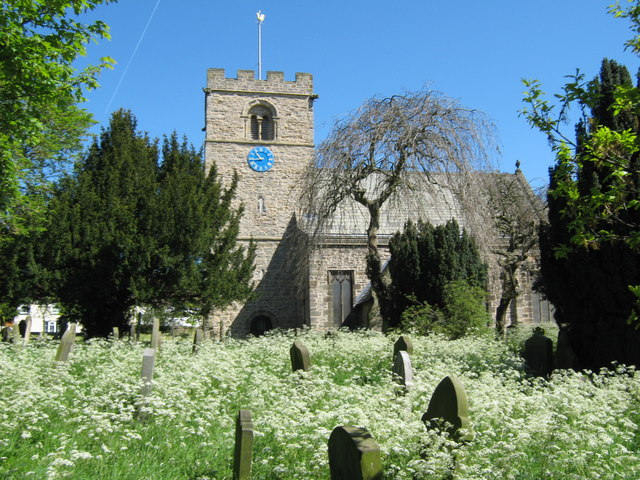
Church of St Michael, Heighington
- Overview Map Street View St Michael's is the parish church in Heighington, County Durham. The present church was built c.1130 AD, over the remains on an even earlier Anglo Saxon …
Co-Curate Page
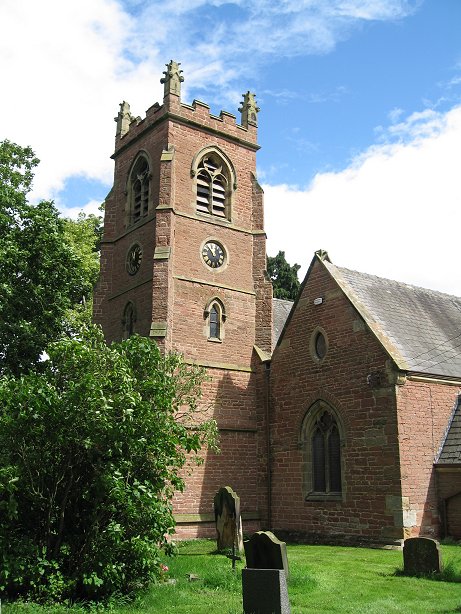
Church of St. John, Low Dinsdale
- St. John the Baptist is the parish church in Low Disdale, originally built in the late 12th century. In 1876 the church underwent a major restoration by J.P. Pritchett, at …
Co-Curate Page
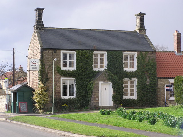
Raby Hunt Inn
- Overview About the Raby Hunt Inn Map Street View The Raby Hunt Inn in the village of Summerhouse was built in c.1835, with an earlier 18th century wing to the …
Co-Curate Page
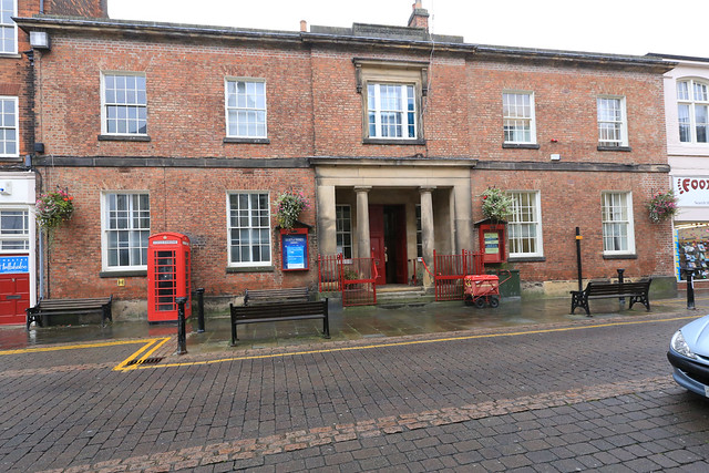
Friends Meeting House, Darlington
- Overview Map Street View The Friends Meeting House is located on Skinnergate in Darlington. The Quakers bought a house and land at Skinnergate in 1678, and converted it into a …
Co-Curate Page
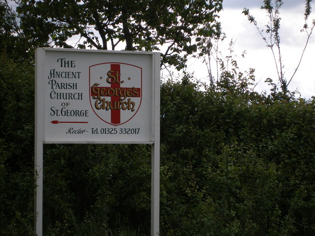
Church of St George, Middleton St. George
- Overview Map St George's Church dates frtom the 13th century. It is located about 1½ miles south-east of the village of Middleton St George. The church is a Grade II …
Co-Curate Page
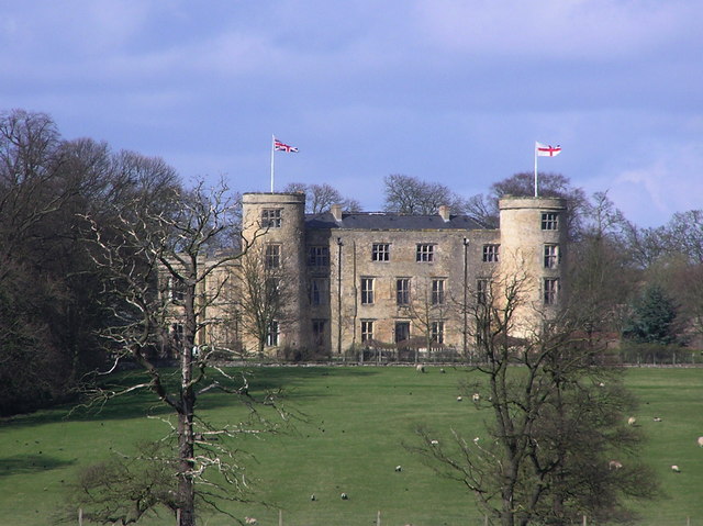
Walworth Castle
- Overview About Walworth Castle Map Street View Walworth Castle is a 16th century mansion house built in the style of a medieval castle, located in Walworth, near Darlington. It stands …
Co-Curate Page
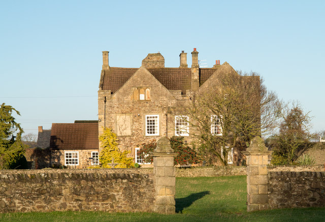
Thornton Hall
- Thornton Hall is a 16th century Manor House (now a farmhouse) located within the Civil Parish of High Coniscliffe in County Durham. It lies off the B6279 road near Ulnaby. The …
Co-Curate Page
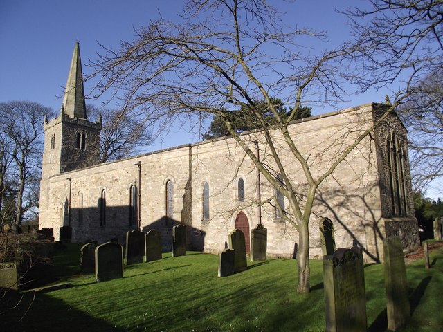
Church of St. Edwin, High Coniscliffe
- Overview Map Street View The Parish church in High Coniscliffe was originally built c.1170 and the tower parapet and spire dates from the 14th century. The church underwent a major …
Co-Curate Page
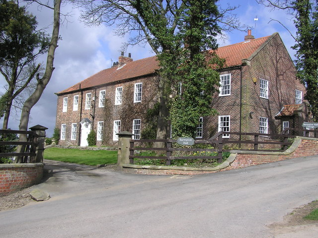
Barmpton Hall
- Overview Map Street View Barmpton Hall, is a farmhouse located at the west end of the village of Barmpton. The farmhouse dates from the late 18th century with early 19th …
Co-Curate Page
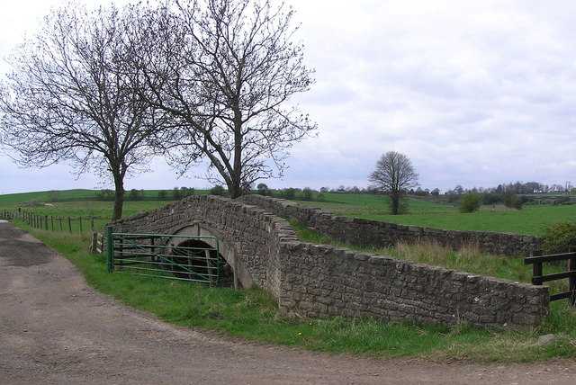
Ketton Packhorse Bridge
- Overview Map Ketton Packhorse Bridge is located off Ketton Lane, to the north of Darlington. The bridge dates from the late 17th or early 18th century and crossed the River …
Co-Curate Page
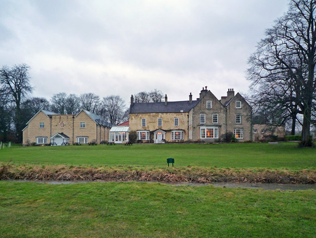
Hall Garth Hotel
- Overview Map Street View Grade II listed building on the National Heritage List for England.
Co-Curate Page
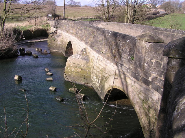
Mill Bridge, Coatham Munderville
- Overview Map Street View Mill Bridge is located east of Coatham Mundeville, and carries Brafferton Lane over the River Skerne. The stone bridge was built in 1861. The bridge straddles the …


Co-Curate Page
St Cuthbert's Church
- Overview Map In 995 AD Darlington was one of the resting places of St Cuthbert’s remains on the journey from Ripon to Durham. Bishop Puiset built a palace (on the site of …

Co-Curate Page
Statue of Statue of Joseph Pease
- Overview Map Street View The statue of Joseph Pease (1799 - 1872) is located at the east end of Prospect Place in Darlington, at the junction with Prebend Row, High …

Co-Curate Page
Darlington Railway Station
- Overview About Darlington Railway Station Map Street View Darlington railway station is on the East Coast Main Line in the United Kingdom, serving the town of Darlington, County Durham. …

Co-Curate Page
St Andrew's Church
- Overview About St Andrew's Church Map Street View St Andrew's Church in Haughton-le-Skerne was built in c.1125, on the site of an earlier Saxon church.[1] The church was restored in …

Co-Curate Page
Barmpton, Great Burdon and Haughton-le-Skerne War Memorial
- The war memorial for Barmpton, Great Burdon and Haughton-le-Skerne is located near St Andrew's Church in Hauton. The memorial was unveiled on the 7th of October 1920 by Lt. Col. …

Co-Curate Page
Church of St Michael, Heighington
- Overview Map Street View St Michael's is the parish church in Heighington, County Durham. The present church was built c.1130 AD, over the remains on an even earlier Anglo Saxon …

Co-Curate Page
Church of St. John, Low Dinsdale
- St. John the Baptist is the parish church in Low Disdale, originally built in the late 12th century. In 1876 the church underwent a major restoration by J.P. Pritchett, at …

Co-Curate Page
Raby Hunt Inn
- Overview About the Raby Hunt Inn Map Street View The Raby Hunt Inn in the village of Summerhouse was built in c.1835, with an earlier 18th century wing to the …

Co-Curate Page
Friends Meeting House, Darlington
- Overview Map Street View The Friends Meeting House is located on Skinnergate in Darlington. The Quakers bought a house and land at Skinnergate in 1678, and converted it into a …

Co-Curate Page
Church of St George, Middleton St. George
- Overview Map St George's Church dates frtom the 13th century. It is located about 1½ miles south-east of the village of Middleton St George. The church is a Grade II …

Co-Curate Page
Walworth Castle
- Overview About Walworth Castle Map Street View Walworth Castle is a 16th century mansion house built in the style of a medieval castle, located in Walworth, near Darlington. It stands …

Co-Curate Page
Thornton Hall
- Thornton Hall is a 16th century Manor House (now a farmhouse) located within the Civil Parish of High Coniscliffe in County Durham. It lies off the B6279 road near Ulnaby. The …

Co-Curate Page
Church of St. Edwin, High Coniscliffe
- Overview Map Street View The Parish church in High Coniscliffe was originally built c.1170 and the tower parapet and spire dates from the 14th century. The church underwent a major …

Co-Curate Page
Barmpton Hall
- Overview Map Street View Barmpton Hall, is a farmhouse located at the west end of the village of Barmpton. The farmhouse dates from the late 18th century with early 19th …

Co-Curate Page
Ketton Packhorse Bridge
- Overview Map Ketton Packhorse Bridge is located off Ketton Lane, to the north of Darlington. The bridge dates from the late 17th or early 18th century and crossed the River …

Co-Curate Page
Hall Garth Hotel
- Overview Map Street View Grade II listed building on the National Heritage List for England.

